The establishment of the Cathcart District Railway in the late 19th century had an enormous impact on the development of Glasgow's southern suburbs. All the buildings featured in this exploration of the architecture of the city's south side neighbourhoods can be visited from stations on the Cathcart Circle line. I have not followed any strict geographical or political boundaries which have changed so much since the inception of the local railway.
The new line opened on 1st March 1886 with a daily service of over 30 trains between Central Station and Mount Florida.
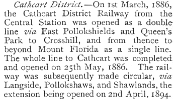
The above extract from the People's History of Glasgow, published in 1899, shows that the Cathcart District Railway's line via Queen's Park and Crosshill reached Cathcart on 25th May 1886.
The circular route back to Central Station by way of Pollokshaws and Shawlands was completed on 2nd April 1894.
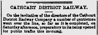
The Glasgow Herald of Monday 1st March 1886, (above), describes a preview of the new line arranged for local dignitaries on the previous Saturday, a few days before it was opened to the public.
Leading the group was Provost George Browne of Crosshill who was also the chairman of the Cathcart District Railway Company. He was accompanied by Hugh Brown, a director of the Caledonian Railway Company who were to operate the new train service.
Also on the trip were Sir William McOnie, Lord Provost of Glasgow, Provost Smith of Govanhill and Provost Hamilton of East Pollokshields. Old view of Cathcart Station from the west, illustrating the "island" type stations on the line
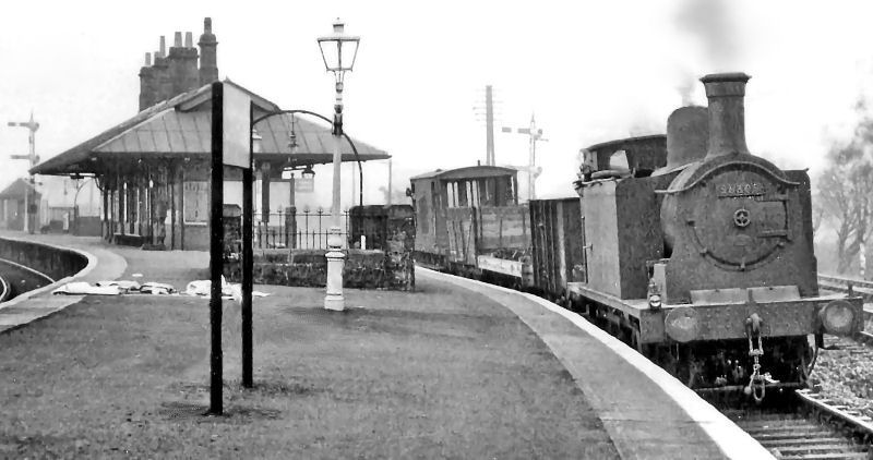
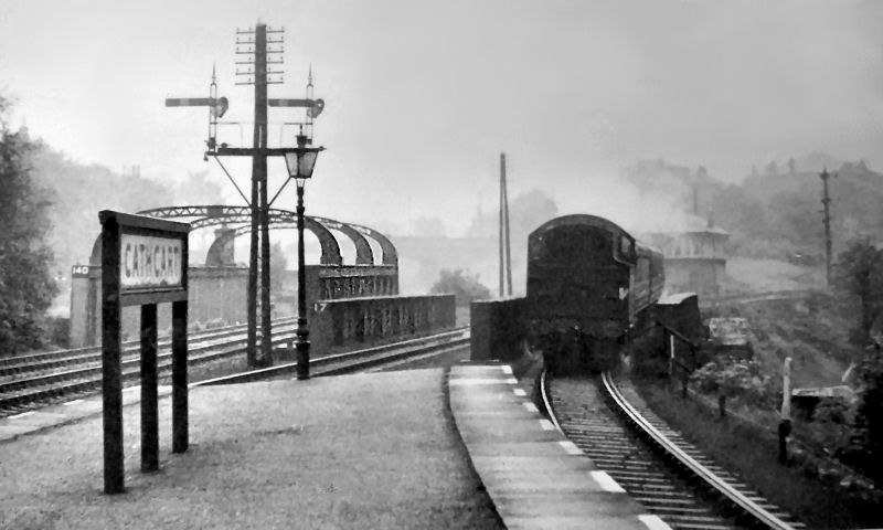
Goods train at Cathcart Station, 1955
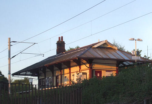
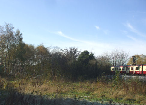
Modern view of Cathcart Station at dusk
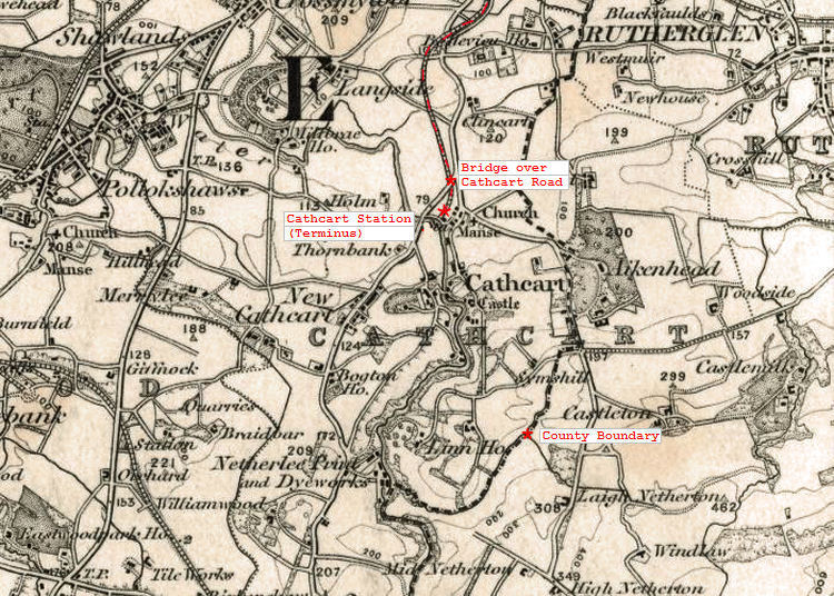
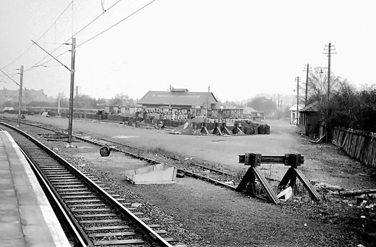
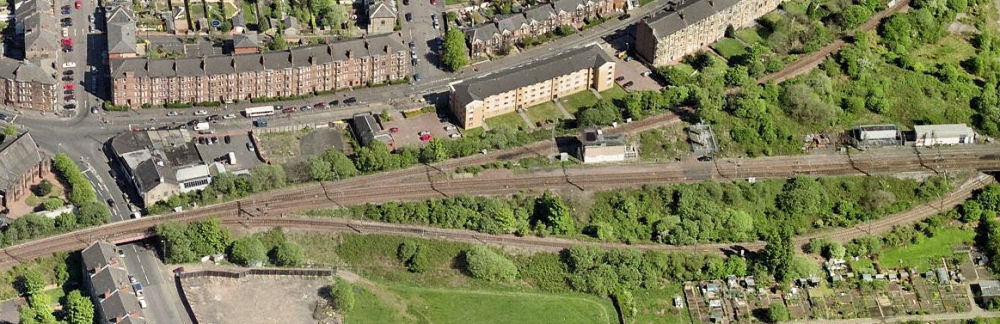
The city boundary had been steadily moving outwards throughout the nineteenth century. Glasgow's borders first crossed to the south side of the River Clyde in November 1846 when the burgh of Gorbals became part of the city. The above map shows the first phase of the railway development in the mid-1880's when Cathcart was the terminus for the line. The original station was situated at Manse Brae, where the site was later used as a goods yard.
Original Cathcart Station building and surrounding goods yard, viewed from platform of present station
View from Manse Brae of train from Newton passing the site of the original Cathcart Station
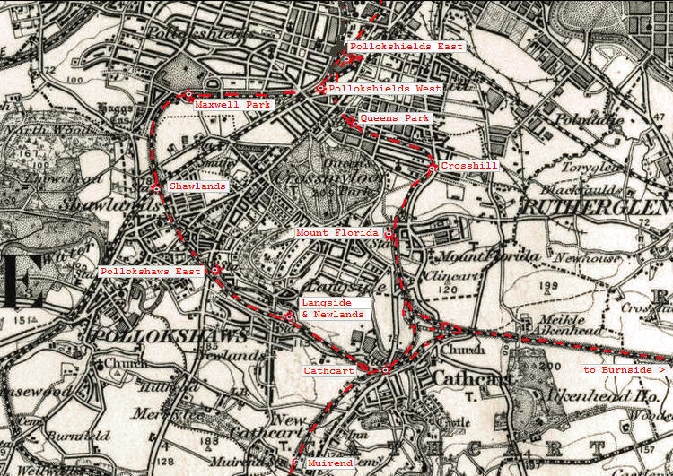
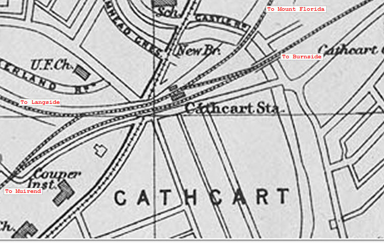
This map from around 1905 shows stations on the completed Cathcart District Railway and the later branch lines of the Lanarkshire and Ayrshire Railway between Ardrossan and Newton. On this line Muirend Station had opened on 1st May 1903 and Burnside on 1st August 1904.
It can be seen that the paths of the tracks around Cathcart was mostly through green fields with no need for any large scale demolition to make way for the railway.
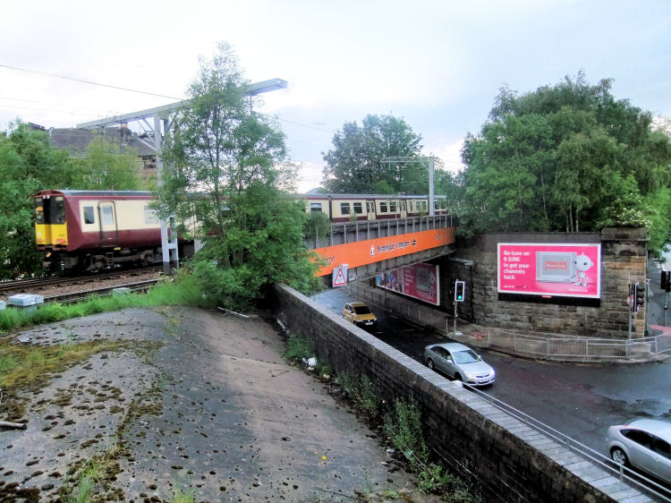
When the new station was built on the other side of the White Cart there was a footbridge allowing passenger access directly from Old Castle Road on the northern side of the river.
The entrance to this bridge was blocked off in the 1960's around the time of the electrification of the line.
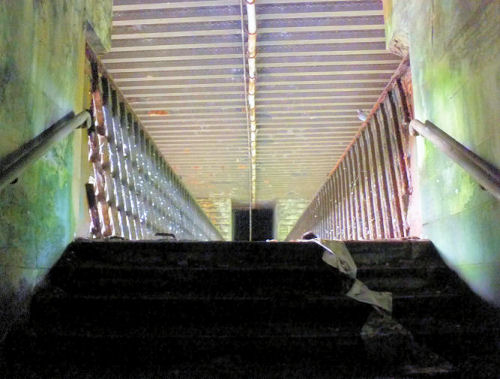
Footbridge from Old Castle Road leading over river to Cathcart Station
View from a 'hole in the wall' of abandoned footbridge from Old Castle Road to Cathcart Station
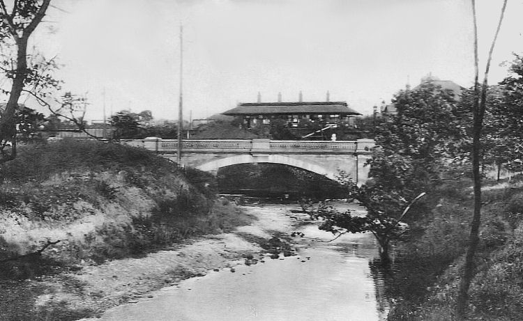
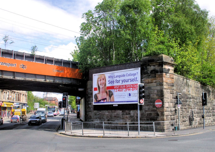
The above photograph shows the railway bridge at Cathcart Road on the bottom left, adjacent to the Clockwork pub.
The line splits shortly after the bridge, before reaching the site of the initial Cathcart Station.
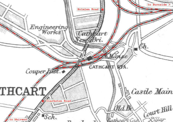
The above map gives a closer view of the railway junctions at Cathcart, showing the additional track operated by the Lanarkshire and Ayrshire Railway.
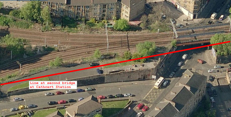
The stretch of line between Burnside and Muirend originally had its own railway bridge at Cathcart, running parallel with the bridge of the Cathcart District Railway.
The subsequent links between the two lines close to Cathcart Station allowed passenger trains to travel from Glasgow Central to Ardrossan via Cathcart on the line which currently terminates at Neilston.
With regard to road transport, the "New Bridge" over the River Cart at Holmlea Road, shown on the map above, was opened in 1901, replacing a narrow humpback bridge dating from 1800.
The extra width of the new bridge allowed the Glasgow tramway to be extended from Langside to Cathcart in 1902, on its way to Netherlee. The tramway had operated its first electric tramcars on 13th October 1898.
The above map gives a wider view of the railway connections surrounding Cathcart Station.
Double railway bridges at Cathcart Station
The site of the second railway bridge at Cathcart can still be clearly seen. These views show new dark grey brickwork in the original cream stonework, indicating where the crossing would have been situated.
View from the site of the dismantled second railway bridge at Cathcart.
This press cutting from April 1906 describes a late night express train running from Glasgow to Ardrossan via Cathcart and Neilston to connect with the steamers to Ireland. Extract from Glasgow Herald, 28th April 1906 regarding railway accident at Muirend
The 'Belfast Express' left the main line at points leading to sidings at Muirend which had been created to store carriages during the reconstruction and expansion of Central Station. The driver of the express, Samuel Cunningham, was immediately aware of the problem and "surmising that something was amiss he applied the Westinghouse brake and succeeded in reducing the speed of the train".
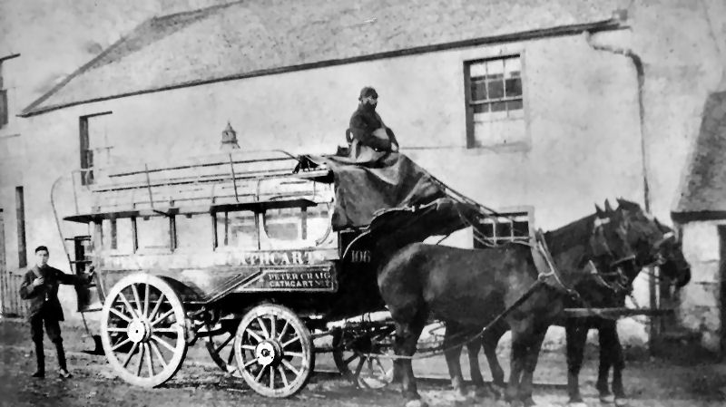
Prior to the completion of the Cathcart Circle in 1894 the "Cathcart 'bus" had been the favoured form of public transport. It ceased to run a few months after the railway was fully operational. Public transport by road had to wait until 1902 when the city's electric powered tramway was extended to Cathcart.
Horse-drawn omnibus at Cathcart
Suggestions for the electrification of the Cathcart Circle had been made as far back as the 1920's and 1930's, citing the London suburban system as an ideal to be followed. Extract from Glasgow Herald, 8th January 1953 regarding the electrification of the Cathcart Circle
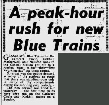
Clean, smooth, electric “Blue Trains” replaced the steam and diesel trains on the Cathcart Circle lines on Monday 28th May 1962.
The Evening Times published on the afternoon of the first day of the new electric services, 28th May 1962, reported that the trains were very popular with the commuting public, with the paper reporting that 5553 passengers had used them in their first morning rush hour.
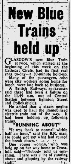
The first hold up, which lasted a mere 30 minutes, was reported on Wednesday 30th May 1962.
Interesting to note how the "city workers" had the time to use the new fast trains to return home for their lunch breaks.
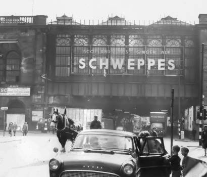
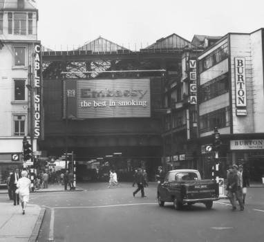
Views from 1965 of Central Station at the "Heilanman's Umbrella" over Argyle Street, looking eastwards from the Oswald Steet/ Hope Street junction (left), and westwards from the Jamaica Street/ Union Street junction (right).
Central Station, 1965
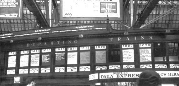
Cathcart Circle trains leaving from platforms 7 and 8 are shown in the station's array of destination boards (below), which were maintained manually by staff placing large timber framed canvas signs in the window for each platform. Destination boards at Central Station, 1965
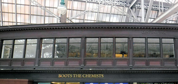
Windows for former destination boards at Central Station, 2017
"Leaving the Central Station at 1.40 the party were conveyed as far as the bridge over Cathcart Road, beyond Mount Florida.
A short stoppage was made at each station on the line to enable the company to inspect the station buildings etc."
The article went on to report that "General satisfaction was expressed at the arrangements, which are all of the most approved order, and are calculated to be of the most service on such a line.
In particular those of the company having practical knowledge of such matters stated their approval of the “island” form of station which has been adopted on the line."
The Police Acts of 1850 and 1852 allowed settlements with populations of over 1200, and later 700, to become independent Police Burghs with their own municipal authorities.
Shortly before the arrival of the Cathcart District Railway, a number of small communities on the southern fringes of Glasgow took advantage of this legislation, creating burghs which had lifespans of less than 20 years.
Crosshill burgh lasted from 1871 to 1891, Govanhill from 1877 to 1891 and East Pollokshields from 1879 to 1891. The districts of Langside, Shawlands and part of Mount Florida were also absorbed in the "great annexation" of 1891.
The expansion of 1912 saw Govan and Pollokshaws joining Glasgow along with Cathcart.
The bridge over Cathcart Road at Mount Florida was the furthest extent of the railway when it first opened for service a few months before reaching this station.
The above maps give a "before and after" view of the area at the time of the expansion of the Cathcart Circle. In the first map, Cathcart is the terminus, while the second map shows the variety of stations and new suburbs served by the steam trains.
The later Cathcart Station was sited further south and west than the original terminus.
Familiar south side place names appear in the later map but not in the earlier.
These districts seem to have been built up after the arrival of the new lines.

Cathcart was now so accessible to the city by train and tram that its annexation in 1912 was almost inevitable.
The 'Belfast Express' ran into stationary carriages in the sidings at Muirend. Fortunately there was very little damage done.
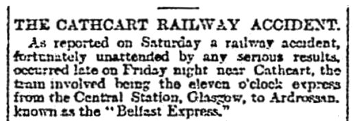
Fortunately most of the damage was done to the empty carriages, with passengers in the express carriages suffering only minor injuries caused by shattered glass.
This article from the Glasgow Herald of 8th January 1953 opposed the idea, painting a romanticised portrait of the line.

The following day the Glasgow Herald reported an even greater use of the new trains in their initial evening rush hour, with numbers up by 33%. The paper reported that "the figure indicates that passengers earlier in the day had acted as unpaid publicists of the service".
There was lots of optimism expressed by the initial passengers that the new service would provide comfort, cleanliness and punctuality for Glasgow's South Side commuters.
The boards for the Cathcart Circle and associated lines were coloured blue, indicating that the routes were served by the electric "Blue Trains" which had come into service on the lines in 1962, three years before this photograph was taken.
The Outer Circle train, via Queen's Park, was leaving from Platform 7 at 10:16, while the Inner Circle train, via Maxwell Park, was leaving at 10:20.
The green destination boards for platforms 4 and 5 were for local deisel trains which had dark green coaches at the time.