
The ancient parish of Cathcart straddled the county boundaries of Renfrewshire and Lanarkshire. It extended over a much larger area than the present Glasgow suburb, stretching all the way from Langside to beyond Netherlee. The ruins of Cathcart Castle, from the east and the south
Reconstruction of Cathcart Castle while still complete
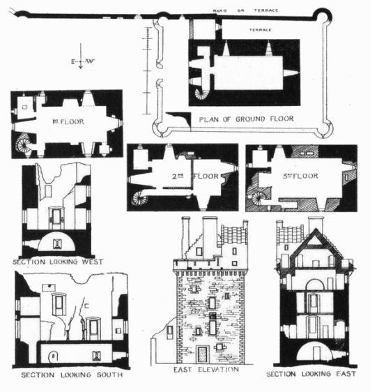
The above representation of Cathcart Castle while it was complete has been derived from the plans shown below, which show the castle surrounded by a turreted courtyard. Plans, sections and elevation of Cathcart Castle while still complete.
Cathcart Castle and the surrounding lands of Cathcart, Bogton and Tankerland passed out of the possession of the Cathcart family in 1546 when they were acquired by Gabriel Semple, the younger son of John, the first Lord Semple. Gabriel perished the following year fighting against the English at the Battle of Pinkie Cleugh and the estate was inherited by his son, William Semple of Cathcart (d. 1578).
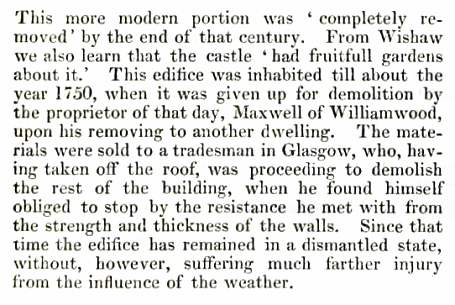
Cathcart Castle was maintained in a habitable condition until around 1750, when it was abandoned to ruination and attempted demolition by its owners, the Maxwells of Williamwood. This occurred after the erection of Cartside House, (later known as Cathcart House), in the parkland below the castle. The stunted remains of the north wall of the castle after demolition illustrate "the streghth and thickness of the walls". This portion is over four feet wide and is still in sound condition.
The estate was gradually broken up and sold in parcels, with the castle and the manor house
coming into the hands of Mr. James Hill in 1788.
In 1801 the remnants of Cathcart Castle together with Cathcart House and the surrounding
sixty acres of land were restored to Cathcart family ownership when purchased by
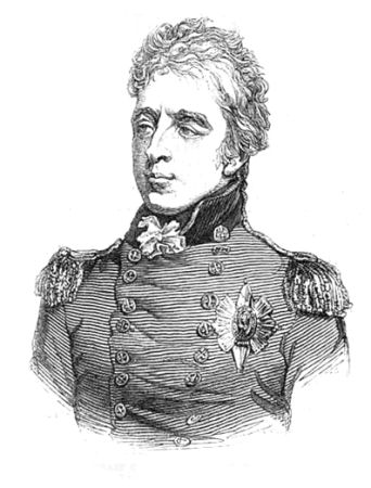
Sir William Cathcart (1755 -1843), tenth Lord Cathcart, who would later become the first Earl Cathcart in 1814.
Sir William also acquired the contiguous lands of Symshill. Portrait of Sir William, tenth Lord Cathcart, first Earl Cathcart
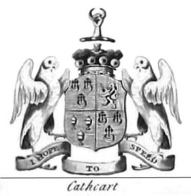
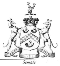
Arms of William (1755 -1843), tenth Lord Cathcart, and Hugh (1758–1830), fourteenth Lord Semple
Lord Cathcart's main residence was an elegant townhouse in Whitehall, London, which
was much more salubrious than his ancient family keep. The engraving below of his house dates from
1797.
Engraving from around 1785 showing curtain wall surrounding Cathcart Castle
Parts of the curtain wall at Cathcart Castle still survive and can best be viewed in the winter time when there is less surrounding vegetation.
Part of curtain wall at Cathcart Castle viewed from Linn Park
View from the top of the curtain wall at Cathcart Castle over the parkland below.
This engraving shows Cathcart House in the foreground with the castle sitting high above the trees in the background.
This twentieth century photograph again shows Cathcart House in the foreground but you can clearly see how the ruined remains of the castle had been used as a quarry, providing an easy and cheap source of stone for re-use in rubble masonry.
Extract from Rambles round Glasgow, 1856, detailing the attractions of Cathcart for ramblers.
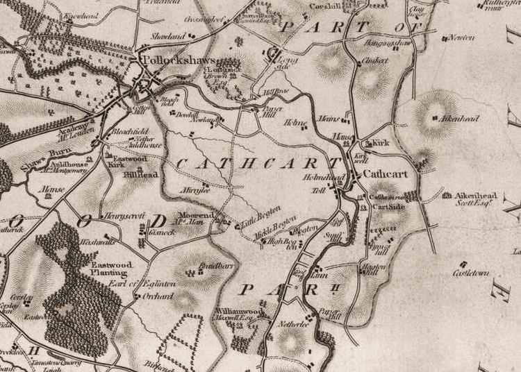
This early map of the Renfrewshire part of Cathcart dates from before 1800. The map shows just one crossing over the White Cart Water, the present day Snuff Mill Bridge, which is shown as a toll bridge at "Holmehead".
Bogton House, which was built in 1580 for John Blair, the son-in-law of Sir Robert Semple, third Lord Semple, was situated near to the present day Muirend Railway Station. The House and Lands of Bogton remained in the hands of the Blairs until 1679 when they were were sold to James Hamilton of Aikenhead.
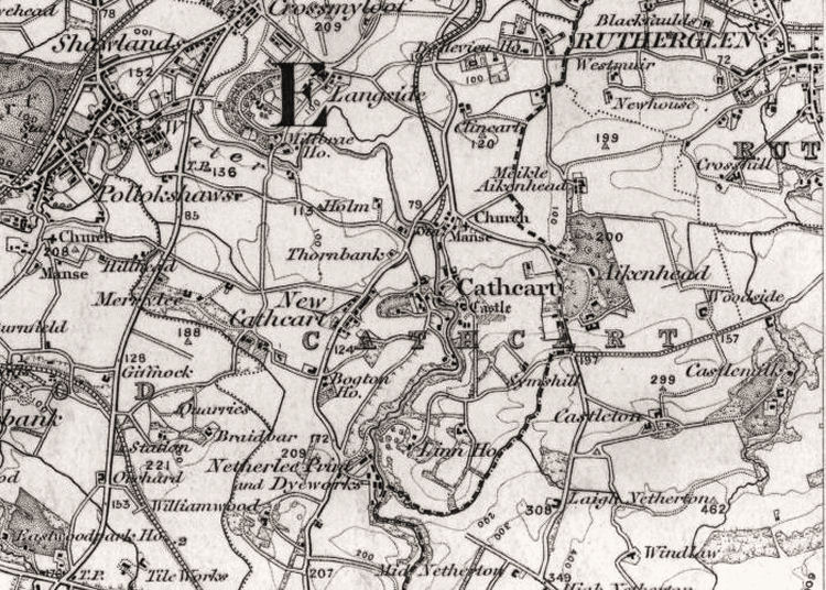
This map of Cathcart, from the mid 1880's when the district was being developed as a Glasgow suburb, shows the county boundary still in place, but gives more details of the Lanarkshire side of Cathcart parish. By 1886 the railway had arrived in Cathcart and would soon expand into the surrounding areas.
At this time Cathcart had a twin village, New Cathcart, a settlement developed on the other side of the White Cart Water.
Edith Cottage in Old Castle Road, home of Cathcart Old Men's Club
This vintage view shows the shops in Old Castle Road, which, as the name suggests, led from the village up towards the castle. The shops run between Kilmailing Road, nearest the camera and Kirkwell Road, at bay windows at the next corner.
These views show the terraced houses of Kirkwell Road (above) and Kilmailing Road (below) in the early years of the twentieth century. The old detached house seen at the bottom of Kirkwell Road is now the site of the rear entrance to St. Fillan's Primary School. Kilmailing Road leads to Cathcart Old Parish Church.
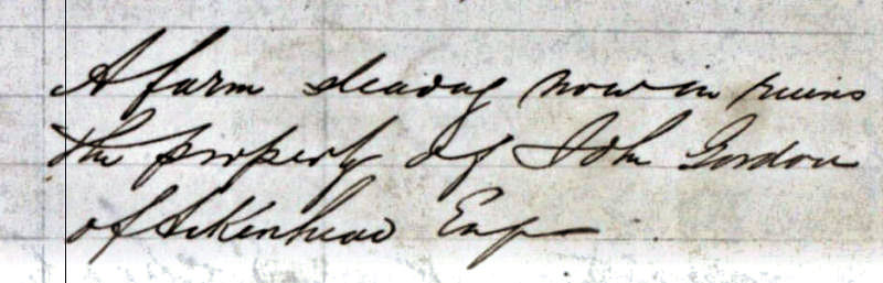
Old Print of Kirkwell Farm, Cathcart, with castle in background
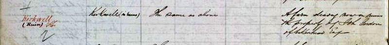
This extract from the Ordnance Survey Name Books of 1856-1857 regarding Kirkwell Farm describes it as being "in ruins". The description column reads "A farm steading now in ruins, the property of John Gordon of Aikenhead Esq". Presumably the farm would have been previously let to a tenant farmer.
This view shows the newly built two-storey semis and bungalows of Courthill Avenue, running uphill from Crompton Avenue, immediately to the east of Old Castle Road. The photograph, which dates from around 1930, shows that the trees and shrubs which mark this suburban development today had yet to become established. It would appear that the new houses were completed and occupied within a very short period of time.
1930's view of Barrie's Garage, Carmunnock Road, with Cathcart Old Parish Church in the background
This 1879 photograph of Cathcart Old Parish Church shows the future site of Barrie's Garage in the foreground. The photographer was looking towards the top of Manse Brae with the front face of the church tower facing Kilmailing Road. The pathway bordered with neat hedgerows led to Carmunnock Road at what is now Menock Road.
This modern view from the forecourt of Barrie's Garage shows the church tower and the wall surrounding the graveyard.
View of Cathcart Old Parish Church, Kilmailing Road and Manse Brae from forecourt of Barrie's Garage
Barrie's Garage / Gulf Garage, 1966
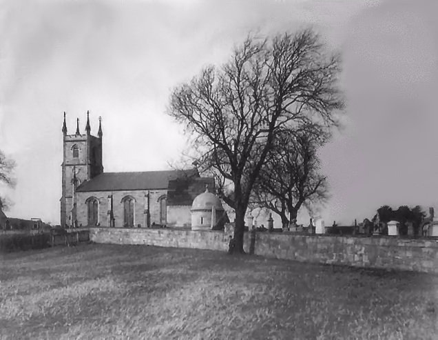
Tower of the abandoned Cathcart Old Parish Church, built 1831
Cathcart Old Parish church was dedicated to St Oswald and built in a Norman style which is unusual in Scotland. James Dempster was the architect of the 1831 version of the church. Victorian photograph of Cathcart Old Parish Church from a spot near Crompton Avenue
Ruins of Cathcart Old Parish Church from Kilmailing Road
Close up view of earlier Cathcart Old Parish Church, while still complete
Construction of the new church had began in 1914 but was interrupted by the outbreak of the Great War. When work was restarted in 1923 its architect, Henry Edward Clifford, had retired on medical advice. His partner, Thomas Melville Lunan, was so badly affected by his experiences in the war that he was unable to work on his return to Scotland.
Tower of present day Cathcart Old Parish Church, completed in 1929
This view of Old Castle Road at the Old Smiddy is looking towards the newly erected three-storey tenements at the corner with Crompton Avenue. The first floor of the Smiddy had an infirmary for dogs, indicated by the sign on the gable. The children playing in the roadway obviously had no fear of any approaching traffic interupting their games!
This view of the opposite side of Old Castle Road from the Old Smiddy shows thatched cottages built hard on to the street as the roadway approaches the junction with Snuff Mill Road.
After the cottages were demolished in the early twentieth century the site was used as garden allotments. It wasn't redeveloped until the 1960's when blocks of two storey flats were built.
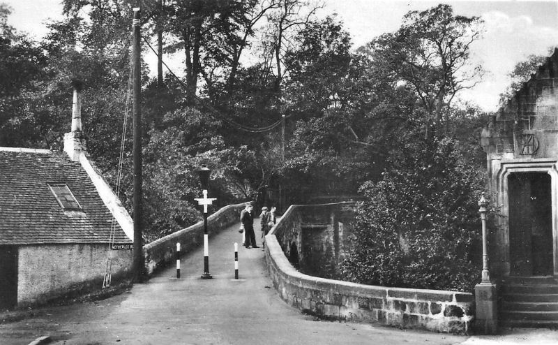
Leaving the village by Old Castle Road and Snuff Mill Road you would come to the old bridge which originally carried the high road from Glasgow to Kilmarnock.
'Granny Robertson's Inn', facing the approaches to the Snuff Mill Bridge was a popular place of refreshment before it was demolished in the early 1890's.
Granny Robertson's Inn, Snuff Mill Road, Cathcart
A more detailed description of the hostelries of Cathcart can be found in my Old Cathcart - Illustrated Guide webpage.
The street sign at the Snuff Mill Bridge shows that it was part of Netherlee Road, which provides an explanation as to why Rhannan Road suddenly changes its name to Netherlee Road after passing the lane which leads down to the old bridge.
Old photograph of approaches to Snuff Mill Bridge
Old view of Snuff Mill Bridge with local children
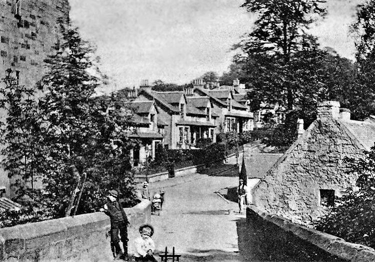
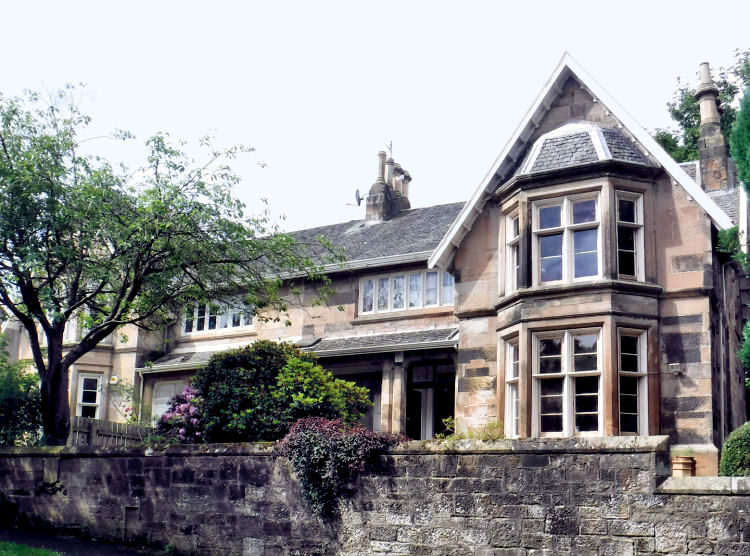
Crossing the Snuff Mill Bridge from the village of Cathcart, you would come to Braehead which is situated at the top of the lane at Rhannan Road / Netherlee Road. Braehead is where I have lived for the past 35 years, having also lived in Kirkwell Road for 10 years. This view, which was taken from the same spot as the Victorian picture, shows that the gateposts for Braehead House and much of the structure of the old cottages are still in place. The remaining parts are used as the outbuildings of Braehead House, which you can see in the background.
A close look at what at first sight appears to be a plain wall reveals the lintels and outlines of the doorways and windows of the old row of houses. These openings have been infilled with brick and rubble.
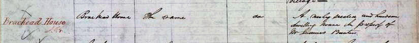
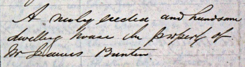
Braehead House was built as a rather plain two-storey dwelling with little external embellishment. It is described in the Ordnance Survey Name Book for 1856-1857 as "A newly erected and handsome dwelling house, the property of Mr James Bunten".
Braehead House, 2017, and extracts from Ordnance Survey Name Books, 1856-1857
Braehead House and the surrounding rows of dwellings are shown towards the top left of the map below, near the corner of the road down to the "Old Bridge".
Map surveyed at the same time as the 1856-1857 Ordnance Survey Name Books
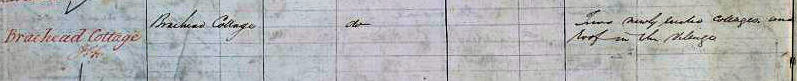
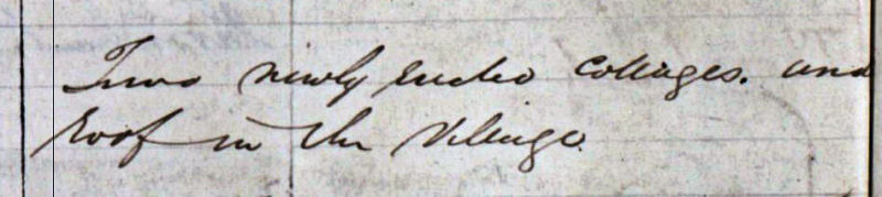
"Braehead Cottage", shown in the above map was supposedly designed by Alexander 'Greek' Thomson as a "Double Villa" and is now better known as Braehead Villa. It is described in the Ordnance Survey Name Book for 1856-1857 as "Two newly erected cottages and roof(?) in the village". Braehead Cottage a.k.a. Braehead Villa, 2017, and extracts from Ordnance Survey Name Books, 1856-1857
Gatehouse at Cathcart Cemetery, 1877
The gatehouse at the Brenfield Road entrance of Cathcart Cemetery dates from 1877, as shown in the plaque over the door (left).
Cathcart Police Station, 1892
Cathcart Police Station was housed in a two storey building situated at the prominent corner where Merrylee Road meets Clarkston Road. It was designed in the Scottish vernacular style by Paisley based architect, Charles Davidson.
New Cathcart Church, 1908
The "New" in the church's title refers to its location in New Cathcart rather than the building, which was erected by the United Free Church of Scotland in 1908.
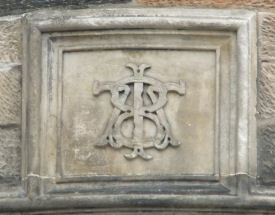
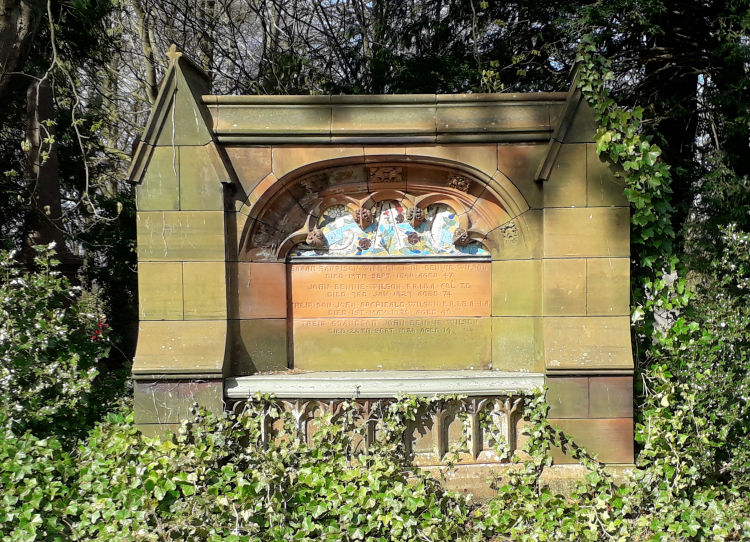
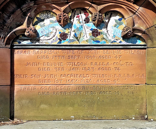
The tomb of John Bennie Wilson, the architect of New Cathcart Church, can be found in Cathcart Cemetery. He designed the monument for his wife Sarah, who passed away in 1896.
Tomb of architect, J.B. Wilson, Cathcart Cemetery
Inscription on tomb of architect, J.B. Wilson
< Early 20th century view of Newlands Road from Clarkston Road, with New Cathcart Church in the background
Clock tower at entrance to Weirs Engineering Works, Cathcart
The most striking landmark in New Cathcart is the Art Deco clock tower at the entrance to Weirs Engineering Works in Newlands Road. The tower and its glazed staircase are part of the offices & amenity block added to the complex in 1937 to the designs of architects, Wylie, Shanks & Wylie.
Offices at works of G & J Weir Ltd; architects Wylie, Shanks & Wylie, built 1937
Map showing area around Holm, Cathcart, c.1858
Weirs had started business in Cathcart in 1886, the same year as the arrival of the railway. The Holm foundry was built on the site of an old steading, the Holm, which was surrounded by green fields when the above map was surveyed in the mid-1800’s.
View of 1901 bridge with tenements of Holmhead Place on site of Cathcart Carpet and Dye Works
Date stone with "1901" inscription on Cathcart bridge
Cast iron lamp standard used for floral display on 1901 bridge over White Cart Water. Cathcart
Holmhead House
Holmhead House is situated in Rhannan Terrace close to the Snuff Mill Bridge. The detached sandstone villa was once occupied by one of the Geddes brothers, who operated the Cathcart Carpet and Dye Works.
Ravensworth is an early twentieth century house designed by the noted Yorkshire architect Fred Rowntree.
Exhibition Drawing of Ravensworth, Cathcart, 1905
Ravensworth was built for Mrs Mary Dunn, a member of the Dunn family associated with the biscuit manufacturers, Gray Dunn & Company. The architect of the villa, Fred Rowntree, was married to Mary Anna Gray, a daughter of William Gray of the same firm. View of Ravensworth, Cathcart, 2014
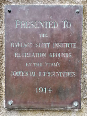
The Wallace Scott Tailoring Institute, situated downstream from Weirs of Cathcart, was designed by Sir John James Burnet and Norman Aitken Dick. It began operating as a textile factory in 1914. The block was converted to residential use with flats which first became available in the spring of 2020.
Wallace Scott Tailoring Institute, Cathcart
The sculpture in the grounds of the Wallace Scott building features a metallic globe which would have been very modernistic when it was installed in 1914.
Sculpture at Wallace Scott Tailoring Institute, Cathcart
Scottish Power Offices Cathcart, awaiting redevelopment as housing, 2017
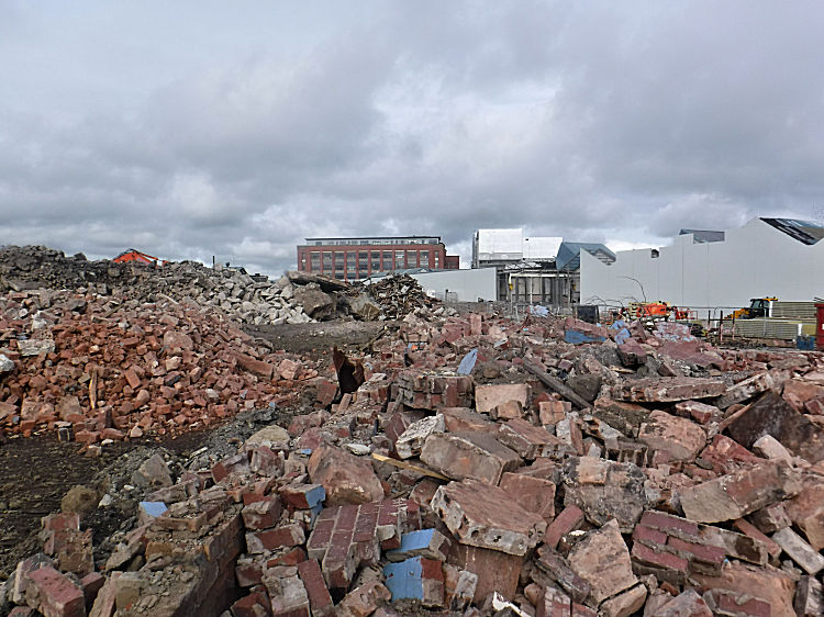
This view from the spring of 2023 shows the remains of demolished Weirs offices and workshops in Inverlair Avenue, with the former Wallace Scott Tailoring Institute in the background.
Demolition of Weirs buildings, Cathcart, March 2023
Aerial photograph showing offices and workshops in Inverlair Avenue prior to demolition
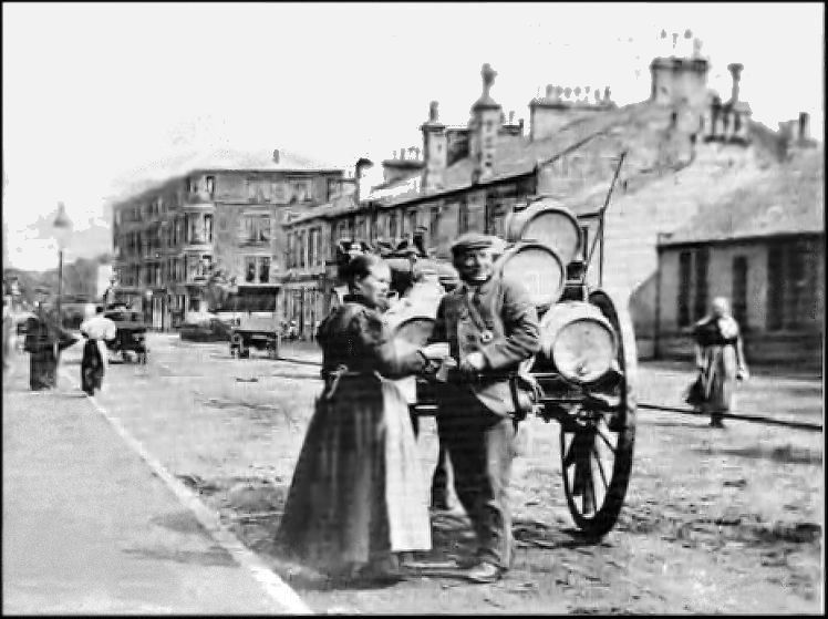
Sour milk cart in Clarkston Road near junction with Merrylee Road
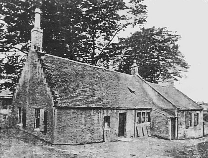
There have been a number of schools in the Cathcart district over the years. The earliest, at Manse Brae and Craig Road, are long demolished.
Cathcart Parish School, Manse Brae - built 1718, extended 1798
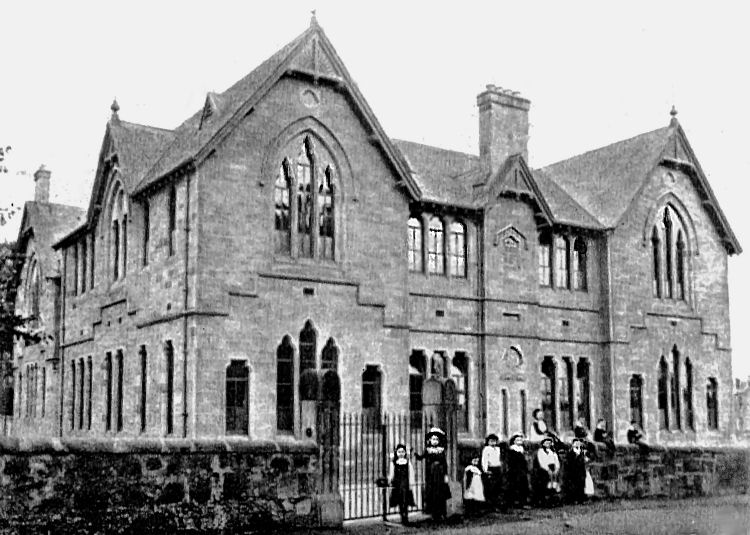
Cathcart Public School, Craig Road, designed by Robert Ewan, 1899
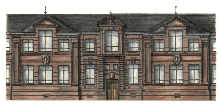
Holmlea School was built in New Cathcart at the same time as the red sandstone tenements of Holmlea Road and surrounding streets.
Holmlea School, Cathcart
Holmlea School, which was designed by A. Balfour, opened in 1908. It has a symmetrical Renaissance style frontage with modernistic Art-nouveau decoration to both the stonework and the fencing surrounding the playground.
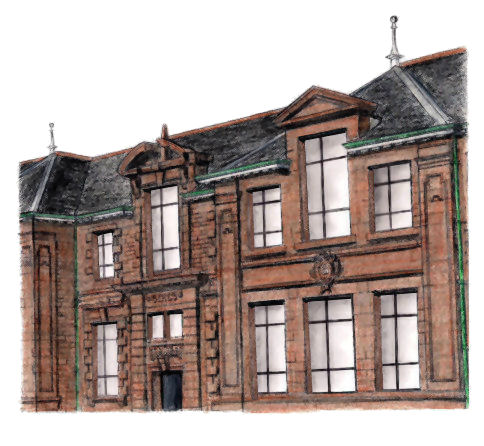
The red sandstone façade has more elaborate features than is usual for schools of this time. Large windows at Holmlea School, Cathcart
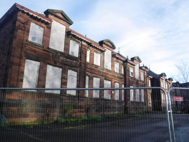
Derelict & boarded up Holmlea School, November 2017
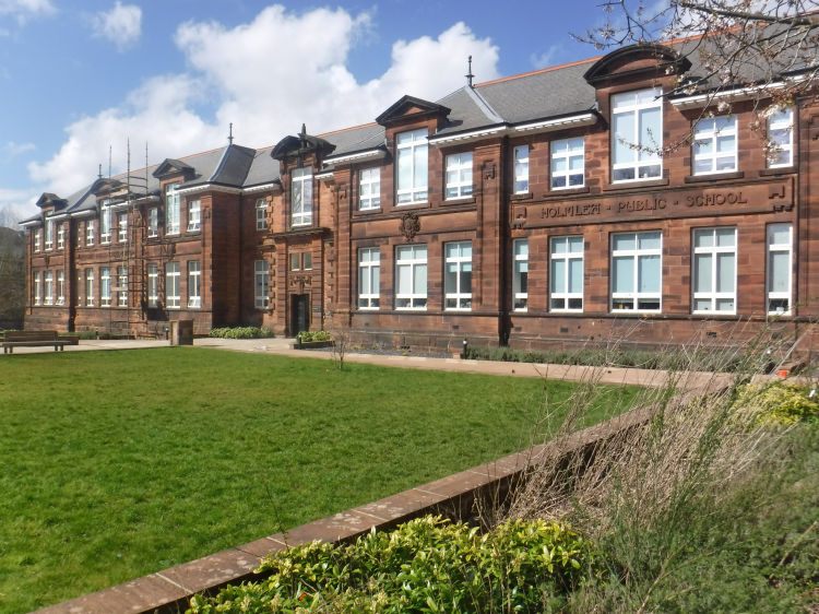
Former Holmlea School after renovation and conversion to flats, April 2023
Former Holmlea School with landscaped garden, April 2023
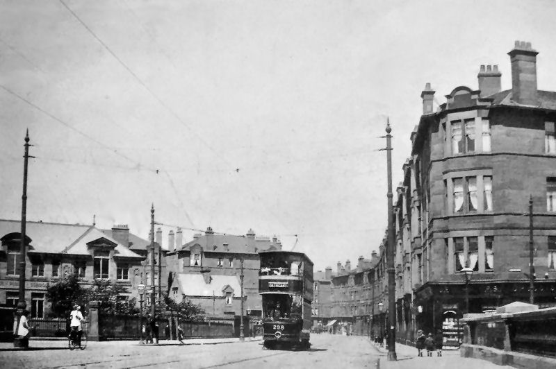
Tramcar passing Holmlea School c.1910
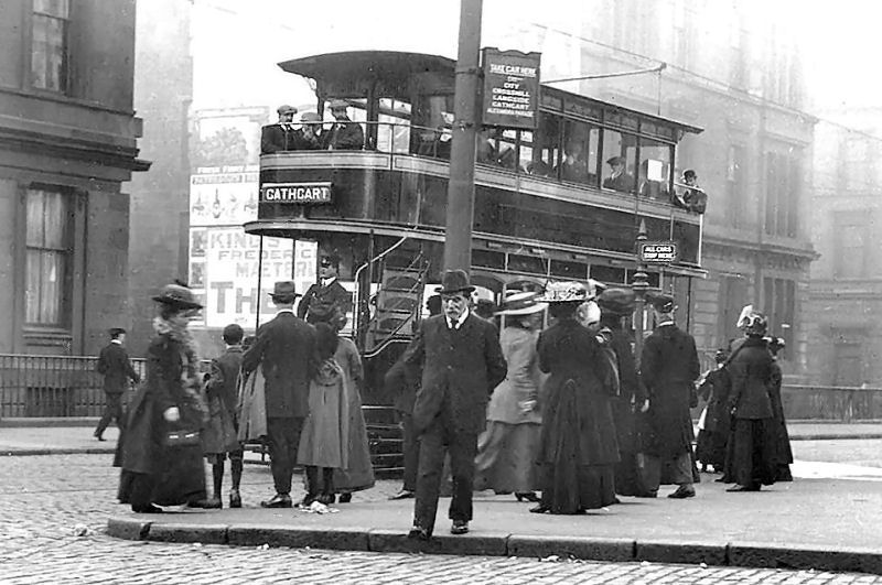
Cathcart bound tramcar in city centre, c.1905
View of Old Castle Road and George Cinema from railway bridge at Cathcart Station
Cathcart Trinity Church
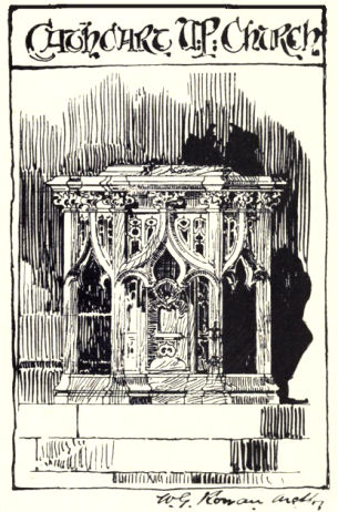
Cathcart Trinity Church originated as Cathcart United Presbyterian Church in 1894. After this denomination's union with the Church of Scotland it was known as Cathcart South Church from 1929 until its merger with New Cathcart Church in 2002. Stained glass recovered from New Cathcart is on display in lightboxes near the main entrance. Drawing of Cathcart U.P. Church exhibited by by W.G. Rowan at Glasgow Institute for the Fine Arts, 1893
Drawing of baptismal font for Cathcart U.P. Church by W.G. Rowan, 1896
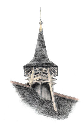
The building was designed by William Gardner Rowan with the opening service taking place on 3rd May 1894. Rowan specialised in the Scots Gothic style of architecture although he made occasional forays into other styles. He lived in Pollokshields and is associated with many well known south side churches, including Queen's Park Baptist Church and Pollokshields Glencairn Church. Ventilator on roof of Cathcart Trinity Church
The present day church hall was actually the original church when it was completed in 1889. The Buchanan Hall, behind the old church hall, was added to the complex in 1912. It features the beautiful dome, shown below, as part of its extravagant styling.
Glazed dome at Cathcart Trinity Church
Tower of Couper Institute
The Couper Institute in Clarkston Road was funded by a bequest from Robert Couper, a member of the family who operated the Millholm Paper Mills on the banks of the White Cart Water.
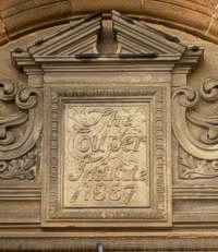
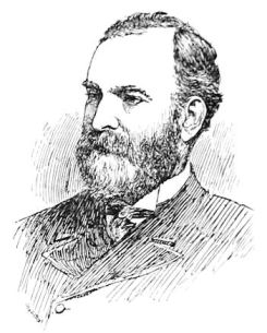
The Public Halls opened in 1887, commerated by the plaque (left), above the entrance. The architect was James Sellars of the prodigious Glasgow partnership of Campbell Douglas and Sellars, who were responsible for other southside landmarks such as the Victoria Infirmary and Queen's Park Church. James Sellars, Architect
Couper Institute Library, Cathcart
In 1923 the Couper Institute was extended with a new hall, followed the following year by a library (above). The stone colour and the building style closely match those of the halls erected 30 years earlier, creating a seamless frontage to Clarkston Road.
Holmwood House
Holmwood House in Netherlee Road, at the Glasgow city boundary, is Cathcart's architectural masterpiece, dating from 1858.
The house has been acquired by the National Trust for Scotland, and the original internal decoration restored. Fortunately the stencilled decoration by C.T. Bowie was left intact under layers of wallpaper during the period when the house was used as Our Lady of the Missions School by an order of religous sisters. A Illustrated Guide of Holmwood House and the surrounding scenery can be viewed at my dedicated page.
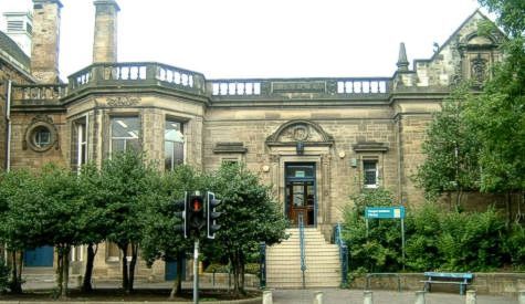
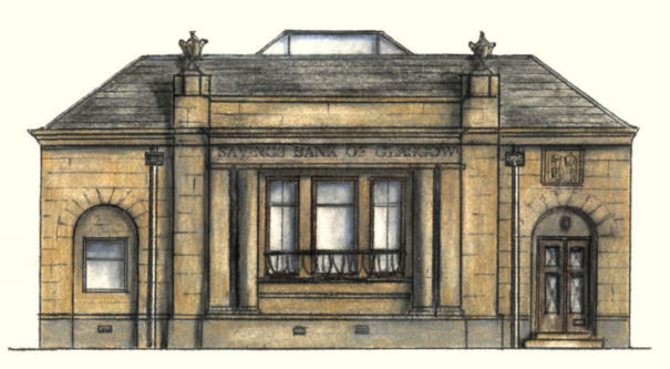
Savings Bank, Muirend
The former Savings Bank of Glasgow in Clarkston Road illustrates an inter-war version of the neo-classical which is much simpler than the Victorian interpretation of the same style. It has a glass roof over the banking hall which can be compared to the elaborate glazed dome over the Savings Bank in Ingram Street, which can be seen in the
Merchant City page of this website.
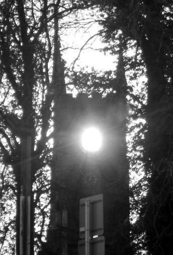
Eerie sight of midwinter midday sun aligned with opening at tower of Cathcart Old Parish Church
Cathcart Parish Council Chambers
Cathcart Parish Council Chambers were situated in Mount Florida, rather than Cathcart proper. The chambers were completed in 1907, 5 years before most of the lands within the old parish boundaries became part of the city of Glasgow in 1912.
The district was the base of the Cathcart family, whose hereditary seat was Cathcart Castle. Very little now remains on the site of the castle which stood at the top of Old Castle Road. In 1980 what was left of the ruins were declared dangerous and required immediate demolition.
The castle had been built around 1450 on a cliff-top overlooking the White Cart Water by the Cathcart family. During the time of Wallace and Bruce an earlier structure was occupied by Alan de Cathcart, who was a staunch supporter of those legendary Scottish heroes.


The proportions of the ruins tie in well with the east elevation as shown in the plans, suggesting that it could be an accurate depiction.
The title of Lord Semple had by that time passed on to Sir Robert Semple (c. 1505–1576), third Lord Semple, who was initially a supporter of Mary Queen of Scots but strategically changed his allegiances in the 1560's during the period when Mary was attempting to recover her throne.
The story of Queen Mary's time with her kinsfolk, the Stuarts of Castlemilk, can be seen in a dedicated page of this website.
The report below from 1882 suggests that the removed upper part of the castle was a later addition to the old keep. The original mediaeval stronghold survived demolition due to the strength and thickness of the walls.

By that time the Semple family had no remaining interests in Cathcart. The leader of the family during this period was Sir Hugh Semple (1758–1830), fourteenth Lord Semple.


Cathcart House was built around 1740 but was demolished in 1927 after Glasgow Corporation had acquired the estate.


The familiar place names in the map give some clues as to their origins, even though the spellings have changed over the years.
The traditional home of the Blair family was the splendid Blair Castle, near Dalry in Ayrshire.


In 1931 it was partially demolished, leaving only the tower accessed from Kilmailing Road still standing. The surrounding graveyard is worth visiting if you wish to discover more about the local history of Cathcart.


The construction work to complete Clifford’s design intentions was overseen by the practice of Watson, Salmond and Gray. The church was finally completed in 1929, allowing the destruction of most of the previous church to commence two years later.
The new church's very solid mediaeval styling, as seen in the drawing of the square tower below, is certainly not typical of early 20th century Scottish architecture.


The viewpoint for the engraving, below, looks towards what is now the entrance to Linn Park to the left and towards the White Cart Walkway, across the bridge to the right.


This photograph of the rows of dwellings built hard to the roadside at Braehead was taken at the corner of what is now Brunton Street at the entrance of Braehead House. The pathway to the left of the gateposts leads down to the Snuff Mill Bridge. The photographer is looking up Netherlee Road towards the entrance to Cartbank House which is featured in the White Cart Walkway section of this website.


The houses were built c.1853 for Robert Couper, co-proprietor of the local Millholm Paper Mill.

The asymmetrical house was designed in the Scots Baronial style, centred on a circular tower.
The cemetery was laid out by William Ross McKelvie at the same time as the gatehouse was being built. McKelvie had gained his expertise at cemetery design during his time as Superintendent of Parks & Cemeteries in Greenock, threafter becoming a specialist in late Victorian Scottish graveyards.

There is an unusual semi-circular feature facing into Merrylee Road which compensates for the simplicity of the overall design. The Police Station was built in pale cream sandstone, with the year of construction, 1892, featured in the stonework.
Cathcart is the nearest station to this building, which now serves as a local medical centre.

The village of New Cathcart grew around the present day Clarkston Road which dates from 1810. The new settlement was situated on the other side of the river from the old village.
The original building (now the hall) was erected in 1898 for the Free Church of Scotland, which combined with the United Presbyterian Church in 1900 to create the United Free Church. The present church was completed in 1908 for the new body. It was designed by John Bennie Wilson and built with rock faced red sandstone with an attractive octagonal tower.
The first minister of the church, Reverend Thomas Pearson, served the various congregations of New Cathcart for over 30 years from 1898 until 1929, when the United Free Church became part of the Church of Scotland.
The church ceased to be used as a place of worship on 19th November 2002, when New Cathcart merged with Cathcart South Church in Clarkston Road to become Cathcart Trinity Church.
The buildings at New Cathcart Church were converted into apartments, which became available for occupation in late 2006.


At that time the major industrial employer in the area was the Cathcart Carpet and Dye Works operated by the Geddes Brothers. The works were demolished around the time of Weirs arrival in the 1880’s. The site was redeveloped with tenement housing, the present day Holmhead Crescent and Holmhead Place.
The “New Bridge” shown in the map had opened in 1800, facilitating development of the land on the other side of the river from the old settlement of Cathcart. It was replaced with the present day polished granite bridge in 1901, allowing the extension of the tram routes all the way to Netherlee.


The perspective drawing of Ravensworth, below, was displayed at the annual exhibition of the Royal Glasgow Institute of the Fine Arts in 1905.

Ravensworth was designed in a very modern style of architecture inspired by the Arts and Crafts movement, standing out from the familiar sandstone villas of the area built around the same time.

It was designed in a fashionable American style as a four storey steel framed structure with red brick external walls decorated with patterned polychromatic finishes.
The building and surrounding formal gardens were acquired by the South of Scotland Electricity Board in 1957 to become their headquarters, with new multi-storey offices added to the grounds 1967-1969.


Holmlea served as a local primary school for nearly 100 years, until June 2005, when the last pupils crossed its doors.
The costs of repairs and renovation, required to bring the building up to the same standard as modern custom-built schools, meant that if an alternative use had not have been economically found, demolition would have the eventual fate of this fine old structure.
Fifteen years after its closure as as school the first occupants of the flats created after the conversion of the building moved in at the end of September 2020.


This church is situated on the western side of Clarkston Road, between the Police Station and the Couper Institute, where its small scale Gothic charm contributes much to the architectural variety of the street.


The building was constructed with locally quarried sandstone in an attractive Beaux-Arts style featuring a squat little spire. The 1895 Ordnance map shows the original outline of the halls with a small library and reading room to the left of the main building. These were replaced after the First World War with an additional hall which, together with a new public library on the other side, left the original building at the centre of the extended complex.
Matching pavilions were built on either side of the existing halls to give a balanced composition. They were designed by Glasgow Corporation's Principal Architect, John Houston, who had been influenced by the pioneering work of William J Anderson, the Dean of Architecture at the Glasgow School of Art in the 1890's. Some of the unusual buildings designed by Anderson and his other pupils are featured in my Victorian Commercial Architecture page.

It was designed by Alexander "Greek" Thomson as a house for James Couper who, with his brother Robert, owned and operated Millholm Paper Mill on the banks of White Cart Water.
Holmwood shows a novel adaptation of Classical Greek styling to fit in with mid-19th Century Scottish taste.

The house is open to the public on afternoons during the summer months, when the surrounding gardens are also at their best.

It was completed in 1927 to the designs of architects, Alexander Nisbet Paterson and Donald McKay Stoddart.
The bank was converted into Muirend's first ever pub, which opened in the summer of 2006 with the highly imaginative title of "The Bank"!
It's good that some useful purpose has been found for this unusual little building.
The nearest station is Muirend, the first stop after Cathcart on the Neilston branch line.

The architects, Crawford and Veitch, designed the building in an appropriate style for council chambers, with Baroque touches to brighten up the single storey frontage. The symmetrical façade features a central dome clad in lead.
The Chambers are situated in Prospecthill Road and are now occupied by local doctors as a surgery and health centre.
A photographic study of this building can be found in my Mount Florida Illustrated Guide.
Mount Florida is the nearest station on the Cathcart Circle to this building.

 |
| |
|
|
| |
|
|
| |
|
|
| |
|
|
| |
|
|
| |
|
|
| |
|
|
|
|
|
All original artwork, photography and text © Gerald Blaikie
Unauthorised reproduction of any image on this website is not permitted.
