
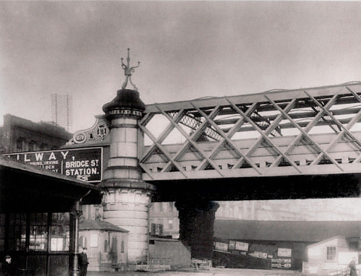
In Victorian Glasgow, Bridge Street Station was the city's first custom-built passenger railway terminal.
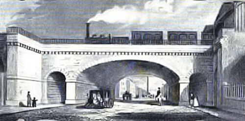
Engraving from 1847 showing train leaving Bridge Street Station and crossing bridge at Kingston Street, then called King Street.
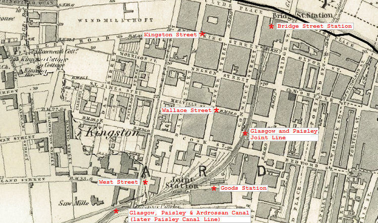
The original Bridge Street Station was developed between 1839 and 1841 for the Glasgow and Paisley Joint Railway.
This elevation of the collonaded booking hall at the station shows the arched openings of a porte-cochčre, either side of the main entrance. The map below gives a plan view of the porte-cochčre, with the horses and carriages entering at the left of the main station entrance and departing from the exit on the right, to the north of the booking hall on the map.
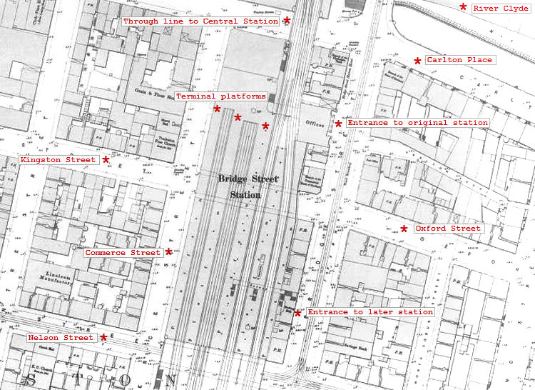
The map shows the four-track line expanding to five on the bridge over Kingston Street on the approaches to the terminal platforms.
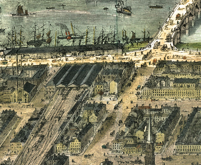
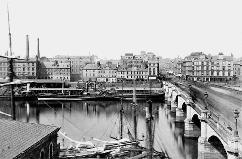
This early scene depicts an aerial view of first Bridge Street Station from the south, looking towards the River Clyde. It ties in very closely with the above map, so presumably it was created around the same time.
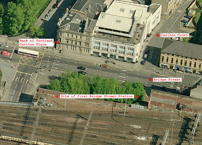
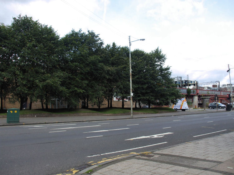
The site of the buildings associated with the first Bridge Street Station is now landscaped as the aerial view from the west (below) shows.
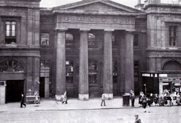
The architect of the two storey station building was James Collie. The station opened in 1841, replacing a temporary wooden structure. The Doric portico fronting the Booking Offices was demolished around 1950, while the station buildings behind survived until 1971.
This later photograph dates from 1939 and shows that the steps leading up to the entrance had been removed.
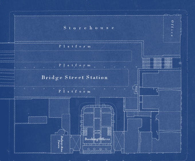
The blueprint below shows the internal layout of the station. The side entrance from the quayside at Clyde Place led directly to the platforms, which were at the upper level.
The station had 5 tracks entering it, with 4 passenger platforms. The additional track between the platforms was used for the storage of rolling stock.
None of the platforms shown in the blueprint above were used for the new station which became operational to the south of the original in 1890. The four-track through line to Central Station passed behind the old buildings, as shown in the map below.
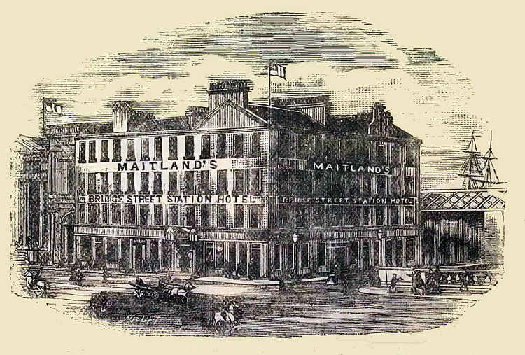
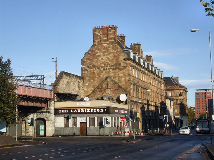
Bridge Street Station Hotel occupied the upper storeys of the corner building adjacent to the Booking Hall. The ground floor of the building had two public houses to keep potential travellers well refreshed.
Bridge Street Station Hotel
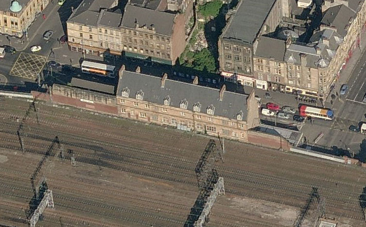
A view of the site of the original Bridge Street Station and Hotel from Carlton Court, which faced the entrance to the Booking Hall. The site was never redeveloped after the demolition of the station buildings in 1971.
This view from the late 1960's shows the original railway bridge leading from the first Bridge Street Station shortly before it was dismantled and the station buildings demolished.
View of Glasgow Bridge from Carlton Place with original railway bridge in background
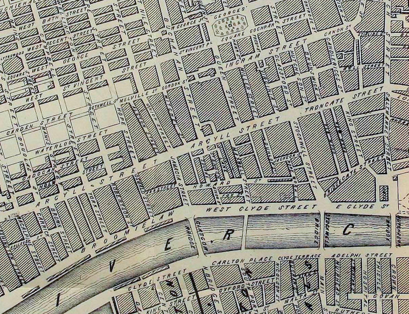
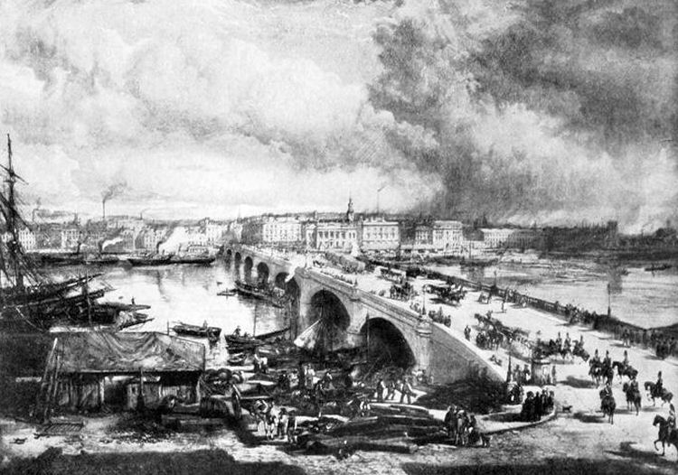
The map below, published in 1850, shows the future site of Central Station between Union Street and Hope Street. The multi-storey warehouses and theatres of Alston Street, the previous site of the village of Grahamston, had to be demolished to make way for the railway terminus.
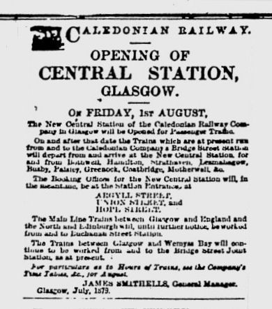
The Glasgow Herald of 1st August 1879 reported on the opening ceremony of the new Central Station the previous day.
“A special train consisting of 13 carriages and drawn by an engine gaily decked for the occasion with evergreen and bannerettes started from Bridge Street at one o’clock.” The paper also published a notice from the Caledonian Railway advising which services would be using the new station after it opened to passenger traffic on 1st August 1879.
The enlarged Bridge Street station had opened to the Lanarkshire services previously terminating at Southside Station on 1st July 1879.
This was on the same day that Eglinton Street Station had opened, near the junction were the new and old tracks met.
View from Bridge Street Station of warehouses in Grahamston, soon to be demolished to make way for Central Station
The remnants of the second Bridge Street Station, which you can currently see from the trains approaching Central Station, are of a completely different building,
situated to the south of the original Bridge Street Station shown on the earlier map. This large new station opened in 1890.
The design and construction of the new station was carried out by the Caledonian Railway Company Architects and Engineers Department in 1889/ 1890, under the supervision of engineer, George Graham.
The station building was designed by James Miller in his preferred French Renaissance style.
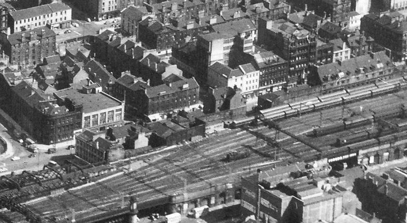
View of both Bridge Street Stations from the late 1960's
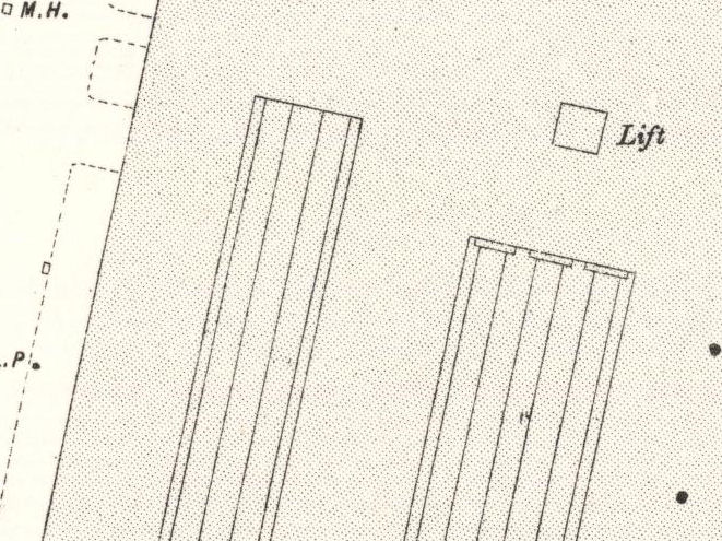
The map below shows Bridge Street Station in the period 1890-1906, before Central Station had been extended to take in more trains.
It was still in use as a railway terminal even though the four platforms nearest the entrance at Bridge Street were used for the track passing through, en route to Central Station.
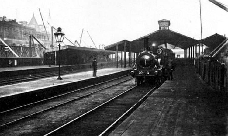
Steam engine at platform of original Bridge Street Station during reconstruction works c.1890
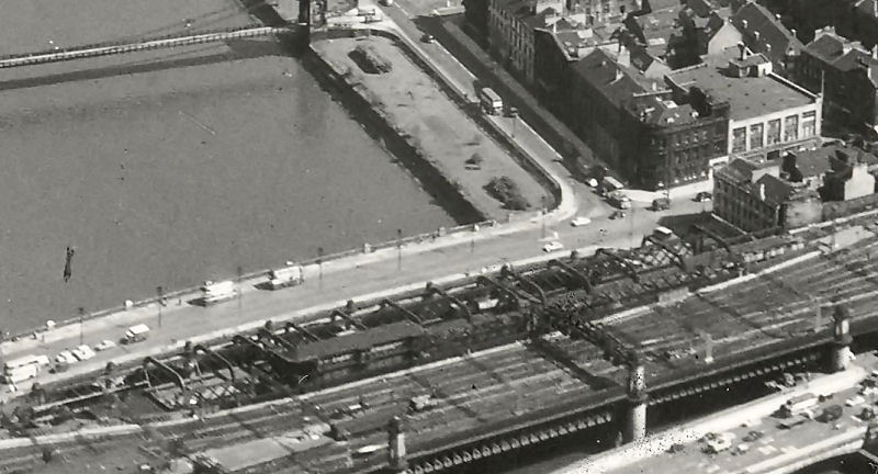
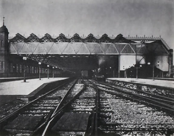
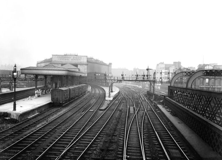
This photograph shows a view from the south looking towards the trains at the terminal platforms of the second Bridge Street Station which opened in 1890. The through trains to Central Station would have used the track on the far right of the photograph with the smoke-stained cladding below the roofspace.
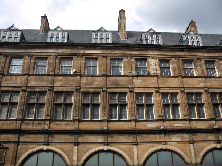
The stonework on the upper levels of the station has been well preserved.
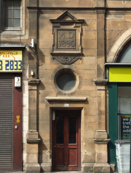
The entrance to the former station at 52 Bridge Street shows the year of construction of the new station buildings, 1890.
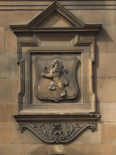
The Caledonian Railway's lion crest features above the former station entrance at 40 Bridge Street, which now leads to the flats on the upper levels.
A close up look at the terminal platforms of the enlarged station, shows 5 tracks with 4 passenger platforms. The additional track between the platforms was used for the storage of rolling stock.
Some of the trains from Edinburgh and the major Lanarkshire towns used the terminal platforms to provide through services to Paisley, Greenock and Wemyss Bay.
These services stopped at the stations at Pollokshields, which had opened in 1870, and at Eglinton Street which had opened on the same day as the enlarged Bridge Street Station in 1879.
This provided Caledonian Railway passengers with a wider choice of destinations in the face of stiff competition.
Billboard at the northern side of the river at Central Station points to Bridge Street Station for the 4 terminal platforms on the opposite bank.
The 4 through lines from Bridge Street terminated at the Union Street side of Central Station, which had 9 platforms at that time.
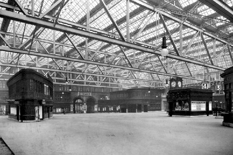
The bright new concourse of Central station in 1905 shows that the platform numbering system had been reversed from the layout of 1890 shown in the above map. Many of the internal features have survived to this day.
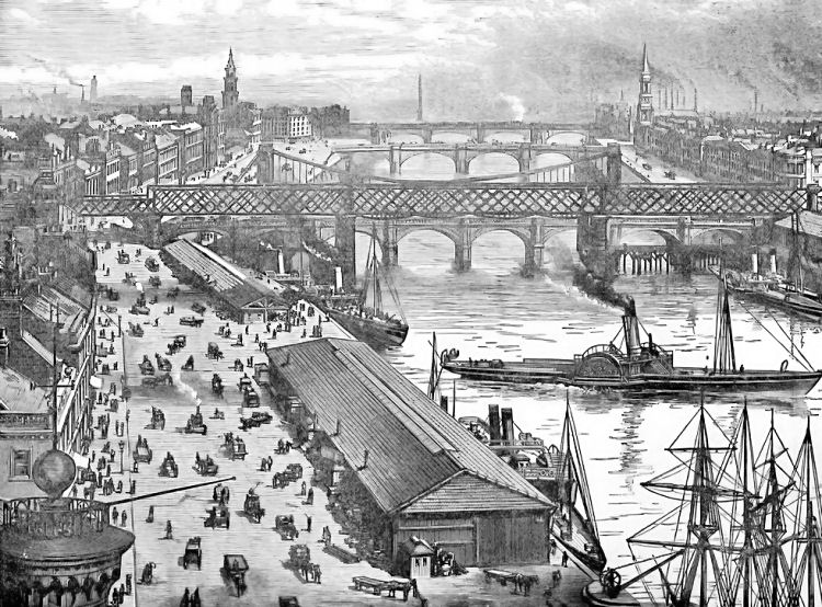
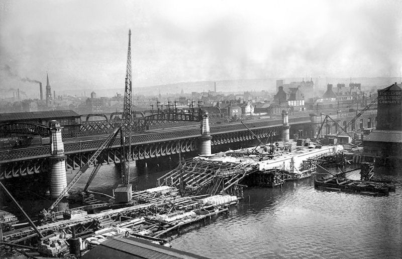
The expanded version of Central Station is shown below, with the original bridge to the right of the picture.
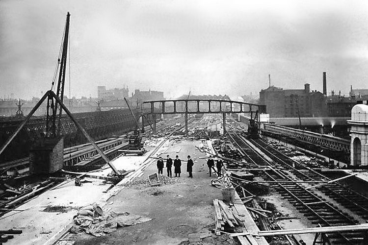
View from 1902 showing the construction of the additional bridge to serve the additional platforms of Central Station, looking southwards towards the second Bridge Street Station. The original bridge, shown to the left of the photograph, was still carrying all the trains terminating at Central Station.
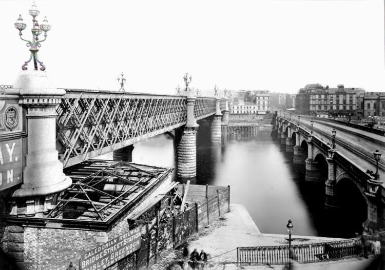
View from the Clyde looking back at the site of the first Bridge Street Station.
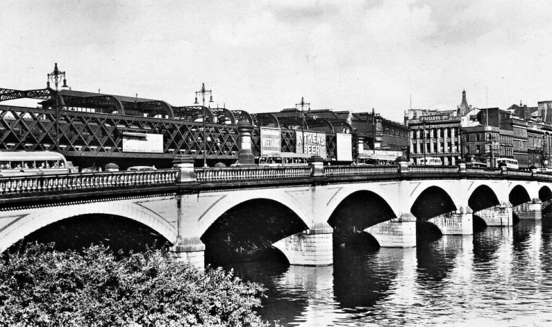
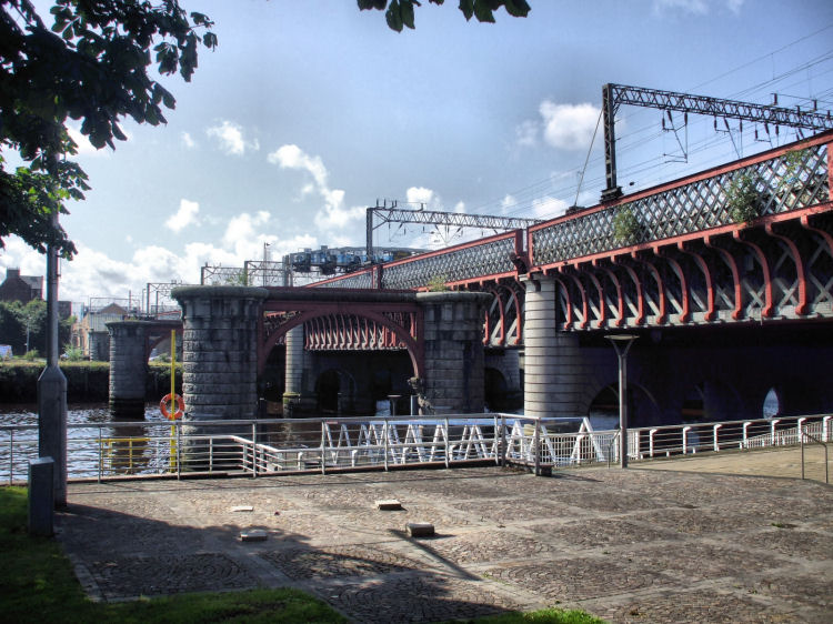
View of the original bridge from Bridge Street to Glasgow Central Station
View of riverside from Bridge Street Station c.1850, before the construction of original bridge to Glasgow Central station
View of original railway bridge from the Broomielaw
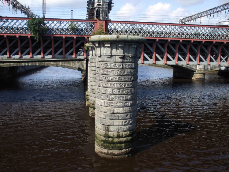
View of the supports of the original bridge which once carried the four track railway from Bridge Street to Glasgow Central station
Granite pier which supported dismantled old bridge leading to Glasgow Central.
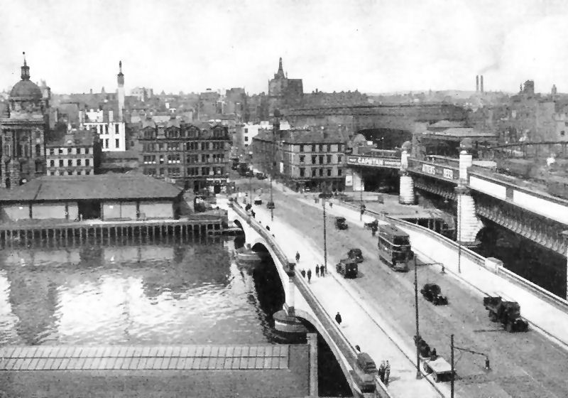
View from Broomielaw, on approaches to Central Station, looking back to Bridge Street
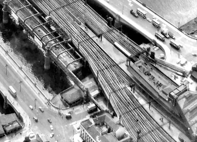
Aerial view of partially dismantled railway line from Bridge Street to Central Station
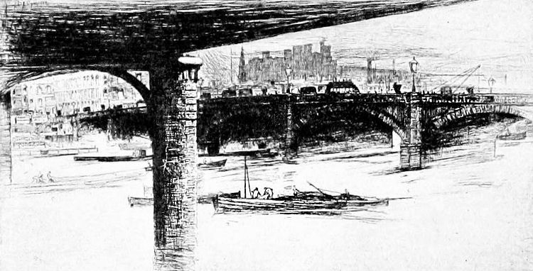
Victorian etching of granite pier carrying railway bridge to Glasgow Central
Construction of King George V Bridge with both Bridge Street Stations in the background, 1926
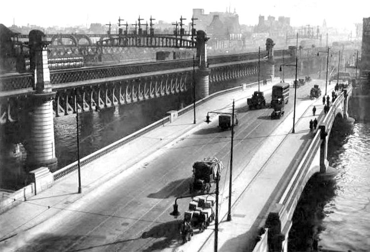
This view from Broomielaw shows the later railway bridge from Glasgow Central Station heading south across the river. The adjacent King King George V Bridge is carrying a bus and other road traffic into town from Commerce Street, which has some very high railway arches let as commercial premises.
View of King George V Bridge and the later railway bridge from Glasgow Central Station
This view of the King George V Bridge from the south shows the expanded Central Station with additional platforms served by the later railway bridge.
View of newly completed King George V Bridge looking towards Central Station
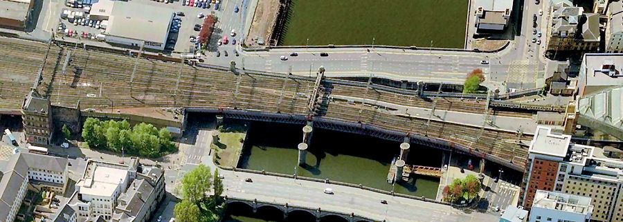
Aerial view of rail and road bridges on approaches to Central Station
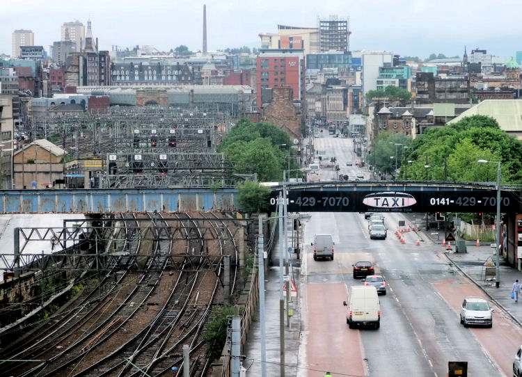
View from M74 motorway at Cumberland Street, looking down Eglinton Street and Bridge Street towards the city centre.
The lines to the massive Central Station in the distance can be seen to the left of the picture.
The gable of the second Bridge Street Station can be seen behind the trees on the left side of the street
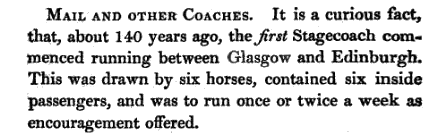
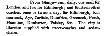
Before the coming of the railway to Glasgow, goods were transported at a leisurely pace by rivers and an expanding network of canals. Passengers had to rely on horse-drawn coaches which were very slow and unreliable and out of reach of the common man.
This extract from “The topographical picture of Glasgow in its ancient and modern state” by Robert Chapman, was published in 1822. It describes the introduction of the first regular stagecoach from Glasgow, 140 years earlier, around 1680. Not exactly mass transportation!
The situation in the early 1820’s, when the book was published, was only a little better.
The extract, below, describes the horse-drawn coaches avialable to passengers at the time. It also gives a fascinating insight into the unforeseen revolution, which would come 20 years later when the old forms of transport were replaced by the iron horse.
An illustrated history of Travel in Glasgow before the Railways is featured in a dedicated page of this website.
The earliest form of steam transport between Glasgow and Paisley was by road, rather than by rail. In 1834, John Russell ran 6 steam powered road-carriages between Glasgow and Paisley on a regular hourly service.
During the Glasgow Fair holiday, however one of the carriages blew up, killing 4 people, allegedly as the result of sabotage by the road trustees, who were hostile to this form of transport.
The service was abandoned a short time later.
The remains of one of these coaches is held by the Glasgow Museum of Transport after being found in a barn near the Paisley Road.
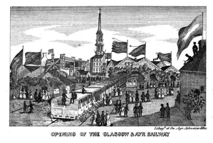
Lithograph of Ayr Station commerating the arrival of the first trains from Glasgow in 1839.
In the early days of the railways Glasgow was a great centre of locomotion manufacture.
It was situated just south of the River Clyde opposite the future site of Central Station.
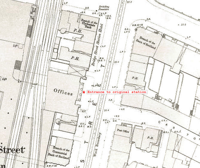
The porte-cochčre, through which horses and carriages could pass through, allowed the intending train passengers to alight under cover, protected from the weather.
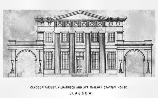
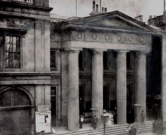
The pends for the porte-cochčre, either side of the Booking Hall, provided access to the station for horse-drawn carriages.
The little pub adjacent to the station was the Railway Arms Tavern. The upper storeys at the corner of Bridge Street and Clyde Place contained the Bridge Street Station Hotel.
This pattern was also used for the terminal tracks entering the later Bridge Street Station and Southside Station, both of which had 5 tracks and 4 platforms.
After the opening of the new station, the buildings of the earlier station had a variety of uses.
The collonaded Booking Hall was converted to offices surrounded by shops and public houses with banks at either end of the block.
The upper floors of the corner building to the north of the Booking Hall continued to be used as an hotel.
The lines across the Clyde in the background are approaching Central Station.
The paper reported that the Caledonian Railway had taken possession of all properties on the city centre site on 28th May 1876.
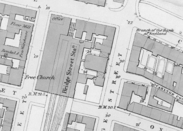
The photograph below shows the frontage of the station between Nelson Street and Kingston Street.
It was closed and redeveloped in 1905/ 1906, after Central Station had been extended to provide extra platforms.
The old station's booking hall had been in use for the enlarged station from 1879 until 1890.
There was an arched entrance to a central booking hall at street level. There were entrances leading directly to the high level platforms at each end of the building, at 40 and 52 Bridge Street.
In 1994 the upper floors of the second Bridge Street Station were converted into apartments. The flats are accessed from stairways entered from the old station entrances at 52 and 40 Bridge Street.
This pattern was also used for tracks entering the earlier Bridge Street Station and Southside Station, both of which had 5 tracks and 4 platforms.
The tracks would eventually cross the river to provide 4 extra platforms at the Hope Street side of Central Station.
The station would be later expanded towards Hope Street to replace the 4 terminal platforms at Bridge Street.

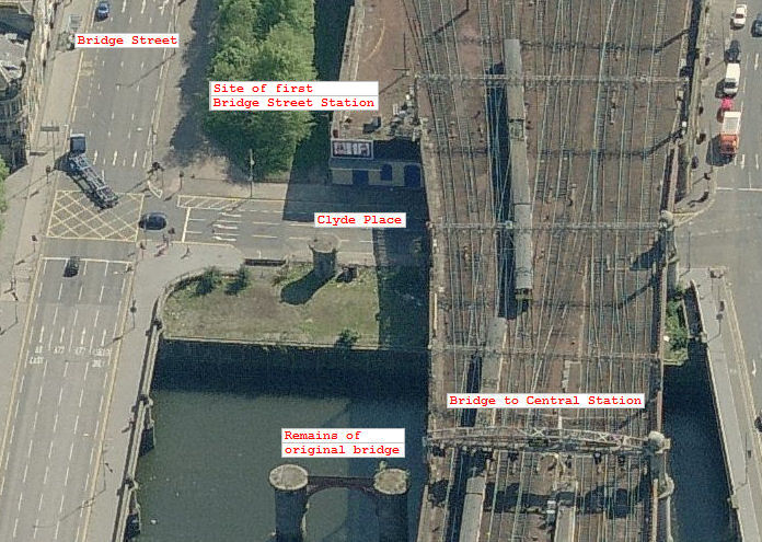
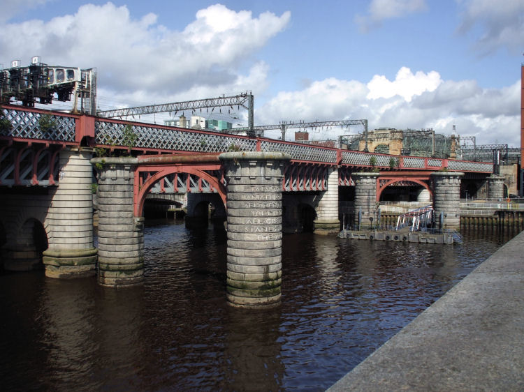
All that remains of the original four track bridge are the granite supporting piers. The present day eight / ten track bridge leads into Central Station on the northern side of the river.
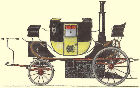
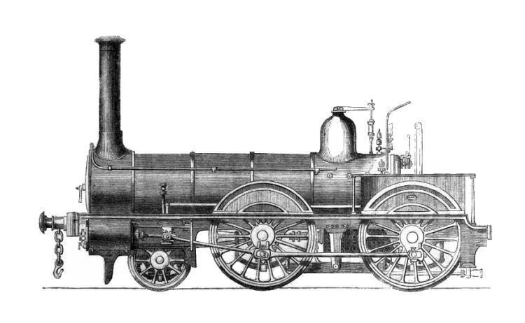
The engine illustrated above was built in the 1850's by Neilson & Company at their Hyde Park Works in Finnieston, Glasgow.
Walter Neilson had began locomotive manufacture at this location in 1843, where the proximity to the harbour allowed for the easy shipment of foreign orders.
As business expanded the foundry and engine works had to move to a much larger site at Sighthill on the northern edges of the city.
![]()
 |
| |
|
|
| |
|
|
| |
|
|
| |
|
|
| |
|
|
| |
|
|
| |
|
|
|
|
|
All original artwork, photography and text © Gerald Blaikie
Unauthorised reproduction of any image on this website is not permitted.
