
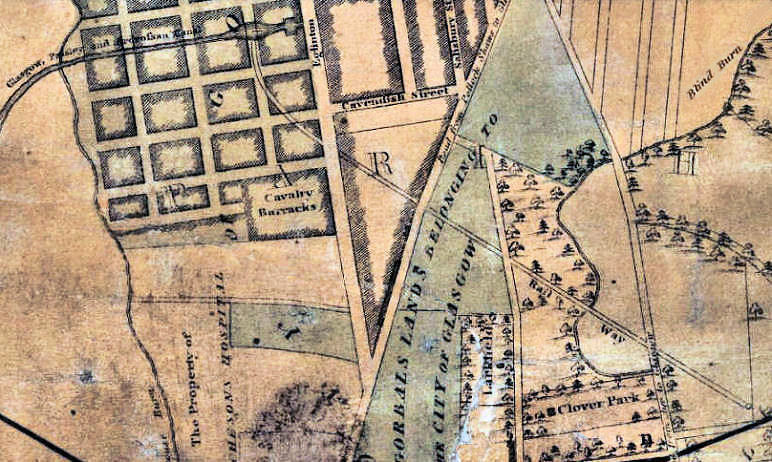
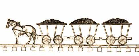
In 1811, Glasgow's first ever railway was created with a short length of track running through the Gorbals area carrying horse-drawn wagons transporting coal from William Dixon's colliery at Little Govan to Port Eglinton, the terminus of the Glasgow Paisley and Ardrossan Canal. The colliery was situated at the northern edge of Govanhill near the junction of Cathcart Road and Aikenhead Road.
The extension to the M74 motorway closely follows the path of Dixon's old line, which ran downhill with conventional track across the rough terrain leading from the colliery and over the little stream known as the "Blind Burn", but became a tramway running down the middle of the road on the approaches to the terminus at Port Eglinton.
The lading was divided among wagons carrying one-and-a-half tons of coal each, rather than one large wagon. This provided flexibility in the use of the horses and the rolling stock.
With the coming of steam locomotion in the middle of the century, horses were still used to haul the coal wagons needed to fuel the railway engines but were no longer required to pull vessels along the canal's towpath which were replaced by steamboats. As time and industrial innovation progressed, this part of the city would be totally transformed by the new transport technology.
In the 1840's new track was laid for the Polloc & Govan Railway, which was the first in the area to carry steam locomotives. It ran to the south of Dixon's original line, with railway traffic passing through a new tunnel at Eglinton Toll heading for the harbourside at the River Clyde. Southside Station was a Caledonian Railway passenger terminal situated at the junction of Cathcart Road and Pollokshaws Road at Gushetfaulds in the Gorbals.
From 1st June 1849, the Caledonian Railway used the station as a terminal for its branch line to Lanarkshire, Dumfriesshire and Carlisle via Polmadie and Rutherglen. This length of track is now part of the West Coast Main Line.
Southside Station continued to be used as a terminus for the Caledonian Railway�s southern routes though Lanarkshire until it closed in 1879, during the development of lines to the new Glasgow Central Station.
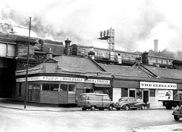
Southside Station was in operation in the very earliest days of photography. This poor quality image has survived to show the entrances to the station and the adjacent coal depot, as seen in the old map.
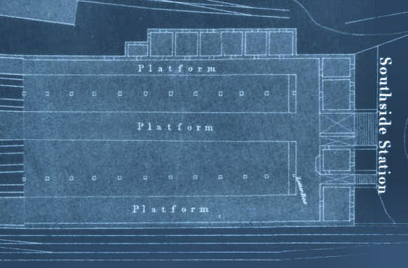
The blueprint of Southside Station, below, shows the platforms which were entered from two stairways from the yard shown in the above photograph. The station had 5 tracks entering it, with 4 passenger platforms. The additional track between the platforms was used for the storage of rolling stock.
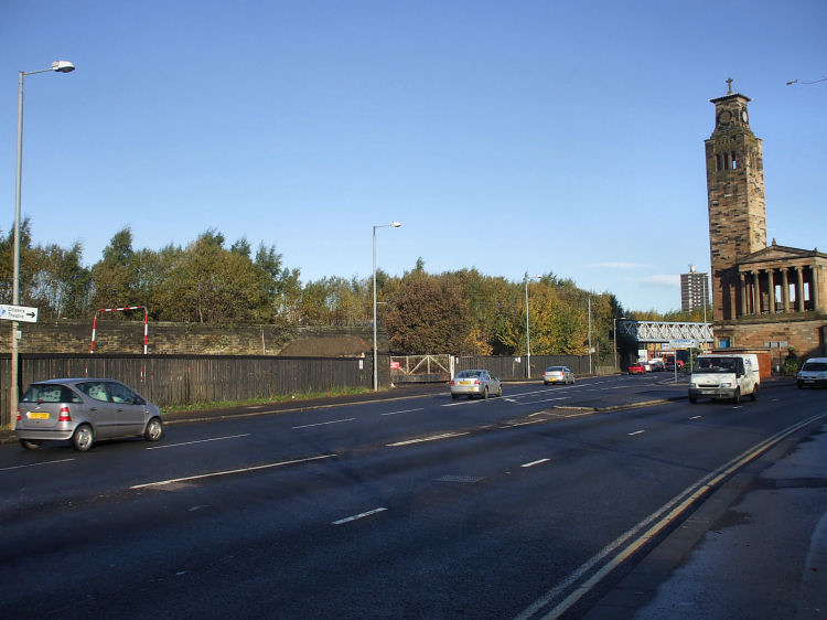
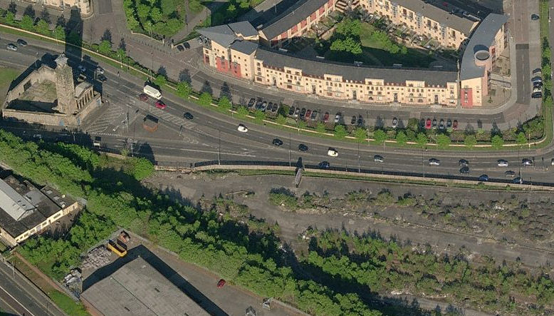
The photograph below shows the site of Southside Station from Cathcart Road, alongside the ruins of Caledonia Road Church.
Photograph from site of Southside Station looking towards entrance from Cathcart Road.
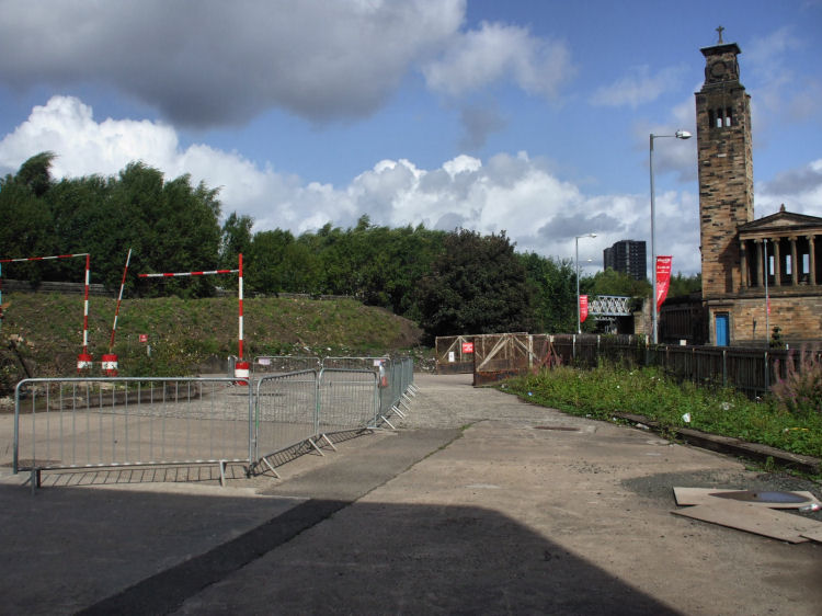
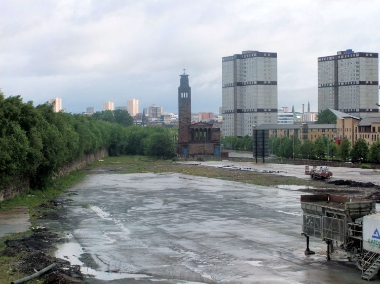
Long view from 2011 of the site of Southside Station with the overgrown railway embankment, built for the Barrhead line, to the left.
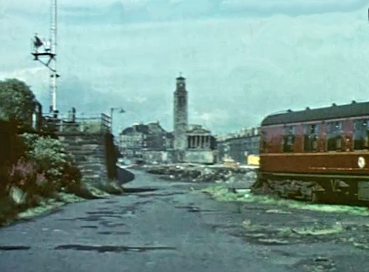
View from 1967 from a similar situation to the 2011 photograph. An old railway carriage and a signal on the viaduct add a bit of character to the scene.
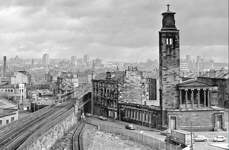
View from the late 1960's of the viaduct carrying the Barrhead line over Cathcart Road and on behind Gorbals Street. The burnt out remains of Caledonia Road Church can be seen with the surrounding tenements still standing.
Workshop facilities were sited at Southside Station, as a supplement to the Caledonian Railway's huge main works at St Rollox, Springburn, on the other side of the Clyde.
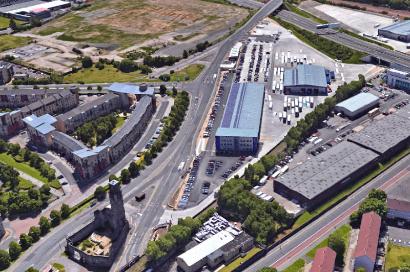
Aerial view of the site of Southside Station, Caledonia Road Church and flats in the "New Gorbals".
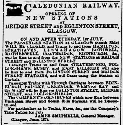
Notice of the station's impending closure on 1st July 1879 was published in the Glasgow Herald of 27th June 1879.
It informed passengers of the replacement stations which were to open on the same day.
The horse-drawn omnibuses used to connect Southside Station with Buchanan Street Station were withdrawn at the same time.
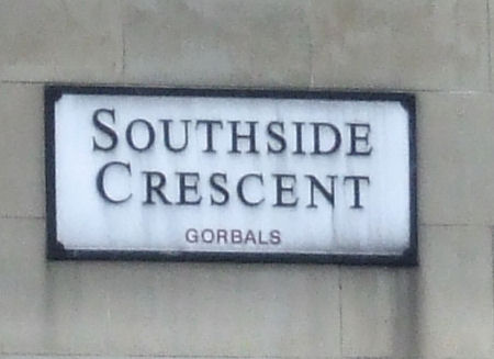
The old station is commemorated by Southside Crescent in the housing development facing its former site.
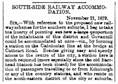
The letters column of Glasgow Herald of 22nd November 1879 published a reader's proposal for new station at the junction of Cathcart Road and Aikenhead Road as a replacement for Southside Station.
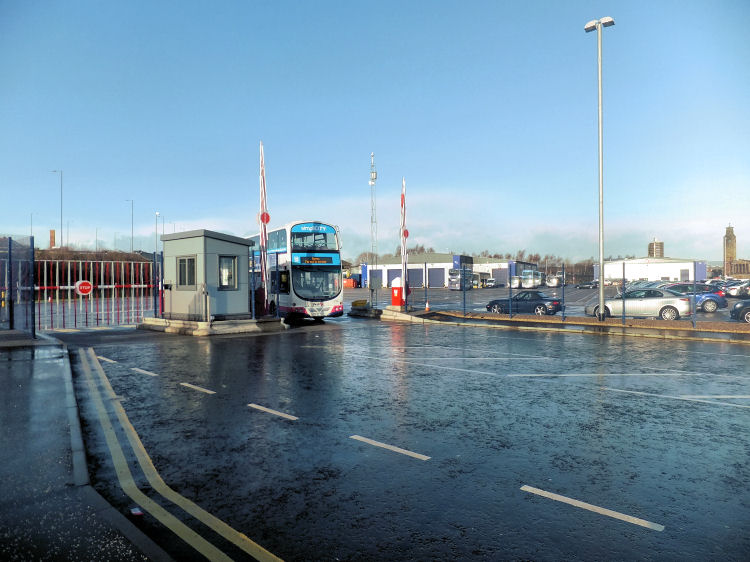
In late 2014 the site of Southside Station was transformed into the 'Caledonia Depot' for the buses and administrative offices of Firstbus, who operate Glasgow's bus system.
Aerial view of Caledonia Bus Depot, Gorbals
Bus leaving Caledonia Bus Depot on the site of the old station, with Caledonia Road Church in the distance
Gorbals Station was created as a partial replacement for the abandoned Southside Station. It opened on 1 September 1877 and remained in use until 1 June 1928.
The present "railway inn" style premises was built on the site of two adjacent pubs on the ground floor of a tenement that stretched from 1 to 37 Cathcart Street, Gorbals. This tenement and the associated pubs disappeared from the Post Office Directories of 1874/75 and 1875/76, when the block was demolished and the railway viaduct was being constructed by the Glasgow, Barrhead and Kilmarnock Joint Railway.
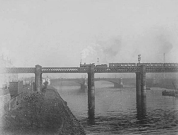
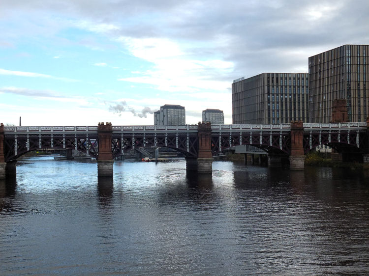
This photograph from c.1900 shows a train from St Enoch Station crossing the Clyde by the City Union Railway Bridge, heading towards the Gorbals stations.
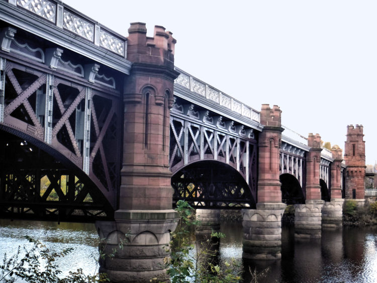
This view from the Gorbals side of the river shows the reburbished and repainted City Union Railway Bridge, November 2016.
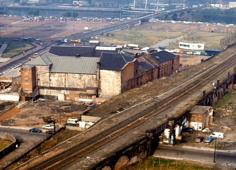
This aerial view from 1977 shows cleared sites of the old tenements which surrounded the City Union Railway viaduct which crosses Cleland Street at the bottom of the picture. The Citizen's Theatre is the only survivor of the area surrounding Gorbals Cross which now includes the Glasgow Sheriff Court complex and the Glasgow Central Mosque.
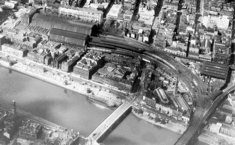
This aerial view shows the approaches to St Enoch Station with the line crossing the City Union Bridge, passing over Stockwell Street and then along Dunlop Street to the terminal.
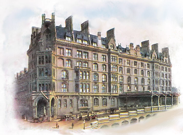
An early 20th century sketch of the massive St Enoch Station and Hotel
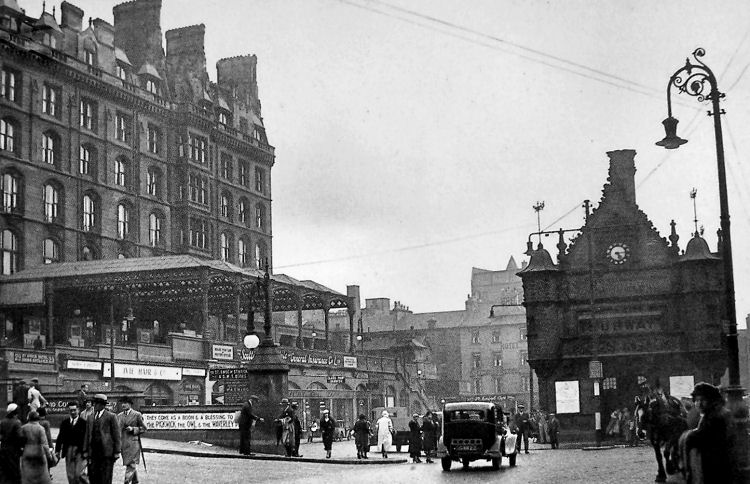
The entrance to St Enoch Station was elevated from the square below and featured a large covered area for the dropping off of passengers. The famous sign at the beginning of the driveway read "They come as boon and a blessing to men - the Pickwick the Owl and the Waverley Pen".
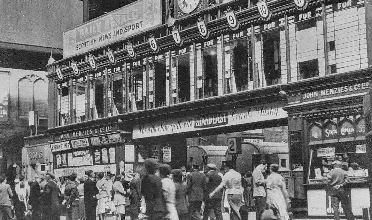
This view shows rushing crowds at the destination boards of St Enoch Station searching for their trains on the old lines.
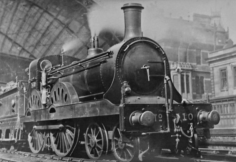
Glasgow and Southwestern Railway's steam locomotive No. 110 seen leaving St Enoch station, c.1897.
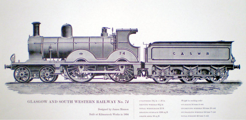
Engineer's drawing of Glasgow and Southwestern Railway's steam locomotive No.74 built at Kilmarnock Railway Works, 1894.
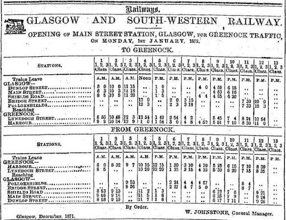
Main Street was the first station on the line from St Enoch to Paisley.
It opened on 1 January 1872 when services terminated at the temporary station at Dunlop Street, which was in use while St Enoch Station was under construction.
Main Street Station remained in use until 1900 when a new station in Cumberland Street replaced it.
The timetable on the station's opening day shows that services to Greenock were shared with Bridge Street Station, meeting up at Shields junction.
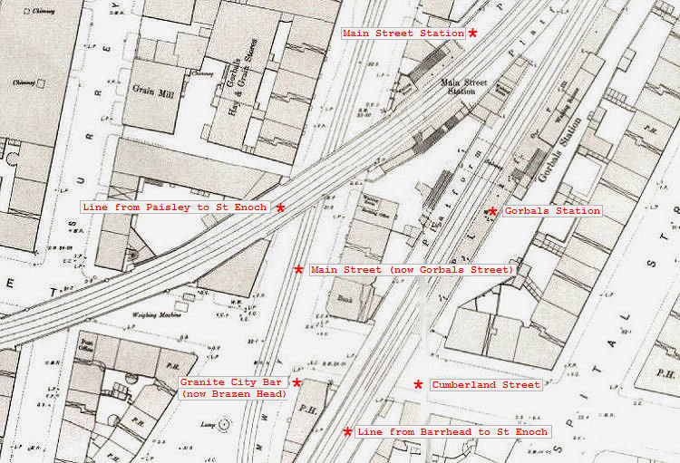
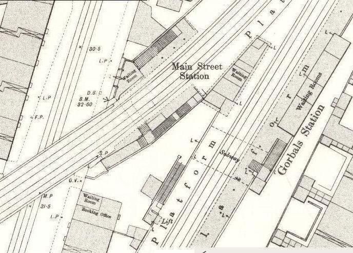
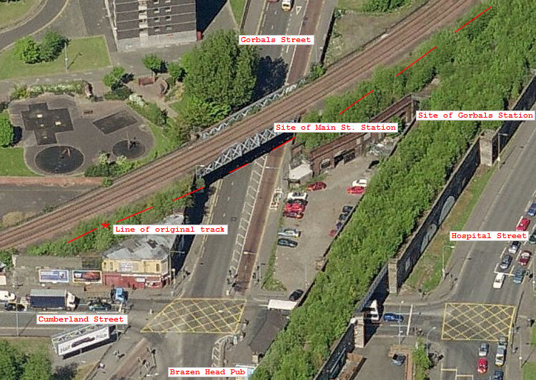
The map below shows the lines to St Enoch approaching Gorbals Station and the nearby Main Street Station, before they connected at Gorbals Junction.
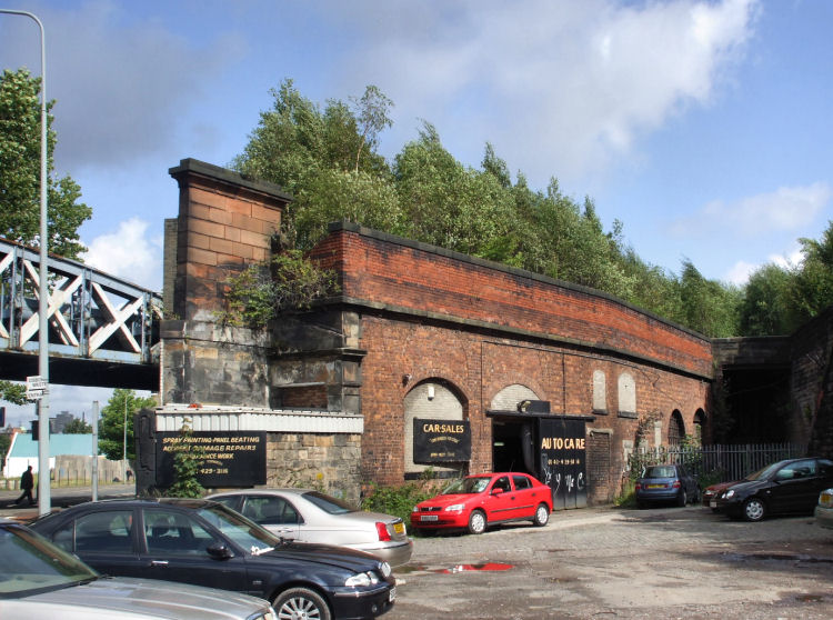
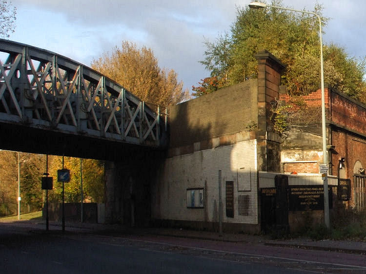
The remains of both stations at Gorbals Street can still be seen.
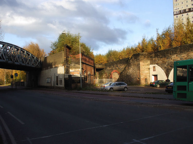
The photograph below shows the site of the stations before the two lines merged at Gorbals Junction.
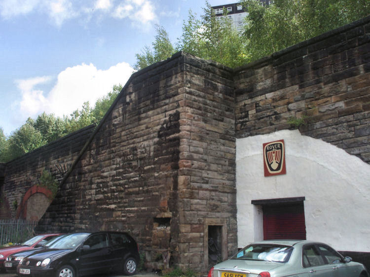
The stone staircase leading to the city bound platform at Gorbals Station is still in place.
On the other side of Gorbals Station, at Hospital Street, you can see the staircase leading to Waiting Rooms and outbound platform.
Close-up view of map, showing stairway entrances on both sides of Gorbals Station as seen in the above photographs.
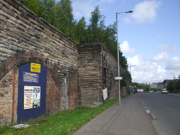
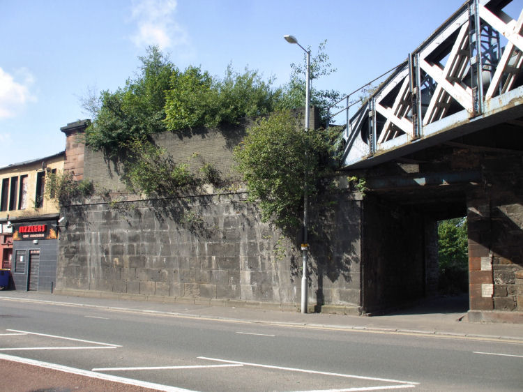
Site of Main Street Station. Like the line and platforms at Gorbals Station, it is overgrown with trees and weeds.
The present day bridge near the site of Main Street Station was a later construction, carrying an additional two tracks over Gorbals Street after Main Street Station closed in 1900.
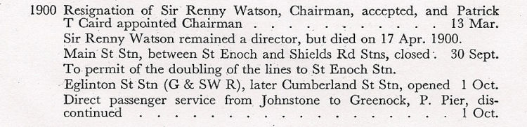
This extract from the "Glasgow and South Western Railway 1850-1923" , published by the Stephenson Locomotive Society in 1950 shows the changes which occured in 1900.
Main Street Station closed on 30th September 1900 to "permit of the doubling of the lines to St Enoch Stn".
On the other side of Gorbals Street from Main Street Station, you can see the overgrown site of the 1870 bridge alongside the 1900 bridge.
An aerial view of the sites of both stations from the south.
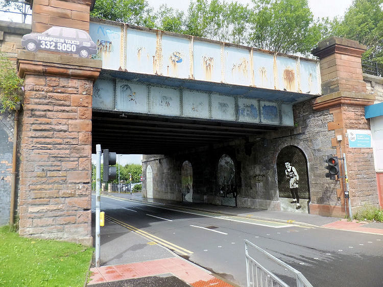
The City Union Railway bridge, linking Gorbals to the north bank of the Clyde, has also had a complete makeover.
View from Hospital Street of steam train on viaduct crossing bridge over Rutherglen Road on approaches to Gorbals Junction.
View from Hospital Street of famous boxer Benny Lynch, featured in one of the murals in underpass at Cleland Street, down the line from the above bridge at Rutherglen Road .
The public artwork was conceived as a "history wall" of famous people with connections to the much derided old district of Gorbals. Liz Peden came up with the idea to �demonstrate to our young people that no matter where you come from, you can achieve great things.� As well as Benny Lynch you can see the sketch of a 'Girl in a Wood� by the artist, Hannah Frank, as well as a portrait of the founder of Pinkerton�s National Detective Agency, Allan Pinkerton, standing alongside U.S. President, Abraham Lincoln.
The railway benefited from the effects of gravity as the track carrying the loaded wagons ran downhill on a gentle gradient from the colliery to the canal terminus. Extensive horsepower was mainly needed to transport the empty wagons back uphill to the coal pit.
Later maps show a subsequent addition to the tramway which ran down West Street to Windmillcroft Quay on the banks of the Clyde. This quay was built by the Dumbarton Glasswork Company to transport coal downstream to their works at Dumbarton, which had no locally accessible sources of fuel.
After the Polloc & Govan Railway was purchased by the Caledonian Railway Company in 1847 the developing network had the capacity to travel southwards through Rutherglen and Motherwell towards the English border.
The station opened on 29th September, 1848, providing a service to Arthurlie Street, Barrhead, operated by the Glasgow, Barrhead and Neilston Direct Railway, which a short time later was taken over by the Caledonian Railway.

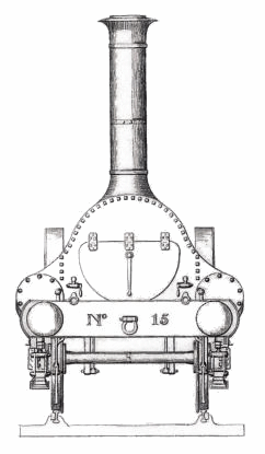
The new locomotives could travel from Southside Station in Glasgow over the border to Carlisle at speeds unimaginable to the the old horse-drawn stage coaches which they had replaced.
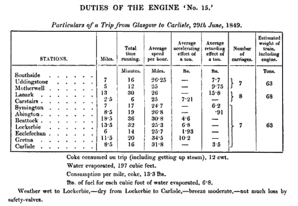
During the first month of operation between Southside Station and Carlisle, Caledonian Railway's Passenger Engine 'No.15' made a number of well monitored trips to assess the speed and efficiency of the new class of compact little steam engines. The maximum average speed reached in the various trials was 41 miles per hour, when the locomotive was carrying five carriages on a non-stop stage between Lockerbie and Carlisle. The table below shows another journey calling at all the intermediate stations on the route.
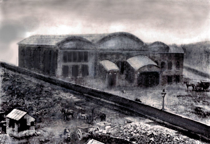
The track for the horse-drawn coal wagons can be seen in both the photograph and the blueprint. The old picture of the station vaguely shows the wagons and the horses around the same location as the rails at the bottom of the plan, below.
This pattern was also used for the tracks entering both versions of the terminals at Bridge Street, each of which had 5 tracks and 4 platforms.
The Barrhead line which previously terminated at Southside was later elevated and carried by an embankment and bridge heading towards Gorbals station, the last stop before the St Enoch Terminus.
After Gorbals Station opened for Barrhead services in 1877, Southside Station continued to be used for Lanarkshire services until it closed in 1879.
I can remember seeing the old timber framed buffers at ground level as I passed by on the 105 trolleybus, before it went under the bridge.
The Glasgow and South Western lines were all south of the river, making it easier to centralise the repair and transfer of rolling stock. Their main workshops were in Kilmarnock, with no need for facilities at their Glasgow terminals.
The site of the station was later used as a freight terminal.
Buchanan Street was the terminus for the Caledonian Railway's services to the north of Scotland, with routes to Stirling, Perth and Aberdeen.
The new station allowed access to trains on the Barrhead branch line to and from St Enoch Station, which had opened nearly a year earlier.
The photograph below shows the viaduct carrying the extended Barrhead line over a new bridge, crossing Cathcart Road, close to Caledonia Road Church. The familiar railway pub at the bridge, the Granite City, survives as the Brazen Head.
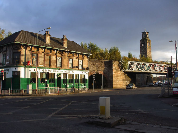
The new Granite City Bar was built abutting the railway viaduct south of Gorbals Railway Station, Hospital Street, which was situated on the other side of the bridge over Cumberland Street, which is still in place.
According to the old Post Office Directories the original corner pub on the site was let to James Anderson, who retained the license for the new pub which first appears as a "stand alone" entry in the Post Office Directory for 1876/ 1877.
It is maintained in a remarkably good condition to carry a disused passenger line!
Trains from Dunlop Street went through the stations at Main Street and Shields Road. Trains from Bridge Street went through Pollokshields Station.
Main Street Station was on the left and Gorbals Station was on the right.
The site of the dismantled 1870 bridge carrying the track into Main Street Station is shown by the much fresher grey brickwork, which was put in place after the bridge had been dismantled.
Colour differences below the wall show where the bridge supports would have been situated.
The following day, 1st October, a new station, "Eglinton Street Stn (G & SW R), later Cumberland Street Stn", opened.
The Post Office Directories for this period show that this large new station had 2 separate addresses, 225 Eglinton Street and 100 Cumberland Street.
The line of the original track at Main Street Station, as shown in the old maps, is marked by a broken red line.
The murals by artist Liz Peden of Gorbals Arts Project were completed in the summer of 2016.
![]()
 |
| |
|
|
| |
|
|
| |
|
|
| |
|
|
| |
|
|
| |
|
|
| |
|
|
|
|
|
All original artwork, photography and text © Gerald Blaikie
Unauthorised reproduction of any image on this website is not permitted.
