

Prior to the large scale re-grouping of small railway companies in the 1920's, there were three different railway stations at Shields Junction in the Pollokshields area of Glasgow.
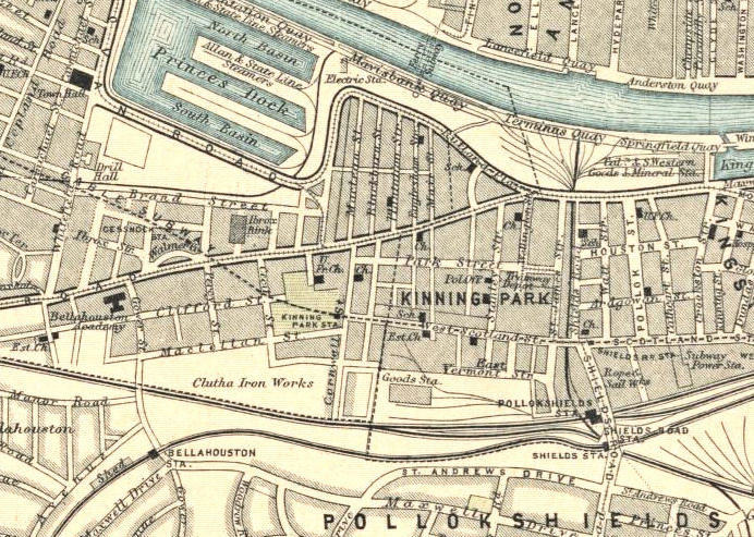
The map below, from the 1890's, shows the stations sitting next to each other on the western side of Shields Road, north of St Andrew's Drive. The Post Office Directory for 1892/1893, around the time when the above map was surveyed, has entries for all three stations.
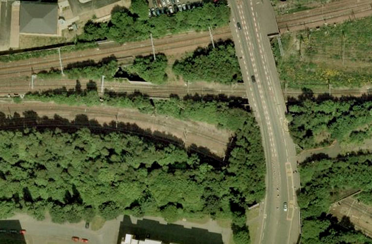
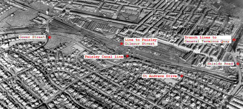
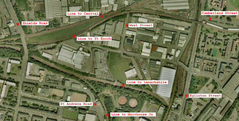
These aerial views show the situation when the stations were in operation compared to as it is today.
The map below was surveyed in 1858 before the track at Pollokshields Station was laid or any of the stations were built.
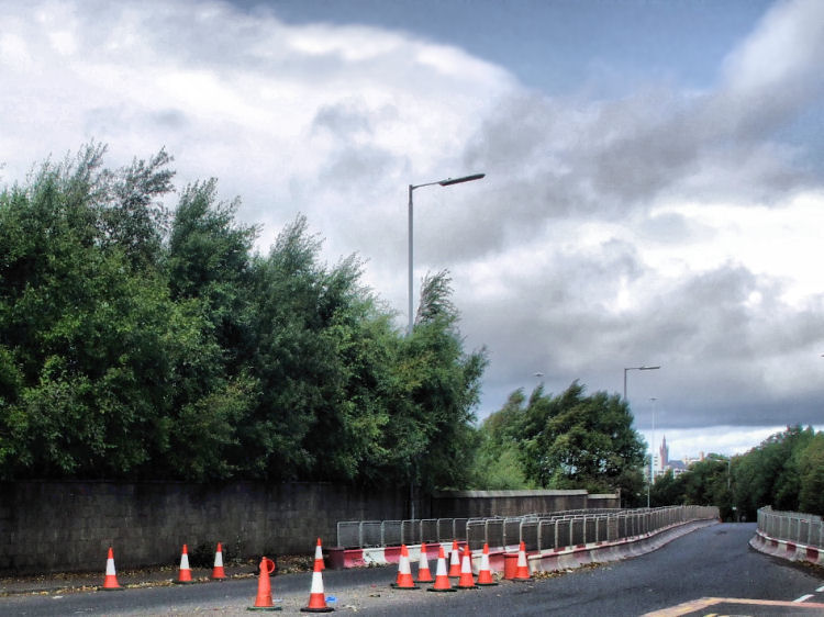
The sites of the 3 station entrances on Shields Bridge are marked today by 3 different walls of varying height.
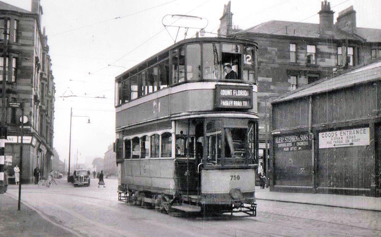
The photograph, above, shows the situation in 1957 when the combined Shields Road Station was still in operation. It was taken from the same viewpoint as the modern photograph and shows that the redundant station buildings were still standing at the time. The photograph below shows a No. 12 tram on the extended 'peak hour' route to Linthouse, which was introduced to provide a service for workers at the Govan shipyards. The tram would have been in Govan Road at Linthaugh, near the bridge over the approach road to the Clyde Tunnel.
Shields Road Station was situated on the original line from Paisley to Glasgow Bridge Street Station which had opened in 1840.
In 1870, when Shields Road Station was opened by the City of Glasgow Union Railway, this stretch of track was diverted for trains which would terminate at the new St Enoch Station.
Initially the trains terminated at Dunlop Street, while St Enoch Station was being developed. The view below is from the site of the former booking office for Shields Road Station. There were double staircases either side of the booking office, leading down to the platforms.
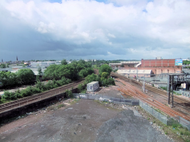
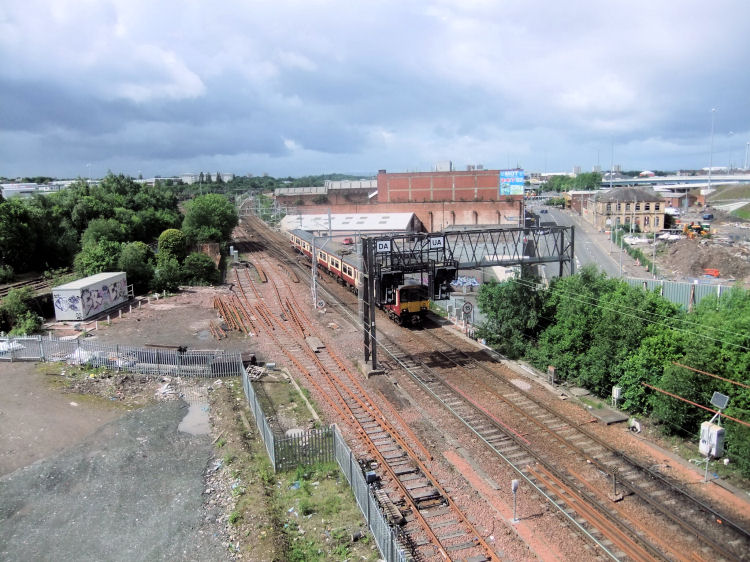
The bridge where the Caledonian line to General Terminus Quay passed under the original 1840 track is still in place.
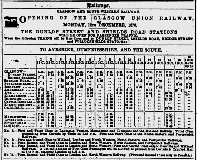
The Glasgow Herald of 12 December 1870 published the notice, below, intimating the opening of the new stations at Dunlop Street and Shields Road. Pollokshields Station came into operation on the same day.
Aerial view from the west, looking towards Shields Road.
Pollokshields Station was situated on a stretch of track which was built much later than the other lines which existed alongside the canal in the mid 1800's.
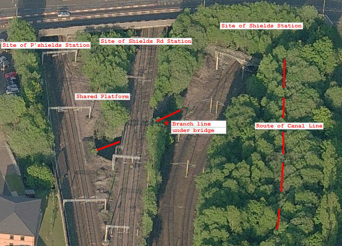
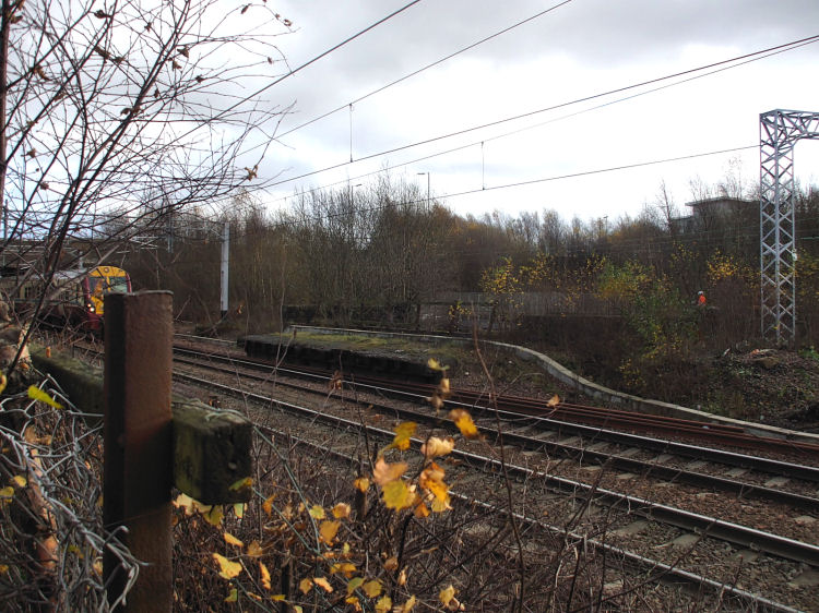
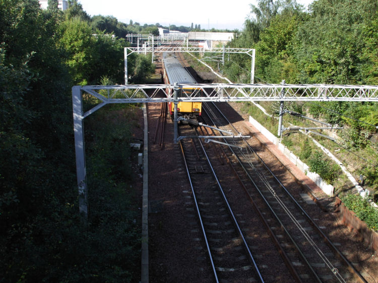
The view below shows a Paisley bound train approaching the remains of a platform at Pollokshields Station which was shared with the city bound platform of Shields Road Station.
View from the site of the entrance stairs leading down to the narrow city bound platform at the former Pollokshields Station, to the right of the picture.
View from the site of the entrance stairs leading down to the outbound platform at Pollokshields Station, which it shared with the city bound platform of Shields Road Station.
When the route of the canal is added to the present day aerial view, you can see that part of the infilled route is still visible on the eastern side of Shields Bridge.
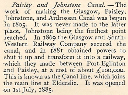
After the canal was infilled, the Glasgow and South Western Railway opened their Paisley Canal line on the route. The rail track followed a much straighter course than the water did.
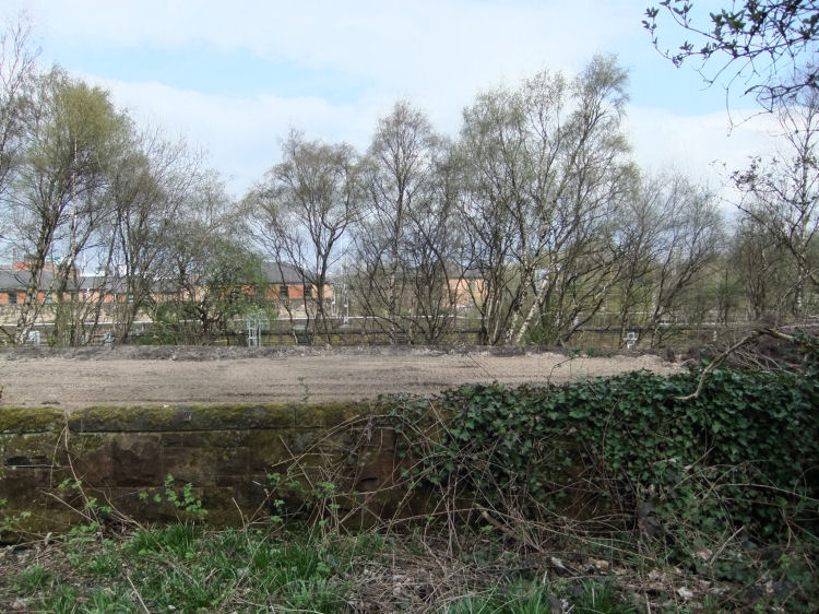
In 2010, as part of a £24 million upgrade to Shields Depot, the heavily overgrown route of the canal at Shields Station has been cleared.
The site has been levelled to lay track for the new depot being built for a new fleet of 38 Siemens Desiro Class 380 electric trains.
Extract from The People's History of Glasgow, (1899) outlining the origins of what it calls the "Glasgow, Paisley, Johnstone, and Ardrossan Canal" and the subsequent railway route.
The present day Paisley Canal line operates from Glasgow Central Station, branching off from the main Glasgow/ Paisley route, just west of Shields Depot.
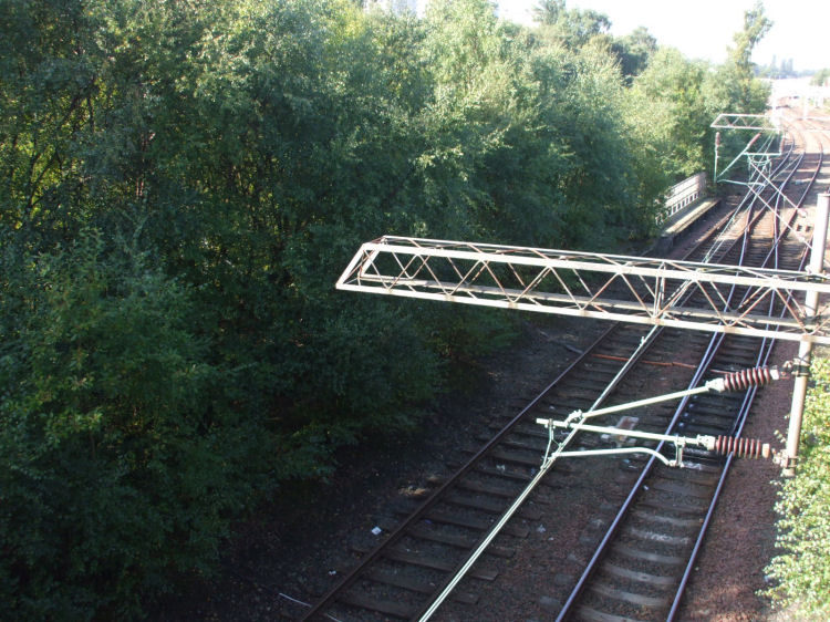
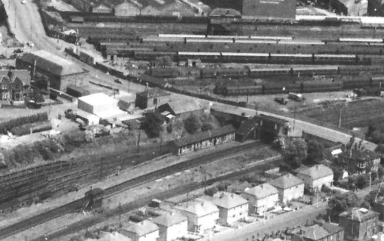
The view below is from the bridge at Gower Street, looking back towards Shields Depot, which is behind the trees to the right. Bellahouston Station was situated on the other side of the bridge when the line opened in 1885.
A larger view of the whole area lets you see the site of Bellahouston Station on the Paisley Canal line where it passes under the bridge in Gower Street.
This view of Bellahouston Station from the 1960's shows the bridge at Gower Street and the then modern semi-detatched houses in Maxwell Drive at the bottom of the frame.
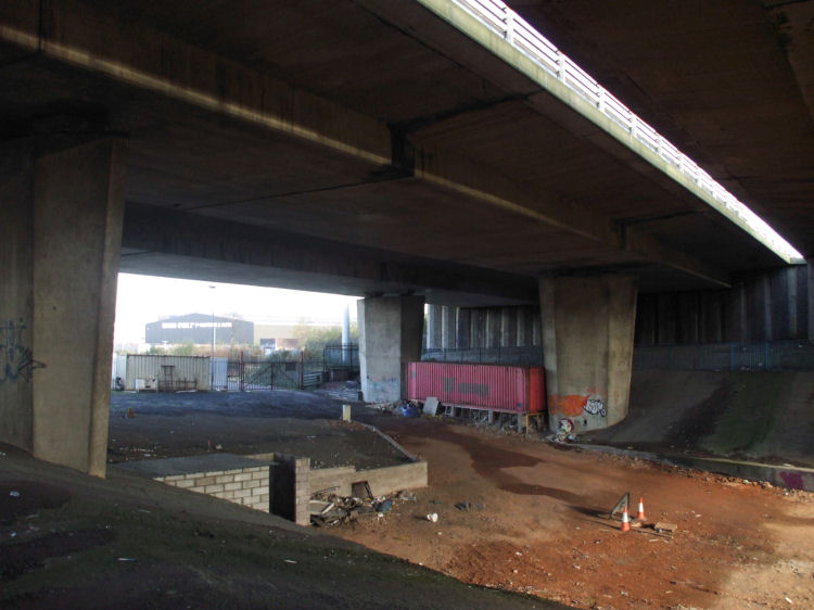
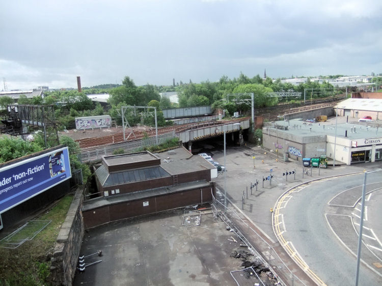
The remains of part of the route of the Caledonian line from Shields Junction to General Terminus Quay can be seen at the corner of Shields Road and Scotland Street, under the M8 motorway.
Aerial views of the track between Shields Road and Gower Street show that Shields Depot was built on the site of the old canal.
Aerial view of the track between Shields Junction and the city show that the old railway links are still very much in place.
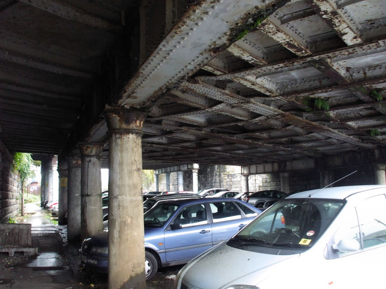
Under the bridges at West Street, where the lines to Central and St Enoch cross over.
After passing over the bridges at West Street the tracks diverge. The line to St Enoch is on the left, heading towards Cumberland Street, and the line to Central is on the right.
City bound train crossing the bridge at West Street. In the background you can see Scotland Street and the extended M74 motorway, shortly before it merges with the M8.
View of West Street Subway Station at corner with Scotland Street, adjacent to the railway bridges. If the old line was ever brought back into use as part of the Glasgow Crossrail scheme for passenger travel north of the River Clyde, this would be the ideal site for an interchange with the rail lines to Central Station and the Glasgow Subway.
The three stations, Pollokshields, Shields Road and Shields, which had existed side-by-side since the mid 1880's, were combined to form a new Shields Road Station which opened on 1st April 1925.
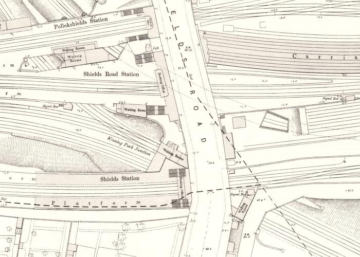
Pollokshields Station on the Glasgow & Paisley Joint line was at 312 Shields Road.
Shields Road Station on the City of Glasgow Union line was at 326 Shields Road.
Shields Station on the Glasgow and South Western's Paisley Canal line was at 350 Shields Road.
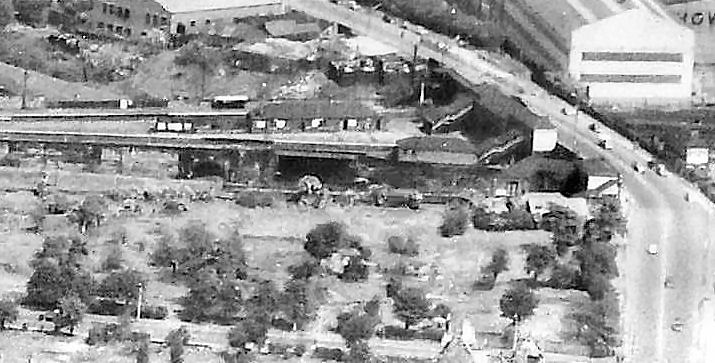
The paths of the various lines are still recognisable, with the exception of Shields Station at the bottom, where the track for the Paisley Canal line has been lifted.
The trees mark the sites of the former station buildings, which have vanished almost without trace.
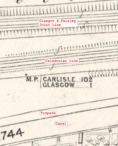
The Glasgow Paisley and Ardrossan Canal, which would later form the route of the Paisley Canal railway line, is shown at the bottom of the map, running parallel with the rail track.
Between the canal and the Glasgow & Paisley Joint line, the map shows the Caledonian Railway's lines which diverged at Shields Bridge. The line to General Terminus Quay passed under the Glasgow and Paisley Joint line while the track which ran alongside the canal towpath connected to the route to Paisley.
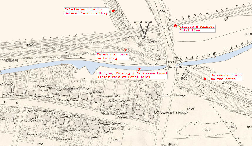
Map showing site of trackside milepost; "M.P. Carlisle...102 Glasgow...1".
Shields Station was nearest the camera, behind the dense foliage; Shields Road Station was behind the centre wall and Pollokshields Station, the smallest of the 3, was behind the last wall.
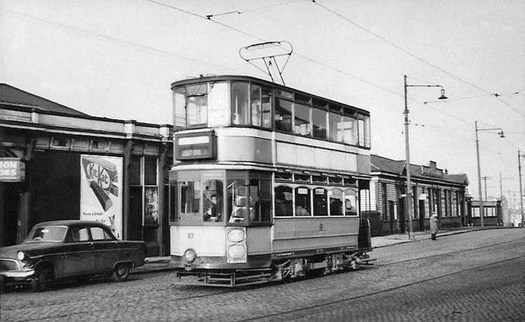
The picture is one of a collection of photographs of trams in Pollokshields taken by Mr J L Stevenson which are being scanned by Pollokshields Heritage, who kindly supplied the image. The tram captured on film was a No. 12, which operated between Mount Florida and Paisley Road Toll.
The trees on either side of the bridge now cover the site of the platforms and waiting rooms at Shields Road Station.
Many of the trains from Dunlop Street only travelled as far as Renfrew, passing through the new Shields Road Station on the way.
Other services operated to Ayrshire, Dumfriesshire and to Carlisle for connections to the major cities of England.
Trains to Carlisle continued to run from Bridge Street, through the new Pollokshields Station.
All the trains to Greenock from Bridge Street/ Pollokshields and from Dunlop Street/ Shields Road stopped at Paisley.
On the far left, you can see the small amount of space left for Pollokshields Station and the need to share a platform with Shields Road Station.
When the original Paisley to Glasgow line was diverted to St Enoch, a replacement line from Shields Junction to Bridge Street Station would have been needed. Pollokshields Station was situated on this additional track, which was squeezed into the gap at the northern end of the complex.
There was a booking office fronting Shields Road, with stairways either side leading down to the platforms.
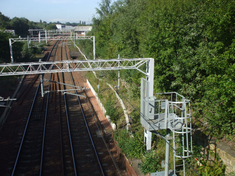
The train passing through is heading for Paisley Gilmour Street Station.
Shields Station was opened on 1st July 1885 when the Paisley Canal line came into operation.
The track has been lifted and the station buildings demolished at this location, so there is nothing much left to explore.
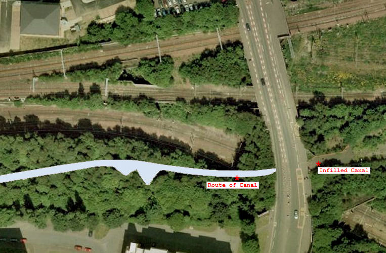
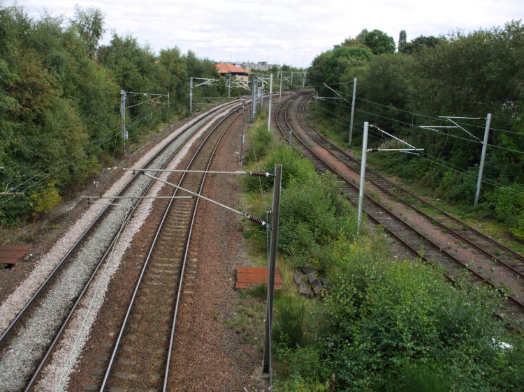
The Paisley Canal line is now initially 4 track, before merging at the M77 motorway, close to here.
The main Glasgow/ Paisley Gilmour Street line passes the other side of the building with the red roof at the top of the picture.
You can also see the branch line from Shields Junction to General Terminus Quay and the Glasgow subway stations in the area, from Shields Road to Cessnock.

![]()
 |
| |
|
|
| |
|
|
| |
|
|
| |
|
|
| |
|
|
| |
|
|
| |
|
|
|
|
|
All original artwork, photography and text © Gerald Blaikie
Unauthorised reproduction of any image on this website is not permitted.