
Cumberland Street Station was built by the Glasgow & South Western Railway following the doubling of the track to St Enoch Station in 1900. It was constructed as a replacement for Main Street Station, Gorbals, which was too small for the increased rail traffic.
The new station had four platforms stretching from Eglinton Street to Salisbury Street. It was in use from 1900 to 1966, when passenger services to St Enoch Station ended.
At the time of closure Cumberland Street Station had been the last stop on the City Union Line before it crossed the Clyde towards the city centre.
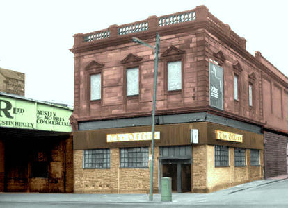
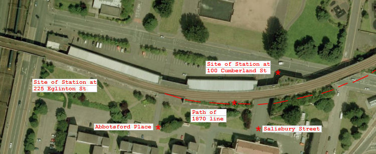
The Post Office Directories in the early 1900ĺs show two different addresses for the station, 225 Eglinton Street (above, left) and 100 Cumberland Street (above, right). This reflected the fact that there were two separate station buildings at either end of the four very long platforms.
The stationĺs original title was Eglinton Street. It was changed to Cumberland Street in 1924 to avoid confusion with the Caledonian Railway station also called Eglinton Street, which served trains operating from Central Station from the early 1880's.
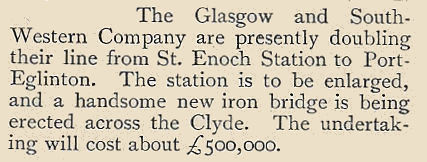
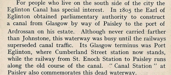
This extract from The People's History of Glasgow was published in 1899 around the time when St Enoch station was being enlarged and the line across the river was being doubled.
This expansion created the need for a new station at Port Eglinton, south of the River Clyde, specifically designed to cope with the increased traffic generated by doubling the track heading into town.
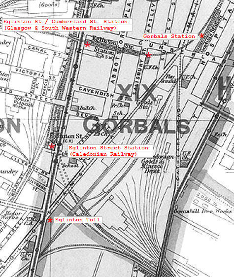
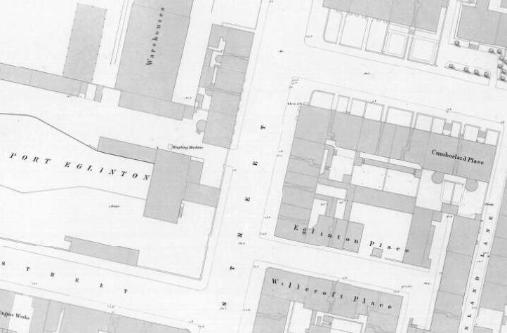
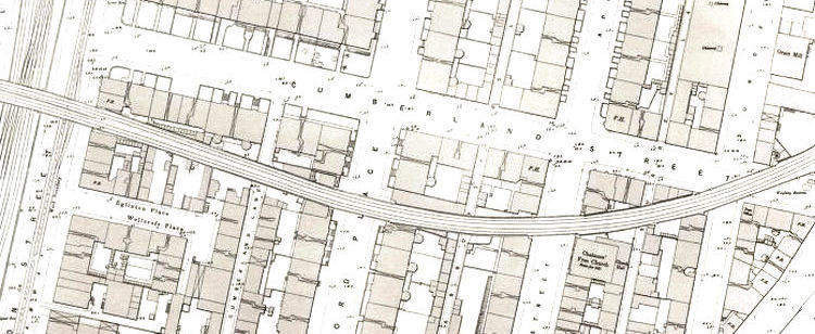
The map below shows the junction of Eglinton Street and Cumberland Street, facing the canal terminus, before the arrival of the familiar passenger railway lines which were soon to dominate the area.
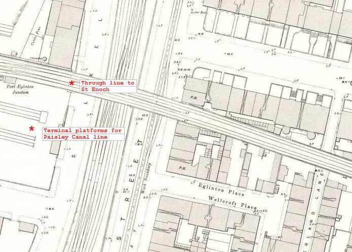
The map below shows the same junction after the arrival of the railway, before the new station had been built.
The track had first crossed Eglinton Street in 1870 to the north of the path of the old canal. City bound trains headed for Main Street Station as the last stop before the St Enoch terminus.
In 1900 the line which had previously terminated at the end of the canal was extended over the street into the new station. The station building was constructed at the corner of Wellcroft Place and Eglinton Street.
The extract below from Glasgow: Its Rise & Progress was written in the 1930's, shortly after the station had been renamed as Cumberland Street.
It outlines the early history of the area and the connections with the Earl of Eglinton and the construction of the canal which would later be infilled and replaced by railway tracks.
Eglinton Street was originally called Bloomsbury Street. It was renamed in honour of the Earl of Eglinton around the time of the opening of the canal.
Much confusion has been caused by the fact that various parts of both lines can be seen in the present day freight line running along Cumberland Street.
It would appear that there was a major re-alignment of the track for the 1900 station, rather than a simple doubling up with a parallel line.
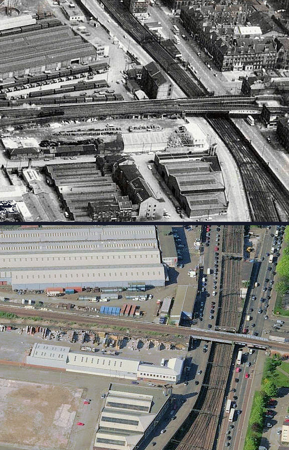
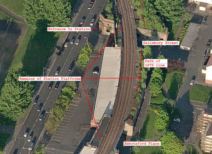
Creating a layer of the path of the original line from a pre-1900 map, and adding it to a modern aerial photograph, lets you see what is retained of the old route.
Between Eglinton Street and Abbotsford Place the 1900 line and station building have been completely removed.
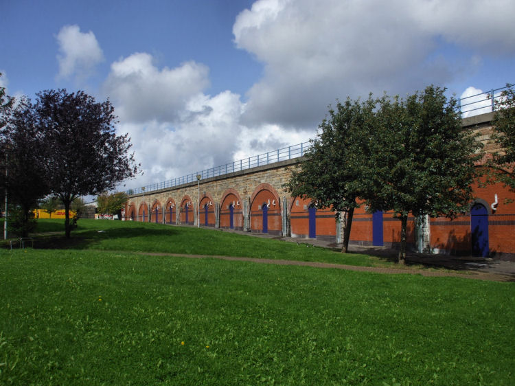
The 1900 line has been retained between Abbotsford Place and Salisbury Street, alongside the viaduct which carried the 1870 line from the rear of the station at Salisbury Street.
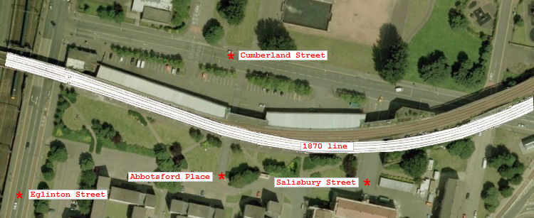
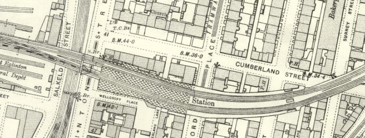
The final map, dating from 1934, shows that the passenger platforms of Cumberland Street Station were under cover as far as Abbotsford Place, then open to the elements down to the Salisbury Street entrance.
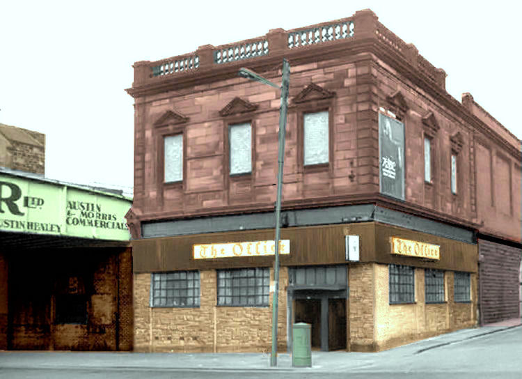
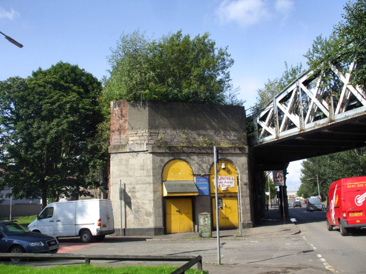
The view below shows the building at 225 Eglinton Street for Cumberland Street Station after the closure of the St Enoch terminal.
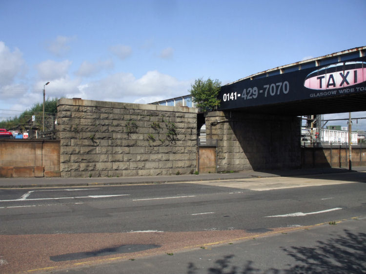
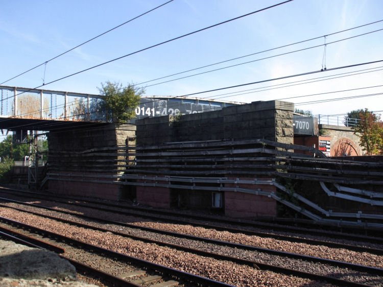
The bridge next to the station building was erected in 1900 at the same time as the station. It has since been dismantled, leaving only the earlier 1870 bridge to the north.
The station buildings at Eglinton Street and at Cumberland Street/ Salisbury Street were both designed by William Melville, engineer to the Glasgow and South Western Railway.
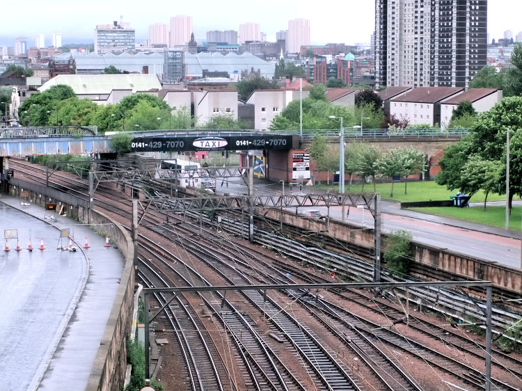
Long view of the site of Cumberland Street Station with the huge glass structure of the St Enoch Centre in the distance. This would have been the site of St Enoch Station, the terminus for most of the passenger trains crossing the bridges shown below.
On the southern side of the remaining line, the station buildings and platforms have been completely removed between Abbotsford Place and Eglinton Street.
This view looking towards Eglinton Street shows the landscaped route of the former track leading towards the site of the demolished station building.
Looking towards Port Eglinton from the landscaped area which was formerly the site of the station building at 225 Eglinton Street.
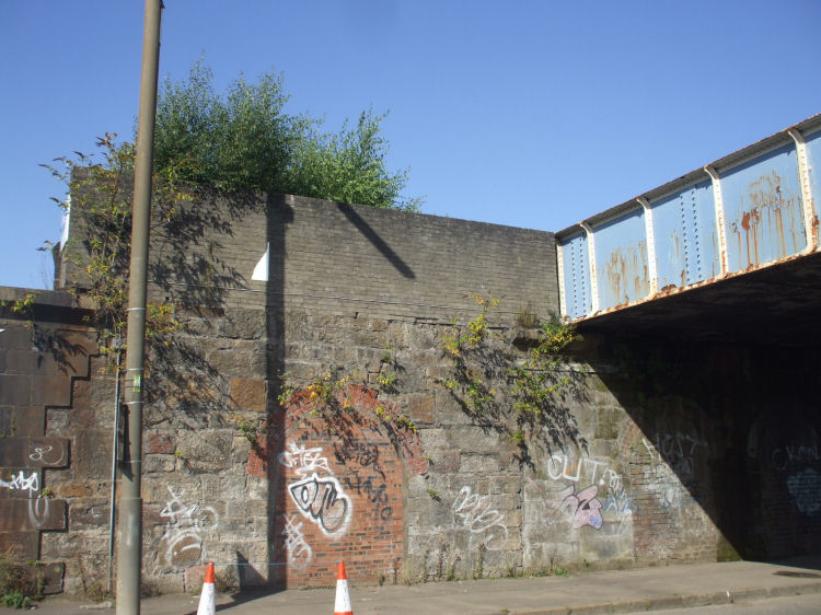
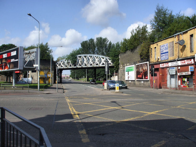
The route of the 1900 bridge over Eglinton Street can be clearly seen by the redundant stone pier.
The original 1870 bridge to the north of the old canal terminus is still in place.
On the other side of the wall, where the bridges crossed the Caledonian Railway's line into Central Station.
In Port Eglinton, where the old canal terminated, the brickwork marks the route of the missing line.
This composite view shows the line at Port Eglinton before and after the removal of the 1900 bridge
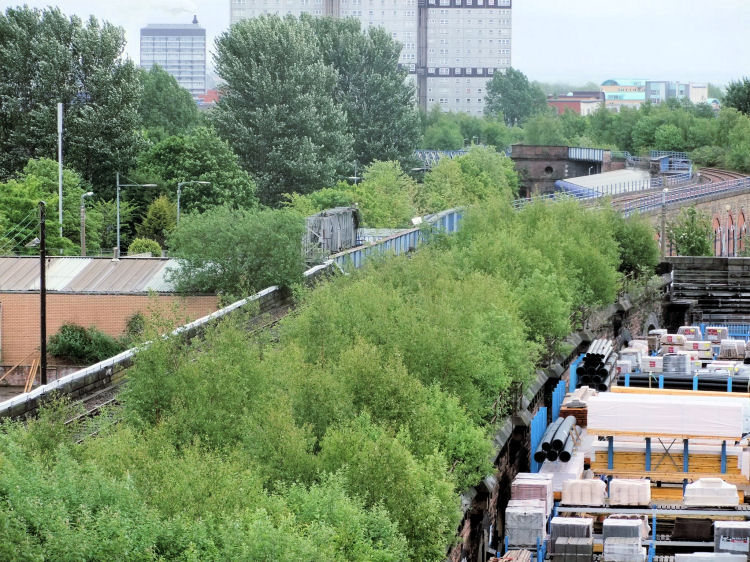
Overgrown site of line at Port Eglinton, as it approaches the missing bridge. The remains of Cumberland Street Station can be seen in the distance.
The Builders Merchant's yard, bottom right, would have been the site of the terminus for the Paisley Canal line, below the viaduct for the second bridge which was constructed to extend the track to St Enoch Station.
Sketch of the canal terminus in 1835, with horse-drawn wagon unloading pig-iron to be transported by boat.
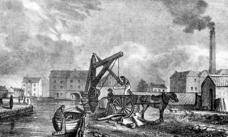
In the background, to the left, you can see passengers awaiting to board boats to Paisley and Johnstone.
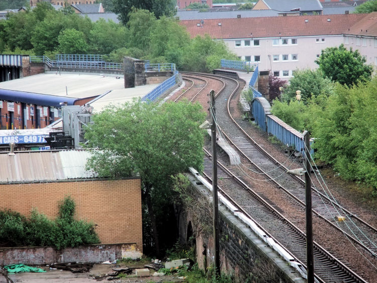
View of the track passing over the bridges at Eglinton Street and past the remains of the platforms of Cumberland Street Station on the bridge over Abbotsford Place.
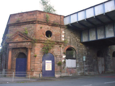
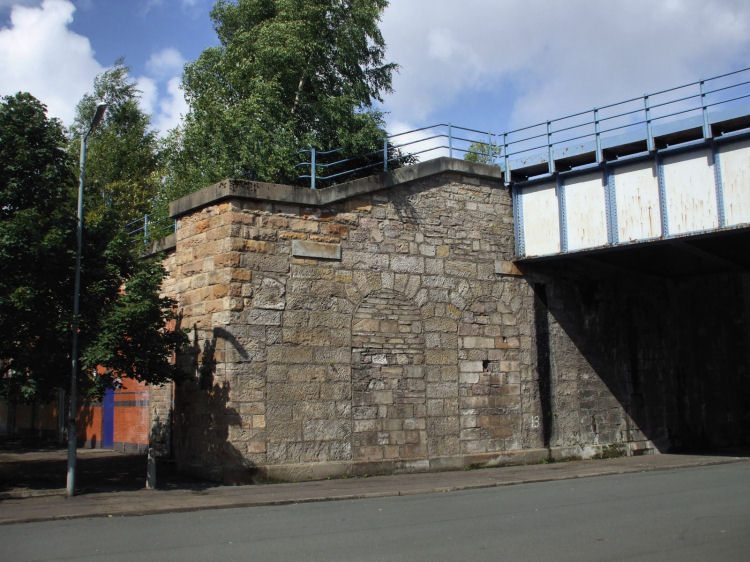
The red sandstone station building at the corner of Cumberland Street and Salisbury Street was situated at the eastern end of the platforms.
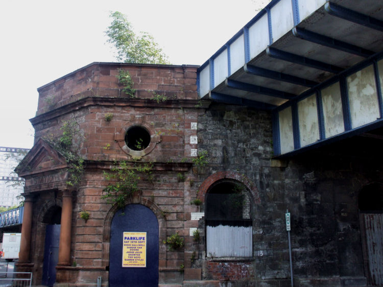
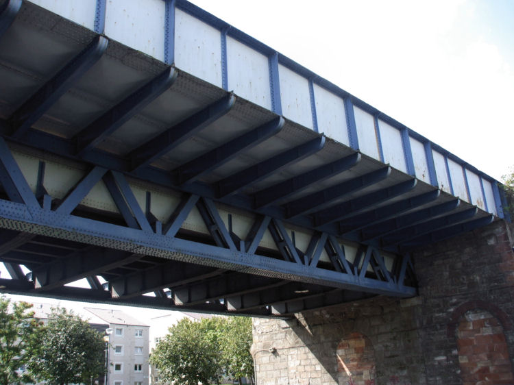
The shallow bridge nearest to the entrance carried a city bound platform across Salisbury Street.
Behind the bridge platform, the 1900 railway bridges across Cumberland Street and Salisbury Street are still in place, entering and leaving the station.
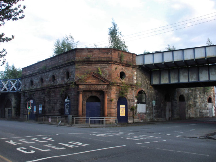
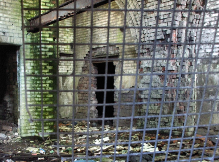
View of the station entrance at the corner of Cumberland Street and Salisbury Street.
You can see the shallow bridge carrying the station platform over Salisbury Street alongside the deeper bridge carrying the track.
A look inside the station building shows it to be in a state of complete dereliction .
The aerial view below shows the surviving parts of the station between Salisbury Street and Abbotsford Place. Nothing remains of the station between Abbotsford Place and Eglinton Street.
On the Cumberland Street side of the line a shallow bridge carries part of the station platform across Abbotsford Place.
Looking back towards Salisbury Street at the rear of the station building, you can see that the site of track and platforms for the 1870 line is now badly overgrown.
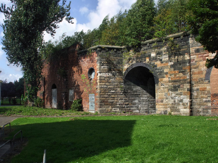
From the other side of Salisbury Street you can see the stone viaduct which carried the 1870 track towards Abbotsford Place. The stonework shows traces of the bridge supports and doorways underneath.
Grey brickwork next to the 1900 bridge marks the site of the 1870 bridge entering the rear of Cumberland Street Station from the east.
Long view along Cumberland Street from corner at Brazen Head pub looking towards Eglinton Street.
The grey brickwork on either side of the street shows where the line from Main Street Station crossed over.
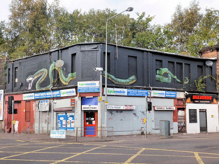
The building at the corner of Cumberland Street and Gorbals Street has been decorated with a reptilian mural. The CCTV camera appears to be part of the snake's vision of the street!
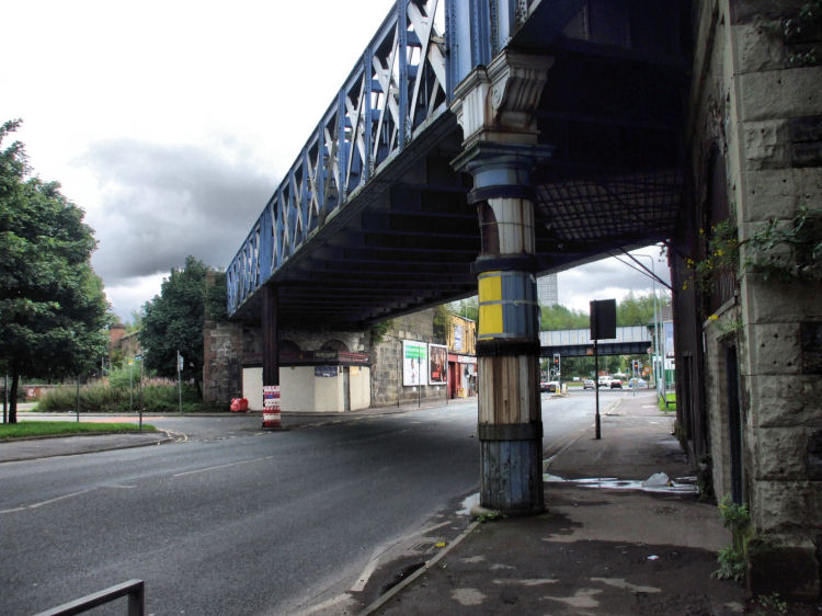
View of the line crossing Cumberland Street towards the St Enoch terminus shows the 1900 bridge supported by cast iron columns. The bridge leading into the site of Gorbals Station can be seen in the background.
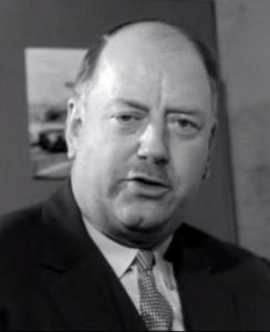
The closure of Cumberland Street Station was part of the programme of rationalisation proposed by Doctor Richard Beeching (left).
At the time Beeching's proposals created much more of an uproar in remote rural areas than in Glasgow, where there had been a long term realisation that the city had an over provision of railways dating from the period before nationalisation in 1948.
The Lord Provost of Glasgow, Mrs Jean Roberts, commented on "the wonderful opportunities the proposed rail closures are likely to present for redevelopment and for easing the traffic problem in the centre of Glasgow."
Beeching's proposals were seen as an opportunity for extending and linking up existing rail and underground systems, allowing co-ordinated road and rail transport in the city.
Cumberland Street station closed on 14th February 1966, a few months before all services from St Enoch ended.
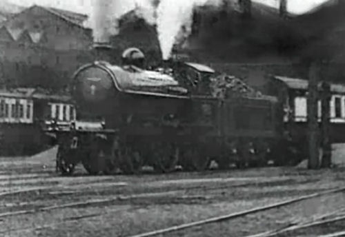
Here we see an Ayrshire bound train leaving St Enoch Station on its way to Cumberland Street.
The report, which was published on 27th March 1963, proposed the closure of 435 Scottish stations including the Glasgow mainline terminals at Buchanan Street and St Enoch.
The editorial in the Glasgow Herald of 28th March 1963 commented that "The railways have inherited a system created in the age of competition with the horse".
Before Central Station had opened in 1879, transfers between the Caledonian Railway's terminal at Buchanan Street and their terminal at Southside Station, Gorbals, were by horse-drawn omnibus!
Passengers arriving at Buchanan Street wishing to get to Southside Station for connections to Lanarkshire had to use a very primitive means of road transportation. As the editorial had pointed out, the situation in the 1960's was obviously very different.
![]()
 |
| |
|
|
| |
|
|
| |
|
|
| |
|
|
| |
|
|
| |
|
|
| |
|
|
|
|
|
All original artwork, photography and text © Gerald Blaikie
Unauthorised reproduction of any image on this website is not permitted.
