
The River Clyde at Glasgow was not navigable for large vessels until the 19th century,
so other ports on the estuary had to be used for the transportation of goods. It would take until the late Victorian era before the technology was available to develop the vast areas of docks which were in use in Glasgow's heyday as a port, shown in the map below.
This map shows the docks and shipyards operating in the 1930's along the River Clyde in and around Glasgow.
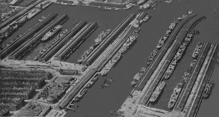
Prince's Dock (left) and Queen's Dock (right) had miles and miles of wharves in the 1930's when this photograph was taken.
1850's map showing Windmillcroft, the site of the Kingston Dock, and the 3 adjacent ferry crossings
Going downsteam from east to west the ferries were:
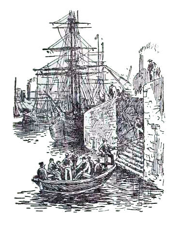
An unfortunate accident occurred on 30th November 1864 when a ferry operated by rowing boat overturned in mid-channel after setting out from Clyde Street, Anderston, heading for Springfield Quay on the southern side of the river.
Clyde Street Ferry, Anderston
The Glasgow Herald of 2nd December 1864 was highly critical of the authorities, describing the catastrophe as “a sad and agonising commentary on the manner in which these ferries have been conducted. Looking at the sad result, we may now express surprise that calamities of this kind have not been of more frequent occurrence".
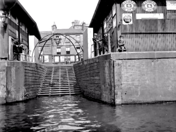
Steps leading down to York Steet Ferry
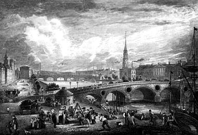
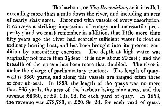
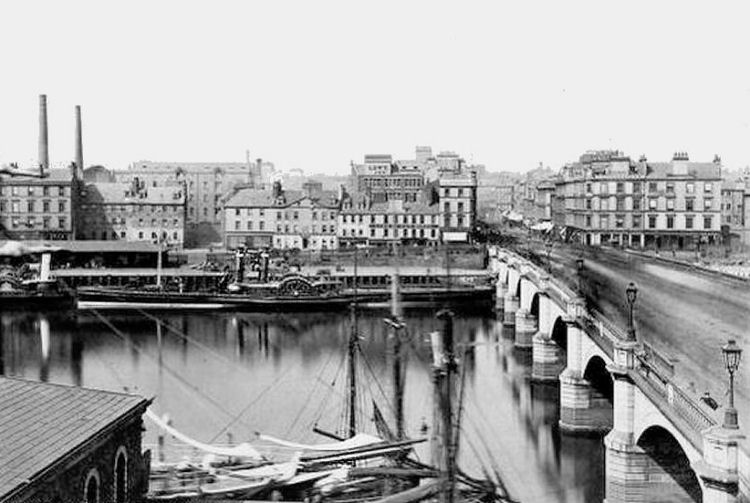
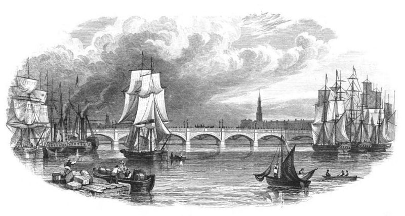
Heading east after passing the York Street Ferry there would have been no need to use boats to cross the river as this view of Glasgow Bridge shows. The bridge opened for traffic on 2nd January 1772 on the site of the present day Jamaica Bridge. In the distance you can see the Stockwell Bridge, which was later replaced by the Victoria Bridge.
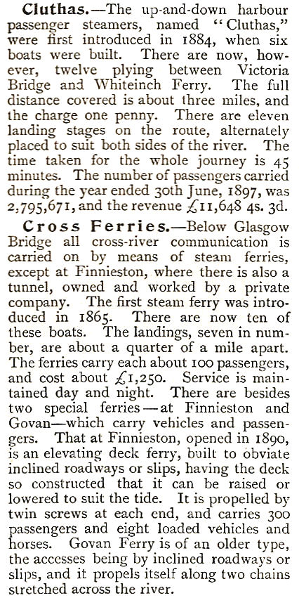
The article below regarding the Clyde Ferries was published in 1899.
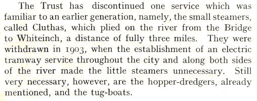
The ferries going up and down the river, rather than across, were called “Cluthas”.
The Cluthas only lasted another 4 years after the above article was published.
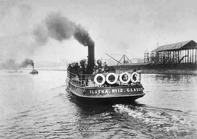
Going downsteam from the City Centre the Clutha Landing Stages were:
North
South
Clutha ferry No.10 making its way down the the River Clyde from Glasgow city centre.
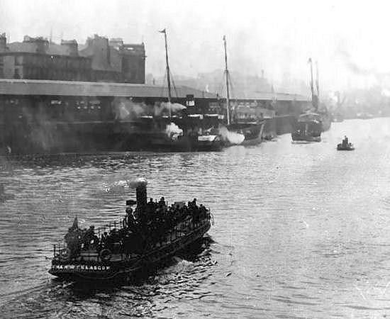
Clutha ferry No.12 leaving the terminal Whiteinch landing stage, returning to the city centre.
Map showing site of Whiteinch ferry next to the terminal Clutha landing stages along the Clyde.
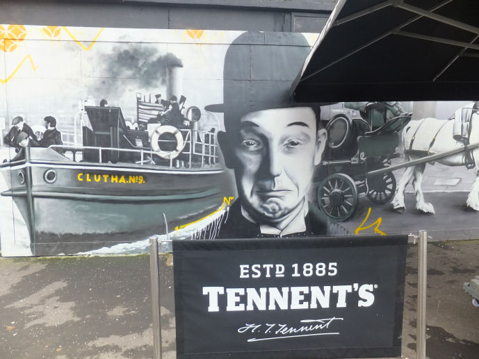
Mural showing 'Clutha No.9' alongside Stan Laurel at Clutha Bar, Glasgow
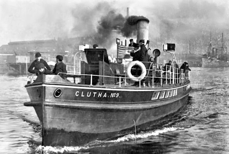
The mural was faithfully reproduced from the photograph below, showing Clutha No.9 arriving at the Govan landing stage.
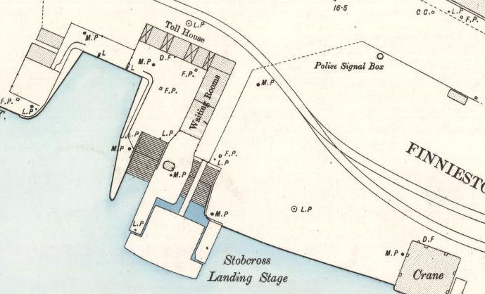
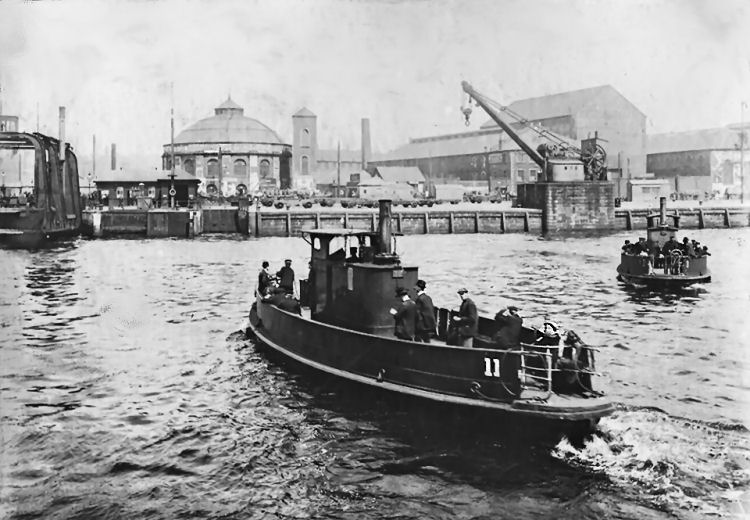
The Finnieston vehicular ferry and the Clutha landing stage at Stobcross had adjacent stops at Finnieston Quay beside the North Rotunda.
The Finnieston vehicular ferry shown here was built by Ferguson Bros of Port Glasgow in 1908. It replaced two earlier, smaller, versions which were then deployed elsewhere on the river.
The banks of the river were so congested that there was no room to have them sloped to suit a conventional vehicular ferry. Enclosed locks were constructed on either side of the river to accommodate the specially designed vessel, which had an elevating platform deck which could be raised or lowered, allowing the ferry to be used at all stages of the tide.
This view from the south bank of the Clyde shows the Stobcross passenger ferries crossing the river. The Finnieston vehicular ferry, the North Rotunda and the Stobcross Clutha landing stage can be spotted in the background.
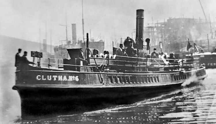
Clutha Ferry No.6
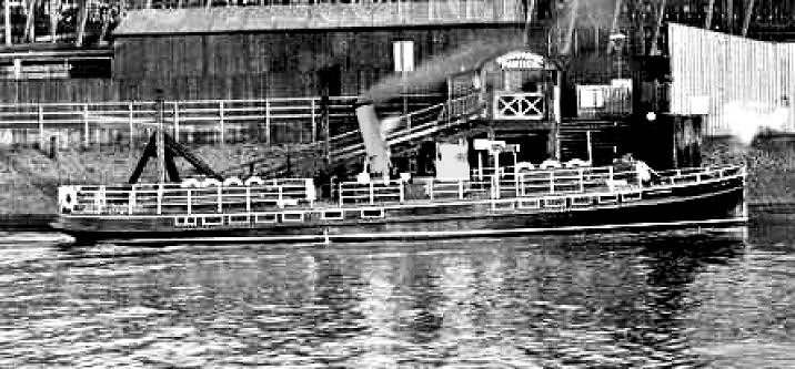
Clutha ferry at Meadowside Landing Stage, Partick
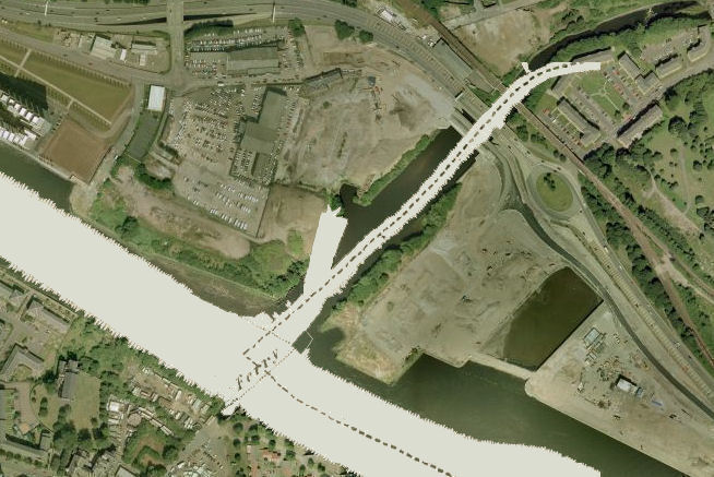
This image shows the stretch of the Clyde at the confluence with the River Kelvin, taken from an 1850's map and overlaid on a modern aerial photograph. The graving dock at Meadowside, Partick has since been filled in. The combined image shows the site of the Govan Ferry on the south side of the river where the inlet for the ferry terminus can still be seen.
In June 2011 a new Govan Ferry service began to operate between a new pontoon at Water Row and the Kelvin Harbour landing stage.
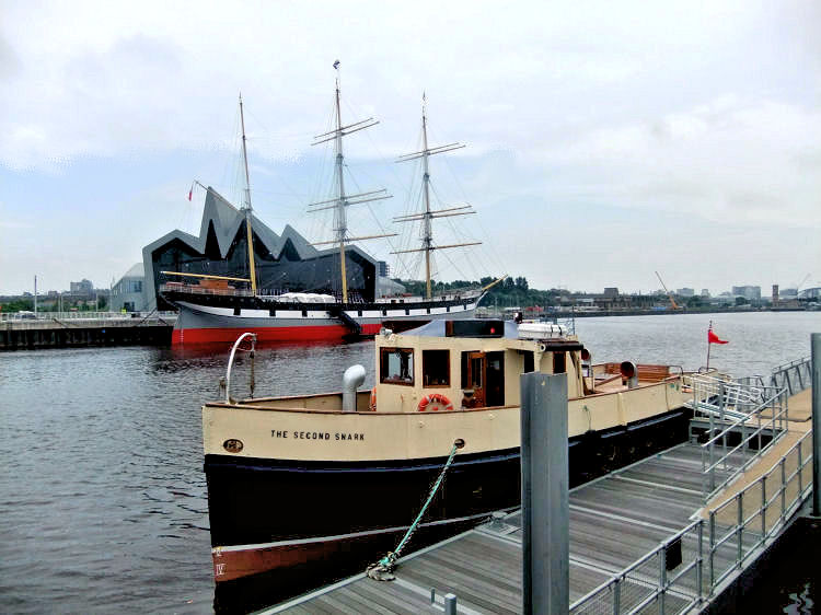
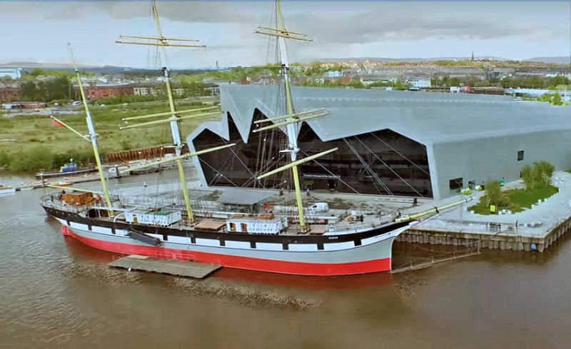
The Tall Ship in front of the museum is the S.S. Glenlee, a three masted barque, launched in Port Glasgow in 1896. It was recovered from Seville Harbour in Spain in 1992 by the Clyde Maritime Trust who carried out an extensive restoration of the vessel.
S.S. Glenlee, berthed at Riverside Museum Glasgow
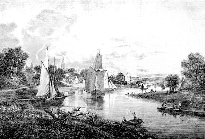
Glasgow had originated as a Cathedral City which had subsequently developed as a market town with a vigorous community of traders. In the seventeenth century, the importation of goods was hampered by the fact that the Clyde was unsuitable for commercial shipping above Dumbarton, so goods destined for the city's markets were stored in warehouses principally at the harbour of Irvine. The merchandise had to be transported to Glasgow by road using pack horses. The scene below is looking towards Govan to the left and Partick to the right at a very shallow stretch of the River Clyde. The foreground shows punts and flat bottomed barges where the steersmen propelled their vessels by pushing against the river bed with long poles.
Punts and barges on shallow stretch of River Clyde
Deepening the shipping channels on the Clyde between Dumbarton and Glasgow had been a long and laborious process in the days before the invention of steam powered dredgers. The river was very shallow with many fords and bars consisting of sand, silt, gravel and boulders. Small vessels which had run aground had to wait for spring tides or floods to allow them to take to the water again.
This steam powered dredger was built on the Clyde in 1824, just five years after the death of James Watt, a steam engine pioneer and native of Greenock.
The river was gradually deepened throughout the century and eventually large vessels from America and the West Indies were able to make it all the way to the Broomielaw, where the quays were constantly being extended to accommodate the new steamboats.
This description of the gradual progress in making the Clyde navigable during the first half of the century was published in 1860.
Engraving of Glasgow Harbour in 1802
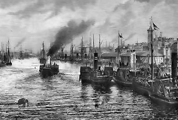
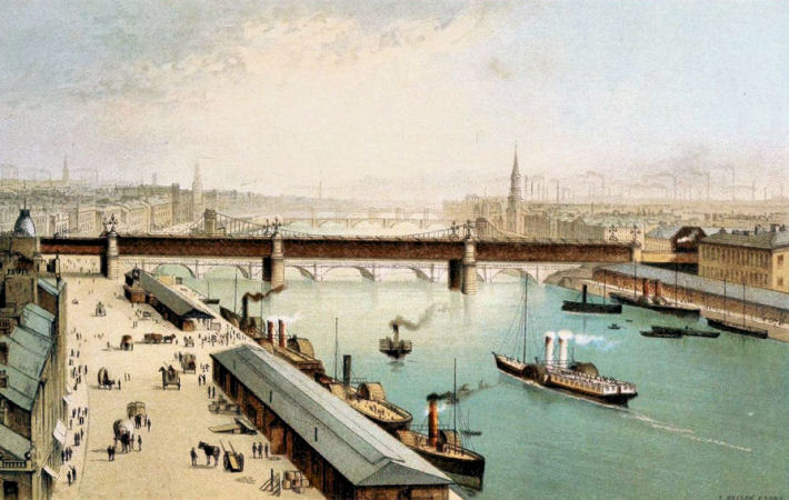
This view of the Broomielaw and the busy activity on the Clyde comes from an engraving published in 1829.
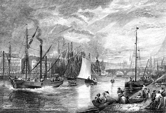
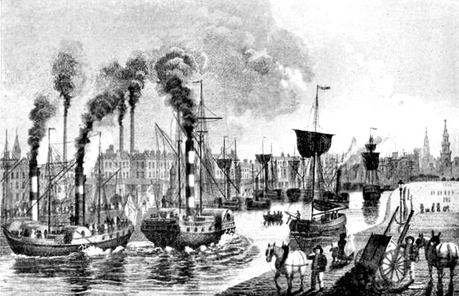
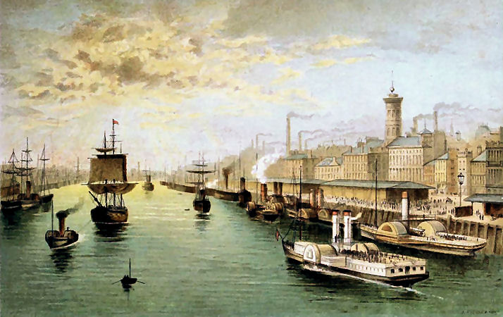
A later view from the same vantage point showing even more activity among the paddle steamers
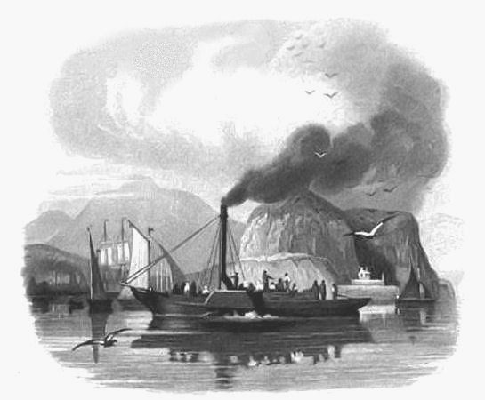
The first passenger carrying steamboat in Europe was Henry Bell's Comet, which was built on the Clyde at Port Glasgow.
In the early 1800's, Henry Bell was one of the early innovators seeking an effective method for steam powered propulsion on water.
The above view shows the Comet carrying passengers at a leisurely rate along the banks of the Clyde. The steamer's engine powered the paddle wheels on each side of the vessel.
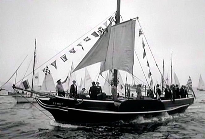
A replica of the Comet was launched in Port Glasgow in 1962 to commemorate the 150th anniversary of the original vessel. It is now on display as a tourist attraction in the town.
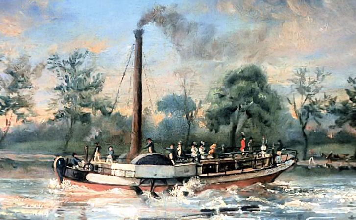
Before long the Clyde at Glasgow was filled with lots of paddle steamers modelled on the Comet.
Paddle steamer berthed at Broomielaw with future site of Central Station at Grahamston in the background
Victorian ladies at the Broomielaw with their cases packed for a trip down the Clyde
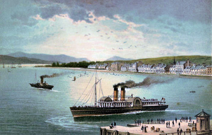
View of paddle steamers at Helensburgh on Firth of Clyde
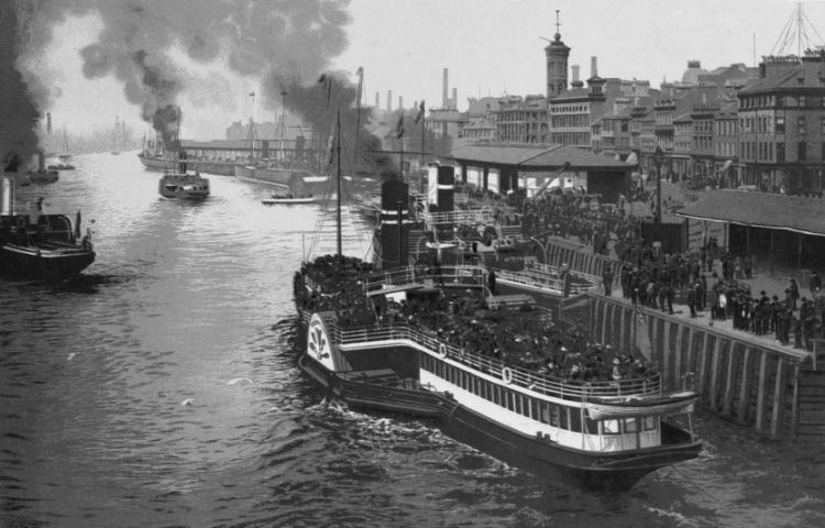
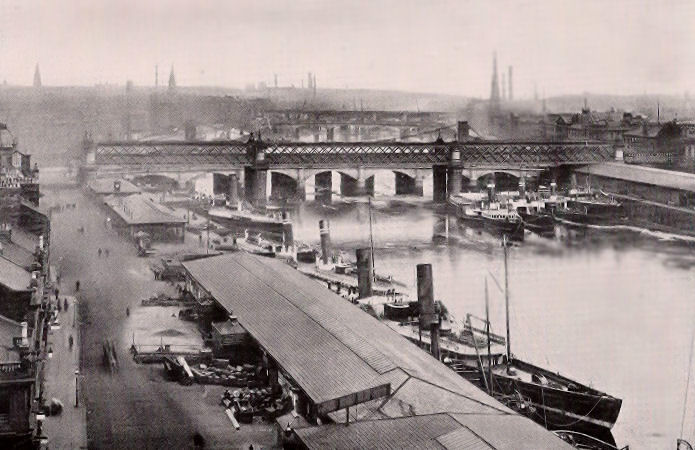
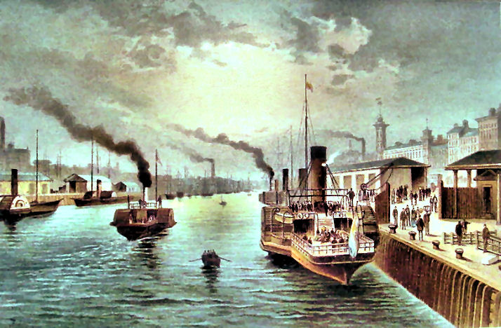
By 1900, when this photograph was taken at the Broomielaw, the river was full of larger passenger steamers, with not a sail in sight. These steamers travelled to destinations far and wide on the Firth of Clyde and Ireland as well as short distances down the river.
The above photograph would have been taken from the top of the tower of the
Sailors' Home which stretched to six storeys in height. The building was built at the corner of James Watt Street and Broomielaw to the designs of J.T. Rochead. It was completed in 1856 and demolished in 1971.
Sketch of Sailors' Home Broomielaw
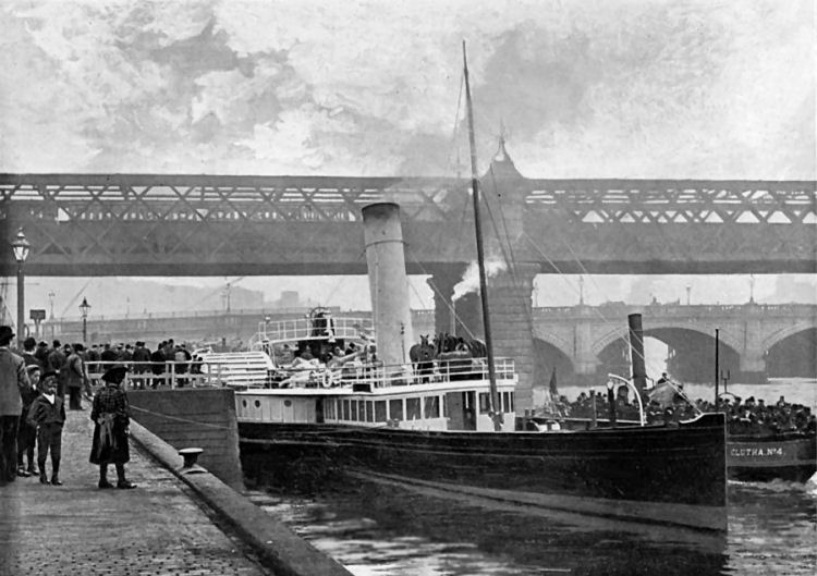
Glimpse of Clutha No. 4 passing steamer at the Broomielaw, near approaches to Central Station
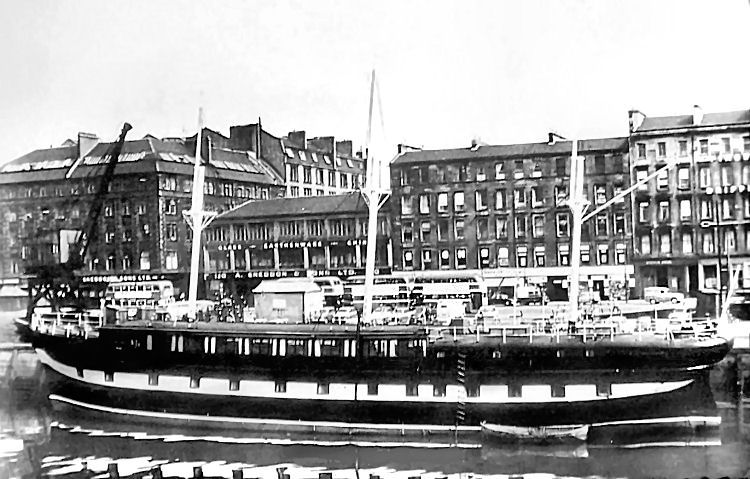
The S.S. Carrick was a familiar sight in the 1950's and 1960's for travellers coming and going from the SMT 'red bus' terminus along Clyde Street.
S.S. Carrick berthed at Clyde Street
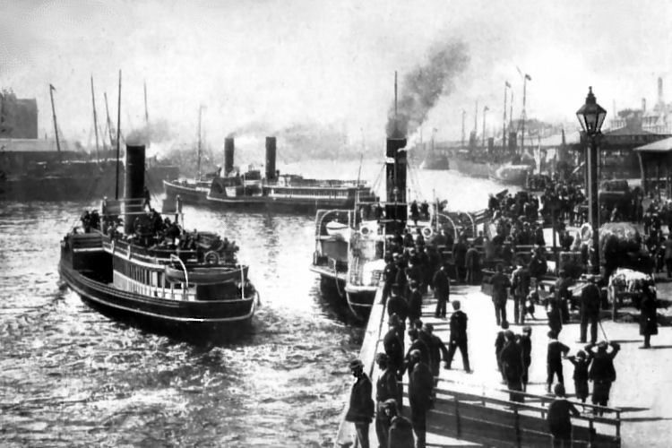
Victorian view of the Broomielaw, looking East
Victorian views of the Broomielaw, looking west
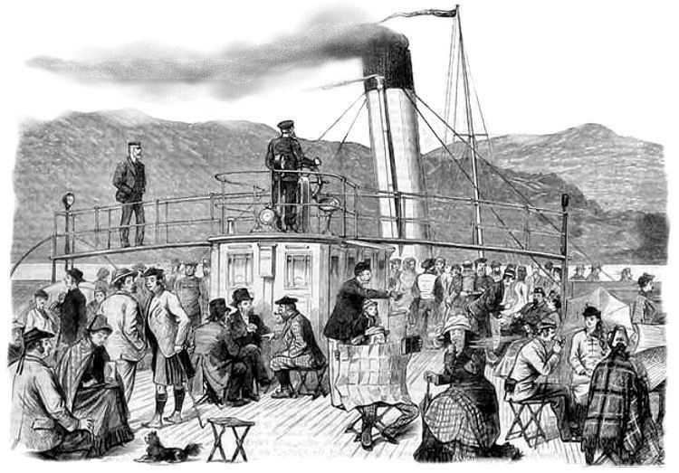
The arrival of the Clyde steamers brought many vistors to previously remote towns and resorts on the estuary. Passengers on deck of steamboat on excursion 'Doon the Watter', 1880
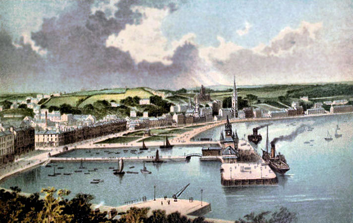
Victorian view of Rothesay, Isle of Bute
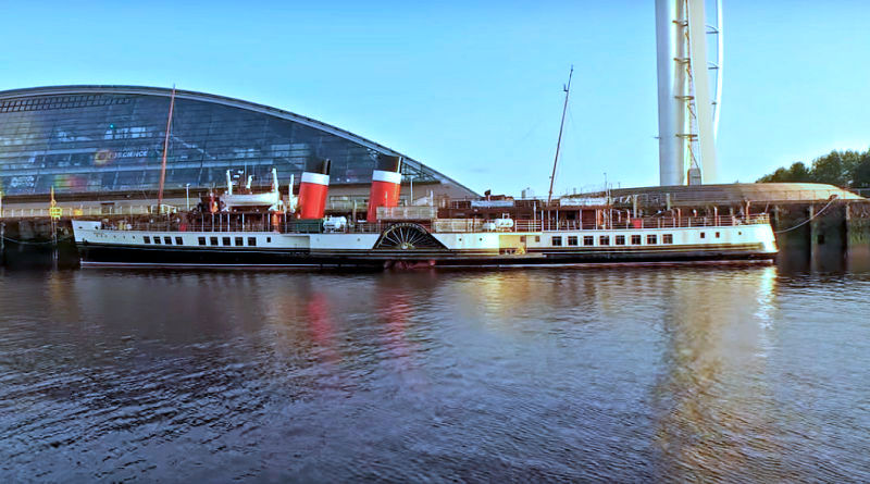
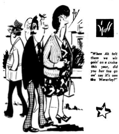
The famous Waverley is the last seagoing passenger carrying paddle steamer in the world. She was built in 1946 and operated until 1973 on the Firth of Clyde as both a ferry and pleasure steamer.
P.S. Waverley berthed at Glasgow Science Centre
Following preservation, the Waverley currently operates passenger excursions on the Firth of Clyde, the Bristol Channel and other scenic coastlines around the British Isles.
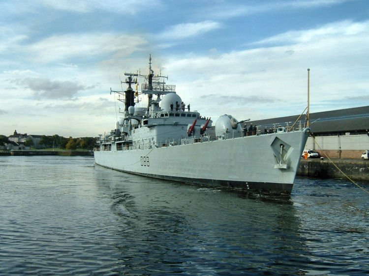
The destroyer HMS Glasgow pictured on the Clyde, 11th October 2004, before being
decommissioned and dismantled
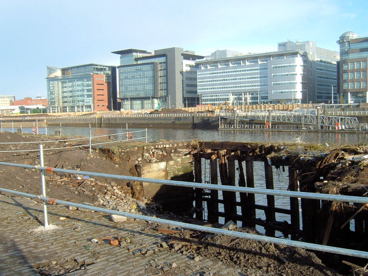
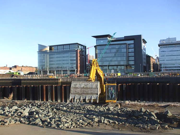
Quayside redevelopment on south bank of the Clyde, Glasgow city centre, 2007
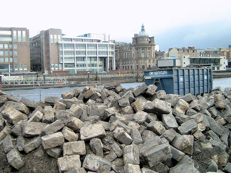
Cobbles lifted during quayside redevelopment
Clyde Place Quay, 2007
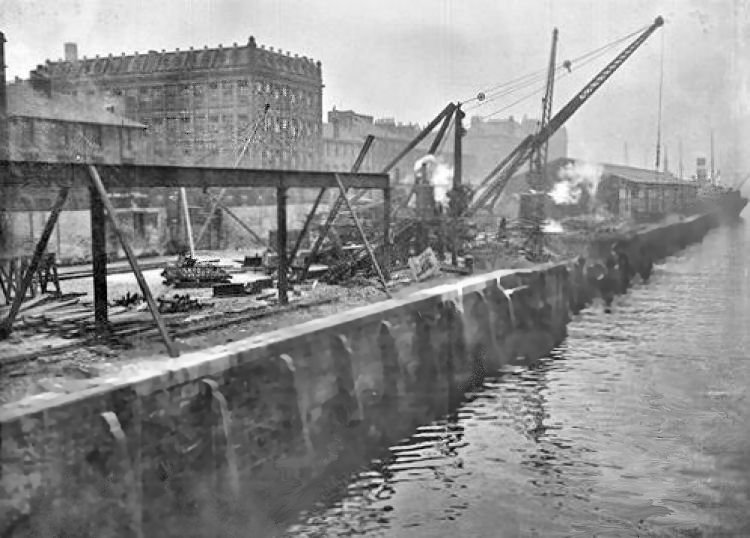
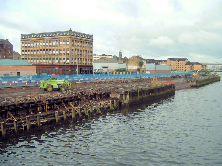
The pictures below show Clyde Place Quay, Tradeston, as a working dock in 1928 and during the redevopment of the quayside in 2007.
Clyde Place Quay, 1928
Clyde Place Quay, 2007
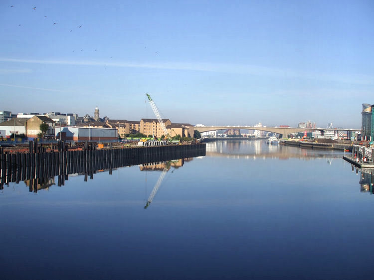
Reflection of quayside redevelopment
The nearest dock to the city centre was the small Kingston Dock which opened in 1867 on the site of Windmill Croft.
It closed in 1966, during the construction of the Kingston Bridge when the site was infilled to allow for redevelopment.
Queen's Dock at Stobcross operated from 1880 providing nearly two miles of additional wharf accommodation to the growing port.
This huge dock was used by the Clan Line for ships bound for South Africa, by the City Line whose vessels visited the ports along the coast of India and by the Donaldson Line which specialised in trade with North America.
On the other side of the river Prince's Dock was completed in 1897, adding another two miles of new wharves to the harbour.
The ships of the Canadian Pacific Company, the Anchor-Donaldson Line and many others were berthed at Prince's Dock.
West of the confluence with the River Kelvin, Merklands Quay came into operation in 1907 for the transporation of livestock.
The adjacent Meadowside Quay opened in 1912 for the movement of grain from the North American prairies using huge elevators on the quayside.
In 1907 Rothesay Dock was constructed at Clydebank for the coal trade.
Yorkhill Dock was completed in 1910, providing berths for the Anchor Line for its New York passenger liners.
The King George V Dock was completed in 1931 and is currently the only working dock in this stretch of the Clyde.
The infilled Prince's Dock was the site of the 1988 Glasgow Garden Festival. In 2007 Pacific Quay was redeveloped to provide new headquarters for both BBC Scotland and Scottish Television.
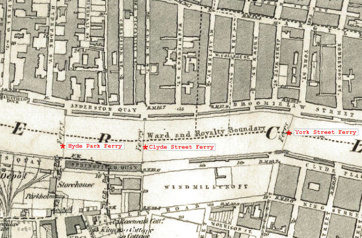
York Street Ferry (York Street to West Street)
Clyde Street Ferry (Clyde Street, Anderston, to Springfield Quay)
Hyde Park Ferry (Hydepark Street to Springfield Quay)
Stobcross Ferry (Finnieston Quay to Mavisbank Quay)
Finnieston Vehicular Ferry (Finnieston Quay to Mavisbank Quay)
Kelvinhaugh Ferry (Yorkhill Quay to Prince's Dock)
Govan Ferry (Ferry Road, Partick, to Water Row, Govan)
Meadowside Ferry (Meadowside Street, Partick to Holm Street, Govan)
Whiteinch Ferry (James Street, Whiteinch to Holmfauld Road, Linthouse)
Renfrew Ferry (Yoker to Renfrew)
Erskine Ferry (Dunbartonshire to Renfrewshire)
27 men were packed into the ferryboat, which was being steered by the passengers while the ferryman collected the fares.
Bad steering caused the swell of a passing steamer to come over the broadside of the rowing boat.
The boat capsized throwing all the occupants into the freezing water. Only 8 were saved, the remaining 19 were drowned.
The ferryman of the Hyde Park Ferry rescued two men who had managed to cling on the upturned boat as it flowed downstream.
The subsequent protest about the inadequacies of cross-river transportation was responsible for the introduction of steam ferries in 1865.
Between the bridges on the south side of the river you can see Carlton Place and the tall spire of Gorbals Parish Church.
The bridges provided a barrier for the navigation of larger ships any further upstream.
Victoria Bridge
Jamaica Bridge
Stobcross
Pointhouse
Meadowside
Sawmill Road, Partick
Whiteinch
Springfield Lane
Highland Lane, Govan
Water Row, Govan
Linthouse
The berth for the ferry was contructed in 1890 to suit the shape of the ferry boats with their ingeniously designed elevating platform decks.
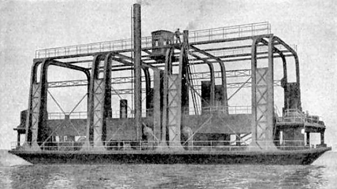
The double-ended vessel was built with four twin-columned cast iron deck supports which gave the necessary strength to carry much heavier loads than the earlier versions.
The power to move the platform to the level of the landing quay was provided by steam winches. The mechanism was counterbalanced to minimise the power required for the operation.
The original ferry terminus on the north side of the river is outlined in the surrounding water.
Both rivers, the Clyde and the Kelvin, were widened upstream from the confluence.
The service is provided by MV The Second Snark, which was built in 1938 for use at William Denny's Dumbarton shipyard as a tug and tender.
The ferry provides a route to the new Riverside Museum for visitors who can take the subway to Govan and enjoy a trip across to the attractions on the other side of the river.
By the end of the century the harbour at Irvine was becoming choked up with sand. In 1688 Glasgow Council bought land at Newark Bay on the south bank of the Firth of Clyde where they developed the harbour of Port Glasgow.
The little islands and sandbars on the river were known as “inches”. Old maps show Whyte Inch and Water Inch near the confluence with the Kelvin, while further downstream at Renfrew were King's Inch and Sand Inch. These old obstructions are still remembered in some local place names.
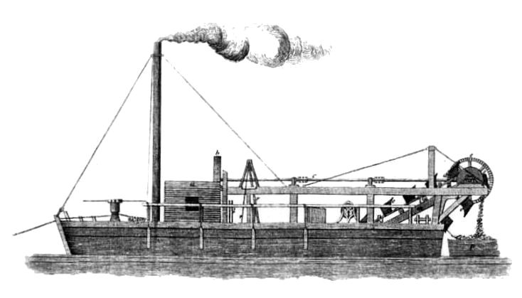
Before the advent of the steam engine, horses were used to pull an endless chain revolving round a capstan, pulling up buckets of matter from the river bed. Dredging machinery powered by steam made the process much more efficient. This kind of equipment had previously been used in the construction of the Caledonian Canal, which was completed in 1822.
The system on board the vessel above was manufactured by Claud Girdwood and Co., mechanical engineers, of Glasgow. The dredge was situated at the centre of the boat, filling 22 buckets placed on the links of 2 endless chains. Each bucket emptied its contents into punts at the stern of the vessel. It was reported that up to 30 tons of mud and gravel could be raised in 7 minutes depending on the nature and depth of the bottom.
The first quay at the Broomielaw was constructed in 1662, when the men-servants of the city's gentry were commandeered by the Town Council to carry the sand needed for backfilling the new structure.
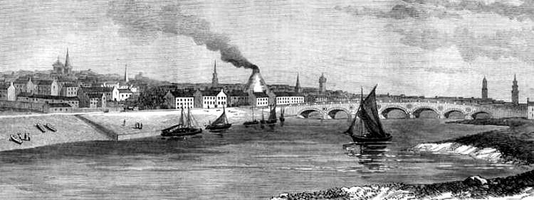
The vantage point is on the south bank of the river, looking upstream towards the city.
The small open boat in the foreground would have been used for cross-river travel. You can just make out a lady with an umbrella in the boat. On the quayside, you can get a glimpse of passengers waiting to board.
In the summer of 1812 trips were advertised from the Broomielaw to Greenock and Helensburgh on Tuesdays, Thursdays and Saturdays at a cost of 4 shillings per passenger. The boat was shipwrecked in 1820, but the engines were recovered.
Bell had collaborated with the American engineer Robert Fulton, who built the world's first commercially operated steamboat which went in to service on the Hudson River in August 1807, operating from New York City to the state capital, Albany.
Robert Fulton had lived and worked in Britain from 1804 to 1806 where he acquired engines manufactured by Boulton and Watt to be taken over the Atlantic for his new vessel.
Before returning to America Fulton had visited the world's first steam powered boat, William Symington's Charlotte Dundas, on the Forth & Clyde Canal and made sketches of her machinery. This experimental vessel was built in 1803 for towing vessels on the canal, but was rejected by the operators because the wash caused erosion of the canal banks.
The view below shows that additional speed could be achieved with assistance from sail power when the winds were favourable.
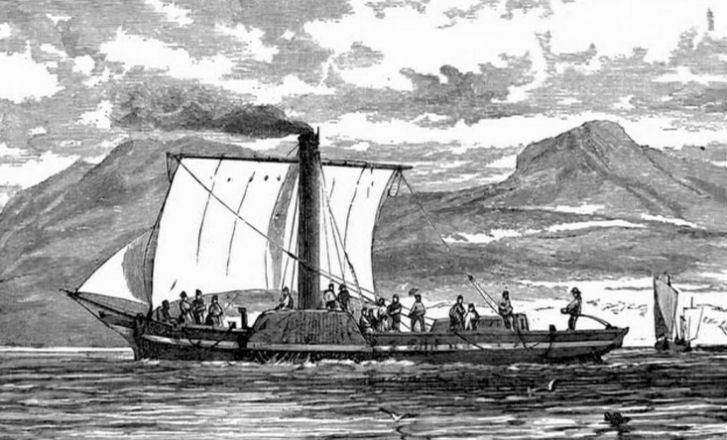
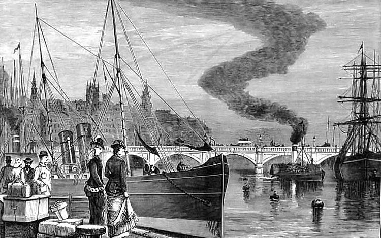
The railway bridge in the background had been completed in 1879, providing access to the newly built Glasgow Central Station.
Cruising 'Doon the Watter' was a popular pastime for the citizens of Glasgow up until the 1960's when cheap foreign package holidays became popular.
The vessel was built at the Glasgow shipyard of A. & J. Inglis and the marine steam engine was constructed by Rankin & Blackmore of Greenock.
![]()
 |
| |
|
|
| |
|
|
| |
|
|
| |
|
|
| |
|
|
| |
|
|
| |
|
|
|
|
|
All original artwork, photography and text © Gerald Blaikie
Unauthorised reproduction of any image on this website is not permitted.
