
Welcome to this exploration of the section of the White Cart Walkway which runs from the Snuff Mill Bridge in Cathcart to Netherlee, following the course of the river through the beautiful surroundings of Linn Park.
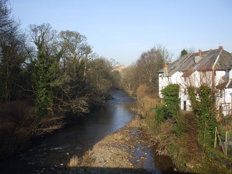
White Cart Water, looking downstream from Snuff Mill Bridge, February 2008
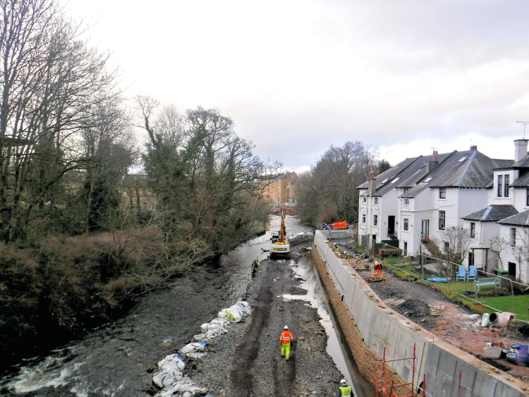
White Cart Water during construction of flood defences near Snuff Mill Bridge, February 2019
Winter scene at Snuff Mill Bridge, Cathcart
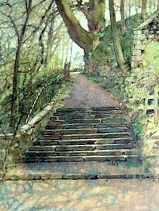
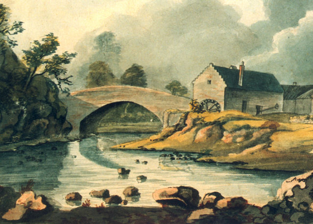
Watercolour of start of White Cart Walkway
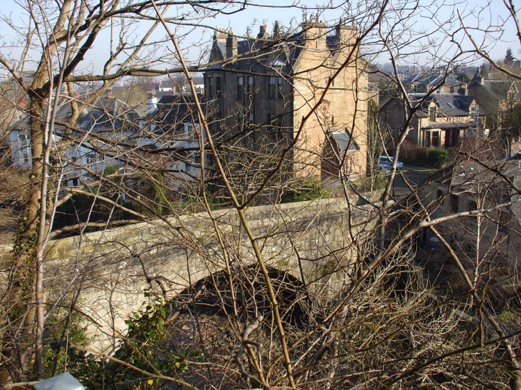
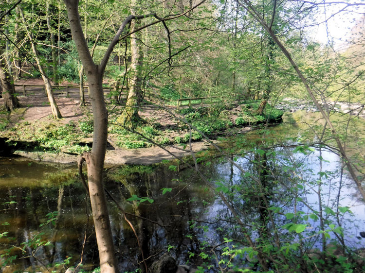
Snuff Mill Bridge viewed from start of White Cart Walkway
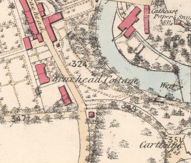
The Cathcart Snuff Mill was known by various names in old maps and records. It appears on the 1850's maps as either "Cathcart Paper and Snuff Mills" or "Cathcart Paste Board and Snuff Mills". The Post Office Directories of the time shows the mill in the ownership of Solomon Lindsay and Sons, Papermakers.
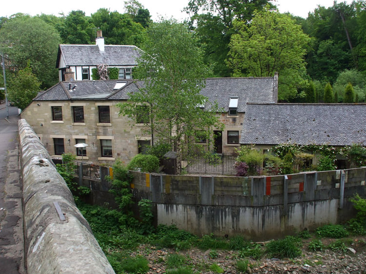
Rebuilt housing on remains of Snuff Mill with modern defences from the river, which was at a very low level after a dry spell
View of Snuff Mill from White Cart Water
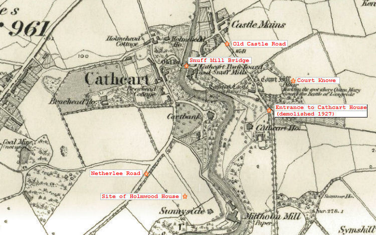
Map from 1850's shows the mill being powered by water diverted at a weir, which raised the water level at the inward end
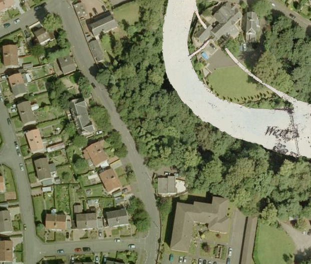
Present day aerial view, at same scale, with river added from Victorian map
View of a millwheel powered by water from the elevated channel and the outflow back to the river
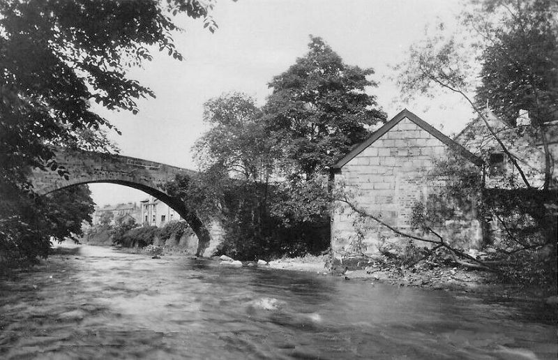
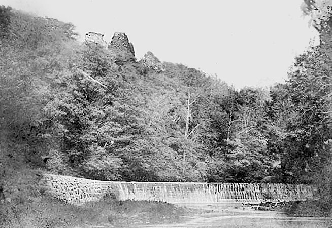
Victorian photograph of weir, showing Cathcart Castle high above the channel diverting water to the mill
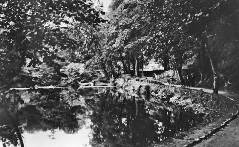
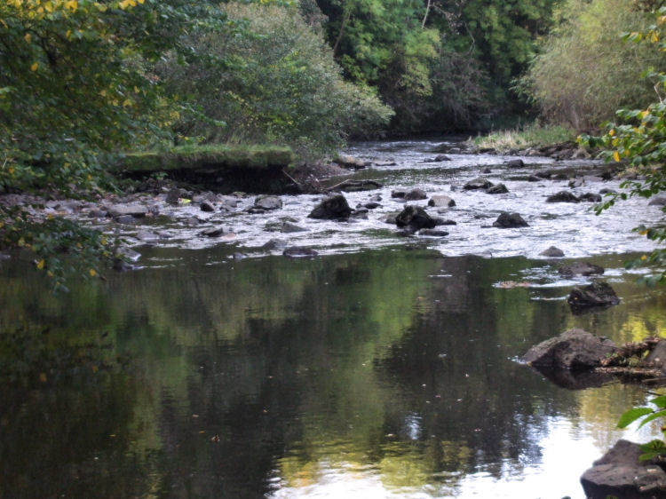
Looking downstream from riverside path towards weir and mill lade
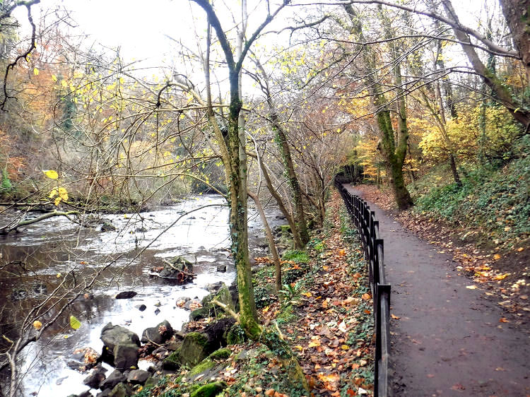
Present day view of riverside path
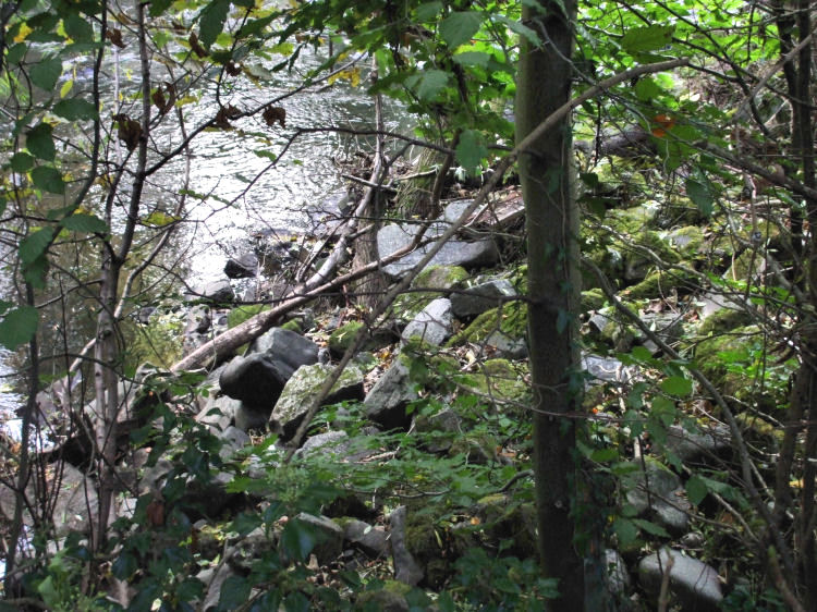
The site of the weir is marked today by large stones left in the river
The channel were the river was diverted to the mill has been blocked with stones
Map and aerial view of Cartbank House on opposite bank to the weir
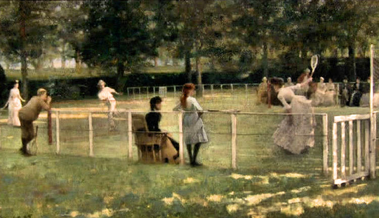
The Tennis Party, a painting by John Lavery, 1885, of a scene at Cartbank, Cathcart
Lavery's painting of a Lady on a Safety Tricycle, 1885, was set at the entrance to Cartbank House which is still recognisable 125 years later
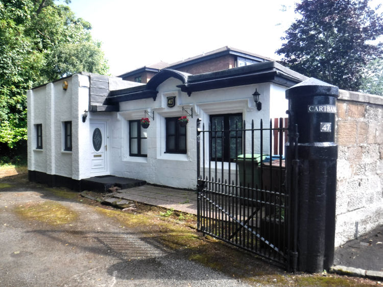
Gatehouse at Cartbank House
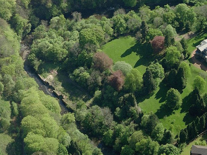
Glimpse of Cartbank House from Linn Park, sitting high above a steep ravine at White Cart Water
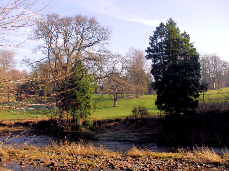
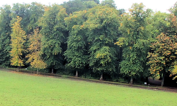
White Cart Walkway viewed from Linn Park
Linn Park viewed from White Cart Walkway
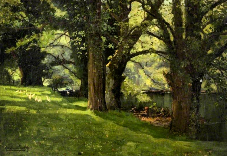
Early twentieth century painting of the White Cart in what is now Linn Park
South-east fa�ade of Alexander Thomson's Holmwood House, which can be seen from pathway
A fully illustrated tour of Holmwood House can be seen at my dedicated web page
1850's map showing Cathcart section of White Cart Water, before Holmwood House was built
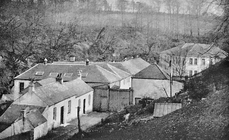
Millholm Paper Mill was owned and operated by brothers, Robert and James Couper. The proceeds of the estate of Robert Couper, who died childless on 12th June 1883, were used to help establish the Victoria Infirmary. Robert also left a bequest to provide the Couper Institute for the residents of Cathcart. Old photograph of Millholm Paper Mill, Cathcart
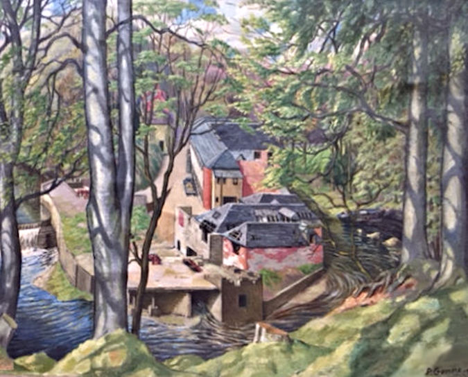
Painting of Millholm Paper Mill, Cathcart: Image courtesy of Carole Quarrell
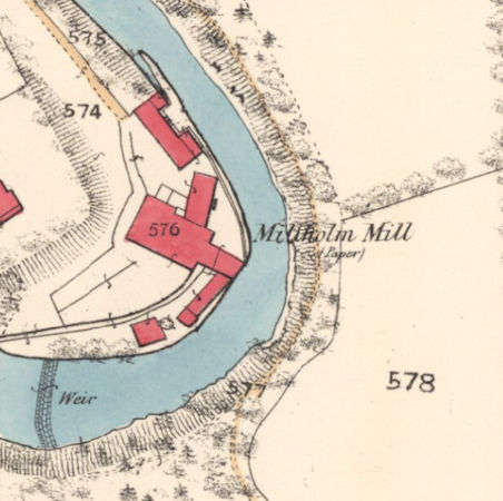
Map showing Millholm Paper Mill at 'horseshoe' bend in White Cart Water, Cathcart
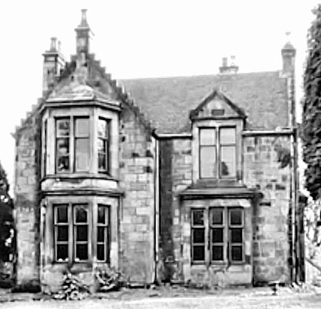
Sunnyside House, Cathcart, built for Robert Couper of Millholm Paper Mill
Site of Millholm Paper Mill on riverside - Sunnyside House was situated facing the bend in the river
Extract from Statistical Accounts of Scotland, 1845, by Rev. James Smith
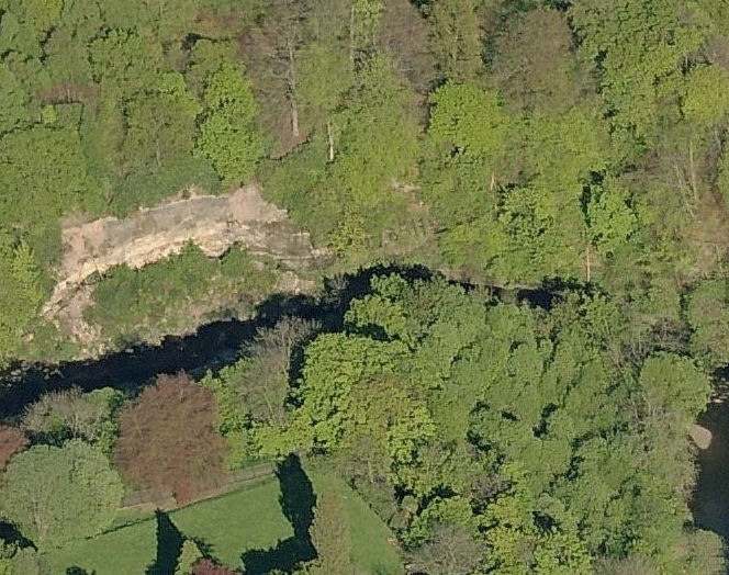
Exposed layers of rock on riverbank facing Millholm Paper Mill
Burning the local limestone in small kilns fired from the adjacent coal produced quicklime which was used in the papermaking process as a bleaching agent and for reducing the acidity of the finished products.
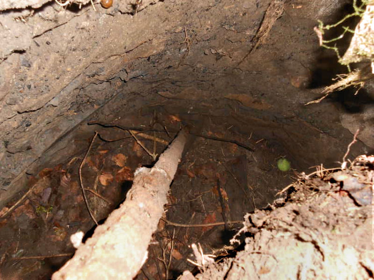
Inside abandoned mine shaft at Millholm, Cathcart: image courtesy of Andrew Roscoe
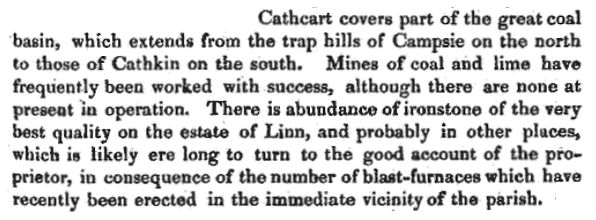
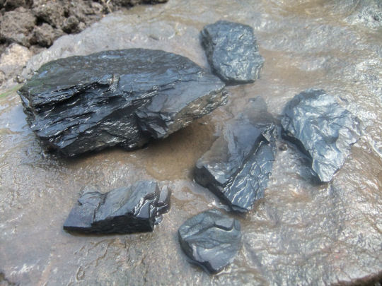
As well as water power from the fast flowing river there were ample supplies of coal in the locality to provide heat and power for industrial processes. There were also beds of shale to be found along the riverside yielding the raw material for oil, gas and synthetic dyes used in local manufacturing.
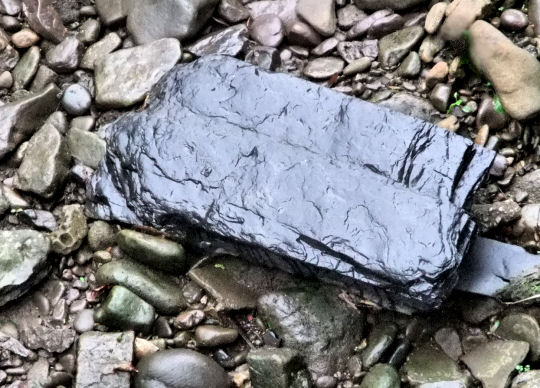
Huge slab of black shale lying on exposed river bed
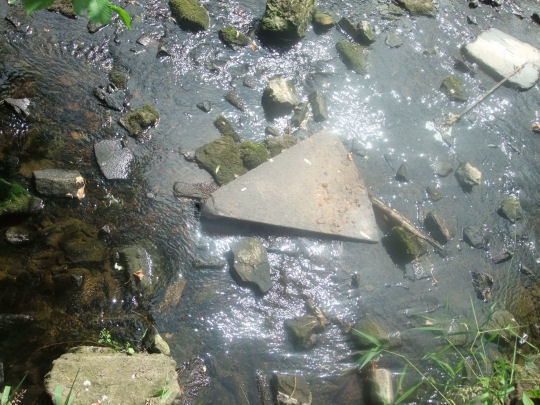
Triangular section of old millstone on river bed at Millholm, Cathcart
Surviving walls at Millholm, Cathcart
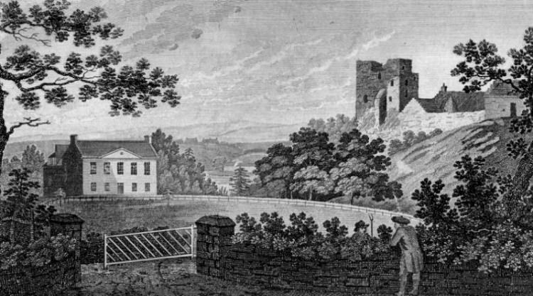
Deep hollow in Linn Park, formerly the foundations and solum of Cathcart House, which was demolished in 1927
Close-up view of site of Cathcart House, originally known as Cartside House
Engraving from 1798 of Cathcart House and Castle from what is now the Seil Drive entrance to Linn Park
Seil Drive entrance to Linn Park, 2014
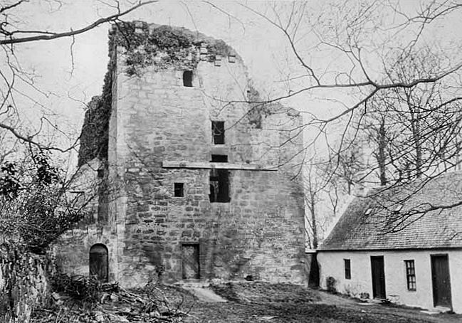
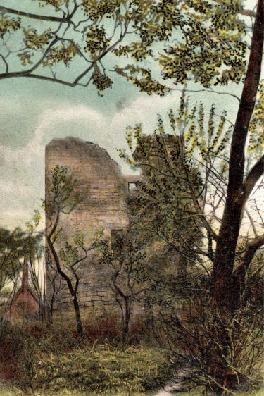
The story of the castle and its surrounds can be found in the
Cathcart, Origins & History section of this website
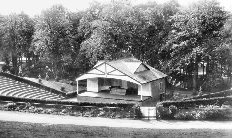
The bandstand at Linn Park was a popular venue for outdoor entertainment which became obsolete with the advent of television. It was removed in the 1960's, but the site is still recognisable, with a natural slope leading to where the stage once stood.
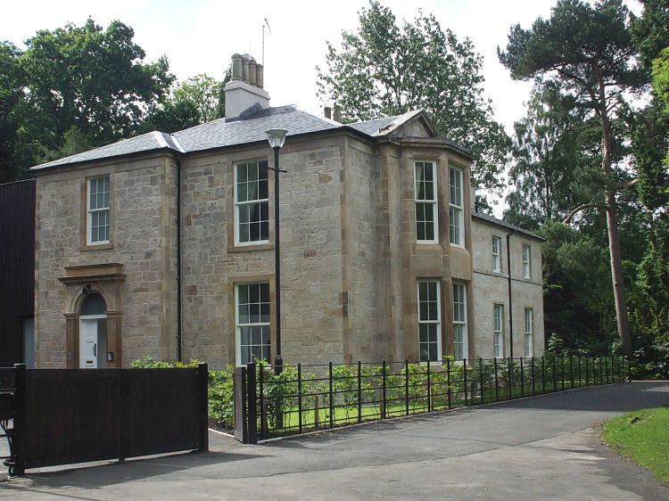
The more southern parts of Linn Park, where the bandstand was situated, originated as part of the "Lands of Hagtonhill" centred on Linn House, which was built c.1811. The mansion was extended in 1852 and converted into four dwellings in 2007.
Linn House, built c.1811 with side extension added in 1852.
This sale notice from 24th October 1811 describes a "genteel new house" at the site. Sale Notice for Hagtonhill with new house, dated 24th October 1811
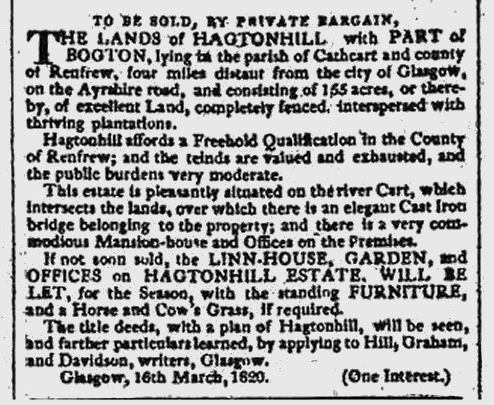
The "Lands of Hagtonhill" were described in a later sale notice, published on 16th March 1820, in which Linn House is described as a "very commodious Mansion-house". The notice also mentions an "elegant Cast Iron bridge belonging to the property", which is still very much in use today. There is no mention of the cast iron bridge in the 1811 sale notice, so it was presumably put in place sometime between 1811 and 1820.
The 1820 notice offered a larger area of land than did the 1811 advertisment, as it included part of the lands of Bogton which were separately owned by James Hall's wife, Mary Maxwell. This additional land had been the subject of a legal action by the creditors against Mrs Hall, which was determined at the Court of Session on 11th January 1814.
Sale Notice for Linn House, dated 16th March 1820
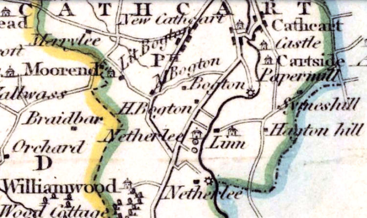
Map published in 1826, showing Linn House and Hagtonhill
The above map shows the county boundary at Hagtonhill with the Renfrewshire side coloured green and the Lanarkshire side coloured blue. The Cathcart Castle Golf Course was laid out in 1898, mostly on the Lanarkshire side of the boundary in the ancient parish of Carmunnock. The clubhouse was situated on the Renfrewshire side of the boundary in Cathcart parish, near the steading of Simshill, which would later be developed as the site of Simshill Primary School.
Cathcart Castle Golf Club vacated the course in the mid 1920's, moving to new location near Clarkston in December 1925. The club retained their old name at their new site in East Renfrewshire. The land where their previous course was situated was by that time owned by Glasgow Corporation and became a municipal facility known as Linn Park Golf Course.
Glimpse of former Cathcart Castle Golf Course from pathway behind Linn House at Hagtonhill
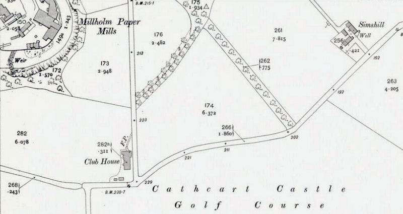
Map showing clubhouse of Cathcart Castle Golf Course and farmstead of Simshill, 1910
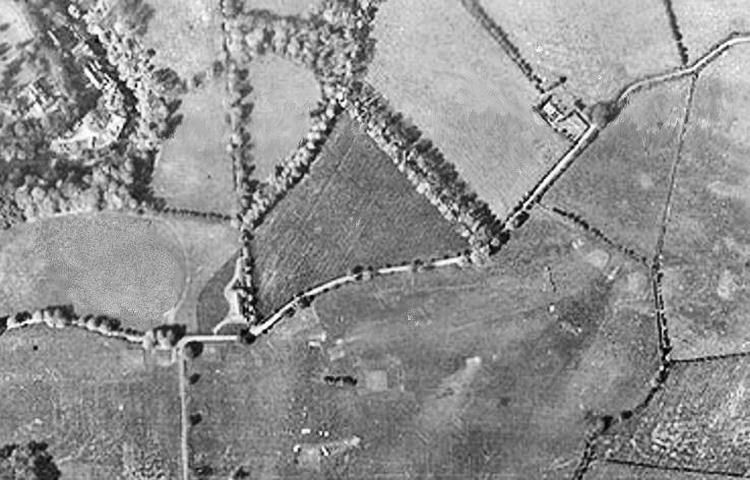
Aerial view of Linn Park Golf Course and nearby fields of Simshill, before the post-war housing development
Aerial view of golf course and surrounding area from the north
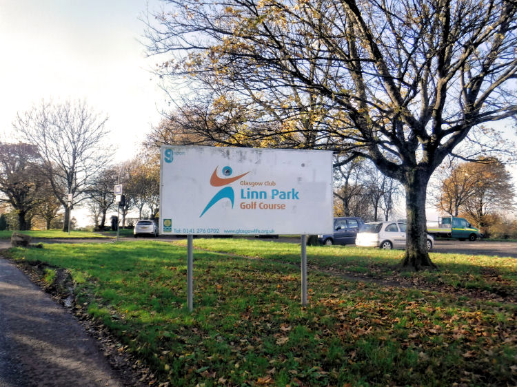
Sign at entrance to Linn Park Golf Course, Simshill Road
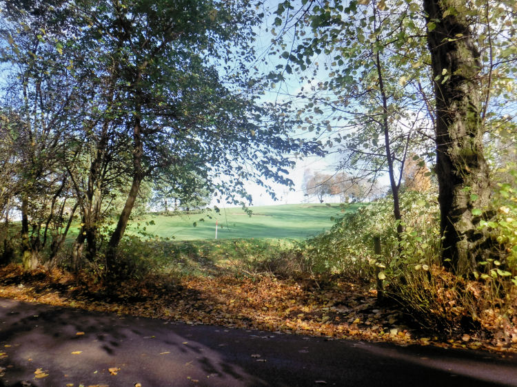
Putting green at Linn Park Golf Course
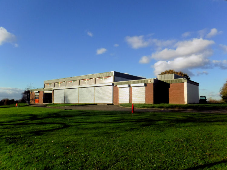
Clubhouse at Linn Park Golf Course
White iron bridge, cast as a single span, provides a crossing at the Netherlee section of the park
Snowy reflection of white bridge at Linn Park
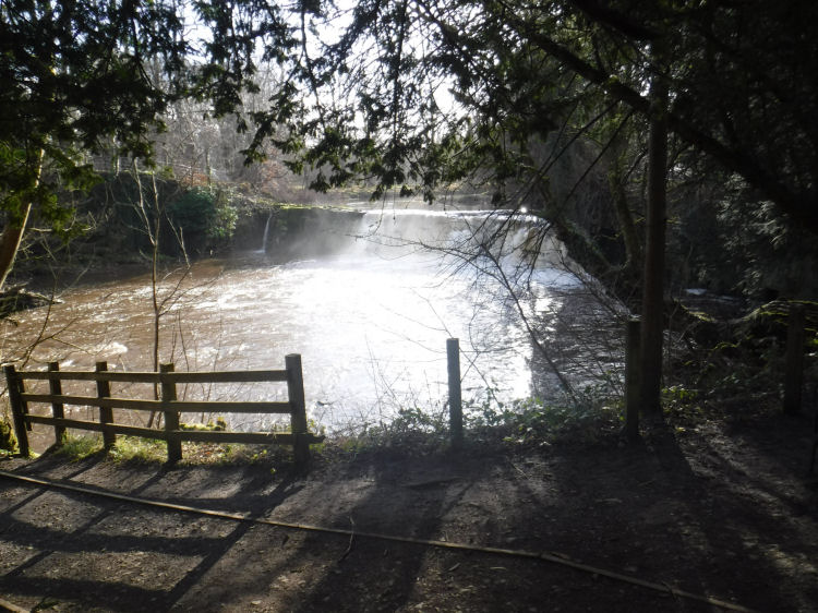
"Linn" is an old Scots word for the waterfall from which the park derived its name
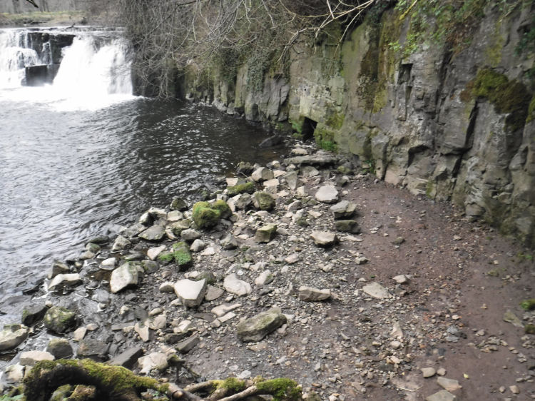
Sunlit view of Linn Falls from White Cart Walkway
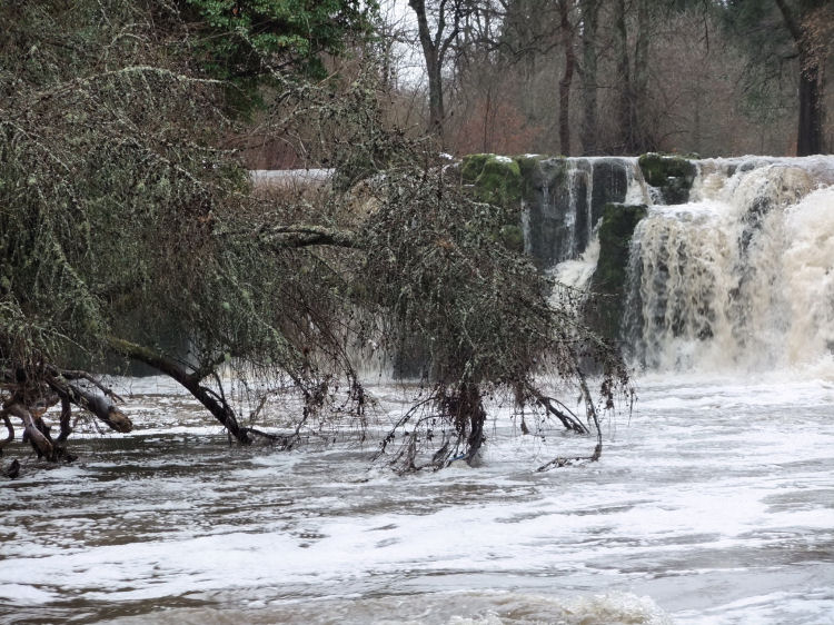
Winter view of Linn Falls swollen with meltwater
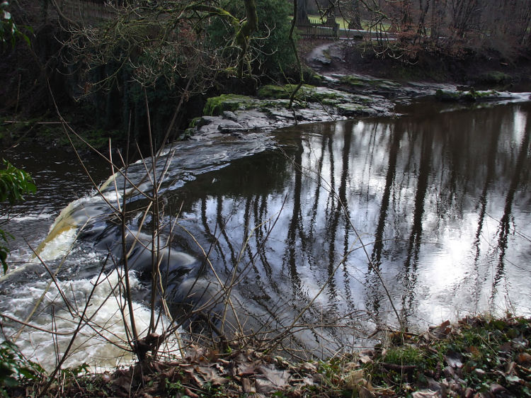
Reflections on river flowing towards waterfall
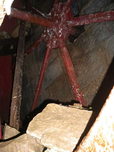
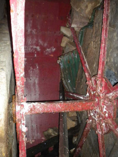
The natural powerful flow of the Linn Falls was utilised by various local mill owners over the years. Downstream from the falls there is a tunnel leading to a surviving wheel pit, complete with a red iron water wheel.
Mill wheel at Linn Falls: images courtesy of Andrew Roscoe
Stratified layers of rock on riverside close to Linn Falls
Signs of old quarrying on the stratified layers of rock
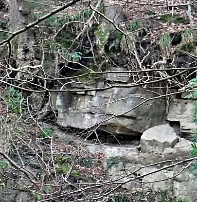
Large fragments of smooth faced quarried rock resembling dressed masonry at Linn Falls
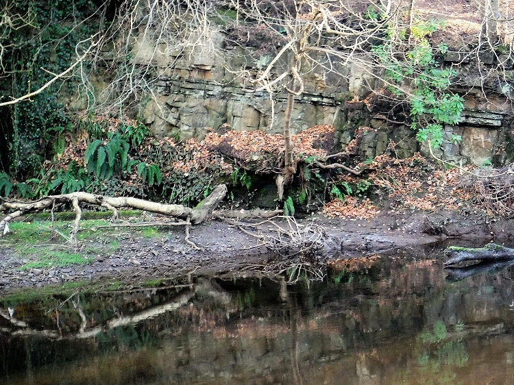
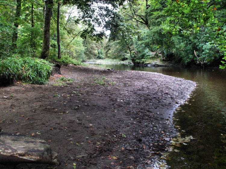
Linn Park "beach", a short distance downstream from the waterfall
1850's map of the Netherlee section of Linn Park
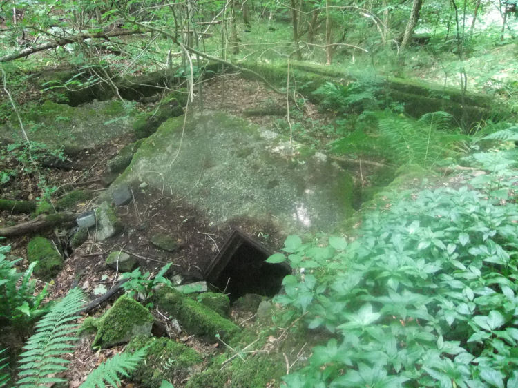
Ventilation shaft at an abandoned coal pit in Linn Park
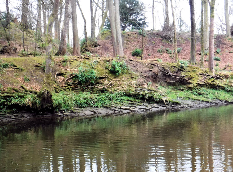
Thin layers of shale and sedimentary rock on banks of White Cart Water, Linn Park
In the mid-Victorian era oil and gas were produced from the local black shale which was abundant in the district. Fragments of local shale, which is very brittle and flakes off easily in your hands
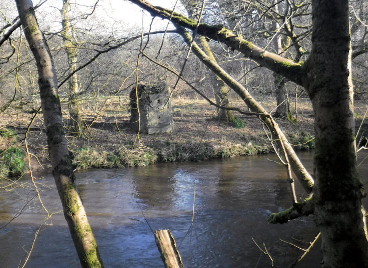
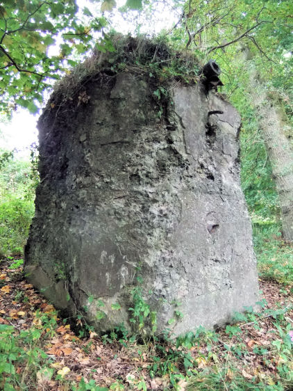
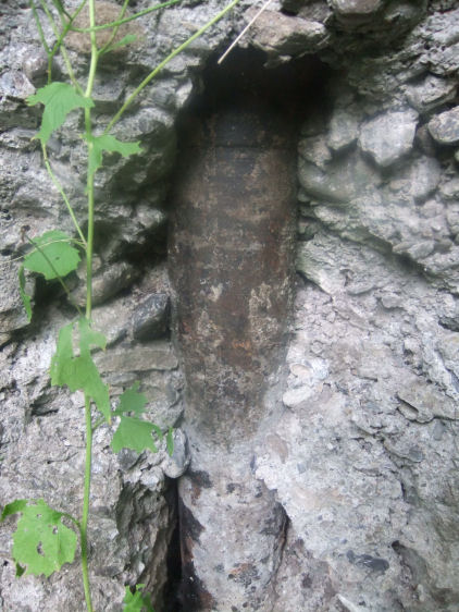
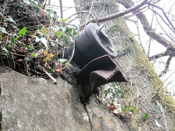
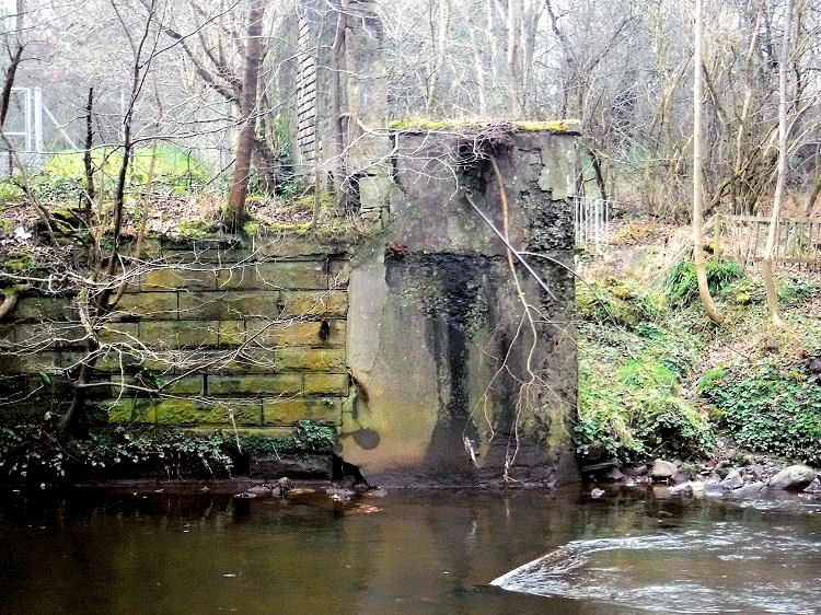
The Netherlee section of the park contains the overgrown remains of what appears to have been a small vertical retort used for shale oil extraction. A single cast-iron distillation column passed through a coal-fired furnace and the resulting mixture of oil vapours were collected from the black outlet pipe which protrudes from the top of the structure. This outlet was connected to Netherlee Print and Dye Works by a pipe bridge. The inlet pipe which can be seen near the bottom of the retort was for the injection of steam. Vertical shale oil retort with large cast-iron pipe protruding from the top of the structure
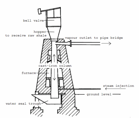
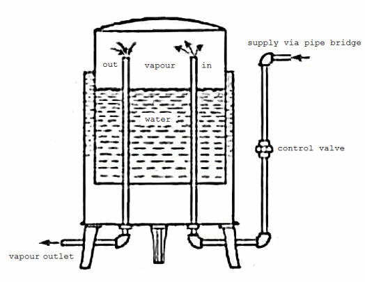
This form of shale retort was developed by Scottish engineer Alexander Carnegie Kirk in collaboration with James �Paraffin� Young. Diagram showing internal structure of a typical vertical retort
The diagram shows the hopper on top, with a valve mechanism to prevent the escape of gas. The crushed shale was dropped into the cast-iron column where it would slowly disintegrate in the heat of the surrounding furnace. Steam was injected into the bottom of the retort to diffuse and moderate the heat. The spent shale ended up in an undergound trough of water, from which it was regularly removed. The water provided a seal to contain the vapours within the retort.
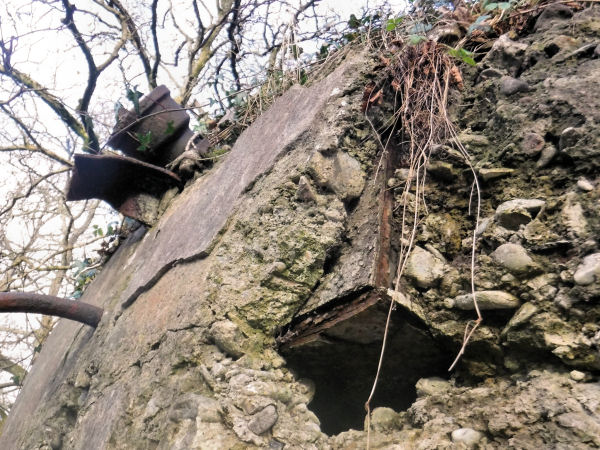
Exposed section of cast-iron column at base of shale oil retort, Netherlee
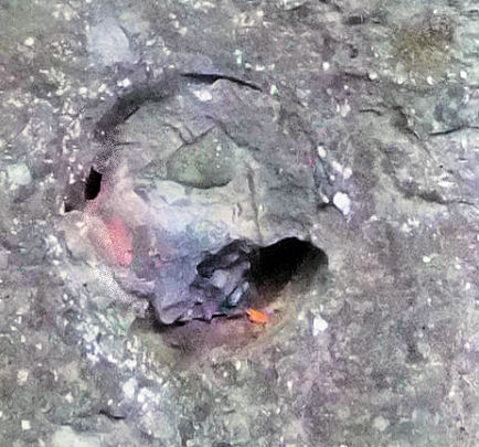
Steam inlet at base of shale oil retort, Netherlee
Cast-iron outlet pipe and remains of pipe bridge support at shale oil retort, Netherlee
Exposed rusted ironwork from inside abandoned retort, Netherlee, 2017
The gasometer shown in the above map was used for the storage of the gaseous products of the retort on the other side of the river. It was situated on the elevated bank next to the concrete pier designed to receive the pipe bridge, shown in the photograph below.
Concrete pier receiving pipe bridge at site of gasometer at Netherlee Print and Dye Works
Diagram showing gasometer for storage of vapours produced from shale oil retort
This type of simple gasometer would have facilitated the safe storage of the volatile products of the vertical retort situated on the opposite side of the river. The gaseous mixture was heavier than air but lighter than water, allowing it to be isolated at low pressure in the cylinder of the apparatus.
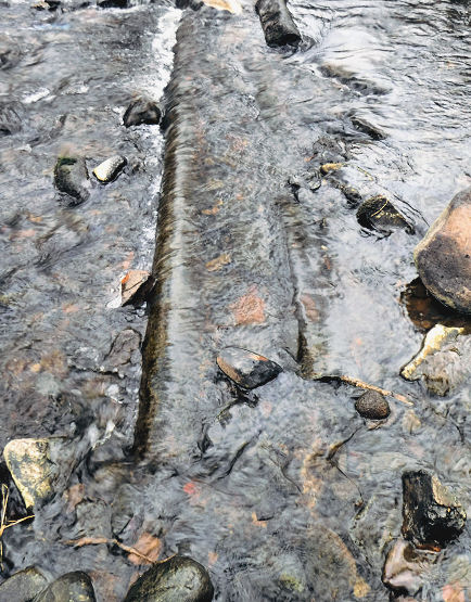
When the water level is very low, the remains of parts of the pipe formerly carried over the White Cart can be spotted on the river bed a short distance downstream from the works.
Remnants of pipe bridge at Netherlee Print and Dye Works
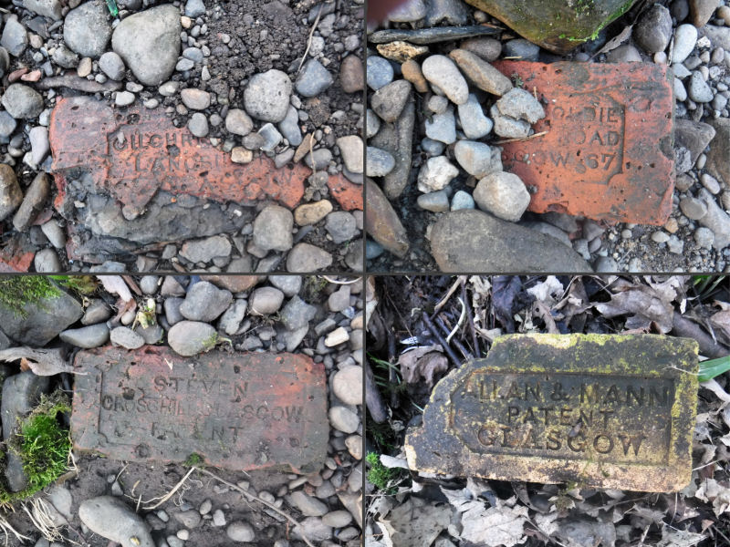
Depending on the height of the water, various traces of the old buildings can be found among the pebbles and rocks of the river bank. A selection of bricks found near the site of the Netherlee Print and Dye Works is shown below. The bricks contain the markings "Gilchrist & Goldie, Langside Road Glasgow, 1867", "Steven, Crosshill Glasgow, Patent" and "Allen & Mann, Patent, Glasgow", indicating that they all came from local south side brickworks in the mid-1800's.
Collage of assorted bricks found around Netherlee Print and Dye Works
Mark Cranston maintains the constantly updated Scottish National Brick Collection website as a very useful resource to investigate old bricks you may find on your wanderings.
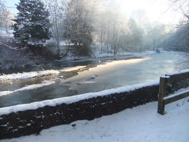
Frozen White Cart Water in midwinter
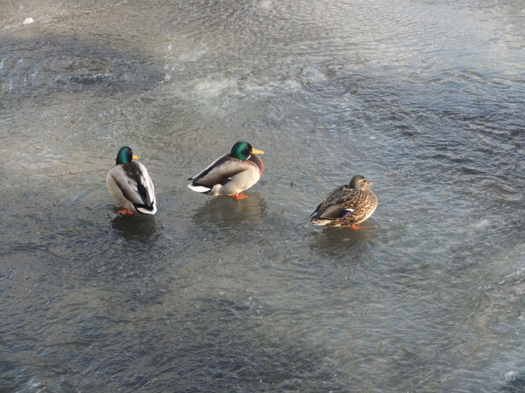
Ducks standing on the ice on White Cart Water


The brothers lived alongside the mill, with James at Holmwood and Robert at Sunnyside, which was demolished in the late 1960's.


The owner of Hagtonhill, Rev. James Hall, had become bankrupt and the estate was put up for auction on behalf of the creditors.


The pieces of shale found on the riverbank were formed from mud and organic matter in thin sedimentary layers. Shales are typically deposited in stagnant or slow moving water, indicating that river beds and surrounding flood plains have probably been in the area since prehistoric times.
The crushed shale was fed in to a hopper attached to the top of the structure. Because of the volatility of the materials the retort was situated on the opposite bank to the Netherlee Print and Dye Works and the output was carried by pipe bridge over the river to be condensed and refined to produce paraffin oil, lubrication oils and synthetic aniline dyes.
The vertical retort produced a greater range of oil and gas derivatives than its predecessors. Various fractions provided products which were utilised for the local manufacturing processes and for the cleaning and lubrication of plant and machinery. The residues were further processed with various chemicals to create a range of fashionable aniline dyes at the Netherlee Print and Dye Works on the opposite bank.

The shale gas would then have been readily available to be condensed and refined to produce synthetic dyes and other substances useful for the industrial processes.
![]()
|
|
| |
|
|
||
|
|
All original artwork, photography and text © Gerald Blaikie
Unauthorised reproduction of any image on this website is not permitted.
