
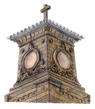
Drawing of tower of Caledonia Road Church, Gorbals
A very early reference to Gorbals is contained in a charter dated 1285 referring to a wooden bridge opposite Stockwell Street, then known as Fishergate. The original small settlement in the lands of Gorbals was named "Bridgend", derived from its proximity to the bridge.
The bridge fell into decay around 1340 and was pulled down a decade later to be replaced by the first stone bridge.
Gorbals was acquired by the Elphinstone family in 1571, and the district was made into a "Burgh of Barony and Regality" in 1607. The dynasty was led by various George Elphinstones until the final George, who built the Baronial Hall on Main Street. On his death, the lands passed into the hands of Lord Belhaven. In 1648 the lands were acquired by Glasgow Town Council, the Trades House and Hutcheson's Hospital.
In 1661 an Act of Parliament was passed, annexing the lands of Gorbals and town of Bridgend to the city for ecclesiastical purposes. In the antiquated language of the age, the measure was described as the ''disolution frae the shire of Clidsdaile, regalitie of Glasgow and parochin of Govean, and vnion to the said citie of Glasgow''.
This did not affect its burgh status, as the Act was mainly intended to allow the inhabitants to become parishioners in the city of Glasgow and attend the church nearest to them.
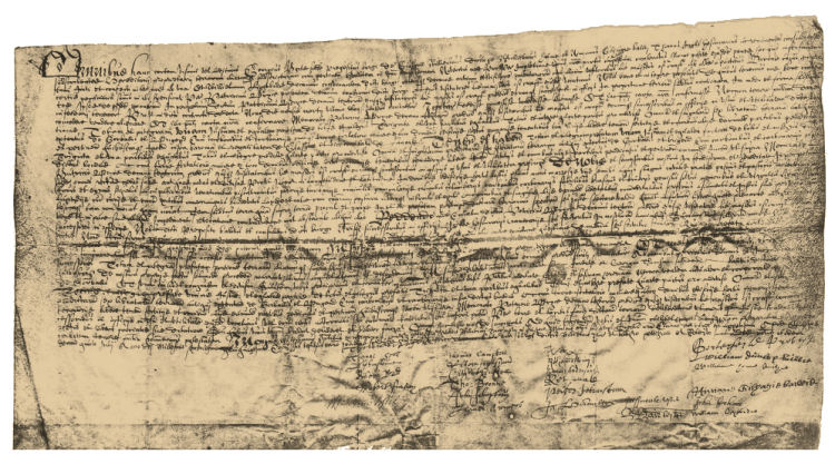
The 'Titles of the Lands of Gorbals' are shown below.
'Titles of the Lands of Gorbals' and attached seal
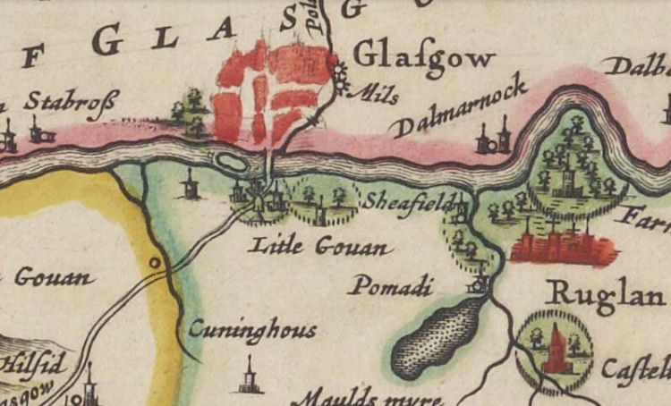
Map of Gorbals from 1783, before the division of the lands
At the division of the jointly owned lands of Gorbals in 1790, the Gorbals village became the property of Glasgow Town Council and the immediately surrounding areas became the property of Hutcheson's Hospital. The new suburb of Hutchesontown was developed to the east of the old village, being laid out from 1794 with regular streets �with good houses from two to four storeys in height�.
In the plan shown below, the area originally acquired by Hutcheson's Hospital is shown in pink, and the lands acquired by the Trades' House are shown in orange and green.
Twentieth century plan of part of the Barony of Gorbals with an overlay of the various 'crofts' and 'faulds'
The Barony of Gorbals stretched all the way from the Clyde to the county boundary with Renfrewshire at Strathbungo. A map showing the furthest extent of the area is included in the Strathbungo & Crossmyloof page of this website.
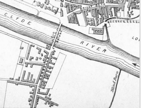
The map below shows the Clyde at the Gorbals in 1654, with a little island near the Stockwell Bridge, facing what would be later developed as Carlton Place.
An illustrated guide to the many historical buildings on the other side of the Stockwell Bridge is featured in my Merchant City page.
Map of Gorbals and surrounding area, c.1654
In 1654 there were six small islands or "inches" on the Clyde between the Stockwell Bridge and the mouth of the River Cart at Renfrew. Another map showing the little inches downstream from the city is featured in my Partick - Origins & History page.
An old report tells us that "it used to be a very common occurrence for stone battles to take place in
the vicinity of the old Stockwell Bridge, between the Glasgow and Gorbals youths, for the possession of an island on the river situated opposite where Carlton Place now stands. The death of a boy caused the objectionable sport to be put down." Islands or "inches" on River Clyde near Stockwell Bridge
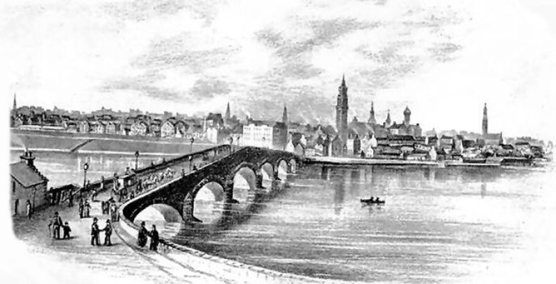
After the old wooden bridge at Gorbals was pulled down c.1350, the first stone bridge on the site was constructed consisting of eight arches, each 12 feet wide. This new bridge remained in good condition for about 300 years, until an order was passed on 18th September 1658 preventing carts on wheels from crossing over.
In 1777 the crossing was upgraded with a wider arched structure, shown above and below, which was built up to prevent danger in times of spates on the river. View of the old Stockwell Bridge from Gorbals side of the River Clyde, 1797
Close up view of tavern on Gorbals side of Stockwell Bridge
The present day river crossing at the site of the old Gorbals settlement is the Victoria or Stockwell Bridge, which opened in 1854, replacing the older stone bridge, shown above.
Construction of Victoria Bridge with temporary wooden bridge in the background, c.1851
View of Victoria or Stockwell Bridge from Gorbals side of the River Clyde
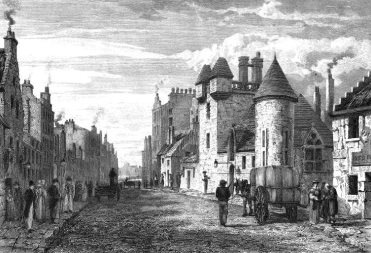
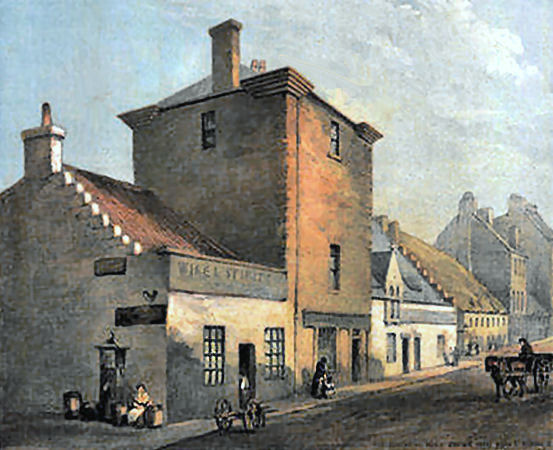
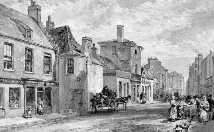
This early 19th century view of Main Street Gorbals, is looking north towards the city centre, showing the Baronial Hall with its square turreted tower and Elphinstone's private chapel with a circular tower.
Engraving of Main Street, Gorbals
Sir George Elphinstone built his mansion on the east side of Main Street, Gorbals. It was built with projecting turrets and elaborately carved timberwork. The chapel was erected a few yards farther down the street.
The arms of the Elphinstone family were carved over the doorway, with the letters S. G. E. for Sir George Elphinstone and D. V. B. for his nephew and successor, Douglas, Viscount Belhaven. Sir George
Elphinstone died bankrupt, and was buried in his chapel in 1640.
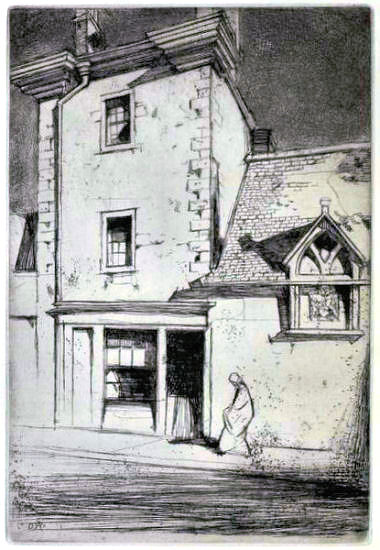
Pencil sketch of single storey buildings in side street off Main Street, Gorbals, 1839
Photograph of Elphinstone's Tower after turrets had been removed.
Coat of Arms featured on Elphinstone's mansion, with motto "Sans Tache", meaning spotless or undefiled.
Pencil sketch of Elphinstone's Tower
Perspective view of Elphinstone's Tower from the north
Rear view of Elphinstone's Tower
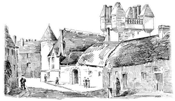
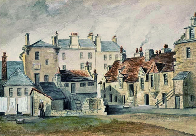
Back court of the Baronial Hall, Gorbals, 1846
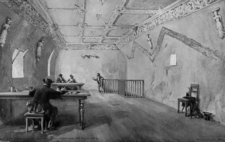
This image of the interior of Gorbals Baronial Hall is dated as 23 August 1858, when the building was occupied as a public house known as the "Old Gorbals Wine and Spirit Vaults".
Interior of Gorbals Baronial Hall
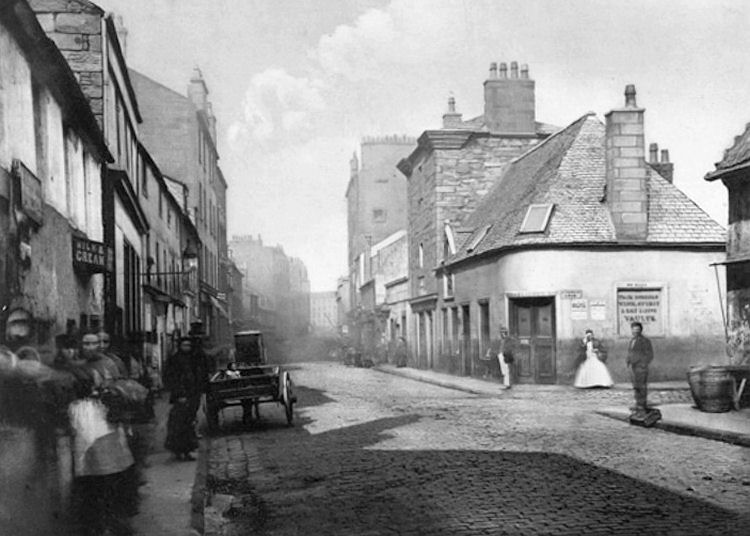
View of east side of Main Street Gorbals looking south
Photograph of Main Street Gorbals, looking north, 1868
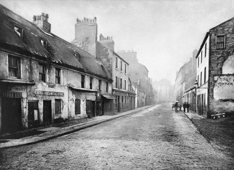
Main Street Gorbals, looking south, 1868
View of back court in old Gorbals
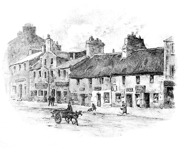
Sketch of Main Street Gorbals, 1876
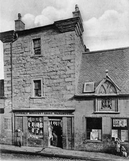
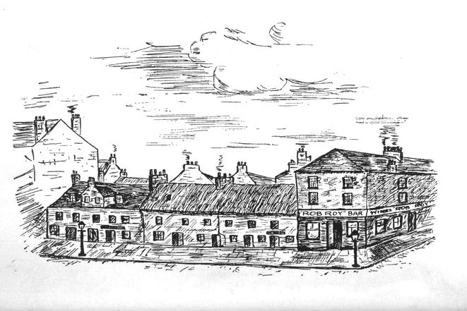
Pencil sketch of shops in Main Street Gorbals
The Rob Roy Bar at the corner of Main Street and Bedford Lane was originally the site of a tavern known as the "Thackit Hoose", which dated back to the early 18th century. It was reputed to have been visited by the infamous Highland outlaw, Rob Roy MacGregor, after whom it acquired its new title. Internally the hostelry featured a horse-shoe bar surrounded by scenes of the daring exploits of Rob Roy.
Row of old houses beside the Rob Roy Bar at the corner of Main Street and Bedford Lane
Corner of Bedford Lane and Main Street with Rob Roy Bar and "Gorbals Public Washing House", c.1890
View of western side of Main Street, looking towards Rob Roy Bar and public wash house, c.1890
'Old Houses in Main Street Gorbals' by Jessie Marion King, 1912
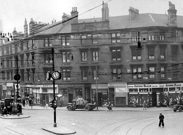
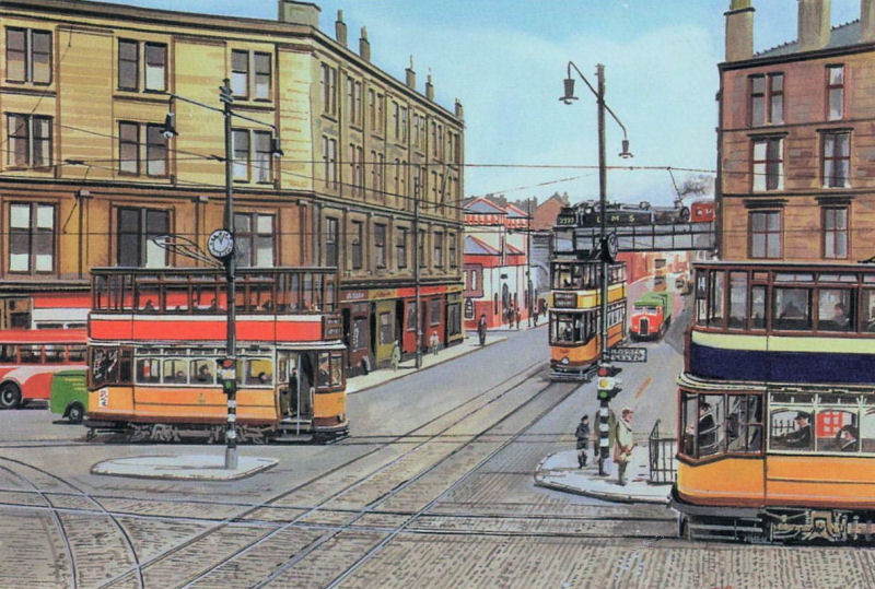
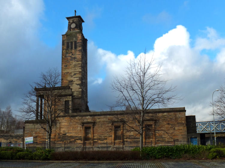
View of Gorbals Cross from Ballater Street c.1910
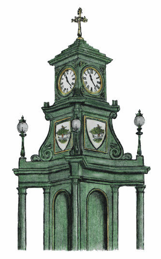
Drinking fountain with clock tower at Gorbals Cross
Drawing of clock tower over drinking fountain at Gorbals Cross
View of Gorbals Cross c.1960
1950's view of Gorbals Cross looking towards railway bridge at Ballater Street
This view from 1977 shows the cleared site of the buildings surrounding Gorbals Cross. There was ample free space for the large scale development of the Glasgow Central Mosque and the Glasgow Sheriff Court complex. Cleared sites surrounding Gorbals Cross following demolitions
This later view of the same scene shows the Glasgow Central Mosque and the Glasgow Sheriff Court occupying the cleared sites. There is a car park on the site of the Palace Bingo Hall. The high rise block at Norfolk Court seen in the 1977 photograph was demolished in 2010. The surviving block, shown below, was demolished in 2016.
Redevelopment around Gorbals Cross
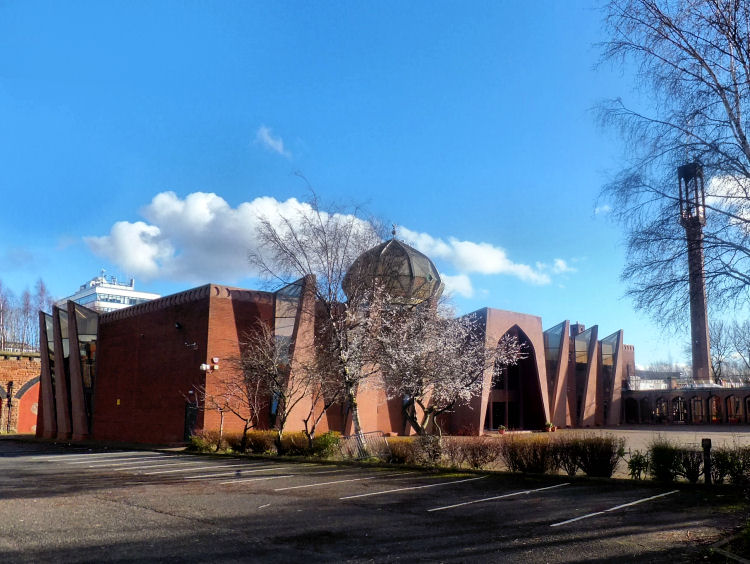
Much of the site of the original settlement at Bridgend, Gorbals, is now occupied by the Glasgow Central Mosque and Islamic Centre, which was developed on four acres of cleared land on the eastern side of Gorbals Street, near the river.
Glasgow Central Mosque on site of original village at Gorbals
View of Glasgow Central Mosque from Ballater Street
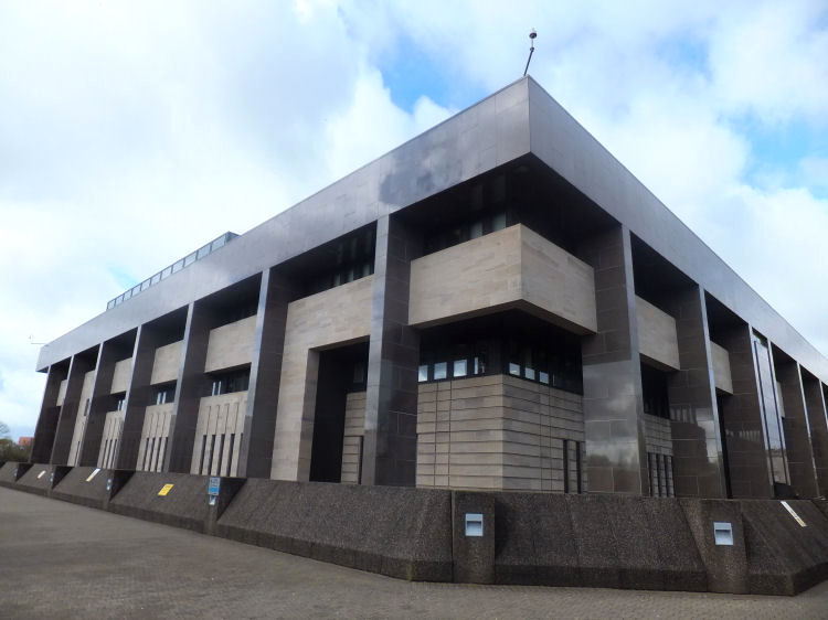
The relocated Glasgow Sheriff Court on the western side of Gorbals Street was formally opened by Queen Elizabeth II on 29 July 1986. The height of the courthouse was restricted to 65ft (19.8m) to fit in with the listed Georgian terraces of Carlton Place. The operational space was therefore confined to just five levels.
Glasgow Sheriff Court viewed from the north-east, at Gorbals Street
The courthouse was built on the site of Gorbals Parish Church in Carlton Place. The history of the parish and the story of how the church lost its spire in 1929 is included in the Laurieston page of this website.
Drawing of tower of Gorbals Parish Church, after it lost its spire in 1929
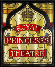
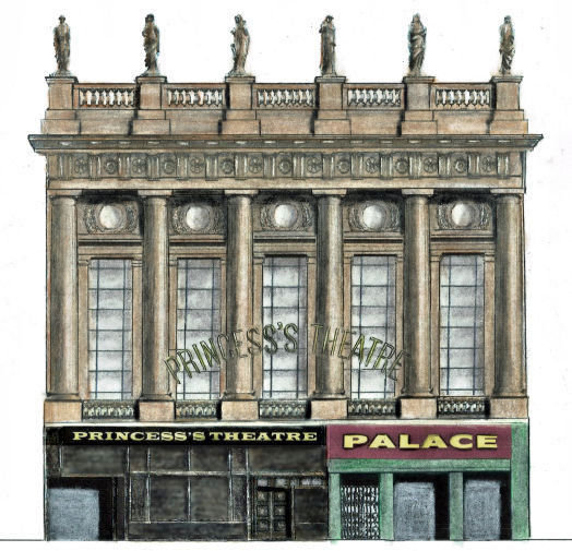
The Citizens' Theatre on the eastern side of Gorbals Street, south of Ballater Street, was erected in 1878 as Her Majesty's Theatre and renamed as the Royal Princess's Theatre in 1880.
The theatre's frontage was designed by architect Campbell Douglas to include Doric columns and statues removed from David Hamilton's Union Bank in Ingram Street. The Royal Princess's Theatre became the Citizens' in 1945.
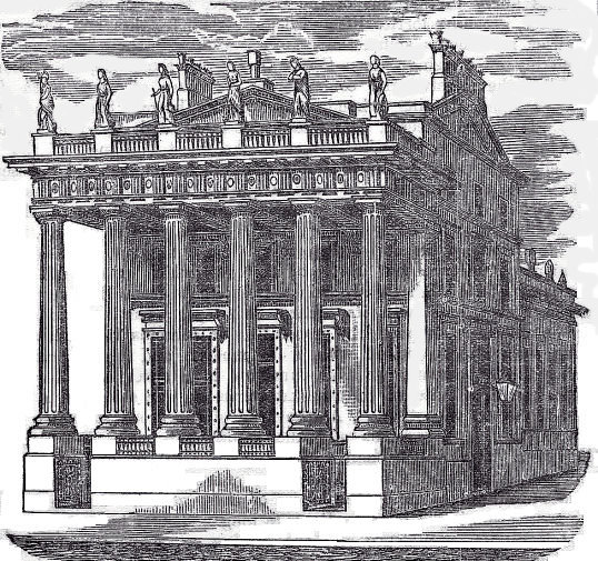
Union Bank Ingram Street, designed by David Hamilton, 1842
Princess's Theatre / Palace Music Hall with transposed elements of Union Bank
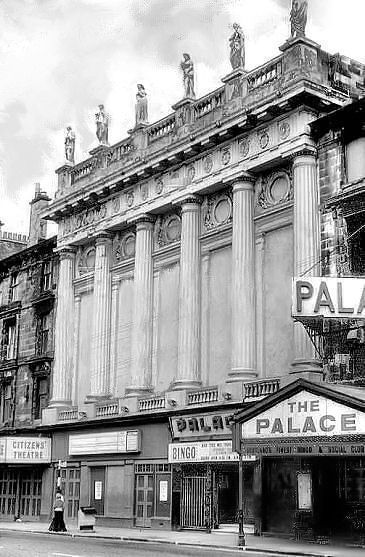
Later frontage of Citizens' Theatre & Palace Bingo Hall, Gorbals Street
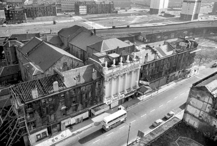
Aerial view of Citizens' Theatre and derelict tenements in Gorbals Street and Crown Street
Fa�ade of the Citizens' Theatre & Palace Bingo Hall
By 1977 the poor condition of the Palace Bingo Hall required its immediate demolition. The classical shared fa�ade with the Citizens' Theatre was also torn down, leaving only a small portion of the ballustrade shown in the photograph below. Fortunately the statues which adorned its distinctive colonnade were salvaged.
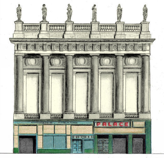
Frontage of Citizens' Theatre after 1977 demolition
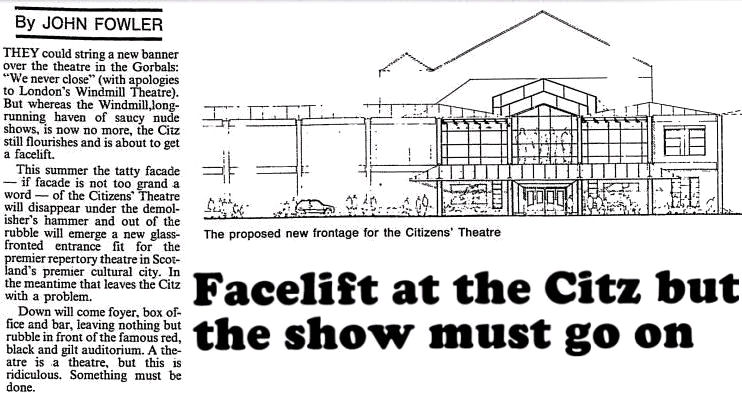
The remnants of the frontage was described by one critic as a "tatty facade - if facade is not too grand a word". Plans were made in 1988 for its replacement with "a new glass-fronted entrance fit for the premier repertory theatre in Scotland's premier cultural city". The new frontage was completed the following year.
Cutting from Glasgow Herald 30th May 1988, regarding replacement fa�ade of Citizens' Theatre
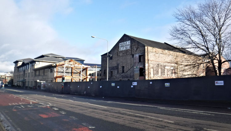
2014 view of Citizens' Theatre on eastern side of Gorbals Street
The yellow brick fa�ade and foyer shown above were added to the Citizens' Theatre in 1989 by the Building Design Partnership as part of the office development ancilliary to the new Sheriff Court. The old Victorian building with its random rubble masonry was left intact behind the new accommodation.
The new building at the front of the theatre only lasted 30 years before it was pulled down in late 2019.
January 2020 views of Citizens' Theatre after demolition of 1989 additions
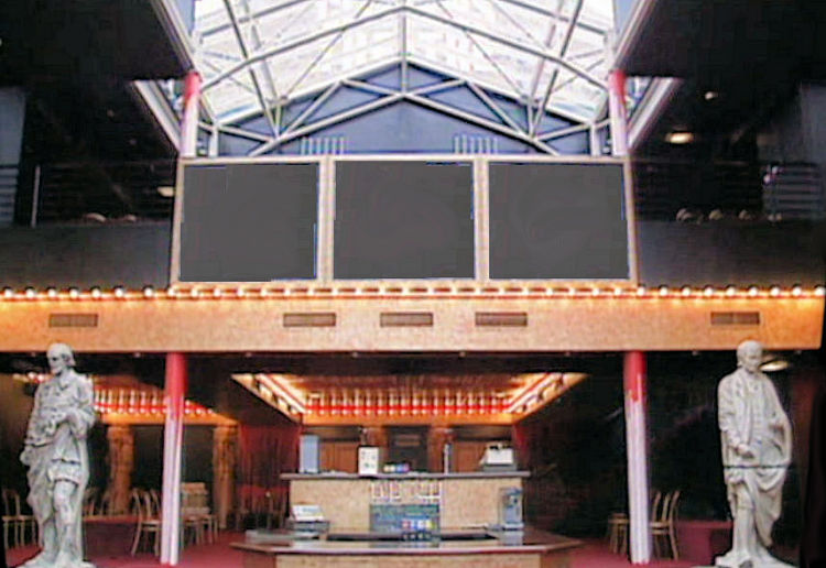
The demolished foyer displayed some of the statues which were originally placed on top of the old fa�ade, which were created by celebrated Glasgow sculptor John Mossman.
Statues of Shakespeare and Burns in foyer of Citizens' Theatre
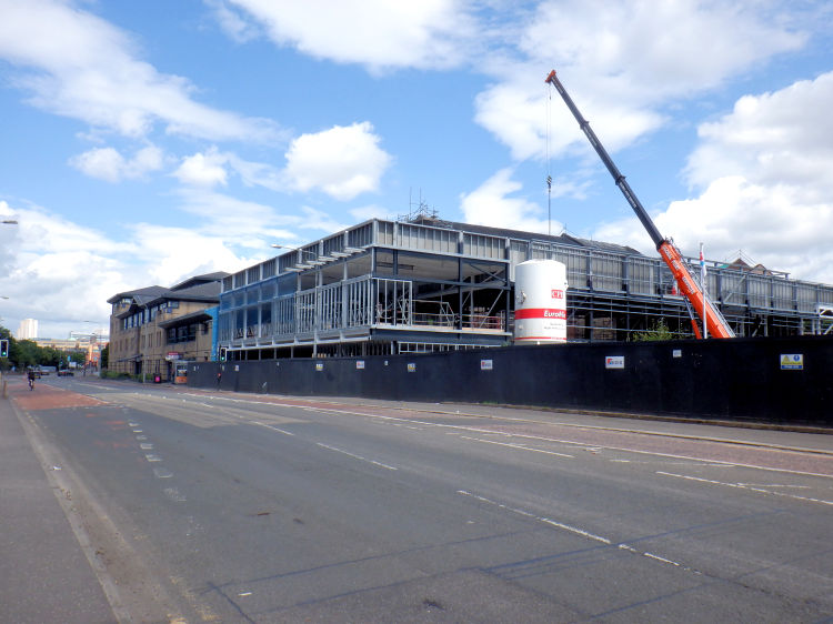
Framework of new building fronting Citizens' Theatre, July 2021
Artist's impression of new building fronting Citizens' Theatre
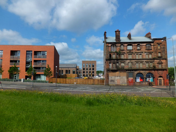
Last surviving tenement in Gorbals Street, surrounded by new housing of Laurieston redevelopment, May 2016
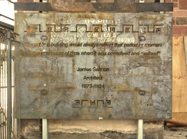
A steel plate which was used as part of the structural renovation of the Gorbals Street tenement in 2019 contains a quotation from James Salmon, the architect of the building which was built for the British Linen Bank around 1900. Steel plate with quotation from James Salmon, Architect, September 2019
Renovation of the Gorbals Street tenement building in 2019
New buildings being constructed alongside Gorbals Street tenement building, July 2021
Traditional old house at gable of typical four-storey Gorbals tenement, built c.1890
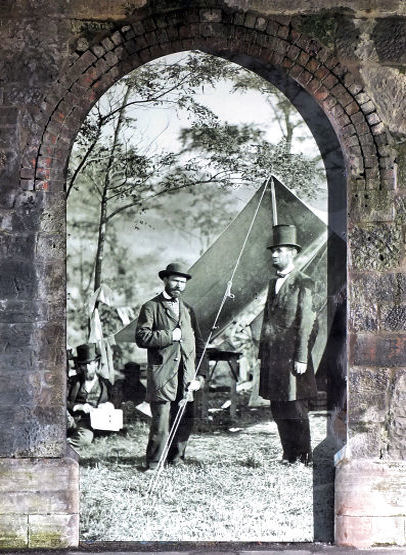
Among the many famous people with Gorbals roots was Allan Pinkerton, who emigrated to the United States and later founded Pinkerton National Detective Agency. The agency's well known motto was "We never sleep".
Birthplace of the legendary detective, Allan Pinkerton (1819-1884), at Muirhead Street near Gorbals Cross
Allan Pinkerton is featured in one of the murals in the railway underpass at Cleland Street which links Hospital Street with Gorbals Street. Mural of Allan Pinkerton with Abraham Lincoln in railway underpass at Cleland Street
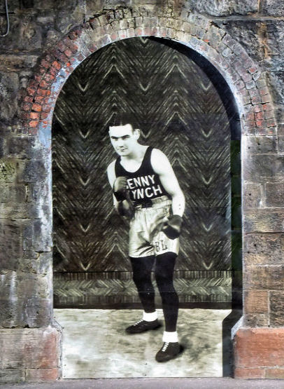
Mural of Benny Lynch, Scotland's first World Boxing Champion, in railway underpass at Cleland Street
Sketch of a 'Girl in a Wood� by the artist, Hannah Frank, in railway underpass at Cleland Street
The redevelopment of the Gorbals began with the creation of a Comprehensive Development Area (CDA) in 1957. Over the next two decades street after street of traditional Glasgow tenemental housing was demolished to make way for sub-standard prefabricated deck blocks and other forms of inferior social housing, most of which has also been flattened to make way for the "New Gorbals".
Tenement block in "New Gorbals"
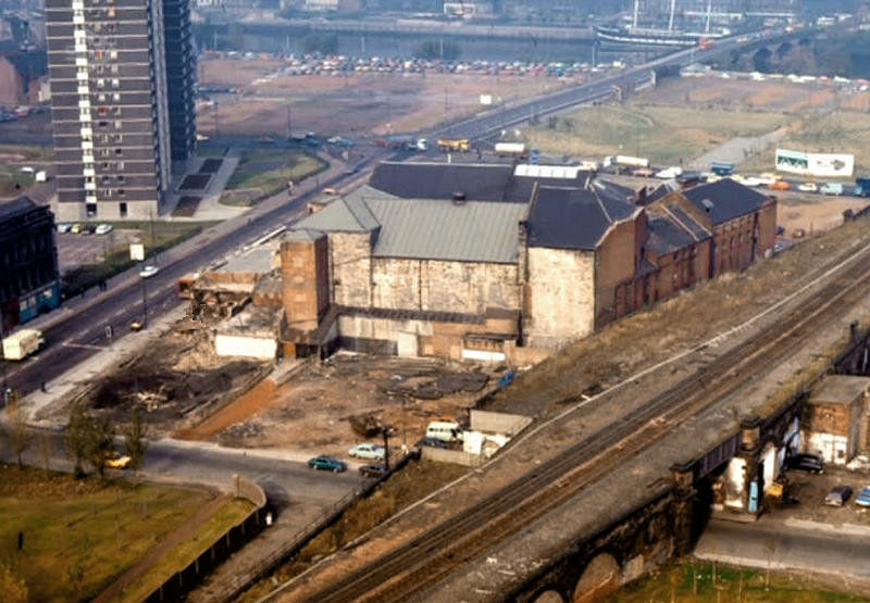
The view below shows the futuristic Glasgow College of Nautical Studies which was established on the banks of the river Clyde in 1969, east of the site of the old village.
Glasgow College of Nautical Studies, RMJM Partnership - built 1969, demolished 2016
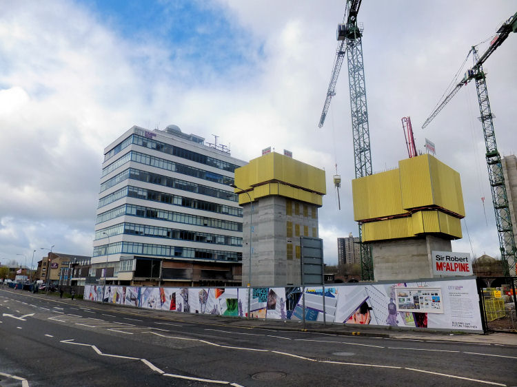
Construction of new City of Glasgow College alongside original Glasgow College of Nautical Studies, April 2014
Partially completed City of Glasgow College before demolition of College of Nautical Studies
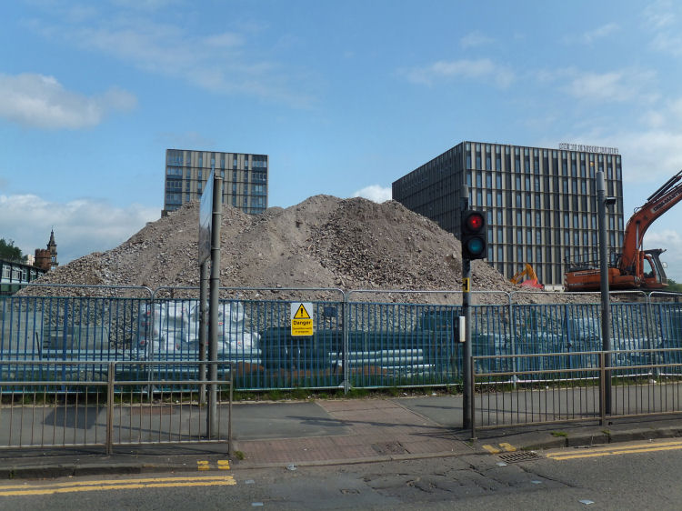
Debris from Glasgow College of Nautical Studies after demolition, May 2016
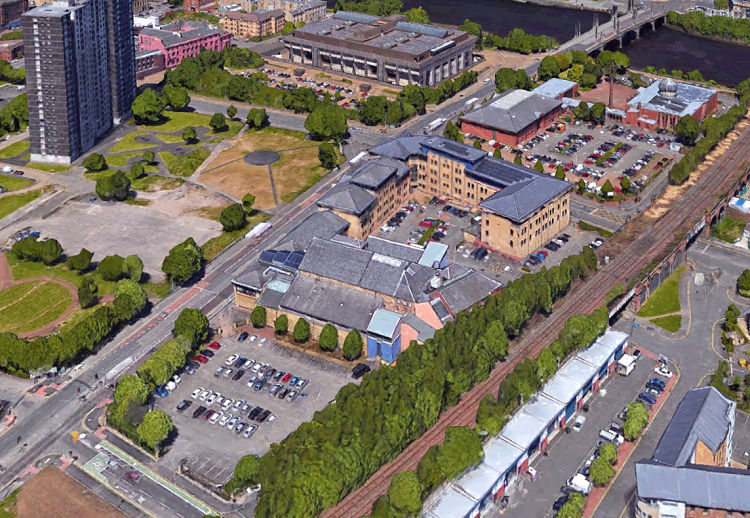
Riverside Campus of City of Glasgow College, viewed from refurbished Albert Bridge, November 2016
The establishment of the Southern Necropolis cemetery was proposed at a public meeting on 15th November, 1839 at the Baronial Hall of Gorbals. At a second meeting on 27th February 1840, a committee was formed to prepare a prospectus with the purpose of making lairs available at moderate rates for all classes of the population. The cemetery was officially opened in July 1840 and extended twice in the following years.
View of Southern Necropolis with gatehouse and St Francis Centre in the distance
The gatehouse at Caledonia Road was designed by Charles Wilson and built in 1848. It features a castellated Norman arched gateway with a tall stair turret. Wilson himself was buried in the Southern Necropolis in 1863.
Gatehouse of Southern Necropolis and nearby multi-storey block create an interesting optical illusion
The same two buildings look very different when looked at from an alternative viewpoint!
Gatehouse and multi-storey block viewed actual size from above
1960's view of St Francis Church and gatehouse of Southern Necropolis, rare survivors of the Gorbals slum clearance programme
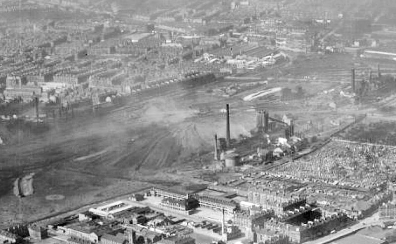
This view, looking south from the Gorbals, shows Govanhill at the top of the frame with the blackened tenements of Aikenhead Road on the boundary of Dixon's Blazes. The Southern Necropolis can be seen on the boundary on the opposite side of the ironworks.
View of Govan Ironworks, otherwise known as 'Dixon's Blazes', south of Southern Necropolis
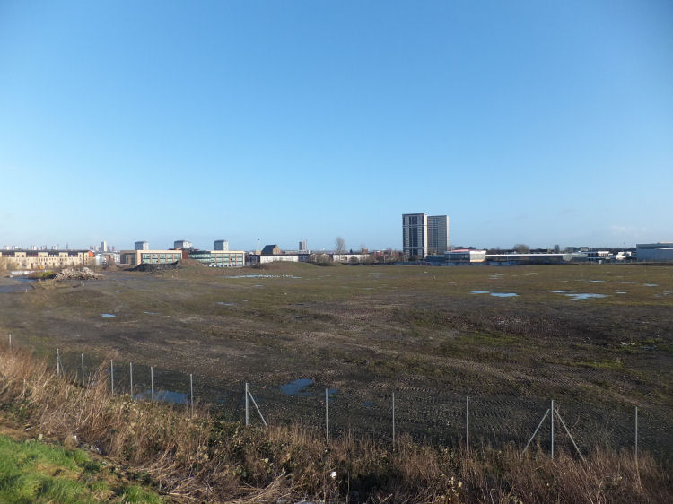
Derelict site of 'Dixon's Blazes' with St Francis Centre and Caledonia Road multis in the distance
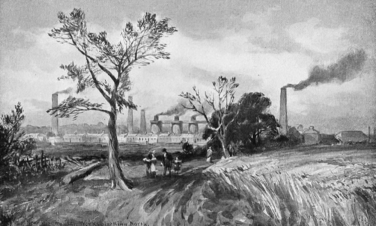
View of 'Dixon's Iron Works looking North' by William Simpson, 1848
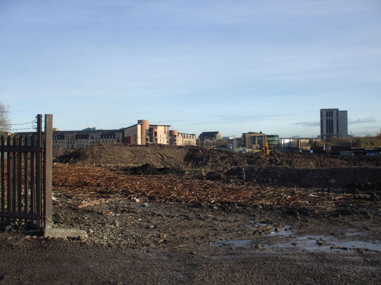
Long view of undeveloped land
between Gorbals and M74 motorway at Govanhill
Caledonia Road Church was Alexander "Greek" Thomson's first
church to be built in Glasgow, erected in 1857. The ruins of the church remained after an arson attack in 1965 to become what is now Gorbals greatest architectural landmark.
Caledonia Road Church, Gorbals
The sculpture group of the "Gorbals Boys" by Liz Peden of Gorbals Arts Project was installed in August 2008 in Cumberland Street. The artist used three local boys to model for the sculptures.
The statue of a �Girl with a Rucksack� in Cumberland Street was created by sculptor Kenny Hunter and unveiled on 14th April 2004. The bronze figure stands on a high pedestal and is said to represent the movement of people through the area over the ages.
Girl with a Rucksack, Kenny Hunter, 2004
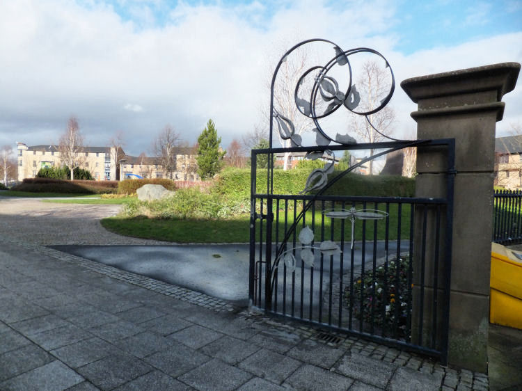
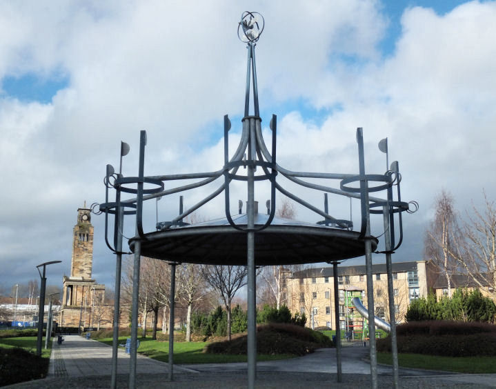
Gorbals New Park has been created to provide a pleasant amenity for the district, sadly lacking in the previous redevelopment of the area. The park has fine landscaped grounds surrounding a children's play area.
Gate at entrance to Gorbals New Park
Bandstand at Gorbals New Park
The 'lands of St Ninian's Croft' in Gorbals had a leper hospital dedicated to the saint of that name dating back to 1350.
Although partially owned by the Town Council, Gorbals was not formally included within the city boundaries until 1846.
The old "Burgh of Barony and Regality" was raised to the status of a Police Burgh in 1808, before its inevitable disappearance.

The land to the west of the old village was sold by the Hutcheson trustees to Mr James Laurie and developed as Laurieston from 1802.
The land acquired by the Trades' House of Glasgow, to the west of Bridge Street / Eglinton Street, was developed as the manufacturing district of Tradeston.
In the archaic Scots language a 'croft' was a small piece of land, usually attached to a building or some other local structure. A 'fauld' or a 'fold' was a field used for the grazing of sheep or cattle.

The lands of 'Little Govan' would later become the suburbs of Hutchesontown and Govanhill.
The surrounding areas of Polmadi (Polmadie) and Sheafield (Shawfield) are still familiar today.

In 1821 the bridge was overhauled, but in 1847, owing to the great increase of traffic, it was removed completely to make way for the present Victoria or Stockwell Bridge.

A temporary wooden structure came into use in January, 1847, erected alongside the construction operations for the new bridge, shown below.


The Citizen's Theatre sits in isolation following the demolition of the adjacent Palace Bingo Hall and the surrounding tenements.
The complex, which was designed by the Coleman Ballantine Partnership, was formally opened on 18th May 1984 by Dr. Abdullah Omar Nasseef, Secretary-General of the Muslim World League.
The design of the mosque is a fascinating synthesis of traditional Islamic architecture with modernistic glass elements, also featuring familiar traces of old Glasgow with red sandstone finishes.
Previously, local Sunni Muslims met at converted premises in Oxford Street and Carlton Place, Laurieston, on the other side of the main road.

The complex was designed by a large team of architects co-ordinated by the Property Services Agency, including the local practice of Keppie Henderson & Partners.
The new court was constructed with traditional durable materials, including granite slabs from Denmark and sandstone and limestone from English sources.


"The art in a building would always reflect that period or moment in the continuum of time when it was conceived and realised"


The murals are part of a "history wall" by artist Liz Peden of Gorbals Arts Project which was installed in the summer of 2016. It shows famous people with Gorbals connections designed by the artist to �demonstrate to our young people that no matter where you come from, you can achieve great things.�

The housing in the "New Gorbals" is much more sympathetic to the traditional Gorbals model. The architect of the block shown below used red sandstone and yellow brick to create an up-to-date version of a typical four-storey Glasgow tenement.
The regeneration of the community is featured in the Hutchesontown page of this website.


The church is featured in detail at my Alexander Thomson's Churches web page.
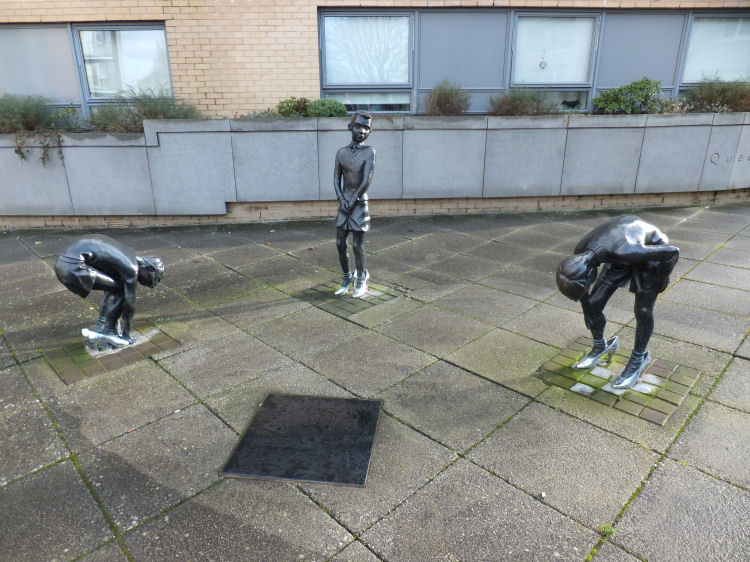
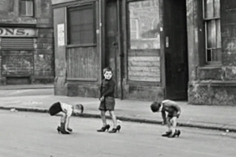
The original iconic image, left, was taken by Scots-Italian photographer, Oscar Marzaroli, in 1963.
The girl with her tracksuit and backpack is a transient figure of the modern age, looking down on a residential thoroughfare far removed from the Cumberland Street of legend.

Gorbals New Park features attractive metalwork by sculptor, Jack Sloan, who designed the gates at each of the entrances and the bandstand in the centre. Sloan was assisted in the fabrication of these pieces in 1998 / 1999 by the highly skilled metalworker, Hector McGarva.
|
|
| |
|
|
|
|
|
|
|
|
|
All original artwork, photography and text © Gerald Blaikie
Unauthorised reproduction of any image on this website is not permitted.
