
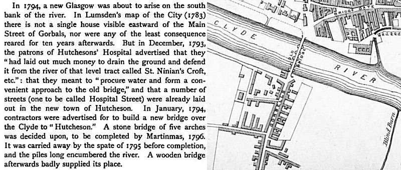
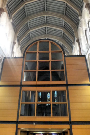
At the division of the lands of Gorbals in 1790, the Gorbals village became the property of Glasgow Town Council and the immediately surrounding areas became the property of Hutchesons' Hospital. The new suburb of Hutchesontown was developed to the east of the old village, being laid out from 1794 with regular streets “with good houses from two to four storeys in height”. The extract above describes the origins of Hutchesontown, which was developed in the area to the east of Gorbals village which is shown in Lumsden's 1783 map as open land with no signs of residential settlement.
View of Glasgow from the future site of Hutchesontown, east of Gorbals village
The riverbank to the east of Gorbals was the situation of the principal salmon shoots on the river. In 1730 the Merchants' Lane, which ran from the Briggait to the Clyde, was a horse road that led to a ford in the river, which came out on the Gorbals side near to where Hospital Street and the City Union Railway Bridge were later established.
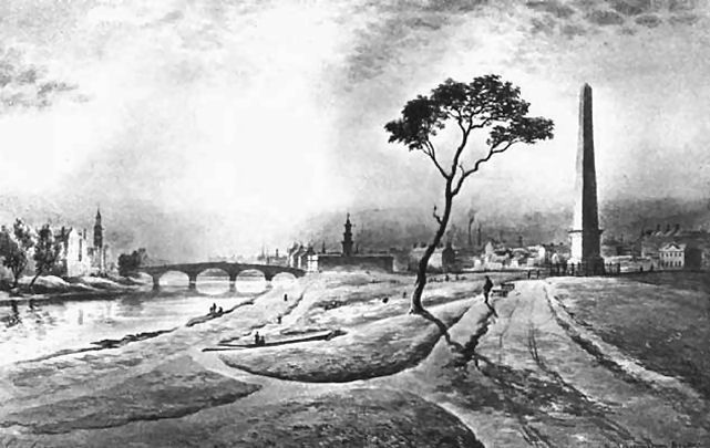
View of the 1830 stone Hutchesontown Bridge from Glasgow Green
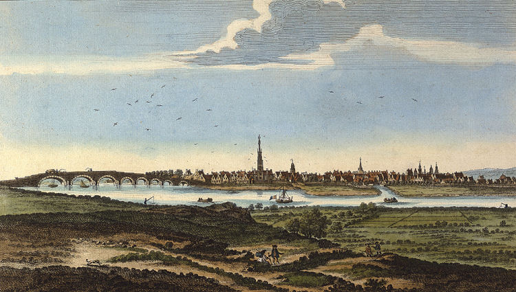
In 1792 the patrons of Hutchesons' Hospital contributed to the costs of erecting a bridge to connect their proposed new suburb with the city at Glasgow Green. The foundation stone was laid on 18th June 1794, but it was never completed. On 18th November 1795, during a great flood, two of the arches were swept away leaving the rest of the structure in ruins.
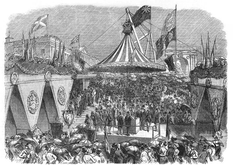
Laying of foundation stone for Albert Bridge, June 1870
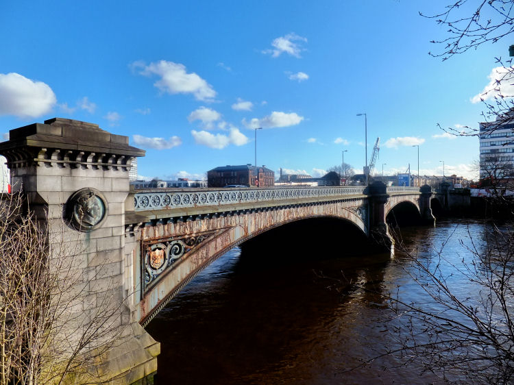
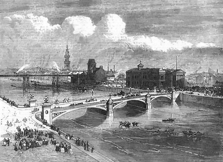
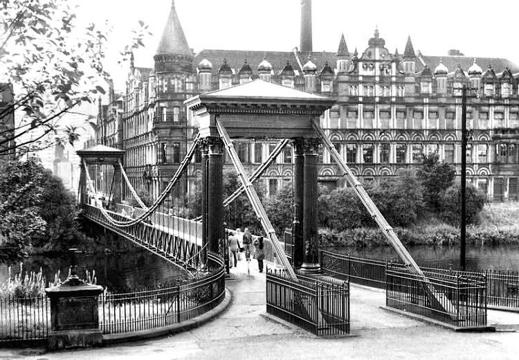
The completed Hutchesontown or Albert Bridge, shown below, opened on 21st June, 1871.
View of Hutchesontown or Albert Bridge looking south towards Gorbals
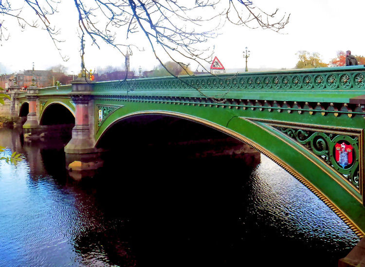
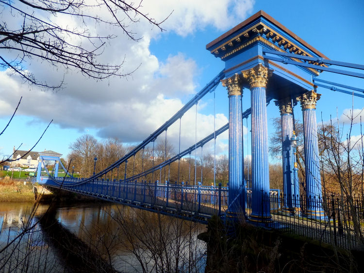
The Albert Bridge has been completely refurbished and repainted with work completed in June 2016. It was officially re-opened by Prince Edward on 15th October 2016.
View of refurbished Albert Bridge looking from Gorbals towards Saltmarket
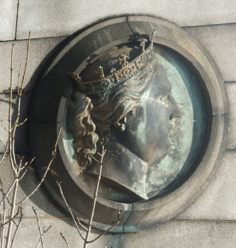
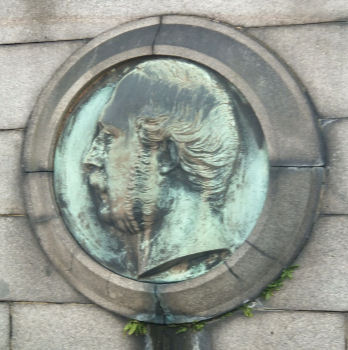
Bronze plaques of Queen Victoria and Prince Albert at Albert Bridge, Glasgow
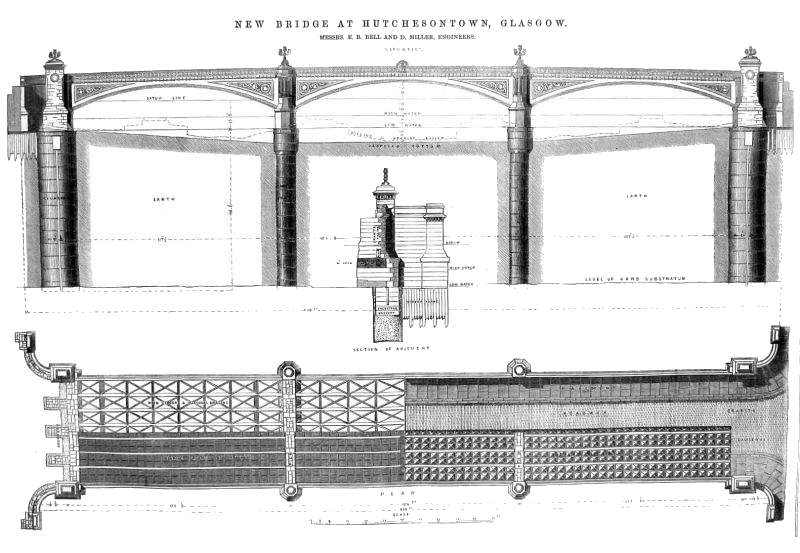
Plans of 1871 Albert Bridge by Messrs Bell & Miller, Engineers, Glasgow
Detail of central arch at Albert Bridge
Glasgow coat of arms as featured in original plans, after refurbishment in 2016
Victorian view of Albert Bridge from Hutchesontown, looking towards Saltmarket
Pupils outside Hutchesons' Grammar School, Crown Street, c.1910
Rear view of Hutchesons' Grammar School, Rose Street, Gorbals, c.1910
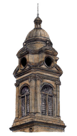
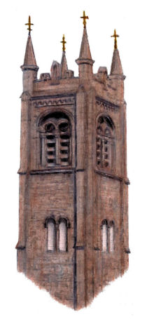
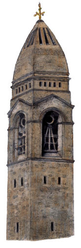
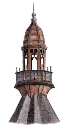
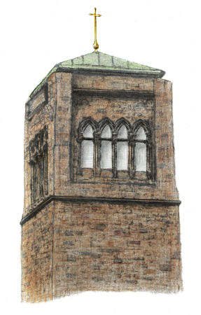
Drawing of tower of Hutchesons' Grammar School by Gerald Blaikie
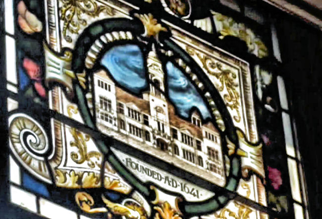
Hutchesons' Grammar School in Crown Street opened on 26 April 1841. It was designed by the distinguished architect, David Hamilton.
The bell tower, shown above, was built as part of the extensions of John Burnet Senior in 1876. The school was relocated to Crossmyloof in 1960.
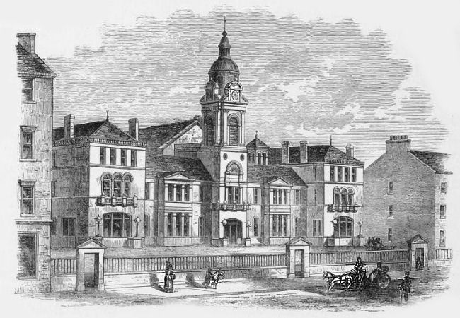
The Crown Street building was occupied for a short time by the Ministry of Pensions before being demolished in the early 1970's. Engraving of Hutchesons' Grammar School, Crown Street
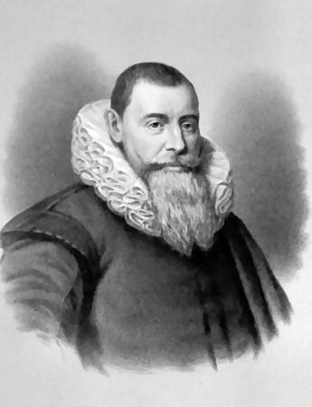
George Hutcheson (left) and Thomas Hutcheson (right), benefactors of Hutchesons' Educational Trust
Stained glass image of of Hutchesons' Grammar School at Hutchesons' Hall
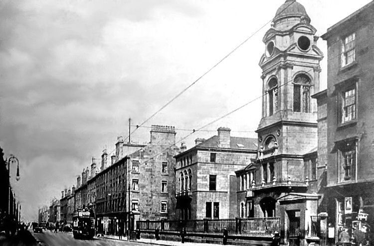
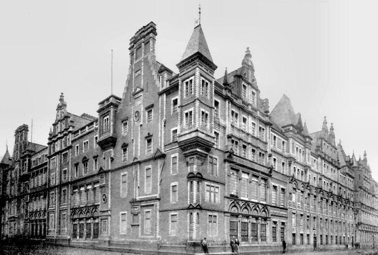
Early 20th century view of Crown Street and Hutchesons' Grammar School
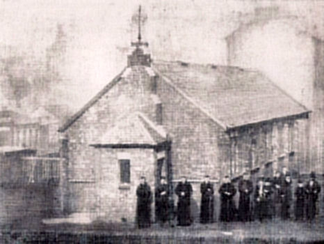
The first Hutchesontown Established Church was built in 1839 at Hospital Street. It achieved the status of a parish church in 1871. The church was acquired by the Glasgow and South Western Railway as part of the improvement scheme which involved the doubling of the tracks through Gorbals to St Enoch Station in 1900. The railway company provided the funds for the site and building of the new church with an attractive square tower, shown below.
Tower of Hutchesontown Parish Church
Hutchesontown Parish Church was designed in a Romanesque style by Alexander Adam of St Vincent Street, Glasgow. It was built with rock-faced red sandstone with a tower at its western corner. It was situated on the northern side of Rutherglen Road between Crown Street and Florence Street. The design of the roof used iron components to provide a clear span across the body of the church.
St Francis Church and Friary in Cumberland Street was the home of the Franciscan "Greyfriars" in Glasgow until the 1990's, when they relocated to the former St Luke's building in Ballater Street, renamed as the Church of Blessed John Duns Scotus.
The Franciscan friars returned to post-Reformation Glasgow in October 1868, occupying the temporary brick building, shown left.
The first part of the present day complex to be built was the friary, designed in Gothic style by Gilbert Robert Blount of London. It was formally opened 11th July 1869 with a high mass, celebrated by Archbishop Charles Eyre of Glasgow. The mass was Mozart's No.12, performed with a choir and orchestra.
In the courtyard of the friary some of the stones of the original Franciscan monastery formed a mound for a cross. The remnants of the High Street buildings were scheduled to be demolished by the City Improvement Trust at the time.
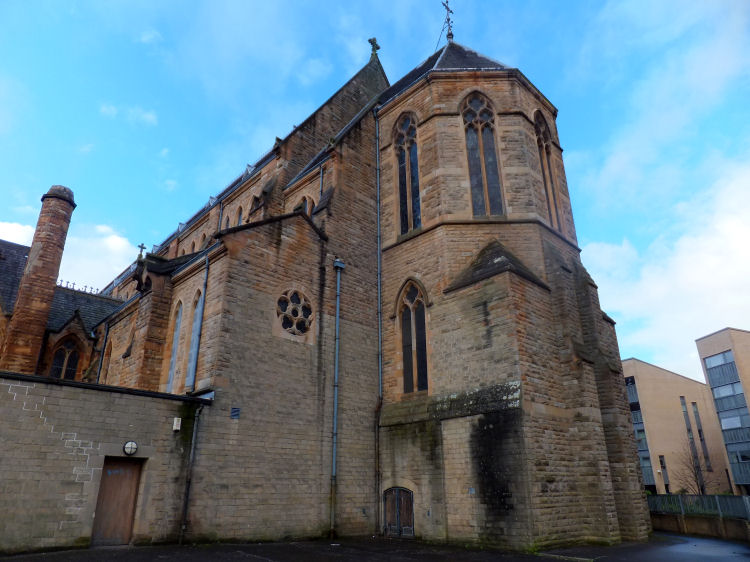
St Francis Church, Baptistry, and Friary, Cumberland Street, Gorbals
St Francis Church was designed by Pugin & Pugin of Westminster in the Early Decorated Gothic style, with a façade featuring three lancet windows. It has no tower or spire in harmony with the austere rules of the Franciscan Order. The octaganonal Baptistry is situated between the Church and the Friary. Mr Peter Paul Pugin attended the ceremony for the laying of the corner-stone on 25th May 1880.
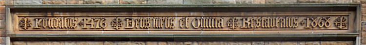
The script over the entrance of the church contains the motto of the order, “ Deus meus et omnia”, which translates as “My God and My All”. It also records that the Franciscans founded a community in Glasgow in 1476, and returned in the post-Reformation era in 1868.
Latin script over entrance of St Francis Church - "Foundatus 1476 - Deus meus et omnia - Restauraus 1868"
External view of chancel at rear of St Francis Church, added 1895
In 1995-1996 St Francis Church was converted by Glasgow City Council into a Community Centre. The adjacent friary became sheltered housing at the same time. The work was skilfully carried out by Page & Park, Architects, retaining much of the character of the old building.
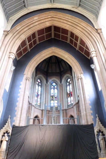
The high altar at the northern end of the church has been preserved behind a woven screen, while new offices and an entrance foyer have been construced within the space at the southern end of the church.
Screened high altar and new-build offices at St Francis Church, Gorbals
The side altars have been preserved, again with protective screening to prevent any accidental damage.
Side altar at St Francis Church, Gorbals, dedicated to St Patrick
The fourteen stations of the cross, which were placed in niches within the stonework high above the congregation, are an interesting and beautiful feature of the church which thankfully have been retained.
Seventh Station of the Cross at St Francis Church, Gorbals
The Franciscan frairs are still in the Gorbals, occupying the former St Luke's Church, Ballater Street, renamed after Blessed John Duns Scotus.
Former St Luke's Church, now Franciscan Parish of Blessed John Duns Scotus
The bell of St Francis Church is now situated in the yard of Blessed John Duns Scotus Church. The inscription reads - John Wilson, Glasgow, AD 1869.
Bell of St Francis Church, Gorbals
The friars at St Francis Church brought with them some relics of St Valentine from France when they came to Gorbals in 1868. The bones of the romantic saint are contained in a decorative casket on display at Blessed John Duns Scotus Church.
Casket containing relics of St Valentine
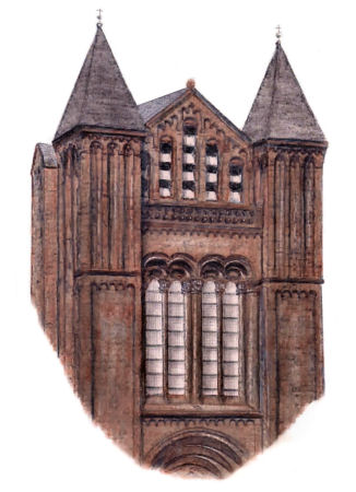
The drawing below is of the tower of St Ninian’s Established Church which was situated on the eastern side of Crown Street at the corner with Kidston Street. At the laying of the foundation stone on 14th October 1884, the church's first minister Rev. Mr Bryce mentioned a temporary iron structure known as Crown Church, in use during the construction of the new building.
The architect of the church was James Ritchie. The foundation stone was laid by J. Nelson Cuthbertson, who also placed a hermetically sealed jar containing newspapers of the day and documents relating to the congregation.
Tower of St Ninian's Church, Gorbals
Following the union of the Church of Scotland and the United Free Church in 1929 the congregation of St Ninian's moved to the nearby building of the Wynd Free Church, shown below, which became the Church of Scotland “quoad sacra” parish of St Ninian's Wynd in 1934.
The Wynd Free Church at the junction of Crown Street and Cathcart Road was built for an existing congregation in 1889.
The history of the Wynd Church goes back to 1685, named after its situation between the Old and New Wynds, alleyways which connected Trongate to Bridgegate in the Merchant City. The Wynd Free Church dates from 1854 with Rev. Dugald McColl being the first minister.
Wynd Free Church, which became St Ninian's Wynd Church in 1934
The Medical Mission buildings, constructed at the same time as the church, were formally opened on 3rd December 1889 by Mr J. Campbell-White. The Mission provided professional care and advice to those whose family income was less than 20 shillings per week. It also gave basic medical training for students intending to go to the foreign missions.
The architectural competition for the design of Cunninghame Free Church at the corner of Ballater Street and Thistle Street produced two rival designs. The competition was won by brothers, Hugh and David Barclay. It was, however, the skilfully executed drawing of the unsuccessful entry by W.G. Rowan which was displayed at the annual exhibition of the Royal Glasgow Institute of the Fine Arts of 1899.
Exhibition drawing of unsuccessful design of Cunninghame Free Church by W.G. Rowan
The Barclay brothers' Cunninghame Free Church featured an unusual bell tower with angular elements emphasising light and shadow.
Bell tower of Cunninghame Free Church
The memorial stone for the new church was laid on Saturday 28th May 1898 by Mr J. Cameron Corbett M.P. at a ceremony presided over by Rev. Alexander Simpson, the minister of the church.
The building in Ballater Street, referred to above, was built as Chalmers Free Church to the designs of Alexander "Greek" Thomson in 1859. It has more of a similarity to his villas and terraces than to the better known Thomson churches of Glasgow. Chalmers Free Church, Ballater Street, 1859
The symmetry of Thomson's composition was spoiled in 1870 / 1871 by the construction of a huge railway viaduct
to the immediate west of the church, which required the removal of one of the side entrances. The
line from St Enoch to Paisley, which cut through the Gorbals, opened on 1st January 1872. A detailed
history of the development of the Gorbals Railways can be found here.
The noise and vibration from the passing trains made the building less desirable as a place of public
worship and the congregation of Chalmers Free Church relocated to a new church in Salisbury Street in
1871. Following the temporary occupation by the Cunninghame Mission, the building was used as
commercial premises before it was demolished after a fire in 1971. Former Chalmers Free Church, Ballater Street, when used as a factory
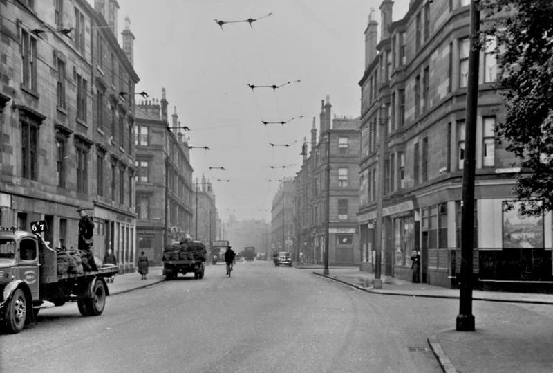
Street scene at Thistle Street, Hutchesontown c.1890
Tower of Saint Bonaventure's R.C. Church, Caledonia Road
St Bonaventure's Church at the eastern end of Caledonia Road was reconstructed from a factory in 1953 by Jack Coia of the celebrated partnership of Gillespie Kidd & Coia.
St. Andrew's Suspension Bridge was designed by engineer Neil Robson and erected in 1855 to connect Hutchesontown with Glasgow Green. It replaced a ferry used by workers to get to their employment. The ironwork was cast by P & W McLellan at their Clutha Works in Kinning Park.
St Andrew's Suspension Bridge
Cobbles forming St Andrew's cross at Suspension Bridge
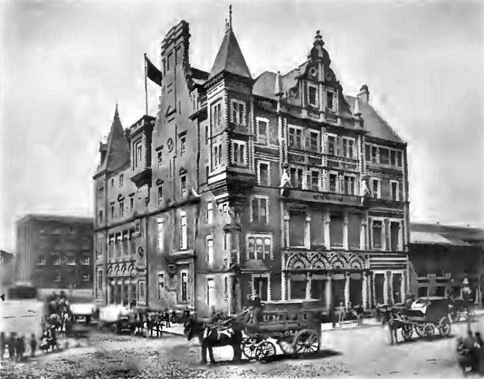
The United Co-operative Baking Society (UCBS) bakery in McNeil Street was a major employer in the area. It opened for business in 1887 with a number of additions and alterations taking place between 1889 and 1914 as the business expanded.
By the time the bakery was demolished in 1973 the Co-op had developed a very large area of contiguous land encompassing McNeil Street, Ballater Street, Adelphi Street and Moffat Street.
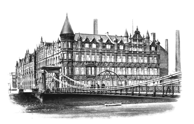
View of UCBS bakery from Ballater Street, looking down McNeil Street towards St Andrew's Suspension Bridge
Photograph of UCBS bakery at corner of Ballater Street and McNeil Street
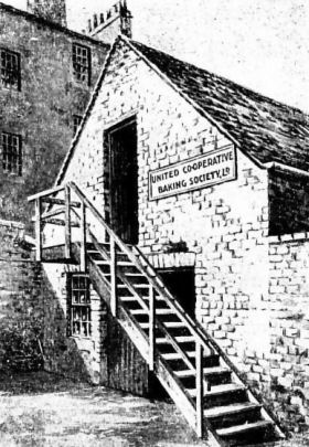
Earliest portion of UCBS bakery at corner of Ballater Street and McNeil Street
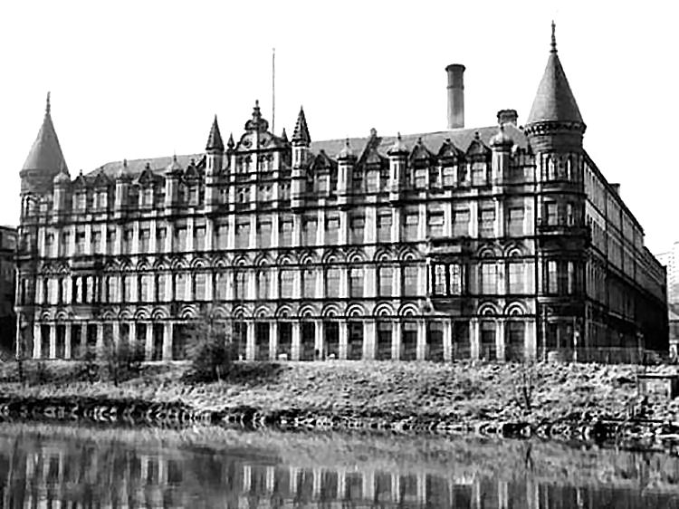
On the riverside, the Adelphi Street façade of the bakery complex can be idenified with its circular turrets at the corners, rather than the square towers of the Ballater Street frontage, shown above.
Photograph of completed symmetrical Adelphi Street façade of UCBS bakery
Eastern end of half-finished Adelphi Street façade of UCBS bakery at St Andrew's Suspension Bridge
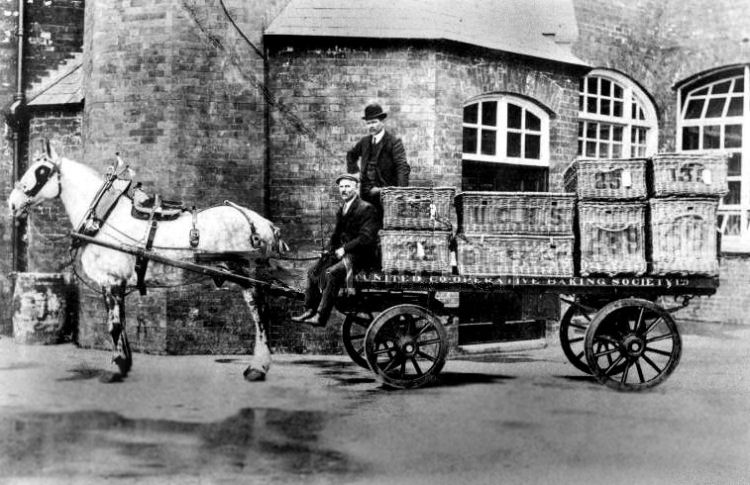
Horse and cart at UCBS bakery, 1917
The earliest UCBS bakery in Gorbals was situated in Coburg Street, Laurieston, which was leased by the Society from the beginning of 1869. The first goods were dispatched from the ramshackle outbuilding, shown left, on the morning of 26th January 1869.
In December 1869 the Society bought premises at Seaward Street, then known as St James Street, Kinning Park, which they fitted out as a bakery which opened for business in the beginning of May 1870.
A site was found at at McNeil Street, Hutchesontown which had some existing buildings on it which were of use to the Society. On 19th September 1885 it was intimated that the "Nursery Mills" in McNeil Street had been bought for Ł4,500 and Messrs Bruce & Hay were instructed to prepare plans of a state-of-the-art modern bakery.
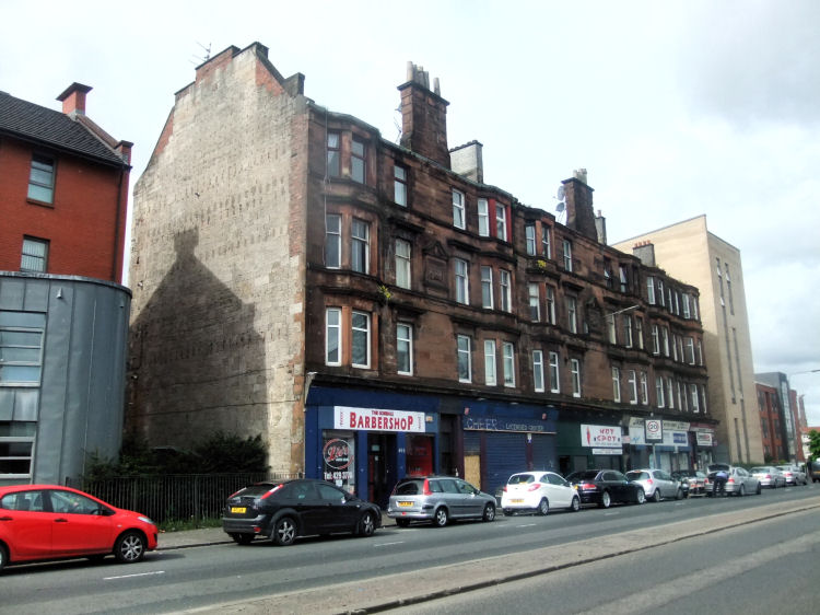
One of the few remaining traditional tenement blocks in Gorbals, facing site of former UCBS bakery, Ballater Street
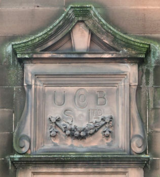
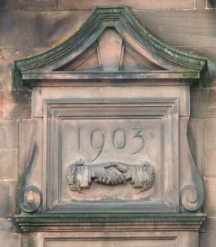
Plaques at Co-op tenement - UCBS 1903
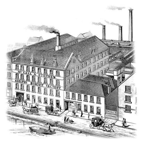
A more specialised bakery was situated in Adelphi Street along the riverside, operated by Messrs. McCall & Stephen as the Adelphi Biscuit Factory.
McCall & Stephen's Adelphi Biscuit Factory, Gorbals
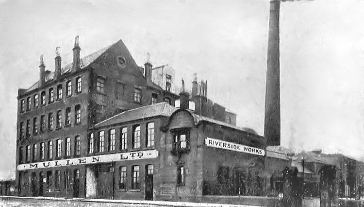
The bakeries of Hutchesontown were supplied with specialised ingredients such as dried egg and powdered cream from Mullen's Riverside Works in Adelphi Street.
Mullen's Riverside Works, Adelphi Street, Gorbals
The St Mungo Halls at the corner of Moffat Street and Ballater Street were the “Co-operative Halls” of the Gorbals, built on vacant land near their huge bakery in McNeil Street. In 1902 the educational committee of the Society instructed local architects Bruce & Hay to prepare plans for five halls containing accommodation for 200 to 1,500 people. The plans also included three blocks of tenements fronting Ballater Street, with shops on the ground floor to be occupied by the Kinning Park Co-op Society. Work began in February 1904 but the halls were not completed until 1906.
In the early hours of 25th November 1981 the disused halls were destroyed by fire in what the Evening Times colloquially described as a “mystery blaze”.
St Mungo Halls, Moffat Street / Ballater Street, Gorbals
St Mungo Halls, Gorbals
1960's view of St Mungo Halls (bottom left) and UCBS Bakery (centre)
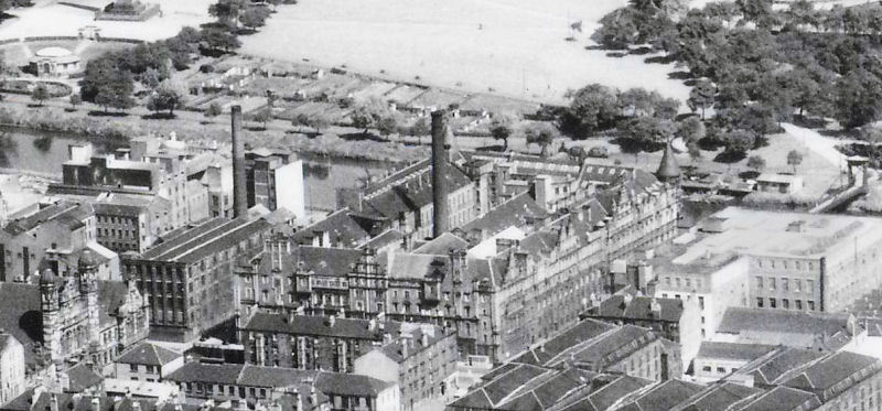
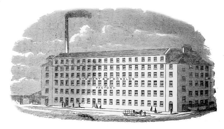
Another major employer in the area were Messrs. Stewart & McDonald who had large wholesale warehouses and retail stores in Glasgow city centre. From 1889 they operated a six-storey factory at Rutherglen Road for the "extensive manufacture of ladies' mantles, children's dresses, men's shirts and slops, hats and caps and ready-made clothing".
Stewart & McDonald's Clothing Factory, Rutherglen Road
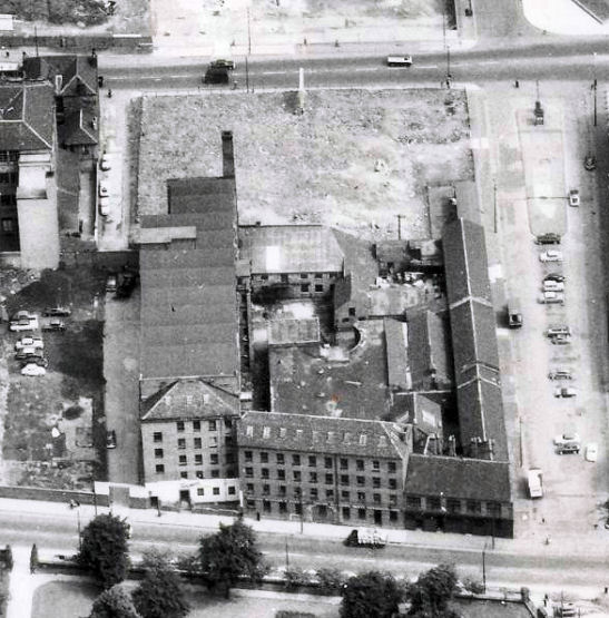
This multi-storey building, erected between 1816 and 1821, is now the oldest surviving iron-framed fireproof industrial building in Glasgow. Until recent years it was occupied as the 'Twomax' garment factory, which can be seen in the 1960's view (below) which shows the multi-bay roof structure of the replacement top level. 1960's view of Twomax Factory, Rutherglen Road, with Ballater Street at top of picture.
This modern view shows the triangular roof of Blessed John Scotus Church in the former vacant site in Ballater Street behind the old factory. Modern view of former Twomax Factory, Rutherglen Road, Hutchesontown
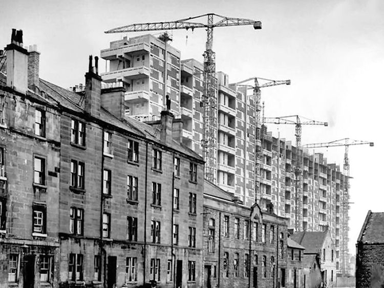
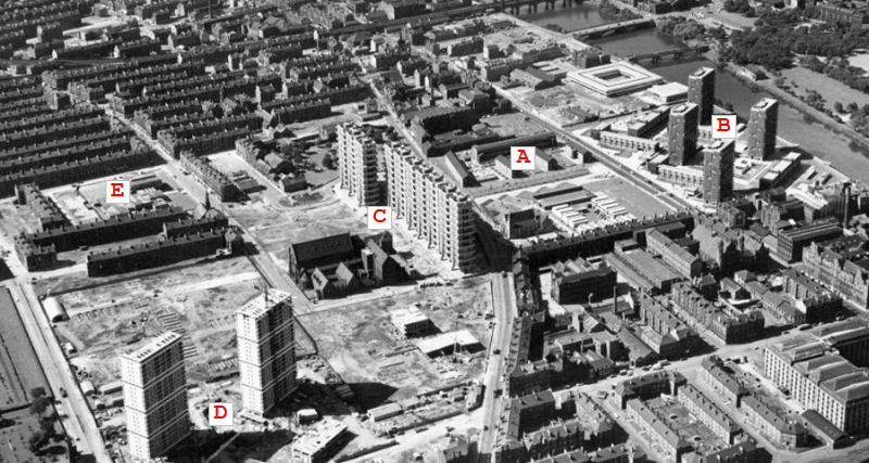
The redevelopment of Hutchesontown in the 1960's & 1970's as part of a Comprehensive Development Area (CDA) was for the most part an abject failure after a very promising start in the late 1950's. The old tenement blocks were pulled down street-by-street and replaced with inferior quality housing that has since been mostly demolished. The area was later rebuilt with the much more attractive development of the "New Gorbals".
Post-war street scene showing old tenement blocks at junction of Crown Street and Rutherglen Road
View of tenements of Rutherglen Road in 1955, prior to redevelopment
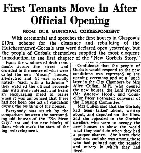
The first phase of Gorbals redevelopment was completed as early as 1958, around the same time as Castlemilk and other peripheral housing schemes were being established to create new homes for the soon to be displaced residents of the old tenements. Modern view of 1950's housing blocks of Hutchesontown 'Area A'
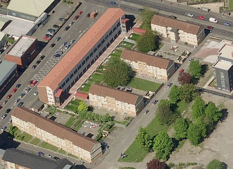
The Hutchesontown 'Area A' blocks were designed by Andrew Gardner of Glasgow Corporation under the supervison of the City Architect, Mr A.G. Jury. The development won a Saltire Society's award for good design in an announcement made on Christmas Day, 1959. Since then the houses have been renovated and well maintained over the intervening years. The surrounding streets have been landscaped to provide an attractive neighbourhood as shown in the aerial view above. Hutchesontown 'Area A' was a relatively small area of redevelopment bounded by Commercial Road shown to the left of the picture and Lawmoor Street to the right. This part of the street is now known as Ballater Place. The main road glimpsed at the top of the photograph is Ballater Street, with Old Rutherglen Road at the bottom.
Newly built housing alongside old tenements in Lawmoor Street, Hutchesontown 'Area A', 1958
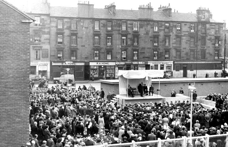
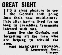
Opening ceremony for Hutchesontown 'Area A', 5th May 1958, with tenements of Lawmoor Street in background
Extract from Glasgow Herald 6th May 1958 describing opening ceremony for Hutchesontown 'Area A'
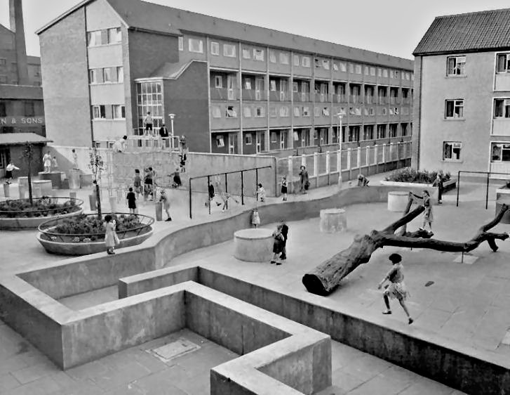
Children's play area at Hutchesontown 'Area A', 1958
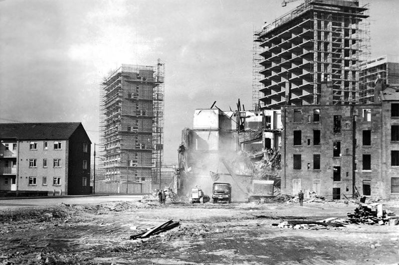
The traditional tenement blocks on the eastern side of Lawmoor Street, facing Hutchesontown 'Area A', were demolished three years after the completion of the new flats. The photograph below shows the cleared site at Lawmoor Street in the foreground while the demolition of housing at Ballater Street was in progress. In the background the early stages of construction of the multi-storey blocks of Hutchesontown 'Area B' can be seen.
Cleared site of demolished tenement blocks in Lawmoor Street, 1961
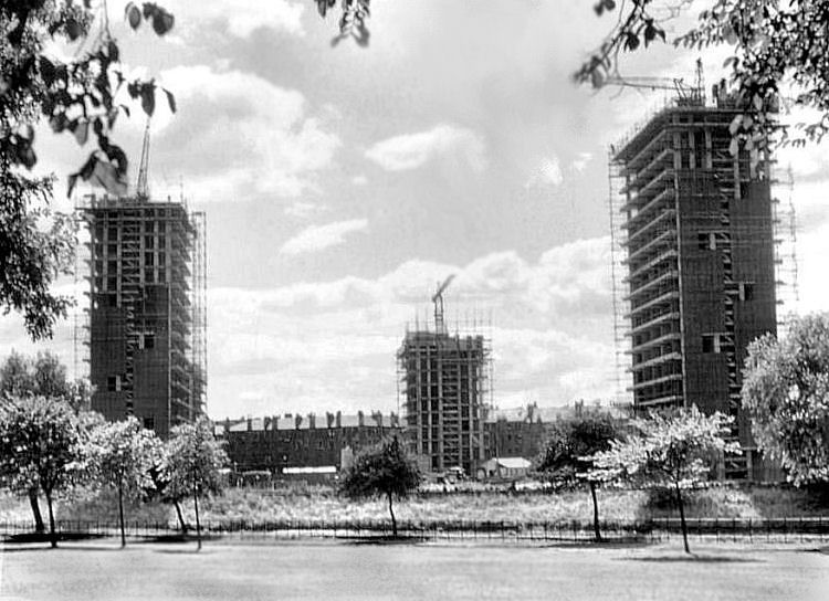
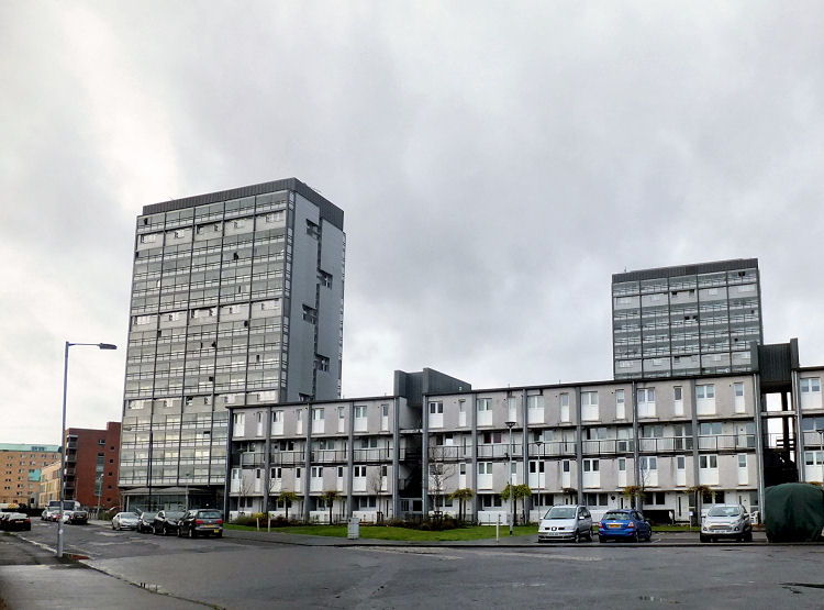
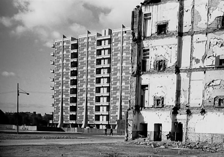
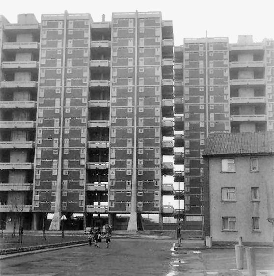
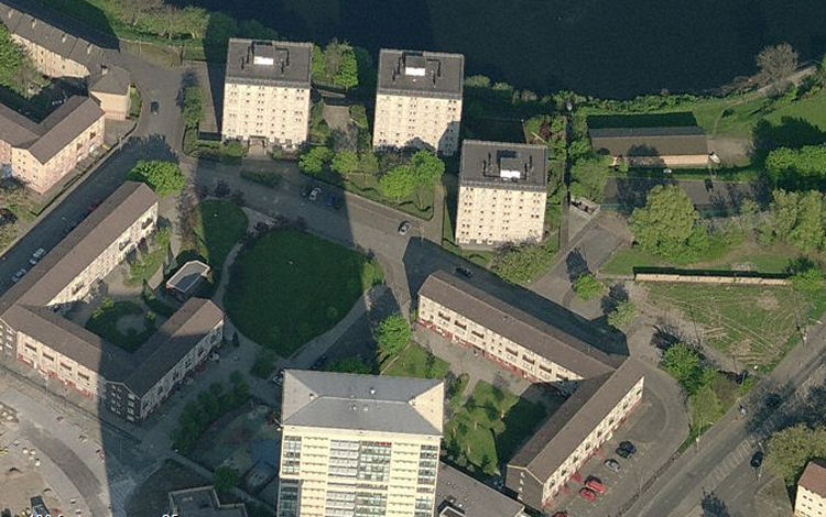
Hutchesontown 'Area B', completed in 1962, was the next phase of redevelopment. This expansion, known as 'The Riverside', introduced tower blocks to the area for the first time and also provided some low-rise split level maisonettes. Unlike the later failed schemes for multi-storey housing in Gorbals, the refurbished tower blocks are still standing.
The architects of this phase were Robert Matthew, Johnson-Matthew & Partners (RMJM). Multi-storey blocks and maisonettes of Hutchesontown 'Area B
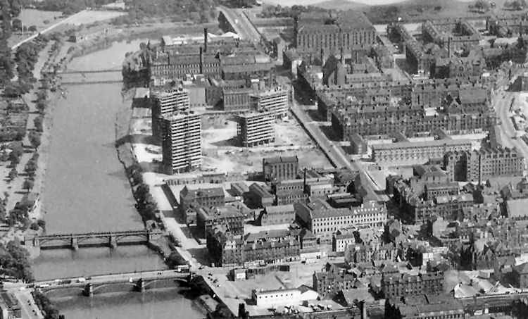
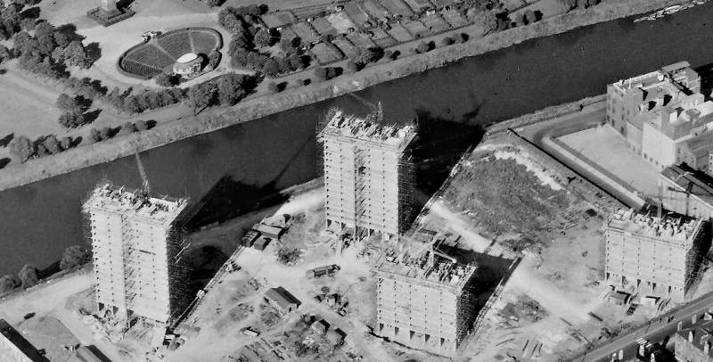
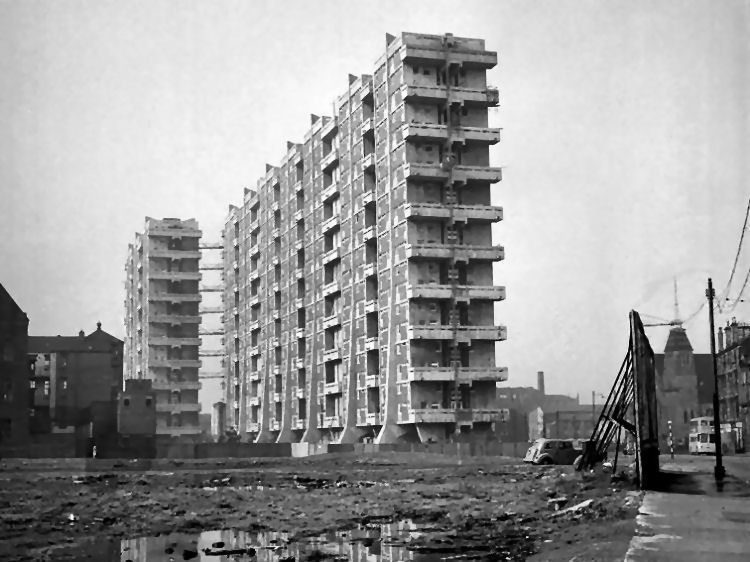
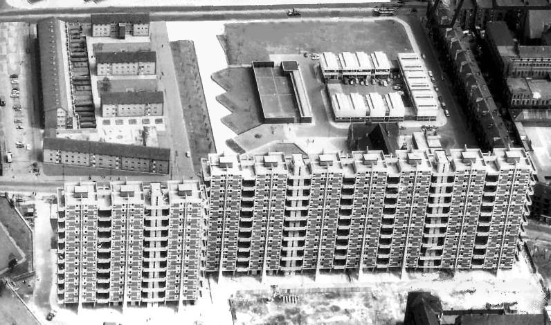
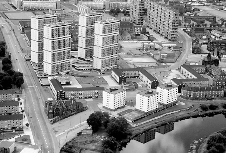
The aerial photograph below shows the stretch of riverside from Albert Bridge at the bottom to St Andrew's Suspension Bridge at the top. The image was captured in 1961, during the construction of the multi-storey blocks of Hutchesontown 'Area B'.
Construction of Hutchesontown 'Area B', 1961
Demolition of traditional tenements during development of Hutchesontown 'Area B', 1961
Views of Glasgow Green during the erection of tower blocks of Hutchesontown 'Area B', 1961
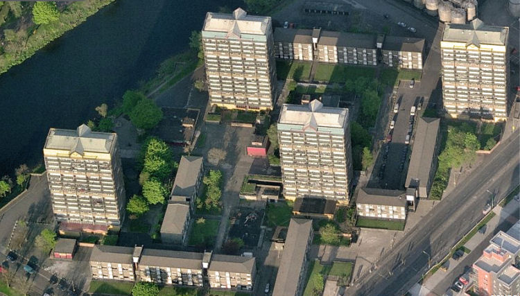
Maisonettes and multis of Hutchesontown 'Area B', November 2015
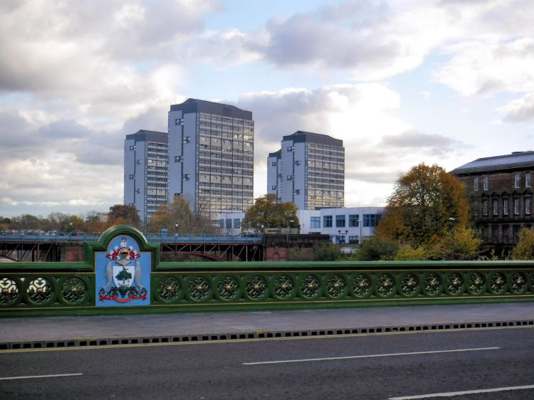
View of tower blocks of Hutchesontown 'Area B' from refurbished Albert Bridge, November 2016
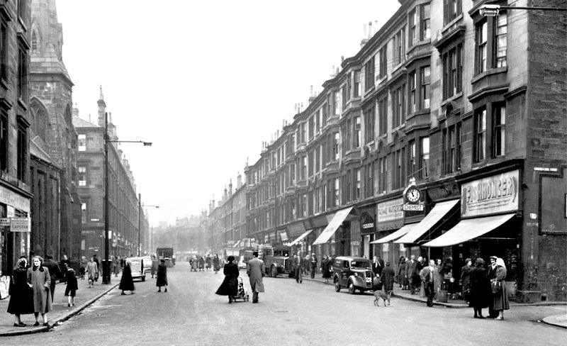
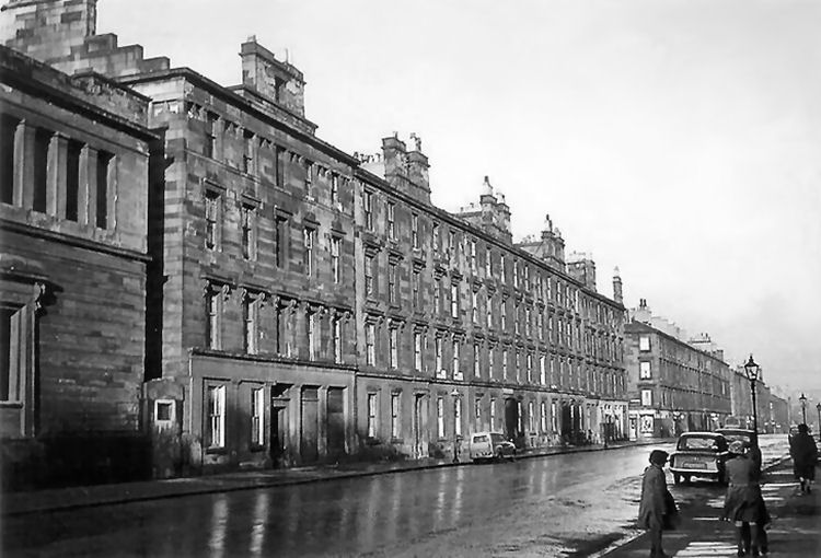
Prior to the redevelopment of Gorbals, Cumberland Street was the main thoroughfare through Hutchesontown - lined with tenement blocks with numerous shops and pubs at street level.
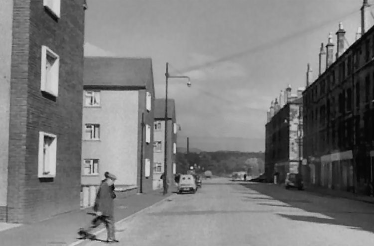
View of Cumberland Street before the development of Hutchesontown 'Area C'
In contrast to the earlier successes, Hutchesontown 'Area C' proved to be a planning and social disaster.
The housing blocks were completed in 1965 with the Cumberland Arcade shopping centre being added in 1969. The shopping centre was surrounded by poorly designed low-rise housing.
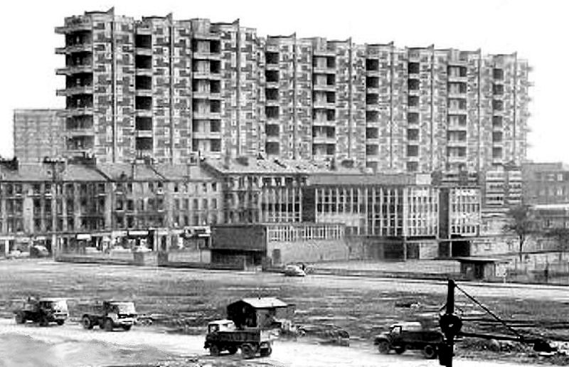
Construction of multi-storey blocks at Queen Elizabeth Square, Hutchesontown 'Area C'
Gable of demolished tenement near to Queen Elizabeth Square, Hutchesontown 'Area C'
Newly completed multi-storey blocks at Queen Elizabeth Square, Hutchesontown 'Area C'
The tower blocks of Queen Elizabeth Square in Hutchesontown 'Area C' were first occupied in 1963, completed in 1965, and swiftly demolished in September 1993. The blocks were designed by the renowned English architect, Sir Basil Spence, who was inspired by Le Corbusier’s housing developments in Marseilles. His ideas did not translate well into the Gorbals, where the wet and windy climate created severe dampness problems in the flats.
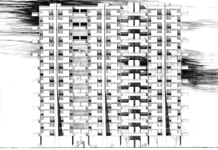
Architect's drawing of multi-storey block at Queen Elizabeth Square, Hutchesontown 'Area C'
Optimistic view of new tower blocks, from the Evening Times, 3rd March 1965
Contrasting architectural styles of Hutchesontown Area 'A' (top left) and Area 'C' (bottom)
Street view of Hutchesontown Area 'A' and Area 'C'
The tower blocks of Queen Elizabeth Square in Hutchesontown 'Area C' were demolished on 12th September 1993.
Demolition of Queen Elizabeth Square, Hutchesontown 'Area C', 1993
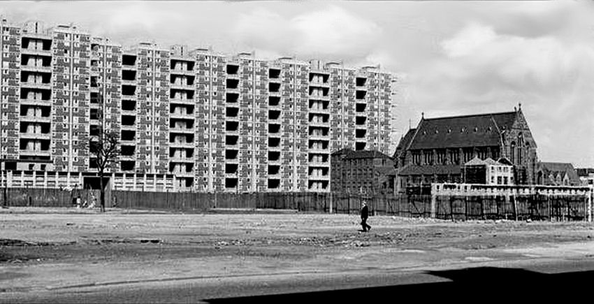
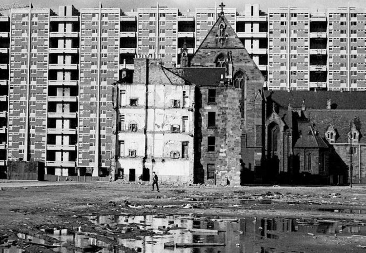
Isolated St Francis Church in Hutchesontown 'Area C'
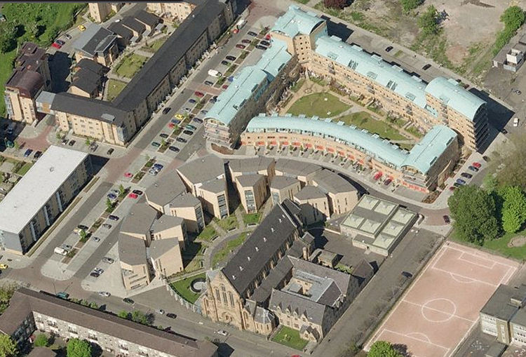
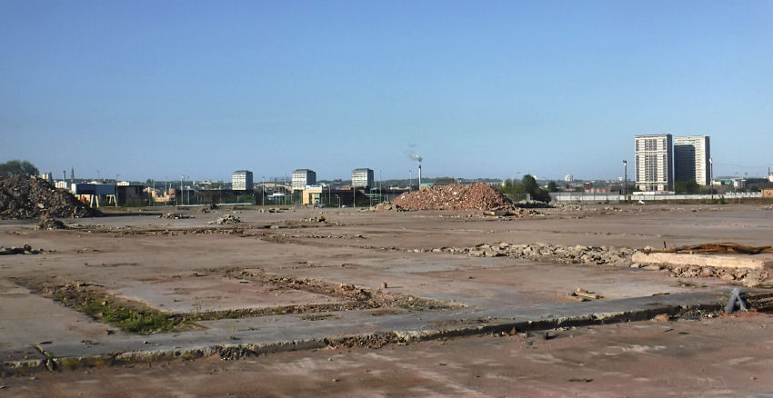
Modern view of site of infamous Hutchesontown 'Area C'
St Francis Church in midst of development of Hutchesontown 'Area C'
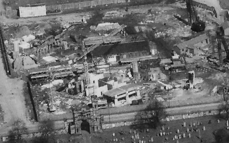
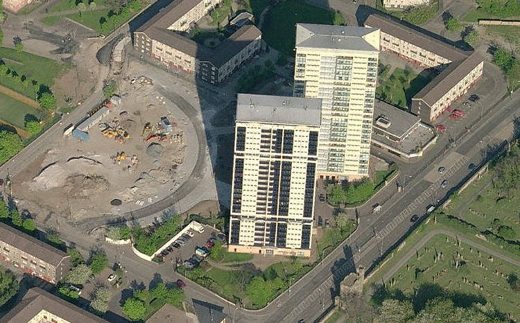
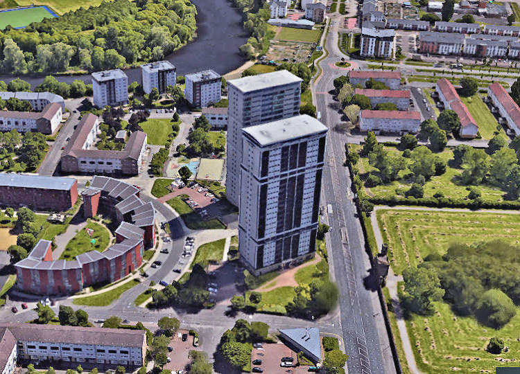
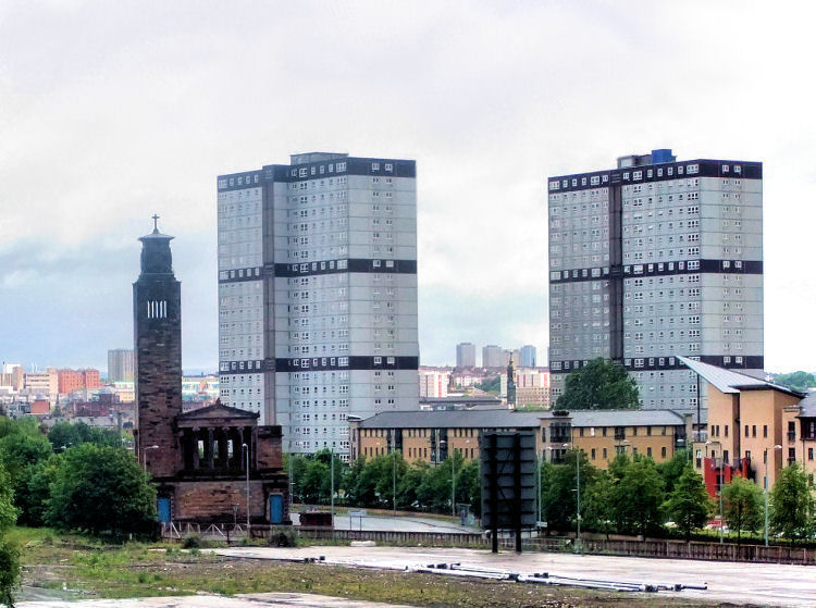
Hutchesontown 'Area D' was developed by the Scottish Special Housing Association. It originated in 1961 with 3 and 4 storey blocks similar to those of 'Area A'. Four 24 storey tower blocks were added by 1968, two of which were demolished in 2006. The area is now noted for the two surviving landmark towers situated in Caledonia Road facing the gatehouse of the Southern Necropolis. There were also three 8 storey blocks at Silverfir Court near the riverbank, which are still standing.
Aerial view of Hutchesontown 'Area D' from the east
Tower blocks of Hutchesontown 'Area D' behind St Bonaventure's Church, 1968
Tower blocks and low-rise housing in Caledonia Road, Hutchesontown 'Area D', 2015
Early stages of construction of tower blocks at Hutchesontown 'Area D'
Cleared site of demolished tower blocks at Hutchesontown 'Area D'
After the demolition of two of the multi-storey blocks in 2006 the site was redeveloped with low-rise housing following the semi-circular line of Oregon Street, as seen at the cleared site behind the remaining blocks, above. New build housing on site of demolished tower blocks at Hutchesontown 'Area D'
View from the west of old and new buildings at Hutchesontown 'Area D'
Three 8 storey blocks on the banks of the Clyde at Silverfir Court, Hutchesontown 'Area D'
Trucks removing debris from demolished tenements in preperation for construction of Hutchesontown 'Area E'
Blocks at Hutchesontown 'Area C' (left) & 'Area E' (right)
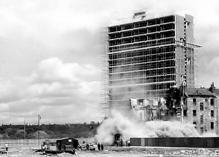
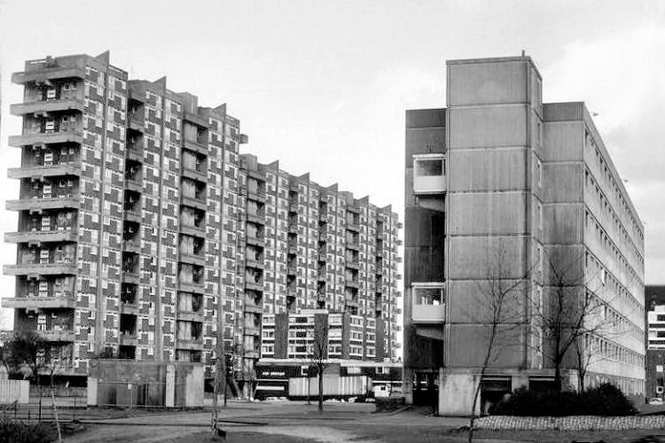
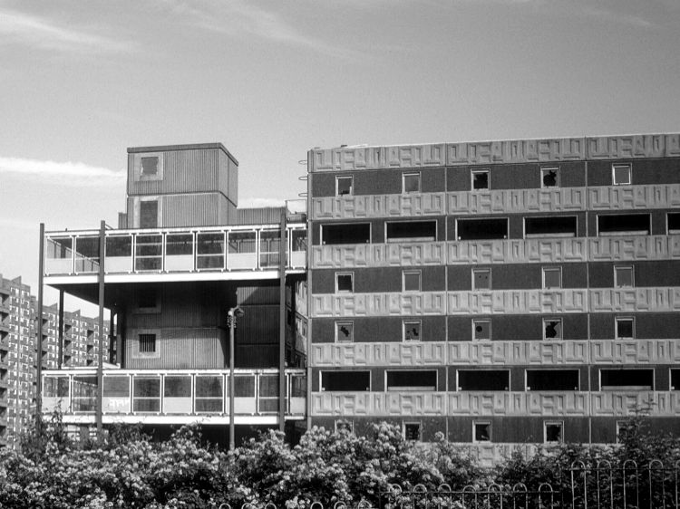
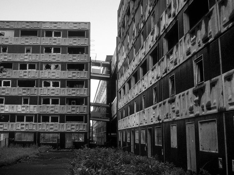
The horrendous Hutchesontown 'Area E' consisted of two 24 storey tower blocks and twelve pre-fabricated deck access blocks assembled by Gilbert Ash (Scotland) Ltd in 1973. The damp ridden deck access blocks were deemed unfit for human habitation after only 8 years and lay empty and abandoned before they were demolished in 1987. The last vestiges of 'Hutchie E' finally disappeared when the tower blocks were flattened in July 2013.
Deck access block at Hutchesontown 'Area E'
Aerial walkways connecting blocks at Hutchesontown 'Area E'
Tower blocks at Hutchesontown 'Area E', May 2011, a couple of years before demolition in July 2013
Old tenements on site of Hutchesontown 'Area E' in 1968, a few years after fire at Caledonia Road Church
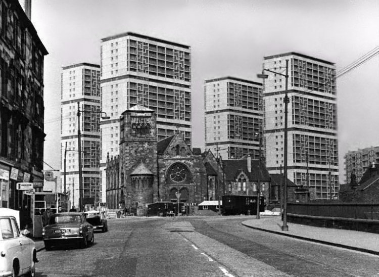
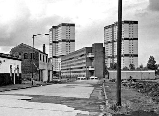
Aerial view of the various Hutchesontown redevelopment areas, c.1968
Early 1960's view of tenement blocks in Hospital Street, abutting rear of Caledonia Road Church
Long view of surviving tower blocks of Hutchesontown from site of demolished Larkfield Bus Depot, 2017
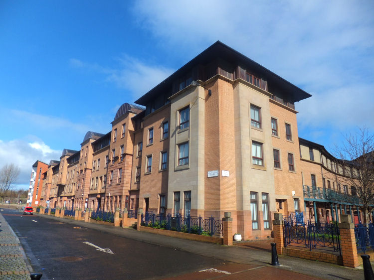
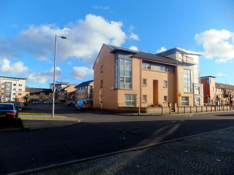
The most modern housing developments of Hutchesontown consist of blocks just three or four storeys high, a reminder of the traditional tenements of the Gorbals.
Housing blocks modelled on traditional Glasgow tenements
Housing in "New Gorbals" at St Andrew's Suspension Bridge
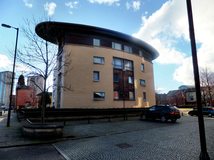
Modernistic apartment block in "New Gorbals"
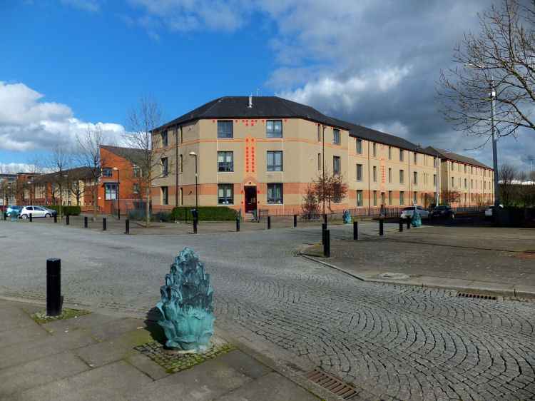
Refurbished 1930's Glasgow Corporation tenement block with pine cone bollards by Liz Peden & Cath Keay, 1998
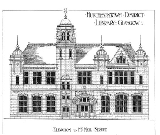
Architect's elevation drawing of proposed Hutchesontown Library published in 1904
Hutchesontown Library in McNeil Street was built with funds provided to the city by Andrew Carnegie in 1901. Hutchesontown Library closed on 31st July, 1964 and was partially
occupied as a day nursery before being occupied as offices by Gorbals Initiative
in 1994. Its current use is as offices.
View of former Hutchesontown Library looking down McNeil Street to suspension bridge
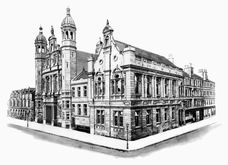
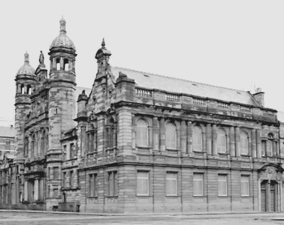
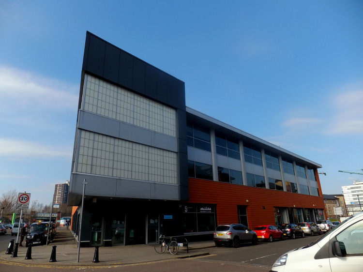
Gorbals Library and Real Learing Centre was built as a belated replacement for Hutchesontown Library, which closed in 1964 and Gorbals Library, Norfolk Street, which closed in 1986.
Gorbals Library and Real Learing Centre, Crown Street
The land to the west of the original settlement was sold by the Hutcheson trustees to Mr James Laurie and developed as the suburb of Laurieston from 1802.
There was no crossing until 1803 when Hutchesons' Hospital erected a temporary wooden footbridge which also collapsed some time afterwards. Luckily it was at low tide and nobody who fell into the river was drowned.
A new stone bridge was erected in 1830, but, after being condemned as being unsafe, it was closed on the 20th June 1868 and replaced with yet another temporary wooden structure.
The foundation stone for the present Hutchesontown or Albert Bridge was laid with great ceremony in June, 1870.


Hutchesons' Girls School, which was situated near Eglinton Toll, is featured in the Laurieston page of this website.
The memorial stone was laid on 3rd December 1898 by Sir John Cuthbertson in a ceremony presided over by Rev. Robert. K. Monteath, the minister of the parish. A casket was placed in the stone with lead tokens and congregational documents. The architect presented Sir John with a silver trowel to be used for the ceremony.
Hutchesontown Parish Church opened for public worship on the evening of Friday 2nd March 1900 with a service conducted by Rev. Mr. Monteath. A Service of dedication followed on Sunday 4th March 1900.
On 12th December 1967, the Presbytery of Glasgow resolved for the dissolution of Hutchesontown Parish Church. The building survived a further decade, however, until it disappeared as part of the Comprehensive Development Scheme for the area.
The friars' presence in Scotland dates back to 1224, during the lifetime of the order's founder, St. Francis of Asissi.
They became established in Glasgow in 1476 at Greyfriars Wynd on the western side of High Street, opposite the University. This is detailed in my Cathedral Precinct page.
The first Superior following the return of the order to Glasgow was Very Rev. Emmanuel Kenners.

The church was formally opened on 1st June 1881 in the presence of Cardinal Manning and Archbishop Charles Eyre of Glasgow. The building was completed only as far as the chancel arch, leaving the area designated for the high altar unfinished until funds were available.
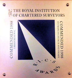
In 1998 the completed project received a commendation in the Urban Renewal category of the annual awards of the Royal Institution of Chartered Surveyors.
The plaque at the entrance foyer of the centre, left, is displayed to celebrate the award.
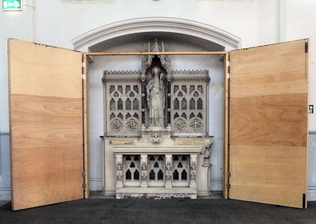
The altar below is dedicated to St Patrick. the patron saint of Ireland, where many of the church's original parishioners hailed from.
The altar which was designed by Messrs. Pugin & Pugin of Westminster was solemnly inaugurated on 1st June 1890.
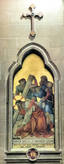
The images at each of the stations were painted on metal panels with a gold foiled background. These panels were seven feet long and the paintings still have their original luminescence originating from the reflective qualities of the background.
The example below shows the seventh station, 'Jesus falls a second time', still richly coloured after all this time.

The church building survived until the comprehensive redevelopment of the Gorbals in the 1970's.
Under threat of legal action, the Wynd congregation, which had resisted the union, were forced to vacate their red sandstone building under protest. Their minister, Rev. Peter Chapman accepted an offer to move to the former St Ninian's Parish Church, shown above.
The red sandstone church and associated Medical Mission were designed in a Romanesque style by William Gardner Rowan of the architectural practice, McKissack & Rowan.
The church building was formally opened on Wednesday 11th December 1889 with a service conducted by Rev A.A. Bonar. Its pastor, Rev. John Riddell, occupied his new pulpit for the first time on Sunday 15th December 1889. Mr Riddell had previously been minister of the Wynd congregation from 1868 until 1873 and resumed his charge in 1887 when the new church was being planned.
The church was gutted by fire in December 1977 and had to be immediately demolished.
This church had replaced the previous building which was sold to the Glasgow and South Western Railway for Ł4000 at the time when they were extending the railway track on the approaches to St Enoch Station.
Mr Simpson described how the congregation had originated as a Home Mission who moved into a building previously occupied by Chalmers Free Church in 1872, when it was about to be sold as a rag store. Mr Cunninghame, after whom the church was named, donated Ł1000 to enable the congregation to complete the purchase. The first minister of the earlier church was Rev. Alexander Andrew.
A history of the various premises occupied by the congregation of Chalmers Free Church including their
final home in Pollokshaws Road can be found in the Laurieston,
Gorbals page of this website.
The building originated in 1878 as Buchanan Memorial Church, designed by John Honeyman. It closed as a place of worship in 1930 and was converted into factory premises. The original spire was deemed unsafe during Coia's 1953 remodelling and was replaced by a copper cap.
The church was demolished in 1993.


It soon became clear that they would have to move more suitable accommodation and on 6th November 1869
a sub-committee was appointed to look out for a site.
By 1884 the relocated bakery had reached the limit of its capacity.
By then the production of biscuits and pastries had been transferred to premises in Scotland Street, but the St James Street bakery could still not keep up with the increasing demand for bread.
A firm of local architects, Messrs Bruce & Hay, were asked to prepare a sketch plan for a new bakery on the St James Street site. Their submitted plans showed that the space available was not large enough to provide all the accommodation desired by the client.
A grand opening day was arranged for 21st May 1887, with Mr Alexander Fraser, president of the Society, declaring the premises open.
The bakery and factory were situated at the rear of the premises behind the office block. The most modern and best machinery was used to produce a range of about 150 different kinds of "biscuits, crackers, cracknels, rusks, fingers, nuts, and snaps". The bakery also produced cakes, buns and shortbread using six huge ovens, reputed to be the largest in Scotland.
A history of this building and its place in Glasgow's manufacturing legacy is included in my
Glasgow Commercial Buildings page.
The factory was converted for use as offices in 1998 and, as at 2014, it is occupied by Glasgow City Council Social Work Department and the Glasgow Housing Association.

Hutchesontown 'Area A', consisted of similar house types to those to be initially built in the new schemes; 3 or 4 storey blocks providing houses with kitchenettes and interior bathrooms with hot and cold running water. As redevelopment progressed it became apparent that Gorbals would not have nearly as much land available as the outlying green field sites and the best alternative was seen as building upwards with multi-storey tower blocks.

Hutchesontown 'Area B' was situated immediately north of 'Area A ' between Ballater Street and the Clyde, centred on four 17-storey tower blocks which were laid out at angle to the previous rigid Gorbals street plan.

The flats in this attractive development were first made available for occupation in April 2009.
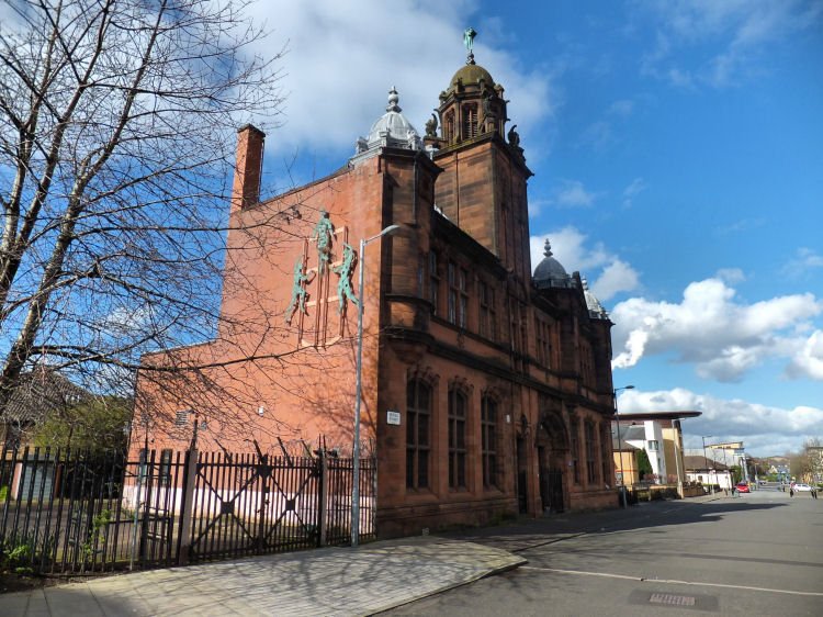
It was officially opened on 17th November 1906 by Baillie John Battersby.
Hutchesontown was the the final and the most decorative of James. R. Rhind's
Glasgow libraries, built in the French Renaissance style, completely different
from any of his earlier Baroque buildings.
An illustrated guide to Scotland's Edwardian Renaissance Carnegie Libraries is featured in a dedicated page of this website.
The new library opened in 2004, designed by CRGP architects to be a learning centre providing local people with free access to the internet and the opportunity to develop their IT skills.
|
|
| |
|
|
|
|
|
|
|
|
|
All original artwork, photography and text © Gerald Blaikie
Unauthorised reproduction of any image on this website is not permitted.
