
Laurieston is situated in the western portion of the old "Lands of Gorbals" which were sub-divided in 1790.
The Gorbals village became the property of Glasgow Town Council and the immediately surrounding areas became the property of Hutcheson's Hospital.
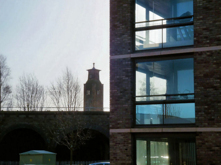
Tower and spire of Gorbals Parish Church, Carlton Place
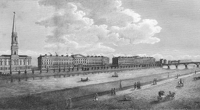
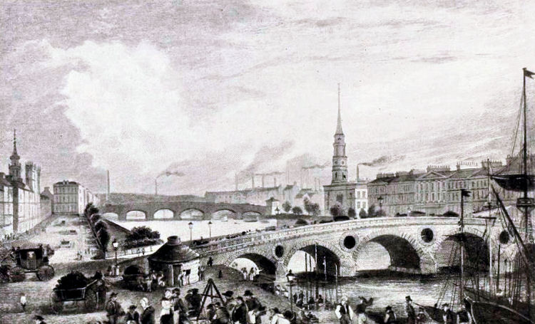
Engraving showing Carlton Place, looking towards the Jamaica Bridge
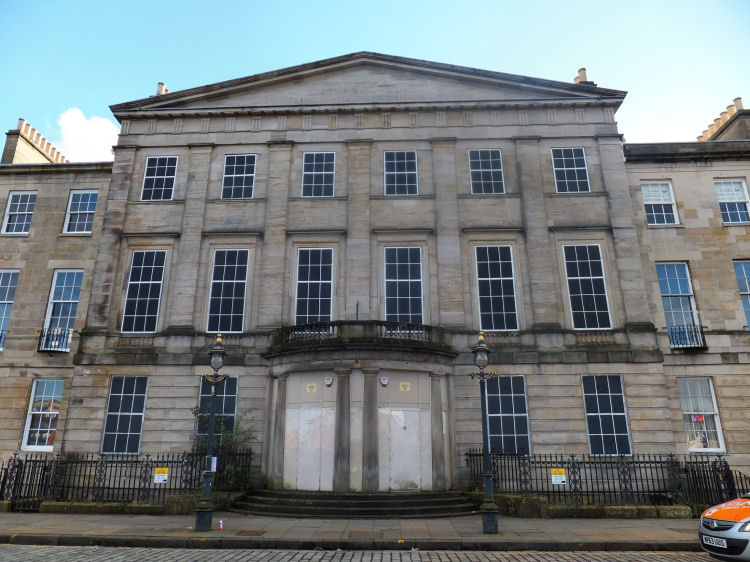
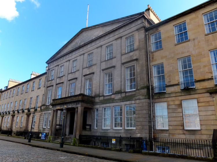
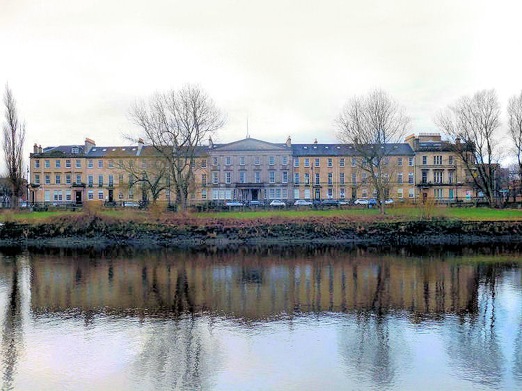
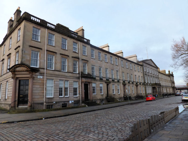
Carlton Place, which was named after the London mansion of the Prince Regent, was developed by brothers James and David Laurie, after whom Laurieston was named.The architect of the grand Georgian terraces was Peter Nicholson.
The foundation stone of the first building on the eastern portion of Carlton Place was laid on 4th June 1802, and the block was completed in 1804. The western part, nearer the Jamaica Bridge, was completed in 1818. The brothers attempted to make the street private by putting up padlocked gates to close up the public right of way between the bridges, but their attempt failed. A row of trees adorned the riverbanks. The brothers lived in the centre houses with the porticos. The eastern one, nearest the church, was later occupied by the Govan Parochial Board.
Hanging out washing and fishing with rod and line on the Clyde at Carlton Place
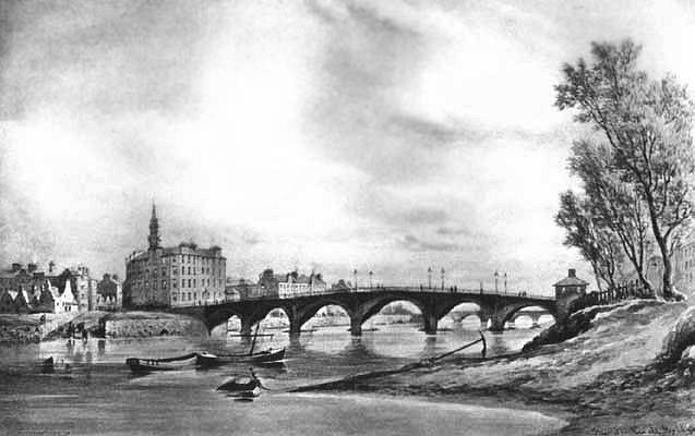
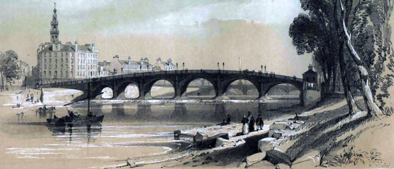
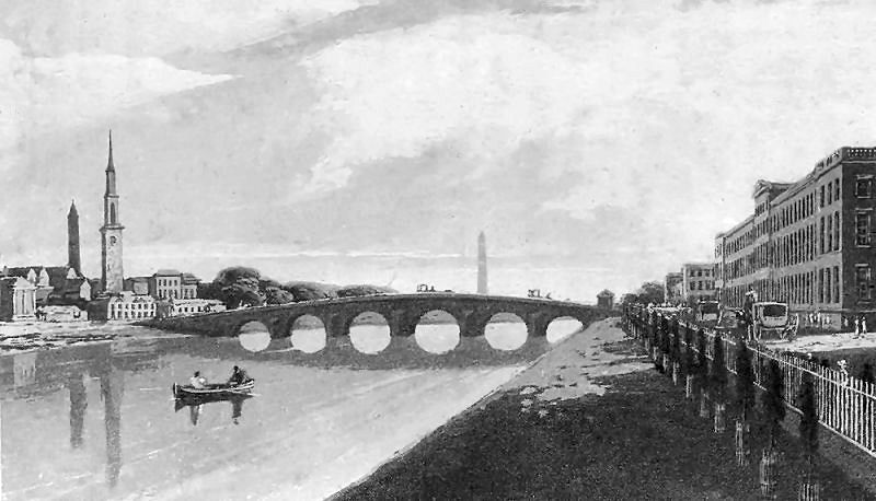
Views of the early Stockwell Bridge from the riverbank at Laurieston
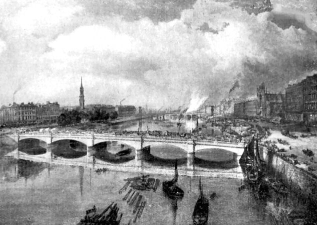
View of the 1854 Stockwell Bridge looking towards Suspension Bridge, with Laurieston on the left
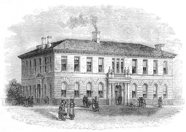
Engraving of Gorbals Parish Church, Carlton Place
The village of Gorbals was in the parish of Govan, and had no post-Reformation place of public worship until the opening of a �Chapel of Ease� in Buchan Street on 16th January, 1730. On 21st February, 1771 Gorbals became a separate parish. The nearby lands of Little Govan and Polmadie were shortly afterwards annexed to the parish of Gorbals. Inscription on foundation stone of Gorbals Parish Church
During the tenure of the Rev. Robert Houston, from 1844 to 1854, a legal dispute led to the congregation being ejected by the feudal superior on 29th January 1852. The building was put up for public sale and became the home of East Gorbals Free Church. It was opened for the new denomination in January 1853.
A decade later, the Church of Scotland claimed the right to buy back the church and in 1864 it was
re-opened as the Parish Church of Gorbals with the Rev. Andrew Leiper being minister.
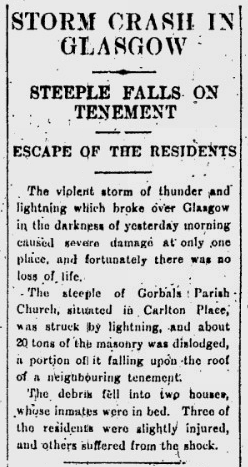
The spire of Gorbals Parish Church was struck by lightning during a thunderstorm on 9th December 1929, but the steeple was not restored to its original height when the church re-opened on 28th December 1930.
Extract from Glasgow Herald of steeple crash of 9th December 1929
Tower of Gorbals Parish Church before and after the 1929 storm
The church was demolished in 1973 and the site is now part of the new Sheriff Court of Glasgow and Strathkelvin.
Carriages at Carlton Place before the erection of Gorbals Parish Church
Eastern portico at Carlton Place
Western portico at Carlton Place
View of western terrace at Carlton Place from north side of River Clyde
Stair towers to rear of Carlton Place
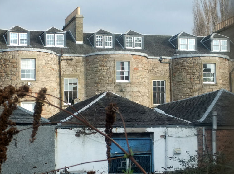
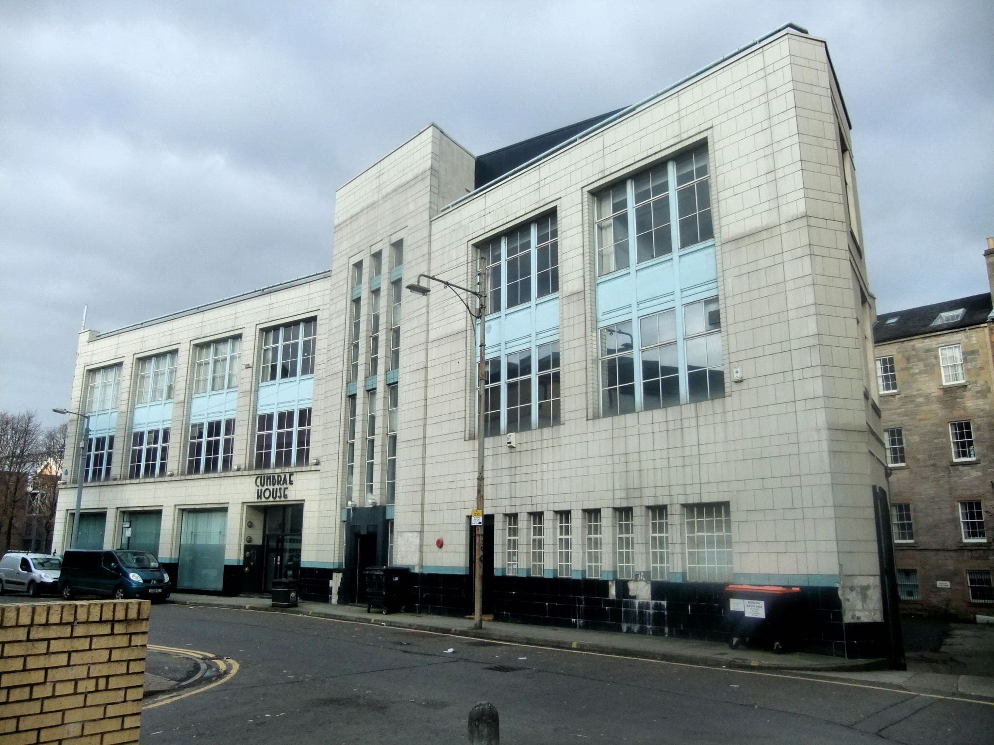
The Art Deco styled Cumbrae House, in Carlton Court at the corner with Bridge Street, was built in 1938 in a style that would have been the height of modernity at the time. The architect was Aberdeen-born Launcelot Hugh Ross, who was a friend and colleague of Thomas Smith Tait, with whom he collaborated in preparing architectural designs for the Glasgow Empire Exhibition of 1938.
Art Deco block at Carlton Court, Laurieston
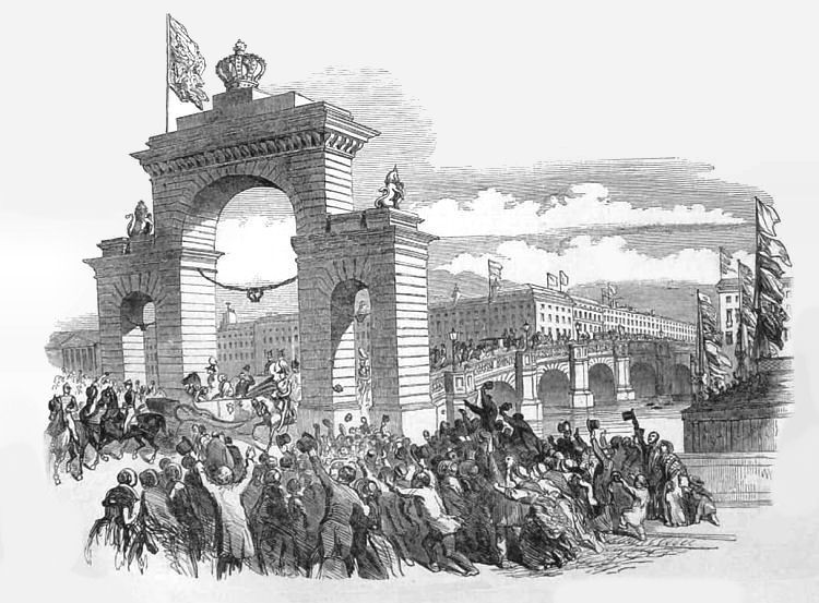
Queen Victoria crossing Thomas Telford's Jamaica Bridge with Carlton Place in the background
On 13th August 1849, Queen Victoria became the first Sovereign to visit Glasgow since James VI in 1617. The Queen and Prince Albert arrived at a landing stage at the foot of West Street in their yacht "Fairy". A triumphal arch was erected on the north end of the second Jamaica Bridge, shown above. The next morning, the Royal procession passed through the city centre to the Cathedral and then to the University in High Street, from where they drove to Queen Street Station for the train towards Balmoral.
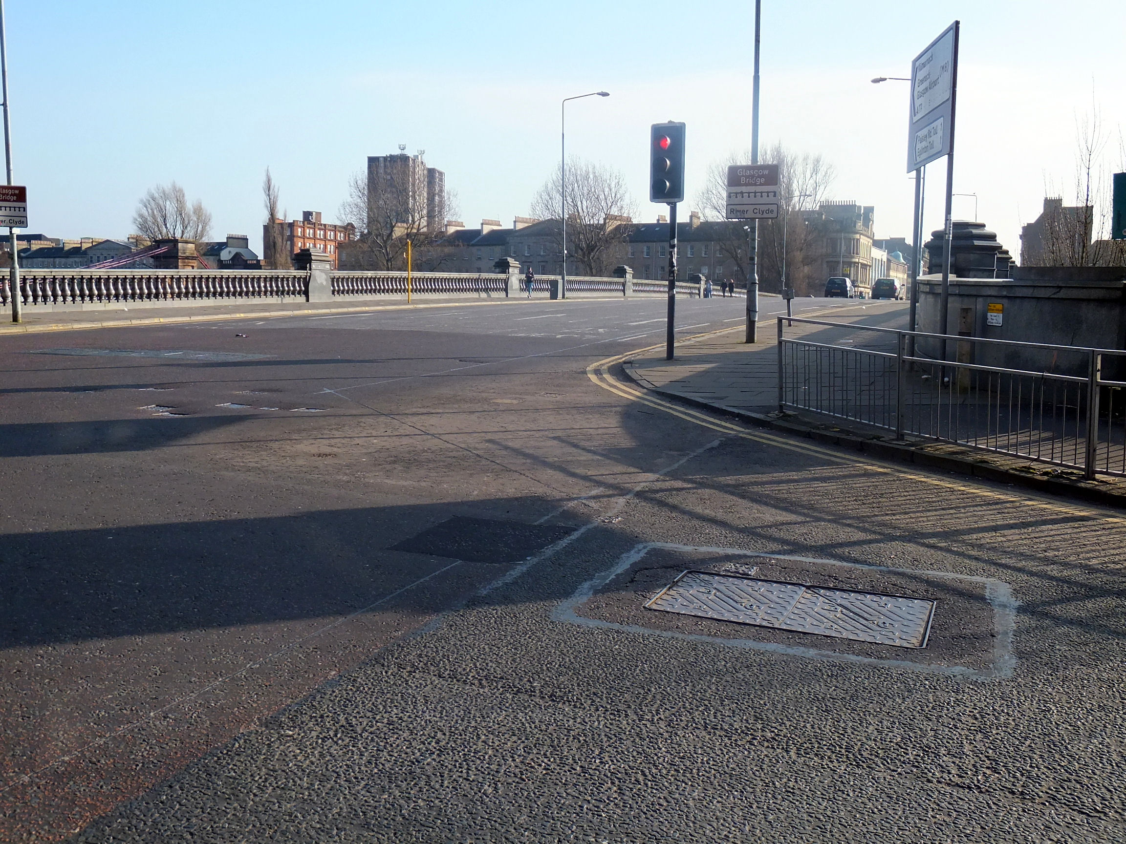
View of present day Jamaica Bridge from same vantage point as 1849 engraving
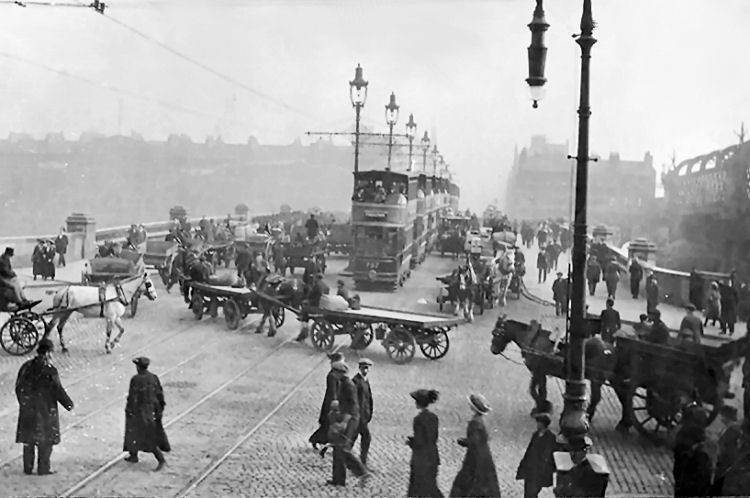
Busy traffic in early 20th century view from north side of Jamaica Bridge
The first Jamaica Bridge, designed by William Mylne, opened on 2nd January, 1772.
The second Jamaica Bridge, designed by engineer Thomas Telford with seven arches, opened in 1836.
View of Telford's Jamaica Bridge leading to City Centre from the South
First Jamaica Bridge and Carlton Place viewed from Broomielaw
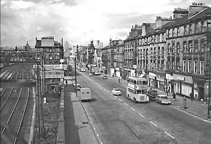
View of the 'grid-iron' street pattern of Laurieston in the 1960's
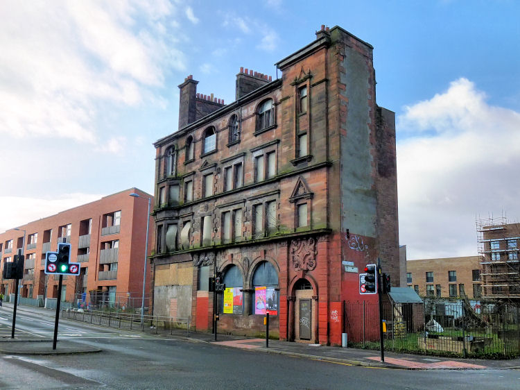
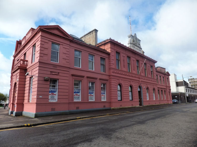
The former British Linen Bank building is the last surviving traditional block in Gorbals Street. As at 2016 the derelict building was awaiting a complete makeover to provide six flats to be let by the Southside Housing Association. The scheme also proposes to provide community facilities at ground level. British Linen Bank building, Gorbals Street, February 2016
British Linen Bank building, Gorbals Street, January 2020
Bank building at corner of Carlton Place and Bridge Street, John Burnet Senior, 1857
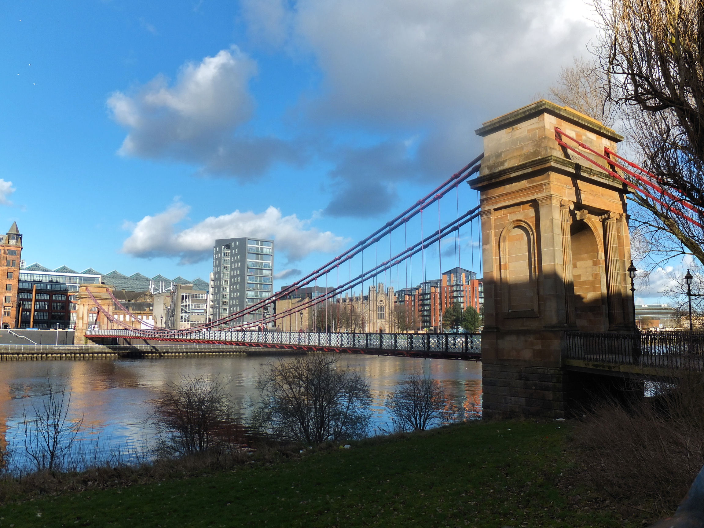
During the construction of the second Jamaica Bridge in 1833, a temporary wooden bridge was built at the foot
of South Portland Street. It became unstable after thirteen years and was taken down. The present Suspension Bridge was erected on the same site in 1853 at a cost of �6,000. The engineer reponsible for the ironwork was George Martin and the arched sandstone supports were designed by Alexander Kirkland. The latticed ironwork was added to the side rails in 1871 to give additional strength to the structure.
Suspension Bridge leading from Carlton Place at South Portland Street
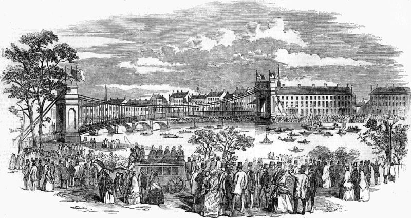
Opening of Suspension Bridge from Carlton Place at South Portland Street, 1853
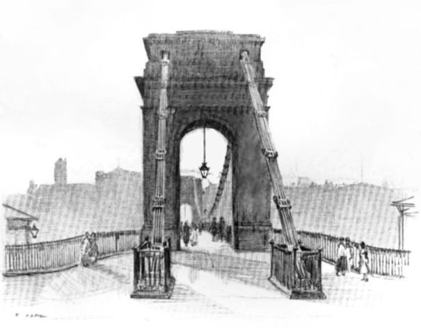
Pencil sketch of Suspension Bridge, looking south towards Laurieston, 1926
View of Carlton Place from corner of South Portland Street
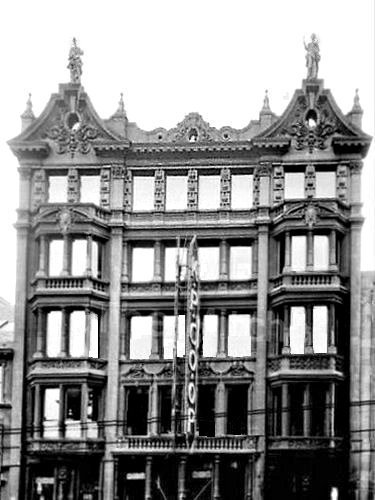
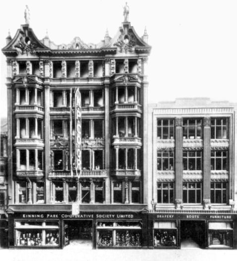
Laurieson's tallest building was the Kinning Park Co-operative Society block in Bridge Street which stretched to six storeys. The glass façade of this block is reminiscent of the Hatrack Building in St Vincent Street, which was erected in the same year, 1902. The Gorbals building was designed by the Co-op's favoured architects, Messrs Bruce and Hay.
Bridge Street blocks, 1902 and 1935
A history of Glasgow's Commercial architecture and the city's pioneering use of modern methods and materials is contained in a dedicated page of this website.
Baroque style tenement block at corner of Bridge Street & Norfolk Street, James Miller, 1898
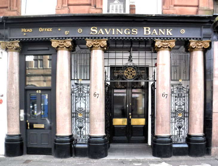
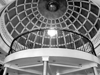
The block at 63-67 Bridge Street features an unusual colour combination in the stonework with the original upper floors faced with cream sandstone contrasted against the red sandstone lower storeys inserted in 1888 to create premises for the southern branch of the Glasgow Savings Bank. The new bank featured an attractive frontage with polished granite columns surrounded by decorative ironwork. The banking hall added to the rear of the tenement features a large dome, typical of banks at the time.
Southern branch of Glasgow Savings Bank when occupied as the 'Cincinnati Club', March 2014
Restored frontage of southern branch of Glasgow Savings Bank, September 2016
Interior views of former southern branch of Glasgow Savings Bank, Bridge Street
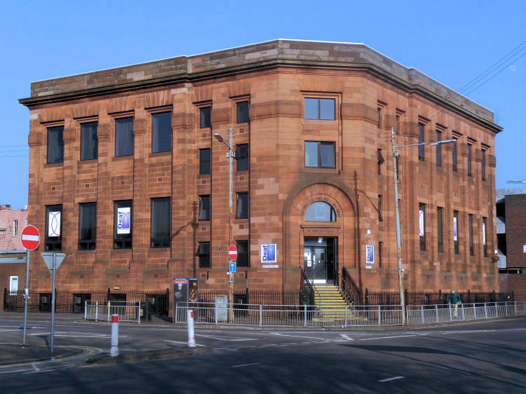
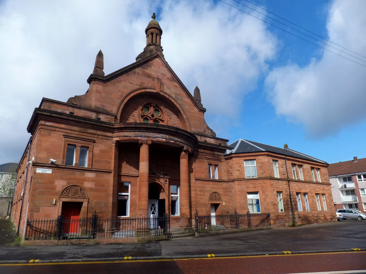
Gorbals Public Library at the corner of South Portland Street and Norfolk Street was designed by City Engineer, Thomas Somers, in 1930 and built with an attractive red sandstone. The library closed in 1986 and the building was converted into a recreation centre for the deaf a few years later.
Former Gorbals Public Library, now "Deaf Connections"
The former Police Office and Barracks at Oxford Street, Laurieston, were designed by City Engineer, Alexander. B. MacDonald and built between 1892 and 1895. The complex was latterly used as a Strathclyde Police Training Centre.
Former Police Office at Oxford Street, Laurieston
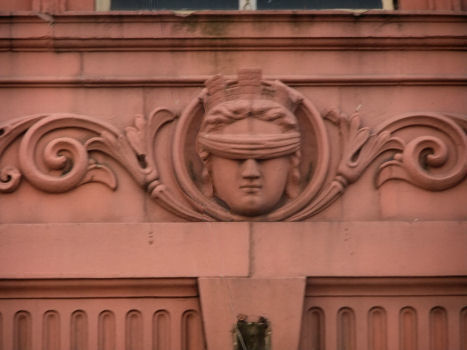
"Blind Justice" over the entrance of former Police Station
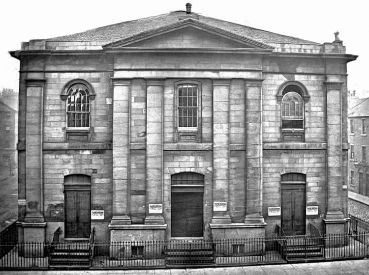
The original building for the Bedford Cinema in Eglinton Street was built in 1825 as the Eglinton Street United Secession Church, later known as Eglinton Street United Presbyterian Church.
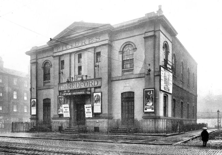
The building was destroyed by fire on the evening of 10th March 1932, and quickly replaced.
Eglinton Street United Presbyterian Church
Bedford Cinema (with original church railings) screening the 1922 version of 'The Prisoner of Zenda'
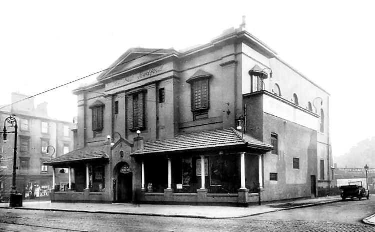
A few years later, after a bit of a makeover and the addition of an entrance pavilion, the picture house adopted the title of the 'New' Bedford Cinema.
Photo and sketch of New Bedford Cinema, Eglinton Street, c.1924
The most recent building for the New Bedford Cinema dates from 1932 when Art Deco was in style. O2 Academy Glasgow
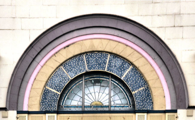
Art Deco style window at O2 Academy Glasgow
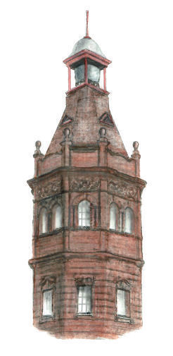
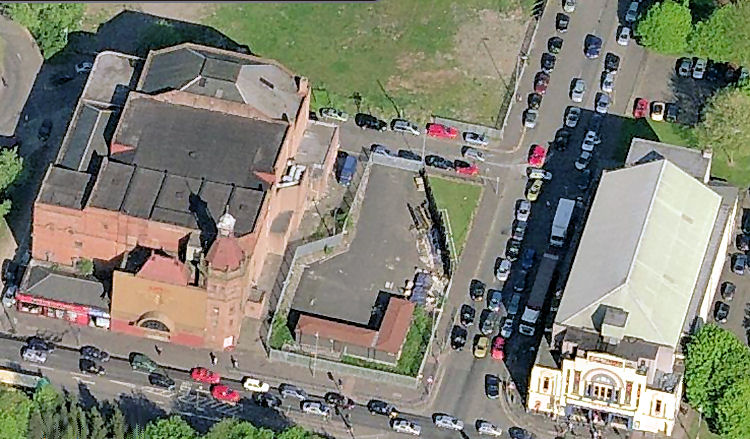
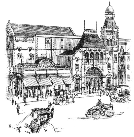
The Coliseum Cinema was situated on the other side of Bedford Street from the O2 Academy. It had a prominent red sandstone tower at its south-western corner. Tower of Colisuem Cinema, Eglinton Street
Colisuem Cinema & O2 Academy from above
The Coliseum's main claim to fame was that it was the first cinema in Glasgow to show the "talkies" in January 1929. It had opened as a theatre in 1905, designed by the English theatrical architect and designer, Frank Matcham. It ceased operating as a cinema in 1980 and was a bingo hall from the late 80's until 2003, when it was abandoned to dereliction.
Early sketch of Colisuem Cinema, Eglinton Street
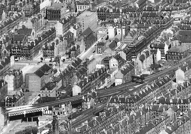
The photograph below shows the area cleared in the early 1970's as part of the Laurieston-Gorbals Comprehensive Development Area (CDA). It is currently undergoing a second regeneration with the clearance of the multi-storey housing blocks which replaced the old tenements.
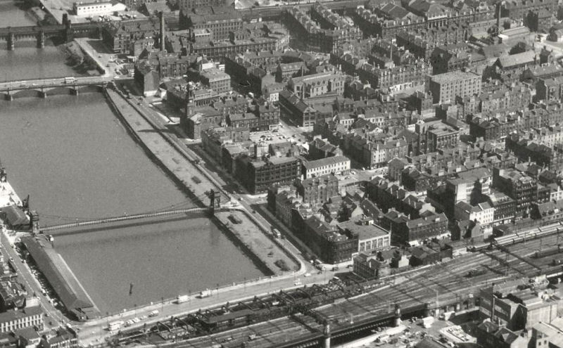
Aerial view of Laurieston in the 1960's
Between Norfolk Street and Cumberland Street the densely grouped layout shown the above photograph was replaced in the 1970's with the new-build housing of the Laurieston-Gorbals CDA. This resulted in much more open space surrounding the new multi-storey blocks of Norfolk Court and Stirlingfauld Place. There was also some low rise blocks at Eglinton Court shown in the top left portion of the aerial view shown below. These white harled flats were designed and built by Crudens Ltd and the development was continued along Eglinton Street on the other side of the railway viaduct at Cumberland Street.
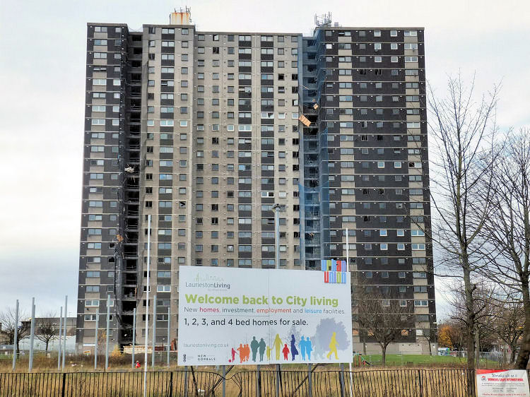
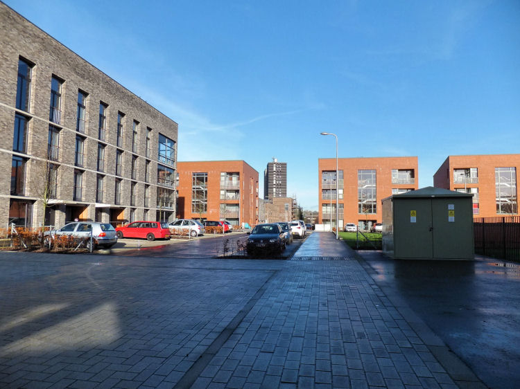
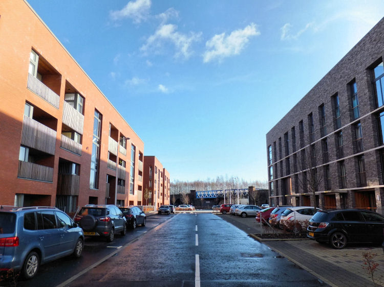
The current phase of housing redevelopment is taking place in the 'Laurieston Transformational Regeneration Area', one of eight designated for the city. It is effective over much of the area covered by the Laurieston-Gorbals CDA of the 1970's. Multi-storey block at Norfolk Court, Laurieston, November 2015
Site of demolished multi-storey block at Norfolk Court, Laurieston, May 2016
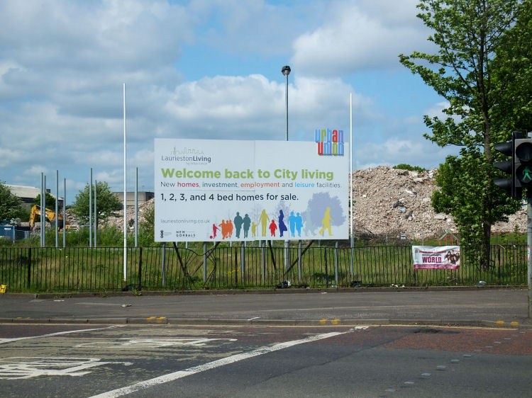
The 'Laurieston Living' project, advertised in the above photographs, aims to provide new housing built around a 'city park'.
When completed it will contain a mixture of townhouses and flats modelled on the traditional Glasgow tenements.
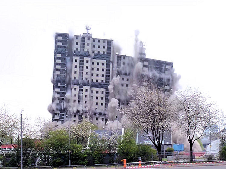
Demolition of last tower block at Norfolk Court Laurieston, 8th May 2016
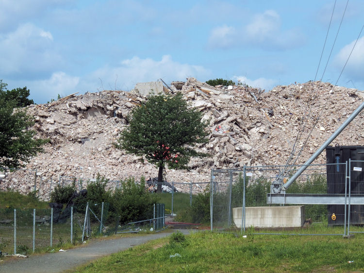
Debris of demolished tower block at Norfolk Court, May 2016
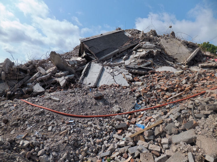
Close up view of the rubble left after demolition of tower block at Norfolk Court, May 2016
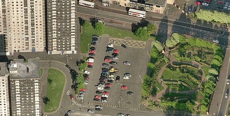
When the tower blocks were still standing and fully occupied the 'Citizens Rose Garden' provided some pleasant amenity space between Norfolk Court and Stirlingfauld Place in Laurieston.
Aerial view of the Citizens Rose Garden, Norfolk Court, Laurieston
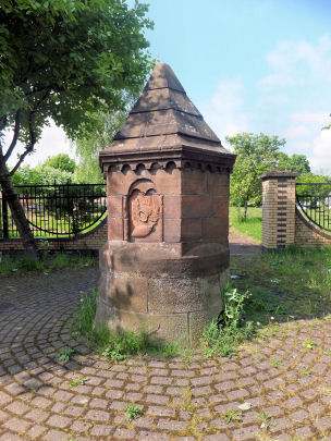
Entrance to Citizens Rose Garden, Gorbals Street, May 2016
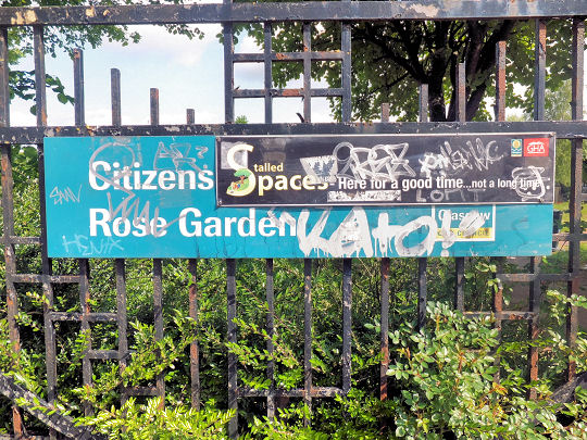
Sign at abandoned Citizens Rose Garden: 'Here for a good time...not a long time'
Abandoned Citizens Rose Garden, with glimpse of ruins of Norfolk Court, May 2016
Site of demolished tower block at Stirlingfauld Place looking towards Cumberland Street, August 2009
Glimpse of Caledonia Road Church from new housing replacing demolished tower blocks of Stirlingfauld Place
View of last surviving tower block from site of first stage of Laurieston redevelopment
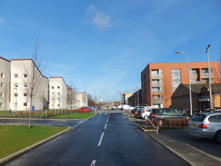
View of Abbotsford Place showing 1970's flats of Eglinton Court to the left and new flats behind Community Centre to the right
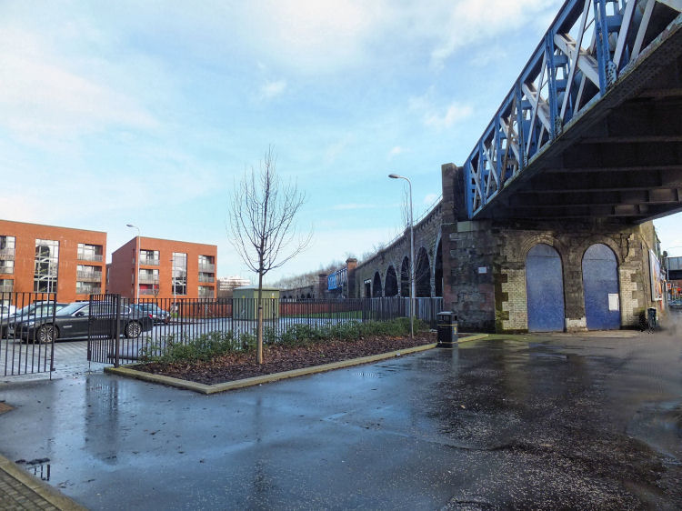
Glimpse of new development at Laurieston from under railway bridge at Cumberland Street
View of new Laurieson housing blocks looking towards Cumberland Street
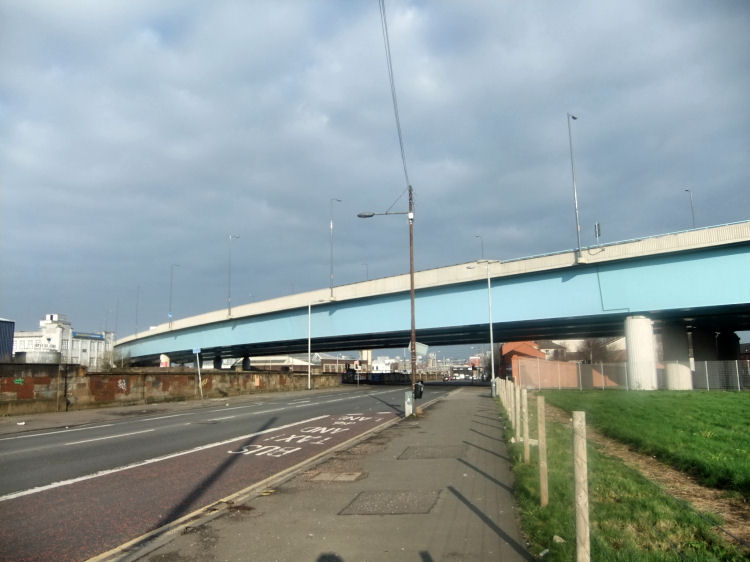
Beyond Cumberland Street, the southern portion of Eglinton Street is dominated by the elevated extension to the M74 motorway which opened in 2011.
Elevated extension to M74 motorway crossing Eglinton Street, Laurieston
The two-storey red brick terraced houses built near the site of the motorway were completed by the Scottish Special Housing Association in 1984.
Preparation for construction of elevated extension to M74 motorway at Devon Street, 2008
Abbotsford School was designed as a well proportioned Roman Pallazzo by H. & D. Barclay. The cream sandstone school opened in 1879 and was occupied for its original purpose until 1996. The school building was converted for use as offices in 2006.
Abbotsford School, viewed from elevated section of M74 motorway
Chalmers Free Church was built at the corner of Pollokshaws Road and Cavendish Street in 1898. The church and ancillary buildings were converted to 36 flats 1995. It was designed by architects, H. & D. Barclay, in an Italian Renaissance style with a semi-circular portico with a rose window above. The church hall and classrooms were situated in a separate building entered from Cavendish Street.
Chalmers Free Church
In June 1994, Ian Falconer, site agent for Crudens, the building company which was converting the derelict building into residential accomodation, uncovered the time capsule which had been laid within the foundation stone nearly a century before. The glass jar contained copies of the Glasgow Herald and the Evening Citizen along with two church pamphlets.
Hutcheson's Girls School was situated on the south side of Elgin Street, later renamed Turriff Street, near Eglinton Toll. Engraving of Hutcheson's Girls School
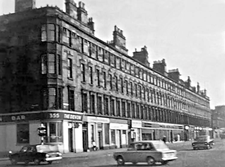
Tenements on eastern side of Eglinton Street, Laurieston, 1969
Corner of Devon Street and Eglinton Street, Laurieston, 1967
The tenement at the head of Eglinton Toll, at the southernmost edge of Laurieston, was erected by the City Improvement Trust in 1878 on the site of the demolished Muirhouse Toll House which had been built in 1843 to the designs of Charles Wilson.
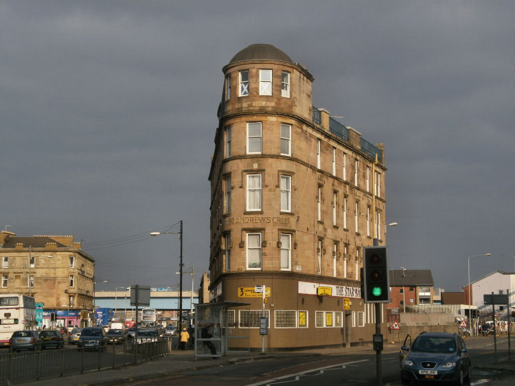
Eglinton Toll, with Eglinton Street to the left and Pollokshaws Road to the right
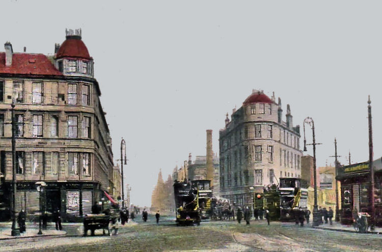
Early twentieth century street scene at Eglinton Toll
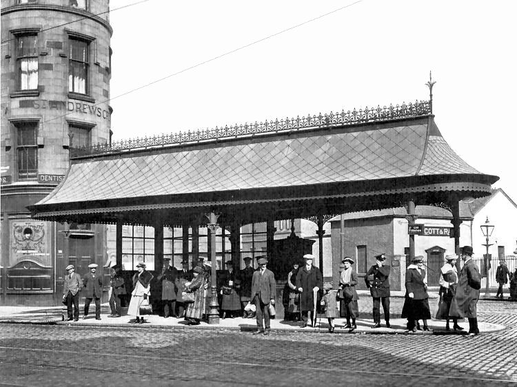
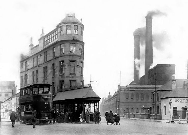
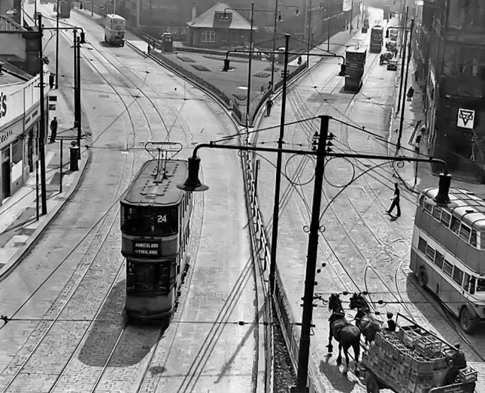
Tram shelter at Eglinton Toll, fabricated at Walter Macfarlane's Saracen Foundry, Possilpark
Langside bound tram at Eglinton Toll, 1917
Inter-war view of Eglinton Toll
Junction at Eglinton Toll in 1950's, after erection of barricade separating tram routes - No.25 from Rouken Glen and No.5 to Holmlea Road
View of Eglinton Toll from window above the Star Bar
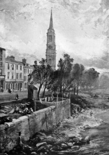
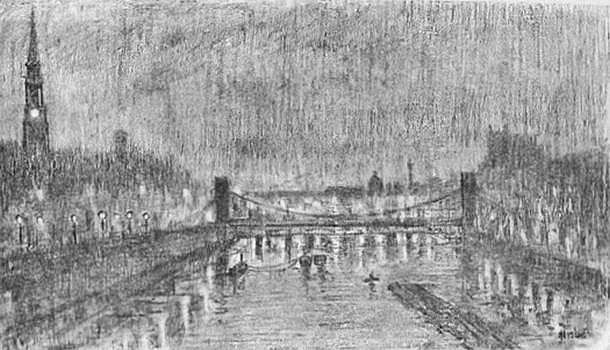
Atmospheric pencil sketch of Laurieston and the Suspension Bridge, 1912
Nineteen acres of land immediately to the west of the old village, comprising Kirkcroft and parts of Tradecroft, were sold by the Hutcheson trustees to Mr James Laurie and developed as the up-market suburb of Laurieston from 1802.
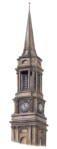
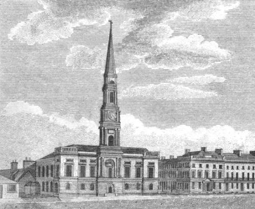
Rev. William Anderson was appointed as the first minister of the new parish, a post he held until his death in 1792. His successor, Dr. James McLean, who was minister from 1793 to 1838, proposed that a new church should be erected in the newly developed Carlton Place. Gorbals Parish Church was designed by the famous architect, David Hamilton. The foundation stone was laid on 22d July 1810, and the church opened for worship on 29th September 1811.


It lasted until 1895 when the phenomenal increase of traffic again demanded increased accommodation. A temporary bridge was erected while the building of the present bridge began, using material salvaged from the old bridge. The final Jamaica Bridge was formally opened on 24th May, 1899.

The block was designed by architect James Salmon for the British Linen Bank and built in 1900. It has been owned by the Southside Housing Association since the mid 1990's.
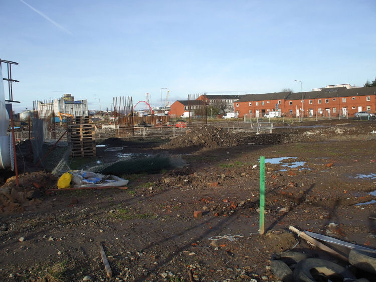
The new build four-storey housing to the south of the bank building is part of the initial stage of Laurieston's redevelopment.


The adjacent block was added for the Co-op's Drapery Department in 1935, when Art Deco was the fashionable style. It was designed by Cornelius Horsburgh Armour, who also designed the Luma Building in Shieldhall.
The site of the demolished 1902 building now only contains the advertising hoarding, shown below, next to the 1935 block, which has fortunately survived.


As at early 2014 it was unoccupied apart from space let as rehearsal rooms to the Apollo Players.

It was designed by architects, Gavin Lennox and Daniel McMath, who specialised in cinema and petrol station work.
In 1973 the venue was converted for use as a bingo club and in March 2003 it became a live concert venue, Carling Academy, which changed its name to O2 Academy Glasgow in 2008.
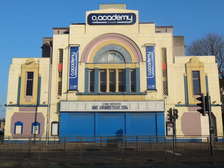
The building had to be demolished after a "mysterious" fire on 29th May 2009.
Gorbals Library can be seen at the top left of the picture with Gorbals Cross at the top right at the other end of Norfolk Street. Gorbals Street is seen at the right side of the picture, running from the Cross down to the railway junction at Cumberland Street. The dark church building situated south-east of the library was St John's R.C. Church in Portugal Street, designed by Pugin & Pugin of Westminster 1896-97. This church served the Catholic parish adjacent to St Francis' in Hutchesontown.
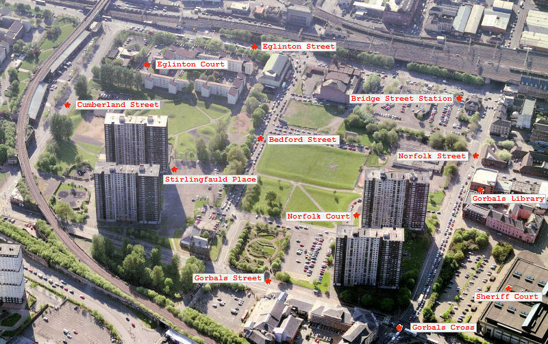
The two multi-storey blocks at Stirlingfauld Place at the left of the above picture were erected in 1973 and demolished in 2008. The tower blocks of Norfolk Court were added in 1976 with the block at 66 Norfolk Court at the bottom right of the picture being demolished in 2010. The last surviving block at 5 Norfolk Court was left standing alone and awaiting demolition as seen in the view from November 2015, shown below.

The memorial stone for the church was laid on 18th December 1897 by Mr David McLean. The opening part of the ceremony took place in their existing church in Salisbury Street with Rev. John Urquhart, its minister, presiding. The congregation had moved from their first church in Ballater Street to Salisbury Street in 1871.
In the closing years of the century, the Glasgow and South Western Railway bought the Salisbury Street church to build a new station in Cumberland Street for the extension of their line from the St Enoch terminal. The railway company paid �7000 for the site. Cumberland Street Station, which was in use from 1900 to 1966, had four platforms stretching from Salisbury Street to Eglinton Street. The new church, below, is less than 100 metres away from the previous building.
The school was designed by architect, John Honeyman, with the foundation stone being laid on 11th June 1868 and the school opening the following Spring. The building was demolished in 1976.


|
|
| |
|
|
|
|
|
|
|
|
|
All original artwork, photography and text © Gerald Blaikie
Unauthorised reproduction of any image on this website is not permitted.
