
Welcome to this wander along Great Western Road, Glasgow, looking at the architecture and green spaces on the way from St George's Cross to Anniesland Cross.
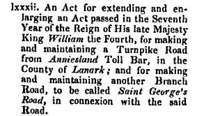
Reference to the extension of the Act of 1836 to create a turnpike (or toll road) which would later become Great Western Road
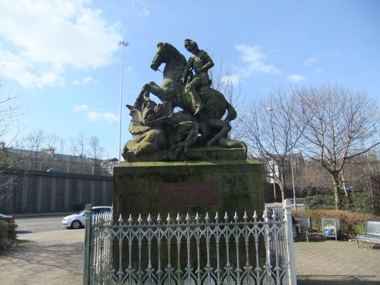
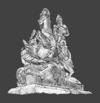
Statue of St George slaying the dragon at St George's Cross
The architecture and other interesting sights around St George's Cross are explored in my Woodside and Firhill web page.
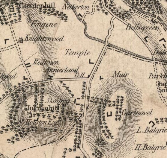
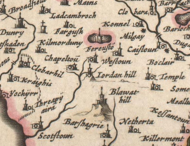
The map below, which pre-dates the construction of Great Western Road, shows Anniesland as two rows of dwellings to the east of the toll point at the junction of present day Crow Road, Bearsden Road and Anniesland Road.
Map from 1795 showing miners' rows at Anniesland and Redtown
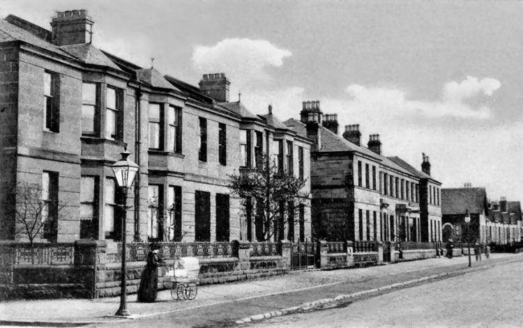
Anniesland and Redtown consisted of rows of cottages occupied by miners employed in the extraction of coal and ironstone from small workings scattered throughout the Jordanhill district. The remains of these old mine workings can still cause problems for local householders who may be unaware that their homes have been undermined. Early twentieth century view of newly built terraces at Crow Road, which replaced the miners rows of Anniesland
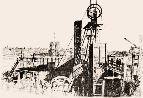
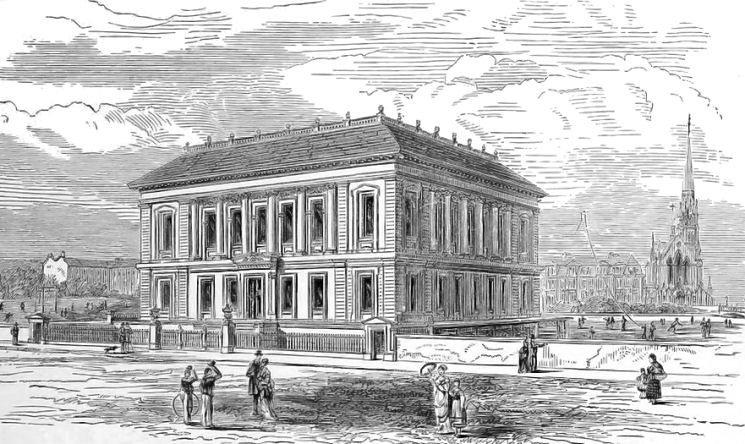
Etching from 1892 showing "Anniesland Pits"
The map below was surveyed in the late 1500's and published in 1684.
Many familiar places with unfamiliar spellings appear on both maps. On the map below, there is no indication of any development between Jordanhill and Temple where the Anniesland toll point would later be created.
Map from 1684 showing area around Anniesland
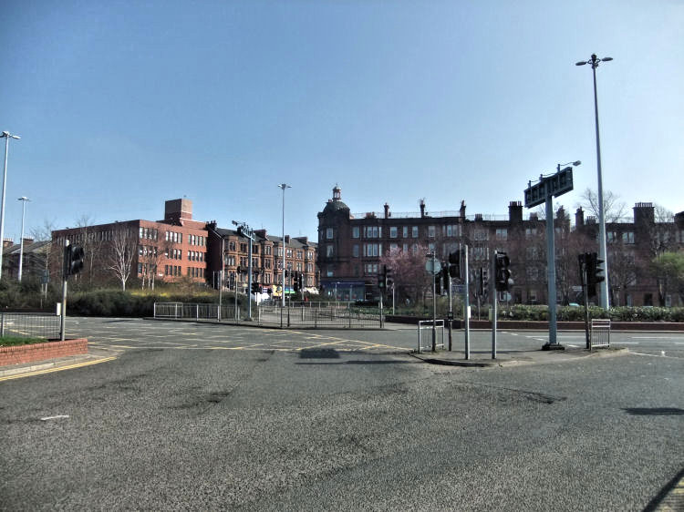
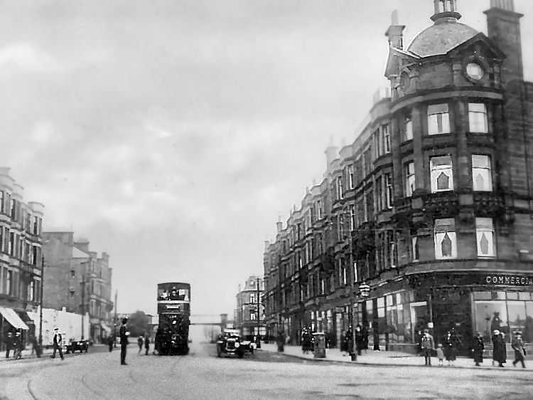
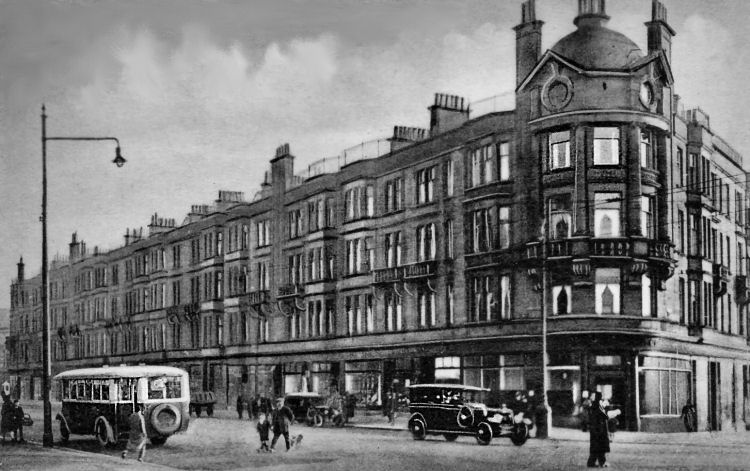
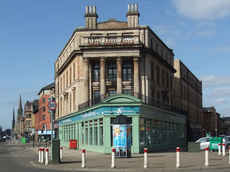
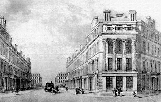
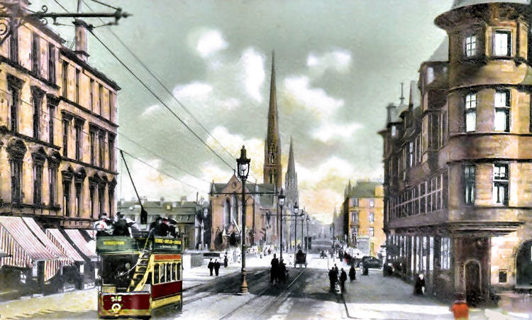
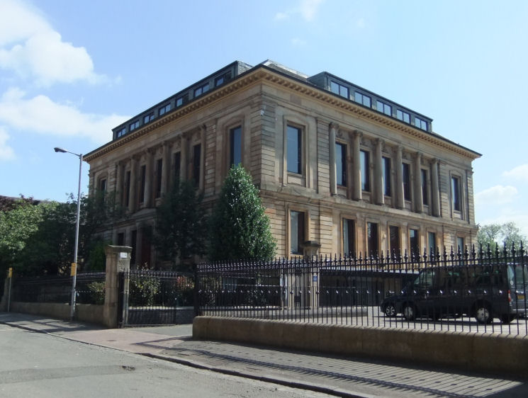
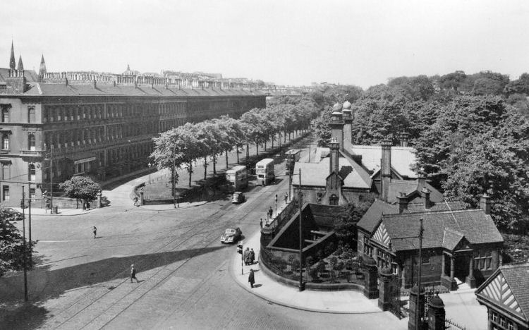
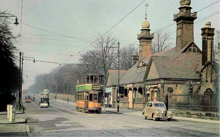
View of Annieland Cross from the west, looking towards Great Western Road
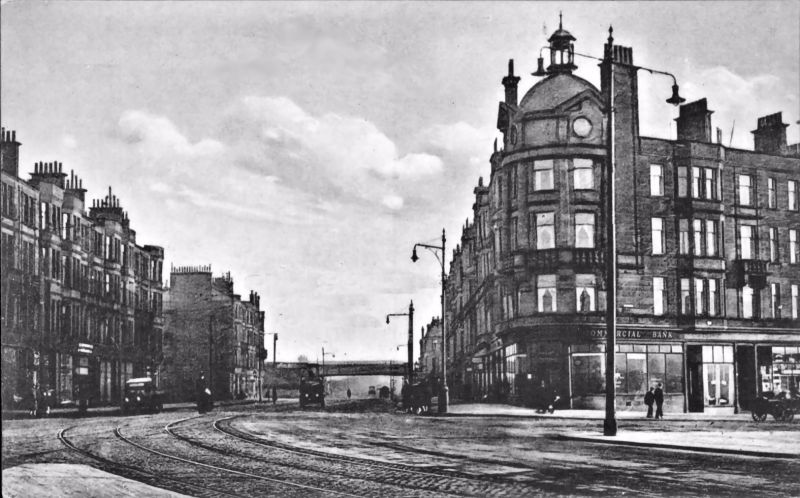
Old view of Annieland Cross from the west, looking towards Great Western Road
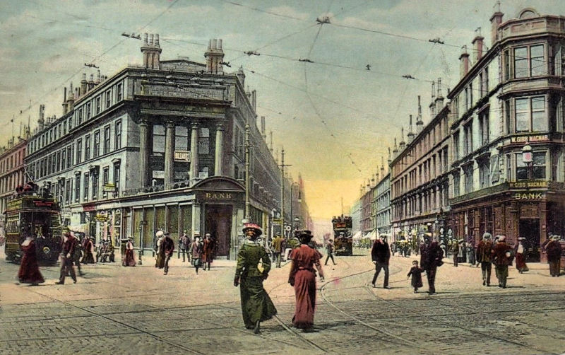
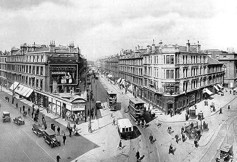
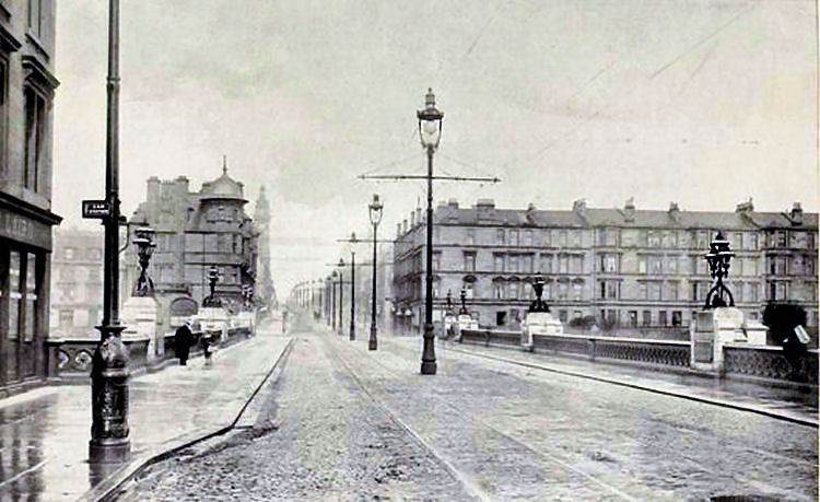
Early 20th century views of Great Western Road at Annieland Cross
Start of Great Western Road at St George's Cross, with the familar spires in the distance
Early twentieth century view of St George's Cross
Sketch of St George's Cross before the church spires of Great Western Road were constructed
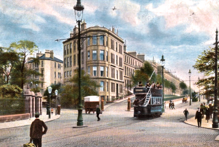
Pedestrians wandering around St George's Cross with no concerns about traffic
This slightly later view, from the upper levels of a tenement block, shows the junction of Great Western Road, Maryhill Road and St George's Road. The dangers of vehicular traffic seem to be completely ignored by the members of the public wandering around the busy intersection.
Pedestrians wandering around St George's Cross with no concerns about traffic
St Mary's Episcopal Cathedral, built 1870 -1884, architect George Gilbert Scott
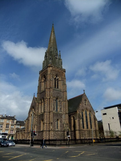
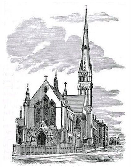
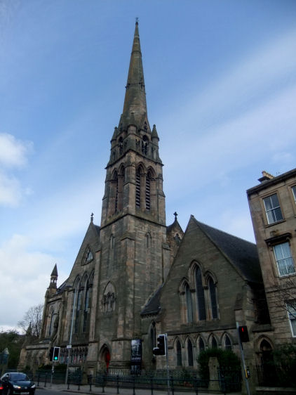
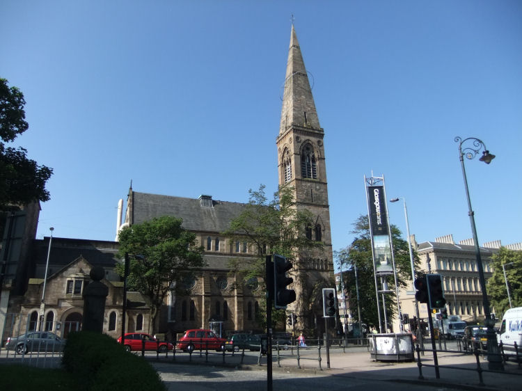
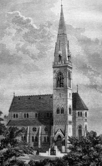
Lansdowne Church, built 1862 - 1863, architect John Honeyman
Spire of Lansdowne Church
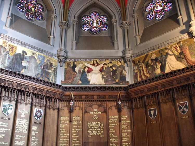
Lansdowne Church War Memorial by sculptor Evelyn Beale - a tryptich centred on Christ welcoming various historical figures
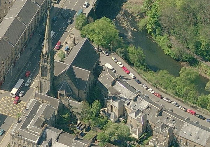
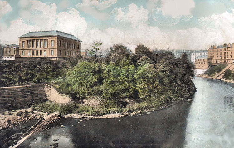
Aerial view of the spire of Lansdowne Church, the River Kelvin and surrounding roads
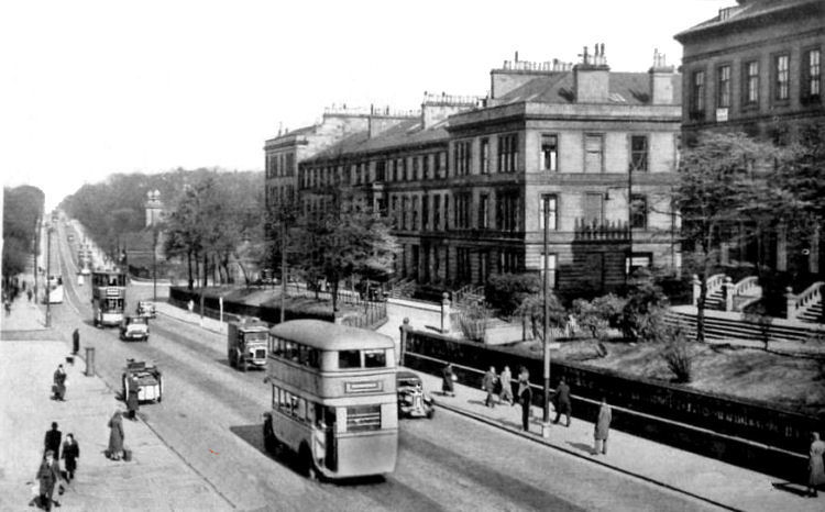
Early 20th century view of Great Western Road with church spires in background
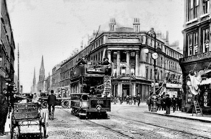
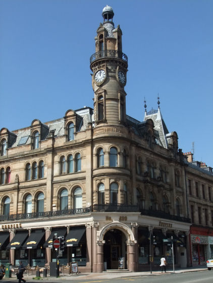
Clock tower at Cooper's corner, built 1886, architect Robert Duncan
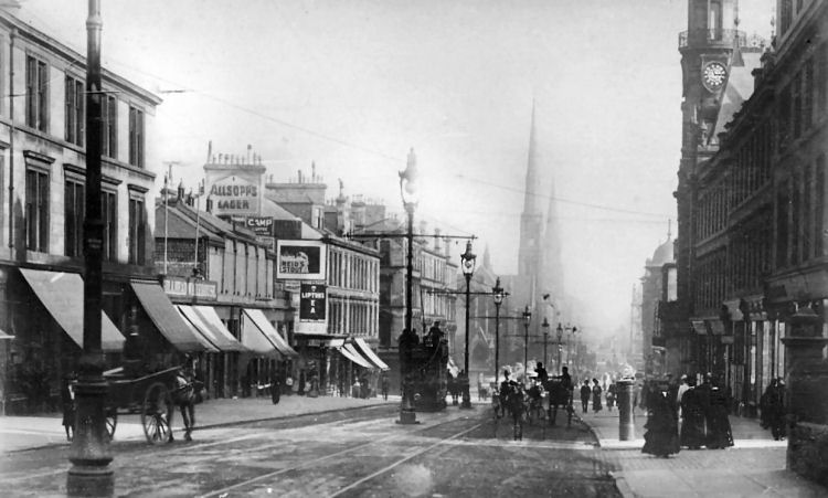
Foggy street scene at Cooper's corner, Great Western Road
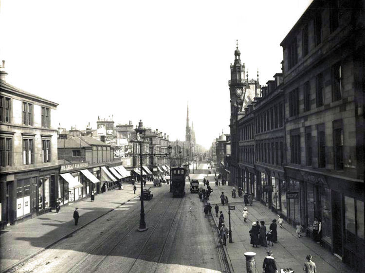
Street scene of Great Western Road on a nice clear day, 1913
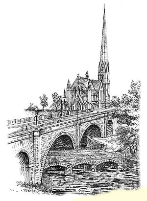
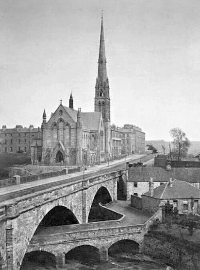
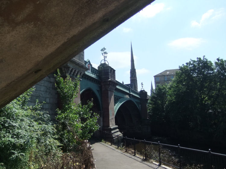
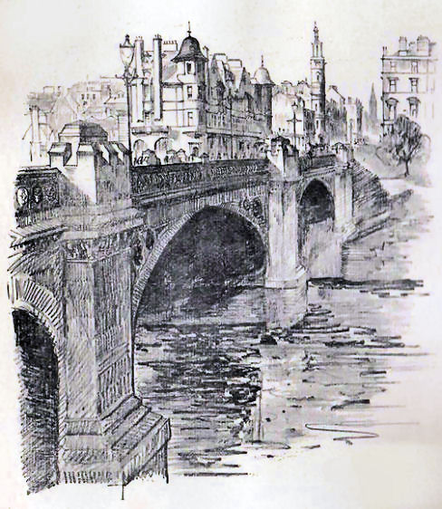
The above sketch shows the high-level bridge built in 1838 to carry Great Western Road over the Kelvin. Lansdowne Church, completed in 1863, can be seen in the background. The bridge shown passing under the central arch was built in 1825 at the site of the old Hillhead Ford. Both bridges were replaced in 1891 with a new bridge, shown below.
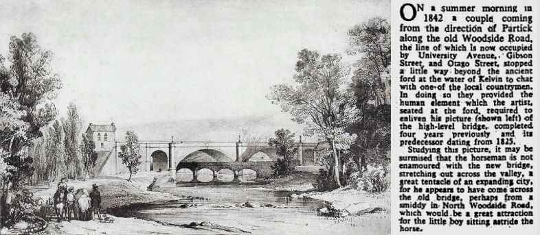
Sketch from 1842 of Kelvin bridges from Glasgow Herald 23rd February 1961
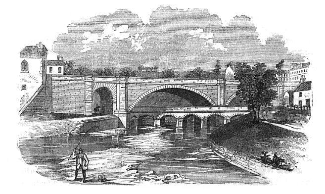
Engraving of the Kelvin bridges and Great Western Road, from 1859
Photograph of the Kelvin bridges and Great Western Road, c.1885
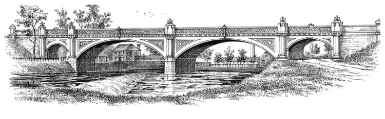
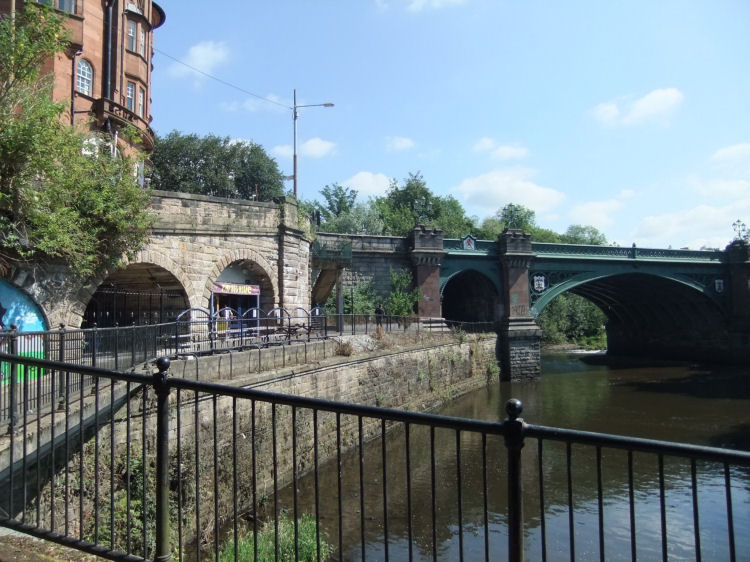
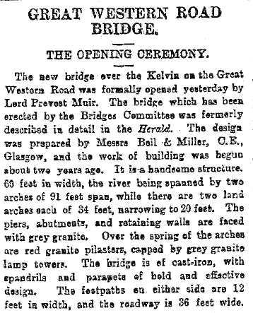
Shortly after the above photograph was taken the original stone bridge was replaced by a cast iron structure designed by civil engineering partnership Bell & Miller, which was formally opened on 29th September 1891.
Great Western Bridge or Kelvinbridge, erected in 1891
Extract from Glasgow Herald 30th September 1891 regarding replacement Great Western Bridge
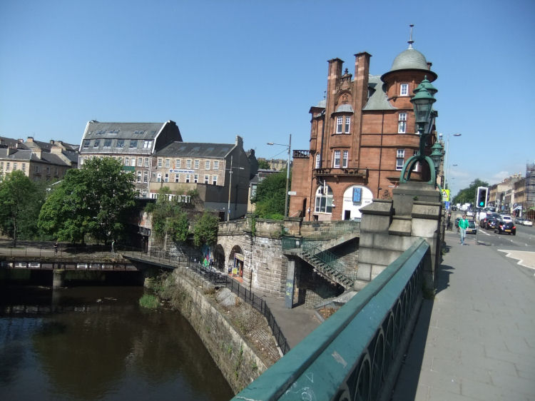
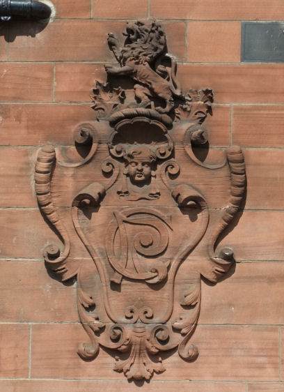
View over Great Western Bridge of the site of Kelvinbridge railway station and Caledonian Mansions
Carved crest featuring Caledonian Railway's lion and monogram at Caledonian Mansions
Historical details and photographs of the Caledonian Railway's Glasgow Central line from Maryhill to Great Western Road can be found in my Kelvin Walkway web page.
Looking up at Great Western Bridge from level of station
1904 view of Great Western Road with central poles for the tramway which had been electrified between 1898 and 1901
Sketch of Great Western Road from the north side of the bridge, 1912
Glasgow Academy built 1878, architect Hugh Barclay
Victorian engraving of Glasgow Academy
Glasgow Academy from the banks of the Kelvin
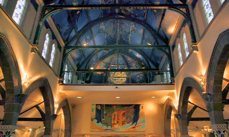
Kelvinside Parish Church built in 1862 and converted into the �ran M�r pub/ restaurant in 2004
Engraving of Kelvinside Parish Church, now the �ran M�r
Roof trusses and decorative ceiling over performance area of �ran M�r, Glasgow
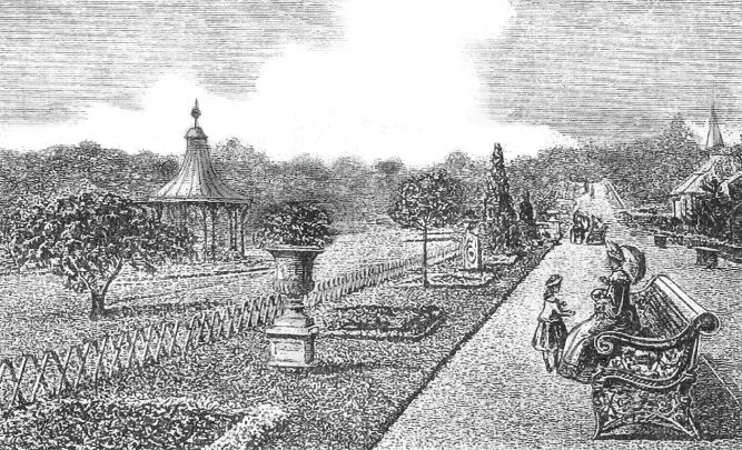
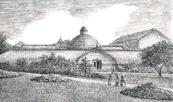
Scene at Botanic Gardens, 1887
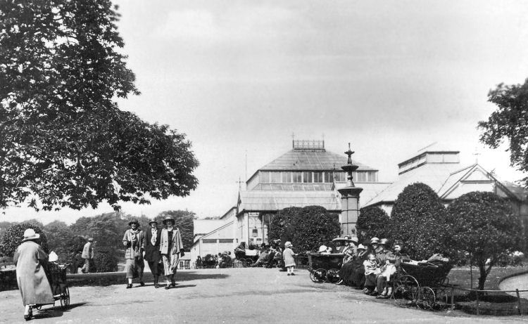
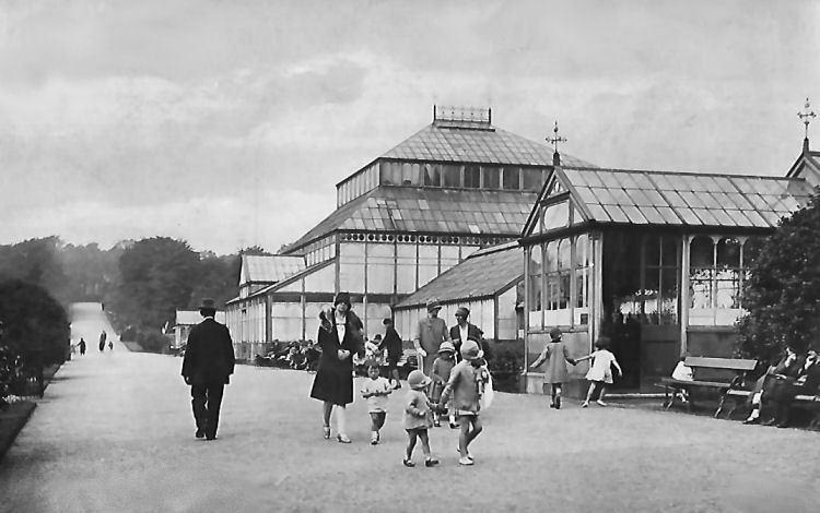
Different fashions for Edwardian ladies (above) and 1930's ladies (below) strolling with perambulators at Botanic Gardens
Inter-war scene of mothers and children at Botanic Gardens, Glasgow
Gentlemen with suits and bowler hats avoiding summer sunshine at Botanic Gardens
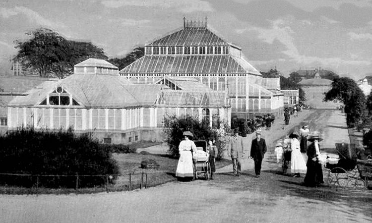
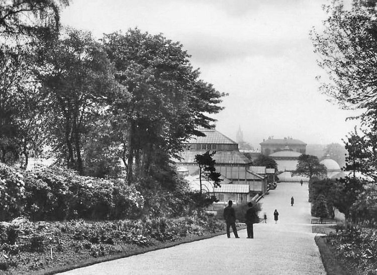
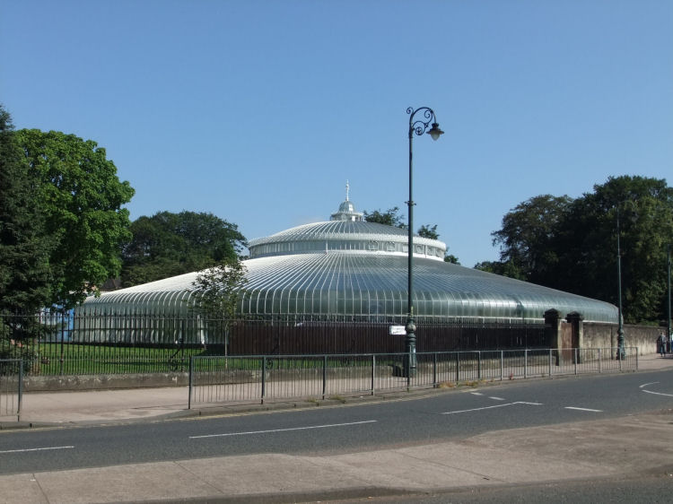
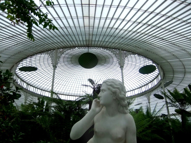
Kibble Palace glasshouse, originally built at Coulport and re-erected at Botanic Gardens in 1872
Inside the Kibble Palace, Botanic Gardens, Glasgow
View of entrance to Kibble Palace, 1887
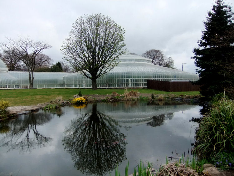
Reflection on pond at Botanic Gardens, Glasgow
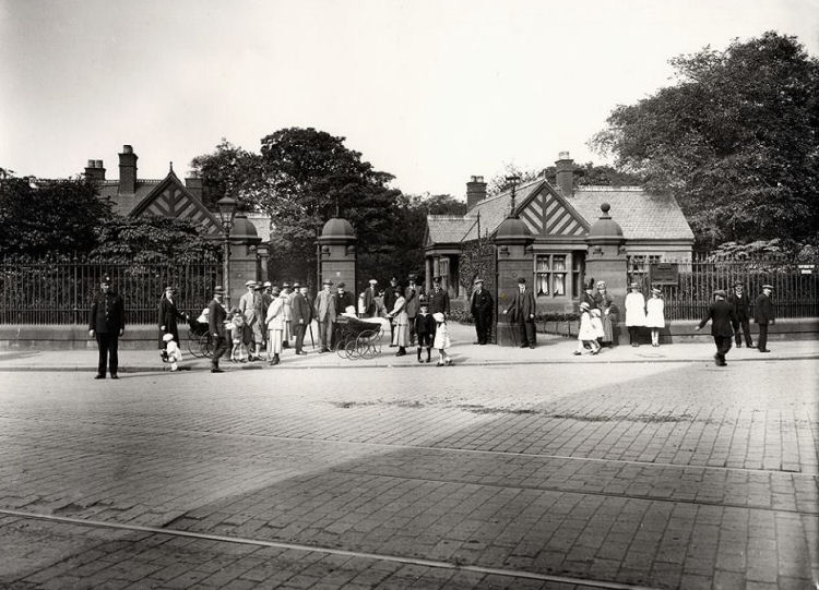
Crowds gathering at gates to Botanic Gardens Glasgow, c.1930
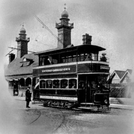
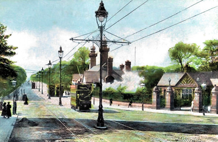
Tram at former Botanic Gardens Station
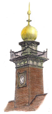
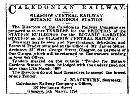
Botanic Gardens Station was the showpiece station of the Glasgow Central Railway which operated through the west end from 10th August 1896. The booking office for the station was designed by James Miller. Clock tower at Botanic Gardens Station, James Miller, 1894
James Miller's plans for the new station were completed in March 1894 and were displayed for potential contractors who had to pay a fee of one guinea to view the architectural drawings and specifications at Miller's offices in West George Street.
Notice from Glasgow Herald, 6 March 1894
Botanic Gardens Station closed in 1939 and had a variety of uses until it was destroyed by fire on the evening of 22nd March 1970.
Steam train passing through Botanic Gardens Station
Platforms at Botanic Gardens Station
Corner of Great Western Road at Botanic Gardens c.1950
Botanic Gardens Station c.1960
Queen Margaret Drive is situated at the eastern end of Botanic Gardens opposite the junction of Great Western Road and Byres Road. Junction of Great Western Road and Queen Margaret Drive
Landscaped terraces along Great Western Road on approaches to Queen Margaret Drive, 1935
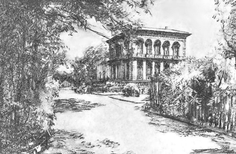
Pencil sketch of North Park House
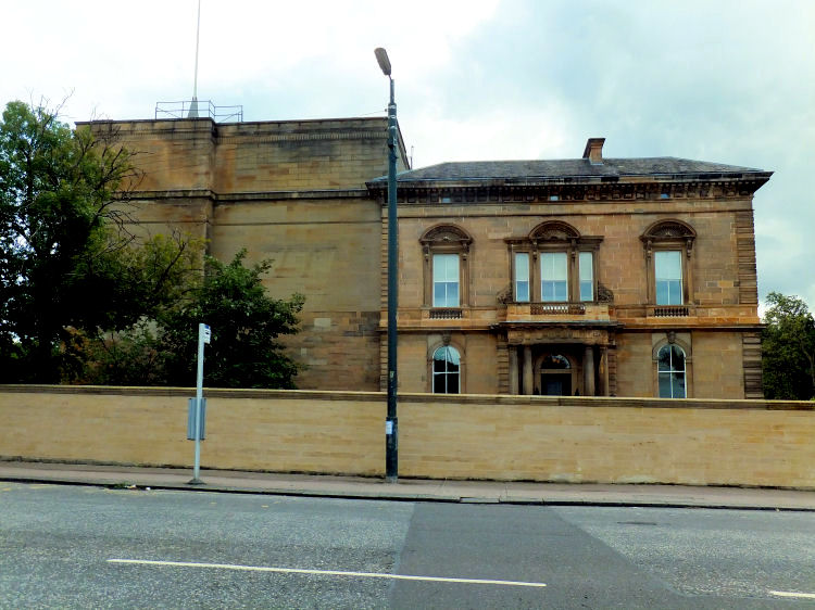
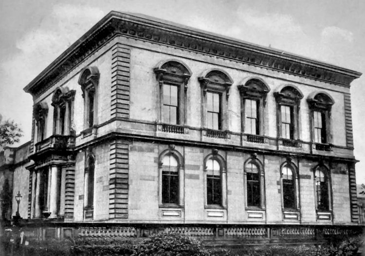
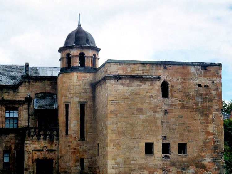
Facing Botanic Gardens, BBC Scotland had its headquarters at North Park House in Queen Margaret Drive from 1938 until 2007. North Park House, designed by J.T. Rochead, 1869 -1871, and 1969 extension for BBC Scotland
Photograph of North Park House and a couple of students when it was occupied as Queen Margaret College
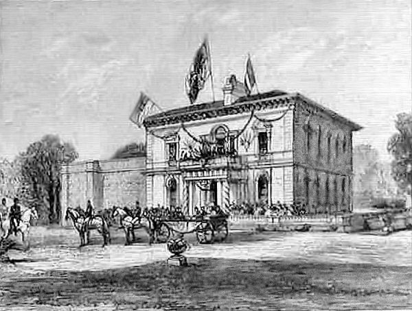
Visit to North Park House by Queen Victoria in 1888
The purpose-built extension to Queen Margaret Medical College of 1895 was designed by John Keppie and Charles Rennie Mackintosh. It too was part of the BBC complex on the site. Details are included in my Charles Rennie Mackintosh web page.
Former Queen Margaret Medical College when unoccupied after the departure of the BBC in 2007
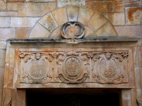
Inscription over entrance of former Queen Margaret Medical College - QMC, 1895
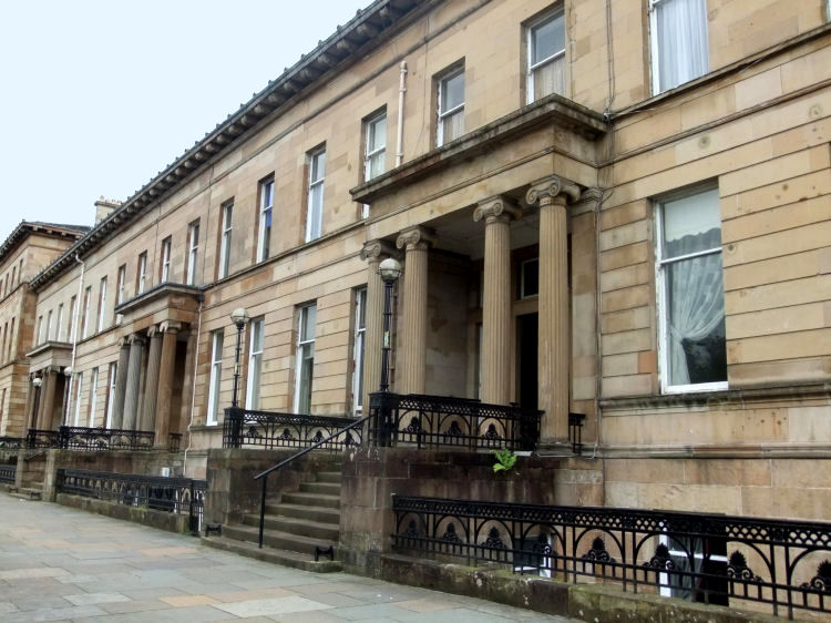
There are many large Victorian villas in the west end, comparible to those of Pollokshields in the south side were more extensive plots of ground were available.
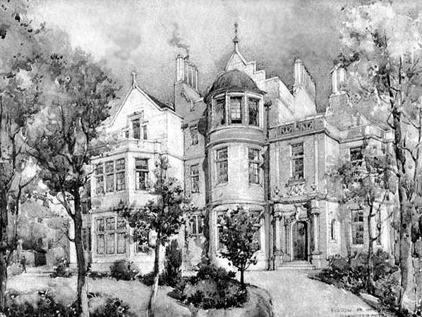
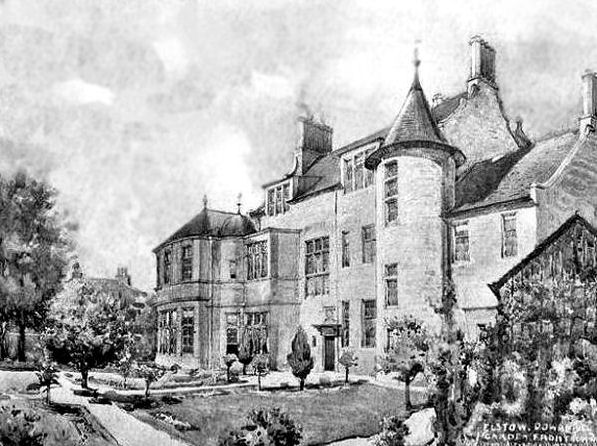
Perspective drawings of 'Elstow' in Victoria Circus, Dowanhill, were displayed at the annual exhibition of the Royal Glasgow Institute of the Fine Arts in 1900. 'Elstow' was built in 1856 and extended and renovated in 1900 to the designs of architect Alexander Nisbet Paterson who prepared the drawings shown below.
Exhibition drawing of 'Elstow', Dowanhill, 1900
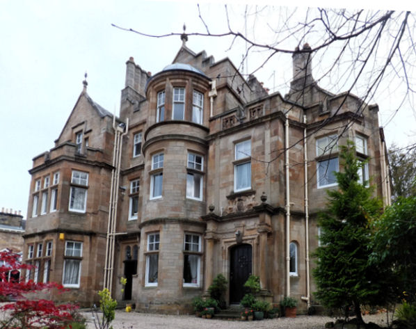
'Elstow', Victoria Circus, Dowanhill, 2014
Exhibition drawing of rear of 'Elstow', Dowanhill, 1900
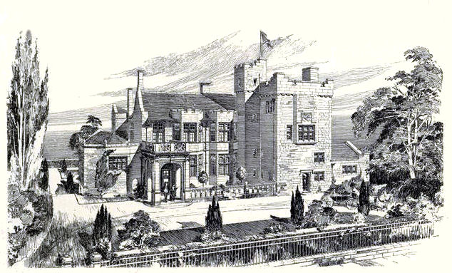
Perspective drawings of 'Stoneleigh' in Cleveden Drive , Kelvinside, were displayed at the annual exhibition of the Royal Glasgow Institute of the Fine Arts in 1901. 'Stoneleigh' was built to the designs of architect Henry Edward Clifford who prepared the drawing shown below.
Exhibition drawing of 'Stoneleigh', Kelvinside, 1901
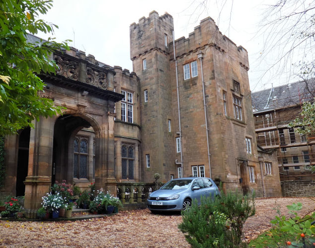
'Stoneleigh', Kelvinside, 2014
Alexander "Greek" Thomson's Great Western Terrace, completed after his death in 1875
Thomson's many terraces throughout the city are explored in my Alexander "Greek" Thomson's terraces web page.
Not all the west end's fine Victorian and Edwardian architecture has survived to the present day.
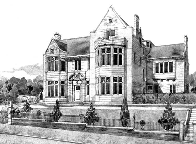
The architects of Kiloran House, Messrs Stewart and Paterson of Glasgow, designed the house and its interior fittings in a conservative style for its time, without falling into the "fin de si�cle" trap which allegedly contributed to the end of Charles Rennie Mackintosh's time as a fashionable designer and architect in Glasgow. Exhibition drawing of Kiloran House , Hatfield Drive, displayed in 1906
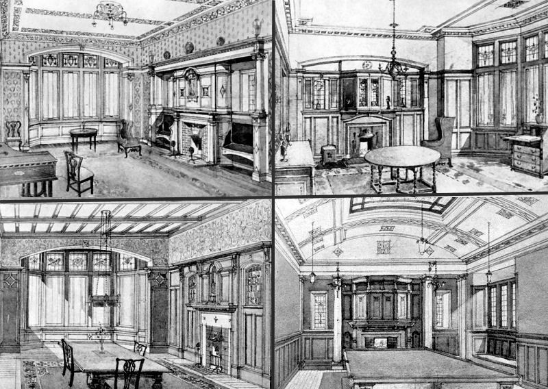
The furnishings and interior decoration of Kiloran House are in total contrast to Mackintosh's unique designs for houses built around the same time.
Interior views of Drawing Room, Parlour, Dining Room & Billiards Room of Kiloran House, Hatfield Drive, 1906
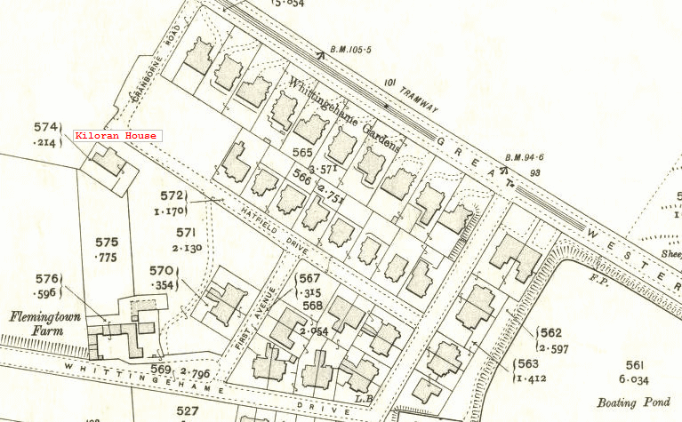
Map from 1909 showing the fields of Flemingtown Farm surrounding Kiloran House
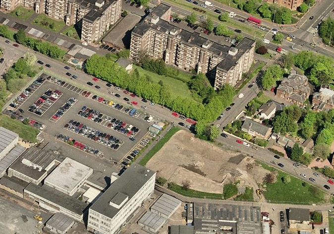
Aerial view of demolished site of Kiloran House at Anniesland College
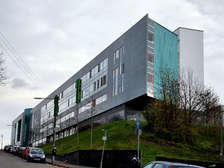
Anniesland College, Hatfield Drive, completed 2011
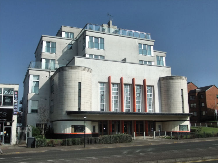
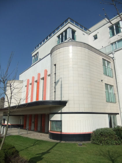
The fa�ade of the former Ascot Cinema in Anniesland was retained as part of a development of 12 flats completed in October 2003
Characteristic semi-circular Art Deco tower designed by Charles McNair for the cinema which opened in 1939
Anniesland Mansions, built 1907 - 1913, architect Hugh Campbell
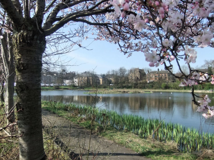
Springtime view of Bingham's Pond which is situated alongside Great Western Road near Anniesland College
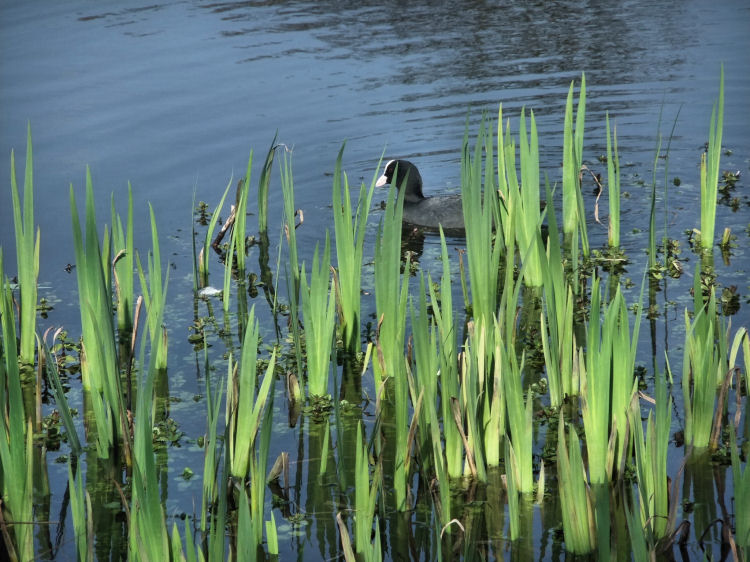
Coot among the rushes at Bingham's Pond, Great Western Road
The journey follows the three mile route of the original Great Western Road, the construction of which was established by an Act of Parliament in 1836.
The houses at Anniesland were built close to the line of Crow Road and those at Redtown were situated on the road to Knightswood.
The botanical theme of the station was accentuated with the two clock towers topped by large golden onion shaped domes!

Although Queen Margaret Drive was a main artery to Maryhill and other suburbs north of the River Kelvin, there were no tram routes using it because of a huge wall erected at the northern end of the original Queen Margaret Bridge, restricting vehicular access.
The story behind the construction of the wall obstructing the end of the bridge is told in the North Kelvinside page of this website.
The house and most of the associated buildings were converted to office accommodation in 2013.
Many of the grandest houses can be found in Kelvinside and Dowanhill on the north and south sides of Great Western Road respectively.
Kiloran House in Hatfield Drive was demolished in 2007 to make way for a new building for Anniesland College. The house was built for James Thomson Tullis in 1905 and design drawings of both the exterior and interior where displayed at the annual exhibition of the Royal Glasgow Institute of the Fine Arts in 1906.
J. Thomson Tullis, who had commissioned the house, was a director of the Glasgow Institute of Fine Arts at the time when Mackintosh's modernistic house designs were being exhibited. To compare the Stewart and Paterson's drawings of those of Mackintosh's houses, you should visit my Charles Rennie Mackintosh, Glasgow Buildings web page.
![]()
 | |
|
|
|
|
|
|
|
| |
|
| |
|
|
|
|
|
|
|
|
All original artwork, photography and text © Gerald Blaikie
Unauthorised reproduction of any image on this website is not permitted.
