
In 1136 King David I of Scotland granted parts of the "lands of Perdyc" to Bishop John Achaius, the first bishop of the Diocese of Glasgow, which had been established in 1115.
The name of Partick comes from an earlier time, when it was part of the Kingdom of Strathclyde
which was centred on Govan on the opposite side of the River Clyde. The local language was a form of Cymro-Celtic, related to modern-day Welsh.
The settlement was originally known as Perdyc. Per in Cymro-Celtic means sweet fruit and teq or deq translates as fair, or beautiful. Perdyc or Partick would therefore have been a place of fair fruit trees or orchards.
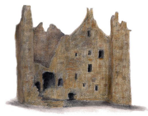
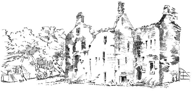
Drawing of the ruins of Partick Castle by Gerald Blaikie
Partick Castle was built near the confluence of the River Kelvin and the River Clyde to serve as a retreat for the hierarchy of the diocese, who occupied it until the time of the Reformation in the 1560's. The castle was abandoned at that time but was rebuilt some fifty years later, in 1611.
A report published by the Glasgow Archaeological Society in 1868 revealed historical details of the castle, which had been rebuilt for the philanthropist George Hutcheson by William Miller, mason of Kilwinning, using some of the rubble masonry recovered from the Bishop's Castle. The poor condition of the stonework accounted for the short period that the restored structure existed in a state of good repair. The foundation stone was laid on 1st April 1611, but by 1783 the building was unroofed and in ruins. It was last inhabited about 1770 by “common work-people” and none of the archaeologists' informants had any knowledge of gentry living in it.
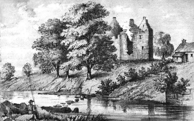
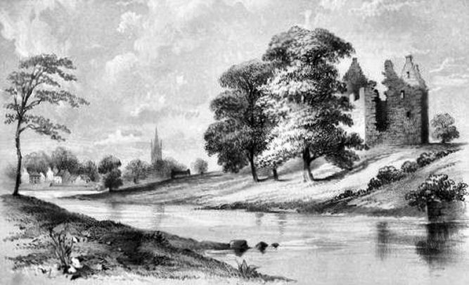
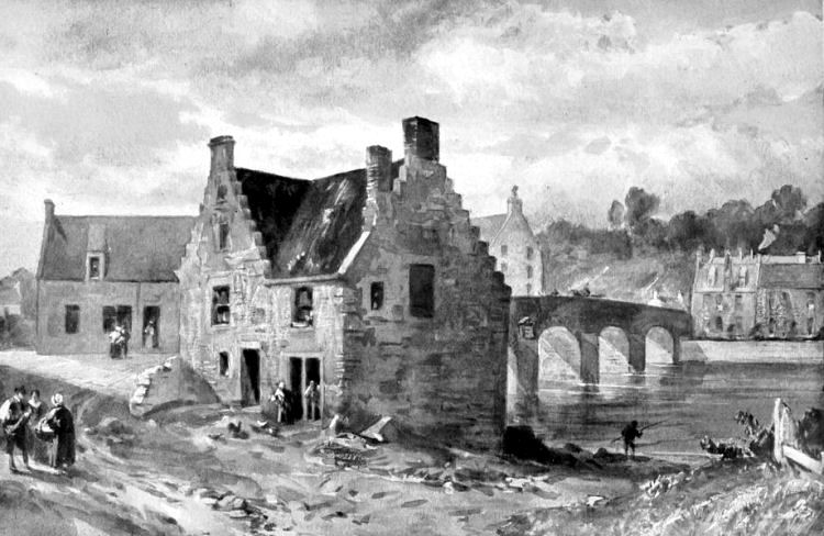
The two views of Partick Castle shown below are from the east bank of the River Kelvin at different times. The first shows a glimpse of Merkland Farmhouse which was built from masonry recovered from the ruins, while the second picture shows the village of Govan in the background.
Views of Partick Castle from the east bank of the River Kelvin
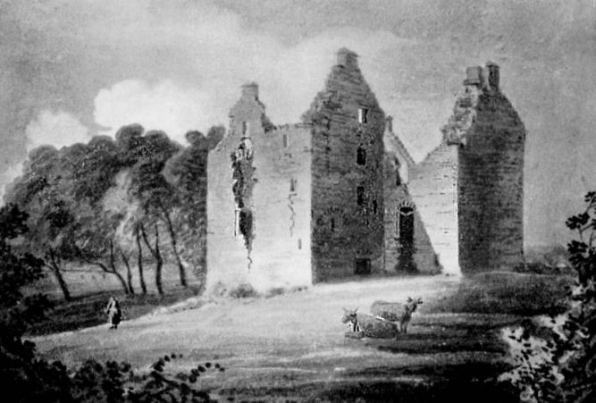
Pen and ink drawing of Partick Castle by James Denholm, 1817
Pencil sketch of Partick Castle by J.C. Nattes, 1799
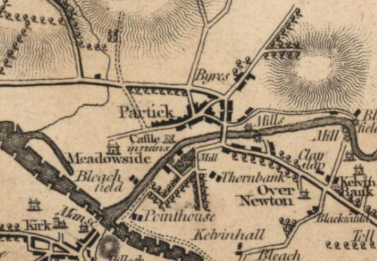
The map below shows the position of the ruined castle.
The map also shows the village of Partick and the numerous mills along the River Kelvin. To the north of the village lay the hamlet known as the "Byres of Partick" or "Bishop's Byres", where sheds providing shelter for cattle were situated at one time.
Map from 1796 showing Partick Castle, Govan Parish Church and the mills along the River Kelvin
Historically Partick was included in the parish of Govan in the county of Renfrew. Govan Parish Church is situated on the other side of the Clyde facing the confluence with the Kelvin. The modern district grew around the granaries and flour mills which were powered by the waters of the River Kelvin which were dammed and channeled to drive the millwheels.
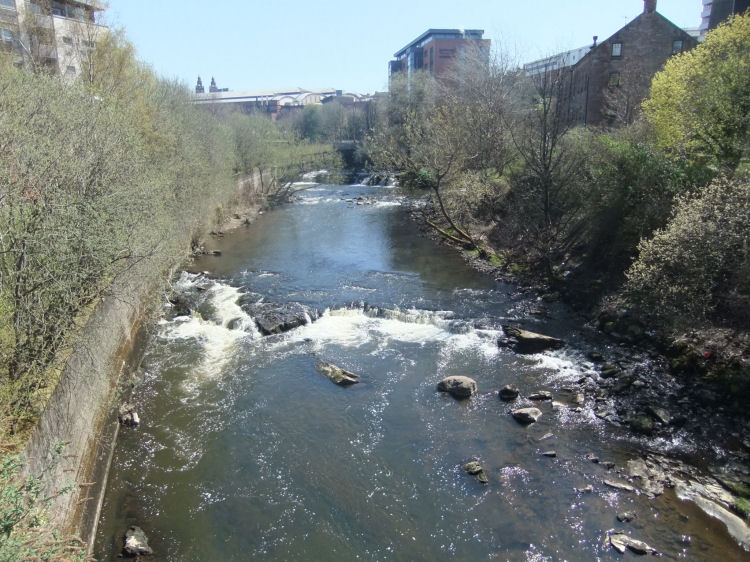
Weirs and channels providing water power for mills on the River Kelvin
The flour mills at Partick were operated by the Corporation of Bakers who had taken possession of the Bishop's mill after the Reformation.
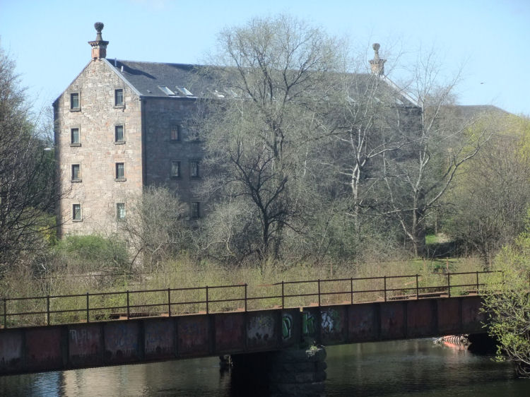
The present day Bishop's Mill (below) was built in 1839 on the site of the 1664 mill, which had been burned down. It remained in operation until the 1960s and was converted into an apartment block containing twenty flats in 1987.
View of Bishop's Mill and abandoned railway bridge to Partick Central Station
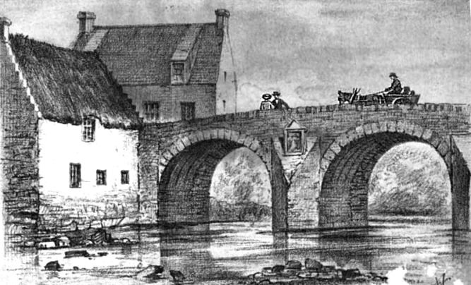
Bishop's Mill and old bridge at Partick
The developers of the residential block at Bishop's Mill successfully retained the character of the old building with cleaned and restored stonework. The matching window frames and entrances add to the impression of a very stylish development which, although lacking the grim authenticity of a Victorian working mill, shows what can be achieved when giving new life to old industrial buildings.
Bishop's Mill apartment block
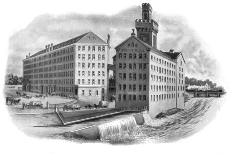
Regent Mills on Glasgow side of River Kelvin, with railway bridge in the distance
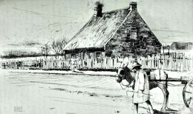
Granny Gibb's Cottage on the south side of Dumbarton Road was the last of the Highland drovers' resting places when the sheep and cattle to be slaughtered for Glasgow's food supply came to
the city by road. Mrs Gibb was succeeded by her daughters, "Mother Gibb" and
"Aunt Gibb" before railways and steamers made the drovers task redundant.
Granny Gibb's Cottage, Partick
This romantic description of Partick was published shortly before the Industrial Revolution and the coming of steam powered manufacturing in the middle of the nineteenth century.
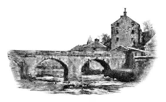
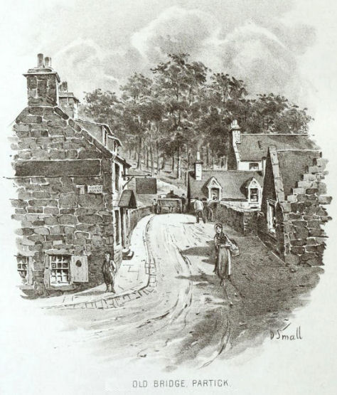
View of old houses surrounding bridge over River Kelvin at Partick
Old Bridge at Partick with arms of Provost Thomas Crawford of Glasgow
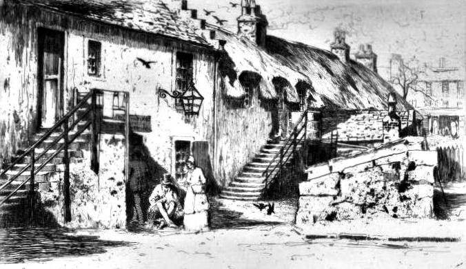
The houses and stables shown in the illustration below were situated next to the Old Bridge Inn, which was the most
popular public house in the village frequented by Glasgow merchants "who were in the habit of coming to the country in search of a good dinner and a quiet glass of toddy". In the 1820's It was occupied by a Mrs. Craig, "a stout old
lady, who prided herself on the quality of her liquors, as well as in the
style in which she could get up a dinner or supper for a large party".
It was a popular venue for weddings, balls and dinner parties.
Old Bridge Inn, Partick
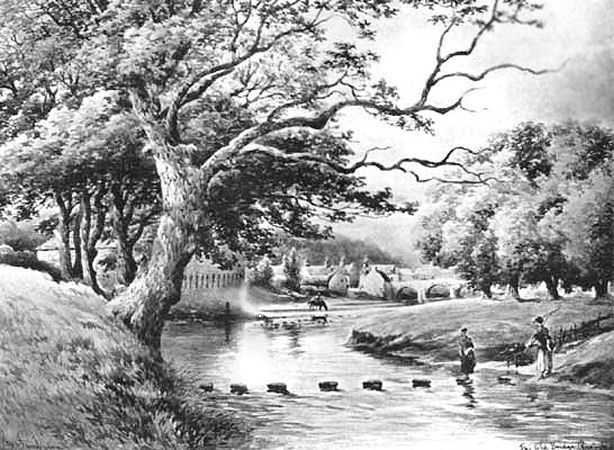
Stepping stones at bend in the River Kelvin, upstream from Old Bridge, Partick
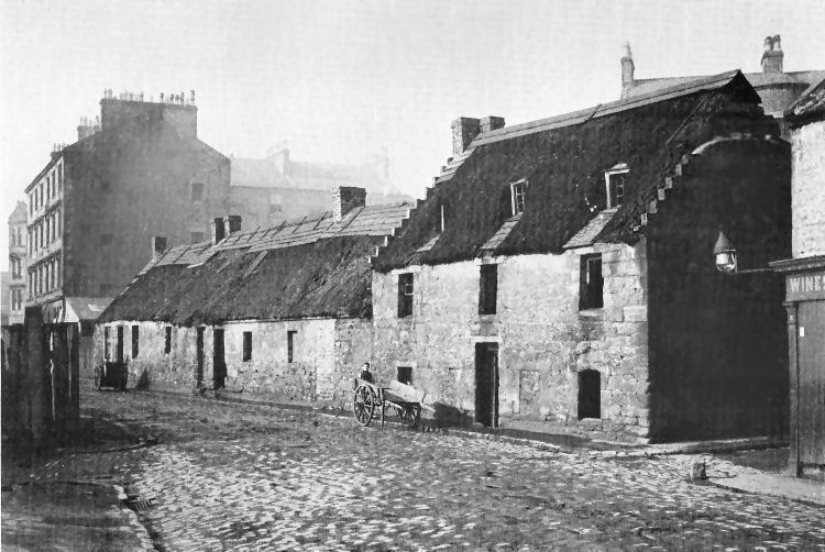
The Industrial Revolution and the arrival of steam power led to the mechanised deepening of the Clyde which changed the nature of Partick from a picturesque riverside village to a centre of heavy industry. Housing was required for the incoming workers employed in the new factories and shipyards and the old thatched cottages and workers rows were soon replaced by multi-storey tenements.
Old and new housing at Castlebank Street, Partick
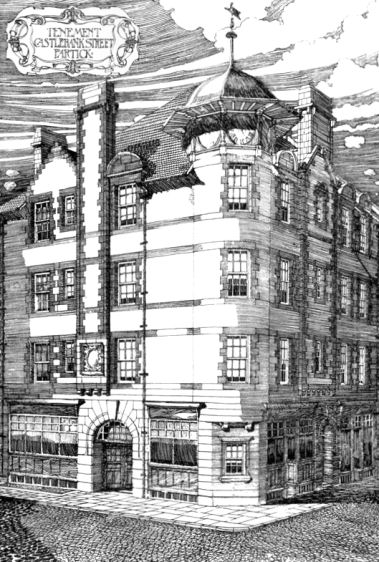
Drawing of tenement at Castlebank Street, Partick, exhibited 1896
Today not a single house of any description can be found in Castlebank Street.
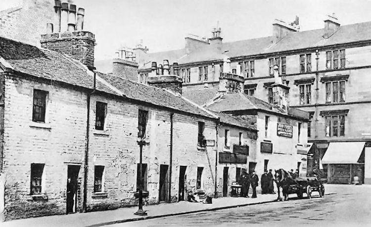
Old and new housing at Keith Street & Dumbarton Road, Partick
In the seventeenth century, the Clyde was unsuitable for shipping anywhere near the confluence of the two rivers at Partick.
There were six small islands on the Clyde between the Stockwell Bridge and the mouth of the Cart at Renfrew.
The rapid expansion of Partick's industry was based not on power from the rapidly flowing waters of the Kelvin, but on the previously languid flow of the Clyde, which had been continually deepened from the early 1820's by steam-powered dredgers built at Greenock and Port Glasgow. This dredging process soon provided deep-water shipping channels all the way to the harbour at the Broomielaw in the centre of Glasgow. By the 1840's the Clyde was deep and wide enough at Govan and Partick to provide for shipyards on both sides of the river, capable of building huge ocean-going vessels.
A fully illustrated history of the development of the upper reaches of the Clyde is included in my Clyde Ferries, Cluthas & Docks page.
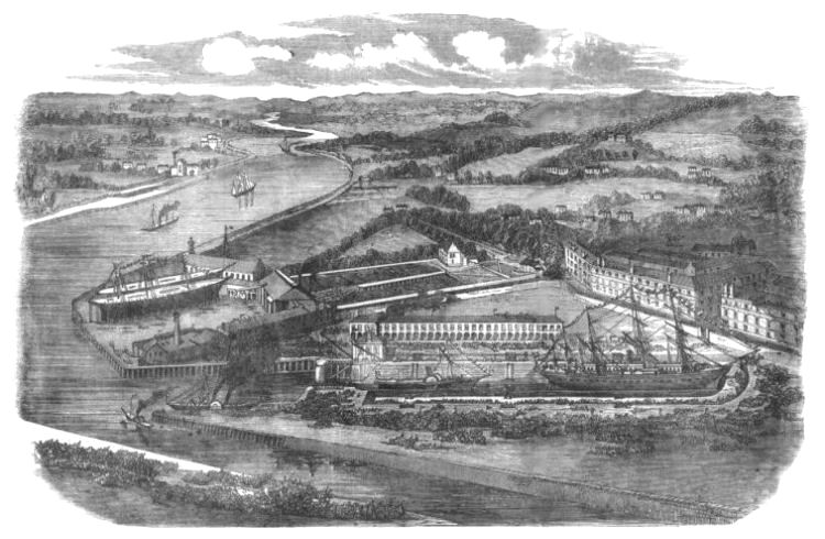
The nearest shipyard to the village of Partick was established by Tod and Macgregor at Meadowside on the west bank of the Kelvin at its junction with the Clyde. Meadowside Shipyard was first occupied at the end of 1846, when the firm transferred its business downstream from Mavisbank, on the opposite shore. Engraving of Meadowside Shipyard and Dry Dock, 1858
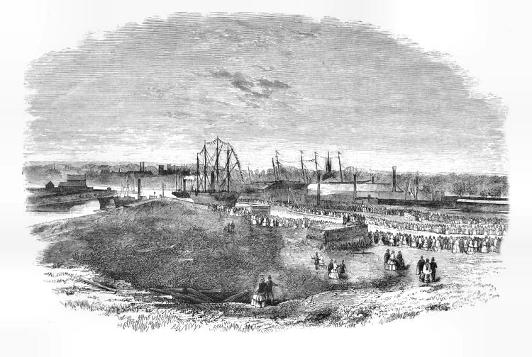
Opening ceremony of new Graving Dock, 28th January 1858
Meadowside Shipyard was closed in 1935 and the dry dock was in-filled in 1969, around the time the photograph below was taken.
View of Meadowside Granary and surrounding riverside from the late 1960's
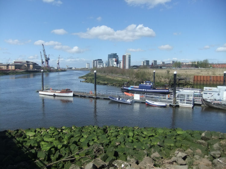
The massive Meadowside Granary was situated on the quayside to the west of the shipyard, on a site that was once home to Partick Thistle Football Club. The original granary building was built between 1911 and 1913 and a huge extension was added in 1936/1937 to create a thirty-four bay, thirteen-storey building. The granary closed in 1988 and was demolished in stages between 2002 and 2005. Some parts of the site have been redeveloped as “Glasgow Harbour”, where the multi-storey buildings are seen in the distance, below.
View of site of Meadowside Shipyard and Granary from eastern bank of the Kelvin
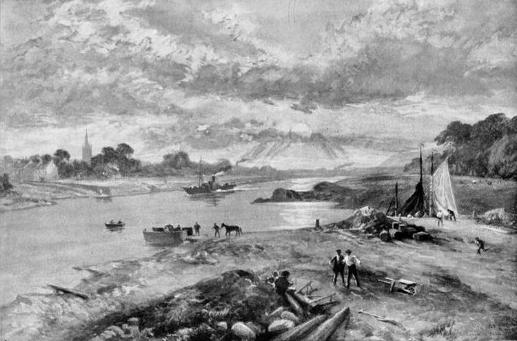
This view of the confluence of the Clyde and the Kelvin at Meadowside dates from the time immediately before the construction of the shipyard. View of Meadowside, Partick, before shipyard opened
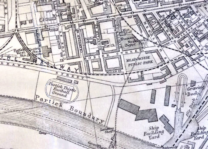
Map showing Partick Thistle's football ground at Meadowside (from 1897 to 1908)
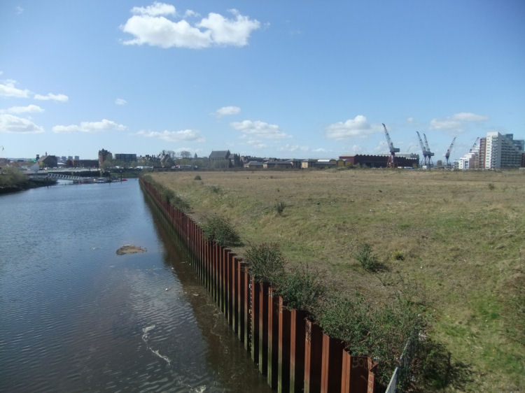
Derelict land at Meadowside on western bank of the Kelvin as it approaches the Clyde
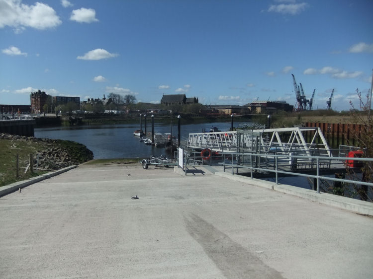
Slipway at confluence of Rivers Kelvin and Clyde
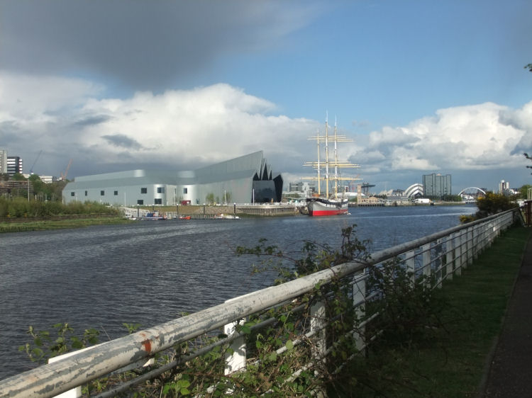
Glasgow's new Riverside Museum is situated on the east bank of the Kelvin at the confluence with the Clyde. The museum opened on 21st June 2011 at the site of the former A & J Inglis Shipyard.
The ultra-modernistic building was designed by architect Zaha Hadid, to fit in with all the other new structures which are appearing along the riverside. Confluence of the Kelvin and the Clyde viewed from Govan
Riverside Museum and SV Glenlee viewed from Govan
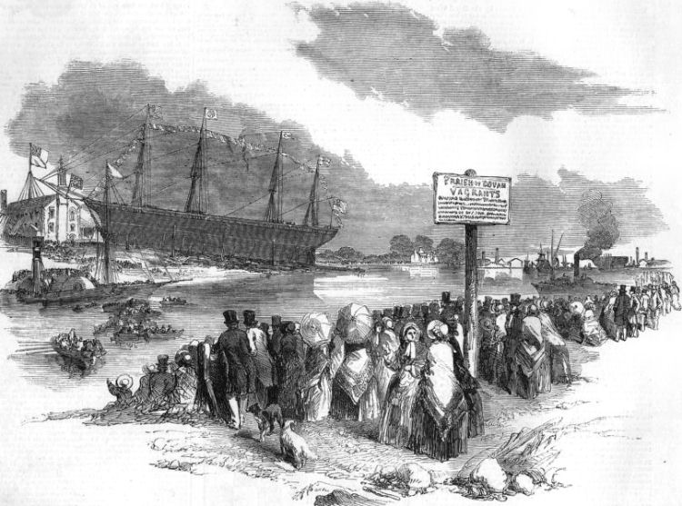
Launch of the steamship, SS Glasgow, at the mouth of the Kelvin in 1851, viewed from Govan
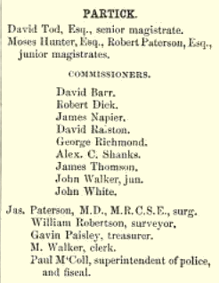
Partick became a Police Burgh in 1852, with the first council led by the senior magistrate, David Tod, who would become Partick's first provost.
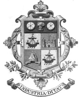
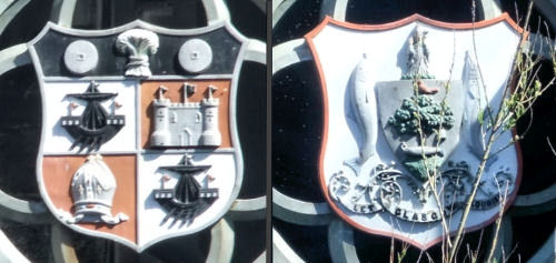
The Burgh of Partick had its own coat of arms reflecting the origins and history of the district. The first and fourth quarters featured longships, known in Scottish heraldry as "lymphads", which are commonly seen in arms from Argyll and the Western Isles. The second quarter had an image of Partick Castle and the third a Bishop's mitre. The coat of arms was topped with a wheatsheaf flanked by two millstones, reflecting Partick's industrial heritage. The Burgh's Latin motto "Industria Ditat" translates as “Industry Enriches” Coats of arms of Partick and Glasgow on Partick Bridge, Dumbarton Road
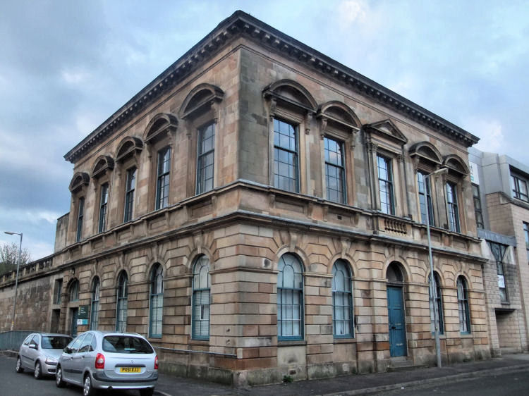
The former Partick Police Station and its associated courtrooms were built in 1853, shortly after Partick had become a Police Burgh. The building, which is situated at the corner of Anderson Street and Gullane Street, also provided the administrative chambers for the fledgling council until the Partick Burgh Hall was built in 1872. Partick Police Station
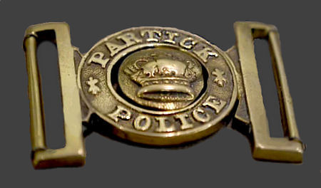
Partick Police Officer's badge
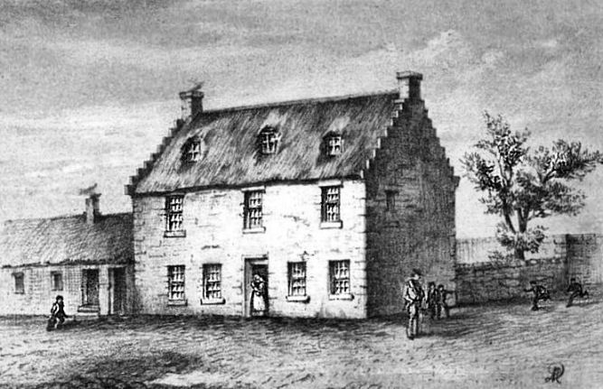
This sketch of the old Police Office in Partick shows a two-storey thatched house fronting Castlebank Street.
Old Police Office, Partick
Early 20th century view of Dowanhill Park
Dowanhill Park, 2014
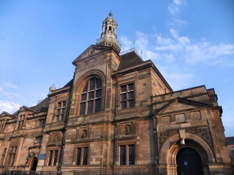
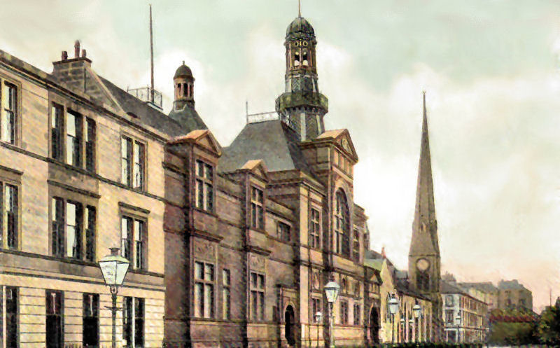
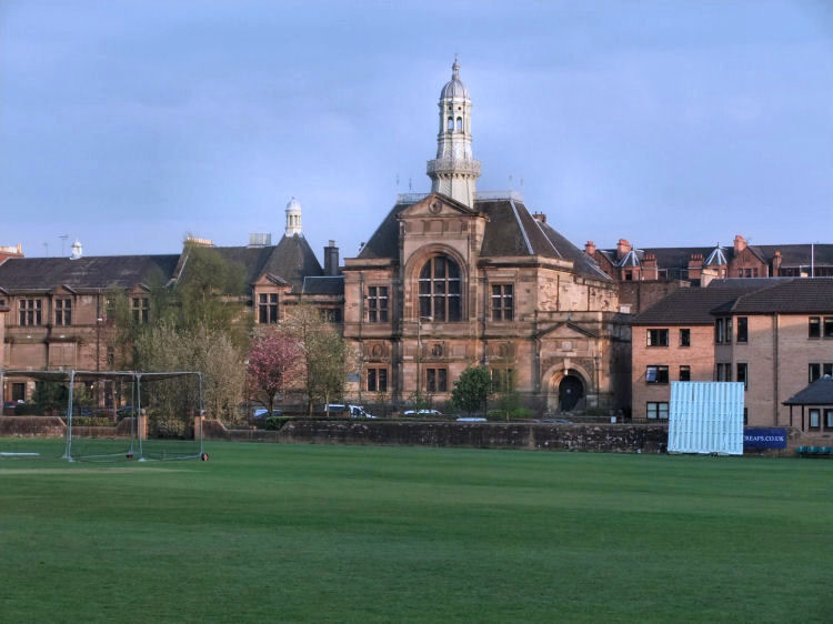
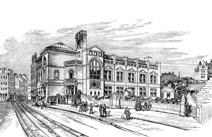
Partick Burgh Halls opened in 1872 on a site facing the West of Scotland Cricket Club's ground. The Halls were built to the designs of William Leiper in a distinctly Scottish version of the François I revival style which was popular at the time. Partick Burgh Hall
Old view of Partick Burgh Hall and adjacent St Mary's Church at the corner with Peel Street
The church has been replaced with the modern flats shown in the photograph below. A full description of St Mary's Established Church is included in the Dowanhill and Partick Churches
page of this website.
View of Partick Burgh Hall from the grounds of West of Scotland Cricket Club, Hamilton Crescent
The cricket ground was the venue for the world's first ever international football match, contested between Scotland and England on 30th November 1872.
The former Hamilton Crescent Junior Secondary School overlooks the West of Scotland Cricket Ground. In 1972 Hyndland Primary School was relocated to this building, which was designed by William Landless for the Govan Parish School Board in 1887.
Hamilton Crescent Junior Secondary School, now Hyndland Primary School
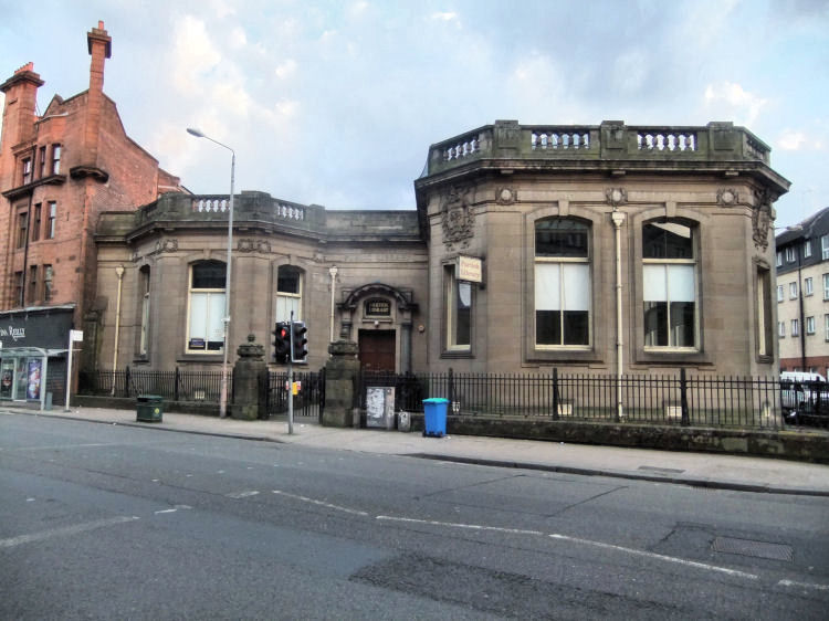
On 21st June 1902, Andrew Carnegie offered the Burgh of Partick Ł10,000 towards the cost of erecting its own library building. Carnegie's offer was declined because the Burgh Council could not agree to the imposition of one penny per pound charge on the ratepayers to pay for the books and to cover the running costs of the proposed library. Partick Public Library
Partick Public Library was built at Dumbarton Road to the designs of Thomas Somers of the Glasgow Office of Public Works. The single-storey sandstone building was positioned diagonally, off the line of the main road. The library is topped a balustraded parapet and has a protruding corner bay which features Glasgow's coat of arms on both sides.
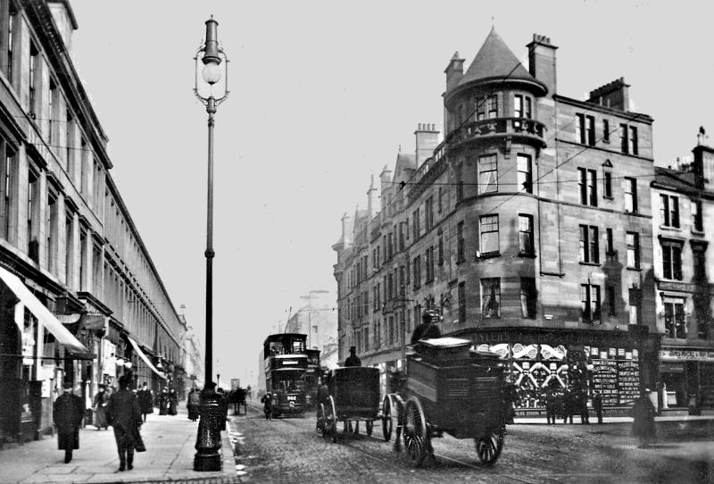
Long view of Dumbarton Road, Partick, 1910
Early twentieth century view of Dumbarton Road, Partick
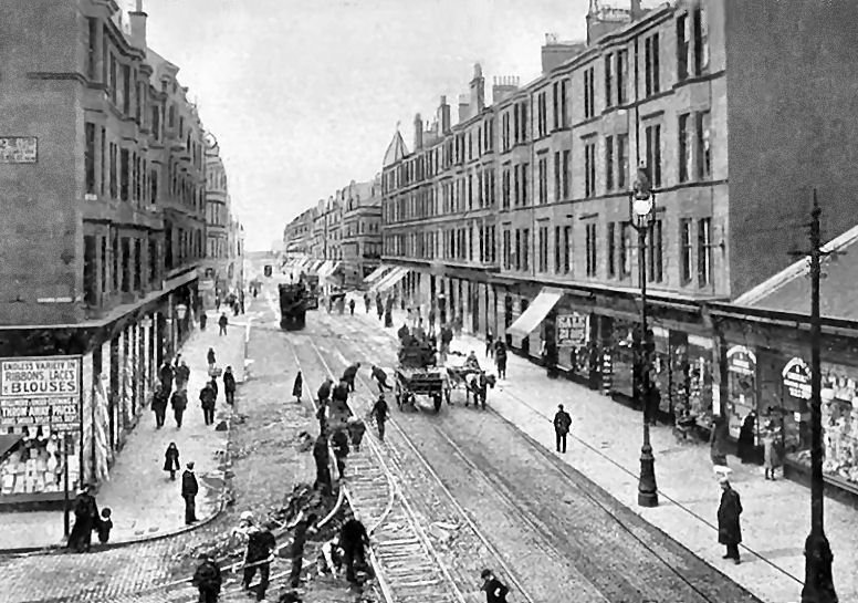
Navvies working on the tram lines at the corner of Dumbarton Road and Hayburn Street, Partick
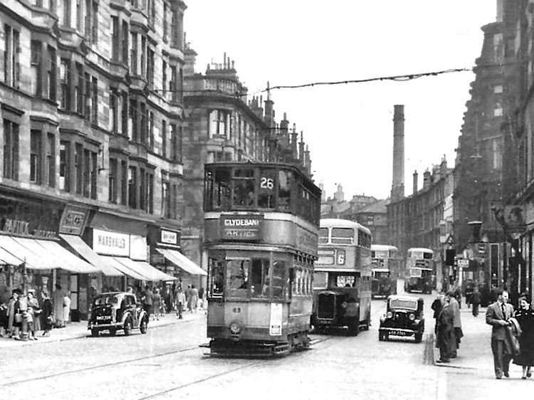
Trams and buses in 1950's view of Dumbarton Road, Partick
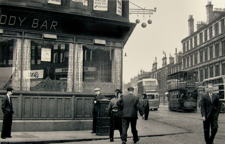
Street scene at Smiddy Bar, Purdon Street & Dumbarton Road, Partick
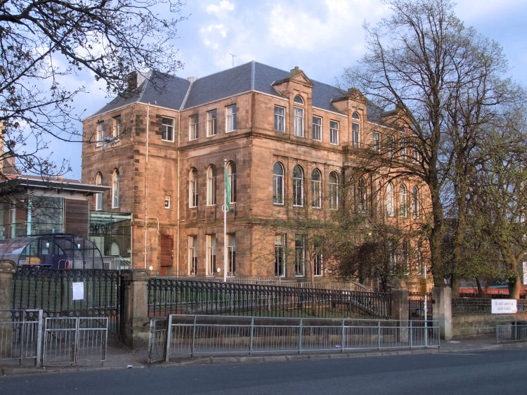
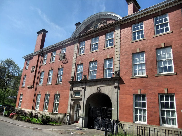
Anderson's College Medical School moved from the city centre to Dumbarton Road, Partick, in 1889 into a purpose-built institution designed by James Sellars and completed by John Keppie. The flamboyant Italianate block also features some Scots Renaissance elements in its design. The building later became known as Anderson College of Medicine and became part of Glasgow University in 1947.
Anderson's College, Partick
Architect's perspective drawing of Anderson's College, Partick
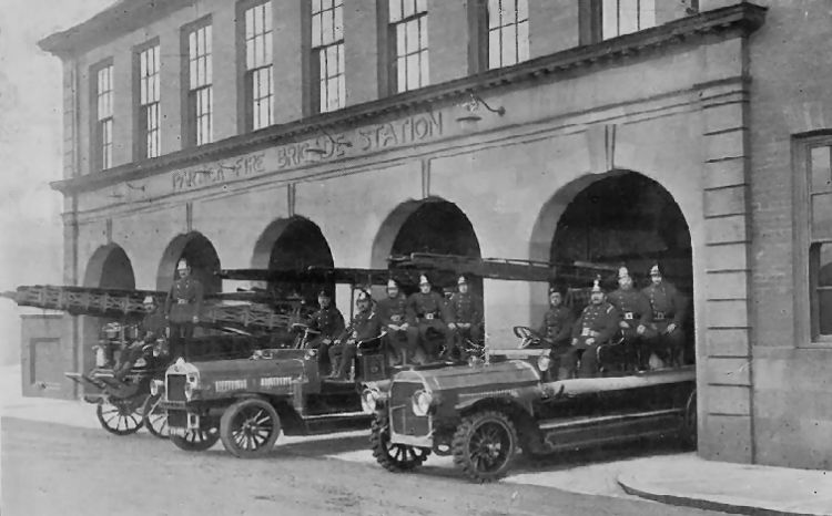
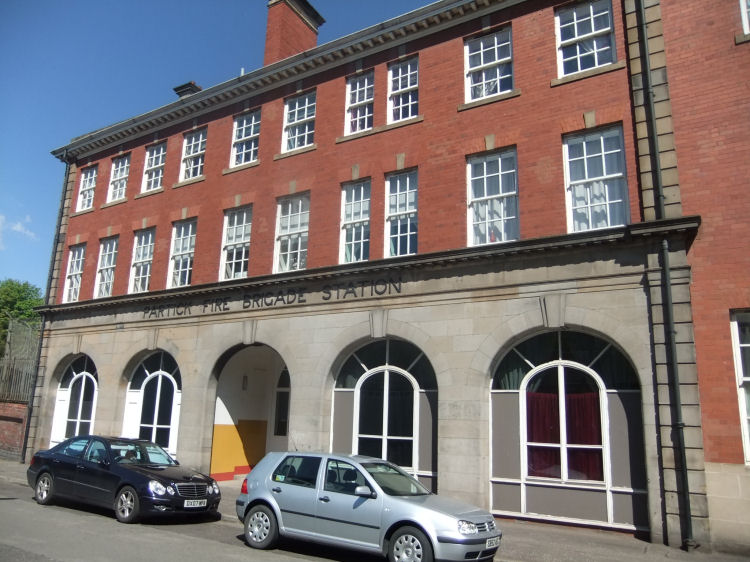
Partick's Fire Brigade and Cleansing Department shared the same block, constructed in 1905/1906 at the corner of Beith Street and Sandy Road. Firemen and engines at Partick Fire Station
The Fire Station in Beith Street was designed by James Miller and built with red brick finished with polished stone at ground level, where the openings for the fire engines are now an attractive glazed feature of the building.
Former Partick Fire Station
Partick Cleansing Department's offices and depot were situated in Sandy Road, round the corner from the fire station. The offices were designed by John Bryce, Burgh Surveyor, and built with red brick to match the remainder of the block.
Former offices at Partick Cleansing Department
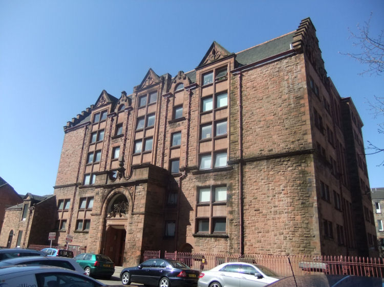
Stewartville Public School was built by the Govan Parish School Board in 1891 in response to the rapid increase in population of the Burgh of Partick at the time. Stewartville Public School, latterly St Peter's Boys School
Stewartville Street was built in the Renaissance style with rock-faced red sandstone. The façade features a series of Dutch gables which is a rather unusual feature for the conservatively minded school boards of the period. The centre of the block is dominated by a large porch with the year of construction, 1890, carved over the entrance. There are crow-stepped gables at both ends of the building.
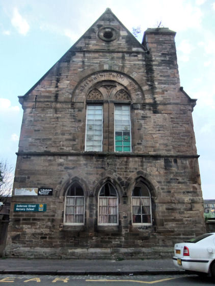
Anderson Street Nursery School was originally known as Partick Free Church School, built in 1846 next to the church and halls. It became Anderson Street School in 1874 after ownership was transferred to the Govan Parish School Board, who added an upper floor with the school's new title engraved on the gable. In 1891 the pupils were transferred to the newly opened Stewartville Public School. The building at Anderson Street was used for various purposes until 1940 when it became a nursery school.
Anderson Street School, Partick
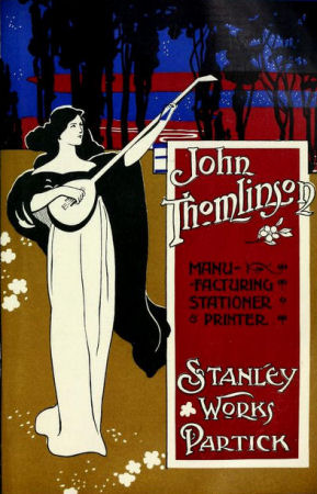
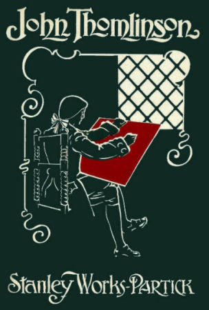
Art Nouveau posters from 1901, advertising Stanley Printing Works, Partick
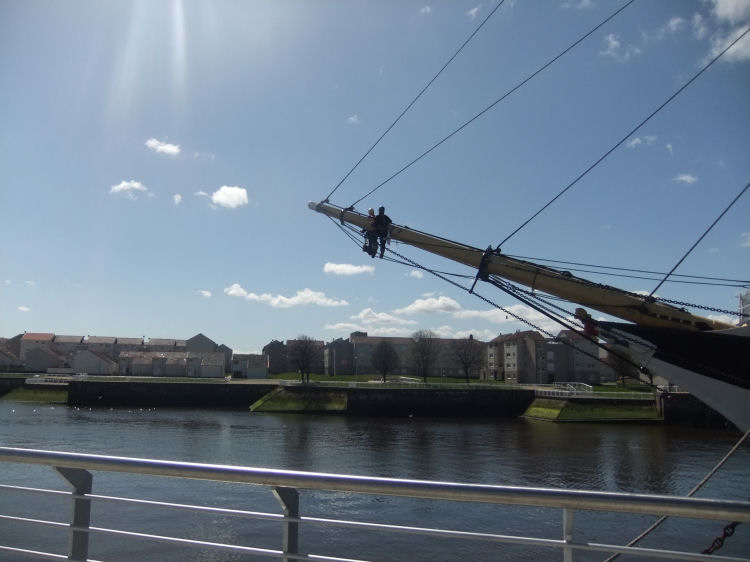
Painters on bowsprit of tall ship on River Clyde
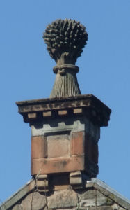
Sculpted wheatsheaf on gable of old mill in Partick
The gift also included the revenues of several churches, including those of Govan and Renfrew.
Merkland Farmhouse was built from the rubble of the castle in 1783, but only remained habitable for sixty years.
The oak timbers of the castle fared better than the crumbling masonry after they were salvaged for use elsewhere.
The building continued to deteriorate into a state to ruination until 1836/1837, when the last remnants of the archaic structure were removed to form dykes in the neighbouring fields.
The lowest mill on the map is the Partick Slit Mill, situated on the opposite bank to the castle. This mill mass-produced ironware with machinery powered by eight large waterwheels.
In 1664 the bakers erected a new mill on the site of the Bishop's mill, which in conjunction with the nearby Town's mill served the needs of the city's constantly expanding population. Demand for bread was high and in 1771, the bakers acquired the malt and snuff mills at Clayslap for use in the milling of flour. Later, the old Slit Mill was adapted to become yet another flour mill, although it retained its original name.


Goods transported to and from Glasgow passed through the harbour at Port Glasgow on the Firth of Clyde, which had been developed for the city in 1688.
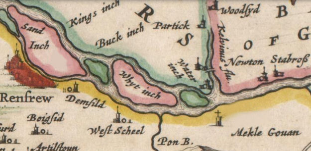
The map below, from around the same time as the establishment of the harbour at Port Glasgow, shows that the Clyde at Partick was very shallow with many fords and bars consisting of sand, silt, gravel and boulders.
The little islands formed on the river were known as “inches”, which are still remembered in some local place names.
(1) Opposite Carlton Place, (2) Water Inch, at the mouth of the Kelvin, (3) White Inch, from which the suburb
takes its name, (4) Buck Inch, a little lower down, (5) King's Inch, on which stood Renfrew Castle, (6) Sand Inch, at Renfrew.
A dry dock and additional quay were later constructions, celebrated with an opening ceremony on 28th January 1858. The engraving below shows the situation shorty after the provison of these extra facilities.
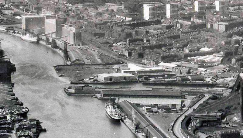
Remarkably it looks very much like the position today, shown in the photograph above, almost as if the shipyards had never existed!
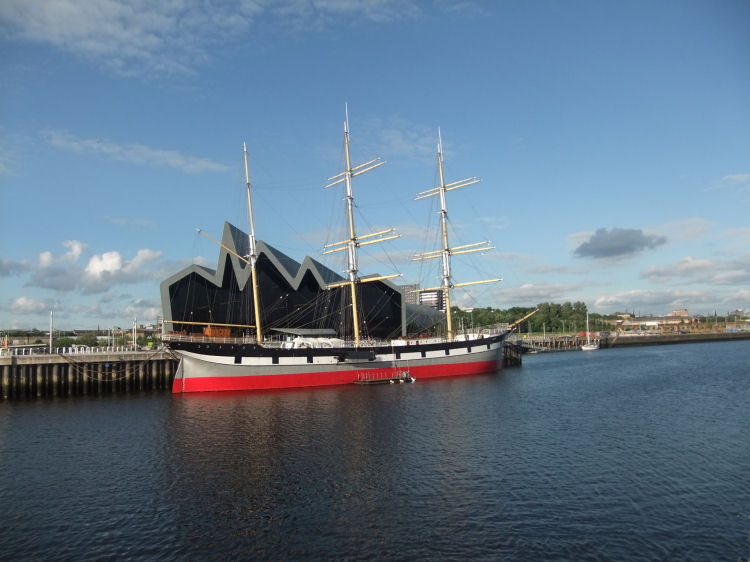
The Tall Ship SV Glenlee is a major attraction for visitors to the Riverside Museum.
A public meeting took place on 4th August 1852 to elect commissioners and appoint magistrates to establish the new burgh. The twelve members of the council listed above first met on 9th August 1852 in a meeting convened to set up the burgh's institutions. The names of the first public officials appointed by the council are also shown in the notice below.
The Viking symbolism of the longships probably reflects the time when the area was occupied by the Norsemen from around the middle of the ninth century. The church at Govan on the opposite shore has remnants of Scandinavian burial stones and other artifacts from this era.
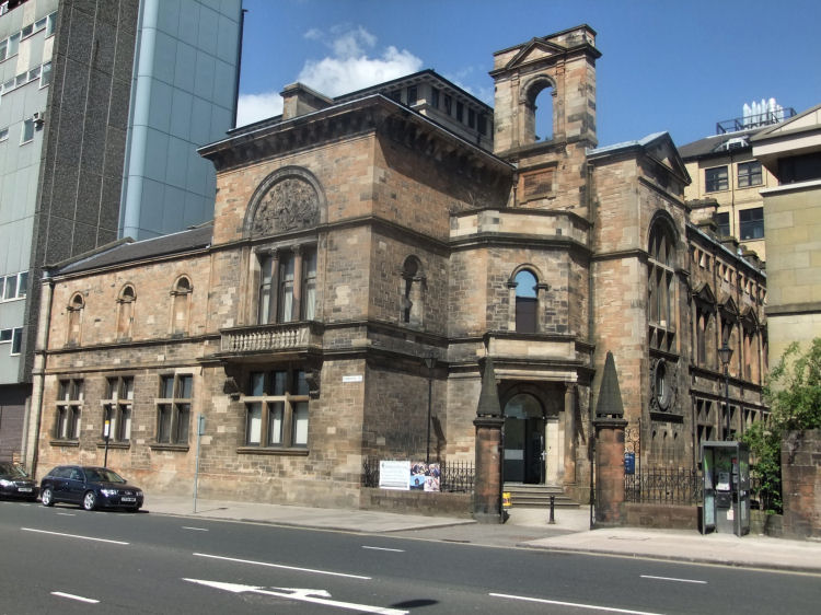
The square-shaped corniced block was designed by Charles Wilson in the 19th century version of the Palazzo style, which was derived from the architecture of the Italian Renaissance. It is currently used as a resource centre for sensory impaired people.

There are three sculpted relief panels above the ground-floor windows carved by John Mossman, representing Compassion, Truth and Justice.
Hamilton Crescent was renamed as Fortrose Street in 1931, but the old name was retained for the cricket ground.
Glasgow had accepted an offer from Carnegie a year earlier and developed a system of grand district libraries for the city.
The residents of Partick had to wait until 1935 to have their own branch library in the Glasgow system, shown below.

At the rear of the block, at Meadow Road, the remnants of electrical plant are still in place from the time when there was a small generating station on the site. This had been built in 1902 by Partick Burgh and closed by Glasgow Corporation in 1920. Refuse from the Cleansing Depot was burned to provide some of the heat for the boilers.
The block was converted to form 23 flats in 1988 by architects, Simister Monaghan & McKinney.
The Glasgow Herald of 25th November 1891 reported on the opening ceremony of the school the previous evening carried out by Mr J. Parker Smith MP. The chairman of the board, Rev. Dr Bremner told the gathering that between the censuses of 1881 and 1891 the burgh's population had risen from 27,396 to 36,538, equal to an increase of over a third.
After the First World War the school became an annexe to the overcrowded St Peter's R.C. School, which had already been extended in 1912 at Chancellor Street, round the corner from St Peter's Church.
The most famous former pupil of St Peter's is the comedian Billy Connolly.
Stewartville Street was converted into 46 flats in 1986 by architects Colin Robertson, Graham and Partners.
![]()
 | |
|
|
|
|
|
|
|
| |
|
| |
|
|
|
|
|
|
|
|
All original artwork, photography and text © Gerald Blaikie
Unauthorised reproduction of any image on this website is not permitted.
