
North Kelvinside originated as a small mid-Victorian suburb developed on land previously occupied by manor-houses and working mills situated on the north bank of the River Kelvin in Glasgow’s west end.
The district was bounded to the north by the Forth and Clyde Canal and to the south by the River Kelvin.
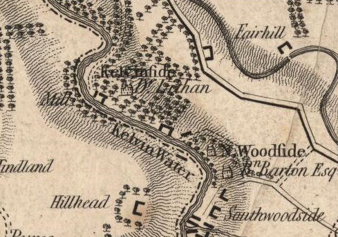
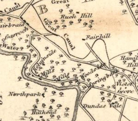
The map below dates from 1795, long before development had commenced on this part of the river. It shows the large houses on the north bank: Kelvinside House, occupied by Dr Thomas Lithan and North Woodside House occupied by Mr Benjamin Barton.
The manor houses and their grounds covered the section of the river which currently lies between Botanic Crescent and Belmont Street.
1795 map showing Kelvinside House and North Woodside House
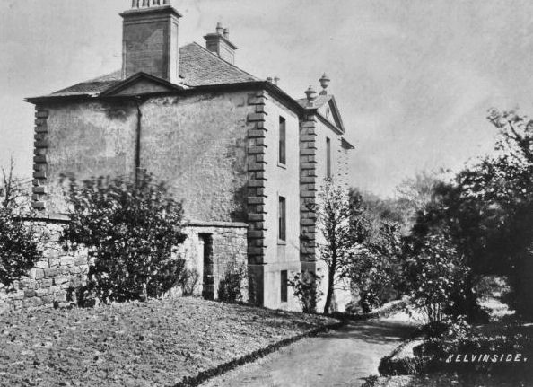
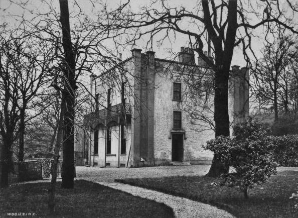
Dr. Thomas Lithan had acquired Kelvinside House and the surrounding estate in 1785. Ownership passed on to his widow after his death in 1807. Kelvinside House
The new suburb was originally referred to as "Kelvinside", a name which is now used for a completely different neighbourhood in the west end.
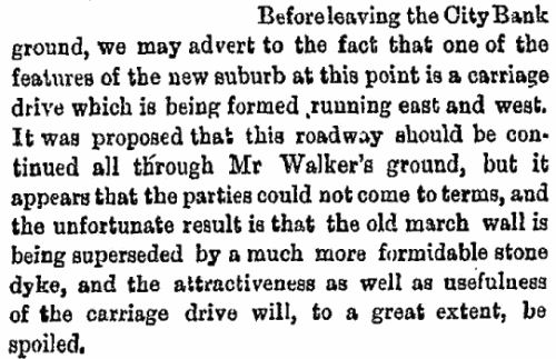
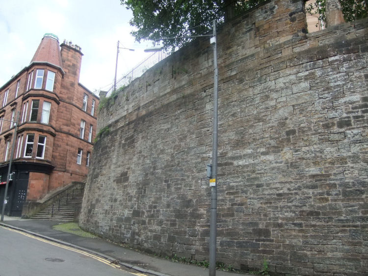
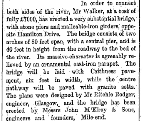
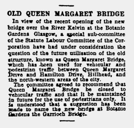
On 11th October 1869 the Glasgow Herald commented on the erection by Mr Walker of a "formidable stone dyke" on the northern side of his new Queen Margaret Bridge which was also under construction at the time. This massive barrier was intended to replace the existing march (or boundary) wall between the two estates.
Reference to retaining wall from Glasgow Herald, 11th October 1869
The "formidable stone dyke" at Queen Margaret Road, built at the same time as Walker's bridge
Commercial advantage, rather than any aesthetic considerations was the main factor in Walker's erection of this barricade, designed to spoil access to any parts of the new suburb not situated on his land.
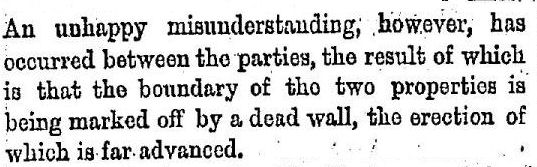
The Glasgow Herald of 20th October 1870 reported on the animosity, describing the situation as an “unhappy misunderstanding”.
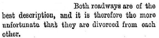
Commenting on the two roads at different levels, the same paper remarked that "Both roadways are of the best description, and it is therefore the more unfortunate that they are divorced from each other"
References to the wall and disconnected roads from Glasgow Herald, 20th October 1870
The above map from 1822 shows that at that time there was a single road connecting Kelvinside House with North Woodside House and other areas on the north bank of the Kelvin. There was never any need for two roads at different levels separated by an unnecessary wall and stairway. View of River Kelvin and houses at North Woodside, connected by a level road
This sketch of the houses at North Woodside was prepared by Andrew McGeorge of the Regality Club, who visited both houses shortly before their demolition.
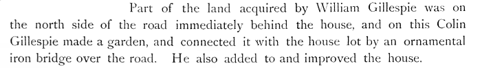
John E. Walker had strategically acquired the site of the Italianate villa which had been built by William Gillespie and his son Colin around 1802. This long narrow plot had been detached from the "land of old extent of Northwoodside" in 1771, when it was purchased by William Fleming. Villa built by William Gillespie on riverbank between Kelvinside House and North Woodside Estate
Extract from a report by Andrew MacGeorge of the Regality Club and map of Gillespie's house at North Woodside
Confusingly, the map above and other published sources refer to both Gillespie's villa and Benjamin Barton's mansion as "North Woodside House", hence the contradictory reports regarding ownership and dates.
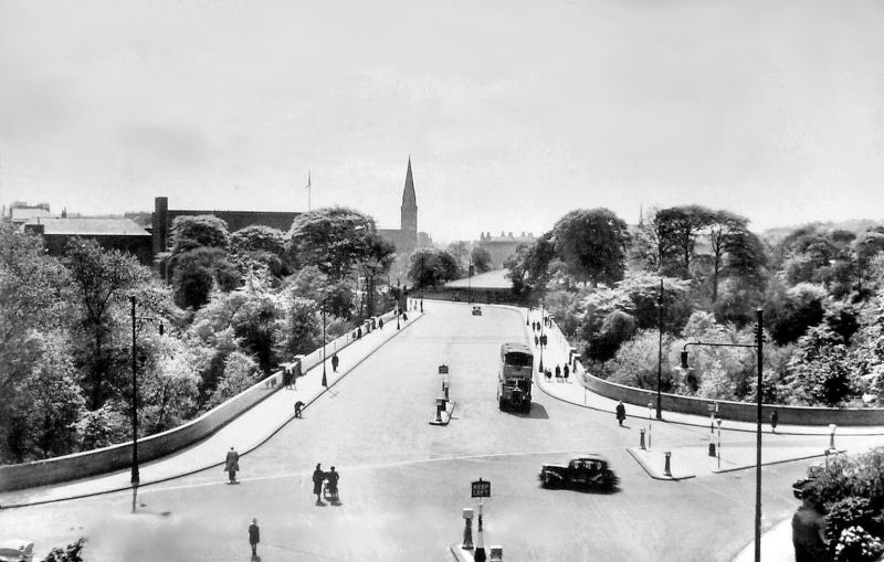
Both Mr Walker and the City of Glasgow Bank erected bridges across the Kelvin to provide access from Great Western Road to their parts of the neighbourhood. These bridges were completed in 1870.
Near the site of North Woodside House, the City of Glasgow Bank erected Belmont Bridge, which linked their disconnected lands consisting of 16 acres on the north bank and 12 acres on the south bank, shown in Andrew MacGeorge's sketch.
The original Queen Margaret Bridge was erected by Mr Walker, who owned 100 acres to the west of the site including the grounds of Kelvinside House.
He also had a long narrow strip of land along the riverbank, much of which is now part of the Kelvin Walkway. View from top of Mr Walker's "dead wall" of the first Queen Margaret Bridge, which was dismantled in 1971
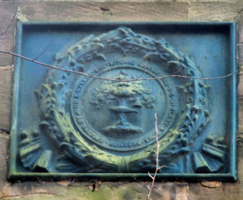
Mr Walker commissioned the construction of the bridge and the massive retaining wall at its northern end. He appointed local civil engineer, Mr Ritchie Rodger, to design and co-ordinate the construction of the bridge and the wall, which were both erected in 1869-1870. The cast iron bridge, supported by substantial stone piers, was constructed by John McElroy & Sons, builders and founders. Extract from Glasgow Herald, 20th October 1870 and plaque with Glasgow's coat of arms attached to bridge.
The plaque reads "Erected by John E. Walker Esq - Ritchie Rodger Esq C.E. - J. McElroy & Sons, Builders
Ritchie Rodger lived locally at 194 Dumbarton Road, Partick. His civil engineering practice operated from 37 West George Street in the city centre.
The original Queen Margaret Bridge was designed in a rather primitive style as a trabeated structure requiring huge vertical supports to carry a relatively narrow roadway. Trabeated bridges constructed with traditional materials are suitable only for very short spans and require supporting masonry on a massive scale reminiscent of megalithic construction.
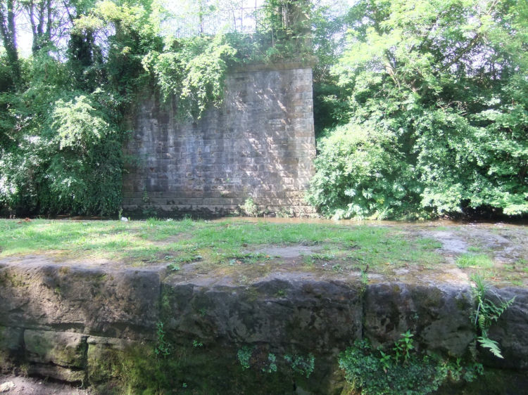
The stunted remains of the central pier, shown in the foreground (below) demonstrates the thickness of the stonework specified by Ritchie Rodger for Walker's civil engineering works. The bridge's south pier in the background was left intact and is still standing. South pier and stub of central pier of the original Queen Margaret Bridge
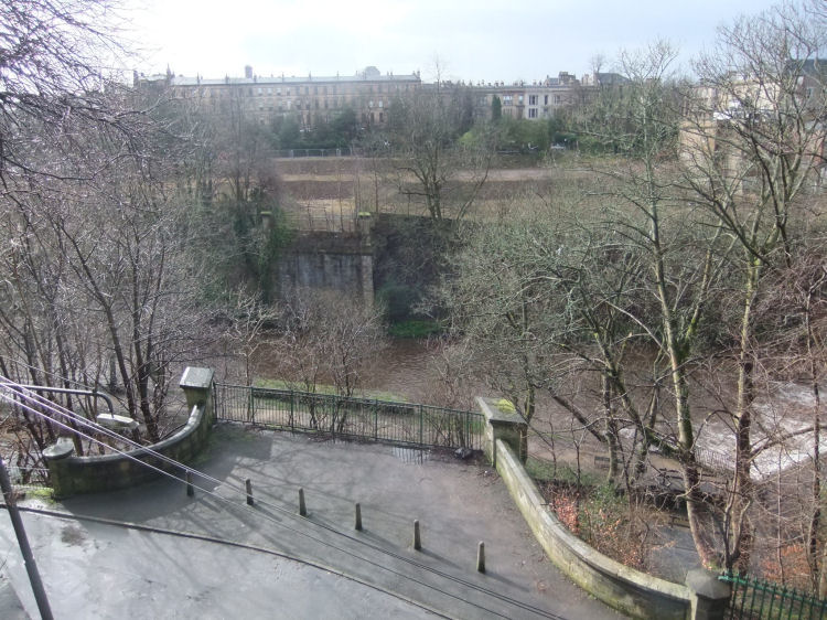
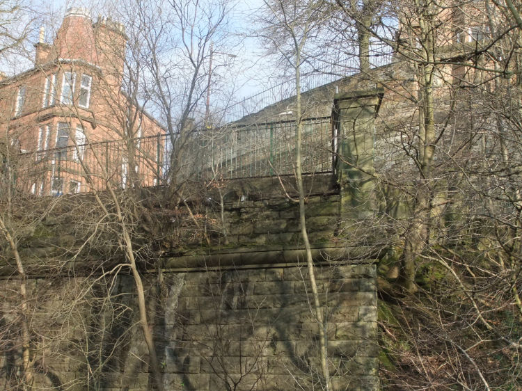
Walker's bridge was situated to the east of the present day Queen Margaret Bridge and terminated at his unsightly fortification which had been put up in order to provide an impenetrable barrier between his land and that of the City of Glasgow Bank. Redundant north pier of Walker's bridge with the retaining wall behind
The original Queen Margaret Bridge, was in an awkward position, crossing low over the river and ending abruptly at the wall. It was replaced by the present bridge in 1929.
The construction of a replacement bridge across the Kelvin at Queen Margaret Drive was sanctioned by Glasgow Corporation on 12th August 1926, with the placing of a contract for Ł73,000. The Parliamentary powers to build the bridge at this site had been obtained as far back as 1914.
In contrast to the original trabeated bridge with its massive stone supports the new Queen Margaret Bridge was constructed with the aid of reinforced concrete as a single arched span capable of carrying the wide new carriageway of Queen Margaret Drive over the Kelvin. Extract from Glasgow Herald, 14th September 1929 regarding closure of original Queen Margaret Bridge, Glasgow
The new bridge retained the name of "Queen Margaret Bridge", rather than the suggested "Garrioch Bridge" in the above article.
Walker's bridge was made redundant with the erection of the new bridge crossing high above the Kelvin at a sensible level which allowed ready access from Byres Road to the all the suburbs in the north-west of the city.
Newly opened Queen Margaret Bridge showing bus heading from Great Western Road towards Maryhill
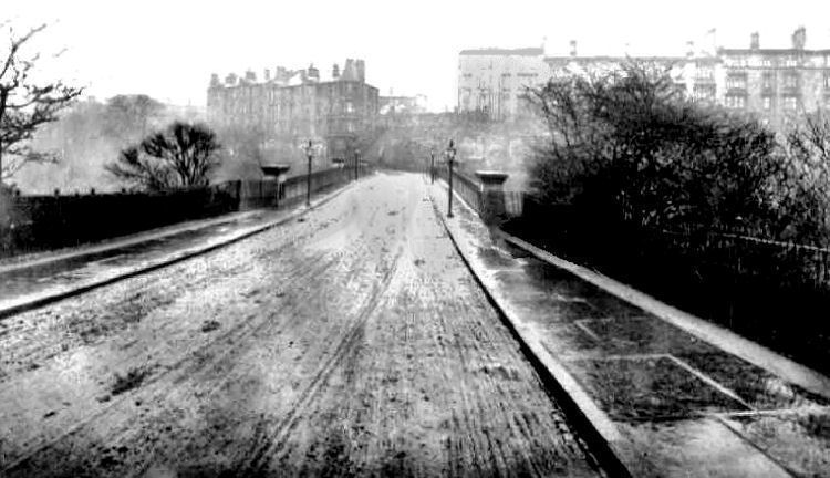
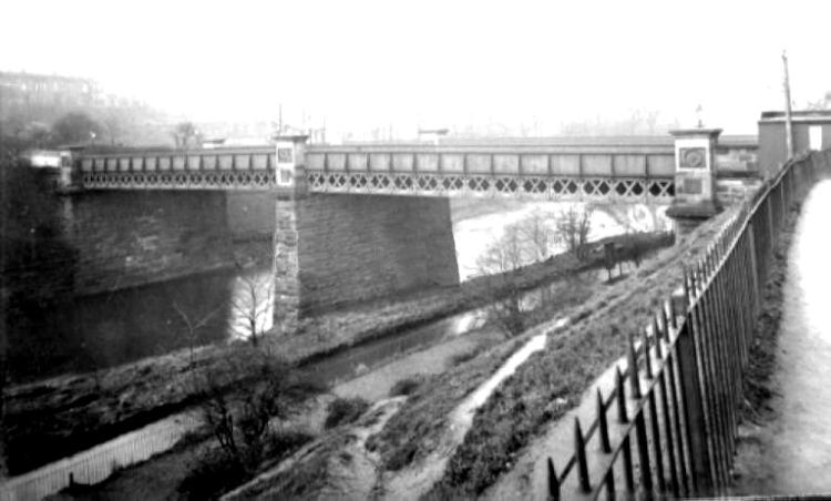
Early twentieth century view of Walker's bridge
This early twentieth century rainy view from the south side of the original bridge shows red sandstone tenements on Walker's land to the left, on the same level as the crossing. His rival's earlier development can be seen to the right, sitting high above the dead wall with no easy access from the bridge.
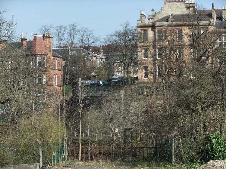
The present day photograph shown below demonstrates the scale of the access problem.
Modern view of Walker's bridge from the south, approaching his huge obstruction
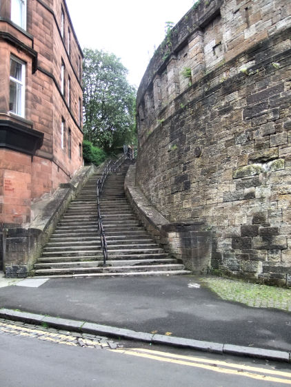
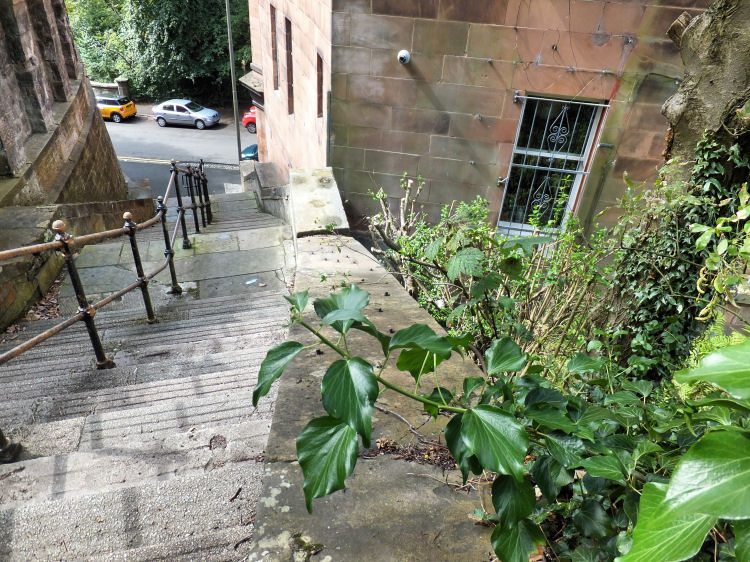
Walker was a coach proprietor and wanted to maximise the benefits of the new carriageways to suit the development of his part of the site. He deliberately made it as difficult as possible for horse drawn traffic crossing his bridge to access his rival’s land, which could only be reached on foot by climbing a very steep set of stairs at the western edge of the wall. View from the bridge of retaining wall, stairway, and later red sandstone tenement
A modern plaque has been attached to the retaining wall attributing it to Alexander "Greek" Thomson, 1872, labelling the adjacent stairway as the "Sixty Steps".
The staircase appears to have been a free standing structure tagged on to the end of Walker's wall. The flat area of land to the west of the wall and the steps was left undeveloped until the red sandstone tenement was built at the foot of the stairway around 1900. This was long after Walker's death in September 1875. Looking down the edge of the stairway, which was tagged onto the side of the wall
Having successfully isolated and secured very limited access to his rivals' land, Walker was in no hurry to commence development on his own part of the site, preferring the area around Kelvinside House to the west of Queen Margaret Drive, where plots were offered for sale through his preferred architects of the time, Messrs Haig & Low of 94 West Regent Street, Glasgow.
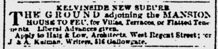
The notice, below, from the Glasgow Herald, 20th May 1872, offers land for feuing for villas, terraces and tenements in what was then described as "Kelvinside New Suburb". Notice for sale of land at Kelvinside House from Glasgow Herald, 20th May 1872
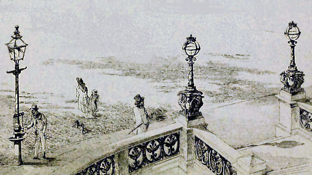
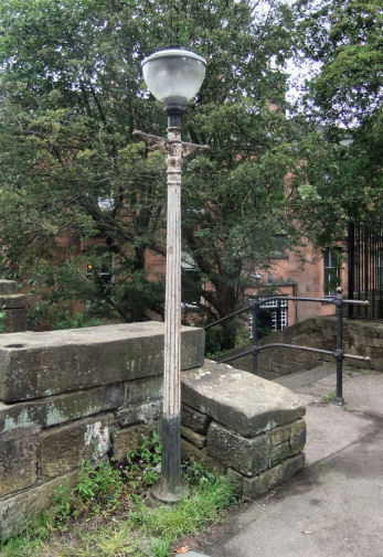
To embellish the bridge and the stairs Walker and his engineer, Ritchie Rodger, would have been able to select ornamental ironwork from Walter Macfarlane's catalogue, which conveniently showed a street scene with a stone staircase. The chosen lamp standards and railings were manufactured a few miles away at Macfarlane's Saracen Foundry in Possilpark, from where the products featured in their catalogue were exported all over the world.
Street scene from Macfarlane's Catalogue showing proposed use of ornamental ironwork at staircase.
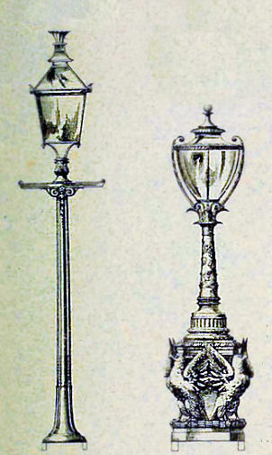
Lamp standards from Macfarlane's catalogue and surviving cast iron lamp post
Most of the original cast iron fittings were removed during World War II to provide materials for the war effort. The lamp standard at the top of the stairs is the only surviving piece, albeit with a replacement light fitting.
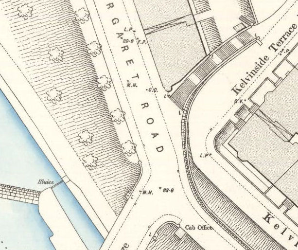
Mr Walker strategically placed his cab office at the entrance to the bridge facing the steps. Residents wishing to leave the top level, on the City of Glasgow Bank's development, were enticed to use the stairway down to the bridge where they could hire one of Walker's hansom cabs. Map showing cab office at Queen Margaret Bridge and nearby stairway.
View of Mr Walker's cab office at the northern approach to his bridge.
The split of the two roads with the carriageway to the right leading up to the top of the retaining wall.
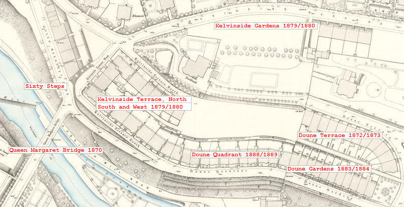
The map below dates from 1894. Contemporary Post Office Directories have been used to add details of the stages of development of the City of Glasgow Bank's land from the Belmont Bridge to the Queen Margaret Bridge.
1894 map showing the various stages of development from 1872 to 1889.
This earlier map was surveyed before the City of Glasgow Bank's development of the area to the south of Kelvinside Gardens. It shows Walker's "bridge to nowhere" ending abruptly at open space in the strip of land he owned along the riverside.
Map surveyed before roads and obstructions were completed at the northern side of Walker's bridge
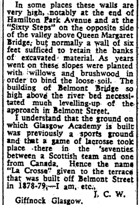
Letter from Glasgow Herald 28th February 1961 regarding retaining walls at River Kelvin
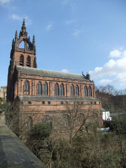
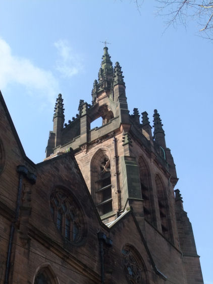
On north side of Belmont Bridge, Kelvin Stevenson Memorial Church, designed by J.J. Stevenson and opened in 1902
North Woodside House stood on the north bank of the River Kelvin near the site of the bridge at Belmont Street and Kelvin Stevenson Memorial Church, above.
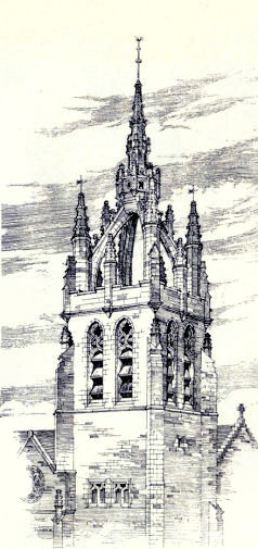
Drawing of tower of Kelvin Stevenson Memorial Church, Belmont Bridge
John. J. Stevenson's drawing of the tower of Kelvin Stevenson Memorial Church, above, was displayed at the annual exhibition of the Royal Glasgow Institute of the Fine Arts in 1900.
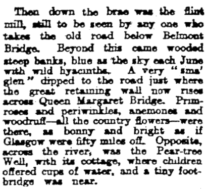
This reminiscence of the pre-development riverbank between the Belmont Bridge and the Queen Margaret Bridge gives a romanticised description of the scenery "where the great retaining wall now rises across Queen Margaret Bridge". It presents a beautiful portrait of a stretch of the riverside previously composed of wooded banks awash with wild flowers, sadly superseded by the vertical face of the dead wall.
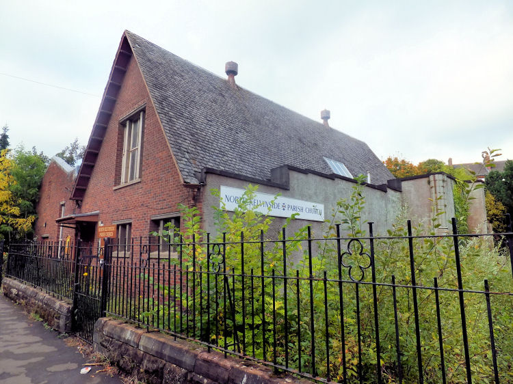
North Kelvinside Parish Church, at the corner of Queen Margaret Drive and Kelbourne Street, opened as Kelvinside U.P. Church in 1896. It was built with rock faced red sandstone in the Late Decorated Gothic style to the designs of the architect, John Bennie Wilson. North Kelvinside Parish Church, Queen Margaret Drive
Kelvinside U.P. Church was established on 3rd September 1893 in the original church hall with an opening ceremony conducted by Rev. Dr. Black of Wellington U.P. Church. The hall was designed in the early English Gothic style by Alexander Petrie and operated as a 'preaching station' under the charge of Rev. John Young, Home Mission Secretary, until July 1894 when Rev. Alex Whyte was inducted as the congregation's first minister.
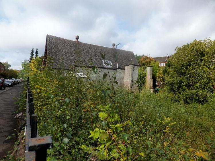
The ground is still so unstable that no alternative use has been found for the site of the church which has returned to the wild.
Overgrown derelict site of North Kelvinside Parish Church, Queen Margaret Drive
The red brick church hall in Kelbourne Street, erected in the 1960's, now serves the congregation of North Kelvinside Parish Church
North Kelvinside Church, Kelbourne Street
At the western edges of the new suburb, on the land attached to Kelvinside House which was in the sole ownership of John E. Walker, there was no need for any civil engineering works before development could proceed.
In 1872, the area to the west of the newly constructed Queen Margaret Bridge, surrounding Kelvinside House, was made available for development.
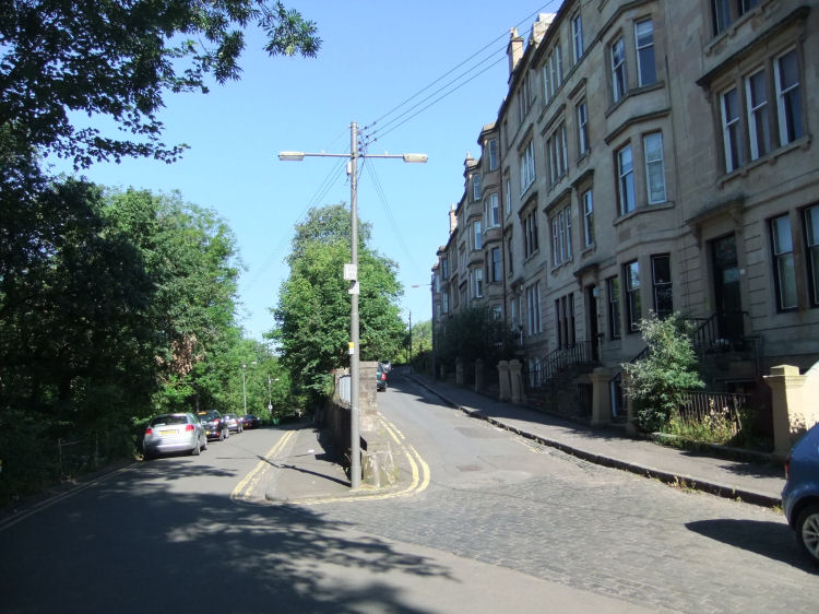
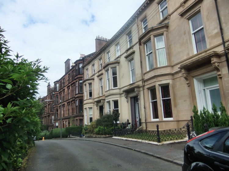
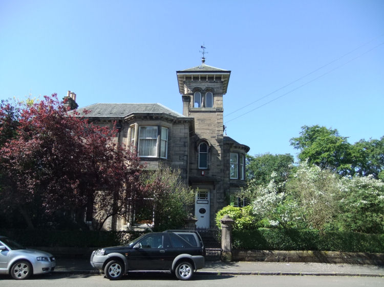
View of Botanic Crescent showing original 1870's terrace and later tenements, built after the demolition of Kelvinside House
Botanic Crescent was originally titled Derby Crescent.
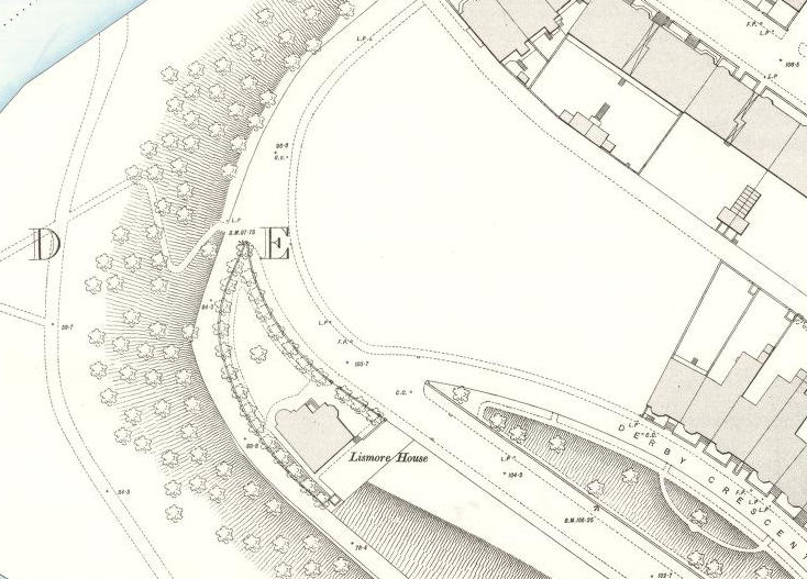
The map below shows the situation in 1894, after the initial development in the 1870's and the later demolition of Kelvinside House. The red sandstone tenements shown in the above photograph were built on the cleared site around the turn of the century.
Map from 1894 showing vacant site of Kelvinside House before red sandstone tenements were built
Lismore House, shown in the above map, is a Victorian Villa in the original North Kelvinside suburb
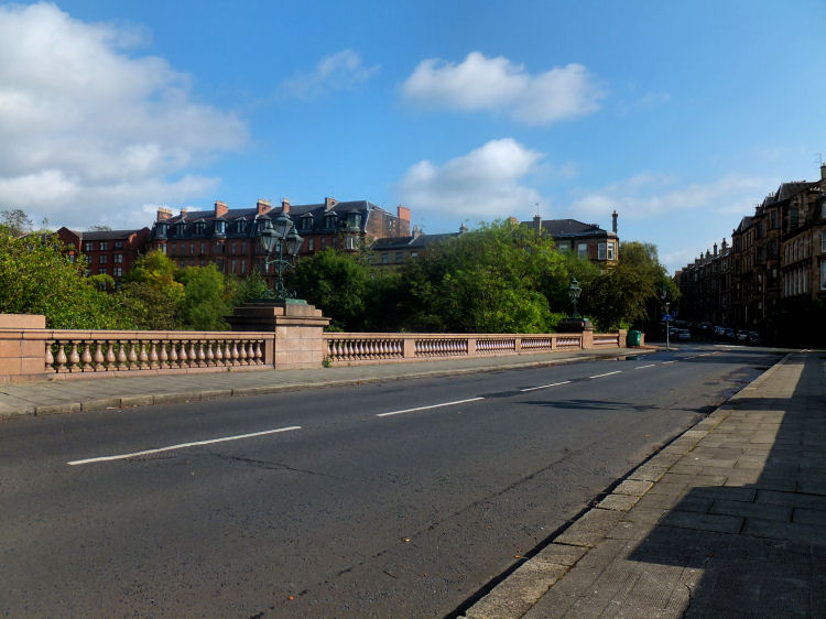
The Kirklee Bridge at the western extremity of Clouston Street was opened in 1900, connecting North Kelvinside with the later suburb of Kelvinside, which was still in the process of development after the land had been annexed by the city in 1891. The acquisition of this territory allowed Glasgow Corporation to extend the Botanic Gardens into what had previously been the landward side of the river.
Extract from Glasgow Herald, 18th January 1900, regarding the Kirklee Bridge
View of North Kelvinside from Kirklee Bridge
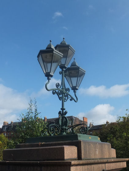
The cast iron decoration on the Kirklee Bridge fared better than that on the original Queen Margaret Bridge and surrounding civil engineering works. Thankfully the magnificent lamps shown below were not removed at the time when the ironwork at the Sixty Steps was being scrapped.
Ornamental cast iron lamps on Kirklee Bridge
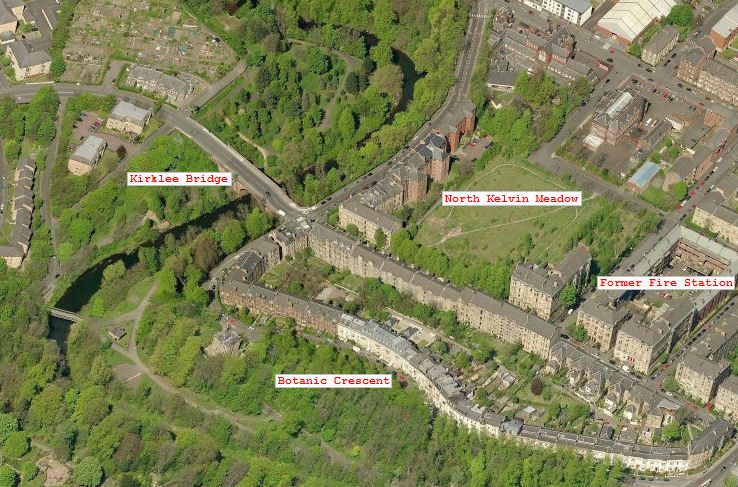
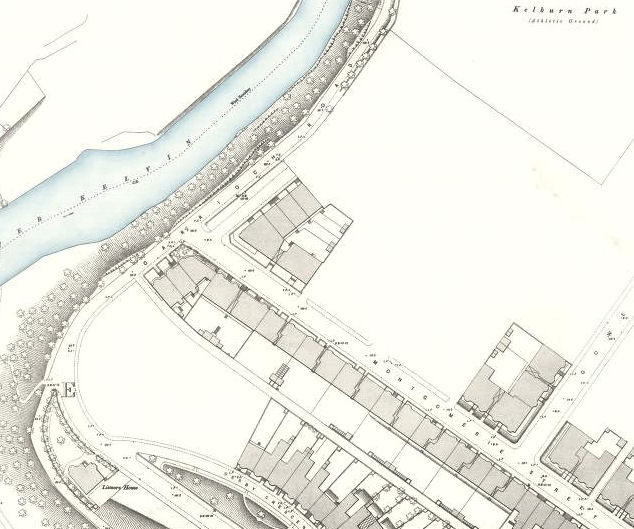
The part of the old estate known today as “North Kelvin Meadow” was never developed at any time as the suburb grew. The aerial picture (above) and map from 1894 (below) show an almost identical layout to the area. Map of undeveloped area now known as North Kelvin Meadow
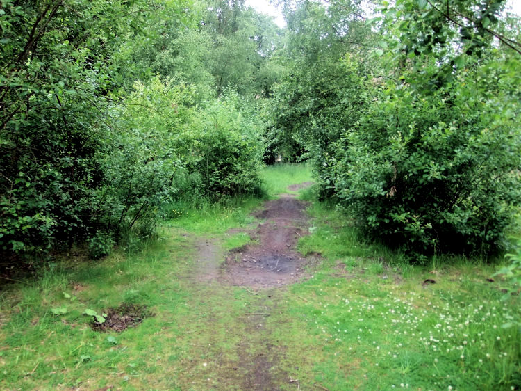
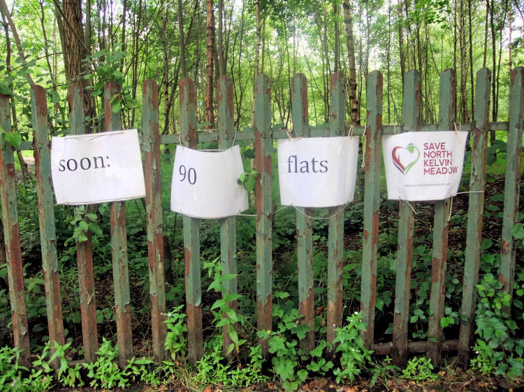
The "North Kelvin Meadow" has been nurtured by locals as a wild natural space. It was under threat of development in the summer of 2011 when these pictures were taken.
Path through North Kelvin Meadow
Protest notice on fence at North Kelvin Meadow
The North West Fire Station at the corner of Kelbourne Street and Sanda Street was constructed in 1936 to the designs of the City Engineer, Thomas Somers. Former fire station at Kelbourne Street and Sanda Street, North Kelvinside
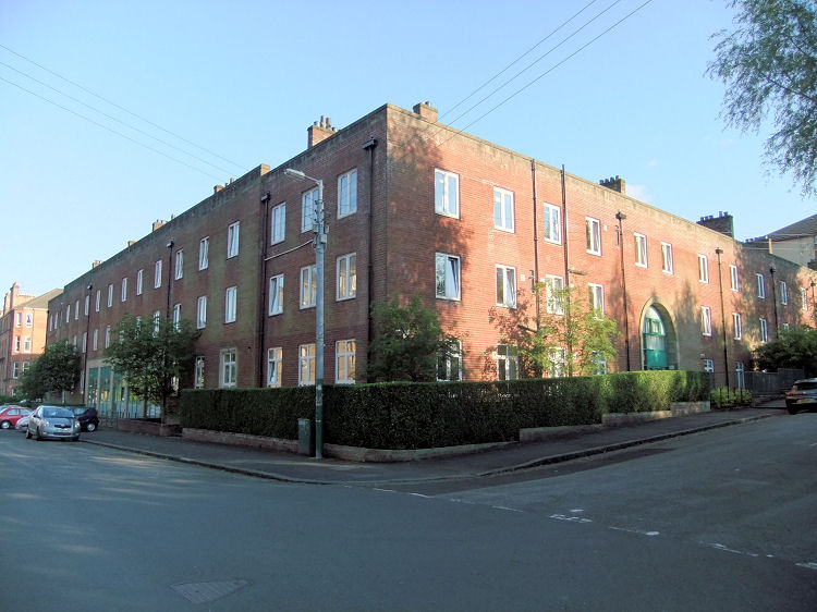
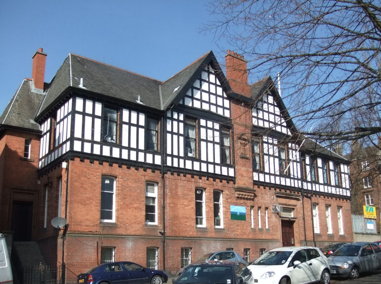
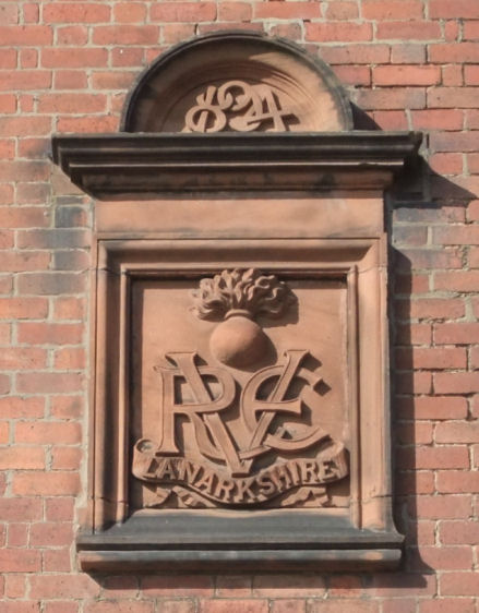
Moving back to the section of North Kelvinside to the east of Queen Margaret Drive, the Lanarkshire Regiment Drill Hall can be found in Jardine Street. The hall was built in 1894 in an unusual mock Tudor style. It was designed by Robert A. Bryden, who is best known as the architect of the Quarrier's Homes at Bridge of Weir.
Red brick Drill Hall in Jardine Street with timber Tudor style upper floor
Plaque at entrance to Drill Hall, showing date of construction, 1894
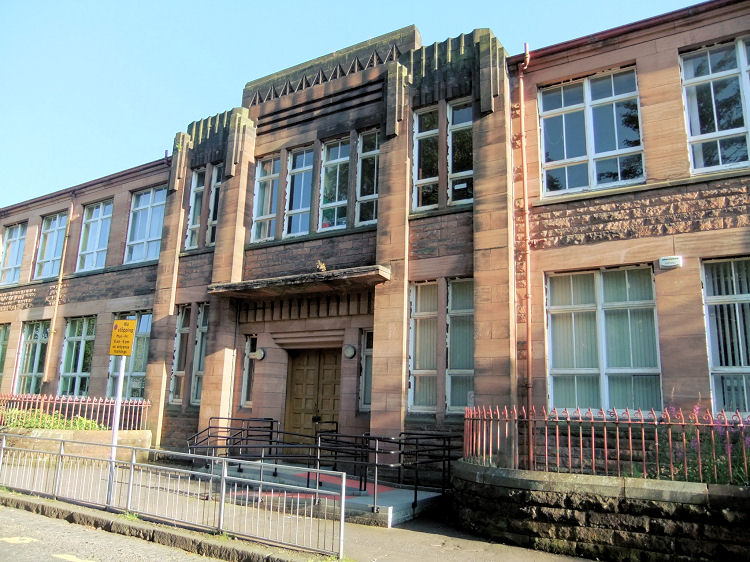
The enlarged St Charles' Primary School was designed in-house by Glasgow Corporation in 1932, when Art Deco was the popular style. The school’s frontage was created with a combination of smooth and rock-faced red sandstone, which is a very unusual medium for the use of Art Deco design.
Entrance to St Charles School, North Kelvinside
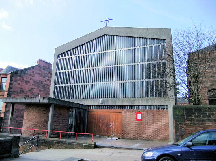
Gillespie Kidd and Coia’s St Charles Church was built in 1959-1960. It is credited to Jack Coia, assisted by Andrew MacMillan, Isi Metzstein and Joe Taylor. Exterior of St Charles Church, North Kelvinside
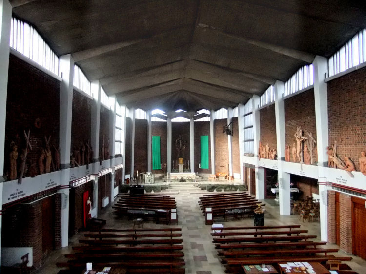
Interior view of St Charles Church, with Benno Schotz's terracotta figures along the walls
More images of the stunning interior of
St Charles' Church,North Kelvinside can be viewed in the Jack Coia section of this website.
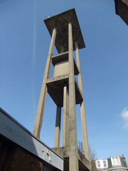
Outside the church there is a 75-foot high freestanding concrete bell tower, which is an unusual local landmark.
Concrete bell tower at St Charles Church, North Kelvinside
A prominent feature of the area is the massive retaining wall and associated "Sixty Steps" erected by John Ewing Walker in 1869-1870, prior to the laying out of the suburb.
The last occupant of the house was Mr Matthew Montgomerie who died there on 17th June 1868.
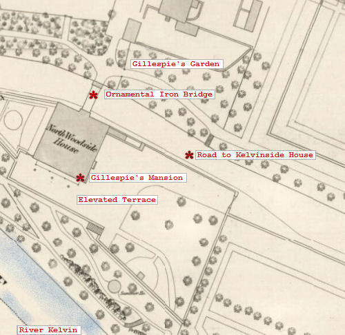
The mansion house and the surrounding ninety acres were then sold to Mr. John Ewing Walker for development.
Development commenced in 1869 after a large portion of the old estate of North Woodside, at the eastern side of the proposed suburb had been acquired by the City of Glasgow Bank and the grounds attached to Kelvinside House on the western side had come into the ownership of local businessman, John Ewing Walker. Significantly Walker had also acquired a long narrow plot of land along the riverbank which had become detached from the lands of North Woodside in 1771.
This is confirmed by the view shown below of the relatively flat wooded riverside west of North Woodside House where the huge wall would later be erected on the site of the square Italianate villa to the left of the sketch. This house was built on a narrow strip of land forming a wooded terrace overlooking the river.

The mansion house of the estate of North Woodside was the three storey house at the bend of the river to the right of the sketch.
When this house was acquired in 1790 by Benjamin Barton, it was described in the conveyance as "that part of the lands of Northwoodside called the Glebe, with the mansion house of Northwoodside and other houses standing thereon”. Mr. Barton possessed this house until his death at the end of 1816, after which it was sold to John Hamilton of Northpark. This part of the estate was eventually acquired by the City of Glasgow Bank.
Walker used the site of the villa and surrounding terrace to create his massive obstruction, blocking access to North Woodside from the west.
The view below shows the distant housing developments on the south bank of the Kelvin at a considerably higher level than the ill-chosen crossing point for Walker's bridge, which was carefully selected to ensure his ascendancy on the northern side of the river.
The stone used for the bridge supports is identical to that used for the adjacent retaining wall.
The object was to provide better communications for the north-western part of the city with Partick and the surrounding riverside districts where many people were employed.
There had been a great desire have public transport connections from Byres Road across the Kelvin, giving direct access to Maryhill and its neighbouring districts. This was impossible to achieve with the low-lying Walker's bridge, which literally hit a stone wall preventing access to the wider area. The less costly option of reconstructing the original bridge had been considered by the Corporation, but was rejected as impractical.
In September 1929, after the new bridge was brought into use, it was decided to close Walker's bridge to all vehicular traffic.
Walker ensured that the roads were not continuous or on the same levels between the two parcels of land.
This is contradicted by the published contemporary evidence, which shows that the wall and associated stairs were an integral part of John E. Walker's civil engineering works of 1869-1870 to the designs of Ritchie Rodger C.E.
Thomson was an architect rather than an engineer and was vice-president of the Glasgow Institute of Architects in 1869-1870, the period when the structural work was being undertaken. If he had any involvement it would almost certainly have been authenticated by the newspaper articles of the time, but it is not.
There are no nineteenth century sources linking any of the complex civil engineering works at this location to Alexander Thomson, who would never have been complicit in Walker's spiteful scheme.
Before the erection of the block shown below, which could be directly accessed at street level, there would have been a sheer drop from the side of the staircase down to the level ground owned by Walker. The stunted remains of the protective iron railings can still be seen.
The alternative way to cross the river was by following the roadway at the top of the wall slowly down to the Belmont Bridge, which was further away from the heart of Glasgow's West End.
The first stage of development was Doune Terrace, which is now part of Belmont Street. Doune Terrace first appears in the Post Office Directory for 1872/73, just 2 years after the new bridges were constructed.
The mansion was demolished in 1869 after the estate had been acquired by the City of Glasgow Bank for the development of a new suburb.
The memorial stone for the church was laid by Lady Bell at a ceremony on 5th October 1895.
The church was demolished in 1987 due to subsidence caused by undermining.
The United Presbyterian denomination joined with the Free Church in 1900 to form the United Free Church, which merged with the Church of Scotland in 1929 when the building became known as North Kelvinside Parish Church.
Sites were offered for the feuing of villas, terraces and tenements through Walker's agents, Messrs Haig & Low, Architects, of 94 West Regent Street, Glasgow.


The corner occupied by the schools at the top of the photograph is shown as Kelburn Park (Athletic Ground) in the old map. The remainder of the site, which still lies vacant, has been used for various recreational purposes over the years, before plans for its development were made in recent times.
The residents’ struggle to preserve this ecologically important ground is being co-ordinated by the
North Kelvin Meadow Campaign .
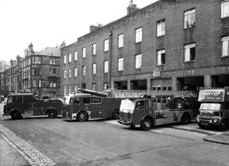
The station and the associated firemen’s housing were converted into apartment blocks in the early 1990’s. The centre of the development has an open landscaped courtyard, where the fire engines were previously garaged. This provides residents' car parking as well as a pleasant urban space.
The hall is currently occupied by the Lowland Reserve Forces & Cadets Association.
The design of the school is credited to William McCaig, the Education Department's architect, who used some modernistic touches in the public areas of the interior.
The church was built around a concrete frame and has a vaulted concrete roof.
The Stations of the Cross were sculpted by Benno Schotz, shortly before his death in 1961.
![]()
 | |
|
|
|
|
|
|
|
| |
|
| |
|
|
|
|
|
|
|
|
All original artwork, photography and text © Gerald Blaikie
Unauthorised reproduction of any image on this website is not permitted.
