
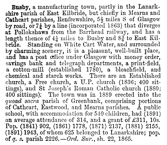
The village of Busby originated on the banks of White Cart Water, which formed the county boundary between Lanarkshire and Renfrewshire. The Lanarkshire part of Busby was transferred from East Kilbride District to Eastwood District in April 1994. Following the abolition of Strathclyde Region in 1996, the whole of the town was included in the East Renfrewshire Council area. Description of the town of Busby and Greenbank Parish from Ordnance Gazeteer, 1901
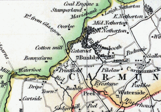
This map from 1832 shows the settlement of "Bushby" on the Lanarkshire side of White Cart Water at the junction of the roads to East Kilbride and Carmunnock. The boundary between Carmunnock and Mearns parishes is coloured green on the map and the boundary between Carmunnock and East Kilbride parishes is coloured red.
Map of Busby, Lanarkshire, 1832
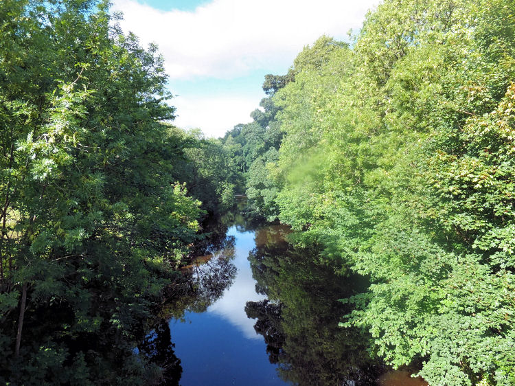
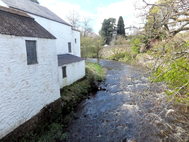
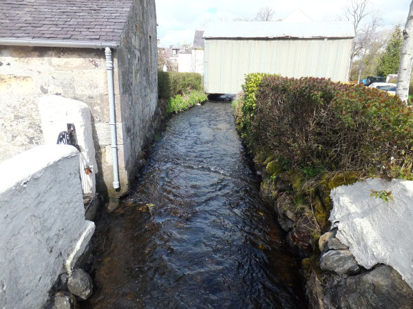
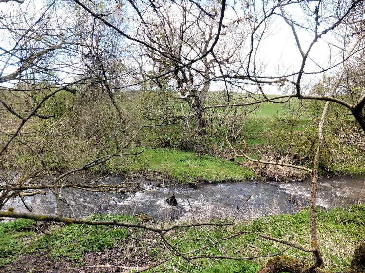
White Cart Water viewed from Busby Bridge
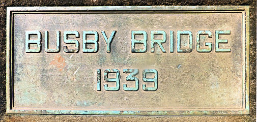
The first bridge at Busby was erected in 1785 to carry the new road from Glasgow to East Kilbride. The present day bridge was built in 1939 to accommodate the widened road.
View of original bridge over White Cart Water from Lanarkshire side of Busby
1939 date plaque at Busby Bridge
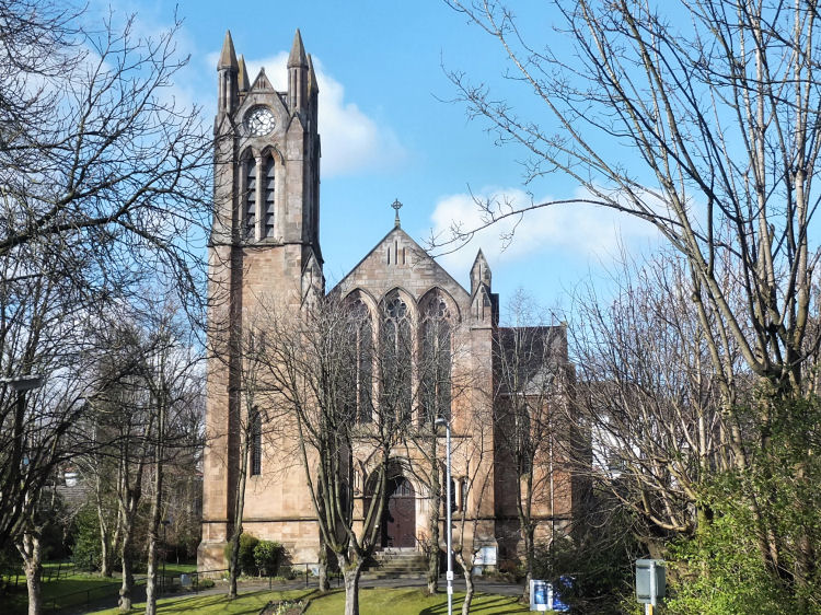
Greenbank Parish Church on Eaglesham Road was established within the boundaries of the Parish of Mearns to supply "much needed accommodation for members of the Church of Scotland residing in Sheddens and Busby".
In 1889, the quoad sacra parish of Greenbank was created from portions of the ancient civil parishes of Cathcart, Eastwood and Mearns.
Greenbank Parish Church
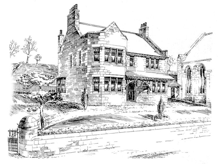
Exhibition drawing of Greenbank Manse by W.G. Rowan, displayed at Glasgow Institute of the Fine Arts, 1898
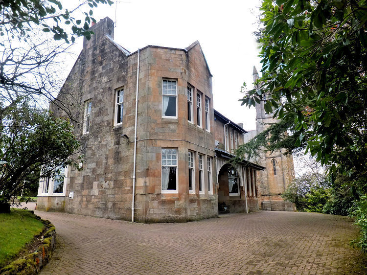
Photograph of Greenbank Manse, 2015
Pencil sketch of Greenbank Parish Church
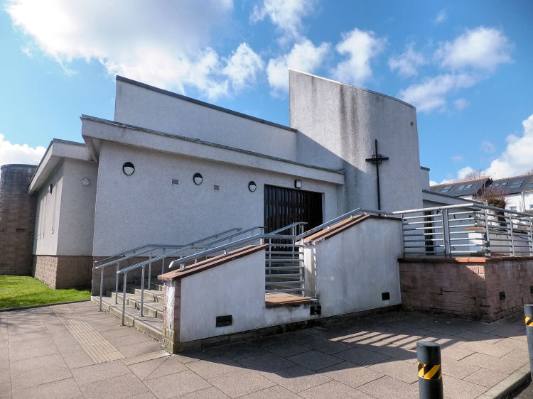
The Roman Catholic parish of St. Joseph was established in 1880 with a small sandstone church, situated close to the Sheddens road junction. It was built on the site of the present day church, which dates from 1971. The parish of St Joseph is included within the R.C. Diocese of Paisley.
St. Joseph's Roman Catholic Church, Sheddens
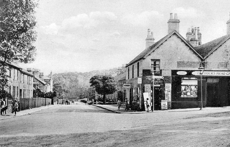
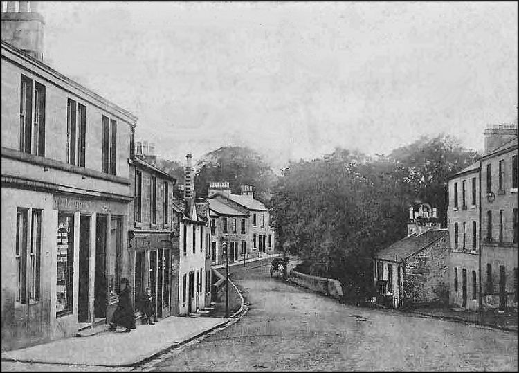
The view below shows the road junction at Sheddens, with signpost showing the road to Busby straight ahead and the Eaglesham road to the right. The Buck's Head Caf� occupies the prominent corner site which has been replaced by a roundabout and modern buildings.
Sheddens road junction before roundabout was created
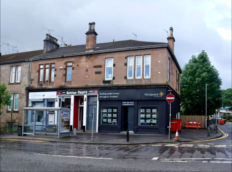
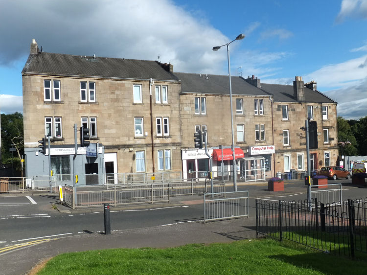
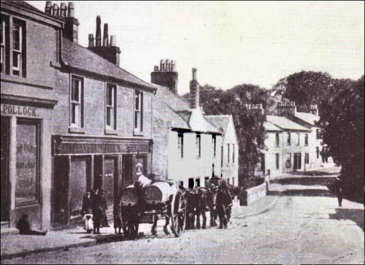
The black corner shop unit shown below at the corner of Busby Road and Arthur Street in Sheddens was at one time occupied by James Davie, grocer and wine merchant. It was part of named block in Busby Road - Wakefield Terrace, which dates from 1884. As of June 2023 the shop is occupied as a sales office for Westpoint Homes.
Shops at Wakefield Terrace, Busby Road, Sheddens
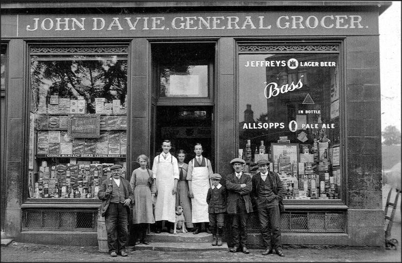
James Davie's shop with the name "John Davie" on the fascia had a fine frontage displaying a great variety of goods for sale. The photograph below shows the shop's staff and some local customers at the entrance to the store.
James Davie's store, Wakefield Terrace, Sheddens
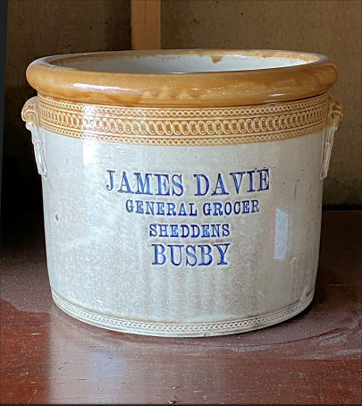
The photograph below shows a 12 pound butter crock made for Davie's grocery store at the Port Dundas Pottery Glasgow. In the days before widespread refrigeration, butter was stored in butter crocks, which were two-piece containers where the fresh butter was stored in the top piece known as the bell and water was contained in the base of the crock. The water was used to seal off the butter from the air, keeping it fresh for a long period. Old butter crock from Davie's store, Sheddens
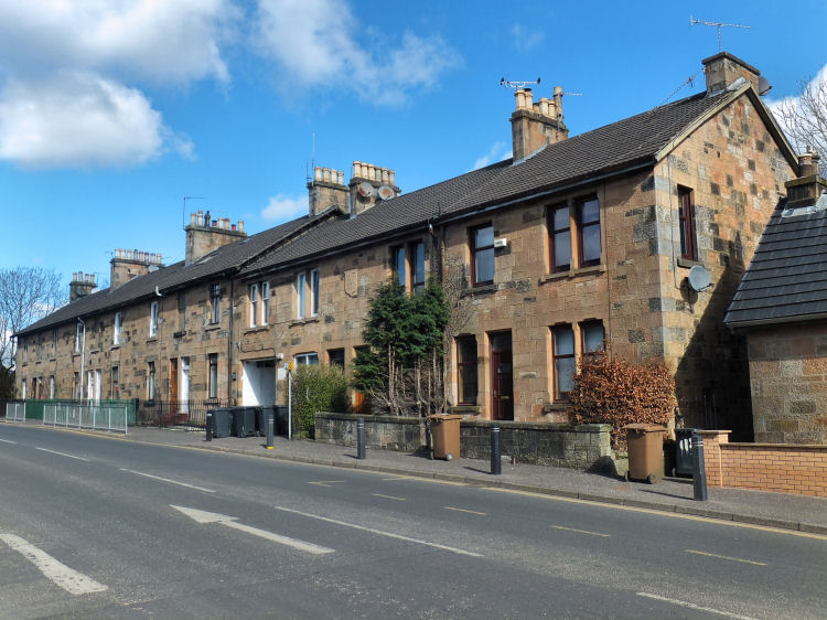
Modern view of old stone-built terrace at Sheddens
Two pictures of children and smartly dressed Edwardian ladies at Viaduct Road, Sheddens
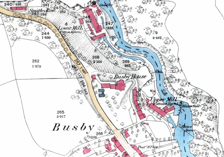
The map below, which dates from 1863, shows the activity along the riverbank of the Renfrewshire side of White Cart Water to the east of the East Kilbride Road. The map displays the proximity of the two water-powered textile mills, situated either side of Busby House.
Map of Busby, 1863
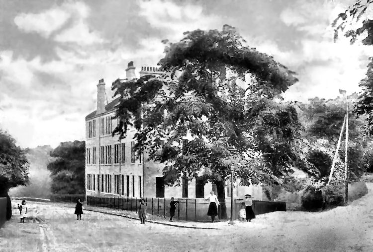
Busby House, which is shown in the above map on an elevated site above the river, was built in 1799 for the proprietors of the adjacent mills. In 1860, four years after the house had been acquired by Mr James Crum of Thornliebank, the house was completely remodelled and extended by architects, Peddie & Kinnear. It was demolished in 1962 and replaced with modern blocks of flats.
Busby House
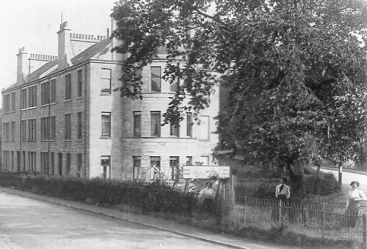
Extended Busby House in 1950's, when used as a nursing home
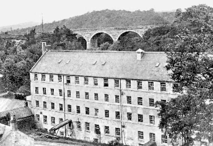
The Lower Mill at Busby was situated downstream from the earlier Upper Mill which was built c. 1780 and demolished in 1900. The Lower Mill was established in 1790 by James Doxon. The largest section of the mill, shown in the photograph below, was destroyed by fire in 1968 and the site re-developed with small garages and workshops.
Lower Mill, Busby, with railway viaduct in background
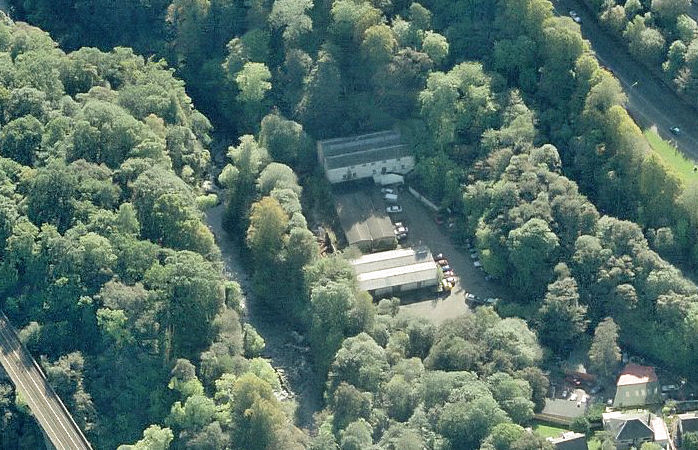
This view shows some of the remnants of the Busby Lower Mill and the adjacent garages and workshops. The railway can be seen at the bottom left, with the mill situated between the river and the main road on the top right.
Site of Lower Mill, Busby, looking upstream on White Cart Water
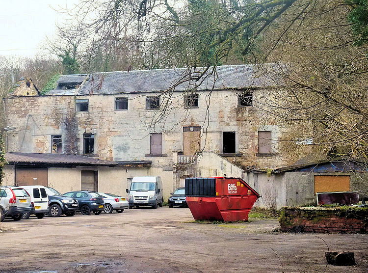
Ruins of Lower Mill, Busby
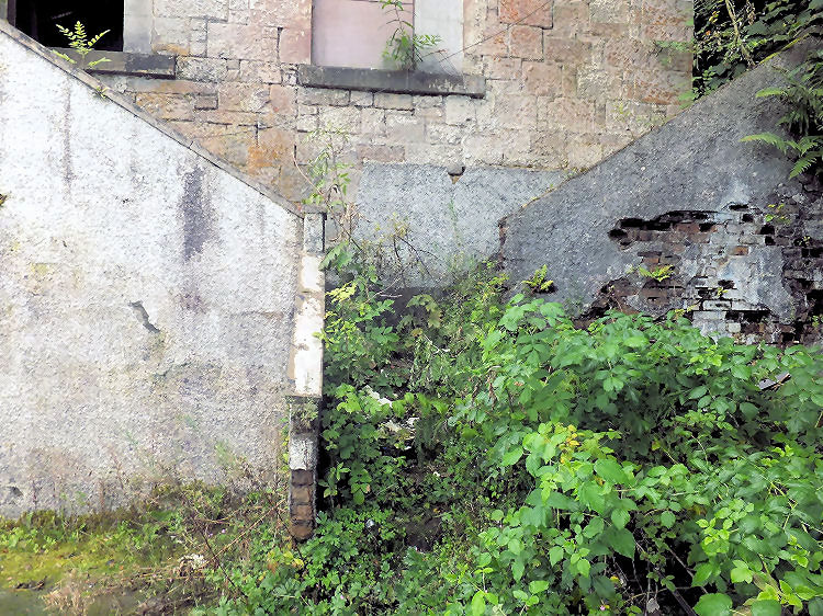
Overgrown staircase at entrance to Lower Mill, Busby
Woodland encroaching on rear of Lower Mill, Busby
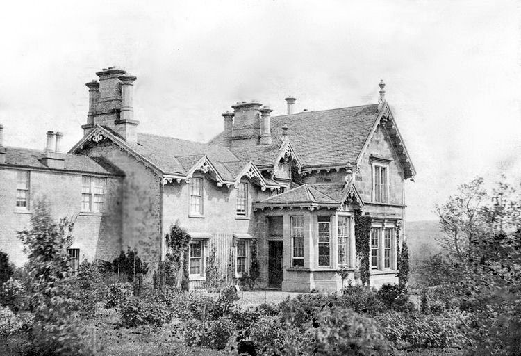
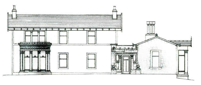
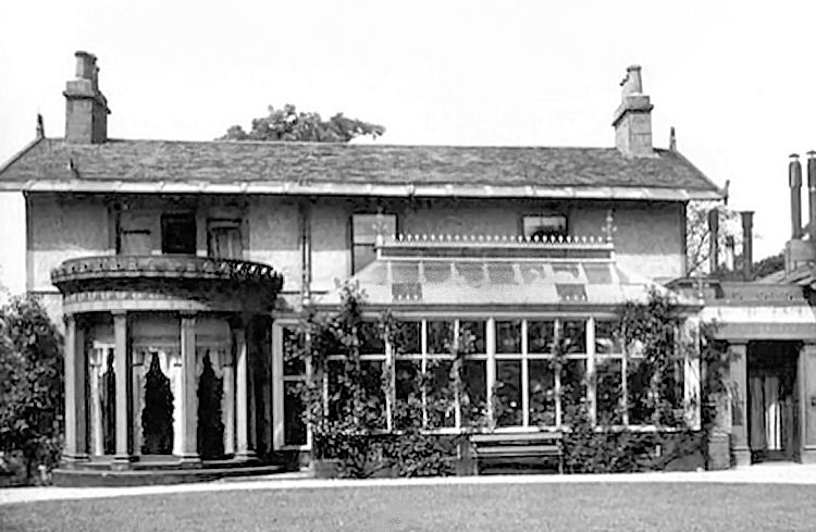
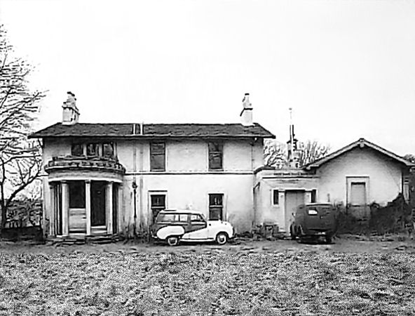
Another local mansion, also named 'Busby House', in Field Road was built in 1796. The house was extended and remodelled by Alexander "Greek" Thomson in 1856-1857 for local landowner, Durham Kippen, who rented it to Messrs. Inglis & Wakefield, the proprietors of the nearby calico printing works. Thomson's extensions were built with locally quarried Giffnock sandstone which provided a contrast to the harled walls of the original house. Busby House, altered and extended by Alexander "Greek" Thomson
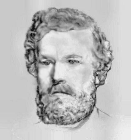
Pencil sketch of Alexander Thomson, architect
View of Busby House with Alexander Thomson's alterations and later conservatory
View showing Alexander Thomson's additions and alterations to the side of Busby House
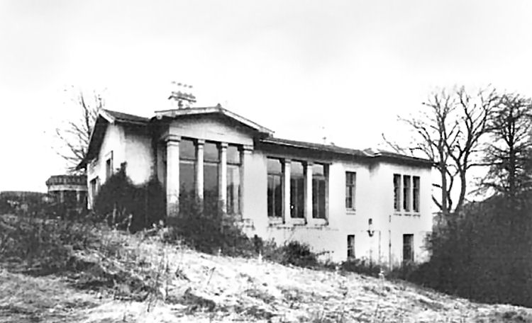
Busby House in Field Road was allowed to fall into a state of dereliction before being demolished in 1969.
Derelict Busby House shortly before demolition in 1969
Duff Memorial Hall was built in memory of the sons of local resident, William Duff, who both died during the First World War. The Hall and Library opened on September 10th 1921. Duff Memorial Hall and Library, Busby
Tenement block in Main Street, Busby
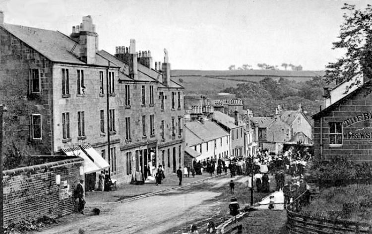
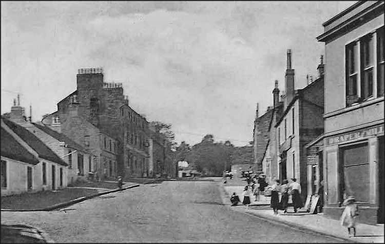
Old photograph of crowds gathered in Main Street, Busby
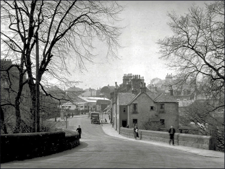
Old view of Main Street, Busby
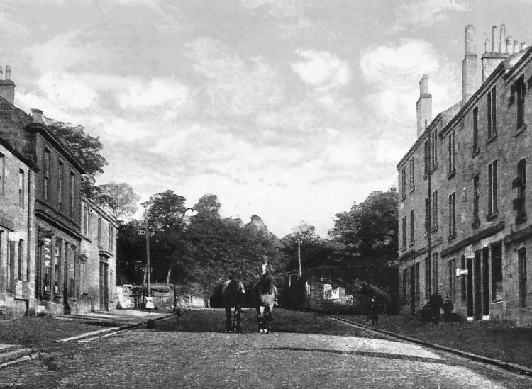
Main Street, Busby
Milk Cart in Main Street, Busby
Horses in Main Street, Busby
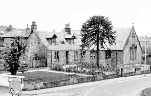
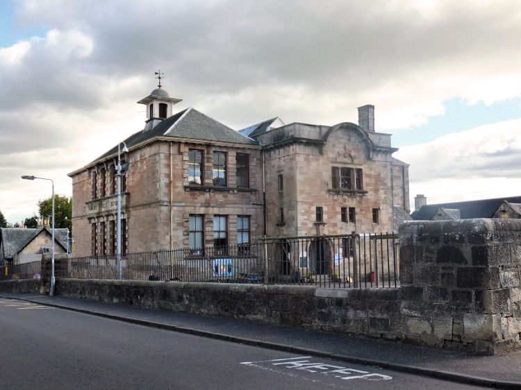
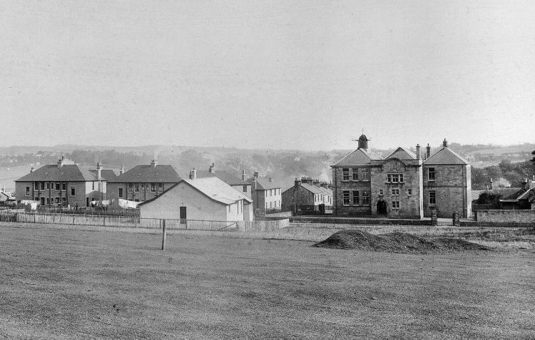
Busby Public School was designed by Glasgow based architect, William Gardner Rowan, who also designed Thornliebank Public School. The school, which opened in 1903, was built in the Edwardian Renaissance style which was popular for public buildings at the time.
Busby Public School
Busby Public School surrounded by open fields
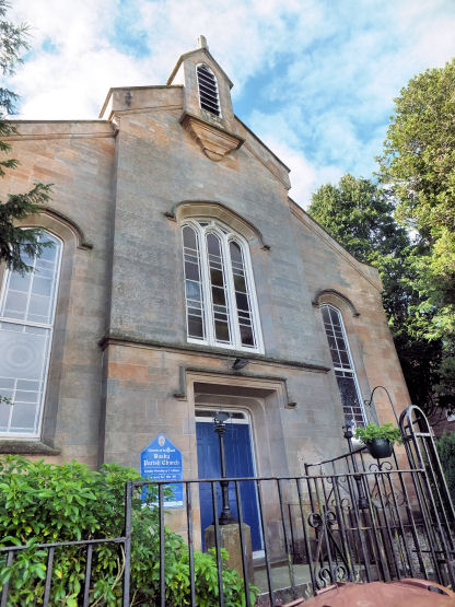
Busby Parish Church is situated close to the school. It originated with a congregation of the United Presbyterian Church which had formed in 1847, long before this denomination merged with the Church of Scotland in 1929. The church then became known as Busby West Church.
Busby East and West churches combined in 1990 to form Busby Parish Church
Former Busby West Church, now Busby Parish Church
Gable of Busby West Church,
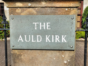
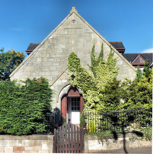
The Auld Kirk, formerly Busby East United Free Church
The former Busby East United Free Church was situated on the Lanarkshire side of the river at the corner of Carmunnock Road.
Gable of the Auld Kirk, Busby
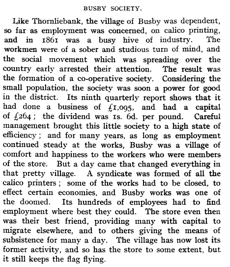
Busby Co-operative Society was formed in 1861, providing for the employees in the local industries. The story of the society is shown in the report, below, published in 1910.
Description of Busby Co-operative Society from 1910
Busby Co-operative Society, Main Street
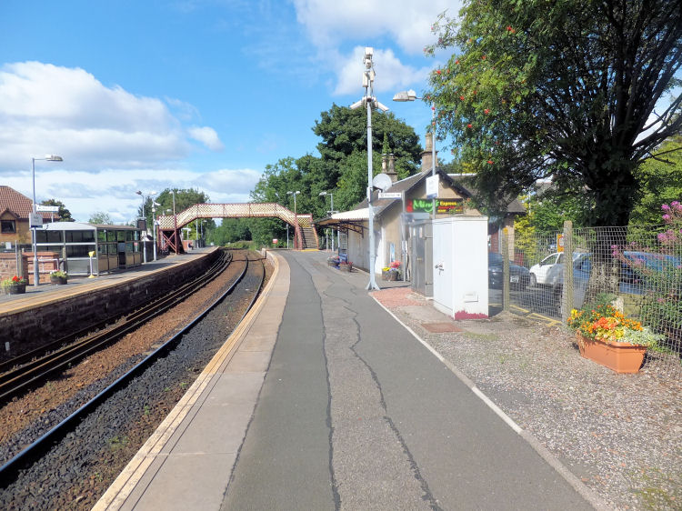
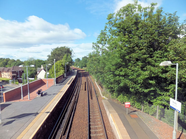
A new branch railway line from Pollokshaws to Busby was opened on 1st January 1866 mainly for the transportation of minerals, raw materials and goods in connection with the quarries and textile mills on the route. It had the side effect of opening the intermediate districts up for the creation of commuter suburbs. Busby Station with booking office now used as a Chinese Restaurant
View of railway line at Busby Station from footbridge connecting platforms
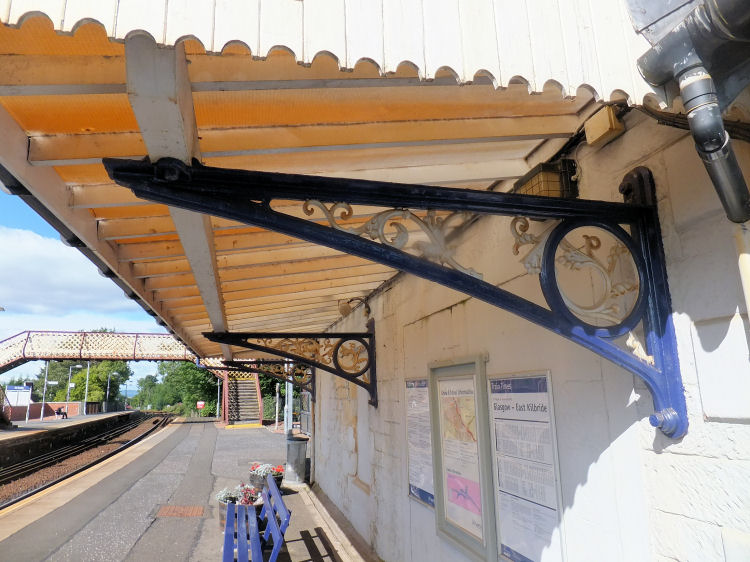
Original decorative cast iron at Busby Station
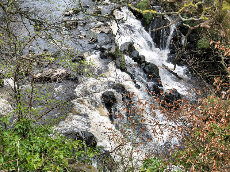
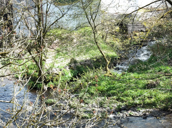
Busby Glen provides local residents with some beautiful walks in the wooded area along the riverbank. The parkland was gifted to Busby by William. J. Kippen, a descendant of local mill owner, Durham Kippen, who occupied Busby House and the surrounding estate. Plaque at entrance to Busby Glen
Waterfall on White Cart Water, Busby Glen
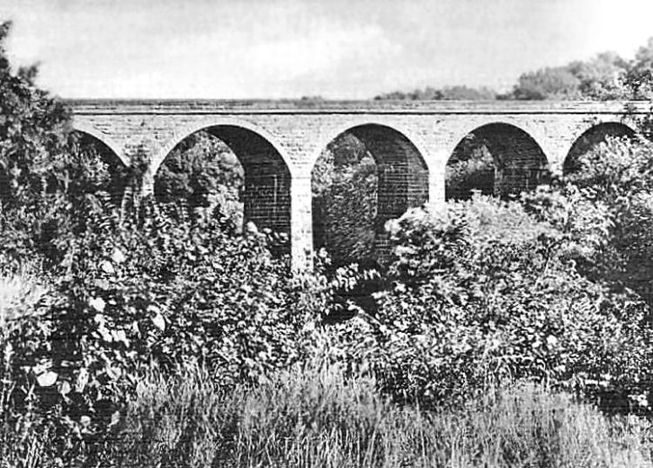
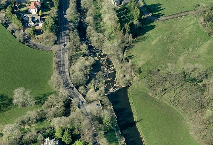
Railway viaduct over White Cart Water, Busby
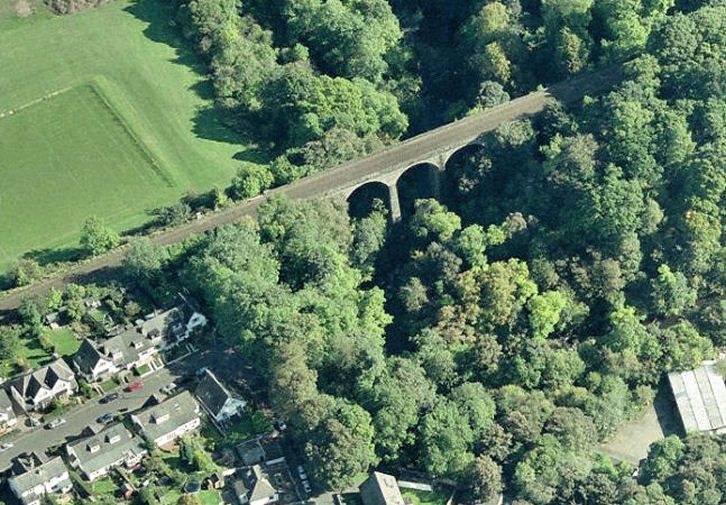
Aerial view of White Cart railway viaduct, Busby
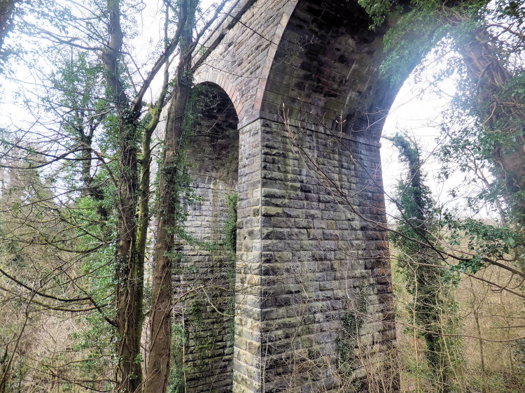
Close-up view of railway viaduct from pathway at Busby Glen
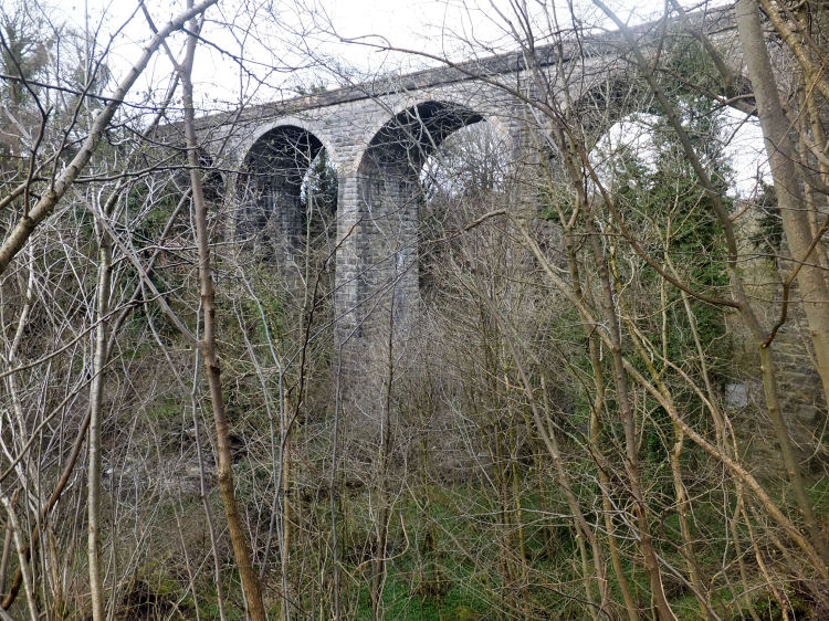
View of railway viaduct from the depths of Busby Glen
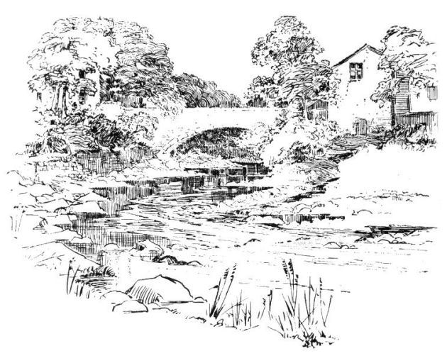
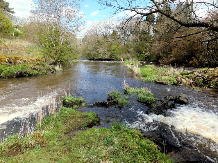
White Cart Water crosses into Mearns Parish at Waterfoot, about three miles downstream from its source in the parish of Eaglesham. There were two water-powered grain mills at Waterfoot, 'Mearns Mill' on the northern side of Earn Water and 'Drip Mill' on White Cart Water, downstream from its confluence with Earn Water. This mill is still operational, under the name of 'Dripps Mill'.
View of White Cart Water at Waterfoot showing Dripps Mill and old bridge
View of White Cart Water and Dripps Mill from old bridge at Waterfoot
Sketch of White Cart Water and Dripps Mill at Waterfoot
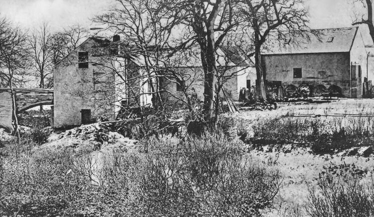
Winter scene at Dripps Mill, Waterfoot
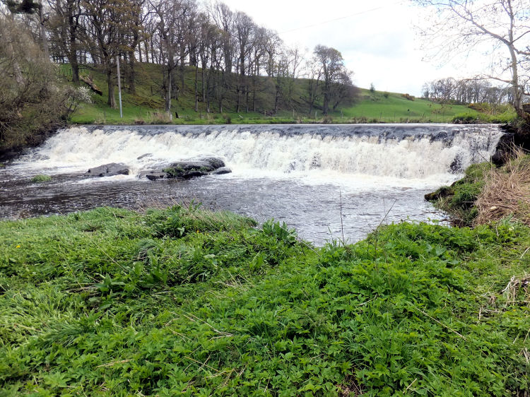
Weir on White Cart Water on approach to Dripps Mill, Waterfoot
Mill lade carrying water into Dripps Mill (above) and outflow back into White cart Water (below)
Aerial view of site of 'Mearns Mill' where the roadway crosses Earn Water close to its confluence with White Cart Water
Confluence of Earn Water (left) with White Cart Water (right)
Site of Mearns Mill on Earn Water, close to confluence with White Cart Water
Busby was developed as a manufacturing centre with water powered mills and bleachfields associated with the textile industry.
The cotton mill on the Renfrewshire side of the river dates from the 1780's.
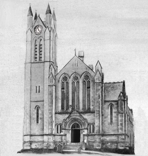
The Church and hall were designed by William G. Rowan in his distinctive neo-Gothic style. The church was formally opened on Sunday 13th April 1884 by Rev. Cornelius Gillan of St. Mary's Edinburgh with the congregation's first minister, Rev. James Fraser,
preaching at the afternoon service.
The photograph was kindly shared with me by the crock's owner, Mr George Bresnick of St Paul, Minnesota, USA.


Lieutenant William Duff jnr died in June 1915 at Gallipoli and his brother, Lieutenant John Mitchell Duff, died in in India in August 1919.


The congregation originated in 1865 following the disruption of the established Church of Scotland in 1843.
After the merger of Busby East and West churches in 1990 to form Busby Parish Church, the buildings at Carmunnock Road were converted to flats as 'The Auld Kirk'.

The line was established by the Busby Railway Company which was absorbed by the Caledonian railway in 1882.
The plaque below is attached to the gate pier at the entance to the park.


![]()
|
|
| |
|
|
| |
|
|
| |
|
|
| |
|
|
| |
|
|
| |
|
|
|
|
All original artwork, photography and text © Gerald Blaikie
Unauthorised reproduction of any image on this website is not permitted.
