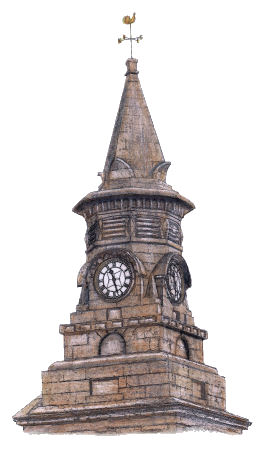

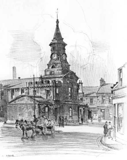
Drawing of clock tower at Town House, Pollokshaws
The Glasgow districts of Pollokshaws and Auldhouse originated around the historic burgh of Pollokshaws and the nearby Auldhouse mansion which were situated in the parish of Eastwood in Renfrewshire.
In the above map of Renfrewshire, from around 1820, Pollokshaws Road is shown coming from the city in a south-westerly direction from Nithsdale Road at Marchtown (Strathbungo) towards Pollokshaws and Auldhouse, which are included within the yellow boundaries of Eastwood Parish. To the east you can see the various districts of the south side which were in the Renfrewshire section of Cathcart Parish, where the boundary is coloured green.
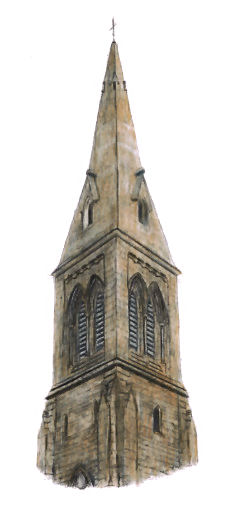
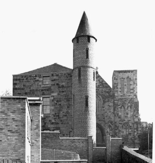
Tower of Eastwood Parish Church
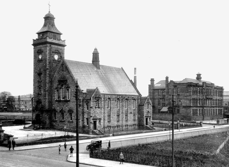
The present day Eastwood Parish Church, which dates from 1863, was designed by architects Charles Wilson and David Thomson . It is situated on the eastern side of Thornliebank Road on the site an earlier church which was built in 1782. Map showing Auldhouse Bridge, Eastwood Church and Auldhouse Mansion, 1858
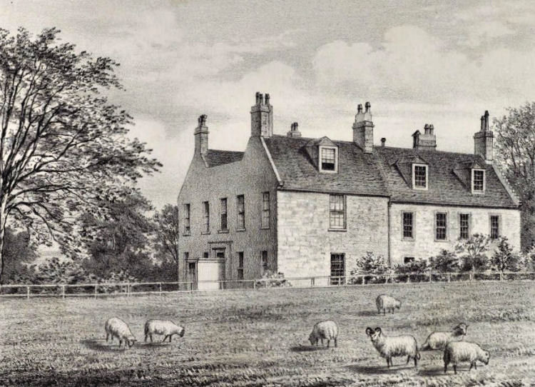
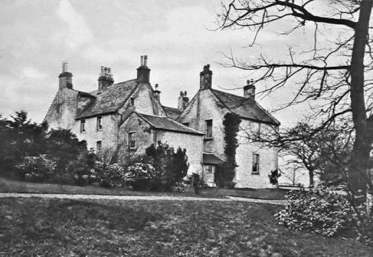
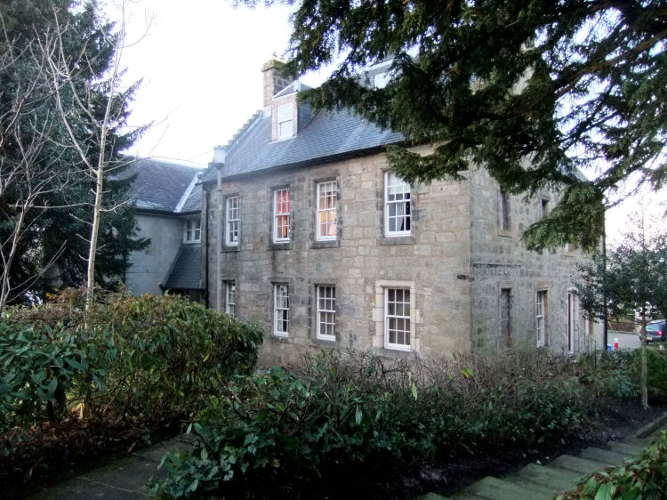
The former Auldhouse Mansion, the oldest house in Glasgow's south side, was built in 1631 to a simple design. It was extended and converted to flats in 1983.
Engraving of Auldhouse Mansion from c.1790
Victorian photograph of Auldhouse Mansion with Eastwood Parish Church in the background
Early 20th century photograph of Auldhouse Mansion from the rear
I was contacted by Irene Carruthers regarding her grandmother, Christina McCorquodale, who had worked in the mansion house in her younger days. Christina and her sisters were employed as housekeeper, cook and maids by the Lang family who "by all accounts were lovely people to work for".
Auldhouse Court, including the old mansion, was developed to provide 24 flats in 1983
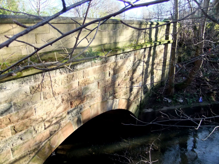
Auldhouse Burn passing under Thornliebank Road at Auldhouse Bridge
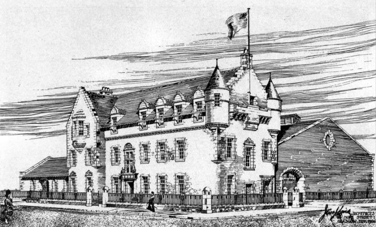
The Territorial Army Drill Hall in Auldhouse Road was designed in the Scots Renaissance style with a symmetrical frontage featuring two saucer-domed towers and a crow-stepped central entrance bay.
This design was not the same as that featured in the exhibition drawing of the proposed building by the architects, J.W. and J.Laird.
Drill Hall, Auldhouse Road
The drawing below was displayed at the Royal Glasgow Institute of the Fine Arts Exhibition, 1907, with the caption �3rd V.B. Argyll and Sutherland Highlanders New Headquarters at Pollokshaws, J.W. and J.Laird, Architects�.
Exhibition Drawing from 1907
The proposed hall was originally intended to be the headquarters of the 3rd (Renfrewshire) Volunteer Battalion (Princess Louise�s) Argyll and Sutherland Highlanders, which became part of the territorial force in 1909.
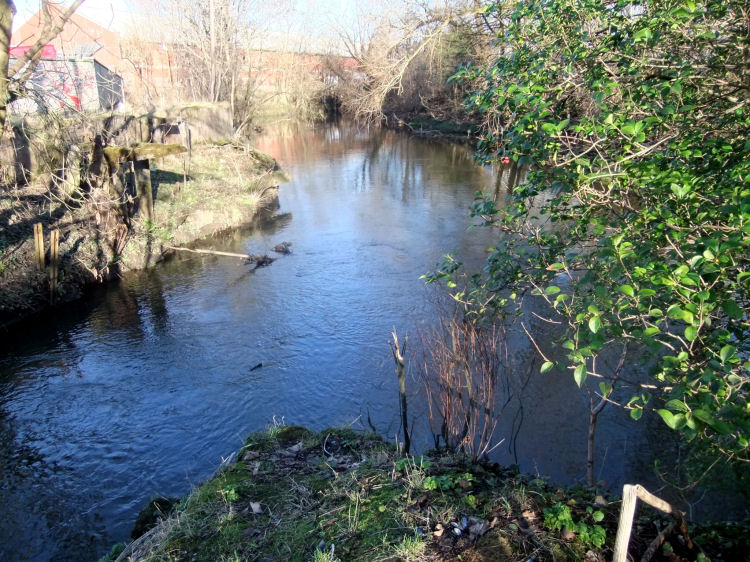
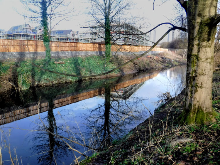
Confluence of Auldhouse Burn (left) and White Cart Water (right)
The little stream which flows though Auldhouse Park joins the White Cart just before the confluence of the two rivers.
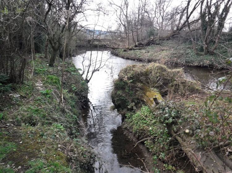
Stream entering White Cart Water at Auldhouse Park
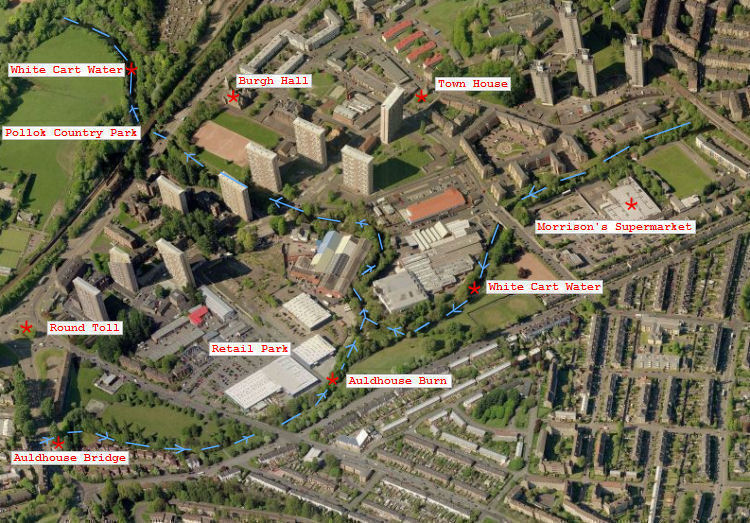
Aerial view of Pollokshaws from Auldhouse Bridge to Pollok Country Park
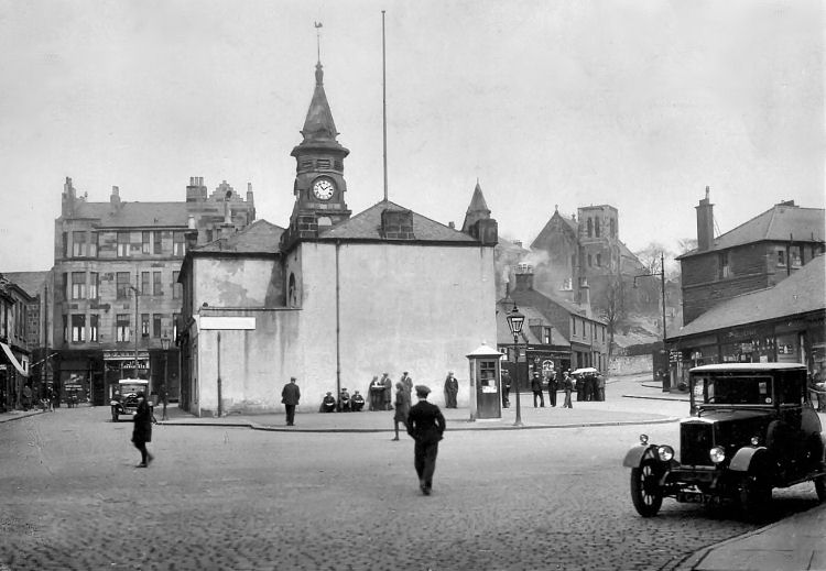
Pollokshaws Town House and memorial to local Socialist hero, John Maclean
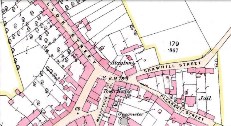
Pollokshaws achieved the status of an independent burgh in October 1812 with Sir John Maxwell of Pollok, 7th Baronet, being the first provost. Map from 1858 showing the Town House and the nearby jail
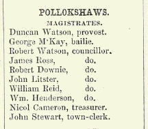
Pollokshaws Council in 1858
The present day Shawbridge Street, Pollokshaws, consists of the old Main Street, north of the bridge over White Cart Water, and King Street, south of the bridge.
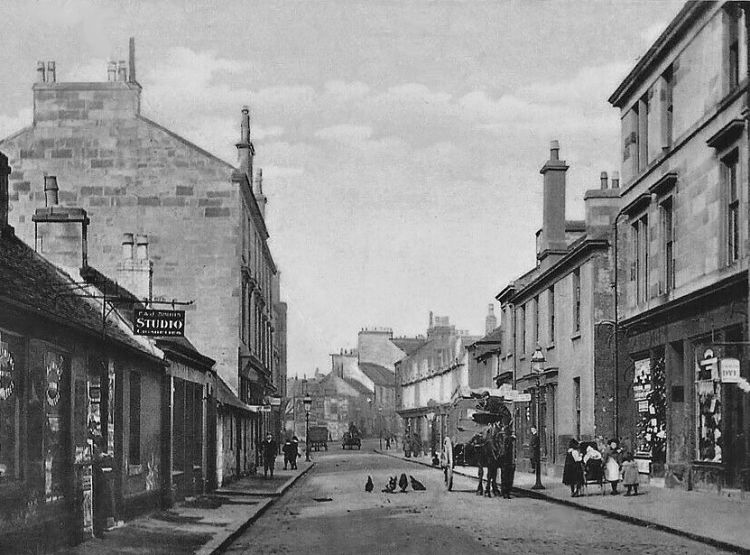
View of Main Street, Pollokshaws, prior to being renamed as Shawbridge Street
View of King Street, Pollokshaws, also renamed as part of Shawbridge Street
The Old Stag Inn is situated in one of the few remaining traditional tenement blocks in Pollokshaws, designed by Thomas Baird c.1888
Views of Pollokshaws Town House with St. Mary's church in background - before and after World War I
By coincidence the car in the above photograph is situated at the exact same spot as the 1950's estate car shown in the photograph below.
1956 view of Pollokshaws Town House with St Conval's School and St. Mary's church in background
1958 view of Pollokshaws from stair tower of St. Conval's School
Stair tower of St. Conval's School, Pollokshaws
1958 view of slum housing in Pollokshaws, prior to redevelopment
Pencil sketch of Pollokshaws Town House and surrounding area, 1926
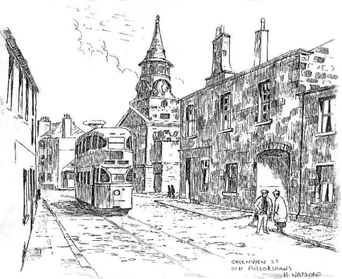
Pencil sketch of tram at Greenview Street, Pollokshaws
Post war prefab housing on cleared site next to Pollokshaws Burgh Hall
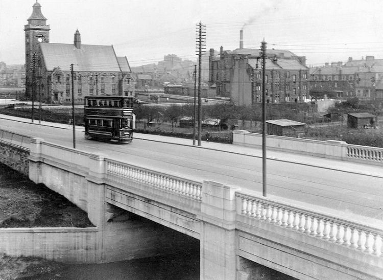
Tramcar crossing White Cart Water at Pollokshaws
The popularity and availability of the motorcar during the inter-war years led to
many road widening schemes allowing space for both electric trams and cars. The main roads through the south east of Glasgow; Clarkston Road, Kilmarnock Road and Pollokshaws Road all required
new bridges to accommodate the improved roads.
Photograph from 1929 showing contruction of widened bridge at White Cart Water, Pollokshaws
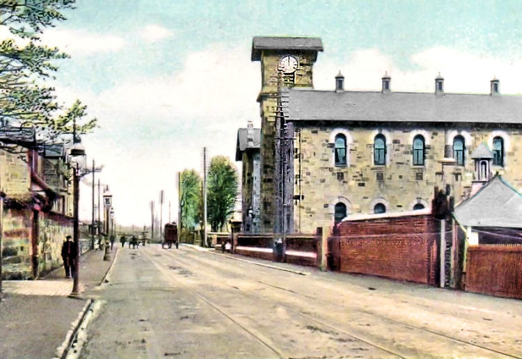
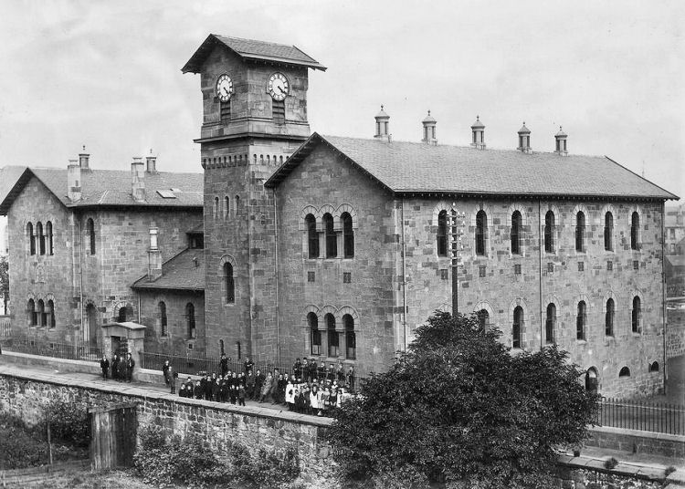
Old photograph of Pollokshaws Burgh Hall and Sir John Maxwell School
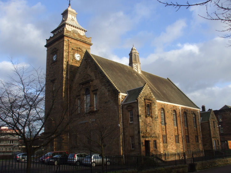
Pollokshaws Burgh Hall, which opened in 1898, was provided for the people of Pollokshaws by Sir John Stirling Maxwell, who contributed towards its upkeep until the burgh was annexed by Glasgow in 1912. The hall was designed in the Scots Baronial style by noted Edinburgh architect, Robert Rowand Anderson, who also carried out alterations and additions to both Eastwood Parish Church and Pollok House around the same time.
Pollokshaws Burgh Hall
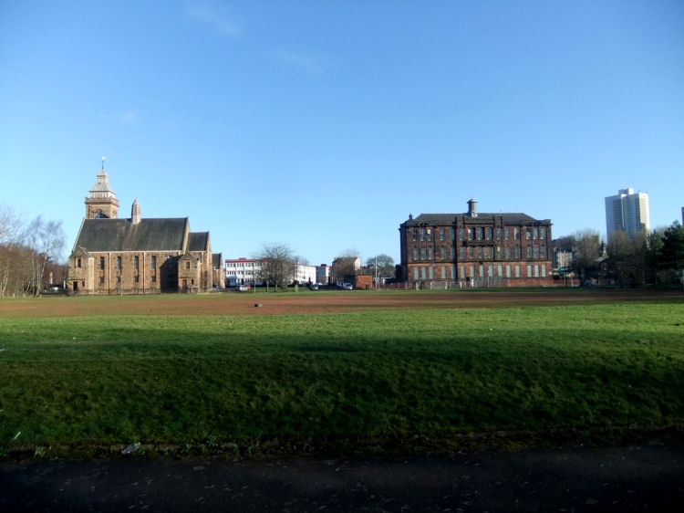
Long view of Pollokshaws Burgh Hall and Sir John Maxwell School from banks of White Cart Water
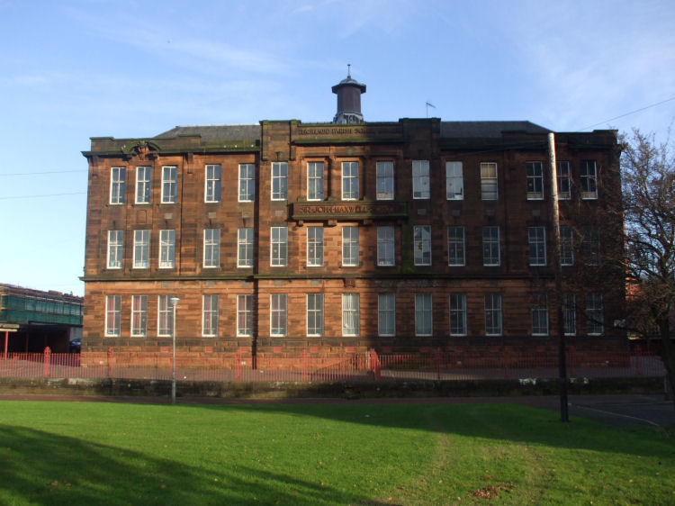
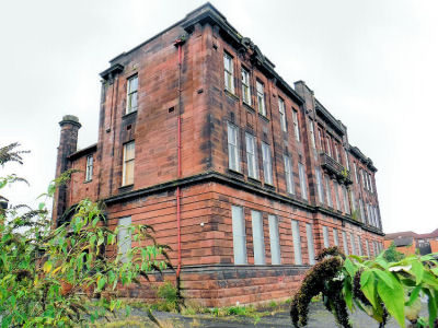
Sir John Maxwell Primary School opened in 1907 and closed in the summer of 2011. The architects of the red sandstone building were John Hamilton and Alexander Young, who designed the school in the Edwardian Renaissance style which was very popular for public buildings in Scotland at the time.
Sir John Maxwell Primary School
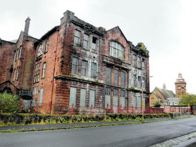
After the last pupils vacated Sir John Maxwell Primary School in the summer of 2011 it was allowed to fall into a state of extensive decay and dereliction with no effort by the City Council to maintain the fabric of the old building. The views shown below illustrate how 5 years of abandonment have caused considerable deterioration to the stonework.
Derelict Sir John Maxwell Primary School, September 2016
Pollok Academy was designed in 1855 by John Baird, a business partner
of Alexander "Greek" Thomson. Baird was also responsible for the extension of 1874.
Its most famous former pupil was the socialist pioneer, John Maclean.
The building, which featured an attractive square clock tower,
was demolished in 1968 during the comprehensive redevelopment of the area. Pollok Academy, Pollokshaws
View of Pollok Academy from elevated platform of Pollokshaws West Railway Station
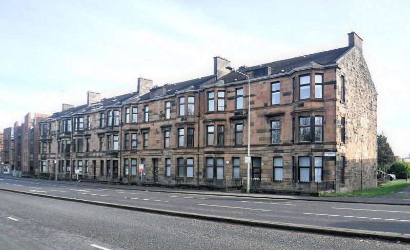
Surviving traditional tenement block in Pollokshaws
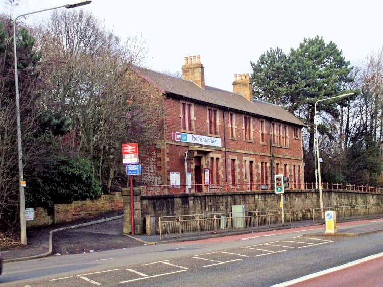
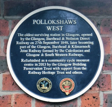
Pollokshaws West Railway Station and Station Master's house, opened 1848
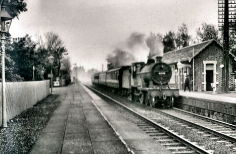
The Glasgow to Barrhead railway line opened in 1848, originally operating from Southside Station in the Gorbals and later from St Enoch Station. The origins of the line are examined at the Gorbals Stations page of this website. The first stop on the route in 1848 was at Pollokshaws (now Pollokshaws West) Station, where the steam locomotive, left, is seen passing through. Many of Glasgow's southern suburbs were served by later stations built along the early lines, providing fast and easy access to the city.
As well as Barrhead, current destinations for trains passing through Pollokshaws West are East Kilbride, Kilmarnock and Carlisle.
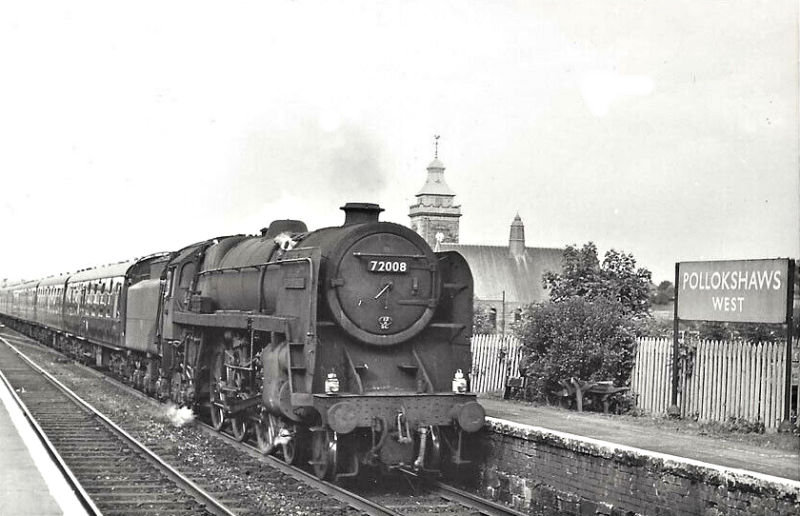
View from Pollokshaws West Station of locomotive No.72008, otherwise known as "Clan MacLeod". This Carlisle based engine was the last survivor of the Clan class before it was withdrawn from service and scrapped in 1966.
Steam locomotive passing through Pollokshaws West Station
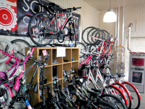
The two-storey Station Master's house at Pollokshaws West station now serves as a base for a community based cycle centre, providing low-cost bike hire and sales as well as training courses and free cycle repairs to local children.
The unoccupied building was boarded up for a number of years before South West Community Cycles approached the Glasgow Building Preservation Trust in 2007 with a scheme to convert it into a bicycle repair and resource centre. After much hard work the centre opened for business in August 2013.
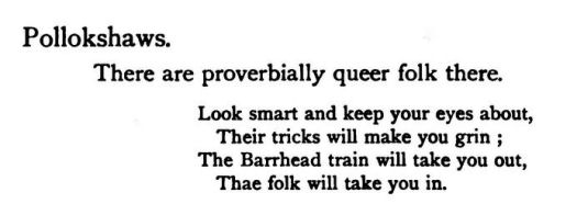
The Barrhead train to Pollokshaws gets a mention in this piece of rhyme regarding the "Queer folk of the 'Shaws".
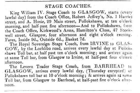
In pre-Victorian times, public transport from Pollokshaws was in the form of horse-drawn stage coaches. The extract below, from an 1833 directory, shows that the Pollokshaws coach was named after the monarch at the time, King William IV.
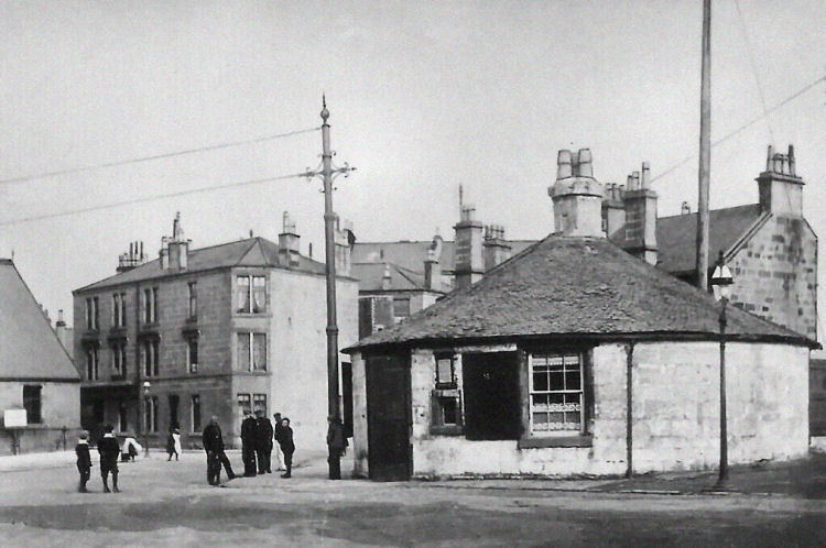
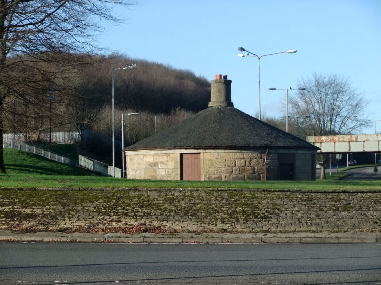
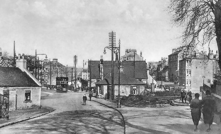
Early twentieth century view of Toll House, built c.1750, where stage coaches once called
Present day view of old Toll House, situated at the roundabout were all the main roads at Pollokshaws meet up
View of Pollokshaws from behind the Toll House
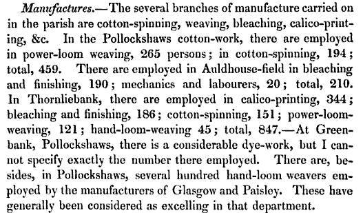
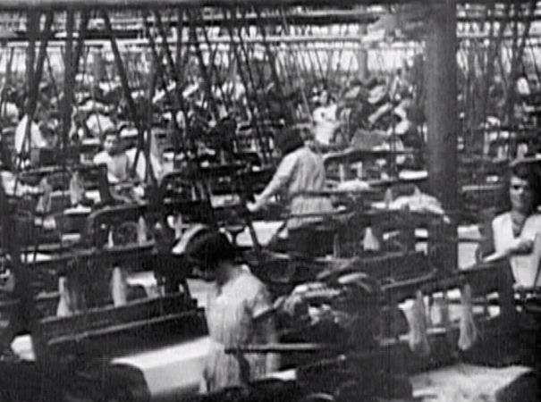
With the coming of the railway and the consequent Industrial Revolution, Pollokshaws found itself in an advantageous position, situated alongside two rivers and with an abundance of local coal. Its proximity to the manufacturers and traders of Glasgow and Paisley also helped the former small village to rapidly become a place of considerable business. Its importance as a manufacturing town was based on the cotton trade and the various processes connected with it. Much of the workforce was engaged in the spinning of cotton and the weaving of textiles with power-looms in the new mills built along the riverside. There was also work available in associated industries in the bleachfields and dye-works.
The extract below gives an indication of the nature of the industries carried out in Pollokshaws and the surrounding area shortly after the introduction of steam powered looms.
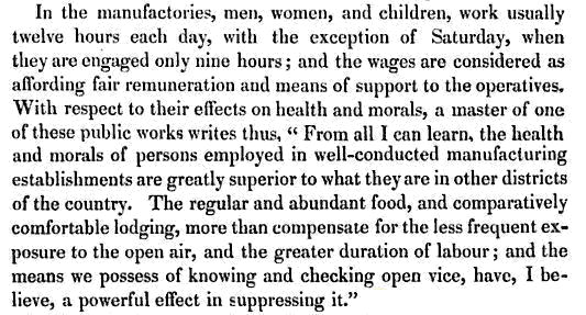
The working conditions at that time were nothing like what you would expect today. The use of child labour and the imposition of excessive hours on the workforce were perfectly acceptable when there were no trade unions to protect people from inhumane exploitation.
The mother of the famous campaigner for workers rights, John Maclean, had worked for a spell in a textile mill in Pollokshaws. This may have had something to do with his actions in 1910 to assist Miss Dicks of the National Federation of Women Workers in organising industrial action over a pay-cut imposed on the mill-girls at Alexander's Cotton Mill in Neilston.
During the prolonged dispute Miss Dicks requested the help of Maclean who successfully organised a strike, protest march and demonstration which reversed the unfair actions of the mill-owners.
The last working textile factory in Pollokshaws was a modern building in Coustonholm Road operated by Claremont Garments, previously D & H Cohen. The factory closed in 1994 and the site developed for the local Benefit Office by the DSS.
The sites of many of the former mills and associated trades situated on the riverside were still in use workshops and warehouses in 2013.
Industrial buildings on the banks of the Auldhouse Burn, Pollokshaws
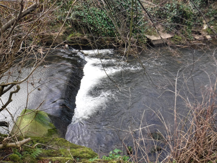
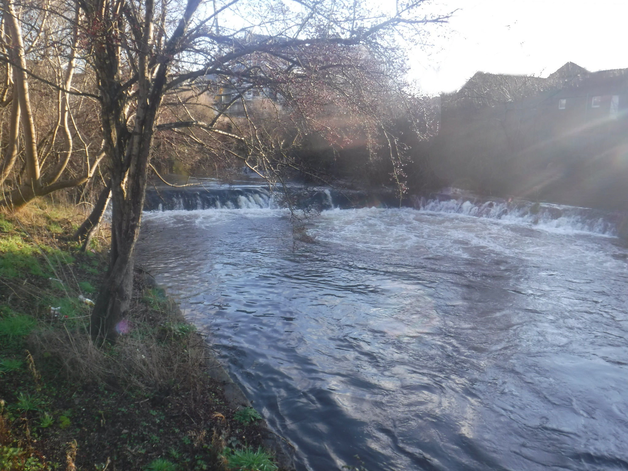
Little weir on Auldhouse Burn, a relic of former water powered mills
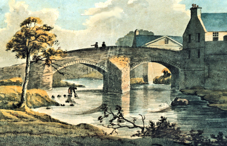
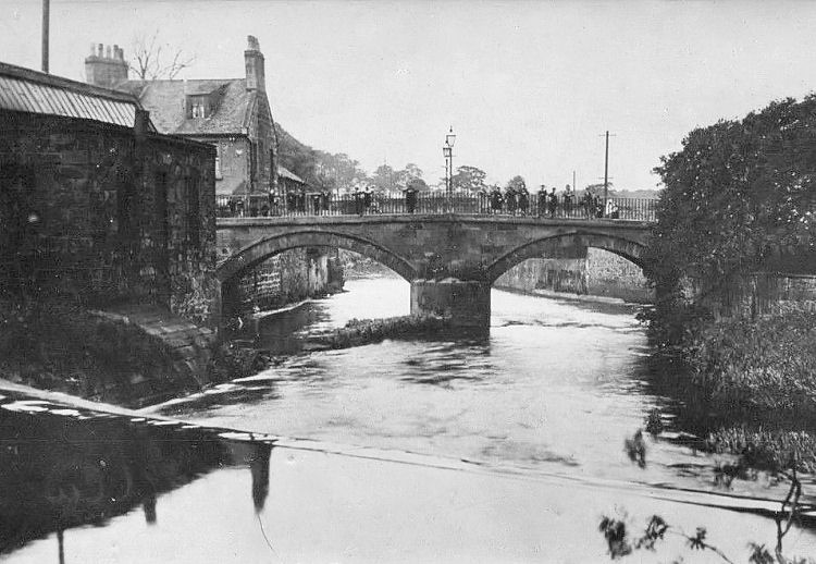
Shaw Mill beside the old two arch stone bridge over White Cart Water, Pollokshaws
Old photograph of Shaw Bridge, Pollokshaws, from a weir on White Cart Water
Weir on White Cart Water on approaches to Shaw Bridge, Pollokshaws
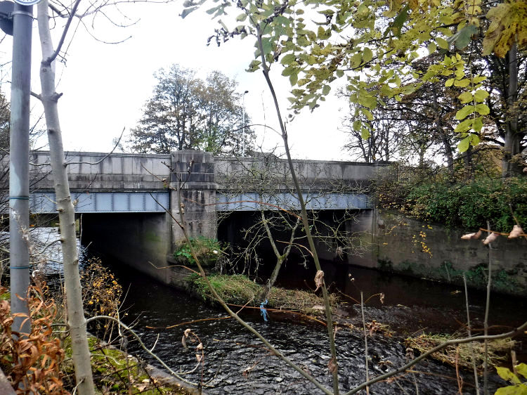
Replacement Shaw Bridge over White Cart Water, Pollokshaws, erected 1934
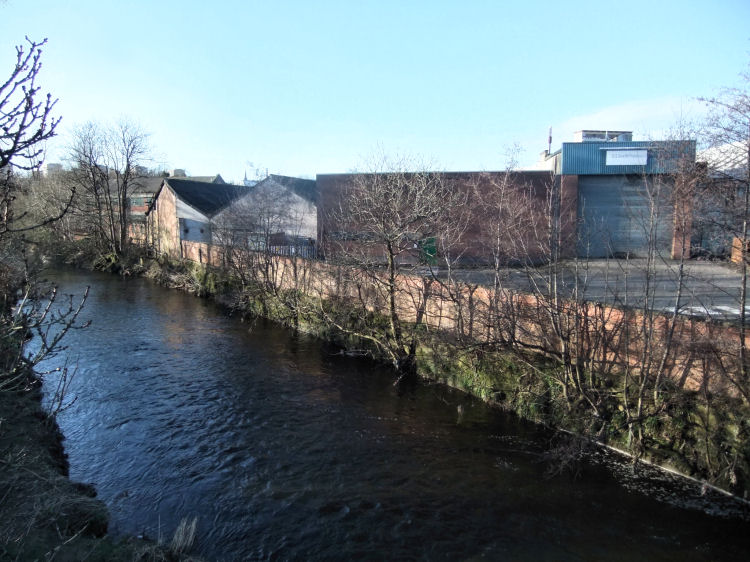
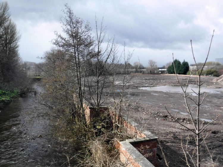
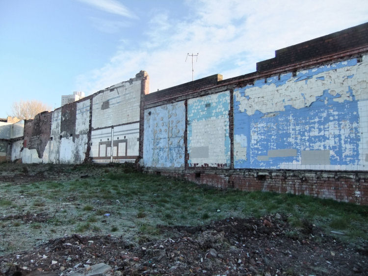
Industrial buildings of the banks of the White Cart Water, Pollokshaws, 2013
The industrial units shown by the riverside in the above photograph were all demolished and the site prepared for residential development as seen in this view from early 2017.
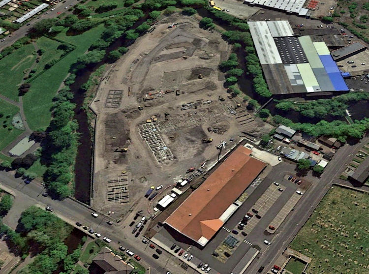
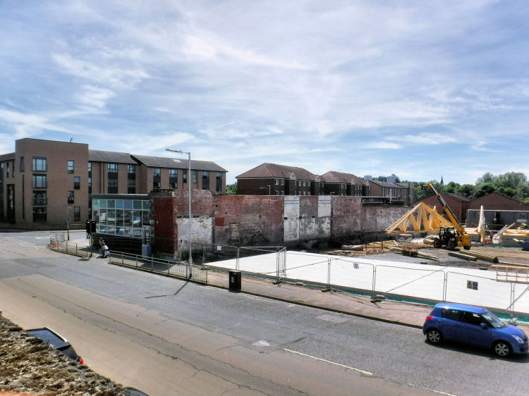
Cleared site of demolished factories and warehouses at White Cart Water, Pollokshaws, 2017
Aerial view of cleared site of demolished factories and warehouses surrounded by White Cart Water, Pollokshaws
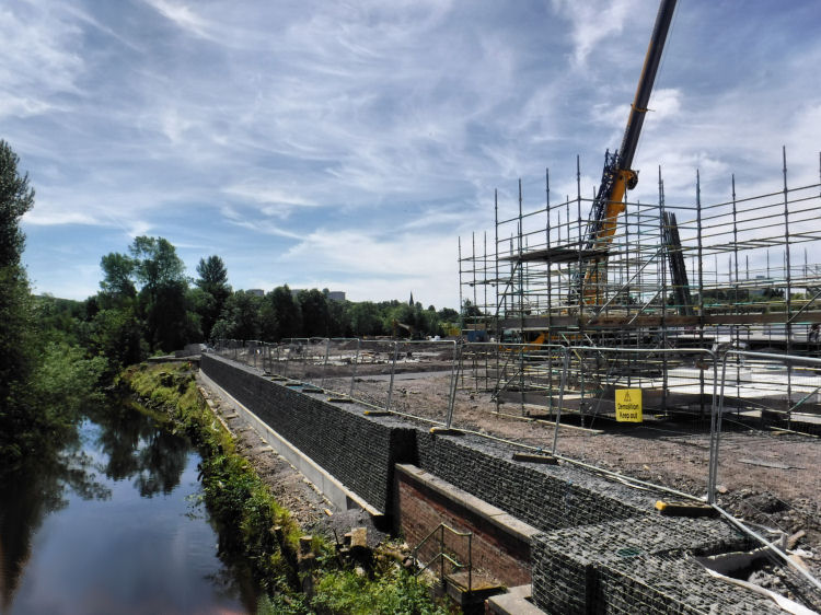
Redevelopment of site of demolished factories and warehouses, Pollokshaws, June 2018
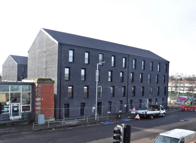
Houses appearing on site of demolished factories and warehouses, Pollokshaws, February 2019
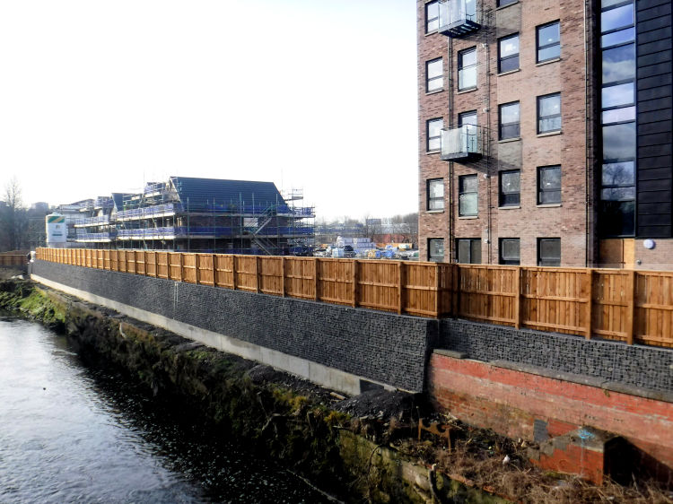
Riverside view of redevelopment at Pollokshaws, February 2019
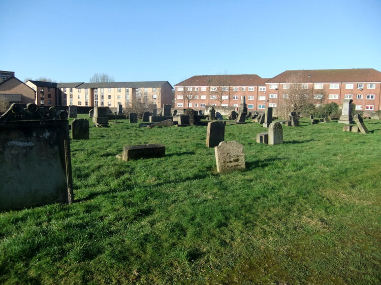
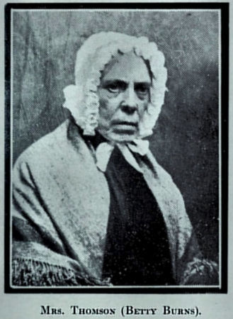
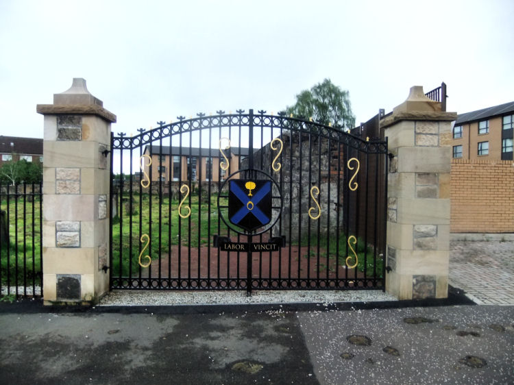
Cemetery at Kirk Lane which contains the grave of Robert Burns' daughter, Betty Thomson
Ornamental iron gates at entrance to cemetery with Latin motto "Labor Vincit" - Work Conquers All
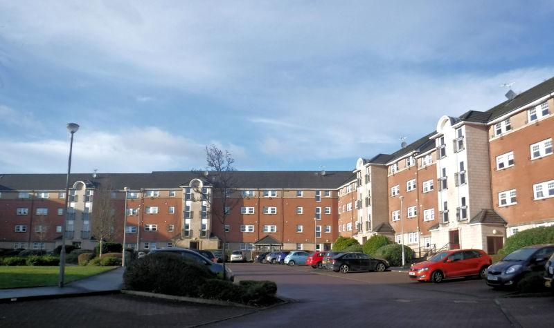
The 1960's redevelopment of Pollokshaws was an abject failure which included the creation of a dreadful shopping centre at Shawbridge Arcade and an absolutely awful concrete and glass public library in Shawbridge Street. New housing at Pleasance Way, Pollokshaws, built 2004/ 2005
The most common type of housing in the redevelopment of Pollokshaws consisted of new flats in multi-storey blocks. Some of the older blocks were demolished in 2008 and 2009.
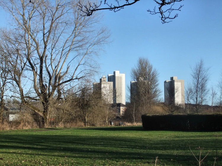
View of Pollokshaws tower blocks from Auldhouse Park
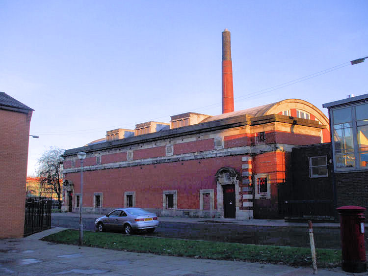
Pollokshaws Baths, Pool and Public Washhouse, the "steamie", were built by Glasgow Corporation after the First World War, at a time when they were providing similar recreational and social facilities throughout the city. The complex became a Sports Centre in the 1980's before its eventual closure and demolition.
Pollokshaws Baths
Site of Pollokshaws Baths, after demolition in the summer of 2010
Remaining multi-coloured walls of Pollokshaws Baths
Redevelopment of site of Pollokshaws Baths, June 2018
New housing appearing on site of Pollokshaws Baths, February 2019
As at September 2016 every single one of the tower blocks in the aerial image shown below has been demolished, with low-rise housing replacing many of them. The bottom left of the picture shows Pollokshaws Baths before it was flattened. The now derelict Sir John Maxwell School can be seen to the left of Pollokshaws Burgh Hall, one of the few buildings left intact.
Soon to be demolished tower blocks of Pollokshaws
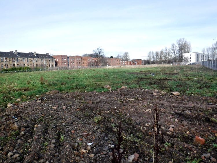
Cleared site of demolished tower blocks of Pollokshaws, February 2019
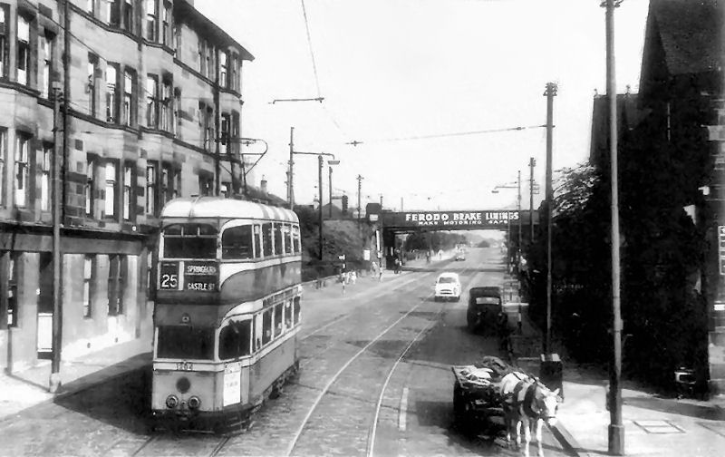
Many of Glasgow's day trippers heading for the delights of Rouken Glen Park got a ride through Pollokshaws on the no.25 tram which also passed through Thornliebank on the way to the Rouken Glen terminus. This 1950's view shows a tram leaving Pollokshaws heading towards the railway bridge at Shawlands Station on the return journey through the city centre to Springburn. An illustrated history of Thornliebank and Rouken Glen with more details of the local tram routes is featured in a dedicated page of this website.
No.25 tram on Pollokshaws Road heading towards railway bridge at Shawlands Station
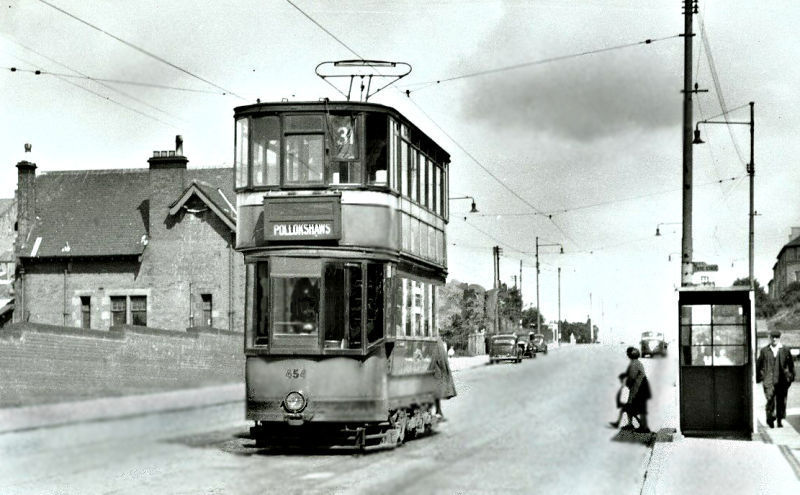
No.31 tram to Pollokshaws approaching Shawlands Station
Pollokshaws was a small sparsely populated village before the Industrial Revolution, but by the time of the census of 1831 it had became a busy manufacturing town with a population of over 4500.
It was conveniently positioned only 3 miles south-west of Glasgow beside the White Cart Water and the Auldhouse Burn, with an abundance of water and local coal providing steam power for the newly mechanised mills.
The cotton trade provided a variety of sources of employment. In addition to spinning yarn and weaving textiles with power-looms, many of the inhabitants were employed in bleachfields and dye-works. The freestone quarries and coalpits in the locality also provided work for the local population.

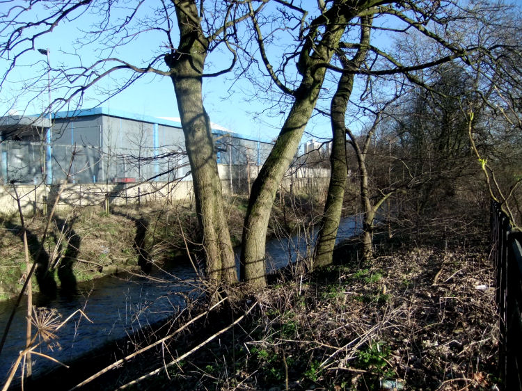
The river flowing in a north-easterly direction past Thornliebank and Auldhouse towards Pollokshaws is the Auldhouse Burn, while the river flowing westwards through Cathcart and Langside to Pollokshaws is the White Cart Water. The two streams meet up at Auldhouse Park in Pollokshaws.
The numerous places of worship in Pollokshaws are described and illustrated in the dedicated Shawlands & Pollokshaws Churches page of this website.


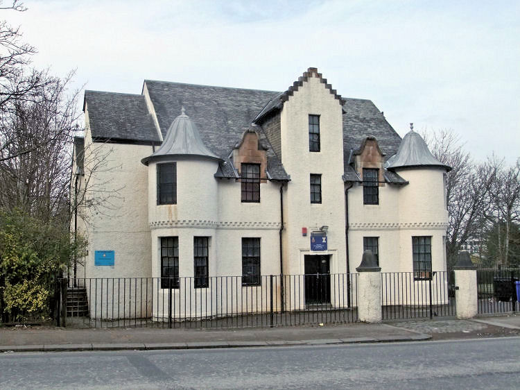
The headquarters building was actually located in Paisley, with the more modest present day drill hall being built in Auldhouse Road.
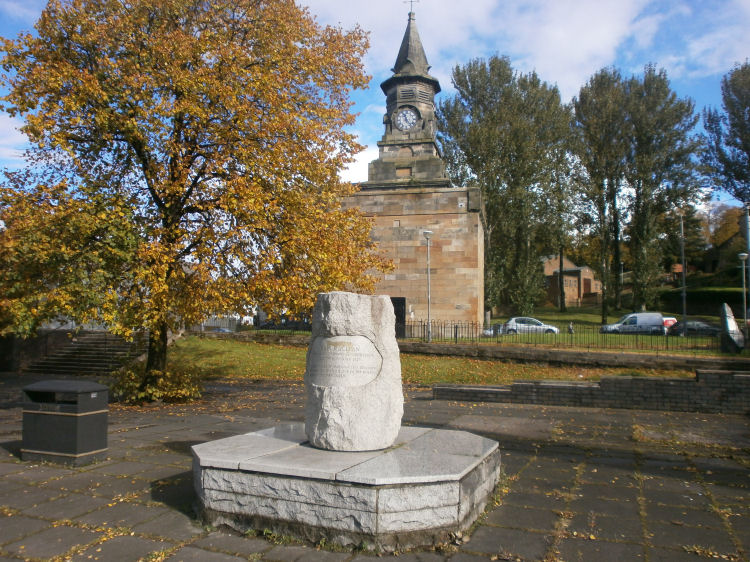
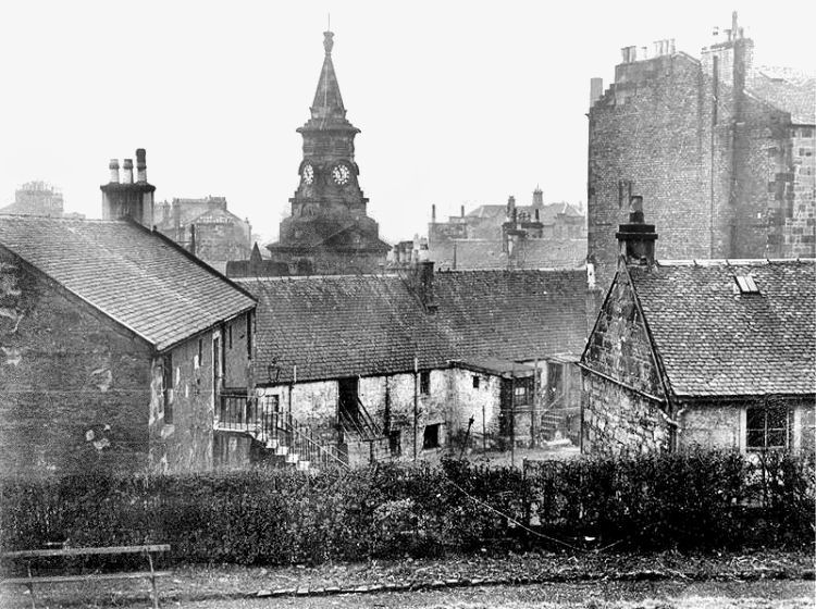
It became a "Burgh of Barony" in 1818, receiving a charter of incorporation with a council comprising of a Provost, Bailie, Treasurer and six councillors. The town-clerk was appointed by the council to administer the affairs of the burgh. The clock tower from 1803, shown above, is all that survives of the old Town House where the council met. The remainder was demolished in 1934.
The Burgh Charter empowered the council to hold courts for the trial both of civil actions and criminal offences. A jail to incarcerate local wrongdoers was built in 1845.
Pollokshaws remained an independent burgh until 1912 when it was annexed to the City of Glasgow.


The school was situated on Pollokshaws Road, opposite Pollokshaws West Railway Station.
There were two coaches daily, operated in much the same way as the transport described in my Travelling from Glasgow before the Railway Age web page. In addition, the stage coaches from Irvine and Barrhead stopped off at the Toll House at Pollokshaws on their way to and from the city.
This commentary on the working conditions in the mills of Pollokshaws is actually meant to be positive!
The new buildings of recent times are much more attractive, such as at the residential development at Pleasance Way, below.

![]()
|
|
| |
|
|
||
|
|
All original artwork, photography and text © Gerald Blaikie
Unauthorised reproduction of any image on this website is not permitted.
