
Welcome to this exploration of Thornliebank and the neighbouring parkland of Rouken Glen, which are situated along the banks of the Auldhouse Burn as it flows through East Renfrewshire, heading towards the Glasgow city boundary.
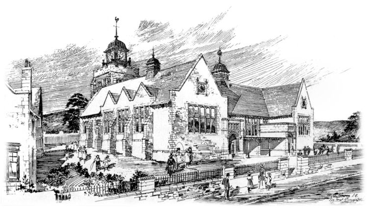
Thornliebank Public School was designed by Glasgow based architect, William Gardner Rowan. His drawing of the building was displayed at the annual exhibition of the Glasgow Institute of the Fine Arts in 1897.
Exhibition drawing of Thornliebank Public School, 1897
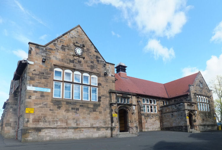
Photograph of Thornliebank Public School, 2015
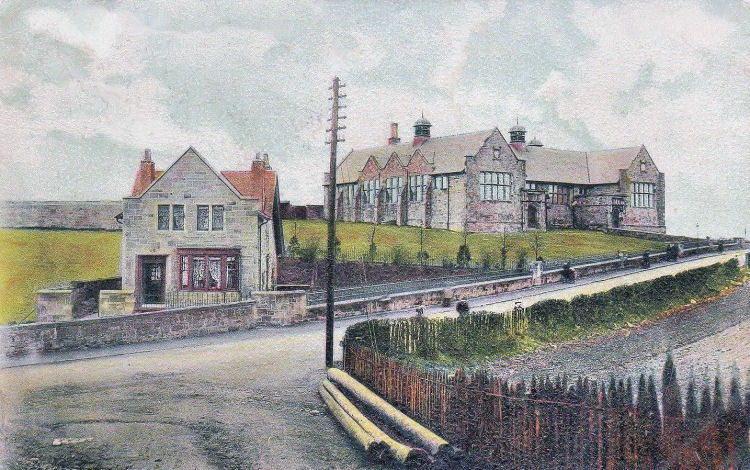
Early view of Thornliebank Public School
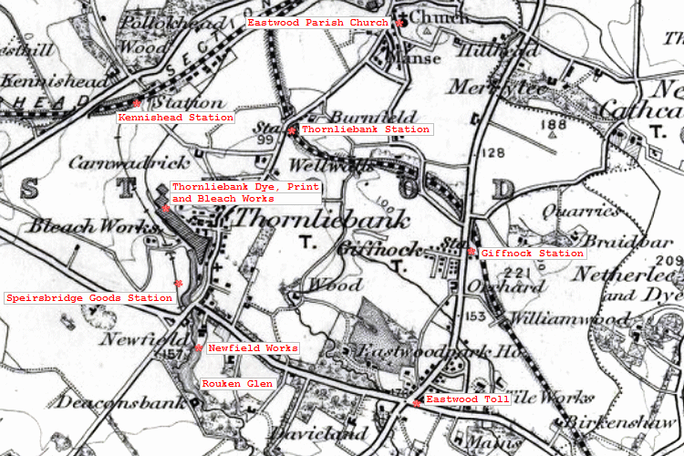
The old village of Thornliebank was situated on the banks of the Auldhouse Burn, south-west of Pollokshaws, where the river met up with the White Cart Water. Most of the district belonged to Messrs Crum of the Thornliebank Print Works, and was almost wholly inhabited by their employees.
From 1881 Thornliebank had a railway station on the Caledonian line to Busby. There was also an earlier branch line on the Glasgow and Kilmarnock Joint Railway from Kennishead to Speirsbridge Goods Station, which had been created to serve Crum's works.
Map of Thornliebank & surrounding area, 1898
Walter Crum (1796-1867)
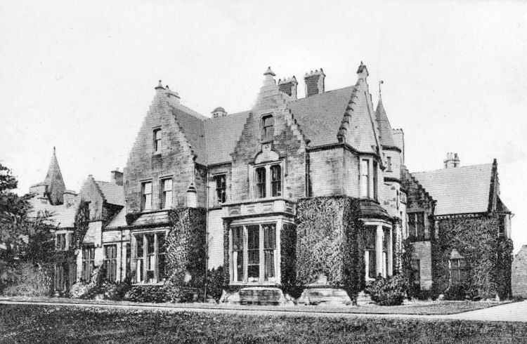
Thornliebank House in Rouken Glen Park was built over a period of many years in a combination of various styles. It was advertised to let in March 1852 as 'The Mansion House of Birkenshaw in the Parish of Eastwood'. The land surrounding the house was 'in pasture'. In 1858 the house and surrounding estate was acquired by Walter Crum, the proprietor of the Thornliebank Printworks.
Thornliebank House
Edwardian view of Thornliebank House with ladies enjoying the sunshine
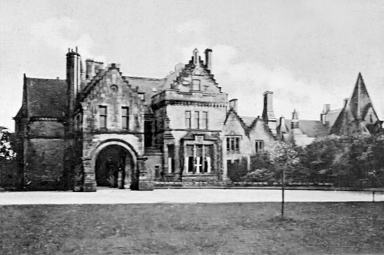
Entrance to Stable Block on driveway to Thornliebank House
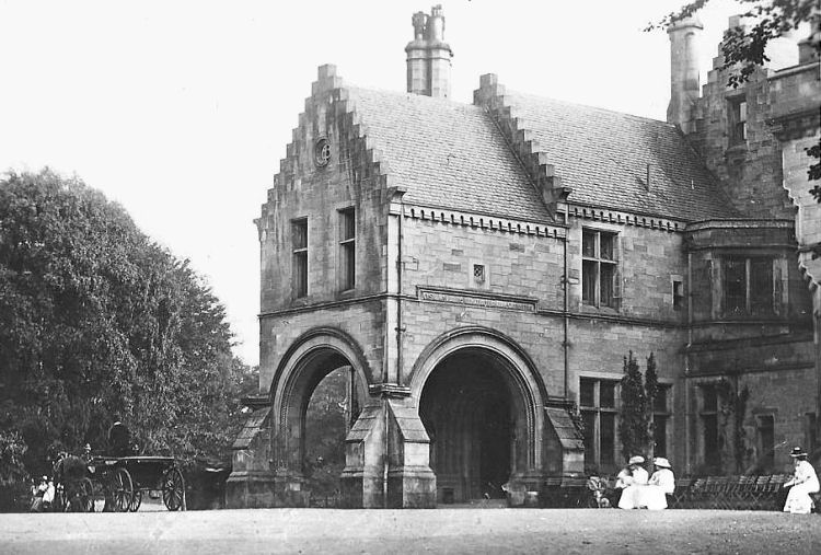
Ornamental entrance to Stable Block, which has avoided demolition
Birkenshaw Cottage at side of Stable Block
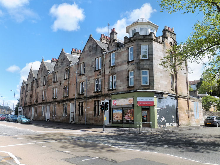
Thornliebank Co-op, Main Street
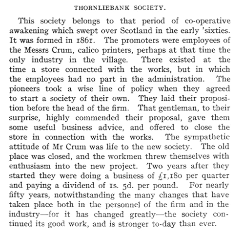
Thornliebank Co-operative Society was formed in 1861, taking over from Walter Crum's company store. The story of the society is shown in the report, below, published in 1910.
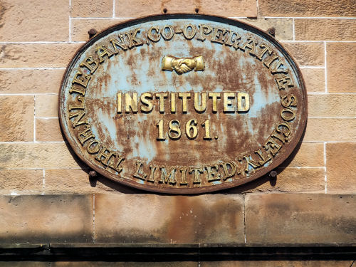
Plaque at Thornliebank Co-op
Tenement block built by Thornliebank Co-operative Society, 1906
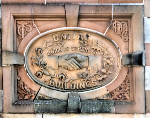
Plaque at Thornliebank Co-op tenement block, T.C.S, 1906
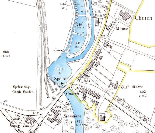
The Auldhouse Burn was dammed at Speirsbridge, creating a system of reservoirs holding the water needed to power Crum's extensive works.
Map of Speirsbridge, Thornliebank, 1897
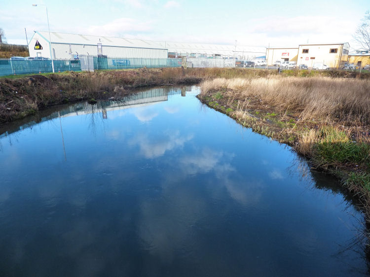
Reservoir shown in above map at the site of former Speirsbridge Goods Station
Weir at reservoir on Auldhouse Burn, Speirsbridge, on approaches to Thornliebank Print Works
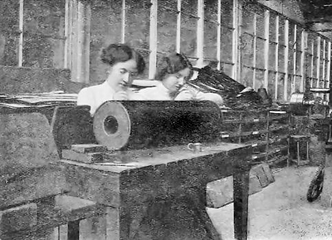
Girls preparing rollers at Thornliebank Print Works
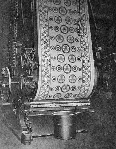
Patterned cotton 'Calico' from printing machine at Thornliebank Print Works
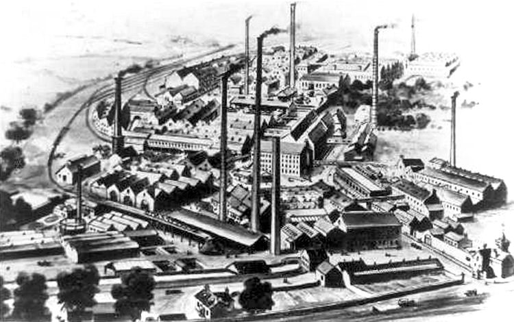
The full extent of the Thornliebank Printworks can be seen in the illustration below. Speirsbridge Goods Station and the associated railway tracks can be seen at the bottom left, but the Auldhouse Burn cannot be spotted as it was culverted and directed through artifical channels as it passed through the works. The only remaining part of the site which can be identified from Main Street are the stone gateposts at the bottom right of the picture.
Thornliebank Print Works
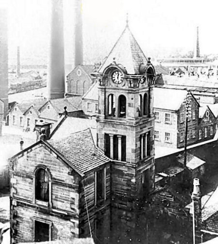
The clock tower shown at the bottom right of the above picture can be seen in close-up in the view below.
Clock tower at entrance to Thornliebank Print Works
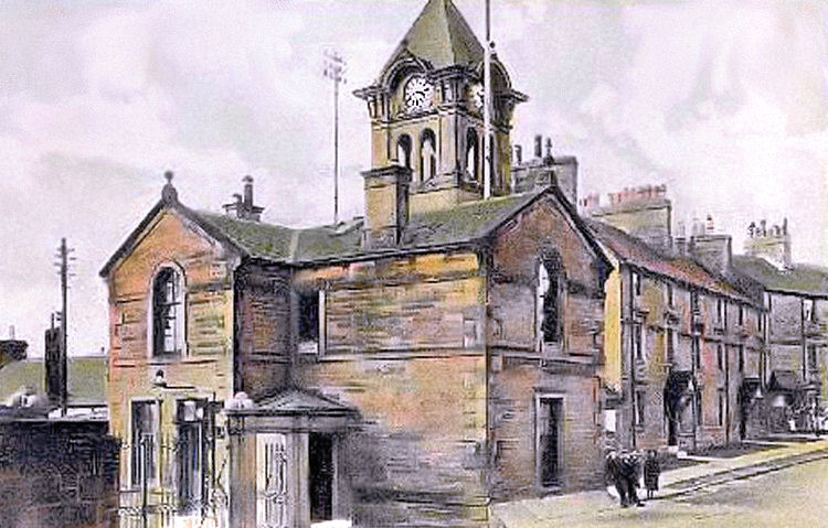
Gatehouse at entrance to Thornliebank Print Works
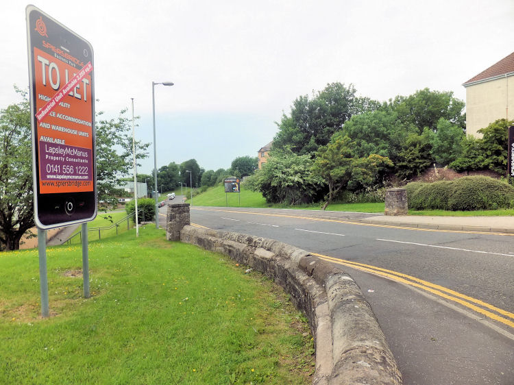
Stone gateposts at the former entrance to Thornliebank Print Works, now the site of Spiersbridge Business Park
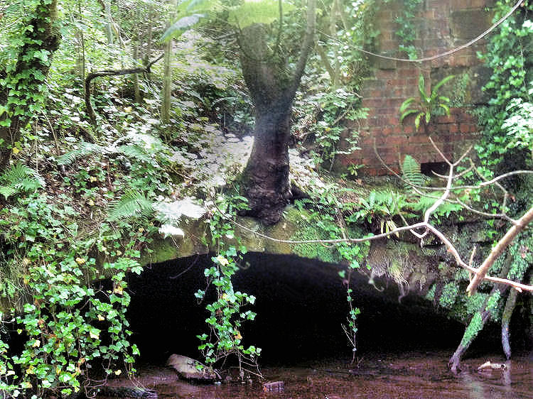
Culverted section of Auldhouse Burn and original brickwork from Thornliebank Print Works
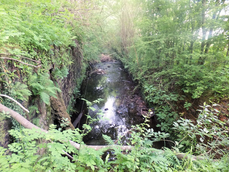
Straightened and canalised section of Auldhouse Burn at Thornliebank Print Works
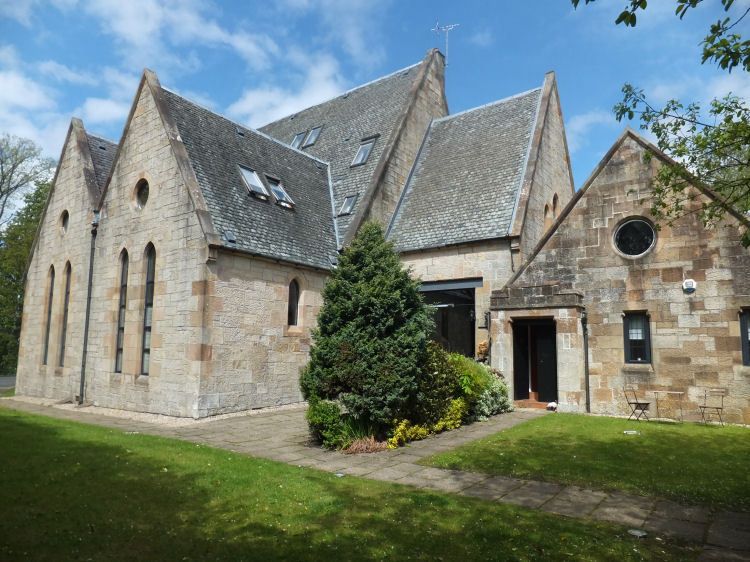
The former Thornliebank Parish Church was built for the established Church of Scotland in 1891 on an elevated site gifted by Alexander Crum, proprietor of the Thornliebank Print Works. After the merger with the United Free Chuch in 1929, the church became known as Thornliebank Woodlands Parish Church.
Thornliebank Woodlands Parish Church from the north-west
The church buildings have been converted by Noah Developments into 10 self-contained apartments, first occupied in October 1993.
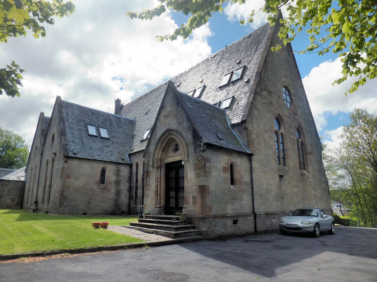
Thornliebank Woodlands Parish Church from the south-east
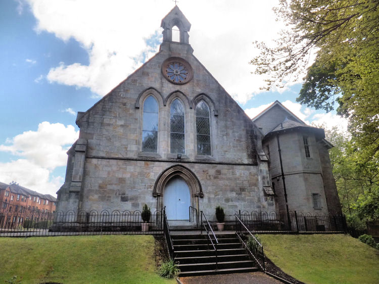
The present day Thornliebank Parish Church was built in 1855 in a simple neo-Gothic style. The congregation originated in 1836 with the establishment of a 'preaching station' in the village for the Thornliebank Secession Church. As a result of a church union in 1847, this denomination joined the United Presbyterian Church of Scotland, who erected the new church building which opened on 6th May 1855. This denomination became part of the United Free Church in 1900, which in turn merged with the established church in 1929.
Thornliebank Parish Church, Spiersbridge Road
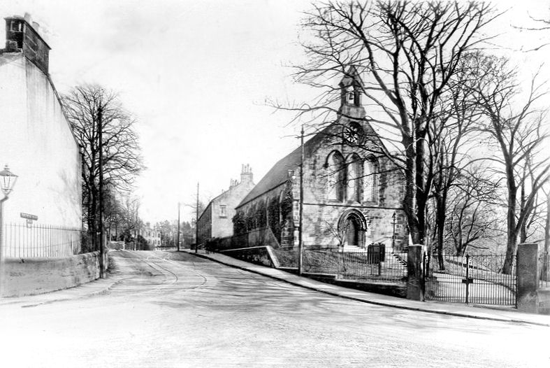
Old photograph of Thornliebank Parish Church, Spiersbridge Road
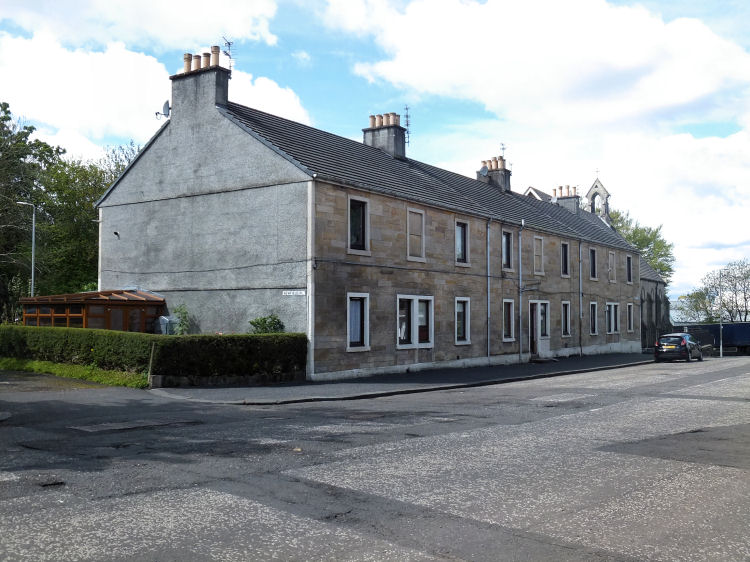
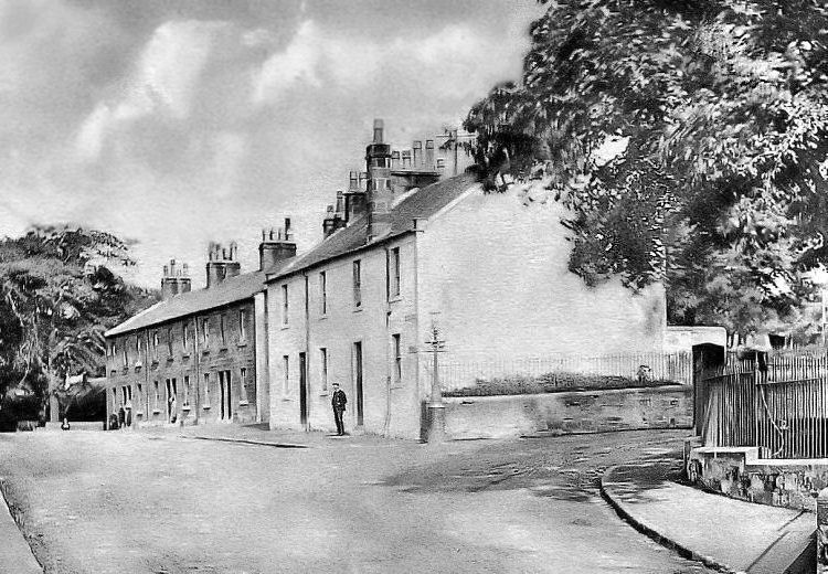
Surviving row of terraced houses behind Thornliebank Parish Church
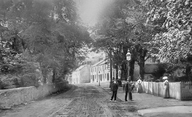
19th century street scene at Speirsbridge, Thornliebank
Edwardian view of Speirsbridge, Thornliebank
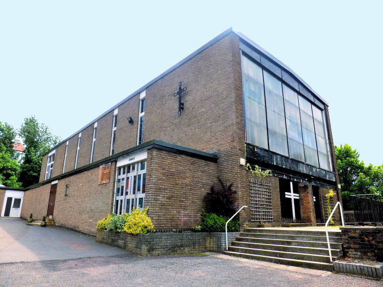
The Roman Catholic Church of St Vincent de Paul, Thornliebank, was constructed in 1960, replacing an earlier structure which was used when the parish was established in 1942. St Vincent de Paul R.C. Church, Thornliebank
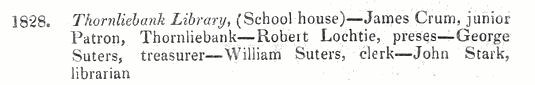
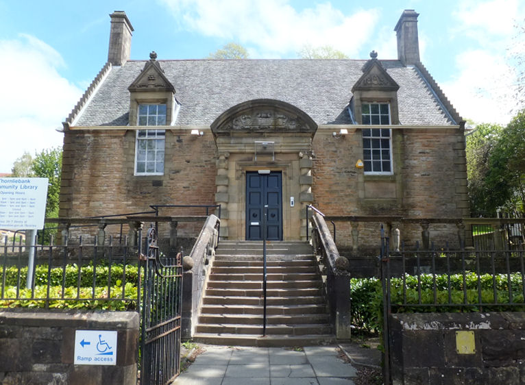
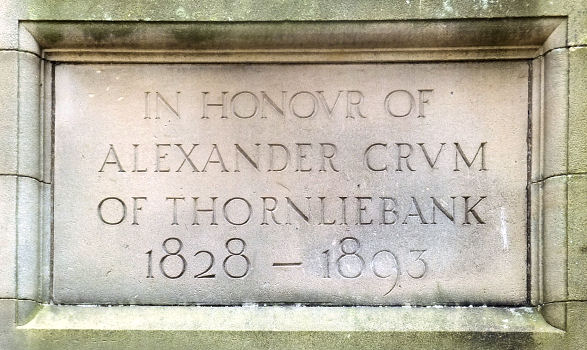
Thornliebank's earliest public library was established in 1828 under the patronage of James Crum Junior. It was situated in the village's school house with John Stark being the first librarian. Coincidentally, 1828 was the birth year of Alexander Crum, after whom the present day Thornliebank Library is dedicated.
Alexander Crum Memorial Library was built in memory of Alexander Crum, who had been the Liberal M.P. for Renfrewshire as well as being the proprietor of the Thornliebank Print Works. The library was situated opposite the gates of the works, allowing employees to use its facilities during their meal breaks.
One of the speakers at the event was Lord Kelvin, who had been married to Alexander Crum's sister, Margaret. He praised his late brother-in-law and described the Thornliebank Works as "an example to the United Kingdom and the whole world, for Mr. Crum adopted as system of smoke prevention and now there was scarceley the faintest visible sign of smoke issuing from those great chimneys". It appears that the Crums were 'Green' long before it was fashionable!
Alexander Crum Memorial Library, Thornliebank
Memorial plaque at Alexander Crum Memorial Library, Thornliebank
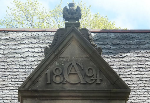
Alexander Crum's monogram, 'AC 1894' at Thornliebank Library
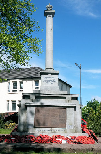
Thornliebank war memorial
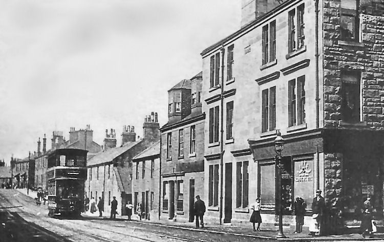
City bound tramcar from Rouken Glen passing along Main Street,Thornliebank
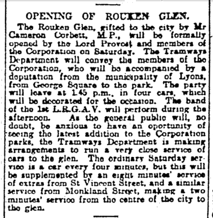
Rouken Glen Park and its mansion house was gifted to the city of Glasgow by Archibald Cameron Corbett in 1906. It was officially opened as a public park on 26th May 1906 by the Lord Provost of Glasgow, Sir William Bilsland. In June 1984 Glasgow City Council eased the financial burden on the city's ratepayers by leasing the park to Eastwood District Council, who have since been succeeded by East Renfrewshire Council.
Extract from Glasgow Herald , 25th May 1906, regarding the opening of Rouken Glen Park the following day
Tram at entrance to newly opened Rouken Glen Park
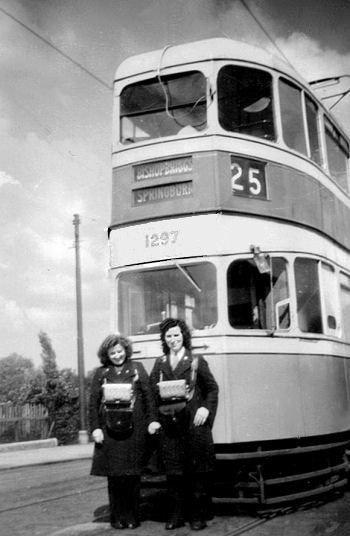
Tram journeys for day trips to Rouken Glen were very popular in the old "red cars" which were updated with a new numbering system in 1938. Passengers used either the No.8 or the No.25 tram, with the No.8 travelling along Kilmarnock Road and Fenwick Road through Newlands and Giffnock to the park gates. A round trip could be completed with a return journey on the No.25 tram which passed through Thornliebank and Pollokshaws before joining up with the No.8 at Shawlands Cross.
My late mother, Nancy, on the left of a No.25 Rouken Glen / Bishopbriggs tram, c.1950
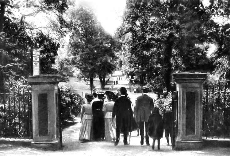
Day trippers entering the gates of Rouken Glen Park
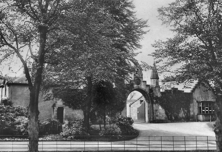
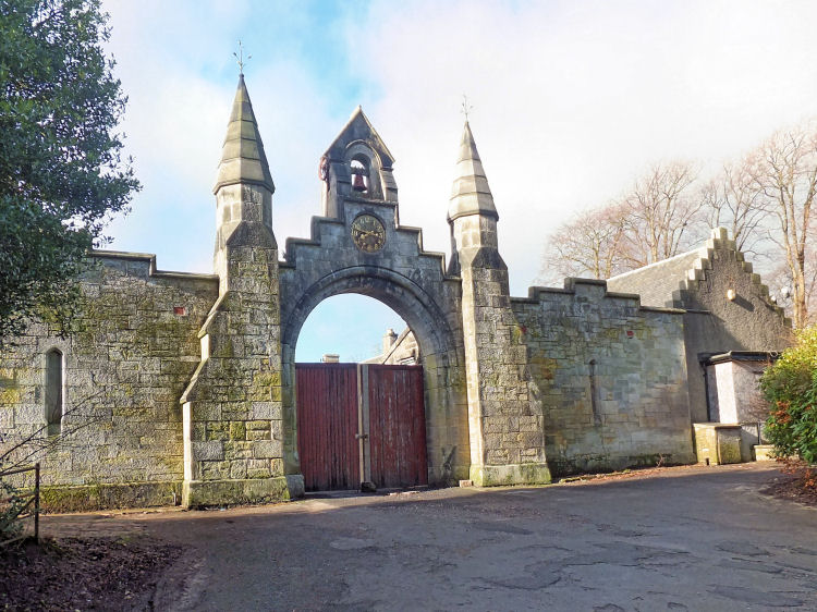
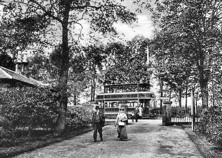
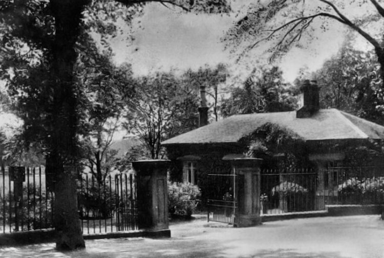
Gatehouse at Rouken Glen Park
Gatehouse at Rouken Glen, shortly after the arrival of the trams in 1906
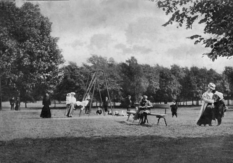
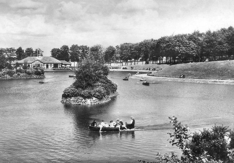
The new park provided recreational facilities for the visitors, such as a boating pond and children's play area.
Edwardian view of children's play area at Rouken Glen Park
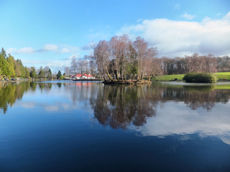
Boating pond at Rouken Glen
Pond at Rouken Glen, 2016
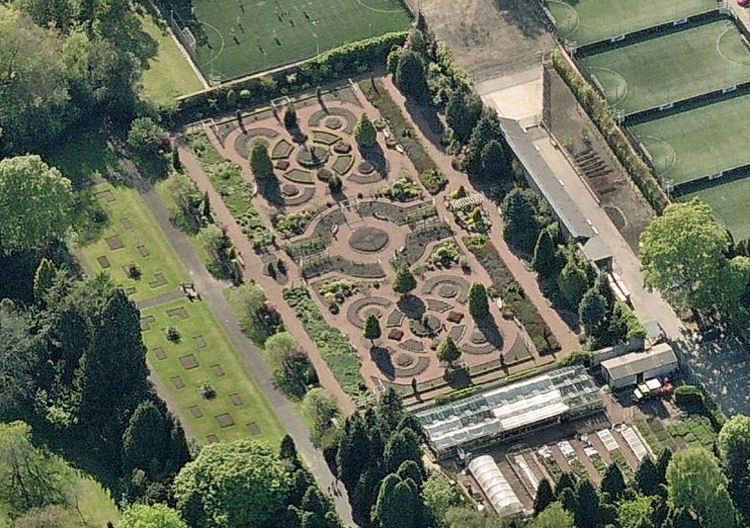
Walled Garden and greenhouses at Rouken Glen Park
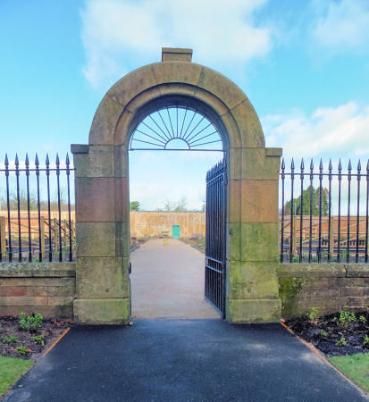
Gate to Walled Garden at Rouken Glen Park
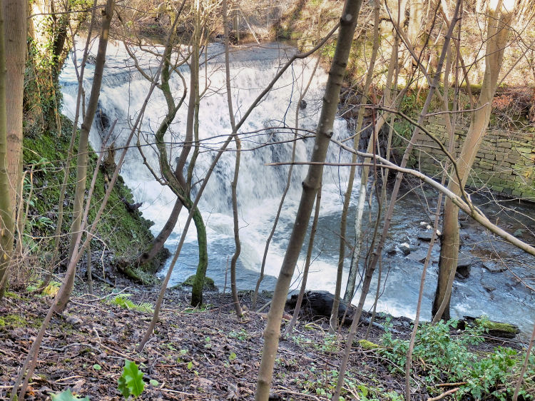
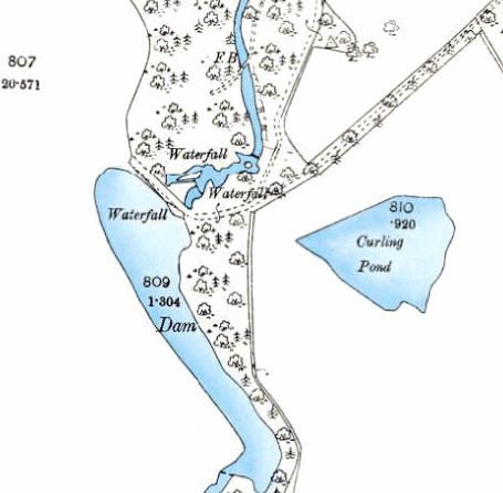
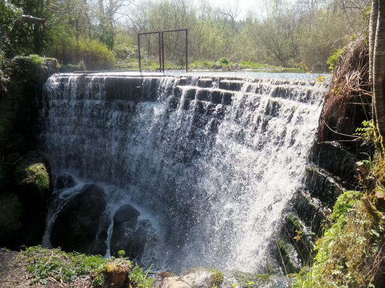
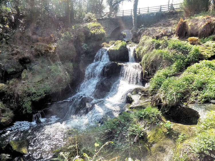
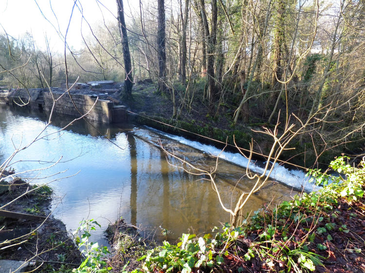
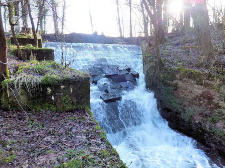
The outflow from the reservoir at the head of Rouken Glen had a series of waterfalls, which are still a major attraction to visitors to the park.
Map showing waterfalls at head of Rouken Glen
Artificial waterfall at reservoir at head of Rouken Glen
Natural waterfall at head of Rouken Glen
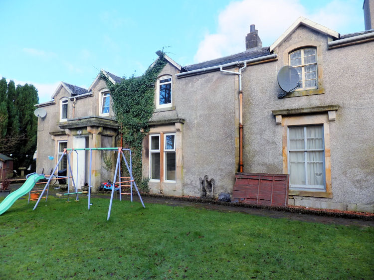
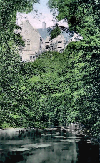
Rear view of Thornliebank House sitting high above Auldhouse Burn
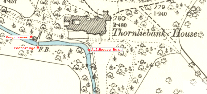
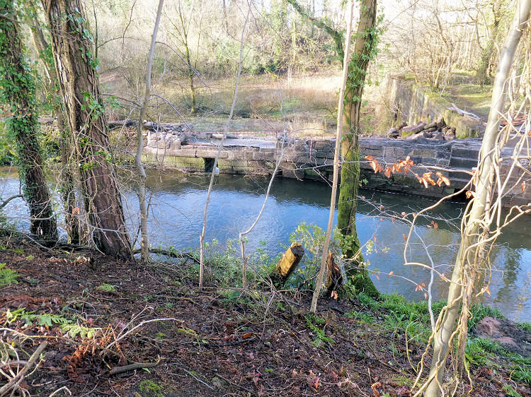
The Auldhouse Burn supplied the water supply for Thornliebank House. The remains of the pump house are still visible beside the footbridge over the burn.
Map showing pump House on Auldhouse Burn below Thornliebank House
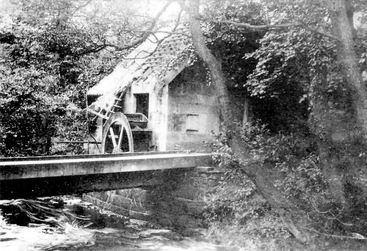
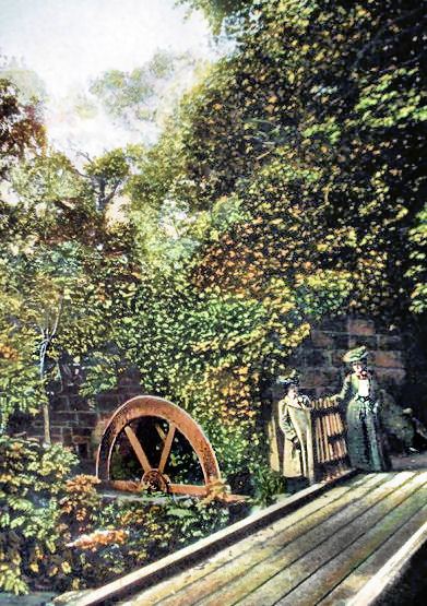
Old mill wheel and footbridge at pump House, Rouken Glen, 1910
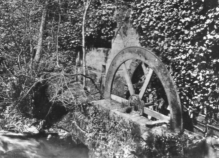
Mill wheel at pump house, Rouken Glen
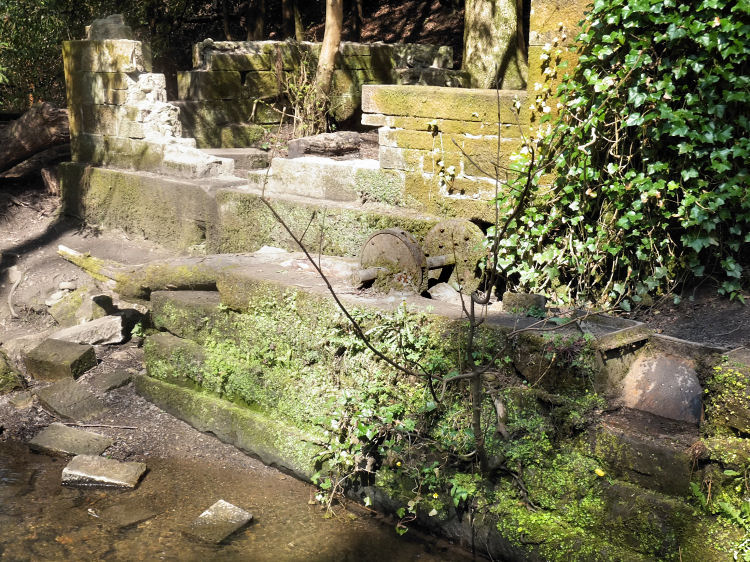
Surviving axle of old mill wheel at pump house, Rouken Glen, 2015
Edwardian ladies on footbridge at pump house, Rouken Glen Park
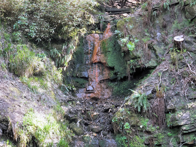
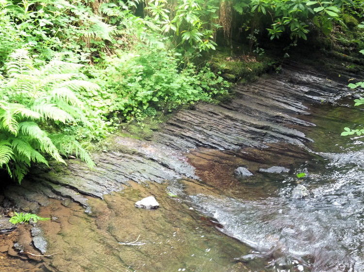
Iron rich rocks with rust coloured lichen on banks of Auldhouse Burn, Rouken Glen
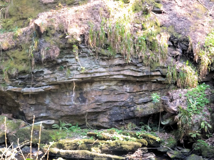
Horizontal beds of sandstone and limestone at Rouken Glen
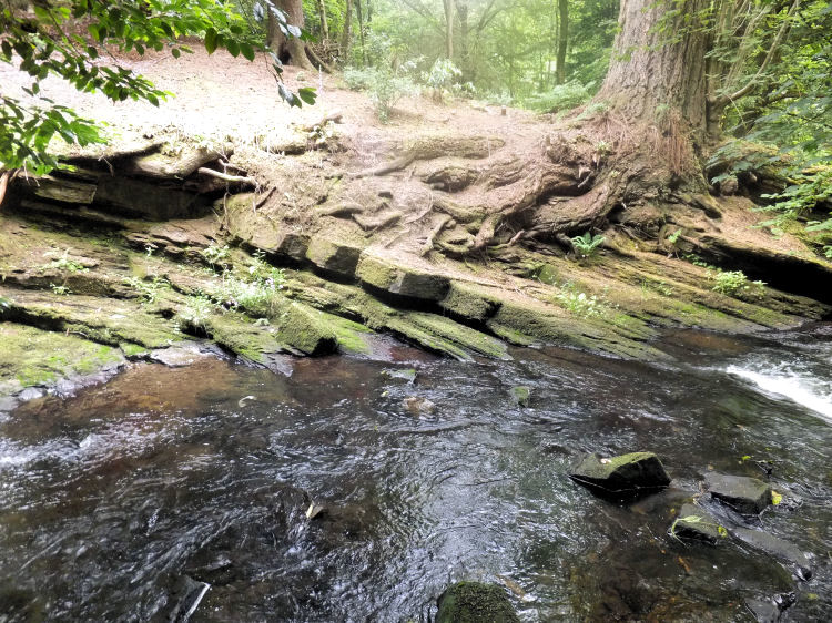
Exposed layers of sedimentary rock surrounding tree roots at Rouken Glen
Thin layers of shale at edges of Auldhouse Burn, Rouken Glen
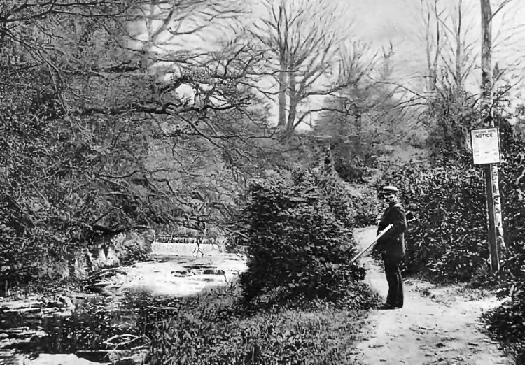
Gamekeeper standing downstream from weir on Auldhouse Burn, detailed below
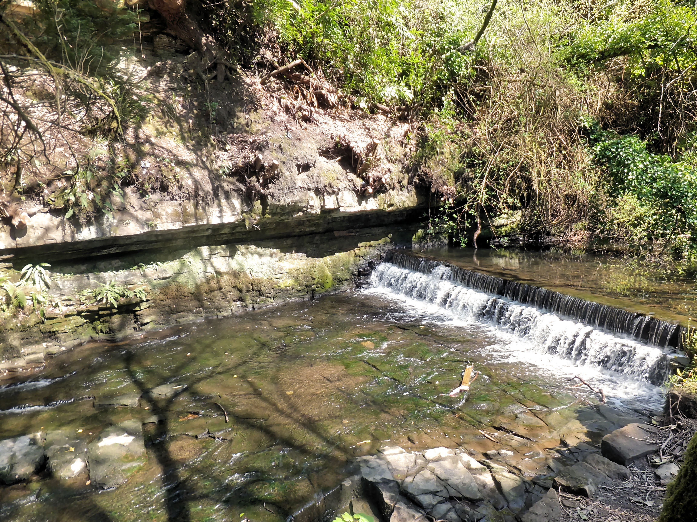
Weir and mill lade on approaches to site of Newfield Works, Rouken Glen
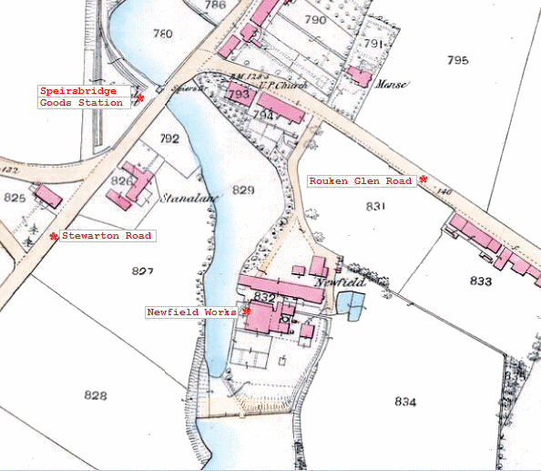
Map showing Newfield Works, on Auldhouse Burn, Rouken Glen
Surviving walls of Newfield Works, Rouken Glen
Mill lade approaching outflow at Newfield Works, Rouken Glen
Outflow at Newfield Works, Rouken Glen
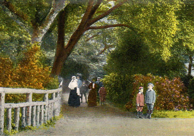
Edwardian family enjoying a day out at Rouken Glen
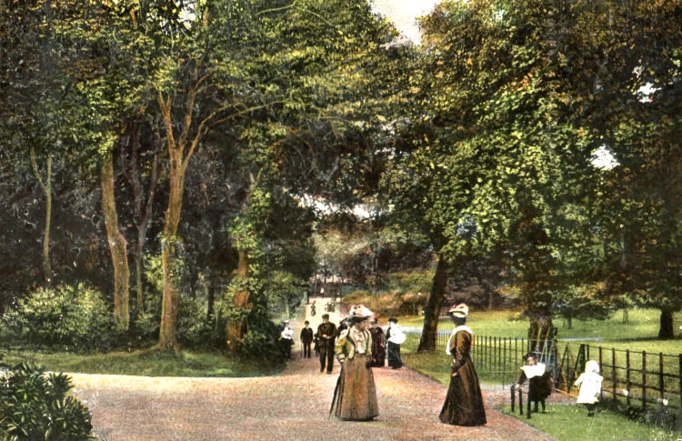
Edwardian scene at main avenue of Rouken Glen Park
Originating as a thriving manufacturing town, Thornliebank has more of a natural affinity with the Glasgow districts of Pollokshaws and Auldhouse than the dormitory suburbs of East Renfrewshire. The area between these neighbouring industrial settlements was developed by Glasgow Corporation with the post-war housing schemes surrounding Eastwood Parish Church in Thornliebank Road.
From the late 18th century various generations of the Crum dynasty operated extensive works engaged in cotton spinning, power loom weaving, calico printing and bleaching, all powered by the waters of the Auldhouse Burn.
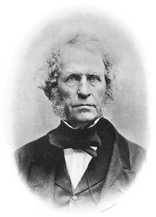
Walter Crum died in 1867 and the estate was passed on to his son, Alexander, who changed the name of the mansion to 'Thornliebank House'.
Much of the beautiful landscaping of Rouken Glen is credited to Alexander Crum.
Alexander's son, William, inherited the estate in 1893 and sold it to Archibald Cameron Corbett in 1905. Cameron Corbett, who would later become Lord Rowallan, gifted the mansion and surrounding estate to the citizens of Glasgow in 1906.
Rouken Glen was officially opened as a public park on Saturday 25th May 1906.
Thornliebank House was demolished in July 1965.
The architects of St Vincent's were Gillespie, Kidd and Coia who specialised in church buildings at the time. The proposed site was on a on a difficult slope which required considerable underbuilding for both the church and the presbytery.
The architect of the neat little sandstone building was Rowand Anderson of Edinburgh, who designed it in the Scottish vernacular style of the late 17th century.
The opening ceremony took place on Saturday 20th March 1897, when Sir John Stirling Maxwell handed the title deeds to Sir Michael Shaw-Stewart, the chairman of the trustees.
![]()
|
|
| |
|
|
| |
|
|
| |
|
|
| |
|
|
| |
|
|
| |
|
|
|
|
All original artwork, photography and text © Gerald Blaikie
Unauthorised reproduction of any image on this website is not permitted.
