
Newton Mearns is a district in East Renfrewshire, south of the city of Glasgow. It is situated in the ancient parish of Mearns which has a history stretching back to the twelfth century.
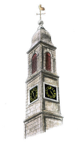
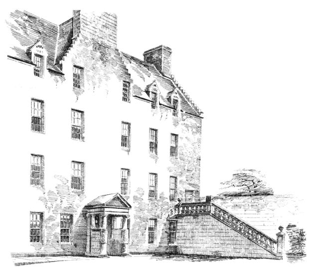
Drawing of Clock tower of Mearns Parish Church
The name Mearns is derived from the ancient British ‘Maeronas’, which translates as a district inhabited by herdsmen or dairy-people.
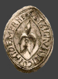
Seal of Nicholas de Mernes c.1170
Nicholas was the son of the patriarch of the family, Roland de Mernes (1124-1204).
The French names associated with early Mearns history indicates that the area was developed in the Anglo-Norman period which originated around the time of the reign of King David I, who ascended to the throne of Scotland in 1124.
‘Nova villa de Mernis', (Newtown of Mearns,) is mentioned in two donations by Sir Herbert Maxwell to
the monastery of Paisley in 1272 and 1316.
Description of Mearns parish from Ordnance Gazeteer, 1901
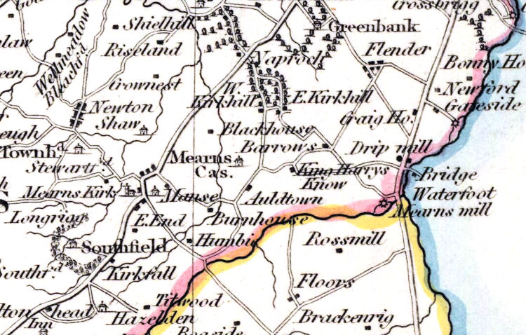
The map below, published in 1826, shows the red boundary of Mearns Parish with Eaglesham Parish to the south, coloured yellow in the map. The boundary is formed by Earn Water, which meets up with the White Cart at Waterfoot.
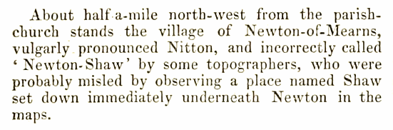
The map was the source of some confusion regarding the name of the village of Newton Mearns,
which is shown as 'Newton', consisting of rows of houses situated on either side of the road to Kilmarnock. It could however be mis-read as 'Newton Shaw', not noticing that 'Shaw' is represented with a house symbol to the south of the village.
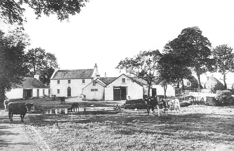
Until recent times this was the site of Shaw Farm on the banks of the little burn shown on the map.
Shaw Farm, Newton Mearns
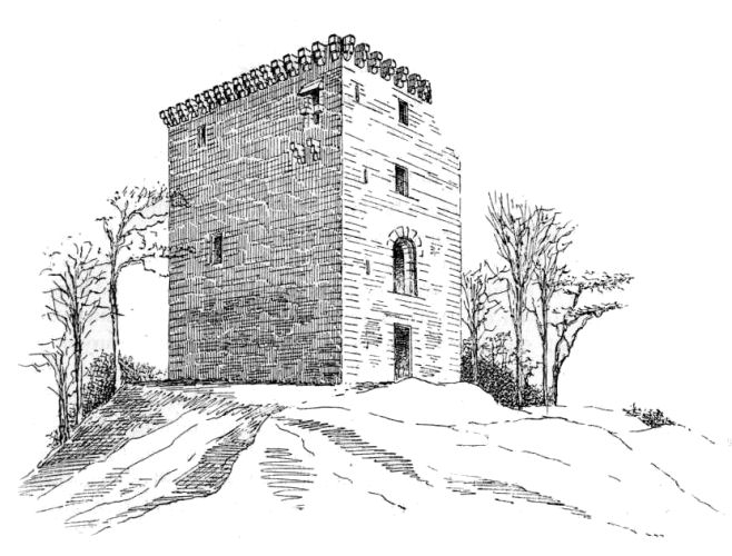
Mearns Castle consisted of a single tower situated on a rocky eminence surrounded with a strong wall and ditch and an entrance secured by a drawbridge.
The castle was built by Herbert, Lord Maxwell, under a royal warrant issued by King James II, who ascended to the throne of Scotland in 1449.
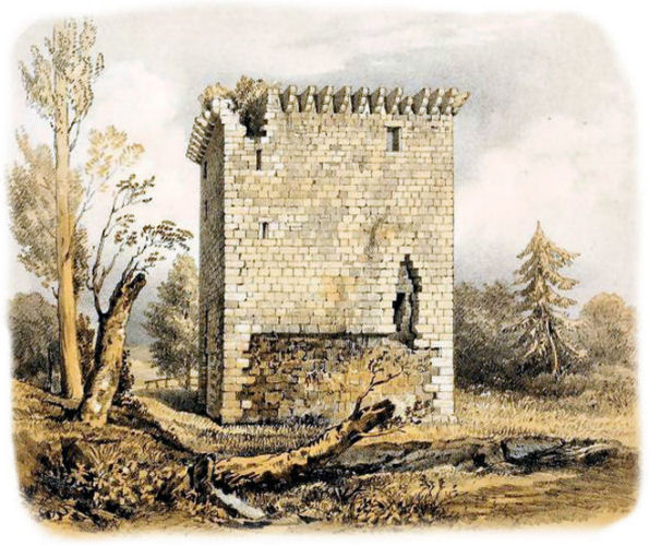
Sketch of Mearns Castle from the south-east
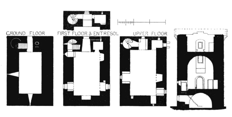
What appears to be the front entrance at the ground floor level of the tower gives access only down to the vaulted cellar.
To enter the habitable parts of the castle you would have to use the opening at the entresol level, which would be very easy to defend.
This doorway leads to the main hall of the castle, which is centred on a large fireplace shown in the section.
The fireplace is at the opposite end of the hall to the entrance, with the windows in the side walls having stone seats.
The entresol entrance gives access to the spiral staircase which leads to the upper storey, but not to the ground floor. Plans and section of Mearns Castle
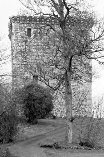
Winter view of Mearns Castle
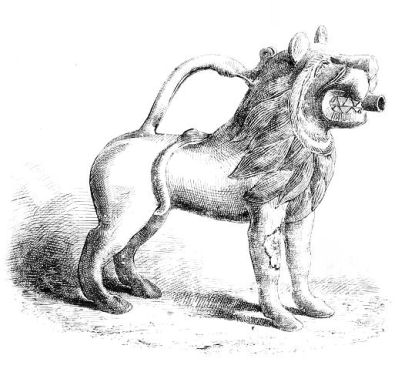
Bronze ewer found in the grounds of Mearns Castle c.1823
Mearns Castle, 1863
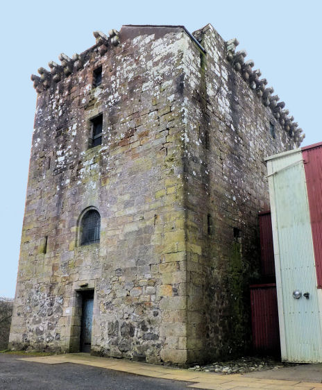
Modern view of Mearns Castle showing arched entresol entrance above cellar entrance at ground level
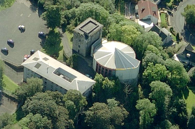
Aerial view of Mearns Castle and Maxwell Mearns Parish Church
Mearns Castle, 1873
Old photograph of Mearns Castle and surrounding woodland
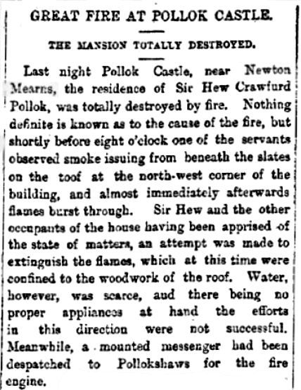
Pollok Castle, Mearns, was the seat of the Polloks of Pollok who could trace their ancestry back to Fulbert de Pollok in the Anglo-Norman period of the twelfth century. Cutting from Glasgow Herald , 1st August 1882, regarding fire at Pollok Castle, Mearns
When the "mounted messenger" arrived at Pollokshaws he discovered that the local fire engine was merely a manual appliance, unsuitable to tackle the fire. He then headed for the Southern Police Office in Glasgow where he raised the alarm for the Central Fire Brigade to be contacted by telegraph. Over an hour after the fire had started a steam powered fire engine was sent out from the city to attend to the blazing mansion. Travelling along poorly maintained roads it took the fire engine over an hour to reach the approaches to Pollok Castle, which was situated at the top of a steep hill. Horses from a neighbouring farm were required to get to get the appliance to its destination. When they got to the fire the only source of water was from a small burn which flowed through the grounds. In those circumstances there was no possibility of saving the building.
In our world of instantaneous communication it is difficult to appreciate the logistical problems which faced our forebears in such emergencies.
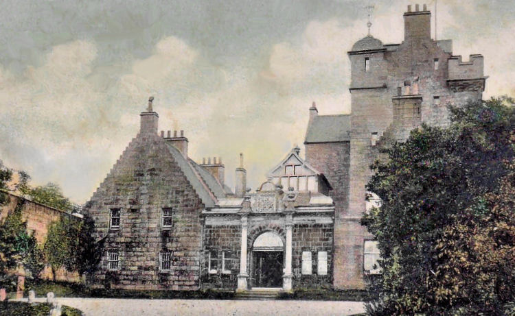
In 1886 the castle was rebuilt in the Scottish Baronial style by Mrs. Fergusson Pollok to the designs of Mr. Charles S. S. Johnston, architect.
Pollok Castle, Mearns, rebuilt 1886
Photograph of Pollok Castle and surrounding estate
The inscription below dates from the reconstruction of Pollok Castle in 1886. Inscription at Pollok Castle detailing the history of the structure
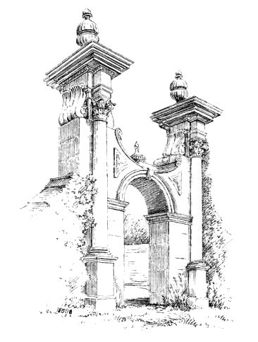
Entrance gateways to Pollok Castle
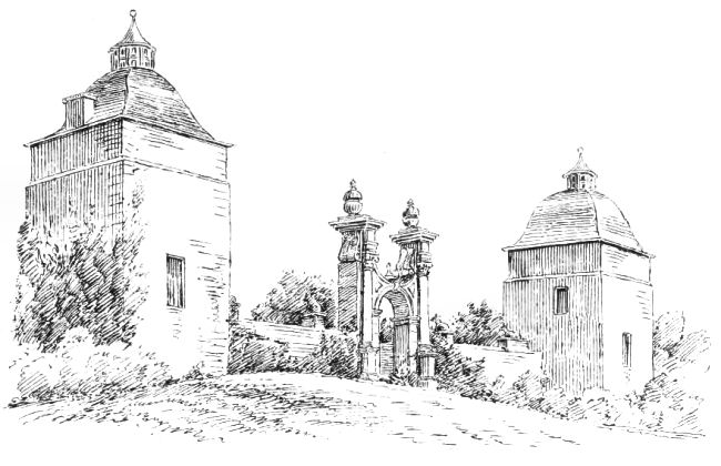
Pavilions at south wall of Pollok Castle
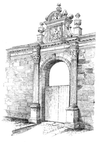
South front of Pollok Castle
Photograph of south front of Pollok Castle
The Polloks were kinsmen of Walter FitzAllan (1106–1177), the first hereditary High Steward of Scotland. The earliest recorded head of the family was Fulbert de Pollok, whose name occurs a number of times in the register of the monastery of Paisley. Fulbert had three sons, Peter, Robert, and Helias.
Helias was a priest and a canon of Glasgow who possessed the church and church lands of Mearns, which he had received from the High Steward. He later granted the church with its lands and teinds to the monastery of Paisley. This grant was confirmed by King William the Lion and by Jocelin, Bishop of Glasgow. Helias's brothers, Peter and Robert, were conspicuous figures at the courts of both Malcolm IV and William the Lion.
In 1947 the estate was inherited by a nephew of the last of the Polloks to occupy the castle, who sold it on to a developer who cleared the site of most of the historical buildings by 1954.
The site of Pollok Castle has been left somewhat isolated from modern Newton Mearns by the M77, Glasgow - Kilmarnock motorway. A new house was built in 2003 in the woodland which once surrounded the demolished castle. Further residential development of the old estate has taken place since then.
Site of Pollok Castle in woodland on opposite side of the M77 motorway from Newton Mearns
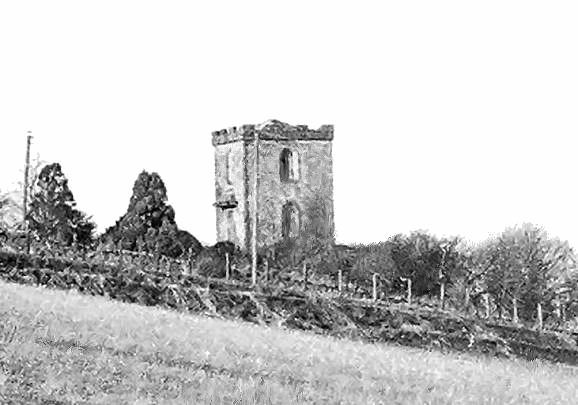
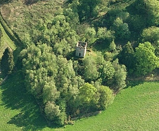
Capelrig Tower is situated on an elevated site, just south of Patterton Railway Station. Hopefully the surrounding mature woodland shown below will survive the suburban encroachent which has spoiled much of this part of East Renfrewshire.
Capelrig Tower viewed from the north
The 'Lands of Caplerig' were named after a 'rig' or ridge of ground which belonged to a chapel which Herbert de Maxwell endowed c.1300. This chapel is believed to have belonged to the Knights Templar. The tower is thought to have been erected around the late 1700's to provide a viewpoint for the surrounding countryside.
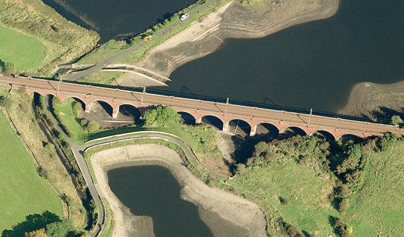
The spectacular Waulkmill Glen Viaduct is situated just west of Patterton Station. It carries the rail track over the reservoir on its way to the Neilston terminus. The railway originated as a freight line operated by the Lanarkshire and Ayrshire Railway connecting the Lanarkshire coalfields with the Clyde coast port of Ardrossan. The viaduct was constructed during the period of its development in the late 1880's. Patterton Station opened in 1903 when the line began to be used for passenger services connecting to Glasgow by way of the Cathcart Circle lines. An illustrated history of the development of these services is included in the Origins of Cathcart Circle
page of this website.
Waulkmill Glen Viaduct
A small selection of old photographs of scenes in and around the old village of Newton Mearns is featured below.
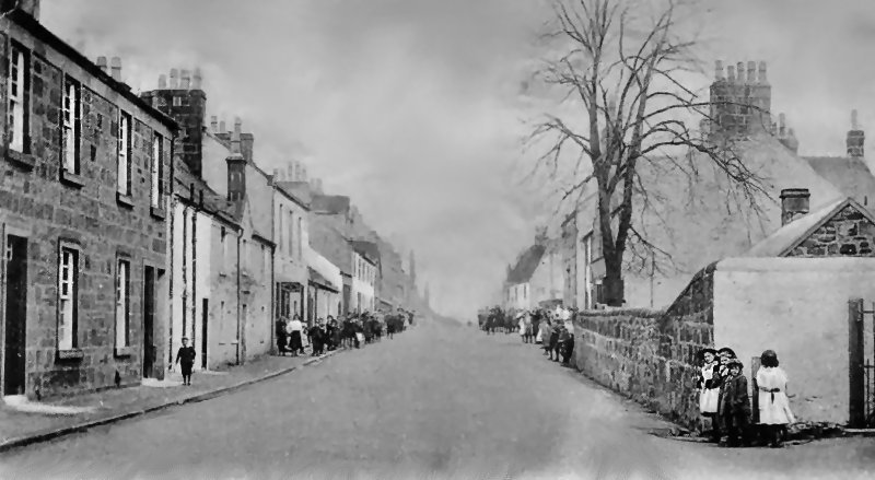
Inter-war view of Main Street, Newton Mearns, now the site of 'The Avenue' Shopping Centre
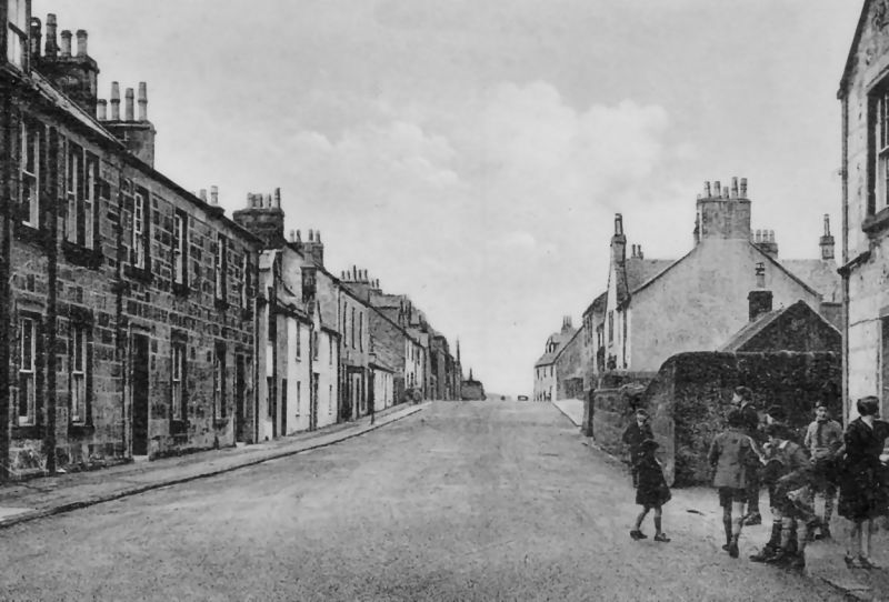
Groups of children at Main Street, Newton Mearns
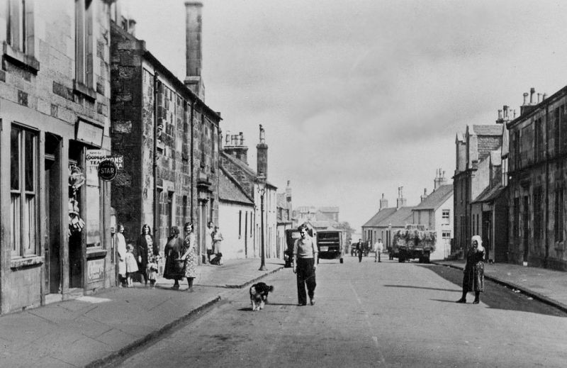
Motorbus in Barrhead Road near the corner with KIlmarnock Road at Mearns Cross
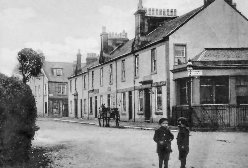
Small boys at same corner of Barrhead Road at Mearns Cross
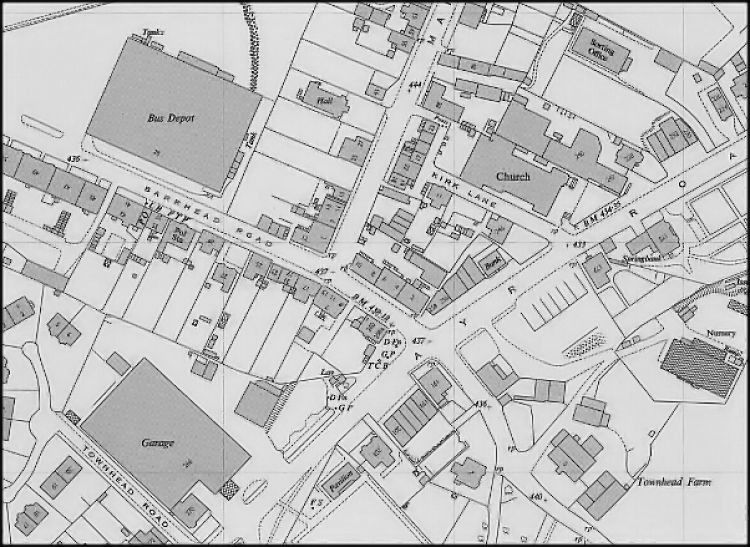
The building seen behind the two boys in the photograph is shown in the map below on the north side of Barrhead Road, at the corner with Kilmarnock Road which appears as 'Ayr Road' in the map.
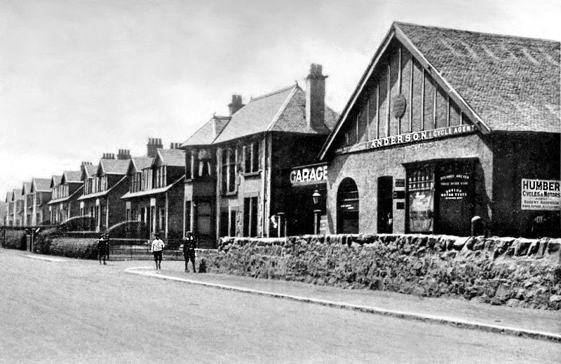
This map, surveyed in 1952, shows the buildings surrounding Mearns Cross prior to redevelopment. Main Street starts from the corner with the terrace at Nos 2 to 10 Barrhead Road and runs to the rear of the Parish Church. The Western SMT bus depot is slightly further along Barrhead Road. Anderson's Garage occupies a large site on Ayr Road just to the south-west of Mearns Cross.
Map of Mearns Cross, 1952
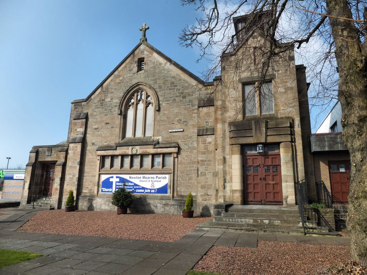
Newton Mearns Parish Church at Mearns Cross was built in 1939, replacing an earlier smaller building on the same site. The church was formally opened on 16th December 1939 by Rev. Dr. James Black assisted by the minister of the congregation, Rev. W. Murray Mackay. Mr Mackay read a list fo the gifts received, including the pulpit and two stained glass windows. The church was designed by James Maclaren Honeyman in a Free Gothic style with Art Deco touches. Honeyman also designed Williamwood Parish Church, but in a very different style.
Newton Mearns Parish Church, Mearns Cross
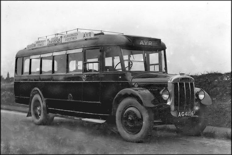
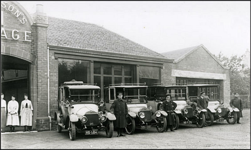
Newton Mearns had a large bus depot operated by Western SMT which was built near Mearns Cross in 1932. The depot housed the familiar "red buses" seen throughout Glasgow's southern suburbs heading for destinations in Renfrewshire and Ayrshire. A predecessor bus operator, Scottish General Transport Company, was absorbed into the new company a few years earlier. Scottish General Transport bus to Ayr via Newton Mearns
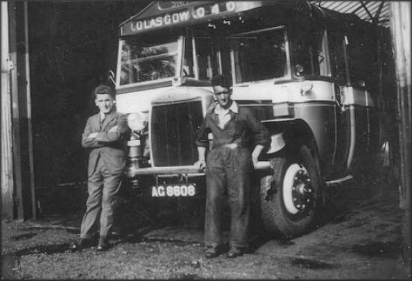
The photograph below shows one of the original SMT buses which were based at the new Newton Mearns Depot from 1932. It was possibly acquired from one of the previous bus operators who went on to form the SMT group. The depot's first manager, Johnny Bell, is shown with a mechanic.
The two letter 'AG' registration plates on these buses were issued for vehicles registered in Ayrshire between November 1925 and May 1934. The Scottish General Transport Company was based in Kilmarnock, so it is fair to assume that was the origin of the two buses.
Original SMT bus at Newton Mearns Bus Depot
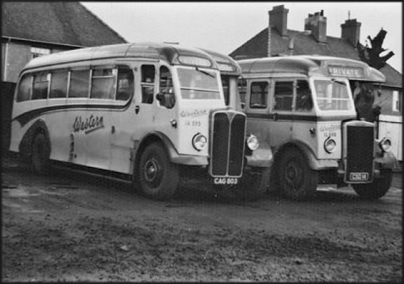
Western SMT buses in late 1940's
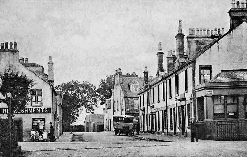
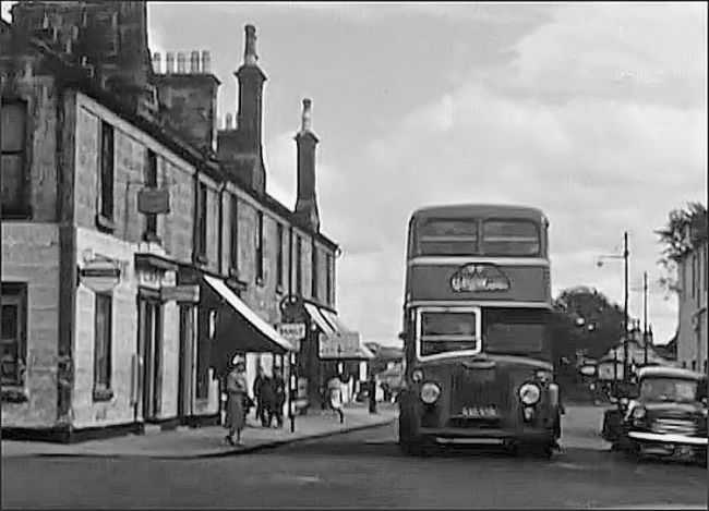
In the post-war years the buses based at the Newton Mearns depot were mostly double deckers. This view from around 1960 shows a Glasgow bound Leyland Titan bus in Barrhead Road approaching the junction with Main Street.
Western SMT bus in Barrhead Road at junction with Main Street, Newton Mearns, c.1960
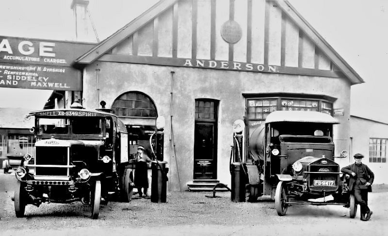
Anderson's Garage, Ayr Road, near to Mearns Cross
Fuel Tankers at Anderson's Garage, Newton Mearns
Limousines and chauffeurs at Anderson's Garage, Newton Mearns
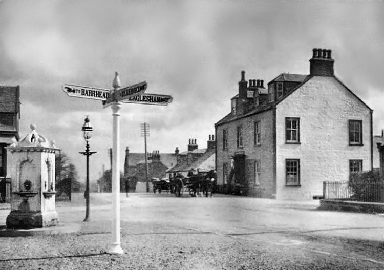
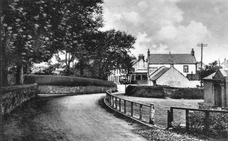
The Newton Inn, also known as Porter's Inn, was a popular hostelry dating back to the era of horse travel in the 19th century.
It was situated in a prominent position at the corner of Kilmarnock Road and Eaglesham Road on the main route from Glasgow to Ayrshire and the coast. Signpost and drinking fountain opposite Newton Inn at Mearns Cross
Mearns Cross viewed from Eaglesham Road
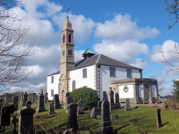
Mearns Parish Church, otherwise known as Mearns Kirk, has occupied the same site since ancient times. A succession of church buildings have been here since the 9th century. The present building was substantially altered and enlarged in 1813, with further alterations and improvements taking place throughout the subsequent years. The graveyard surrounding the church is worth a visit for those interested in local history.
Mearns Parish Church and graveyard
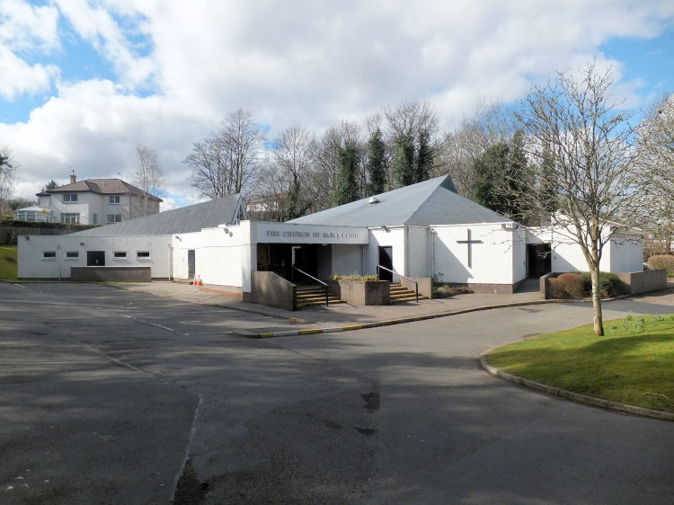
There are two post-Reformation Roman Catholic churches within the traditional boundaries of Mearns Parish; St. Joseph's, Clarkston and St. Cadoc's Newton Mearns. Both parishes are included within the R.C. Diocese of Paisley.
St. Cadoc's church is a modern structure, built in 1981 to replace a prefabricated timber weatherboard church erected when the parish was established in 1966.
St. Cadoc's Roman Catholic Church, Newton Mearns
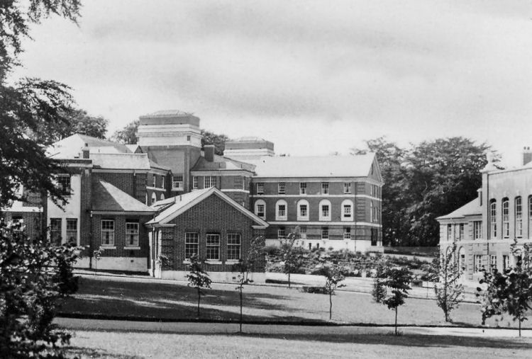
Mearnskirk Hospital was built in the 1930's for Glasgow children suffering from tuberculosis, providing the young patients with the benefits of pleasant surroundings and fresh country air.
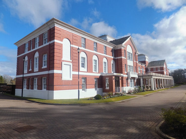
The hospital was sold for development in the 1990's, providing houses and flats on the extensive site.
The administrative block was redeveloped as a council run nursery school. A new custom-designed care home for the elderly, Mearnskirk House, was built on the approaches to the old hospital.
View of newly opened Mearnskirk Hospital with freshly planted saplings in the grounds, c.1930
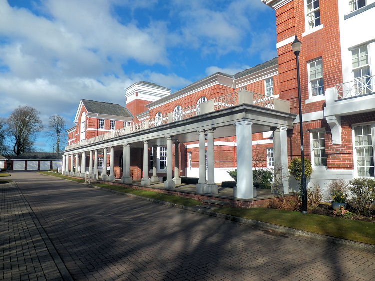
Apartment block converted from former Nurses Home, Mearnskirk Hospital
Colonnade along the front of former Nurses Home Mearnskirk Hospital
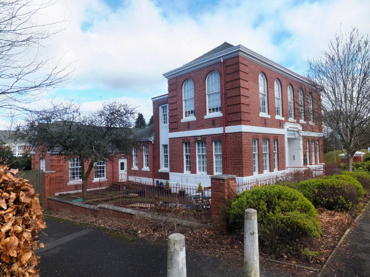
Former Administration Block, now Hazeldene Family Centre & Nursery School
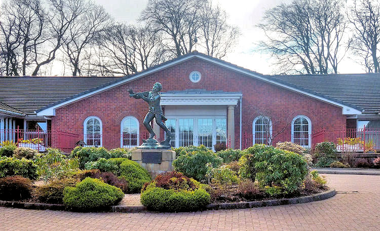
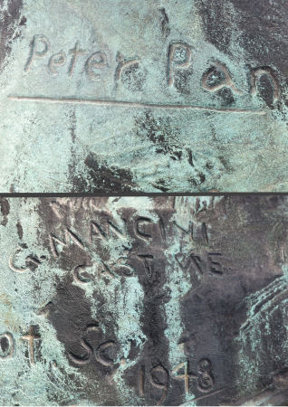
Statue of Peter Pan at entrance to Mearnskirk House, an NHS operated nursing home at former Mearnskirk Hospital
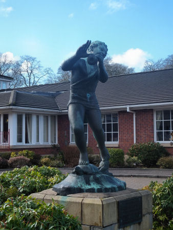
The statue of Peter Pan was dedicated to the first superintendent of Mearnskirk Hospital, Dr. John A. Wilson, OBE, who died before realising an ambition to erect a bronze figure of the little boy who never grew up.
Dr Wilson's friend and hospital benefactor, Alfred Ellsworth, organised fundraising to create the statue which was completed in 1948, two years after Dr Wilson's death. Statue of Peter Pan at Mearnskirk House with scrawled inscription "G. Mancini cast me 1948"
The plaque below the statue reads "In memory of Dr John A. Wilson O.B.E. first superintendent of Mearnskirk Hispital 1928-1946. Erected by A.L. Ellsworth and his friends".
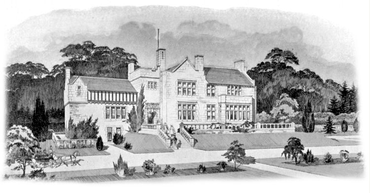
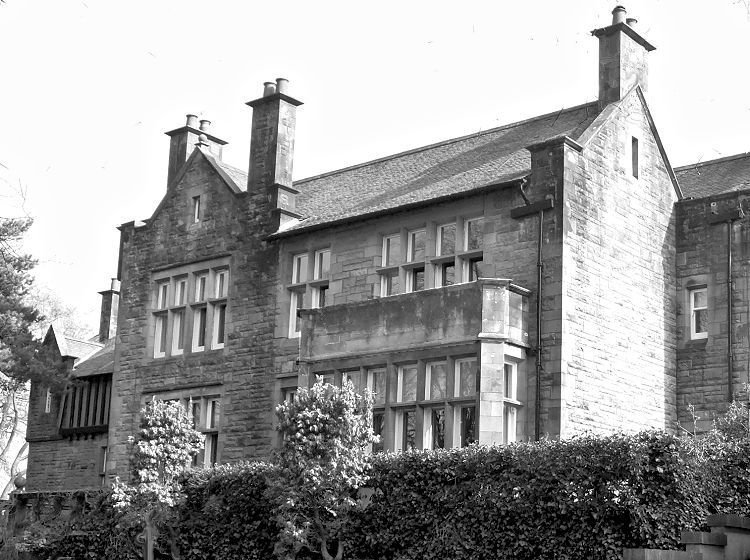
Whitecraigs House, which occupies a large corner site on Ayr Road, was designed in 1898 by architect H. E. Clifford. It was built for William Mann, a local councillor on Renfrewshire County Council who was also a Justice of the Peace. A fountain erected in his memory can be found near to Mearns Cross. Exhibition drawing of Whitecraigs House, 1898
Photograph of Whitecraigs House
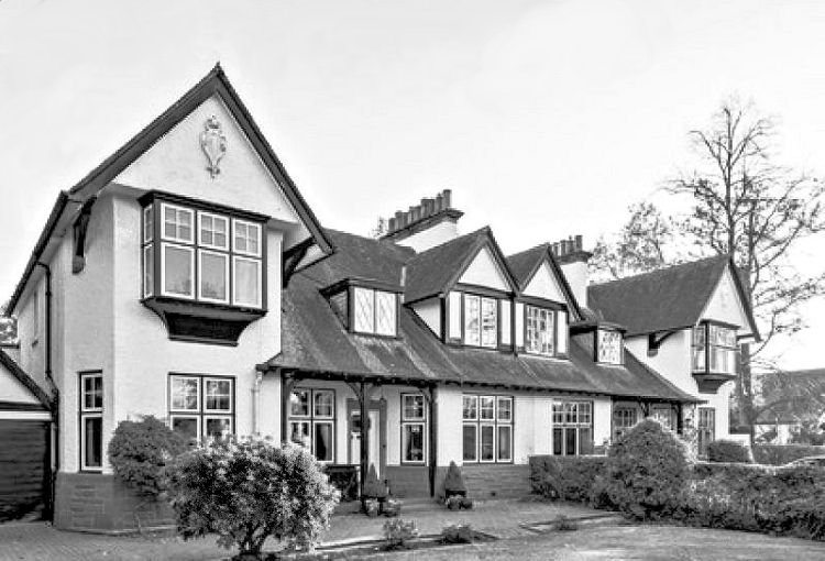
Semi-detached dwellings in Arts & Crafts style at Whitecraigs
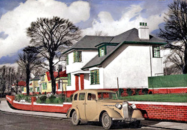
Artist's illustration for new houses at Broom Estate, Whitecraigs, 1938
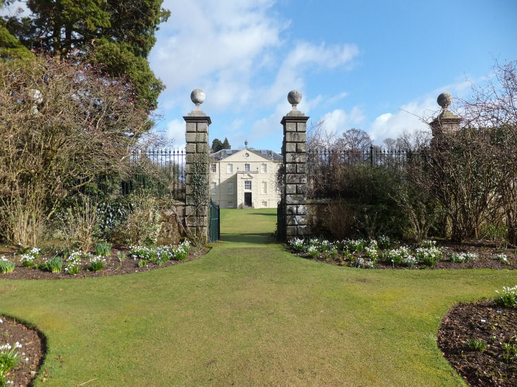
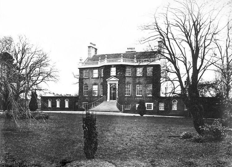
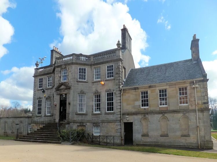
Greenbank House and Gardens are situated off the Mearns Road near Clarkston.
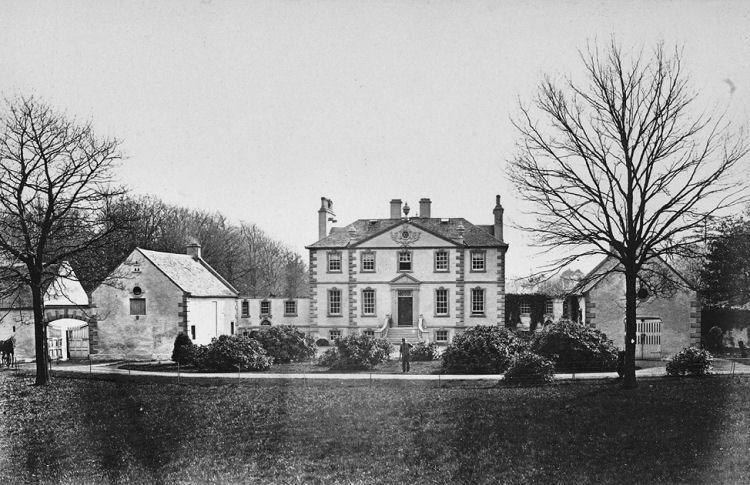
The mansion house was built by Glasgow merchant Robert Allason who had acquired the estate in 1763.
Victorian photograph of of Greenbank House
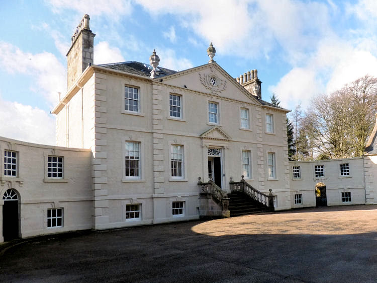
Front of Greenbank House
Sundial in grounds of Greenbank House
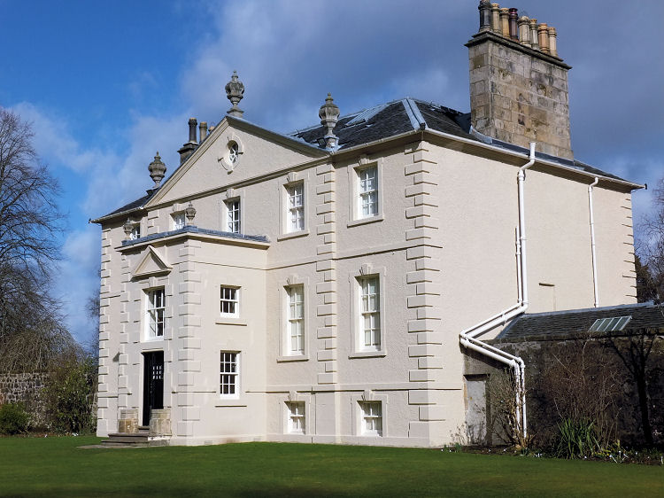
Rear of Greenbank House
Gateway to rear of Greenbank House
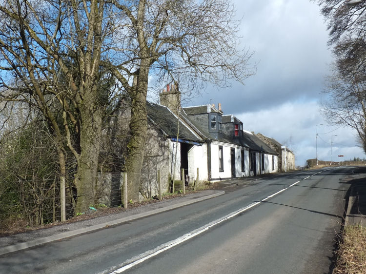
Cottages on Mearns Road, near Greenbank House
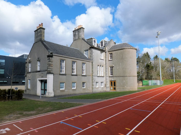
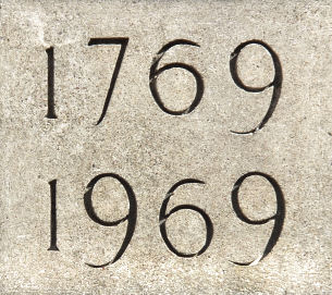
The ancient lands of Capelrig were acquired by Glasgow lawyer Robert Barclay in 1765, who erected the mansion house in 1769.
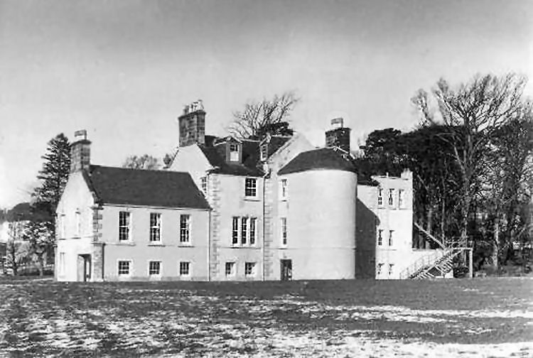
Victorian photograph of an ivy-clad Capelrig House
Front of Capelrig House
Rear of Capelrig House alongside running track for Eastwood High School
Old photograph showing rear of Capelrig House
Date plaque at Capelrig House
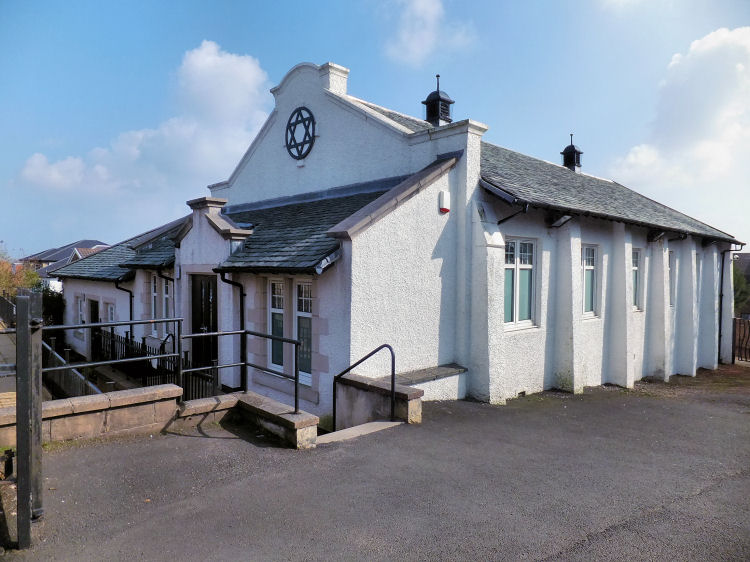
Glasgow Reform Synagogue in Ayr Road occupies a simple brick roughcast hall built in 1910. It was acquired by the congregation and converted into a synagogue which opened in 1968.
Glasgow Reform Synagogue, Ayr Road
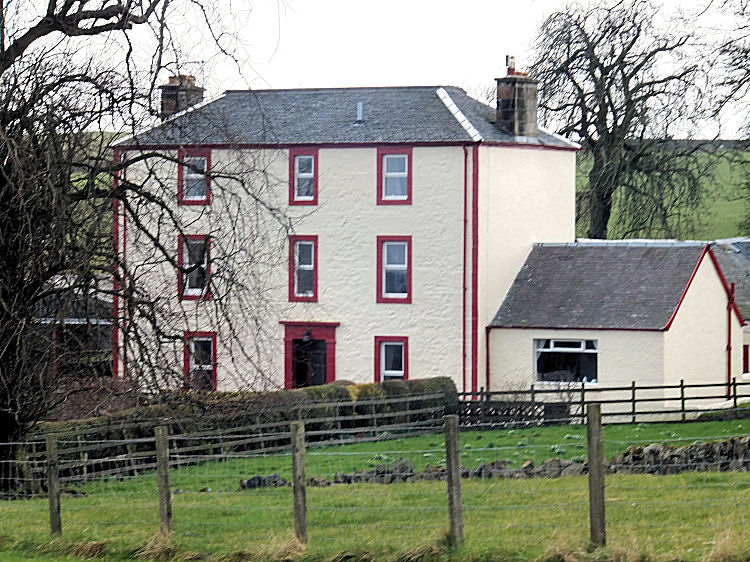
Three storey farmhouse, Burnhouse Farm
The parish is of considerable antiquity with the earliest surviving relic being the seal of Nicholas de Mernes from c.1170.
The seal is shaped as a pointed oval with an image of a fleur-de-lys.
It carries the legend 'Sigillivm Nicolai de Mernes', (Seal of Nicholas of Mearns).
Following the death of Nicholas, the barony of Mearns came by marriage into the possession of the Maxwells of Caerlaverock, Dumfriesshire.
Mary, the heiress, was the daughter of Roland de Mernes. She was married to Aymer de Maxwell, son of Sir John de Maccuswel, the first Lord Maxwell of Caerlaverock.
David had become accustomed with Norman ideas and culture
at the court of Henry I of England, fourth son of William the Conqueror. During David's
reign there was an influx of Normans into Scotland, who
established some of the most powerful families in the country.
The most notable incomer was Walter FitzAlan, who was appointed High
Steward of Scotland by the king. Among the lands granted to him
was almost the whole of Renfrewshire, which he proceeded to divide among his personal friends.

To the east, Mearns Parish was bounded by White Cart Water which formed the county boundary with Lanarkshire, shown blue in the map.
The extract below from 'The topographical, statistical, and historical gazetteer of Scotland' (1848), clears up the mystery.
The warrant entitled Herbert "to build a castle or fortalice
on the Barony of Mearns in Renfrewshire, to surround
and fortify it with walls and ditches, to strengthen it by
iron gates, and to erect on the top of it all warlike apparatus necessary for its defence."
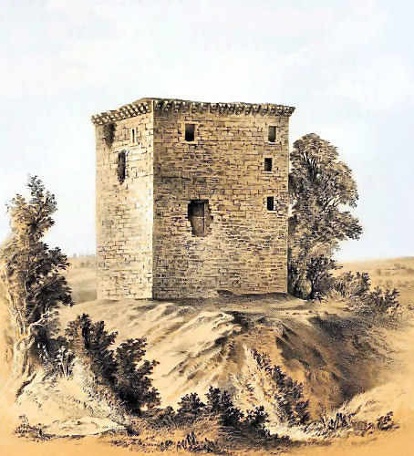
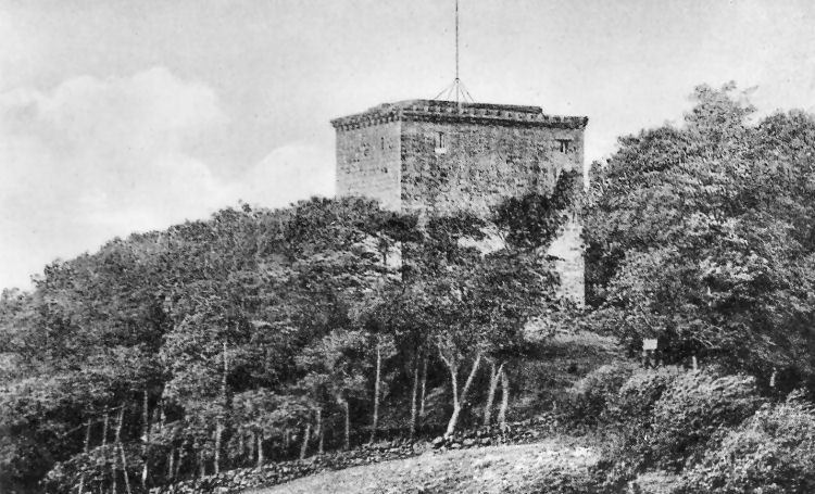
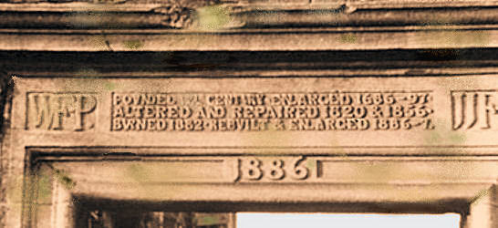
The castle originated as a simple battlemented tower, which was expanded from 1684 by Sir Robert Pollok to form a house, which the Glasgow Herald reported "bore some of the characteristic features of a baronial residence of the sixteenth century". A northern wing was added to the mansion in 1856. This version of Pollok Castle survived until 1882 when it was almost entirely destroyed by fire.

"Founded 12th Century - Enlarged 1686-97 - Altered and Repaired 1820 & 1856 - Burned 1882 - Rebuilt and Enlarged 1886-7"

The parish was associated with Paisley Abbey until the times of the Reformation.

The bus shown below was one of the last Scottish General Transport vehicles used on the Glasgow to Ayr route via Newton Mearns in the late 1920's.
At one time it provided stables for the horse drawn coach service between Newton Mearns and Giffnock railway station operated by Mr Thomas Porter, the proprietor of the Newton Inn. Pictures of this coach and other railway buses can be seen in the Giffnock & Netherlee page of this website.
It later became a general hospital, operating as an annexe of the Victoria Infirmary.
The sculptor of Peter Pan's statue was Alexander Proudfoot RSA, Principal of Glasgow School of Art. It was cast by Edinburgh based artistic bronze founder, George Mancini, who left his mark in the molten metal at the base of the work.
The drawing below by Mr. Clifford was displayed at the architectural exhibition of the Glasgow Institute of Fine Arts in 1898.
The house and gardens were donated to the National Trust for Scotland in 1976 and have since become a popular visitor attraction.

Capelrig House was occupied as offices by East Renfrewshire Council until the summer of 2011. The house is currently used as ancillary offices and stores by Eastwood High School, with the surrounding excess land being surfaced to create playing fields and car parking.
There is no public access to the house.
![]()
|
|
| |
|
|
| |
|
|
| |
|
|
| |
|
|
| |
|
|
| |
|
|
|
|
All original artwork, photography and text © Gerald Blaikie
Unauthorised reproduction of any image on this website is not permitted.
