
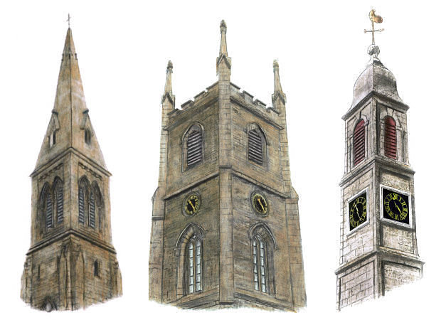
Glasgow's present city boundary cuts through the ancient parishes of Cathcart and Eastwood with some of the southern suburbs being included within the city and others remaining in East Renfrewshire and South Lanarkshire for administration purposes. Drawing of the towers of Eastwood, Cathcart and Mearns parish churches
Descriptions of the Parishes of Cathcart and Eastwood, 1882
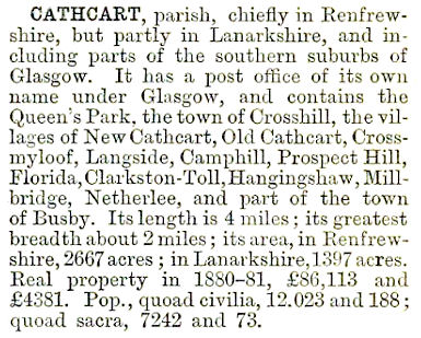
The above map shows the meeting of the parish boundaries of Cathcart, Eastwood and Mearns at Clarkston Toll. Cathcart Parish in Renfrewshire is bounded by a green line and contains familiar place names such as Netherlee, Williamwood and Stamperland.
The blue line follows the course of White Cart Water which forms the the county boundary with the Lanarkshire section of Cathcart Parish, not detailed on the map.
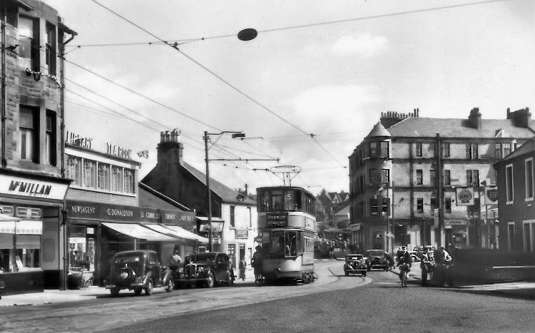
Clarkston Toll was a major hub where the three ancient parishes met up and many roads branched out. Before and after views of approaches to No.5 tram terminus at Clarkston, 1953
Old photograph looking towards Clarkston Toll from the south
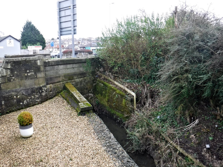
The city boundary between Newlands in Glasgow and Giffnock in East Renfrewshire is formed by the 'Merry Burn', which also marks the traditional parish boundary between Cathcart and Eastwood. Merry Burn crosses under Kilmarnock Road on the Glasgow side as it changes its name to Fenwick Road on the East Renfrewshire side. City boundary at Newlands and Giffnock
Merry Burn flowing under bridge with city boundary sign at Kilmarnock Road / Fenwick Road
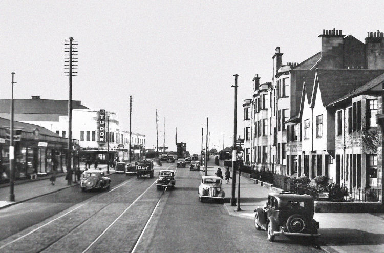
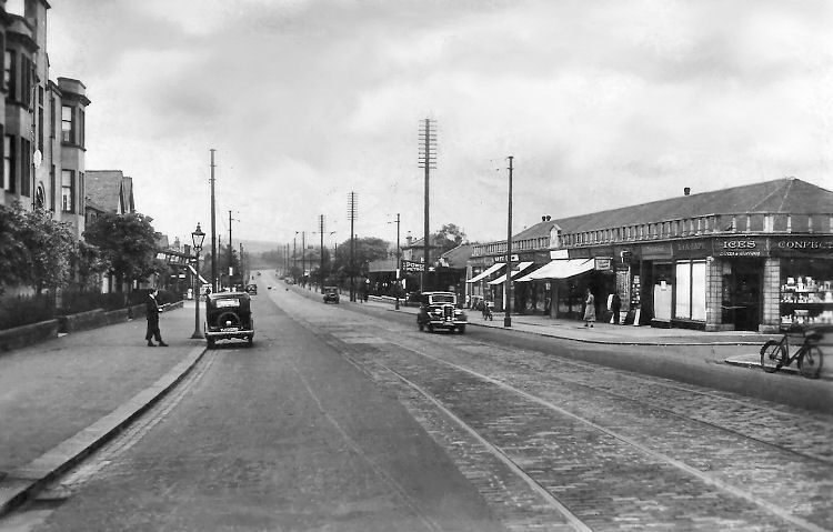
Mid-twentieth century views of Fenwick Road, Giffnock
The numerous quarries at Giffnock were the source of much of the sandstone used in the commercial and residential
development of Glasgow.
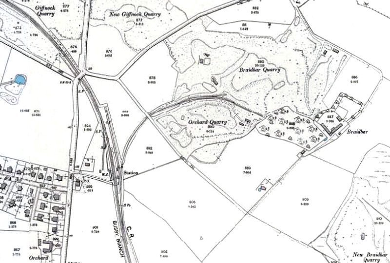
Map showing quarries surrounding Giffnock Station with direct branch to the largest workings
The quarries near the station were Braidbar, New Braidbar, Giffnock, New Giffnock, Orchard and Williamwood. English Quarry and Flag Quarry were situated further up the line, close to where Thornliebank Station would later be sited.
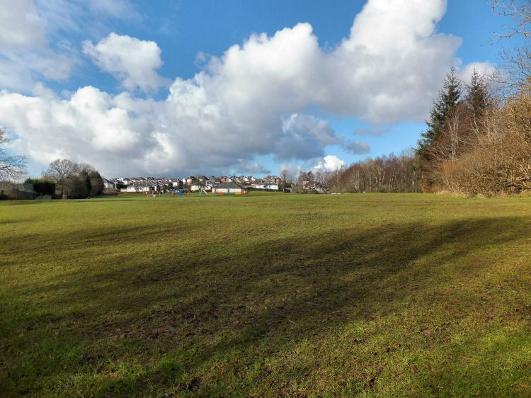
The view below shows the present day situation of the old quarries relative to Giffnock Station. Residential development has taken place on much of the land in and around the former workings. The outlines of the quarries and the surrounding terrain are still clearly recognisable.
View of the site of the quarries around Giffnock Station, 2015
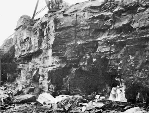
Giffnock sandstones were extracted mainly by open
quarrying, although considerable quantities were also
removed from underground galleries.
The deep deposits consisted of a cream coloured fine
grained sandstone which showed very little sign of stratification allowing it to be worked with equal freedom in almost
any direction.
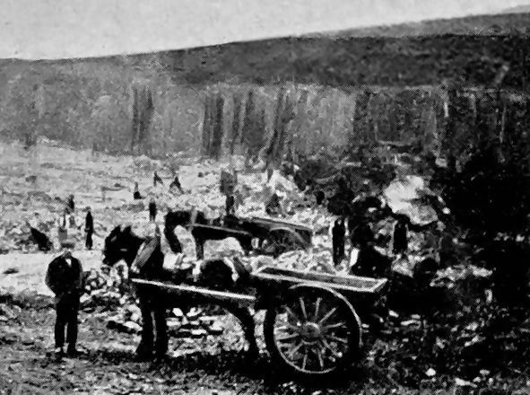
Braidbar was the first major quarry to be opened at Giffnock, worked from around 1840. The rock was found to be fully 50 feet deep, lying in horizontal beds of varying thickness. Horse drawn wagons operated by Glasgow Corporation at Giffnock quarry workings
Quarry workings at Giffnock, showing rails laid for carrying the wagons
Limestone was also quarried in the area. The chief bands were known as 'Orchard
limestone' and 'Arden limestone', both of which occurred
above the beds of Giffnock sandstone. The Arden limestone
was quarried near Thornliebank while
the Orchard limestone from Giffnock was prized for
its valuable properties in the production of cement. The kilns used in the processing of the Orchard limestone
were situated on the site of the of the present day Orchardhill Church.
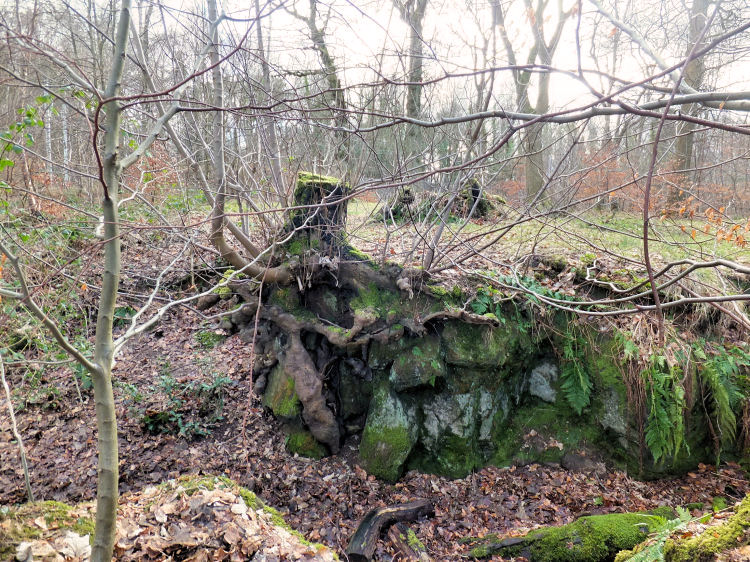
For safety reasons the remains of the deep workings at the old quarries have been closed to public access. The surrounding land has however provided community space as woodland and playing fields. A walk through this area provides interesting insights into the former use of the land.
Outcrop of rock in woodland surrounding old Giffnock quarries
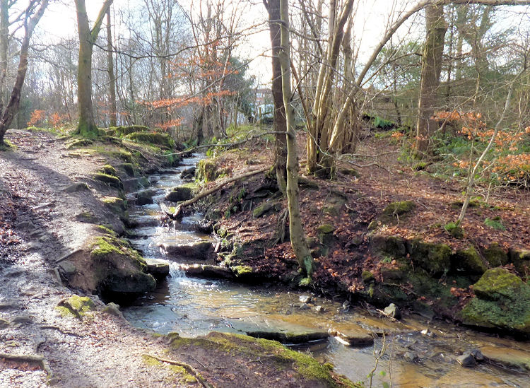
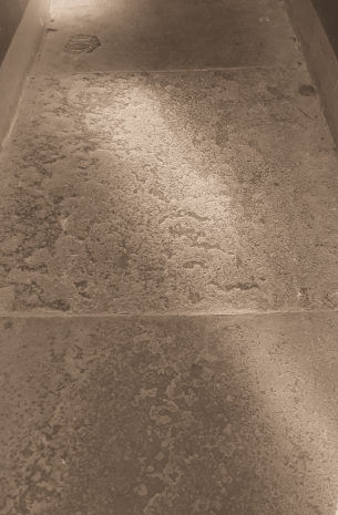
While the deep quarries in Giffnock yielded good quality building stone with very little stratification, the area was also a source of thin beds of stone suitable for creating rectangular slabs known as flagstones which were used for paving and flooring.This form of sandstone was formed in sedimentary layers which could be split along flat planes of weakness.
Weathered layers of naturally formed stone pavement in stream flowing through site of old quarry workings
The thinly stratified stone exposed by the stream is similar to that found at "Flag Quarry" which was extracted to form flagstones suitable for flooring and paving.
The flagstones shown below were used to surface the entrance of a tenement building built in the 1870's in Darnley Street, Pollokshields, to the designs of Alexander "Greek" Thomson. I have created a web page dedicated to the Tenements of Alexander Thomson which illustrates the use of Giffnock sandstone in Glasgow in the latter half of the 19th century.
Giffnock flagstone at entrance to tenement in Pollokshields
View of Giffnock houses from open fields at site of former quarries
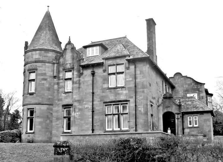
Surprisingly there is very little use of Giffnock sandstone in the housing to be found in the area. Rhuallan House is an exception, being one of the first large villas to be constructed in the developing suburb. Dating from 1893, Rhuallan was designed in a similar style to the villas in the avenues of West Pollokshields, which were constructed with cream Giffnock sandstone a few decades earlier.
Rhuallan House, Giffnock
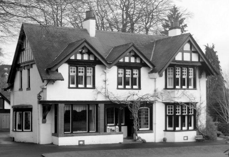
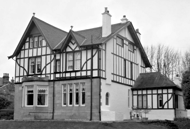
There are many individually designed houses houses to be found in Giffnock, created in the fashionable styles which were around at the turn of the century. These were followed by standardised mass produced bungalows which were popular in the inter-war decades of the 1920s and 1930s.
'Cottages at Giffnock' by Watson & Salmon, Architects, displayed at Glasgow Institute of Fine Arts, 1899
Photograph of 'Cottages at Giffnock', 2016
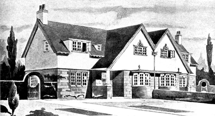
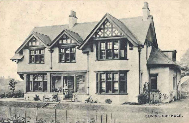
'Elwine', an individually designed detached villa at Giffnock
Picture postcard view of 'Elwine', 1912
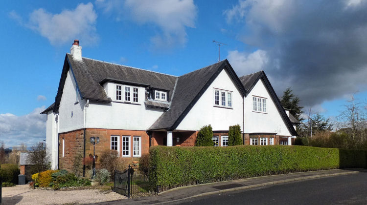
Mock Tudor style detached villa at Giffnock with local sandstone frontage at lower level
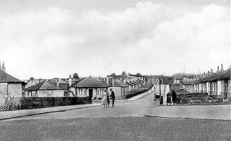
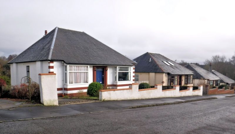
Newly built bungalows at corner of Sutherland Drive and Lawrence Avenue, Giffnock, 1934
Bungalows at Giffnock, January 2020
Orchardhill Church in Giffnock opened on Sunday 13th May 1900 as a United Presbyterian Church just before the denomination joined with the Free Church to become the United Free Church of Scotland, which in turn merged with the established Church of Scotland in 1929. Exhibition drawing of Orchardhill Church, Giffnock, 1899
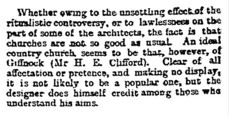
H.E. Clifford's conventional style of neo-Gothic architecture used for Orchardhill Church won the approval of the Arts Critic of the Glasgow Herald who had very conservative tastes. At earlier exhibitions he had been particularly scathing about Charles Rennie Mackintosh's architectural drawings which he berated for displaying signs of decadence. Extract from Glasgow Herald 3rd April, 1899 regarding exhibition drawing of Orchardhill Church
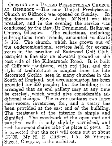
Extract from Glasgow Herald 15th May, 1900 regarding opening of Orchardhill Church
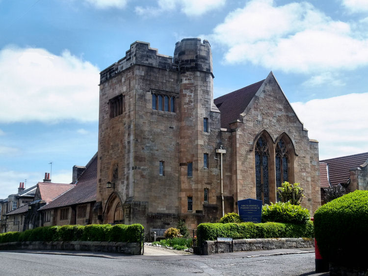
Orchardhill Church occupies a fine corner site and presents a beautiful example of locally quarried cream coloured sandstone.
Orchardhill Church, Giffnock
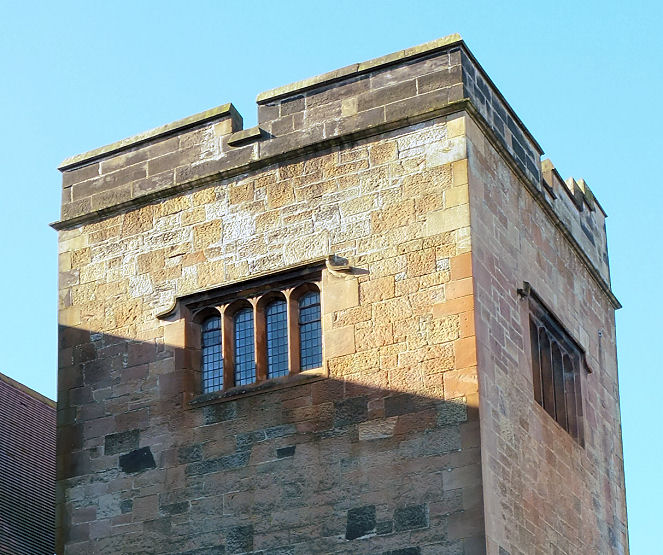
Irregular blocks of local sandstone used for the tower of Orchardhill Church, Giffnock
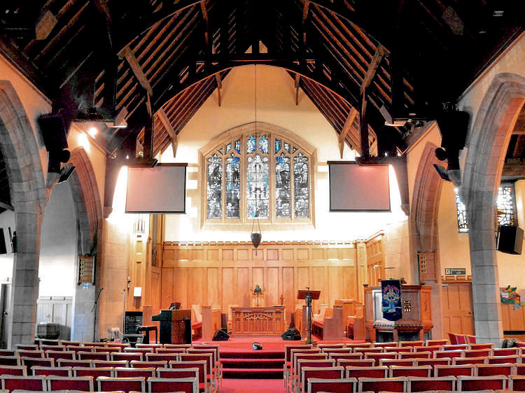
Interior view of Orchardhill Church, Giffnock
'Covenanter's lamp' at Orchardhill Church, Giffnock
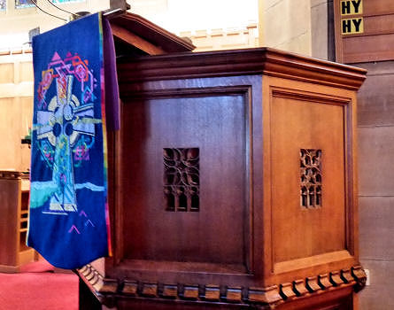
Pulpit at Orchardhill Church, Giffnock
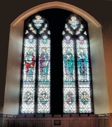
Stained glass portaits of the four evangelists at Orchardhill Church, Giffnock
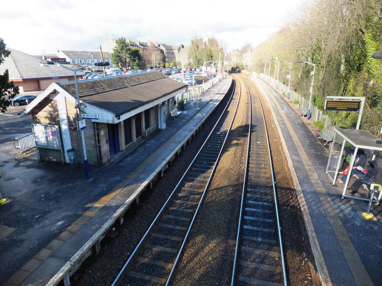
Giffnock Railway Station opened on 1st January 1866 to serve the local quarries, long before the development of the now familiar commuter suburb.
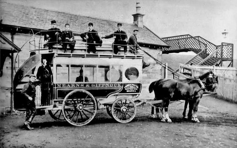
Horse bus at Giffnock Station operated by Thomas Porter, Newton Mearns Inn
View of Giffnock Station from footbridge seen in earlier photograph with horse bus
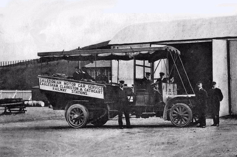
Motor bus carrying passengers to local railway stations in East Renfrewshire
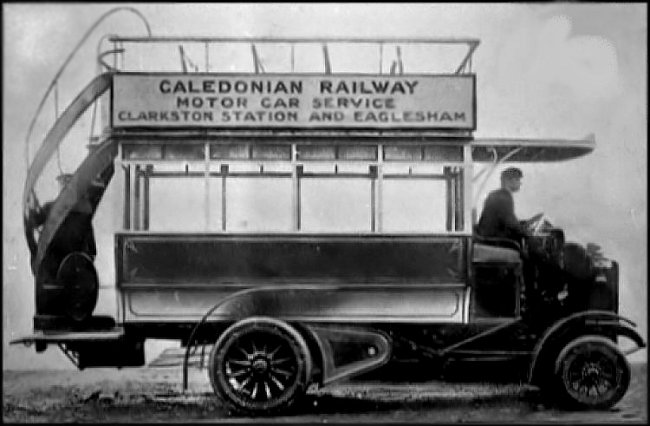
Caledonian Railway bus carrying passengers to Eaglesham which did not have a local station
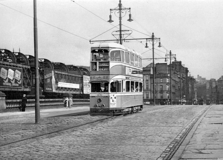
No. 8 tram from Newlands and Rouken Glen crossing Jamaica Bridge, Glasgow
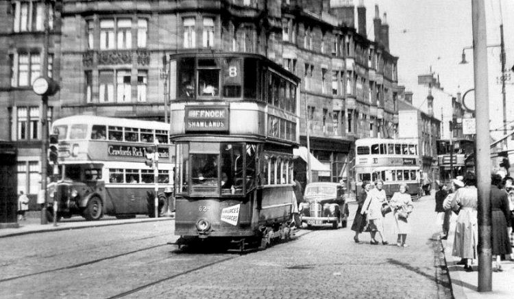
No. 8 tram to Giffnock at Shawlands Cross
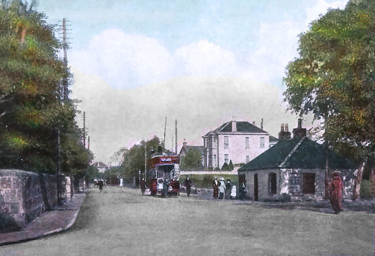
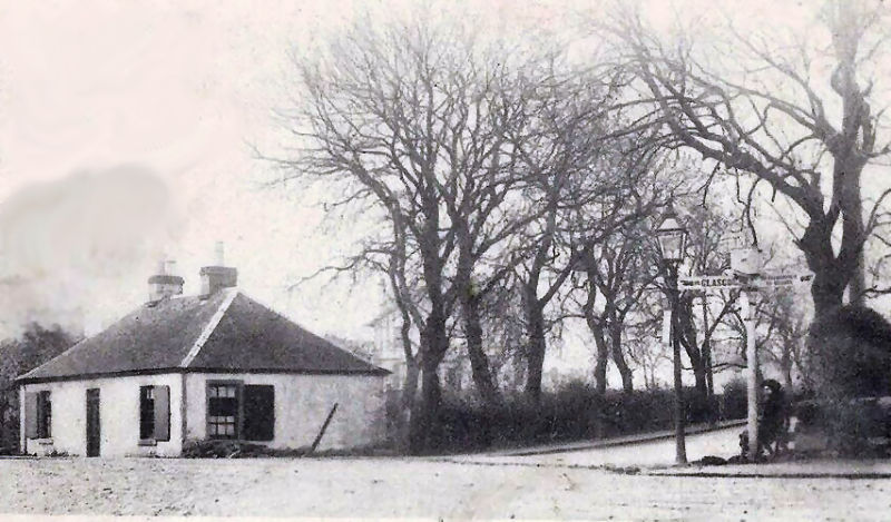
Tram to Rouken Glen passing old toll house at Eastwood Toll before redevelopment
Sign post at the old toll house at Eastwood Toll
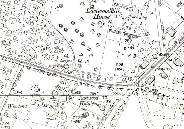
The map below shows part of the tram route for the old "red cars" at Eastwood Toll. This service which passed through Newlands and Giffnock became the No.8 tram under the numbering system adopted in 1938. It passed by the large houses of Woodend and Eastwood Hollows which were built on the site of what would later become the Macdonald Hotel and now contains modern blocks of flats.
Map of site of Eastwood Toll before redevelopment
The two large villas, Woodend and Eastwood Hollows, were demolished in the 1960's to make way for the revised road layout and the huge roundabout.
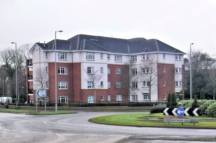
The surrounding area is now occupied by modern blocks of flats which have retained the names of the properties they have replaced.
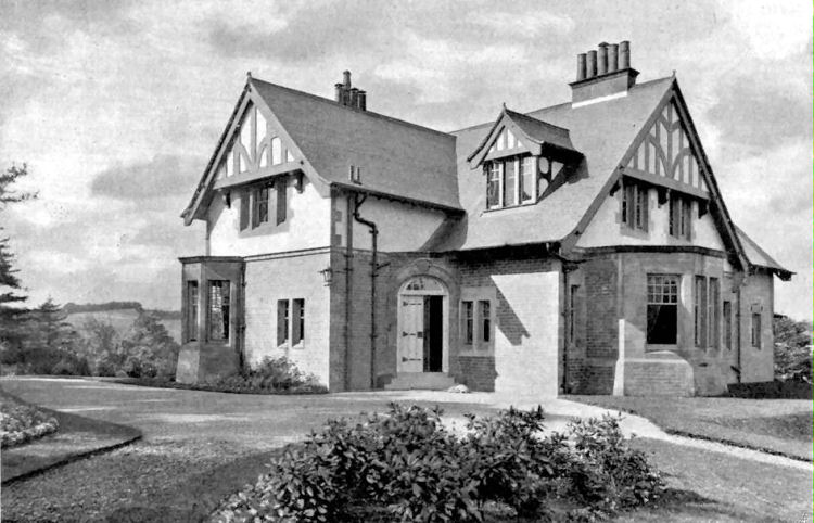
Image of 'Eastwood Hollows' displayed at the Royal Glasgow Institute of the Fine Arts Exhibition, 1901
Blocks of flats at Eastwood Toll, January 2020
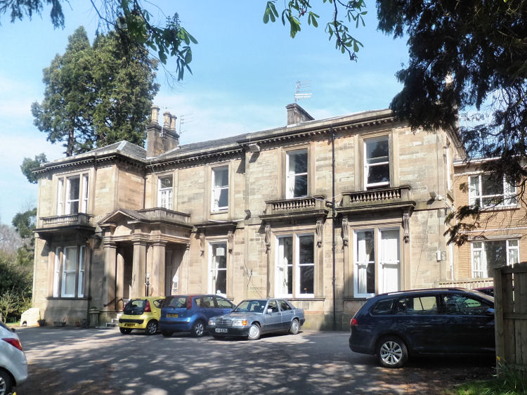
Eastwoodhill House is a large two-storey detached villa situated on the edges of Eastwood Park. It was constructed with locally quarried Giffnock sandstone in the 1850's. The house was built for William Miller, the proprietor of the Netherlee Print Works. It is currently occupied by the Church of Scotland as a residential nursing home.
Eastwoodhill House
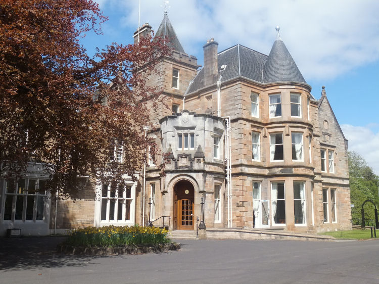
Eastwood House was built in the mid-1800's at the former estate of the Earl of Eglinton, in what is now Eastwood Park. It was erected for Thomas Smith, a leading Glasgow merchant at the time. The house was enlarged and the bay windows added in 1893 by its then owner, David Tod of Tod & McGregor, Shipbuilders. In 1914 The mansion house and surrounding estate was bought by Lord Weir of G & J Weir, Engineers, Cathcart. Since 1968 it has been owned by the local Council and is currently used as a community facility.
Eastwood House
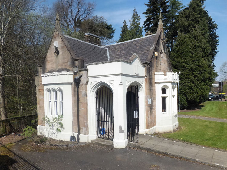
Gatehouse at entrance to Eastwood Park
Old motor cars at Eastwood Toll, c.1940
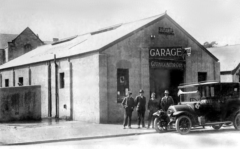
Motor car at garage of Giffnock Motor Company, Eastwood Toll
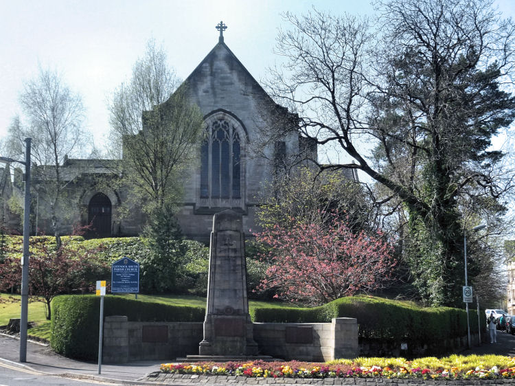
A gable of Giffnock South Parish Church (below) can be glimpsed behind the now demolished garage building.
Giffnock South Parish Church at Eastwood Toll was built in 1929 to the designs of the Glasgow architectural practice, Stewart & Paterson.
It was built with locally quarried sandstone in a conventional neo-Gothic style.
The congregation had previously met in what is now the church hall, which was built in 1913.
Giffnock South Church
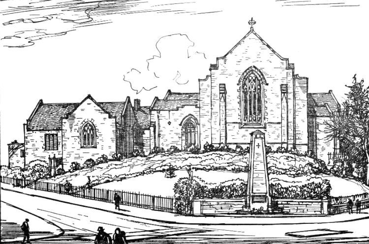
Sketch of Giffnock South Church, 1956
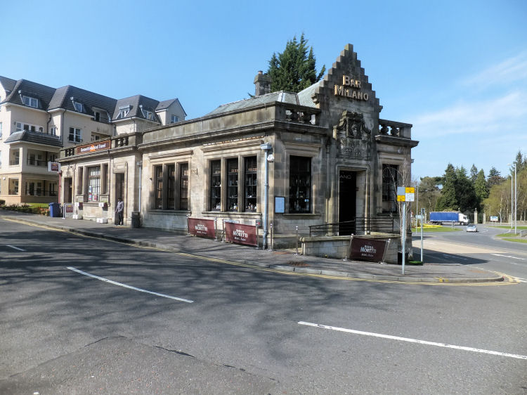
Former Bank of Scotland building at Eastwood Toll, now 'Bar Milano'
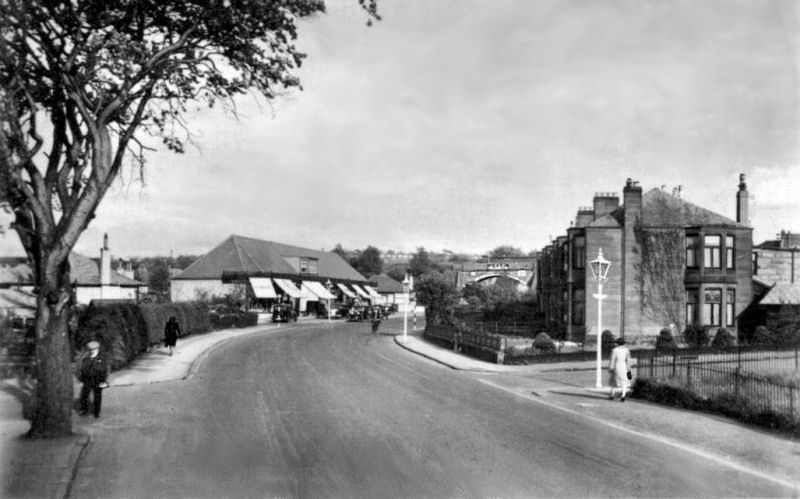
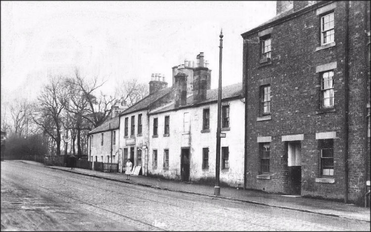
View of shops on Eastwoodmains Road on approaches to railway bridge at Williamwood Station, 1943
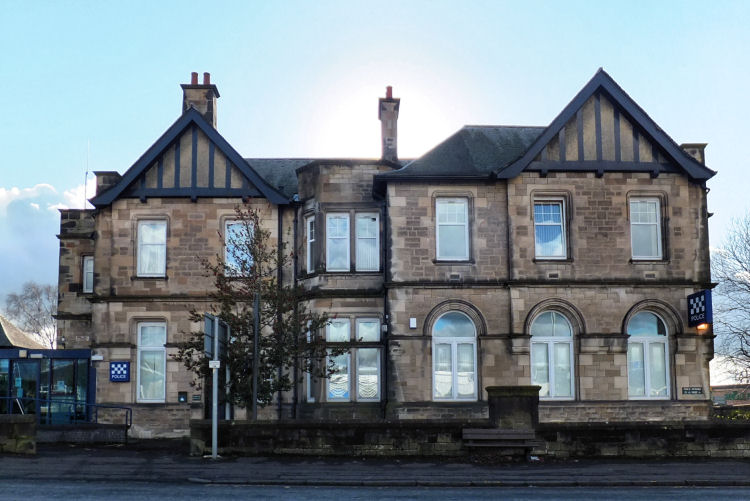
Giffnock Police Station & District Court, built 1915
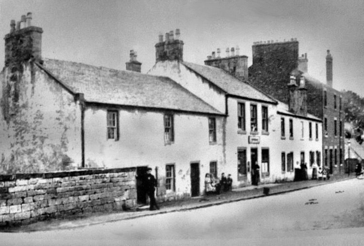
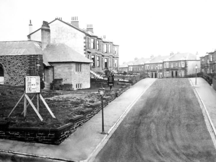
Netherlee Village, before development of suburb
Clarkston Road, Netherlee, looking towards Linn Park
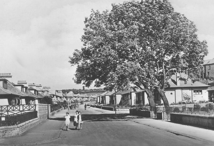
Litttle girls at new houses in Nethervale Avenue
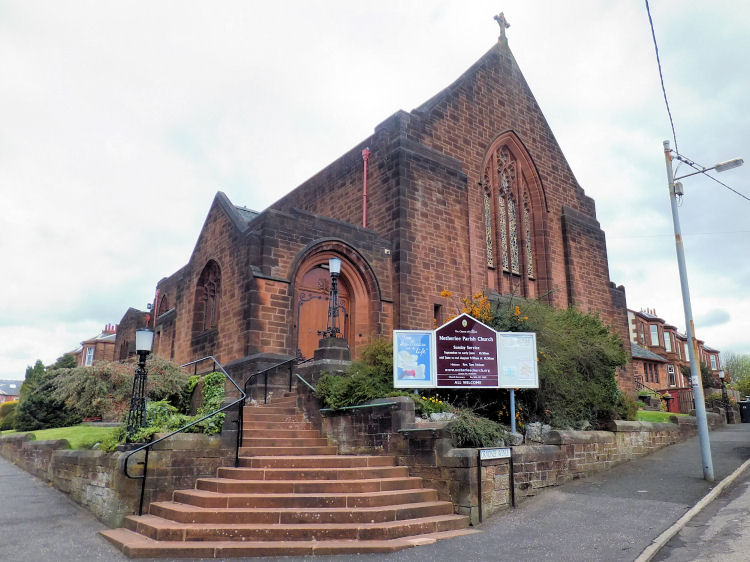
The quarrying of Giffnock sandstone had ceased by the 1920's and 1930's when the present day suburb of Netherlee was being developed. Like the surrounding houses, Netherlee Parish Church was built with red sandstone from Dumfriesshire. It was designed in a neo-Gothic style by Messrs. Stewart & Paterson of Glasgow and completed in 1934. Netherlee Parish Church
Hall at Netherlee United Free Church, 1928
Prior to the completion of the church, the hall had been used for public worship by the congregation. The hall was opened on 29th April 1928 for the United Free Church, which merged with the Church of Scotland the following year. The officiating clergy at the opening service were Rev. Dr. G.H. Morrison and Rev. Dr. P.D. Thomson.
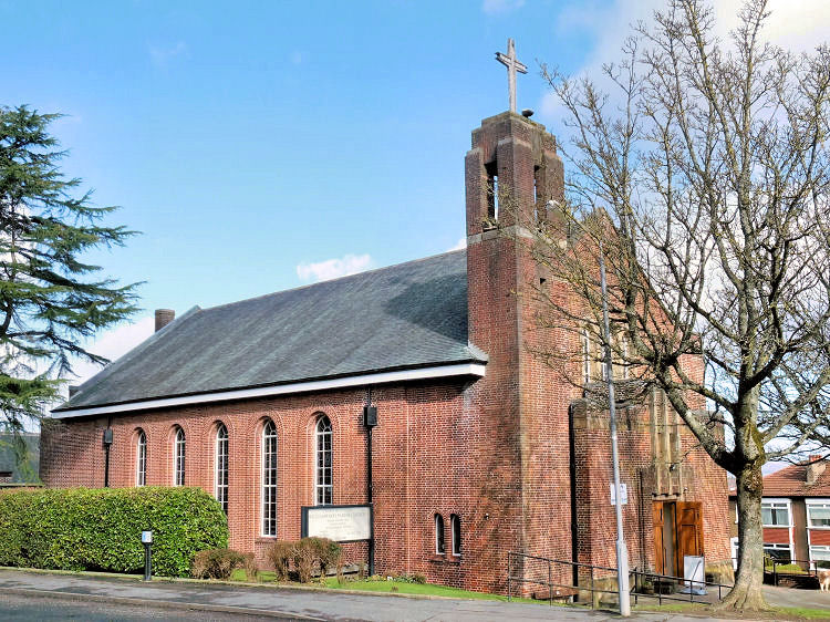
Stamperland Parish Church was designed by the architectural practice of King Main & Ellison under the supervision of Eric Doig Ellison. The foundation stone was laid on 28th November 1963.
Stamperland Parish Church
The congregation of Stamperland Parish Church united with that of Netherlee Parish Church on 1st January 2020. The buildings at Stamperland were subsequently closed in the summer of 2022.
The estate of Williamwood in the parish of Cathcart contained a succession of historic homes of the 'Maxwells of Williamwood', who were also in possession of Cathcart Castle when it was last habitable in the 1750's. Williamwood Parish Church
Williamwood Parish Church was built in 1937 during the residential development of the area. It was designed by James Maclaren Honeyman of the architectural partnership of Wilson, Son & Honeyman. The church was built in red brick with a squat Art Deco influenced belltower.
The boundary of Eastwood Parish is coloured yellow where the agricultural lands of Clarkston were situated along its edge. Within the old parish boundaries Pollokshaws, Auldhouse and Shawlands are part of the Glasgow City Council area, while Thornliebank, Giffnock and Rouken Glen are administered by East Renfrewshire Council.
The red line marks the boundary of the parish of Mearns, where Newton Mearns, Waterfoot and part of Busby are situated. The portion of the village of Busby to the east of White Cart Water was traditionally situated in Lanarkshire.
The photographs below, looking southwards from Clarkston Toll, were taken from the same vantage point immediately before and after the lifting of the tram rails and removal of overhead wires resulting from the withdrawal of tram services on 5th July 1953.
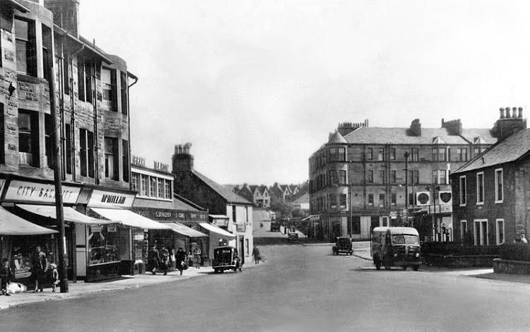
The houses to the left on the picture, below, are in Merryburn Avenue, Giffnock, facing the trees which follow the line of the burn which is culverted for much of its course. The houses on the other side of the trees are in Fernleigh Road, Newlands, Glasgow.
A big expansion in production took place after the opening of Giffnock Station on the Busby Railway line on 1st January 1866. This facilitated the efficient transportation of the district's fine building stone by rail to Southside Station, Gorbals, which later became Gushetfaulds Mineral Depot.
Giffnock Station came into use at the beginning of the era of the development of Glasgow's suburbs with their characteristic tenement buildings.
As well as Giffnock, other stations on the new line were created at Pollokshaws, Clarkston and Busby, opening these districts up for residential development as commuter suburbs.

The stone in the surrounding smaller quarries were found in much shallower strata and its extraction has left fewer visible traces on the landscape.
This drawing of Orchardhill Church by the architect, H.E. Clifford, was displayed at the architectural exhibition of the Royal Glasgow Institute of Fine Arts in 1899.

Orchardhill Church was much more to the critic's liking, being seen as an "ideal country church" and "being clear of all affectation and pretence". I suspect that he is having a dig at Mackintosh and his contemporaries whose designs showed elements of "lawlessness". His derisive comments are featured in my Charles Rennie Mackintosh web page.
Mr Clifford's traditional design for Orchardhill Church was not thought by the critic as "likely to be popular", but "does himself credit among those who understand his aims".


The foundation stone for the new church was laid on 25th March 1933. The service of dedication for the completed church took place on Friday 22nd June 1934 with Rev. Dr.John Hall officiating.
Around 1808, excavations at the site of the old Williamwood Castle unearthed a settlement of 42 archaic dwellings. Near the remains of
these houses were found 12 quern stones used for the hand grinding of grain to make bread. There was also a stone-lined tomb containing an urn filled with ashes.
Williamwood Parish Church was dedicated on 28th June 1937 in a service conducted by Rev. Dr. John White. At the service Dr. White inducted the congregation's first minister, Rev. Daniel Patterson, formerly of Beauly, Inverness-shire.
![]()
|
|
| |
|
|
| |
|
|
| |
|
|
| |
|
|
| |
|
|
| |
|
|
|
|
All original artwork, photography and text © Gerald Blaikie
Unauthorised reproduction of any image on this website is not permitted.
