
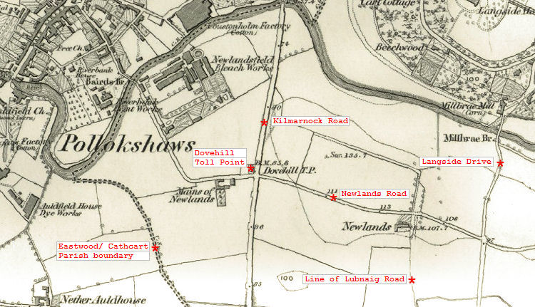
The Glasgow district of Newlands originated as farmland situated in Cathcart Parish on the opposite side of the White Cart Water from Pollokshaws which was in Eastwood Parish. In the Ordnance Survey name books of 1856/57 the entry describes Newlands as "formerly a farm steading but now used as cot houses". Working farm buildings were situated at the "Mains of Newlands" described in the name books as "a good farm steading occupied by Mr Robert Deans & property of Sir John Maxwell". 1850's map showing old parish boundary and former Newlands farmhouse at corner of Newlands Road and Lubnaig Road
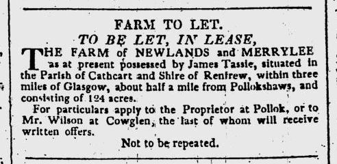
A notice was published in the Glasgow Herald on 28th July 1820, offering the "Farm of Newlands and Merrylee" for let. The lands were owned at that time by Mr James Tassie, who could be contacted at Pollok.
Notice from Glasgow Herald, 28th July 1820, showing "Farm of Newlands and Merrylee"
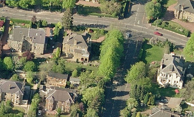
Aerial view of site of former Newlands farmhouse at corner of Newlands Road and Lubnaig Road
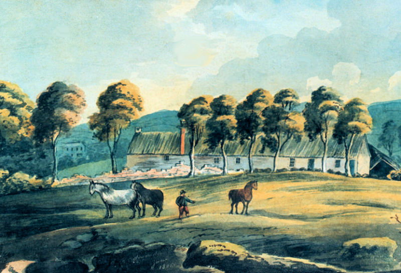
This old view of the single storey buildings of the Mains of Newlands shows Auldhouse Mansion in the background.
View of Mains of Newlands looking west from Kilmarnock Road c.1830
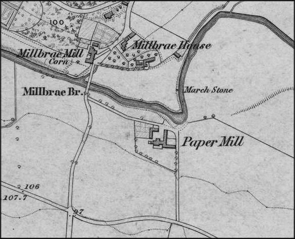
Newlands Paper Mill was the earliest water powered mill in Cathcart Parish, predating the mills of Cathcart and Netherlee. It was situated on the south side of White Cart Water as it flowed towards Millbrae Bridge. After its closure as a working mill, it survived as the farmhouse and outbuildings of Papermill Farm.
Map showing mills on White Cart Water near Millbrae Bridge, Newlands c.1858
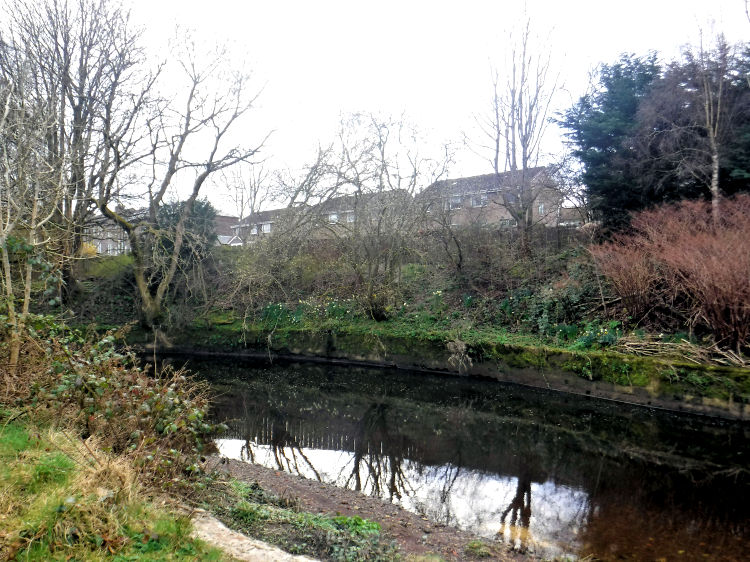
Site of Newlands Paper Mill from river bank
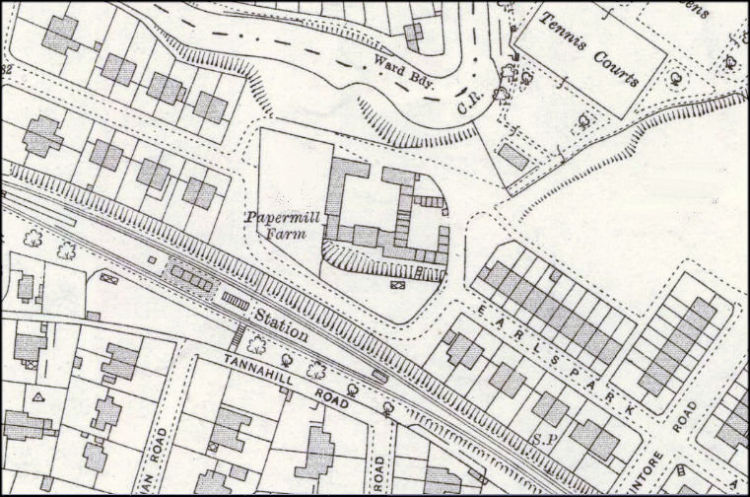
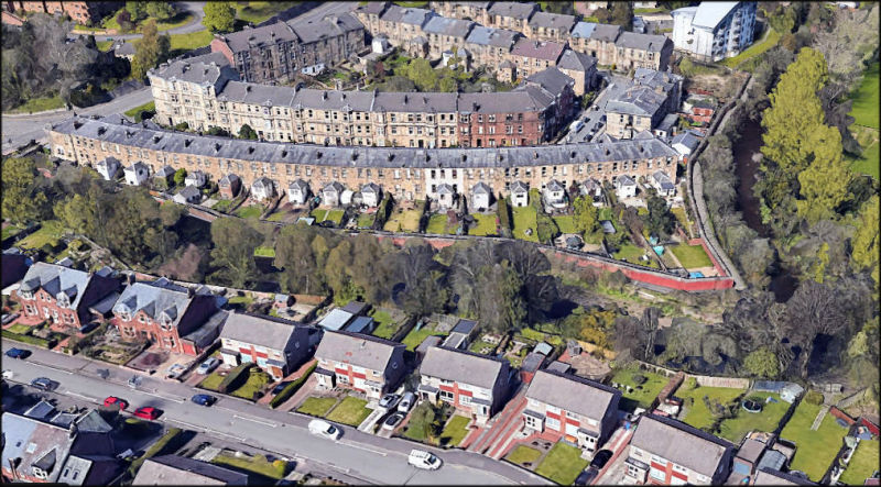
The buildings associated with Papermill Farm survived in Earlspark Avenue until the mid 1960's. The cleared site was developed a decade later in 1975 with new semi-detached housing filling the gaps between the earlier red sandstone houses in the street.
Map showing remains of Papermill Farm, surrounded by residential development of Newlands
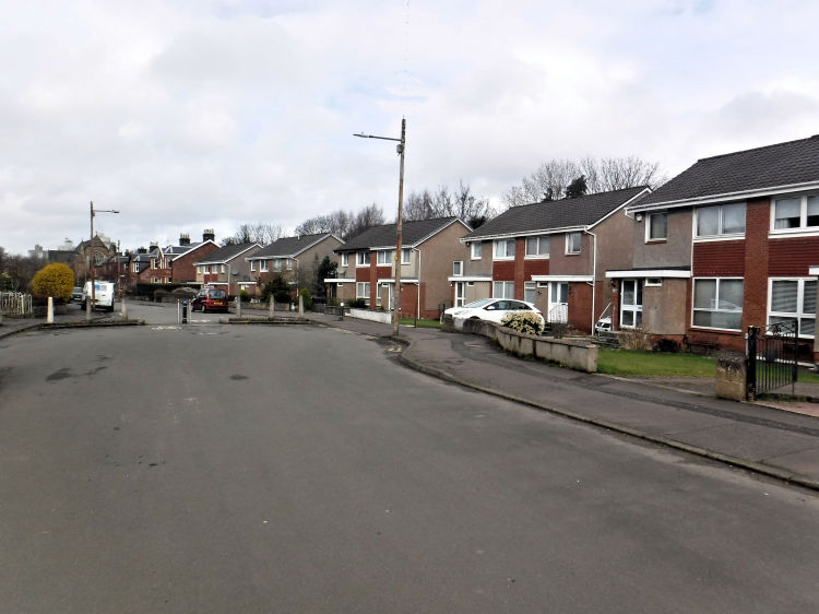
Houses in Earlspark Avenue built in 1975 on site of Newlands Papermill
Aerial view of Millbrae Crescent and Earlspark Avenue at site of Newlands Papermill
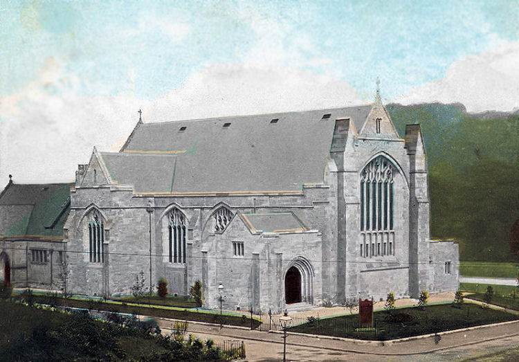
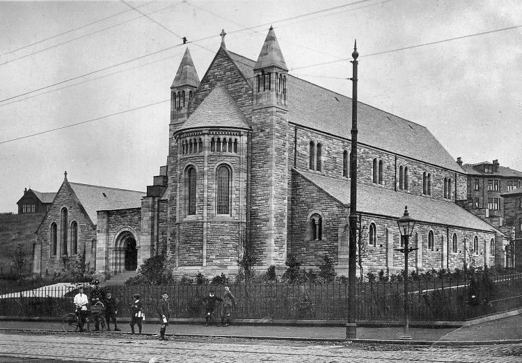
Postcard image of Newlands South Church
Hall at rear of Newlands South Church
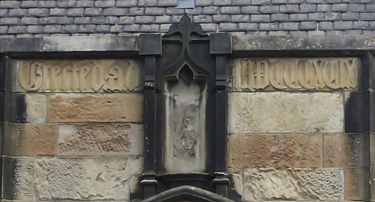
Newlands South Church originated in the hall to the rear which was designed by English architect Fred Rowntree for the United Presbyterian Church of Scotland. Inscription at Newlands South Church Hall: Erected AD MDCCCXCIX (1899)
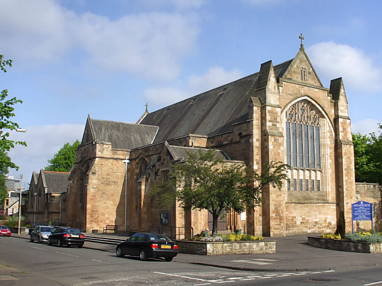
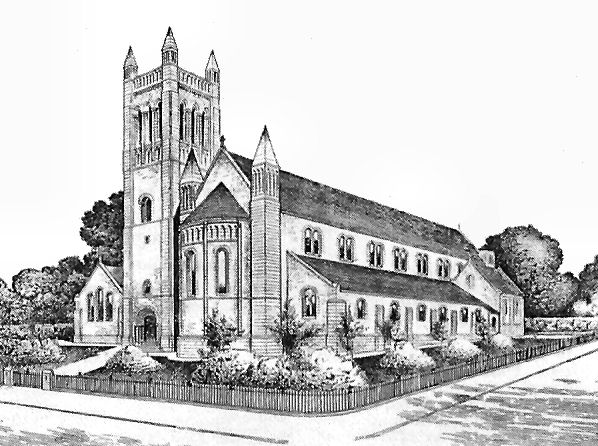
The United Presbyterian Church merged with the Free Church in 1900 to become the United Free Church. Newlands United Free Church opened in 1903, designed in the Perpendicular Gothic style by Henry Edward Clifford.
At the time of the church union in 1929 the building acquired its present title of Newlands South Church.
Newlands South Church
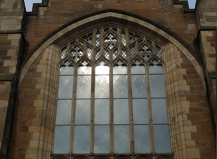
Reflection on main window at Newlands South Church
Frontage to Langside Drive of Newlands South Church
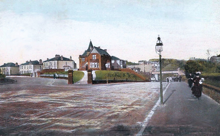
Early twentieth century view of Langside Drive, Newlands
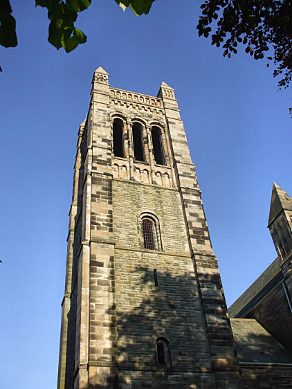
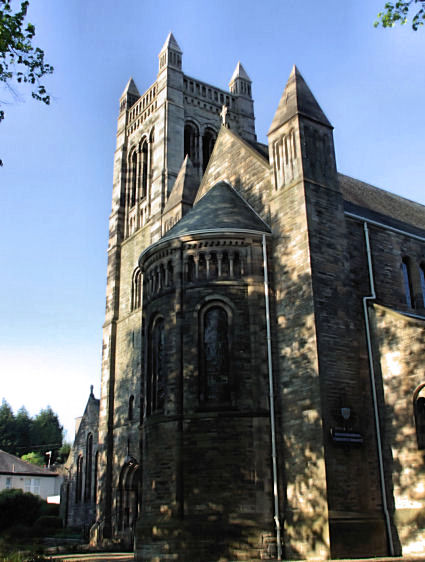
St Margaret's Episcopal Church, situated at the junction of Kilmarnock Road and Newlands Road, was designed in the Norman style by Peter MacGregor Chalmers
and built in stages in the early twentieth century. The hall and vestries were completed in 1908, three
years before work began on the main body of the church. The church was consecrated on Christmas Day 1928 and the tower added by 1935.
The architect's original designs included a spire, which was never constructed.
Photograph of St. Margaret's Episcopal Church before the completion of the tower in 1935
Perspective drawing of St. Margaret's Episcopal Church with proposed tower, 1934
View of tower at St. Margaret's Church, Newlands
Shadows on St. Margaret's Church, Newlands
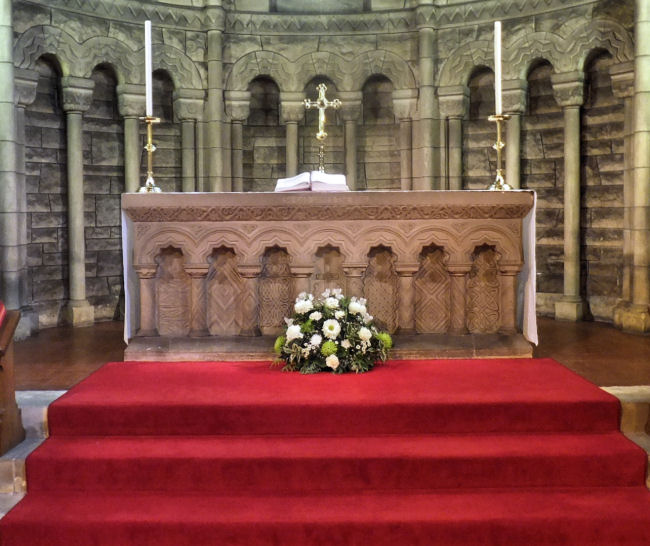
Altar at St. Margaret's Church, Newlands
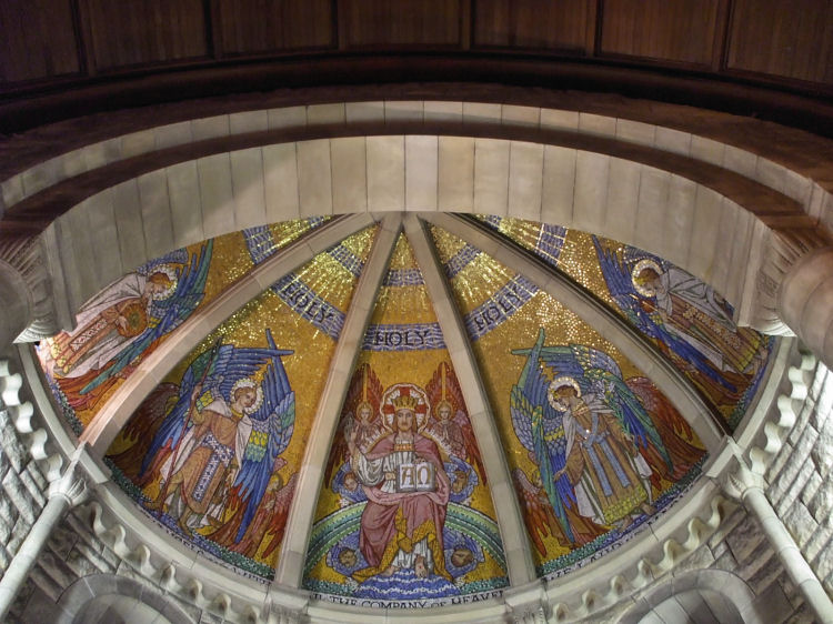
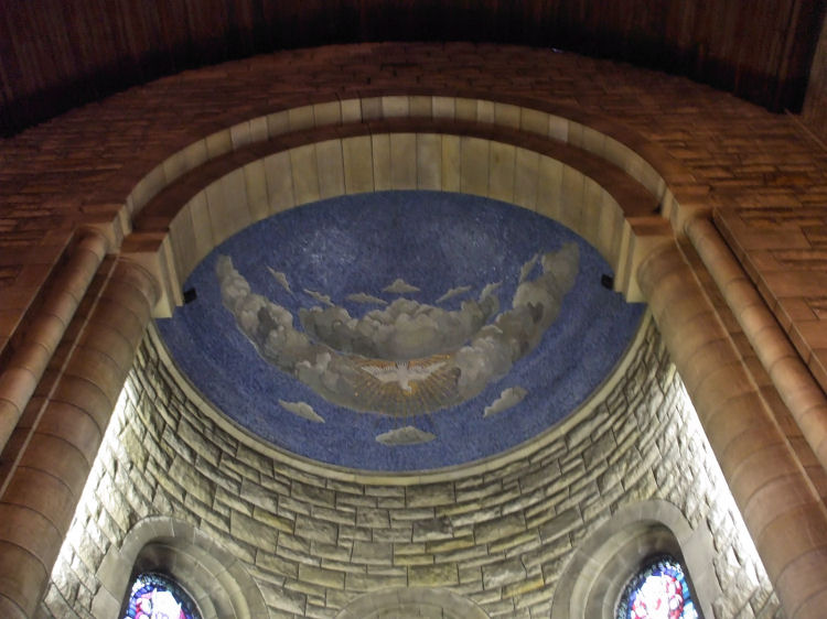
Dome over the altar at St. Margaret's Church depicting Christ the King
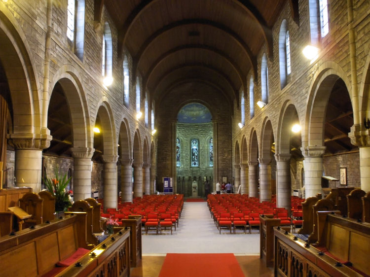
Interior view of St. Margaret's Church from the altar
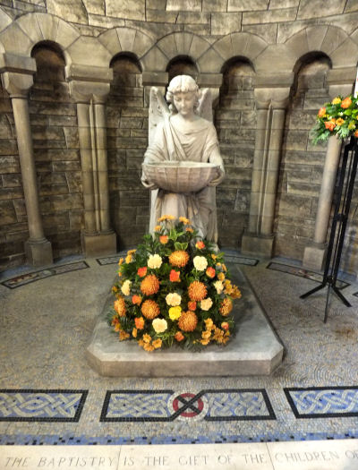
Dome over baptistry at Kilmarnock Road end of St. Margaret's Church
Font at baptistry of St. Margaret's Church, Newlands
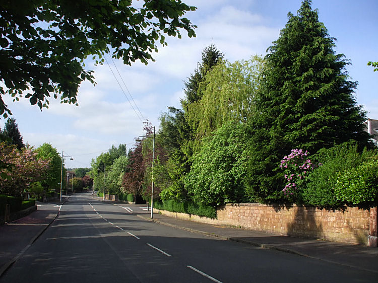
No cars in sight in a tree-lined avenue in Newlands
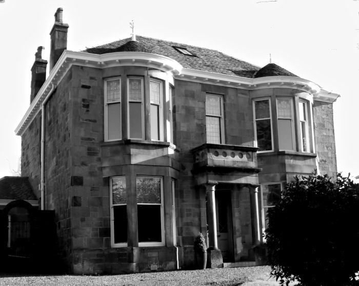
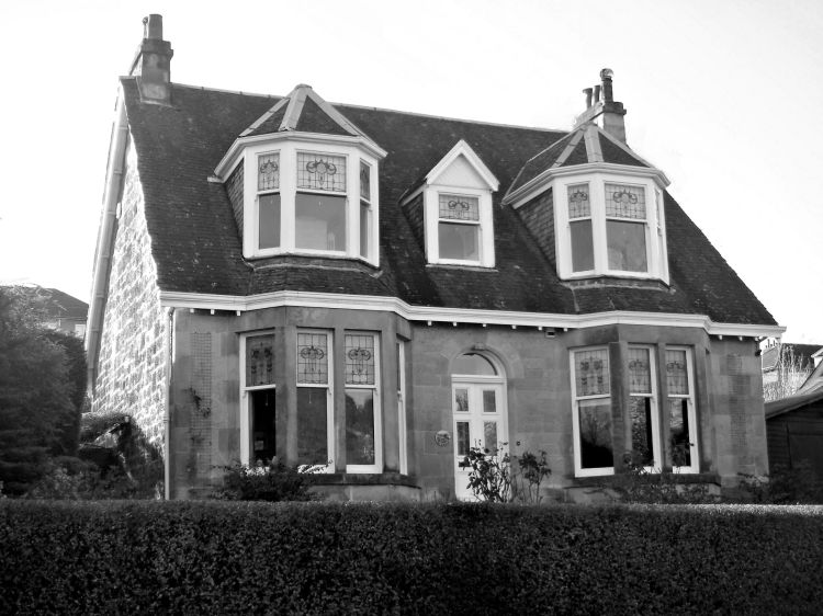
Detached villa in Newlands
Inter-war double villa designed by Thomas Baird
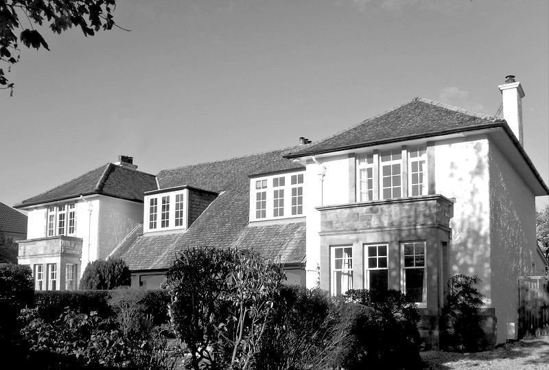
Double villa in Arts & Crafts style, Newlands
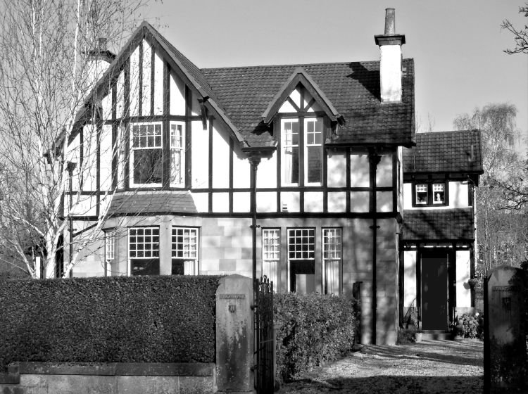
Mock Tudor style villa in Newlands
Cottage style villa in Newlands
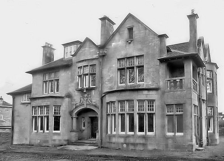
The Beeches - Edwardian villa in Newlands
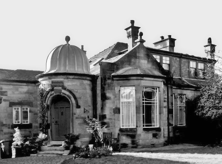
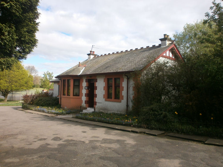
Gatehouse at entrance to Newlands Park
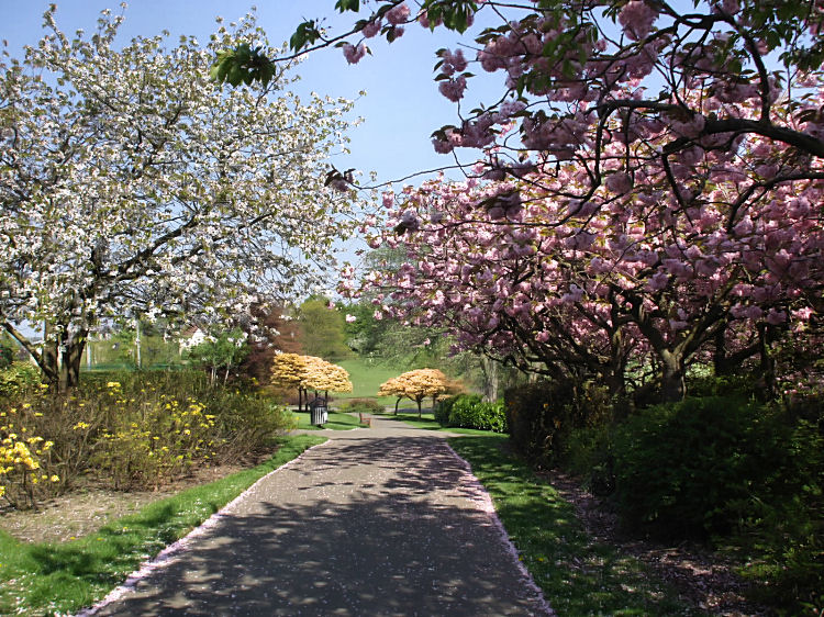
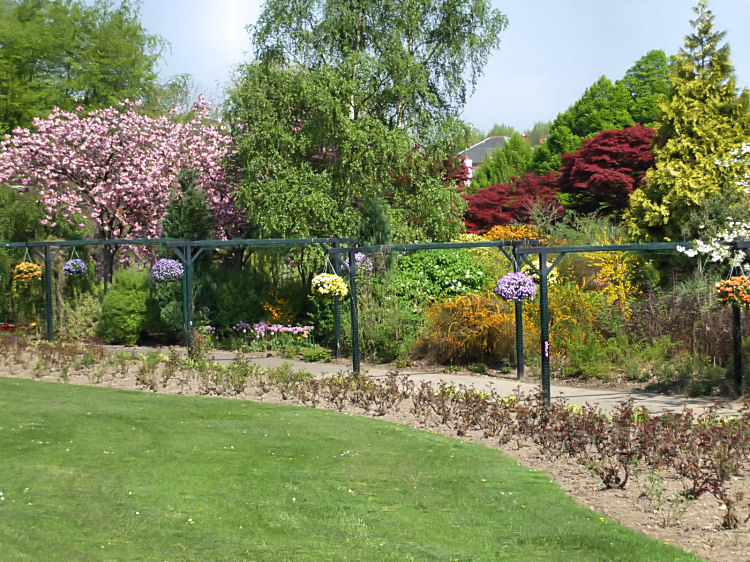
Springtime in Newlands Park
Arbour and spring foliage in Newlands Park
Aerial view of villas surrounding Newlands Park at Kilmarnock Road entrance
Winter in Newlands Park with frozen pond and icy ground
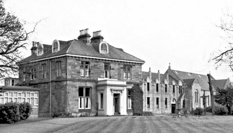
Merrylee House in Briar Road was built in 1855 for Glasgow businessman Thomas Hill, the proprietor of Merrylee Wood which was described in the Ordnance Survey name book of 1856/ 1857 as "a wood situated on both sides of the road leading from Glasgow to Kilmarnock and near the Parish boundary". Merrylee House, Briar Road, Newlands
In 1921 the mansion house was acquired by an order of Fransiscan Sisters who expanded the site with a convent and school. Merrylee House and associated buildings were demolished in 1999 and the site redeveloped with modern housing that fits into the character of the area.
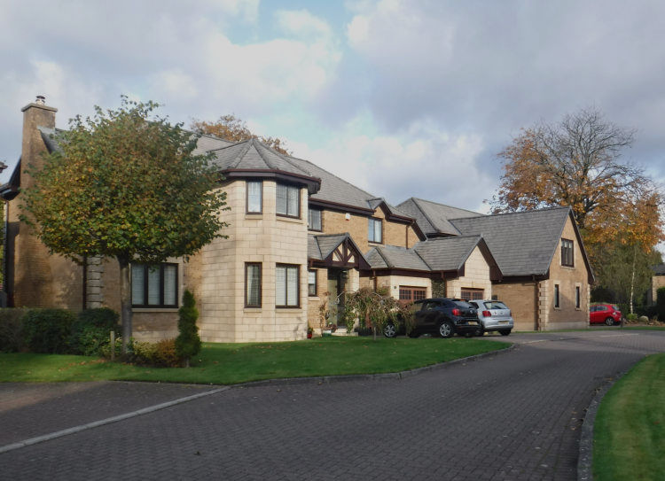
New houses on site of Merrylee House, Briar Road, Newlands
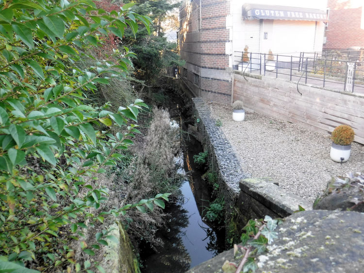
The southern extent of Merrylee Wood was marked by a little stream known as the "Merry Burn" which formed part of the boundary between the parishes of Cathcart and Eastwood. The burn now delineates the city boundary between Fernleigh Road, Newlands, Glasgow and Merryburn Avenue, Giffnock, East Renfrewshire. A more detailed description can be found in the Giffnock & Netherlee page of this website.
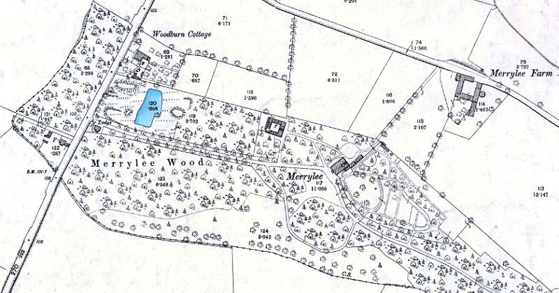
Map showing Merrylee House within Merrylee Wood, Newlands
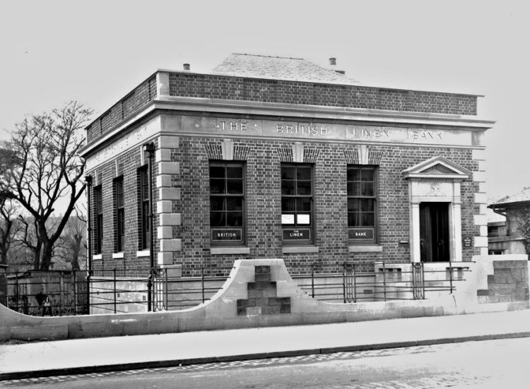
The bridge over the Merry Burn at the city boundary is distinguished with simplistic Art deco styling. The bank building shown on the photograph is on the Newlands / Glasgow side of the stream and exists today as a dental surgery.
Bank building at the bridge on Kilmarnock Road at the city boundary
View of Merry Burn from bridge at the city boundary
Another mansion house was situated on the Glasgow side of the city boundary at Langside Drive, opposite Fernleigh Road. 'Woodend' and its wooded gardens was replaced with the modern housing of Strathendrick Drive in the late 1960's.
Map showing site of 'Woodend', Newlands, 1952
The former site of Merrylee Lodge nursing home in Newlands Road was redeveloped in 2018 with the erection of 31 houses and a children's home. The houses were carefully designed to fit into the surrounding neighbourhood.
New housing at site of Merrylee Lodge, Newlands Road
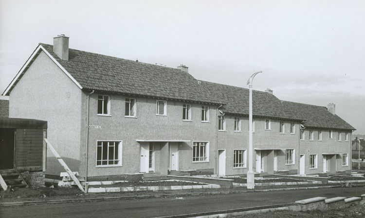
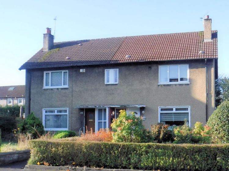
Merrylee Housing Scheme was a post-war development by Glasgow Corporation with an initial phase built 1951-1952. The terraced and semi-detached houses of the first stage had more in common with the city's inter-war council housing than the tenemental style adopted in the peripheral satellite schemes of the late 1950's.
Terraced houses in Muirskeith Road, Merrylee, built 1951
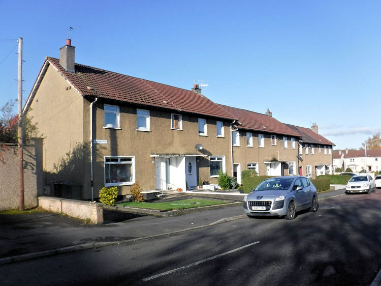
Terraced houses in Muirskeith Road, Merrylee, 2019
2019 view of semi detached houses in Muirskeith Road, Merrylee, built 1951
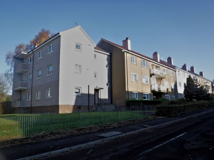
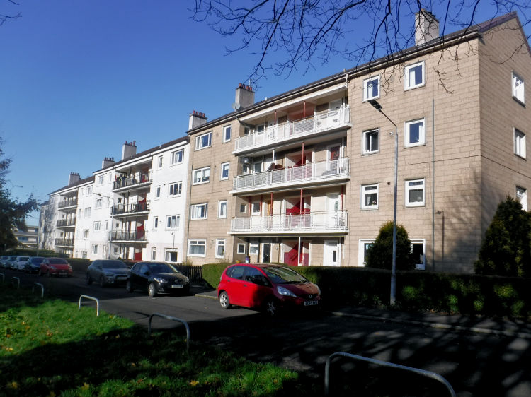
As the decade progressed the house types at Merrylee followed the pattern of Glasgow's other post-war housing schemes with the erection of three & four storey blocks of flats.
Three storey blocks of flats at Merrylee
Four storey blocks of flats at Merrylee
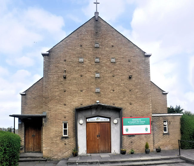
St Gabriel's Roman Catholic church, Merrylee, was built in 1955 during the development of the housing scheme. It was designed by architect Thomas Smith Cordiner, who was the preferred architect of the Archdiocese at the time. This was a period when a lot of new housing developments were proceeding in outlying areas of the city as a consequence of slum clearance and Comprehensive Redevelopment of the old tenemental districts. Congregations were being displaced from the inner-city areas where the more traditional Catholic parishes were situated and new buildings were required for new parishes in the growing outer suburbs. There was a lot of private housing created in the 1950's in places like Simshill and Braehead, Cathcart. Front of St Gabriel's RC Church, Merrylee
The view below shows St Gabriel's situated between a traditional sandstone villa of Newlands and a modernised terrace of Merrylee housing scheme.
Housing surrounding St Gabriel's RC Church, Merrylee
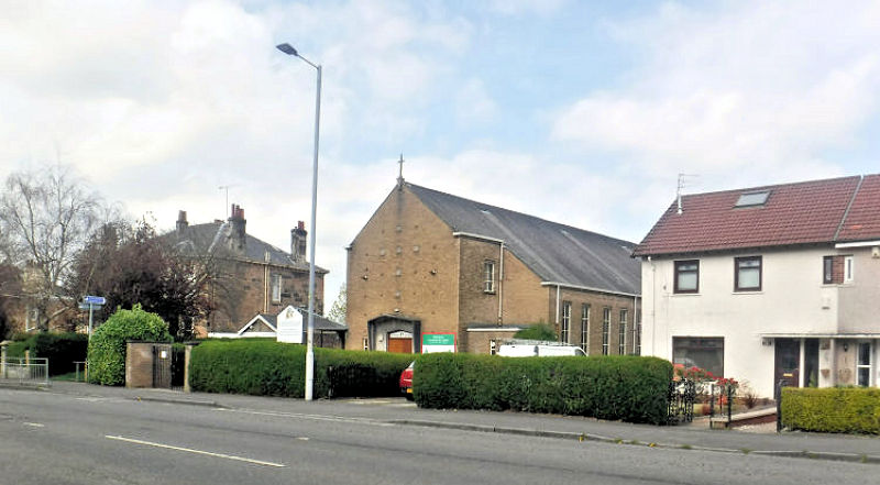
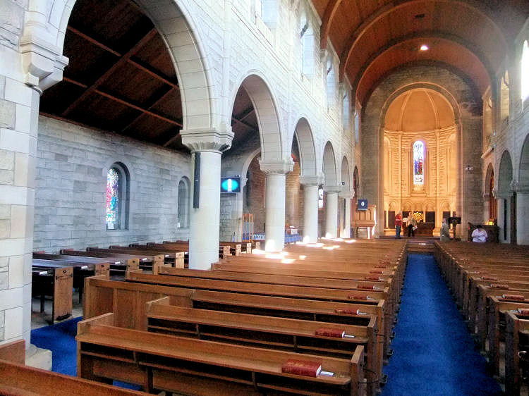
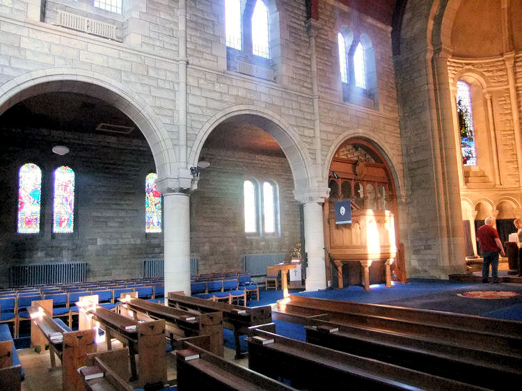
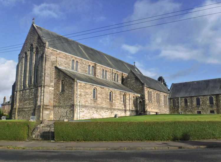
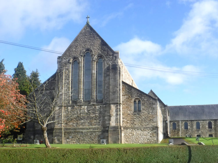
Merrylea Holy Trinity Parish Church was designed by Peter Macgregor Chalmers, who was also the architect of St Margaret's Episcopal Church in Kilmarnock Road. The church opened in September 1915 with additions and alterations completed in 1922.
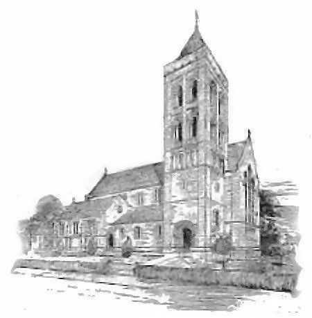
Sketch of Merrylea Parish Church with proposed tower which was never completed
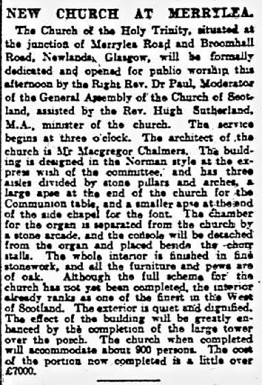
Cutting from Glasgow Herald 15th September 1915 regarding opening of Merrylea Parish Church
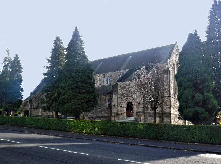
Entrance to Merrylea Parish Church at base of unbuilt tower
Internal view from the rear of Merrylea Parish Church
Pulpit at Merrylea Parish Church
Merrylea Parish Church from south-west
Gable of Merrylea Parish Church
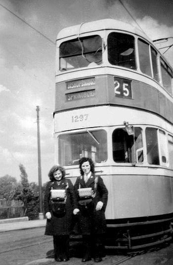
My personal connection to Newlands originated with my late mother, Nancy, who became a tram conductress based at Newlands Tram Depot after she arrived in Glasgow from County Cavan in Ireland in the early 1950's.
Nancy Blaikie on the left of Glasgow tram No.1297 at Rouken Glen terminus c.1950
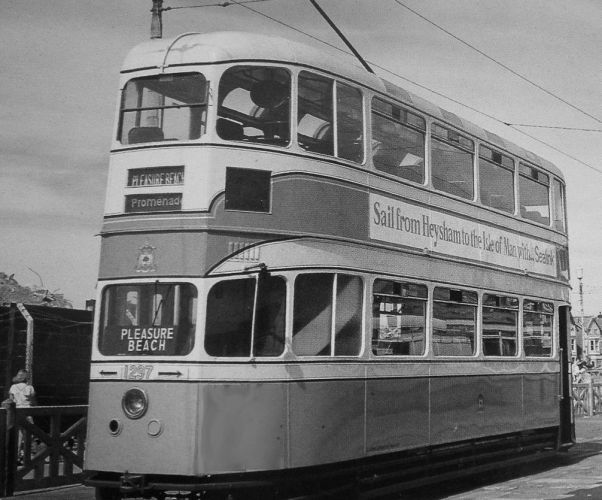
Glasgow tram No. 1297, shown above, was built in 1948 at Glasgow Corporation's workshops at Coplawhill. It was one of a class of tramcars which came to be known as "Cunarders". It remained in service until the tramway's last day of operation in September 1962, when it took part in the farewell parade. In July 1963 it was saved for preservation at the National Tramway Museum at Crich, Derbyshire. The old vehicle returned home for a spell carrying passengers at the Glasgow Garden Festival in 1988.
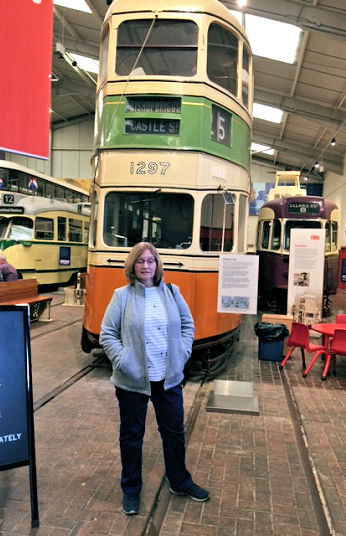
Our good friends, Jean and Dougie Watson, were totally unaware of my mother's connection with the Glasgow trams when they visited the National Tramway Museum in September 2019. While catching up with events shortly afterwards Jean surprised us with a picture on her smartphone of the very same tram featured above.
Jean Watson beside Glasgow tram No.1297 at Crich, Derbyshire, September 2019
Glasgow tram No.1297 on loan at Blackpool
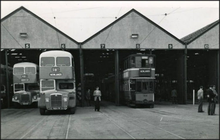
Newlands tram depot was developed from 1910 on the site of the Newlandsfield Bleachworks to the west of Kilmarnock Road. This large area of flat land is now the site of Morrison's supermarket.
Buses and trams together at Newlands Depot before the Glasgow tramways were abandoned in 1962
Early 1960's view of redundant tramcar at Newlands Depot with replacement buses in background
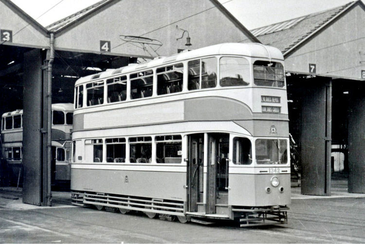
"Cunarder" tramcar at Newlands Depot
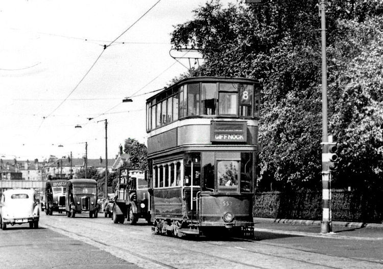
Tramcar at corner of Corrour Road and Kilmarnock Road, Newlands, 1954
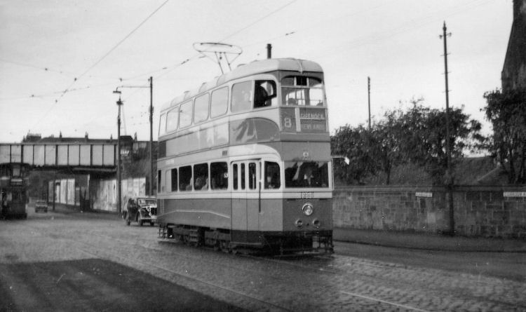
Rouken Glen bound tramcar in Kilmarnock Road, Newlands
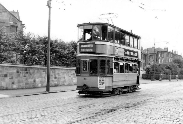
Giffnock bound tramcar at traffic lights in Kilmarnock Road, Newlands
The nearby burgh of Pollokshaws was a busy manufacturing town with no administrative connections with Newlands which was developed as an area of upmarket Victorian villas with large garden grounds.

The foundation stone was laid in September 1898 and the church was formally opened on 1st June, 1899.


Merrylee House had extensive gardens and greenhouses set aside for growing flowers, fruit and vegetables. In the 1860's & 1870's Alexander Walker, gardener to Thomas Hill of Merrylee, won numerous prizes for his flowers at the annual show of the Glasgow and West of Scotland Flower Society.
The adjacent Merrylee Farm was retained by Sir John Maxwell, who let it to various tenants over the years.


In addition to St Gabriel's, Cordiner also designed the Church of Christ the King, King's Park and St Brigid's, Toryglen as well as St Margaret Mary's and St Bartholomew's in Castlemilk.
His designs were generally quite simplistic, featuring brick exteriors which fitted in well with the surrounding new housing.

![]()
|
|
| |
|
|
||
|
|
All original artwork, photography and text © Gerald Blaikie
Unauthorised reproduction of any image on this website is not permitted.
