
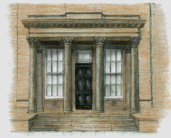
Drawing of portico of Aikenhead House, Kings Park
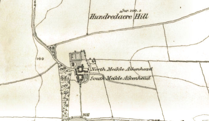
Prior to the housing developments of the 1920’s & 1930's, "King’s Park" was an area of hilly countryside centred on the Hundred Acre Hill beside the steading of Meikle Aikenhead, which was situated on the site of the present day King’s Park Primary School.
The buildings at Meikle Aikenhead were demolished in 1928. Map showing Meikle Aikenhead and the Hundred Acre Hill in the 1850's
King's Park Primary School, built on the site of Meikle Aikenhead, 1932
The public park which we know today was previously part of a private estate centred on Aikenhead House and its grounds.
A section of the estate around the mansion-house was gifted to Glasgow Corporation by the builder, J.A. Mactaggart, in May 1930.
The Corporation retained the beautifully landscaped parkland for use by the new residents as the now familiar King's Park.
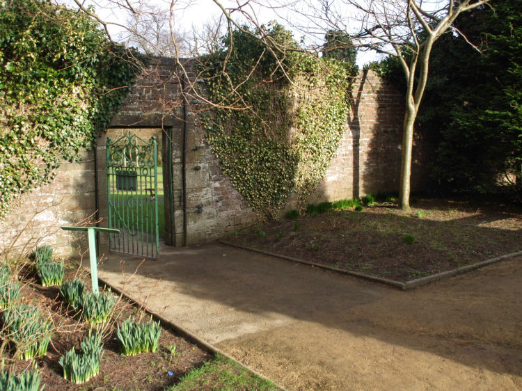
The woods and walled garden of the old estate have been well preserved to be enjoyed by the present day visitors to the park.
The map below shows the original "King's Park" and the houses of Meikle Aikenhead on the slopes of the Hundred Acre Hill.
1920's map showing King's Park as distinct from Aikenhead Estate which is now the public park with that name
The new residential areas were developed by Mactaggart and Mickel Ltd and the Western Heritable Investment Company.
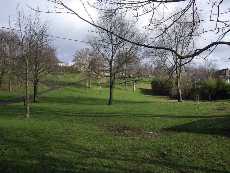
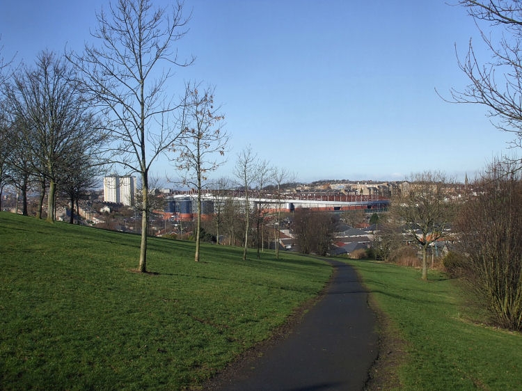
View of Hundred Acre Hill, King's Park, from the south
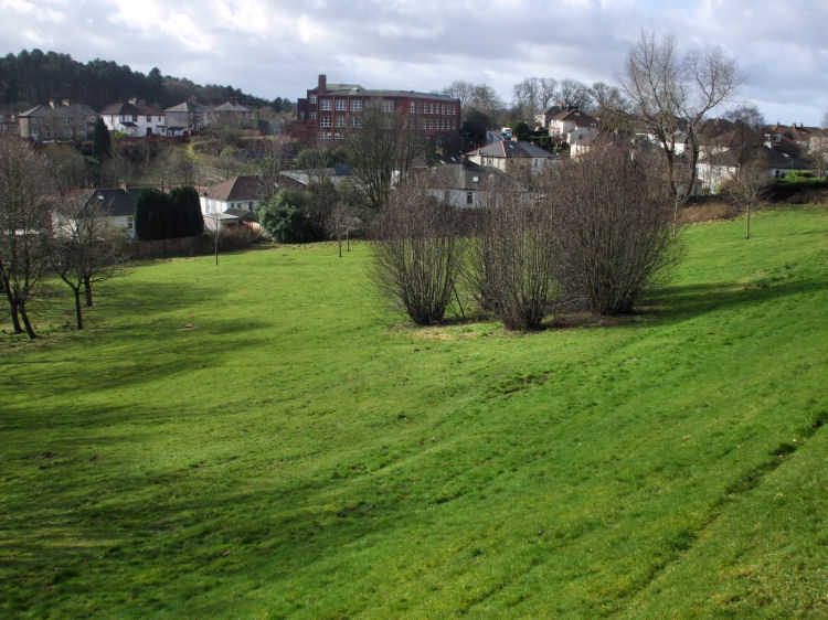
View of King's Park Primary School, former site of Meikle Aikenhead, from Hundred Acre Hill
View of Mount Florida and Hampden Stadium from the northern slopes of Hundred Acre Hill, King's Park
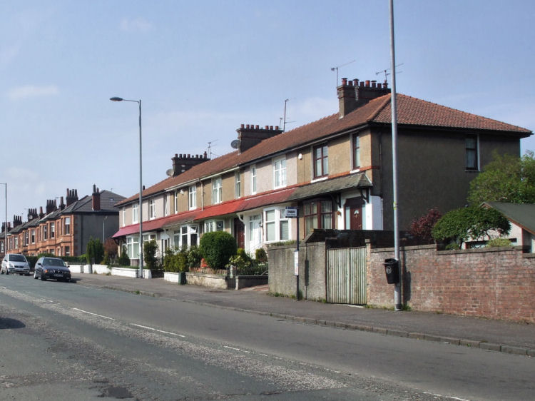
The first mass-produced houses of King's Park were sandstone terraces and semis, built in and around the Carmunnock Road end of King's Park Avenue from 1906/ 1907. This early 20th century development did not not quite reach as far as Aikenhead Road. From the late 1920's an expansion to the south of the fledgling suburb was carried out by Mactaggart and Mickel Ltd and the Western Heritable Investment Company with thousands of new dwellings being created.
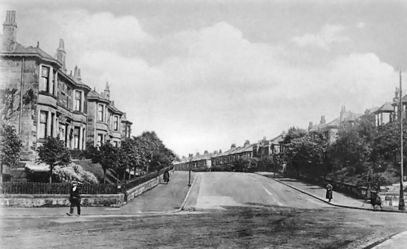
View of King's Park Avenue from Carmunnock Road, showing early 20th century houses
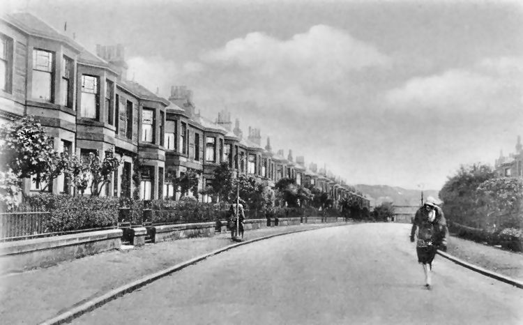
View of sandstone terraces of Second Avenue looking towards Aikenhead Road, c.1930
View of King's Park Avenue from Aikenhead Road showing early sandstone terraces and later inter-war development
View of Aikenhead Road in the early stages of the inter-war development of King's Park
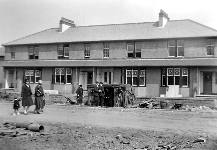
Workmen's bothy in King's Park Avenue during construction of typical "Mac & Mick" terrace, c.1930
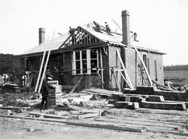
Construction of detached bungalow in Menock Road, King's Park, showing concrete blocks and roof tiles, c.1930
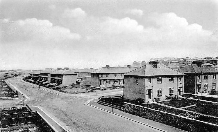
Long view from the far end of King's Park Avenue showing the original two lane carriageway
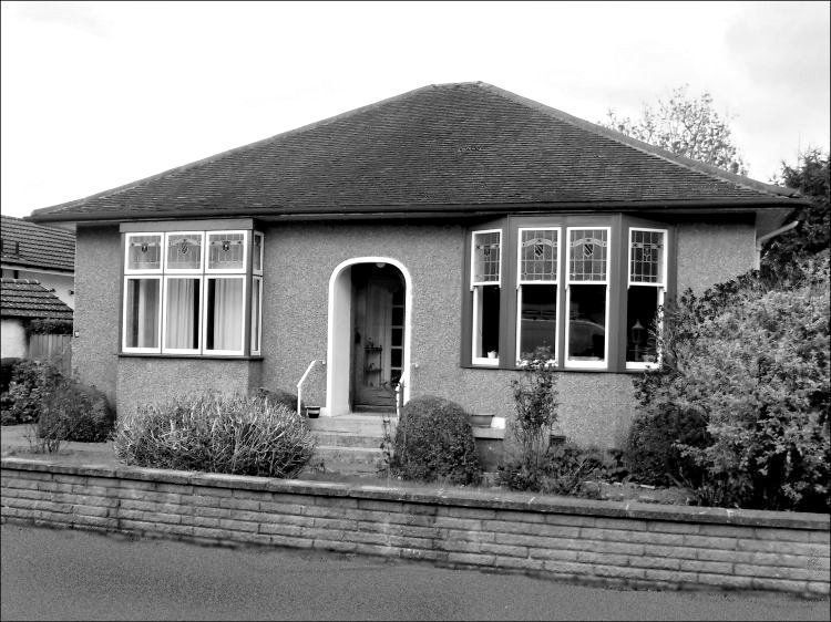
Bungalow in King's Park with original decorative windows
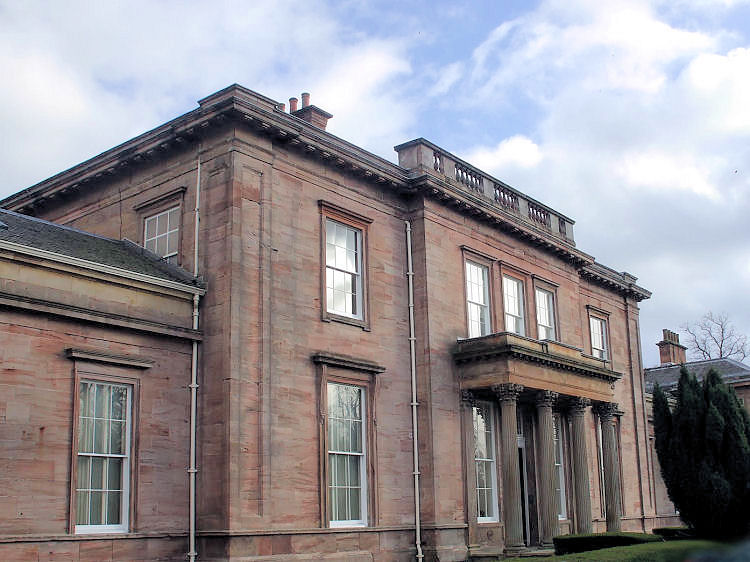
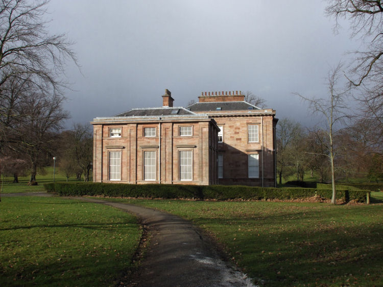
The present day public park was created from the Aikenhead Estate, centred on the 1806 mansion house designed by David Hamilton.
Aikenhead House, Kings Park, Glasgow
Central part of Aikenhead House built in 1806 for tobacco merchant, John Gordon
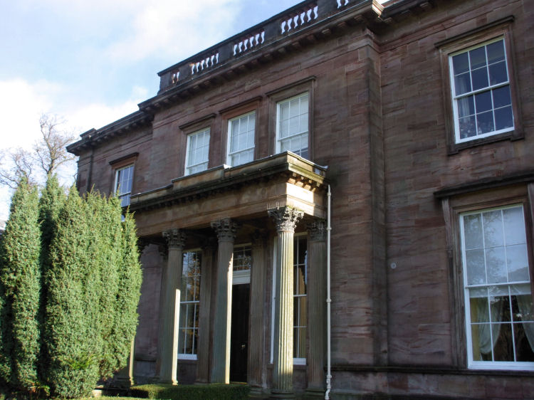
Scrapbook photograph of Aikenhead House in 1878, showing side wings which were added in 1823
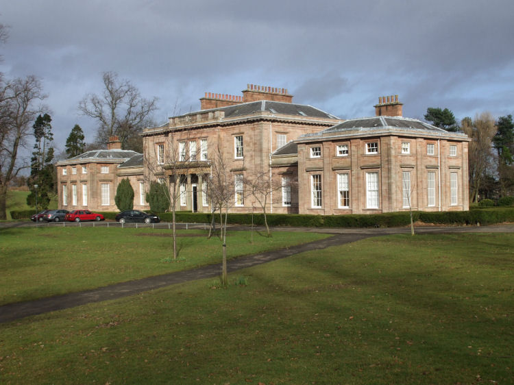
2009 photograph from same spot as 1878, showing very few external changes after the conversion into flats in 1986
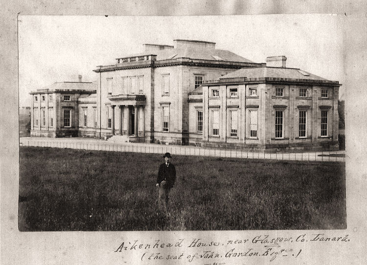
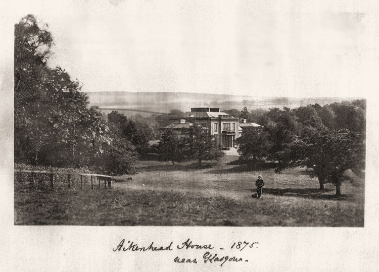
Scrapbook photograph of Aikenhead House in 1875
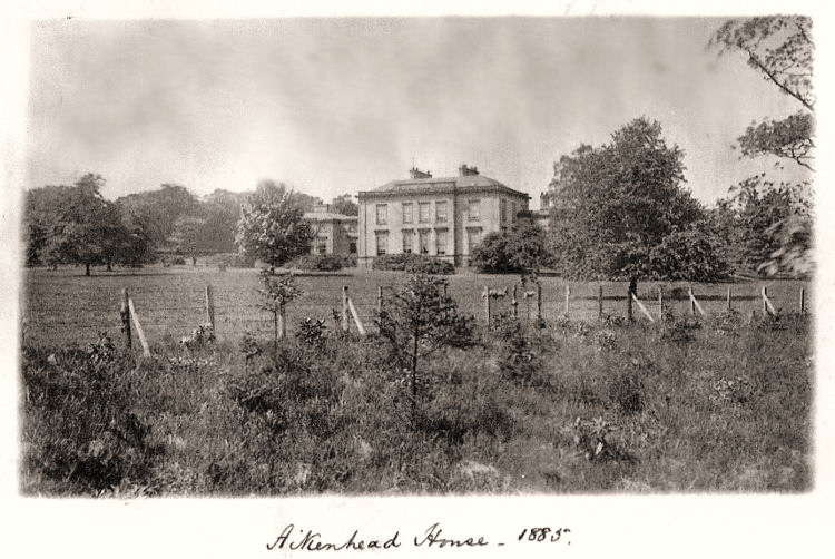
Scrapbook photograph of Aikenhead House in 1885
Window openings, blocked up and painted to provide symmetry and avoid payment of window taxes
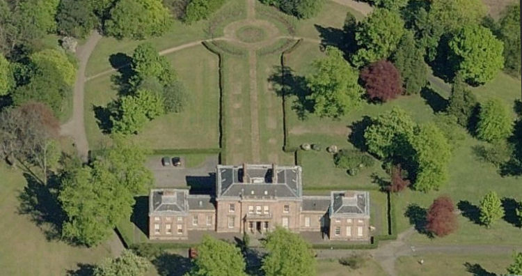
Aerial view of Aikenhead House and gardens to rear
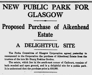
The last private owner of the Aikenhead House was Mr Henry Erskine Gordon (1849-1929), the grandson of John Gordon who had built the house. Mr Gordon died at home on 12th April 1929. In August of the same year the trustees of his estate offered the mansion-house and surrounding parkland to the city for a sum of Ł10,000. This offer was recommended to the Corporation by the Parks Committee but was rejected in September 1929 on account of conditions imposed by the trustees regarding future use of the mansion-house and its immediate surrounds.
Extract from Glasgow Herald 22nd August 1929 regarding proposed acquisition of Aikenhead Estate
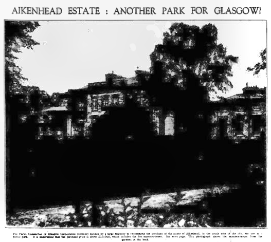
The picture caption reads:-
"The Parks Committee of Glasgow Corporation yesterday decided by a large majority to recommend the purchase of the estate of Aikenhead, in the south side of the city, for use as a public park. It is understood that the purchase price is about Ł10,000, which includes the mansion-house. The photograph shows the mansion-house from the gardens at the back."
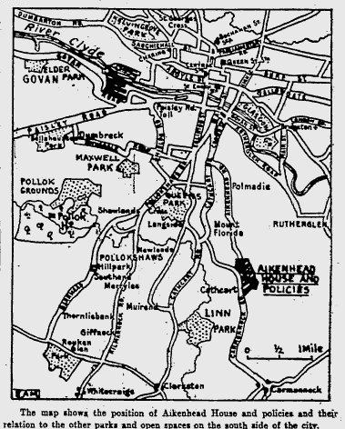
Map from Glasgow Herald 22nd August 1929 showing position of Aikenhead Estate relative to other south side parks
Headline from Glasgow Herald 22nd August 1929 regarding proposed acquisition of Aikenhead Estate
Following the rejected offer to the city, 250 acres of undeveloped land in Aikenhead Estate were acquired by Mactaggart and Mickel Ltd and the Western Heritable Investment Company Ltd for the erection of 3000 houses in addition to the 2900 which had been built previously. Extract from Glasgow Herald 16th May 1930 regarding gift of Aikenhead Estate as a new public park
On 1st May 1936 Aikenhead House was opened to the public for the first time, after it had been converted for use as a museum.
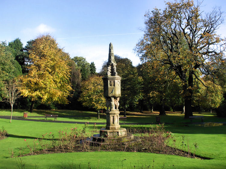
Ornamental sundial from 1885, originally sited at Douglas Castle Lanarkshire, brought to the park in 1930
Entrance to walled garden from park
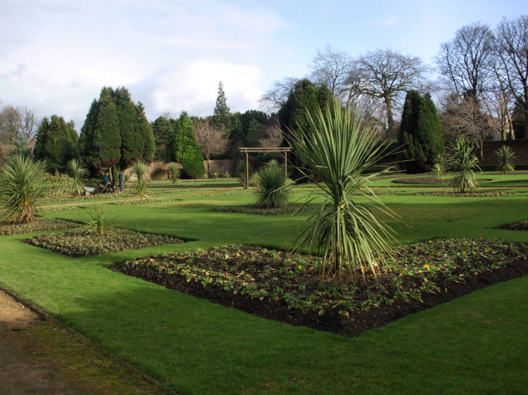
Ornamental plants in walled garden at Kings Park
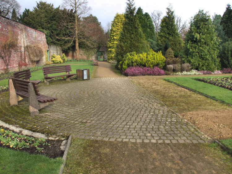
Cobbled crescent in walled garden with benches overlooking flower beds
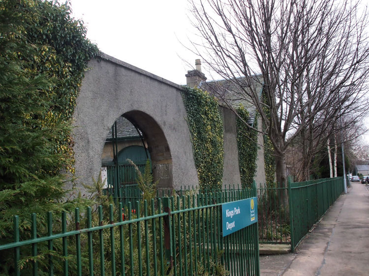
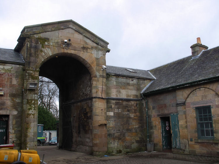
Ivy clad walls at entrance to former stables in Croftpark Avenue
Huge arched entrance to park from cobbled stables courtyard
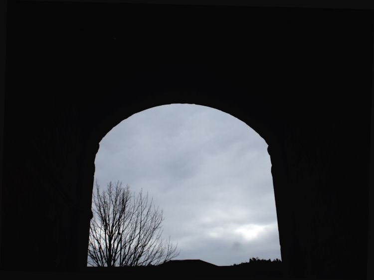
Deep shadows under the arch at stables
Former estate workers cottages in Croftpark Avenue, facing the park
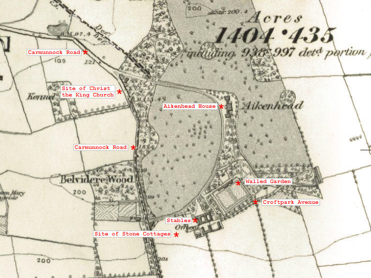
1850's map of Aikenhead Estate
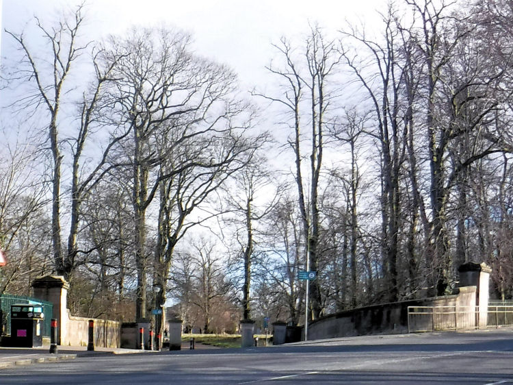
Main entrance to Aikenhead Estate / King's Park, Carmunnock Road
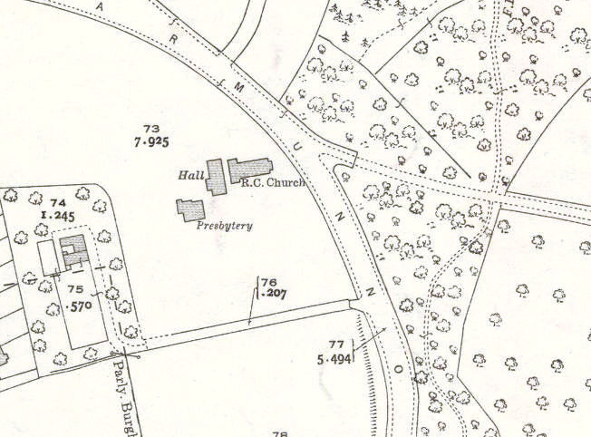
The undeveloped land facing the main entrance to Aikenhead Estate / King's Park was acquired by the Roman Catholic Archdiocese of Glasgow in 1933. The inter-war housing developments of the area had attracted many families from the traditional inner city Catholic parishes who now desired a local place of worship. A mission was established to develop a parish by Rev. Cornelius Dennehy, parish priest of St. Conval's, Linwood. 1935 map of main entrance to Aikenhead Estate / King's Park
The stone built presbytery for Christ the King was completed in 1935, as the date plaque shows. Presbytery for Christ the King Church, built 1935
From 1952 the last remnants of the ancient farmlands of Castle Mains, Cathcart, and the contiguous Symshill were developed by Mactaggart & Mickel to create the housing estate of Simshill, directly to the south of the church. This resulted in a large increase in the numbers of parishioners of Christ the King.
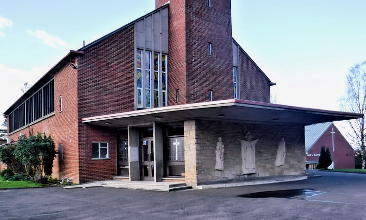
The church was built with red brick with a very tall tower at its eastern end which can be spotted throughout the local area. The tower is capped with a copper pyramidal dome topped with a cross spire.
Christ the King Church, King's Park, completed in 1960
The architect of the new church was Thomas Cordiner who also designed the nearby St Mirin's Primary School in 1954. Cordiner was responsible for many churches in Glasgow's southern suburbs including St Gabriel's Merrylee, St Brigid's Toryglen and St Margaret Mary's and St Bartholomew's in Castlemilk. He is also credited with the design of the Linn Crematorium.
Entrance to of Christ the King Church, King's Park
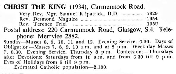
The parish priest at the time the new church was first occupied in 1960 was Very Rev. Monsignor Samuel Kilpatrick, who had served the parish in that capacity since 1949, when he was also Chancellor of the Archdiocese. Clergy of Christ the King Church, 1960
The notice above shows that the priests were kept very busy every Sunday, with five morning masses and an evening mass. There were two early morning masses held each week day for people heading for work or school.
New churches for other denominations were built in the early 1930's in and around Castlemilk Road on the eastern portion of King's Park, on land previously owned by John Auld Mactaggart.
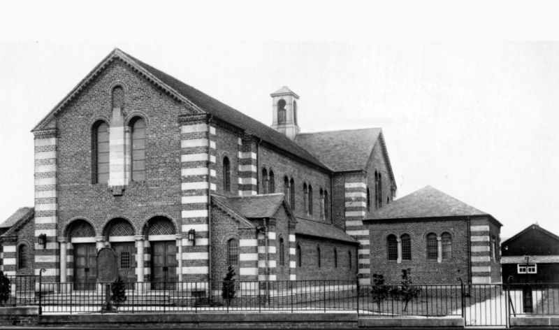
The Church of Scotland's King's Park parish was established in 1930 with a temporary wooden hall on the western side of Castlemilk Road. The brick-built church and halls were completed in 1932.
King's Park Parish Church and original timber hall, 1932
King's Park Parish Church was designed by Thomas Taylor, a partner in the firm of Hutton & Taylor, who had won the commission in a competition. It was created with a cruciform floor plan in a restrained Romanesque style with red brick and cream sandstone dressings.
The original doors and windows of the church featured round-headed brick arches, typical of the Romanesque style.
The foundation stone for the new church was laid on Saturday 6th June 1931 by John A. Mactaggart, who was presented with a ceremonial trowel by its architect, Thomas L. Taylor. The parish's first minister, Rev. William Clarke, laid a casket in a hollow below the foundation stone containing a copy of that morning's Glasgow Herald and other contemporary items.
John Mactaggart was created a hereditary baronet in 1938 and was thereafter properly referred to as "Sir John Mactaggart of King's Park in the City of Glasgow". After his death in 1956, stained glass windows commemorating Sir John and his wife were installed in the church.
King's Park Parish Church, February 2023
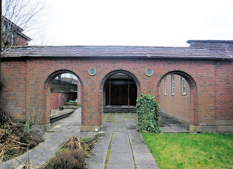
In 1952 extensions entered from a courtyard on the southern side of the church were added. They were designed by Honeyman, Jack & Robertson.
A decorative screen was built to provide a more congruous street view of the extensions, which had flat roofs and rectangular steel framed windows which were was not in harmony with the original building.
Screen at entrance to 1952 additions to King's Park Parish Church
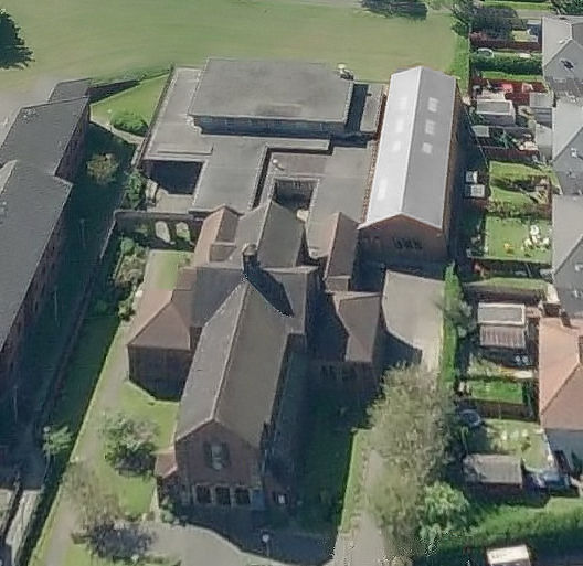
Aerial photograph of King's Park Parish Church
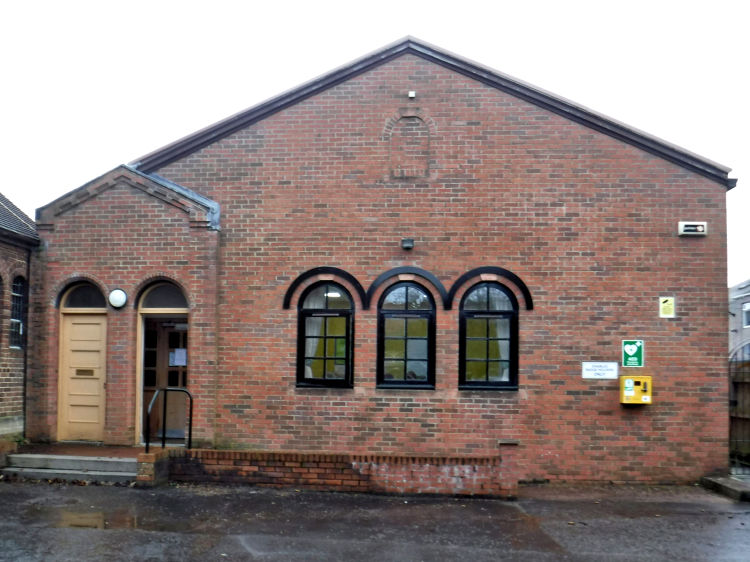
In 1997 a large steel portal framed hall by Grant Design was built to the rear of the church on the site of the original small church hall. It had a brick façade designed to mimic the original 1932 structure, but without the stone embellishments. The aerial photograph, above, shows the full extent of the building which cannot be seen from ground level.
Hall at King's Park Parish Church, erected 1997
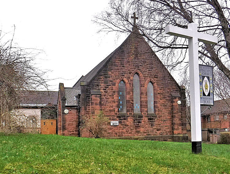
St Oswald’s Episcopal Church was built with rock faced red sandstone in a simplified Gothic style featuring three lancet windows on the east gable. The building was erected in 1931.
The designers of the church were the partnership of James B. Whyte and William G. Galloway, who were the preferred architects of the Glasgow diocese in the inter-war period when the Gothic style was not at all fashionable. They also designed the original St Aidan's Church, Clarkston, Holy Trinity Church, Riddrie and St Serf's Church, Shettleston.
St Oswald's Episcopal Church, King's Park
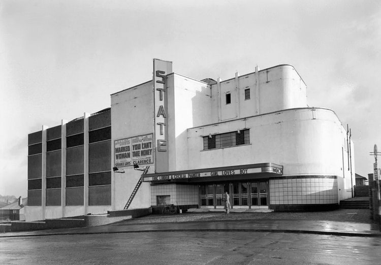
This photograph of the newly built State Cinema in King's Park was taken by the staff photographer of the City Assessor's Department, who also took many photographs of inter-war shop fronts which are now in the possession of Glasgow City Archives. Art Deco style State Cinema, Castlemilk Road, King's Park, 1937
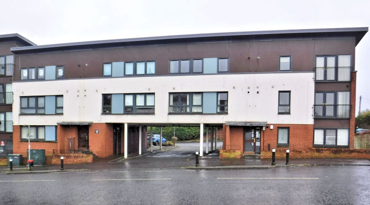
Modern flats on site of State Cinema, King's Park, February 2023
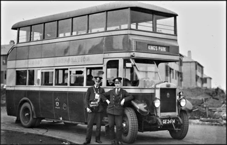
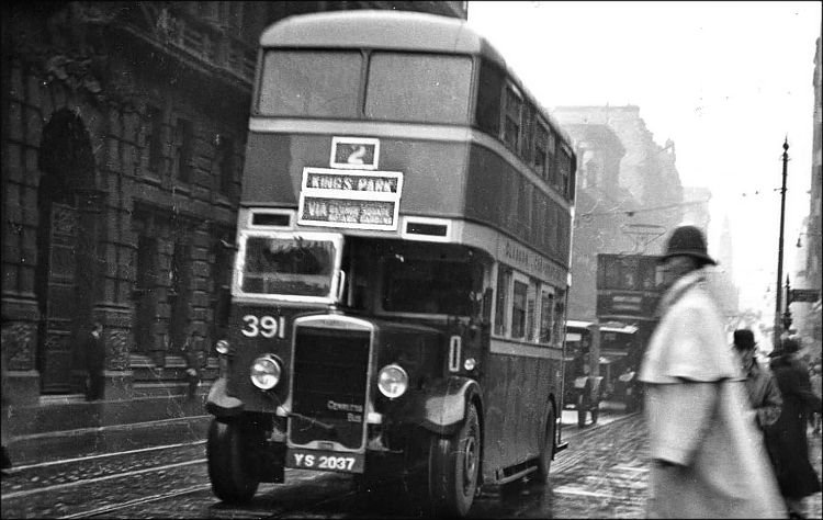
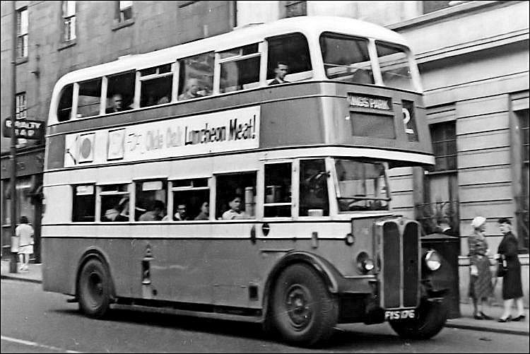
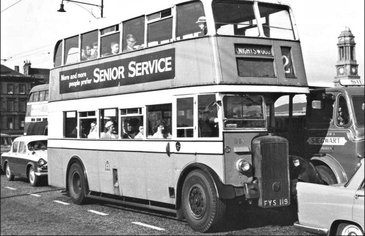
The original bus service for the King's Park district was the No.2 route, which crossed the city centre on its way to Knightswood, a similar inter-war housing development in the west end of Glasgow. It approached King's Park by way of Carmunnock Road and King's Park Avenue. The bus shown below is a Glasgow Corporation Transport Leyland Titan with an open rear staircase. It is seen at the Knightswood terminus during the construction of new houses, around 1930.
King's Park bus at Knightswood terminus with house construction in background, c.1930
The bus shown below is an Albion Venturer SP81, supplied to Glasgow Corporation Transport in 1935.
Rainy view of very early No.2 Corporation bus to King's Park passing through the city centre
No.2 Corporation bus to King's Park passing through the city centre
No.2 Corporation bus from King's Park to Knightwood on Victoria Bridge
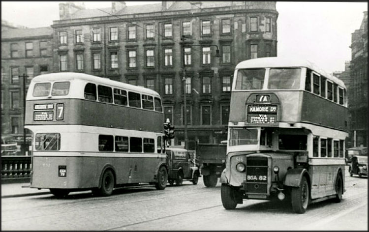
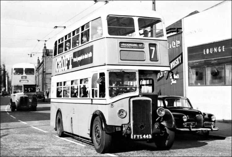
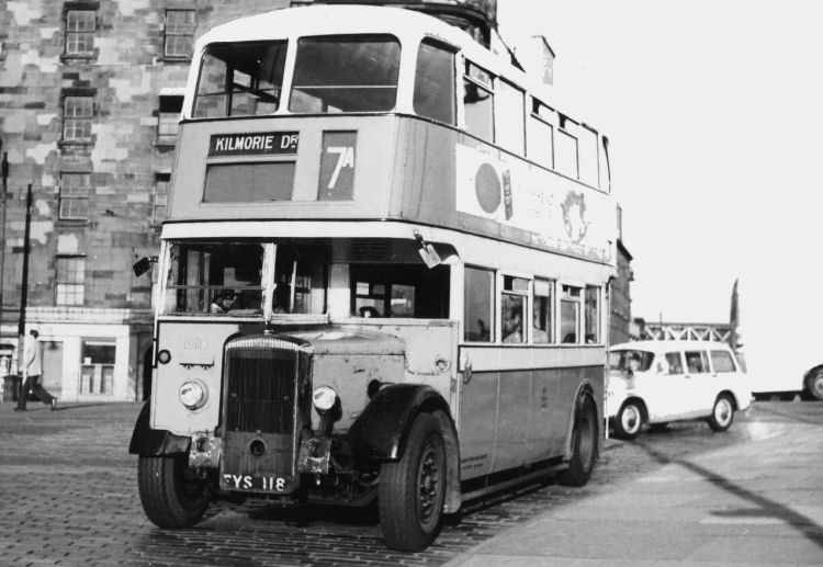
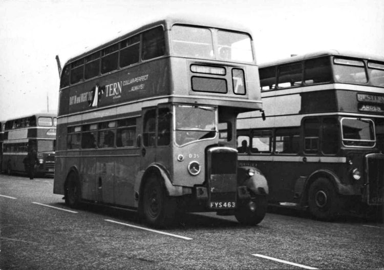
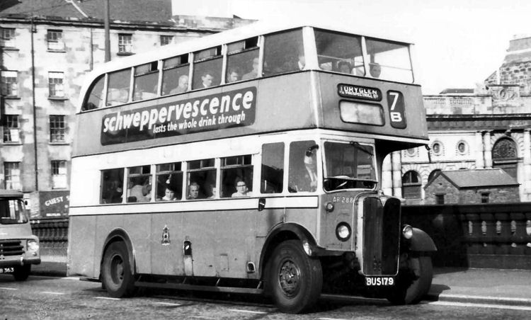
The No.7 route was introduced to provide a direct service from the city centre to King's Park via Aikenhead Road and Curtis Avenue. The surrounding new housing estates of Bankhead, Rutherglen and Toryglen, were served with variants of the No.7 route, with the 7A operating to Kilmorie Drive in Bankhead, and the 7B to Prospecthill Road in Toryglen. The 7B was later renumbered as the No.12.
1940's view of King's Park buses on Victoria Bridge in Glasgow city centre
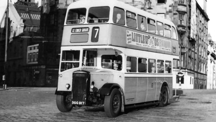
No.7 Corporation bus passing Eglinton Toll on its way from St Enoch Square to Kingsbridge Drive
No.7 Corporation bus approaching terminus in St Enoch Square
No.7A Corporation bus entering Clyde Street, approaching St Enoch Square
No.7A Corporation bus passing SMT "red buses" at their Clyde Street terminus
No.7B Corporation bus crossing the Clyde en route from St Enoch Square to Toryglen
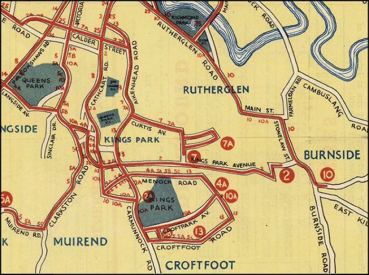
This 1938 route map shows the No.2 service operating along the whole length of King's Park Avenue from Carmunnock Road to Mill Street, Rutherglen. Some of the buses on the route terminated at King's Park. The 2A route had the destination "Aikenhead" on the board indicating its terminus at the junction of Carmunnock Road and Aikenhead Road, near the main entrance to the old Aikenhead Estate and present day park. Route map showing bus services serving King's Park and surrounding districts, 1938


The suburbs were to be built around the new stations, King’s Park and Croftfoot, which were yet to be constructed when the above map was surveyed in the early 1920’s. This map, which was prepared just before the inter-war housing development started, shows Mount Florida and Cathcart Stations as red circles.
On the Newton branch line at that time the first station after Mount Florida was at Burnside.
As the new houses were erected in stages, Kings Park Avenue and the adjacent Second and Third Avenue were extended to Aikenhead Road. Kingsbridge Drive stretched out from the railway bridge to run alongside King's Park Avenue heading eastwards to Rutherglen.

In May 1930 John. A. Mactaggart unconditionally offered Aikenhead House and 68 acres of surrounding parkland as a gift to the city, which was accepted by the Corporation.

During World War II the house was taken over by the military authorities and after the war it was used for a spell as storage space for the Burrell Collection which had no permanent home at the time.
By the 1970's, the boarded-up building was constantly vandalised and was suffering the effects of both dry and wet rot. It was estimated that it would cost over Ł1millon to repair its decaying fabric.
In 1979 the City Council considered the demolition of the mansion, but its “A” listed status prevented them from carrying through the proposal.
In June 1984, consultant engineer Douglas Loan offered to buy the house for a nominal sum of Ł1000. His firm, Classical House Ltd, began work on the conversion to flats in February 1985, which were ready for occupation the following year.
The original church and hall for the new parish of Christ the King were housed in two prefabricated timber weatherboard buildings, painted in a distinct aqua colour.

In 1957 work began on a new permanent church building, which was completed in 1960.

The two curates were Rev. Desmond Maguire and the newly ordained Rev. Terence Friel, who had taken over from Rev. Hugh McCranor.
The church was formally opened on Saturday 6th February 1932 with a service of dedication led by Very Rev. Alexander Martin, Chaplain to King George V in Scotland.

St Oswald’s was as one of the churches built under the "Million Shilling Scheme" which was launched in the 1920's by the Scottish Episcopal Church to provide mission churches for the new suburbs springing up in and around the city.
The Rector of St Margaret's Church, Newlands, the Rev. Edmund Petrie, established two missions in Glasgow's southern suburbs, St Aidan's in Clarkston in 1923, and St Oswald's in King's Park in 1931.
The building was designed by McNair & Elder, architects, in the Art Deco style which was very fashionable when it opened in December 1937.
It was known as the County Bingo Hall from 1972 and was eventually demolished in 2001 to be replaced by modern flats.
The map shows the route of the 7 and 7A buses from Calder Street along Aikenhead Road to Curtis Avenue before reaching the termini at Kingsbridge Drive and Kilmorie Drive, Bankhead, Rutherglen.
![]()
|
|
| |
|
|
||
|
|
All original artwork, photography and text © Gerald Blaikie
Unauthorised reproduction of any image on this website is not permitted.
