
Welcome to this exploration of the history and built heritage of Pollokshields, Glasgow's very own 'Garden Suburb' which was planned and built in the mid-nineteenth century.
This engraving dates from 1829 before Pollokshields had been developed. It was titled "View of Glasgow from the Farm of Shields", with a view looking towards the Cathedral in the distance. What is surprising is the number of multi-storey buildings and chimney stacks in the foreground, presumably in the Gorbals and surrounding districts.
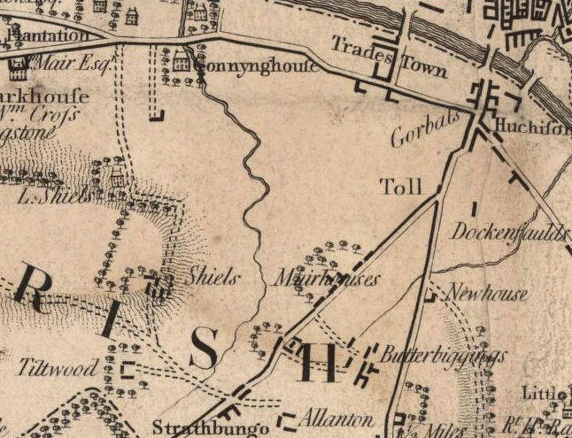
The map above was surveyed about 30 years before the engraving and shows the farm buildings at "Shiels" situated on the hilltop (or knowe) at the present day junction of Shields Road and Albert Drive. Shields Cottage is shown at "L.Shiels" (for Laigh Shields), near where you would now find the junction of St Andrews Drive and Shields Road.
The extensive garden suburb of Pollokshields was developed on land owned for centuries by the Maxwells of Pollok in the parish of Govan in the county of Renfrewshire.
A detailed study of the development of the railway at this location can be found at the Pollokshields Stations section of this website.
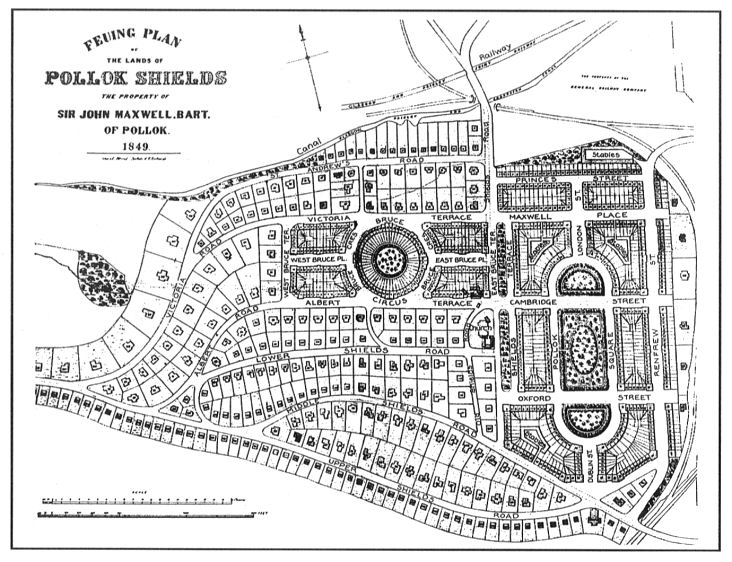
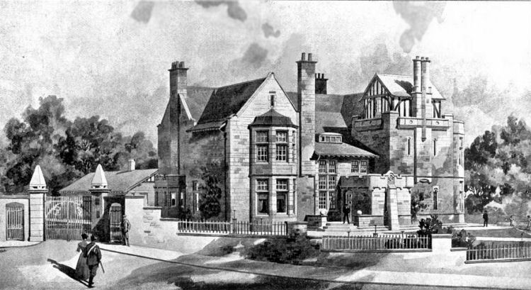
In 1849 Sir John Maxwell commissioned the noted architect David Rhind to draw up a Feuing Plan for the development of fields of Shiels Farm. The suggested layout was never actualised, but the general idea of a tenemental area to the east of Shields Road and an area of villas to the west rapidly became a reality.
Feuing plan from 1849 showing proposed development of Pollokshields as a planned suburb
Aerial view of Maxwell Square, the little park at the centre of East Pollokshields
In 1851 residential development began along the road which ran parallel to the canal and the railway near the site of Shiels Cottage at Laigh (Scots for Low) Shiels.
The first phase of the development progressed over the next 25 years, leading to Pollokshields acheiving the status of an independent burgh for a short period from 1876 to 1891, after which it became part of the city of Glasgow.
The map above shows Pollokshields consisting of a few rows of dwellings situated alongside the Glasgow, Paisley and Ardrossan Canal and the railway lines west of Shields Road.
This earliest part of Pollokshields was redeveloped in the late 1960's and early 1970's when the old houses were replaced with blocks of flats.
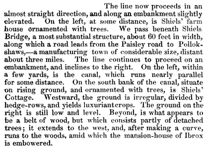
This description of a train journey passing through Pollokshields in 1852 gives an impression of the area before and after the development of the sandstone villas.
Map showing "Cottages" and "Villas" in the earliest part of Pollokshields at Shields Bridge
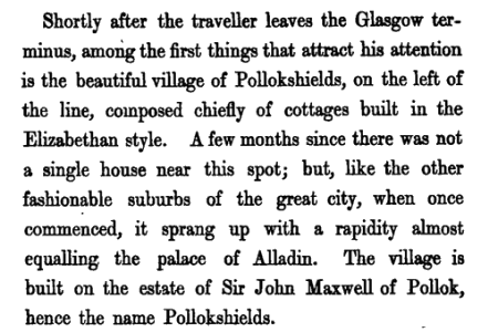
The only remaining building shown in this section of the old map is �South Bank� a detached villa on the north side of St Andrews Drive which is now a Sikh Temple.
View of "South Bank", the only surviving house shown the north side of the map
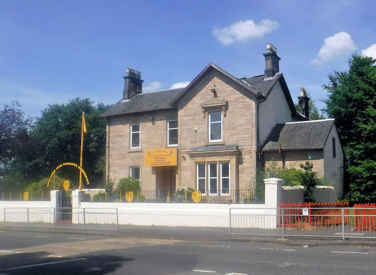
The aerial view shows South Bank completely overwhelmed - surrounded by Shields Railway Depot and modern housing developments.
Aerial view of "South Bank" and surrounding modern developments
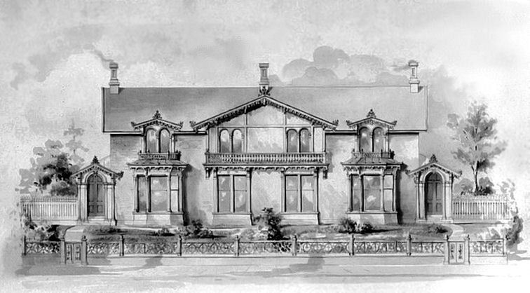
The example, below, of early semi-detached houses in Pollokshields shows that the original dwellings were much more modest in size and in the extent of their garden grounds compared to those which would come later.
This house was situated on the north side of Maxwell Drive on the present site of St Albert's School.
1926 view of semi-detached house at Pollokshields, now demolished
Design for a Double villa at Pollokshields, c.1858
It was insisted upon that the villas of Pollokshields were all built to different plans. No two villas were permitted to be exactly alike.
The number of large villas was greatly expanded from the 1880's through to the completion of the planned suburb around 1910. Detached villa, built 1886, as part of later development in Avenues west of St Andrews Drive, Pollokshields
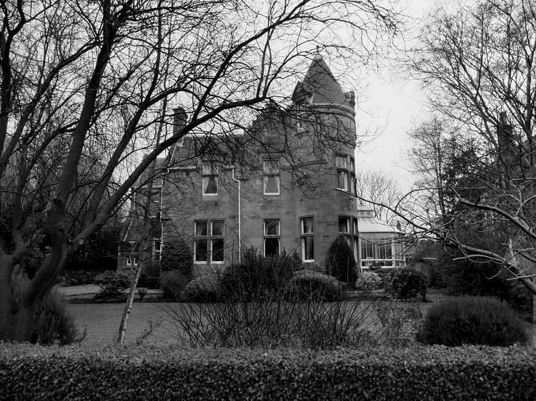
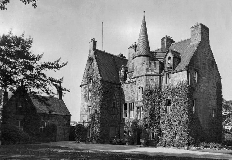
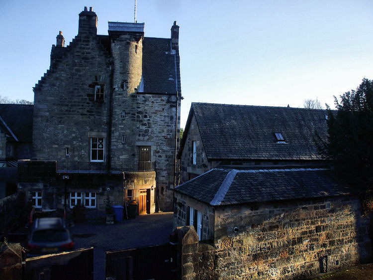
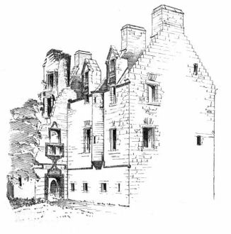
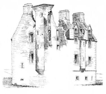
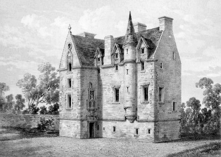
Haggs Castle in St Andrew's Drive was originally built as a defensive tower house in the 1580's.
It was restored as a dwelling house during Victorian times when modern day Pollokshields was being developed.
It had a number of different uses before returning to its present use as a private residence in 1998.
Front view of Haggs Castle, 1933
Rear view of Haggs Castle and associated outbuildings on the old road from Pollokshaws to Govan
Drawings of the ruins of Haggs Castle before restoration
Engraving of restored Haggs Castle
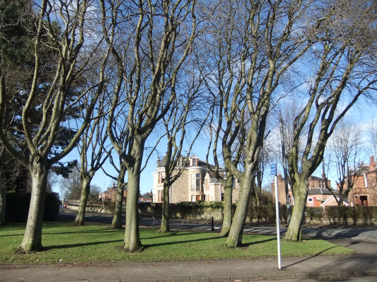
Trees growing alongside the pavements of Pollokshields
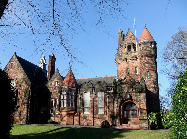
Pollokshields Burgh Hall, which was gifted to the district by Sir John Stirling Maxwell
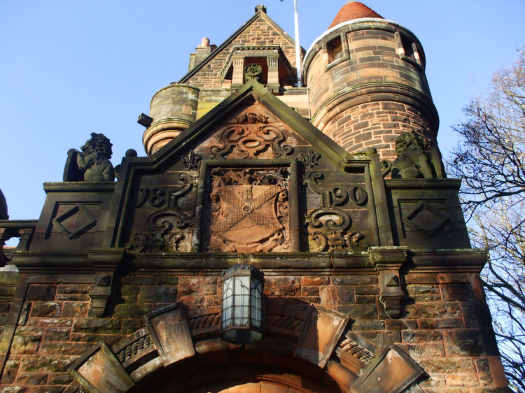
Pollokshields arms carved into stonework over entrance to Burgh Hall, with date of 1890
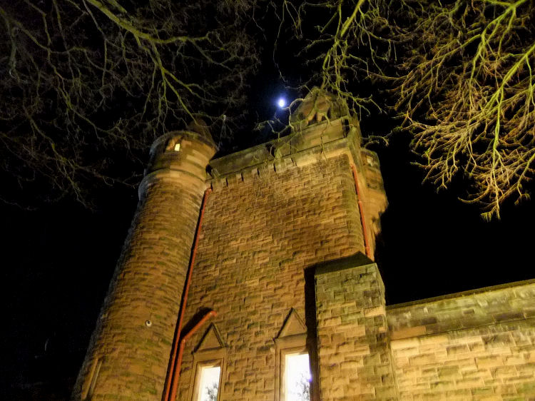
Moonlight over Pollokshields Burgh Hall
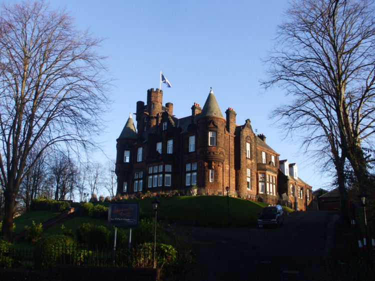
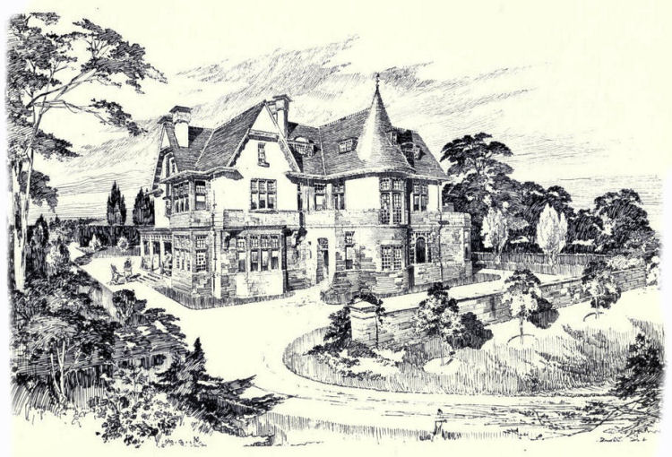
The Sherbrooke Castle Hotel was designed by architects, J.Thomson & R.Sandilands as a private residence, 'Rhuadsgeir', at 11 Sherbrooke Avenue. Their drawing of the house, below, was displayed at the annual exhibition of the Royal Glasgow Institute of the Fine Arts in 1896.
Drawing of 'Rhuadsgeir', later Sherbrooke Castle Hotel, 1896
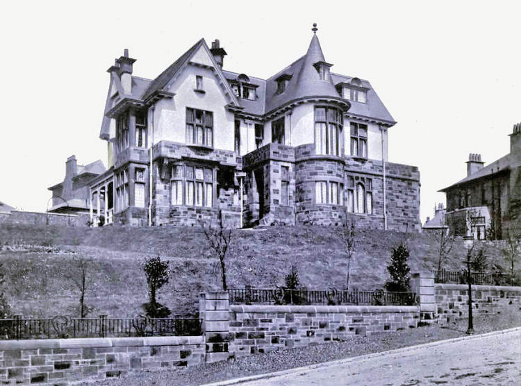
Sherbrooke Castle Hotel
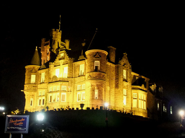
Night time view of floodlit Sherbrooke Castle Hotel
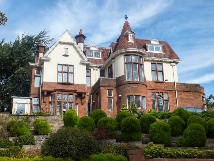
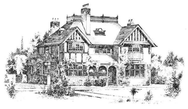
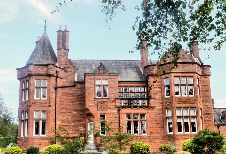
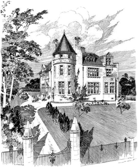
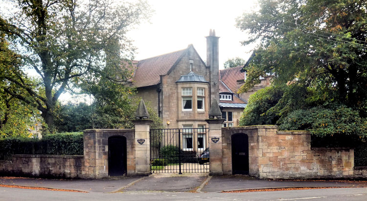
'Kelmscott' is an out-of-the ordinary villa situated in Springkell Avenue, close to the Sherbooke Castle Hotel.
The architect, John Nisbet, skilfully fused elements of the then fashionable Arts and Crafts style with the familiar Scots Baronial style to seen throught West Pollokshields.
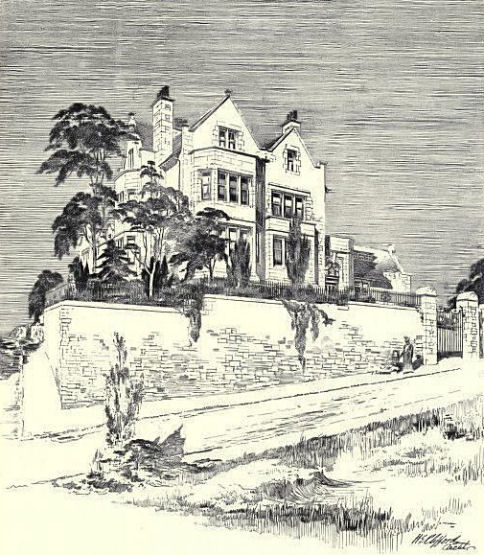
Exhibition Drawing of 'Kelmscott', Pollokshields, 1903
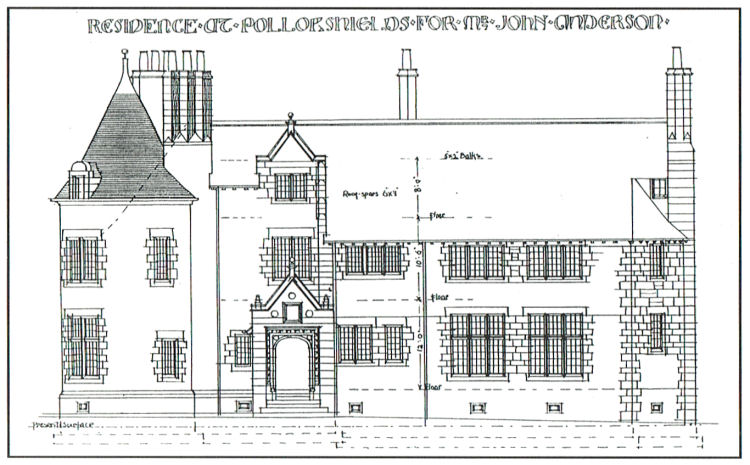
This photograph of the house was taken in 1905, just after its completion. It shows that the 'as-built' version was very close to that envisioned by the architect in the perspective drawing displayed two years earlier. The garden shrubbery had just recently been planted, with the trees being mere saplings.
Photograph of 'Kelmscott', Pollokshields, 1905
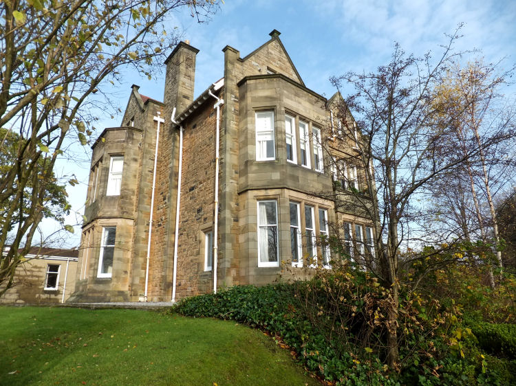
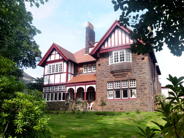
This photograph of Kelmscott from 2014 shows how well preserved the villa has been over the last hundred-plus years. It is a beautiful example of Edwardian domestic architecture, retaining all its original exterior features in pristine condition.
Photograph of 'Kelmscott', Pollokshields, 2014
Architect, H.E. Clifford's exhibition drawing of Sutherland House, Pollokshields, 1900
Photograph of Sutherland House, Pollokshields, 2014
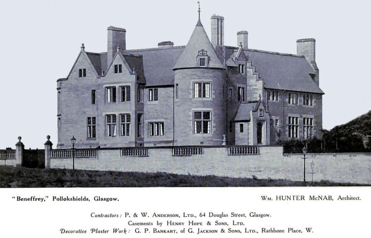
Architect's elevation of 'Beneffrey', Pollokshields, 1910
Architect's photograph of 'Beneffrey', Pollokshields, 1915
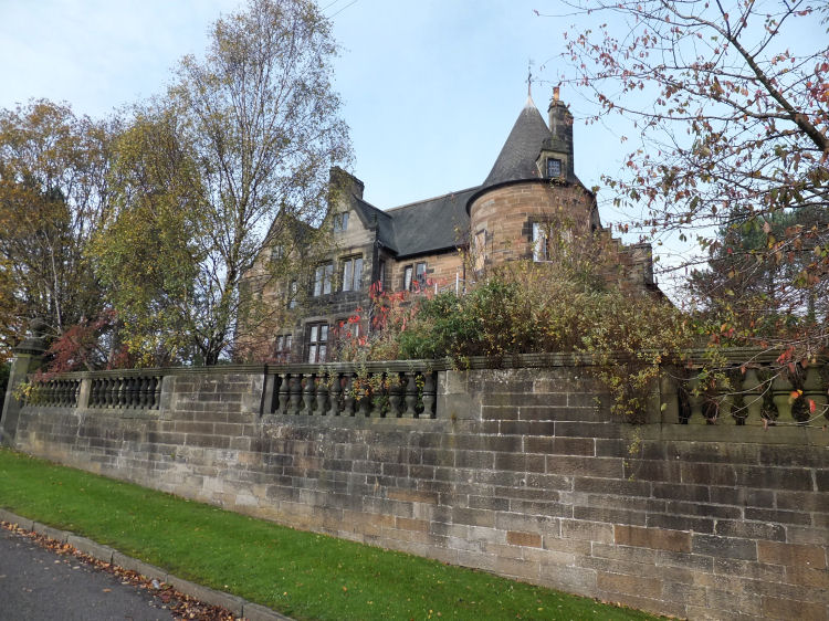
Photograph of 'Beneffrey', Pollokshields, 2014
'Norwoodville' in Nithsdale Road is a typical Pollokshields style detached cream sandstone villa which has been converted for use as a mosque, known as 'Madrasa Taleem Ul Islam'.
The house was first occupied in 1882 and was in use as a synogogue from 1928 to 1984. It then became a private dwelling before assuming its current use as a mosque.
Photograph of 'Norwoodville', Pollokshields, 2017
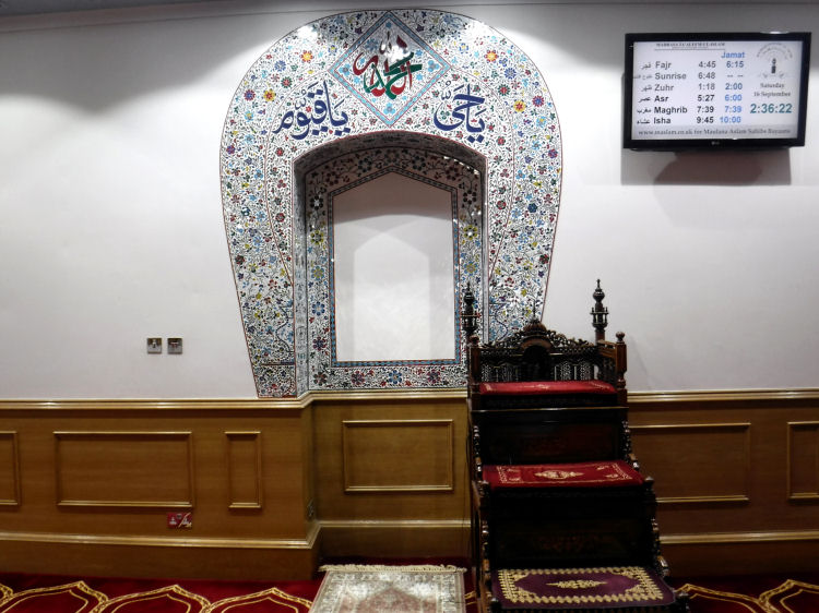
Interior of 'Madrasa Taleem Ul Islam' mosque, Pollokshields
Architect's drawing of 'Ardtornish', Sutherland Avenue Pollokshields, 1893
'Ardtornish' was designed by James Miller in an Anglified Arts & Crafts style, very different from his later Chicago inspired commercial architecture which graced Glasgow city centre in the inter-war years of the twentieth century. 'Ardtornish', Sutherland Avenue Pollokshields, August 2016
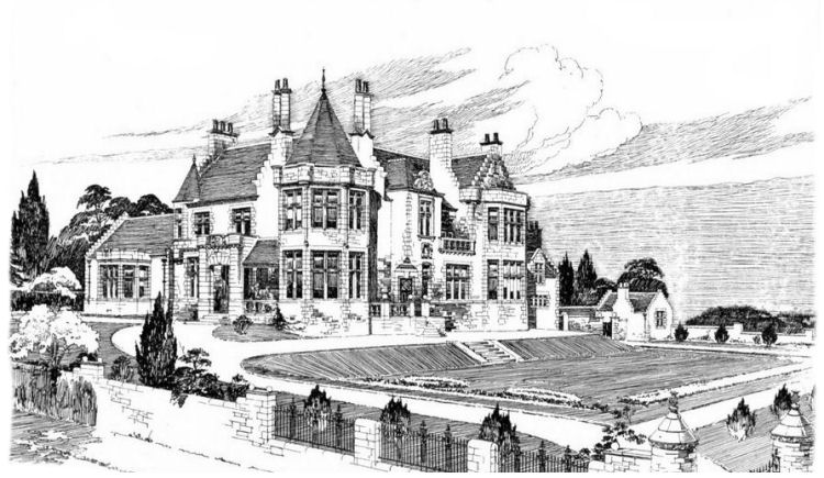
'Matheran' is one of the largest and finest villas in the area, situated on a commanding site at the corner of Sherbrooke Avenue and Springkell Avenue. Exhibition drawing of 'Matheran' at corner of Sherbrooke Avenue and Springkell Avenue
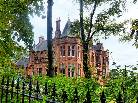
Corner view of 'Matheran', Pollokshields
Entrance to 'Matheran' from Springkell Avenue, "AD 1903"
'Matheran' was occupied by the Glasgow School of Occupational Therapy before reverting to residential use at the end of 2002.
Springkell Avenue fa�ade of 'Matheran', Pollokshields
Nearby you can find 'Inchgarvie', another large villa designed by Messrs. Frank Burnet, Boston and Carruthers around the same time as 'Matheran'. 'Inchgarvie' Sherbrooke Avenue, Pollokshields
Illustration of 'Oaklands', Sherbrooke Avenue, from 1904
Photograph of 'Oaklands', Sherbrooke Avenue, from 2014
If you are lucky enough to find a development plot for a new house in the Conservation Area, Glasgow City Council will ensure that it is built in the style of the existing properties surrounding it. The house under construction, above, is situated in Sherbrooke Avenue. When it is completed the stonework and building style will make it blend in naturally with the beautiful houses erected a century earlier. its good to know that old fashioned workmanship is still around in Glasgow and traditional construction skills haven't been completely overtaken by the modern world.
Further examples of exhibition drawings of large villas can be viewed at the Domestic Architecture of Glasgow's South Side page of this website.
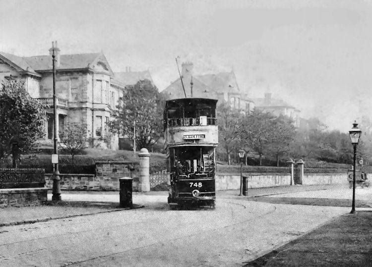
University bound tramcar at junction of Nithsdale Road and St Andrew's Drive
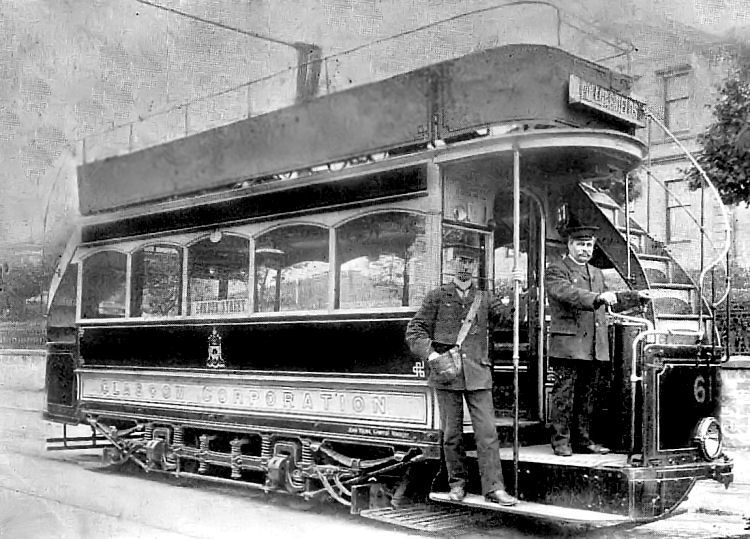
1905 view of tramcar on route from Gordon Street to Pollokshields
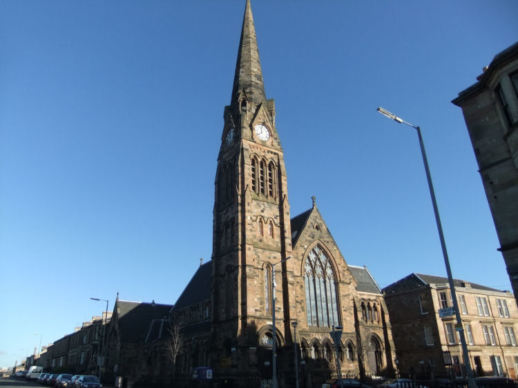
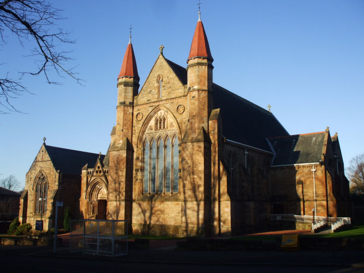
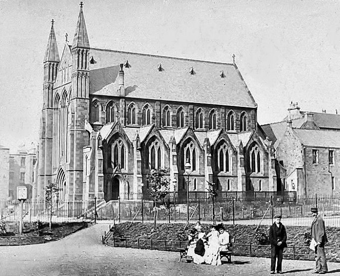
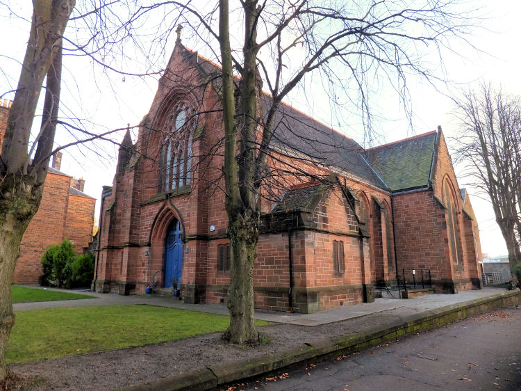
Pollokshields Established Church was designed by Stirling born architect, Robert Baldie. His design drawings were exhibited at the annual exhibition of the Glasgow Institute of Fine Arts in 1875. The opening service for the church building was held on May 19, 1878.
Pollokshields Established Church, built at the corner of Shields Road and Albert Drive in 1878
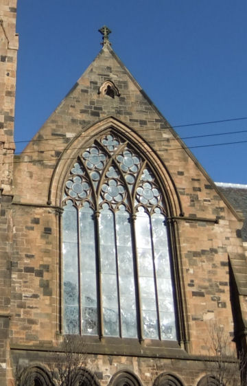
Tracery on window of Pollokshields Parish Church
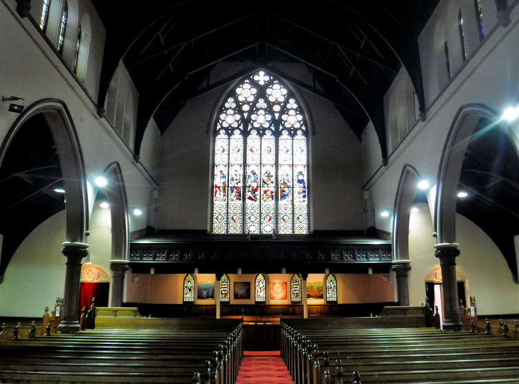
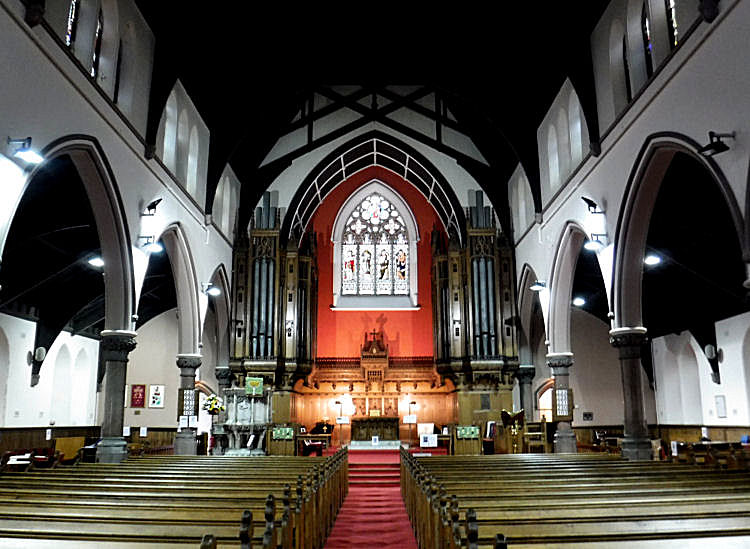
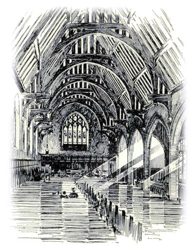
Interior views of Pollokshields Parish Church
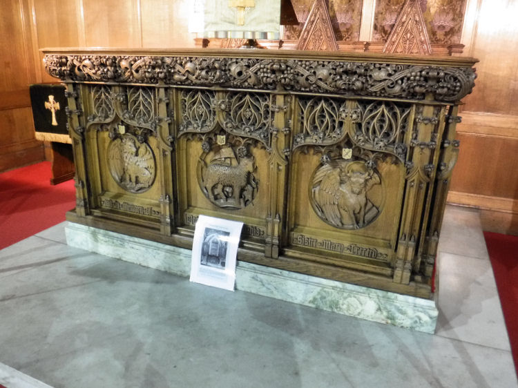
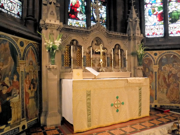
Communion Table at Pollokshields Parish Church, designed by William Gardner Rowan, 1912
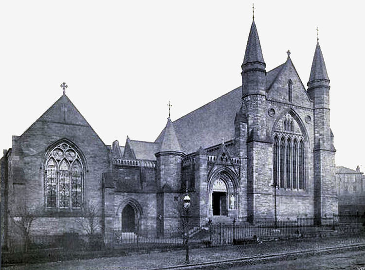
Sherbrooke St Gilbert's Church
Photograph of newly built Sherbrooke Church, 1900
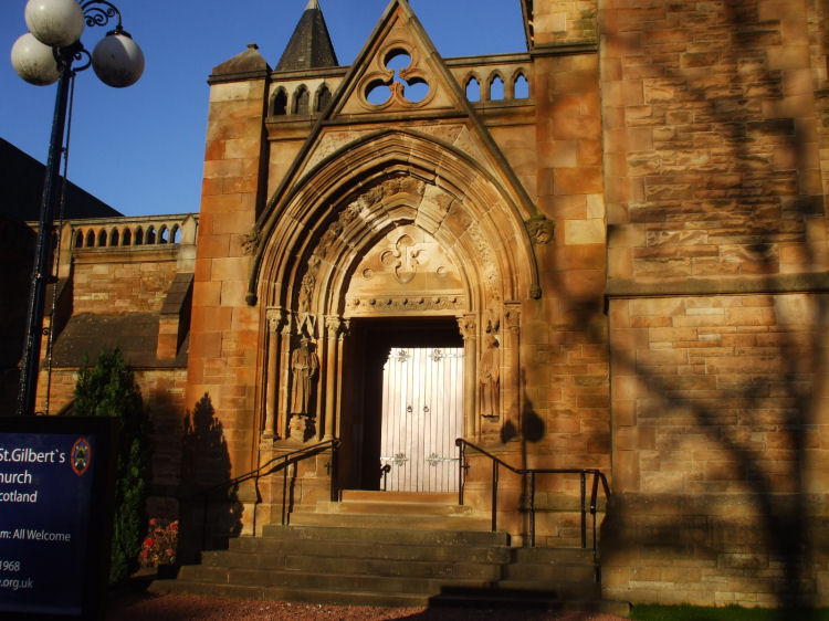
Doorway at Sherbrooke St Gilbert's Church, flanked by carved figures
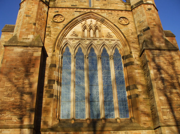
Tracery on window of Sherbrooke St Gilbert's Church
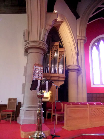
Eagle lectern at Sherbrooke St Gilbert's Church
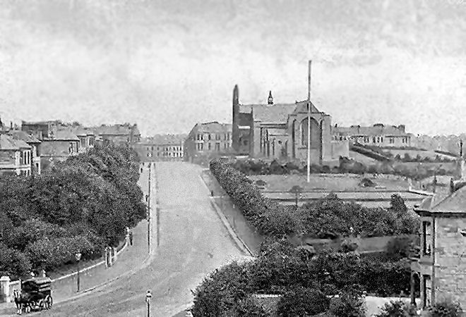
View of Glencairn Drive with Pollokshields Glencairn Church in the distance
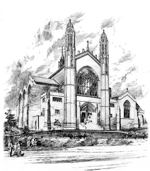
Pollokshields Glencairn Church was known as Trinity UP Church when it first opened in 1891.
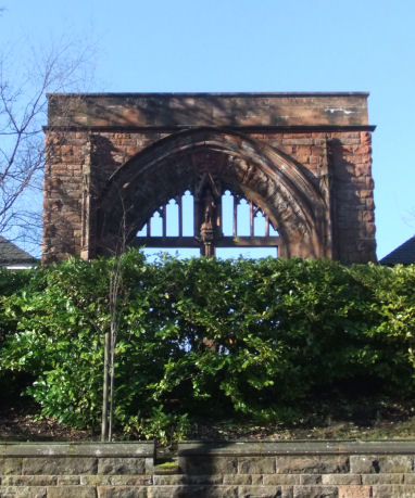
The body of the church was was destroyed by fire in 1988, leaving the east window (below) as the last remaining part of the building. This remnant can be viewed from Shields Road near the corner with Glencairn Drive.
Remains of east window of Pollokshields Glencairn Church
Perspective drawing of Pollokshields Trinity UP Church by architect, W.G. Rowan, 1892
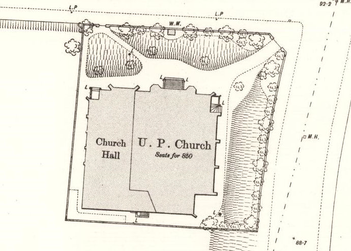
Old map showing Trinity UP Church shortly after it was built
Another church to be mysteriously destroyed by fire was Pollokshields UP Church in Leslie Street, East Pollokshields, which was burnt out in 1983.
Pollokshields UP Church, Leslie Street
Pollokshields Heritage organise an annual lecture series held in the former Pollokshields Congregational Church, close to Maxwell Park Station. I was delighted to present an illustrated talk as part of the 2018-2019 programme.
Pollokshields Heritage Lecture Series, 2018-19
Pollokshields Congregational Church in Fotheringay Road was designed by architects Steele & Balfour in a modest Gothic style. It was formally opened on April 18th, 1903 and is currently used by Hutchesons Grammar School as the 'Fotheringay Centre', a theatre/ concert hall with ancillary accommodation for lectures and seminars.
View of Fotheringay Centre, 2014
Unsuccessful design for interior of Pollokshields Congregational Church, Watson & Salmond, 1902
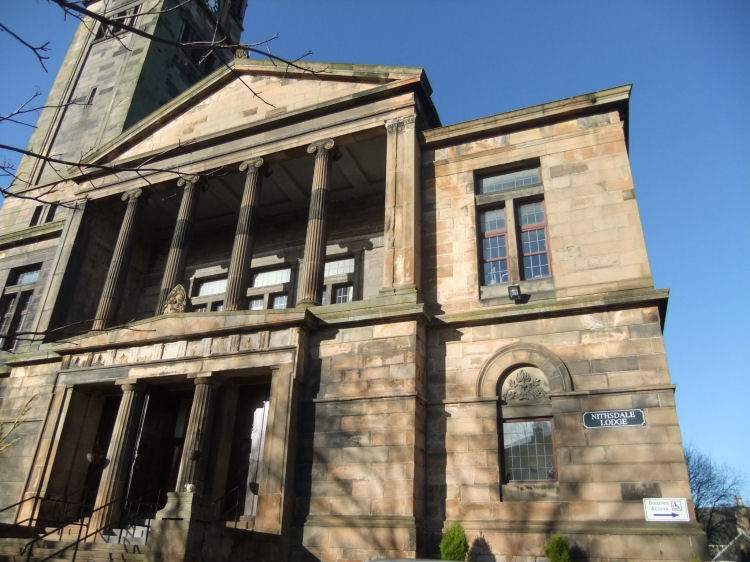
Former Pollokshields Free Church, designed by W.G. Rowan and built in 1878
Pollokshields Free Church is currently used as a nursing home, Nithsdale Lodge
East Pollokshields, which was a burgh in its own right from 1880, was situated to the east of Shields Road. It offered an interesting contrast to the leafy avenues of large villas in the burgh of Pollokshields.
It was built as an up-market tenemental area of large flats with facilities such as shops and schools, which were lacking in the garden suburb.
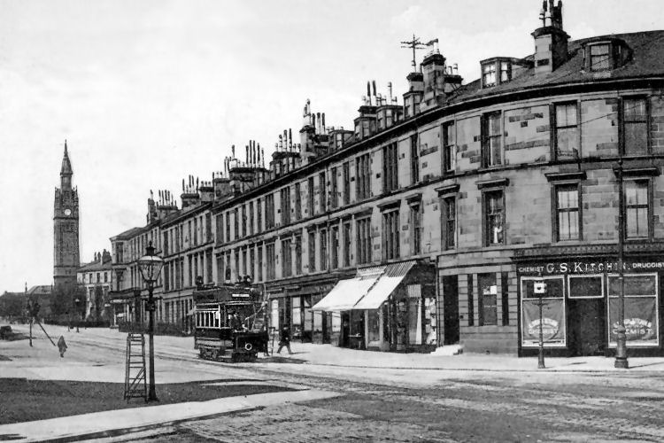
Open topped tram in Nithsdale Road with Pollokshields Free Church in background
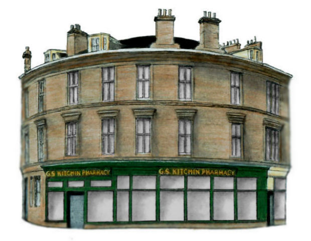
Drawing of "Kitchin's Corner", Pollokshields
1920's street scene at Albert Drive, Pollokshields
1920's view of Kenmure Street, Pollokshields
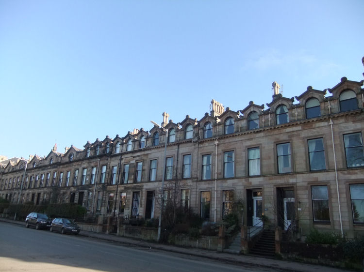
Terraced houses on the eastern side of Shields Road, on the dividing line of the old burgh boundaries
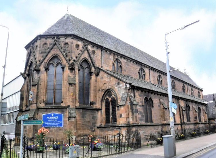
St Ninian's Episcopal Church at the corner of Albert Drive and Pollokshaws Road was designed by architect David Thomson (1831-1910), who was also responsible for many of the tenement blocks of East Pollokshields. The foundation stone was laid on 16th September 1872 by Dr. William S. Wilson, Bishop of Glasgow and Galloway. St Ninian's was the south side's first Episcopal church, predating the much larger and grander St Margaret's in Newlands by half a century.
St Ninian's Episcopal Church, Albert Drive
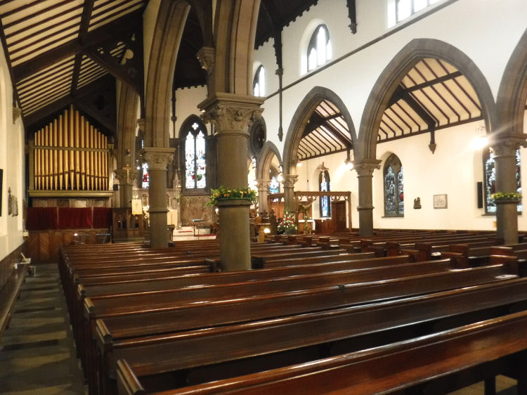
Interior of St Ninian's Episcopal Church, Albert Drive
Altar and decorative panels at St Ninian's Episcopal Church, Pollokshields
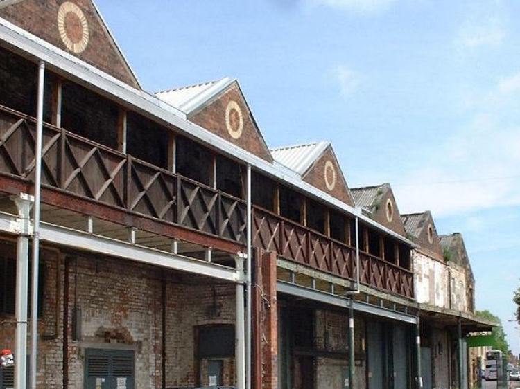
The former Copelawhill Tram Works and Depot was built on the land surrounding St Ninian's Episcopal Church in Albert Drive and Pollokshaws Road. It is currently home to the Tramway Arts Centre. Albert Drive frontage of former Copelawhill tram depot, now the Tramway Arts Centre
The original horse tram depot at Copelawhill was built in stages from 1894 to the designs of W. Clark with trams garaged at ground level and stabling for the horses on the first floor.
First floor stalls of stables overlooking courtyard of former Copelawhill tram depot
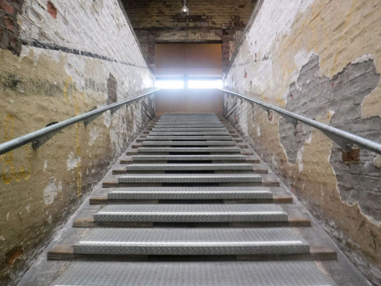
An unexpected feature of the Tramway is a surviving equestrian staircase which led to 8 stables on the first floor with 36 horses per stable. Equestrian staircase at former Copelawhill tram depot, Pollokshields
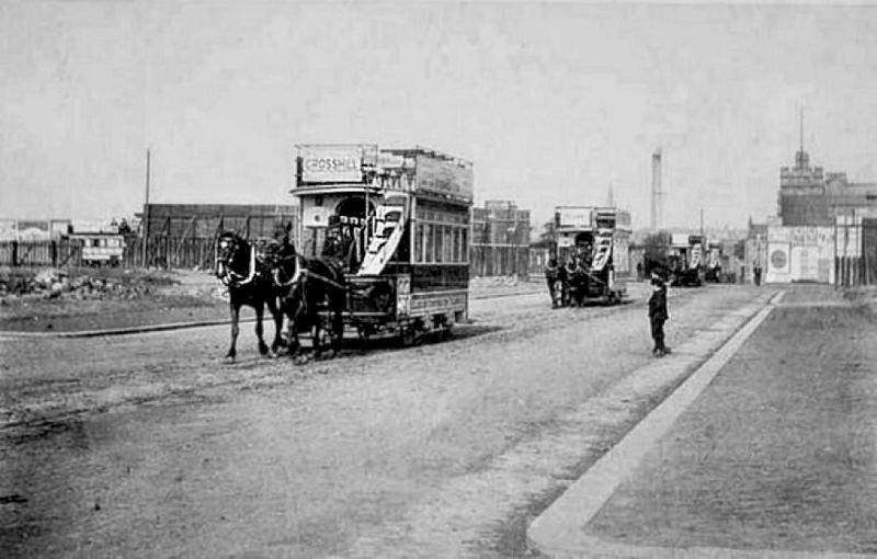
First horse trams to be operated by Glasgow Corporation
This photograph shows the very first trams to be operated by Glasgow Corporation while in procession to the newly opened depot at Coplawhill.
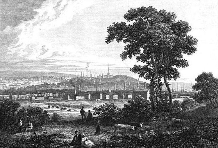
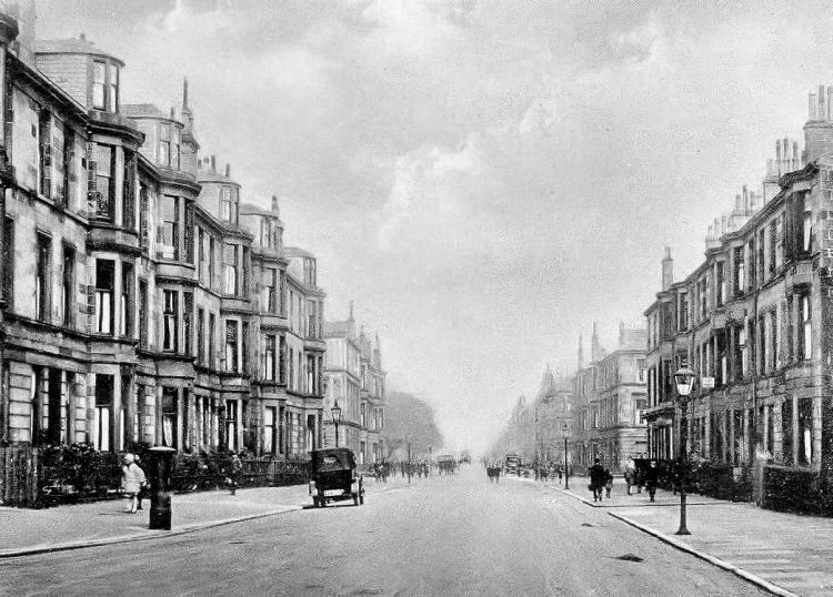
The vantage point for the image would have been situated somewhere around the farmhouse at "Shiels", shown in the map below.
Sir John Maxwell, the 8th baronet, built a bridge over the canal and railway lines at Shields Road, linking Kinning Park to the present day St Andrews Drive.
This description from 1841 of a train journey on the newly opened Glasgow and Ayrshire Railway describes the train passing under the bridge at Shields Road, then described as the road leading "from the Paisley road to Pollokshaws". The description of Shiels Cottage matches the house shown as "L.Shiels" in the earlier map.


The future site of the large houses in the planned garden suburb is shown on the map as "(Part of) Titwood", around a steading named "Haggbowse"
The area east of Shields Road was a separate burgh, East Pollokshields, which was developed with upmarket tenemental housing.
Having being created as a carefully planned suburb, Pollokshields had a total prohibition on trade. Neighbouring East Pollokshields was however allowed the shops, schools and other classes of buildings you would expect to find in a typical Victorian neighbourhood. There were no licensed premises permitted in either district.

Public green space was provided by Maxwell Park which opened in 1890. The large gardens surrounding the houses were widely planted with broad-leaved trees such as beech, sycamore and lime.
There were also trees planted on the kerbsides of the broad avenues to add to the overall greenery and give some spectacular autumn colour.
Nisbet's exhibition drawing of the house, below, was displayed at the annual exhibition of the Royal Glasgow Institute of the Fine Arts in 1903.
The villa displays an unusual combination of materials, blending typical Scottish red sandstone with very English mock-Tudor timber detailing. The arches at the loggia are supported by cast-iron columns.
The architects of the house were Messrs. Frank Burnet, Boston and Carruthers. Their exhibition drawing of the house, below, was displayed at the annual exhibition of the Royal Glasgow Institute of the Fine Arts in 1904.

The exhibition drawings of the two massive villas were displayed side-by-side at the annual exhibition of the Royal Glasgow Institute of the Fine Arts in 1904.

The church was designed by W. F. McGibbon and was built in 1882.

The site of the building was donated by Sir John Maxwell, along with an annuity of �100 in perpetuity to "the clergyman of the first Episcopal Church that should be built and consecrated on his lands or on lands adjacent to his." Rev. Michael. B. Hutchison was the first recipient of this grant.


Access to the stables was provided by very gently sloping flight of steps with 4� in. risers that could be safely negotiated by horses. The steps had non-slip metal surfaces frequently divided by transverse ridges forming the criss-cross pattern.
From 1872, prior to the establishment of the municipal transport system, horse drawn trams had been operated in by the Glasgow Tramway and Omnibus Company. At the end of June 1894 the operation of the tramway was taken over by Glasgow Corporation who already owned and maintained the track.
The depot of the Glasgow Tramway & Omnibus Company had been situated in Tobago Street, Calton, close to Glasgow Green. The stables there had stalls for horses on the both first and second floors with the top floor being used as a hay loft.
The Corporation had decided in 1897 to convert the tram system to electric traction and the following year the Springburn route was the first to be electrified. Horse drawn trams were fully withdrawn from service in the city by the end of April 1902.
![]()
|
|
| |
|
|
||
|
|
All original artwork, photography and text © Gerald Blaikie
Unauthorised reproduction of any image on this website is not permitted.
